An Inventory of the Historical Monuments in City of York, Volume 5, Central. Originally published by Her Majesty's Stationery Office, London, 1981.
This free content was digitised by double rekeying. All rights reserved.
'Maps', in An Inventory of the Historical Monuments in City of York, Volume 5, Central, (London, 1981) pp. . British History Online https://www.british-history.ac.uk/rchme/york/vol5/maps-of-monuments [accessed 19 April 2024]
Maps

MAP 1 showing area covered by MAPS 2–8.

MAP 2. Monuments in the Goodramgate area. Scale 1:1250

MAP 3. Monuments in the St. Saviourgate area. Scale 1:1250

MAP 4. Monuments in the High Petergate and Stonegate area. Scale 1:1250

MAP 5. Monuments in the Low Petergate and Shambles area Scale 1:1250
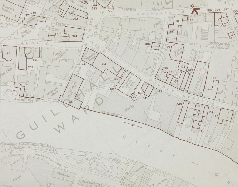
MAP 6. Monuments in the Lendal and Coney Street area. Scale 1: 1250

MAP 7. Monuments in the Ousegate and Castlegate area Scale 1:1250

MAP 8. Monuments in the Fossgate area. Scale 1:1250