A History of the County of Somerset: Volume 8, the Poldens and the Levels. Originally published by Victoria County History, London, 2004.
This free content was digitised by double rekeying. All rights reserved.
'Introduction', in A History of the County of Somerset: Volume 8, the Poldens and the Levels, (London, 2004) pp. 1-7. British History Online https://www.british-history.ac.uk/vch/som/vol8/pp1-7 [accessed 24 April 2024]
INTRODUCTION
THE PARISHES surveyed within this volume were all significantly affected by that area of low-lying moorland now commonly known as the Somerset Levels, (fn. 1) here forming two wide valleys north and south of the Polden Hills. The hills lie as a long and now mostly green ridge pointing north-west from the centre of Somerset towards the river Parrett and the sea. They never quite reach 100 m. O.D. along the 12 km. between Ashcott and Puriton, but their modest height is enhanced by the steepness of their flanks. Within 1 km. on the south scarp and 2 km. on the more gradual north the land falls abruptly to the 15 m. contour and continues to fall in the broad valleys, to 4 m. O.D. in several places in the south and to 3 m. in the north. (fn. 2) A significant proportion of the land thus lies below the high water mark; sluices, locally known as clyces, are needed to prevent incursion of sea water and pumps transfer surplus water from moors first to ditches, then to rhynes, and finally to rivers. The level of the water table is crucial and a continuing matter for discussion between farmers and environmentalists.
The northern valley, named after the river Brue which flows through it, is divided between smaller moors, heaths, and levels which together occupy an area in places some 7.5 km. wide. Its topographical origins eastwards are the smaller rivers which come from the Mendips north-east of Glastonbury, more than 30 km. from the mouth of the Brue at Highbridge and the middle reaches of the Brue itself in the moors south and south-east of Glastonbury. Much of the valley south of the Poldens is known as Sedgemoor or King's Sedgemoor, though further east by a variety of local names, and was formed by the early courses of the rivers Cary and Parrett. It similarly runs inland south and south-east well beyond the confines of the parishes in this volume.
The two valleys are superficially alike: large areas of peat, overlaid on the west, the seaward side, by marine and estuarine alluvium; inland the peat is edged by bands of alluvium which mark the influence of slowflowing rivers bringing silt westwards. (fn. 3) Both peat and alluvium have been introduced over a long period. In origin the area is a deep drowned valley, subject to marine invasion and filled approximately to sea level by clay and alluvial silt, with occasional 'islands' of raised beach deposits, called Burtle Beds after an eponymous 'island' in the Brue valley. From c. 4,500 B.C. the area was gradually transformed into a series of dry islands surrounded by fresh water marsh and brackish reed swamp punctuated with open pools. Areas of alder carr succeeded reed swamp but increasing rainfall encouraged plants to form a raised peat bog which continued to grow, in some places until c. 900 A.D. (fn. 4)
Within that general framework there is local variety. The deepest peats, more than 7 m. thick, occur in the moors furthest inland. (fn. 5) The raised bog formed only in the central Brue valley. Elsewhere, both north and south of the Polden ridge, a complex and ever changing mosaic of reedswamp, open shallow water, and alder carr woodland existed. The variation was probably caused by different drainage conditions, the raised bog forming because there was no channel to remove rainwater. In consequence, turf cutting has been significant in the north for several centuries, continuing on a more limited scale into the early 21st, while until the drainage of Sedgemoor in the late 18th century the gathering of turf, sedge, and rushes was of equal importance. (fn. 6) In both valleys the grazing of animals, especially in summer, was central to the economy.
Extensive flooding occurred in the eastern end of the Brue valley depositing a brown 'Upper Wentlooge' estuarine-marine alluvium over a large area around Godney between the mid to late Bronze Age and the early Iron Age. (fn. 7) The flooding was probably caused by a rise in sea level forcing marine or brackish conditions up from the Axe valley into the Brue. The onset of the wetter conditions is associated with the construction of some wooden trackways, (fn. 8) although such structures had been created almost continuously in the area since the early Neolithic.
Mesolithic flints found on the 'islands' and the wooden trackways found in the peat leading to them and dating from c. 4,000 B.C. to 400 B.C. demonstrate the extensive use of the marshes by hunter-gatherers and later by farmers. Settlement in the wetlands, not necessarily year-round, was possible but probably not extensive. (fn. 9) Roman settlement in the area was clearly intensive, occurring in and around most of the villages which still survive but also on sites, such as the Nidons at Shapwick, only a few feet above the potential flood level. Roman exploitation is amply demonstrated in the briquetage mounds, evidence of salt working in the Brue valley between Huntspill and Burtle. (fn. 10) The salterns around Highbridge date to the 1st and 2nd centuries A.D. while those west of Burtle are of the 3rd and 4th centuries. The move inland suggests coastal retreat during the Roman period, a change which may also have caused the abandonment of the Roman settlement at Alstone. (fn. 11) Linear ditches also north of the Polden ridge and similarly found between Huntspill and Burtle may be related to Roman exploitation, possibly peat cutting, but were conspicuously ignored by later boundaries. (fn. 12)
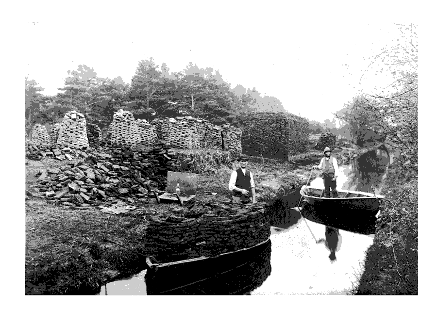
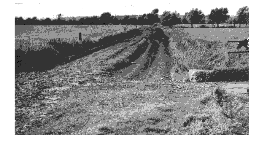
Turf cutting, a significant occupation in the Brue valley.
There is no uniform pattern of settlement, but on the northern slope of the Poldens the villages are on the spring line and are closely spaced. The similar grid layouts of Shapwick, Catcott, Edington, and Chilton Polden, and their regular boundaries raise the possibility of conscious planning, presumably by Glastonbury abbey as owner and possibly at some date in the 10th century. (fn. 13) Elsewhere the earliest phases were largely nucleated but, as at Alstone in Huntspill, Pedwell in Ashcott, and Low Ham in High Ham, secondary settlements were of pre-Conquest origin. Interspersed were, of course, the sites on the 'islands' in the marsh such as Andersea in Westonzoyland and Greylake in Middlezoy. Drainage and reclamation, notably in the 13th century, led to spectacular expansion, particularly at Westonzoyland, and to the creation of isolated hamlets like Withy, anciently part of Shapwick, on recovered marsh, or Moorland in Middlezoy beside the embanked Parrett. Farmsteads of early origin such as Pathe and Thorngrove in Othery and Middlezoy are found on spurs running into the marsh from nucleated settlements.
The ancient boundaries of the parishes in the volume, with the exception of those on the north side of the Polden ridge, are related to topography, though the boundaries on the Levels, established either in the Middle Ages or later, are often the result of agreement after dispute. The waterways and their accompanying dykes and walls proved to be more obvious and satisfactory boundaries than the series of stones or measurements by yards and paces which the Glastonbury abbey surveyors so carefully recorded. (fn. 14)
The main concerns in the Levels were the two linked problems of flood prevention and the reclamation of land for cultivation and improvement. The success of both in the Middle Ages was due to the fact that Glastonbury abbey was owner of most of the land in question and could both initiate major works and ensure their maintenance, and could also encourage their tenants to undertake smaller scale reclamation. Examples of ditching and embanking by tenants are to be found in nearly every parish in this volume and its successor and are particularly significant around the 'island' of Sowy covering the parishes of Westonzoyland, Middlezoy, and Othery; along the low ridge called Nidons running between Chilton Polden and Shapwick; around the 'island' of Meare; and in the gradual division of Hearty Moor in West Pennard.
The largest single medieval drainage undertaking was the diversion of the Brue to flow westwards, perhaps largely through natural channels, from Meare Pool to join the river Parrett either flowing into a pill which reached deep inland, (fn. 15) or by means of a channel which had to be cut through the clay belt. (fn. 16) The work was carried out in the later years of the 12th century for the responsibility for maintaining all the watercourses between Glastonbury and the sea was placed on named individuals among whom were Ralph de Sancta Barbara of Brentmarsh (fl. 1189) and Robert de Ewyas, lord of Huish in Burnham (d. 1198). (fn. 17) The construction of the bridge over the cut in the clay belt, known as the high bridge, which has been associated with the same work, could well have been contemporary with it for a Reynold atte Brigge was described as ancestor of a man who held adjoining land at the end of the 13th century. (fn. 18) Reed beds at Meare Pool in the mid 13th century (fn. 19) may suggest that the new outflow was, at least initially, a success.
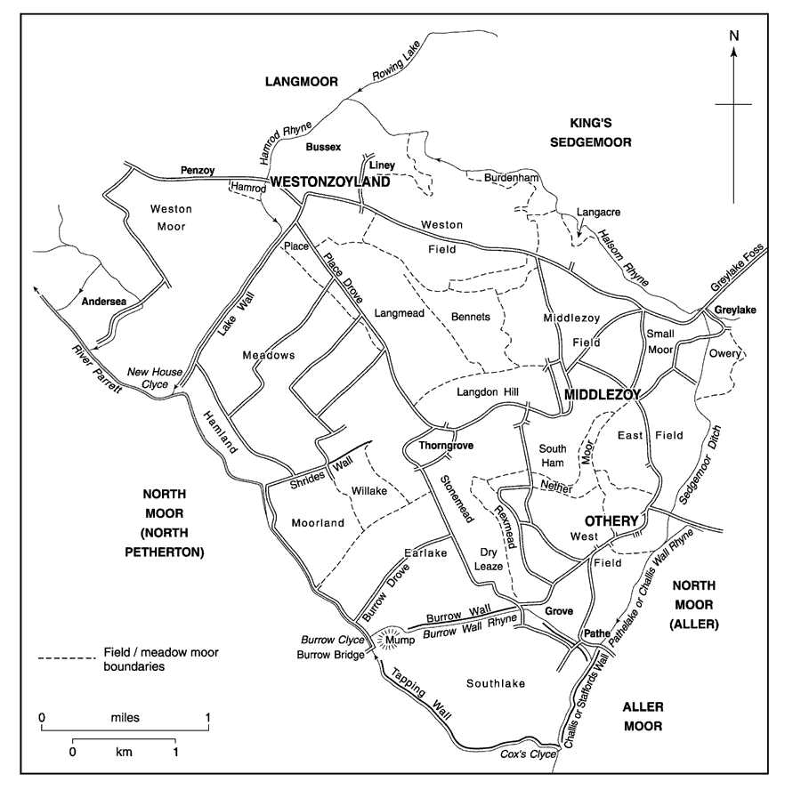
The Sowy parishes before inclosure.
Smaller works throughout the area involved straightening existing watercourses and digging new ones, building and raising flood walls, and generally maintaining both a satisfactory outflow of water and an efficient means of communication and internal trade in spite of the constant hazard of fish weirs. Thus a Sowy tenant acted as a boatman in the 13th century along both the Brue and the Axe, (fn. 20) and crops from High Ham, for example, were taken by water across Sedgemoor for onward delivery by road to Glastonbury abbey. (fn. 21)
Those crops from High Ham were principally grain from one of the few parishes in this volume where arable cultivation did not begin its significant decline in the later Middle Ages. Inclosure and demesne leasing may be said to have been deliberate policy on Glastonbury abbey estates before the end of the 15th century, but the pace of the former was governed by local considerations. Open field arable persisted significantly in, for instance, Cossington, High Ham, and Shapwick into the 18th century.
Inclosure of King's Sedgemoor 1795.
The dissolution of Glastonbury abbey in 1539 marks an important stage in the development of the Somerset Levels. The monastic estate was divided between several owners and cooperative agriculture came to an end. Thus, for instance, there were no longer concerted movements of flocks and herds between the summer pastures. The Crown became the owner of the soil of the rich moorlands which by the early 17th century had seriously lost their value and had, in any case, been devastated in 1607 by extensive flooding. The need to drain and protect from recurrence of flood had to be balanced against the local fear that the improved pastures would be overstocked by outsiders to the prejudice of common rights. Until the later 18th century the commoners largely won. Cornelius Vermuyden failed to convince those of Sedgemoor in the mid 17th century and the only successful schemes were at Cossington and Catcott and along the warths of Huntspill and Puriton. (fn. 22)
There followed years described as 'barren' when, without the financial interest of the Crown to keep improvement as an issue, owners and tenants seem to have been content to live with occasional hazards and to enjoy what the rich grasslands produced in the way of fat stock and abundant cheese. (fn. 23) Rising demand for food, damage from overstocking, and the evident prosperity of graziers on improved ground brought from 1777 a series of Acts of Parliament under which by 1807 all the moorland in the parishes in this volume was divided and allotted. The earlier schemes, mostly involving the reclamation of individual blocks of land in the Brue valley, were less successful than the comprehensive drainage of Sedgemoor, but the Brue Drainage Act of 1801 brought both sides of the Poldens into some sort of equality. Thus were created the King's Sedgemoor Drain, which diverts the Cary across the moor along the western end of the Poldens to discharge into the Parrett at Dunball clyce, and the South Drain which takes the Brue south of its old and less efficient course. (fn. 24)
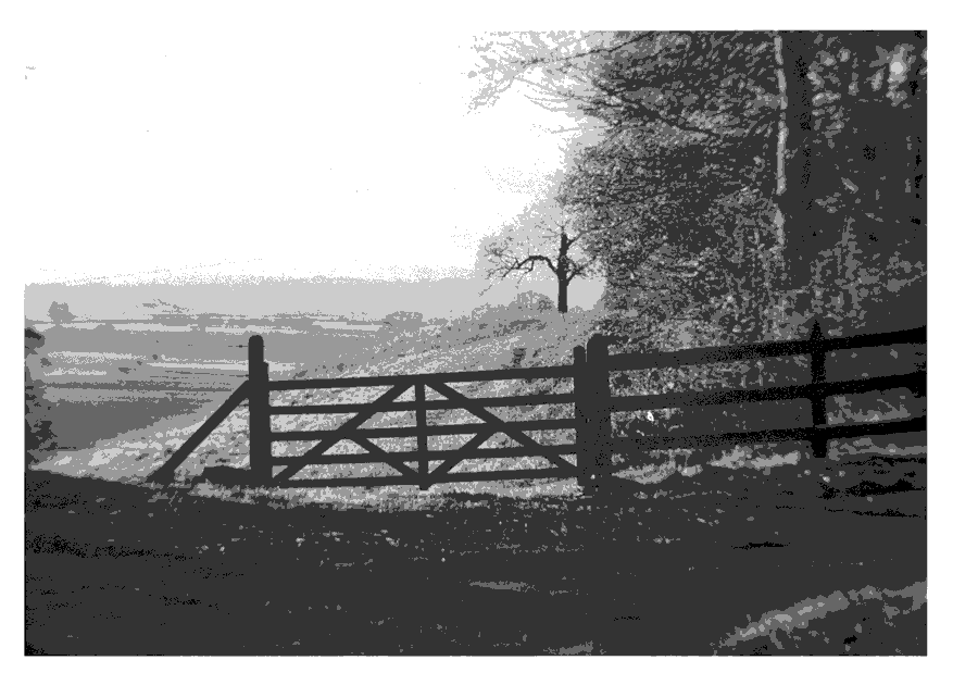
View south from the Polden ridge.
The Henley - Pedwell Drove connecting High Ham with Ashcott and Glastonbury.
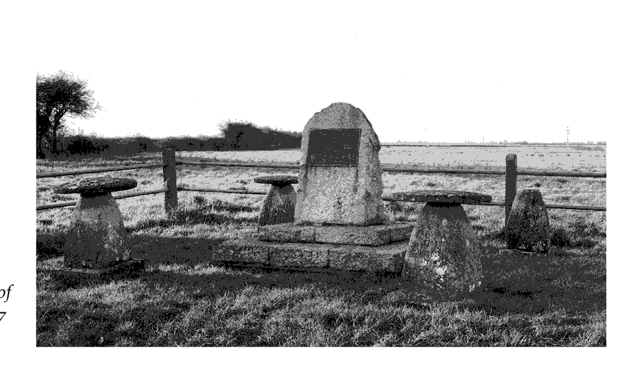
Site of the battle of Sedgemoor formed in 1927.
The South Drain came to be, for a short time, a commercial canal linking Glastonbury with the sea at Highbridge, an enterprise soon overtaken by a railway along a similar route. The railway was an important factor in the modest success of both towns. Highbridge, only partially covered in this volume where its southern suburb South Highbridge overflowed into Huntspill, enjoyed the commercial success of improved agriculture as well as maritime trade and railway engineering.
High rainfall still presents problems apparently insuperable, but part of the solution came from the need in the Second World War for a large supply of water for a munitions factory in Puriton. The Huntspill river was created and the King's Sedgemoor drain widened to guarantee an adequate supply of water. Together the two schemes corrected the defects of earlier solutions. (fn. 25) At the turn of the 21st century the unique character of the Levels is appreciated as never before; it can no longer be the exclusive preserve of the farmer for its long settlement history, its unique flora and fauna, and its increasing popular attraction all make demands which must be balanced. Concern for the environment of the Levels as a whole has been expressed in a series of studies culminating in suggestions for the restoration of those areas of peat production to something like original wetland. (fn. 26)
To those who did not know them, passage across the Levels could be hazardous, and national events usually passed the area by. At least some of the Cornish rebels protesting against taxation in 1497 seem to have marched along the Poldens on their way to Blackheath and men from all villages on or near the route were fined. (fn. 27) The independent Clubmen who emerged towards the end of the Civil War were led by Humphrey Willis, whose family came from Woolavington and whose operations were based at the western end of the Poldens. (fn. 28) In June 1685 the duke of Monmouth marched from Bridgwater to Glastonbury, very likely in that summer weather across Sedgemoor. His return journey was certainly across the moors, where he had hoped to find new support from the Clubmen, and where a night was spent possibly near Pedwell. The loss of the battle of Sedgemoor, fought in the moors north-west of Westonzoyland, marked the defeat of his enterprise. Only a relatively small number of men from the Polden and Sedgemoor villages were accused of being involved, though of a total of 64, 15 came from Huntspill and 13 from Chilton Polden. Thomas Plaice, a sergemaker from Edington, was said to have been the leader of the clubmen; and supporters of the Monmouth cause were still active in and around Huntspill several years after 1685. (fn. 29)