A History of the County of Middlesex: Volume 4, Harmondsworth, Hayes, Norwood With Southall, Hillingdon With Uxbridge, Ickenham, Northolt, Perivale, Ruislip, Edgware, Harrow With Pinner. Originally published by Victoria County History, London, 1971.
This free content was digitised by double rekeying. All rights reserved.
'The hundred of Gore', in A History of the County of Middlesex: Volume 4, Harmondsworth, Hayes, Norwood With Southall, Hillingdon With Uxbridge, Ickenham, Northolt, Perivale, Ruislip, Edgware, Harrow With Pinner, (London, 1971) pp. 149-150. British History Online https://www.british-history.ac.uk/vch/middx/vol4/pp149-150 [accessed 19 April 2024]
THE HUNDRED OF GORE
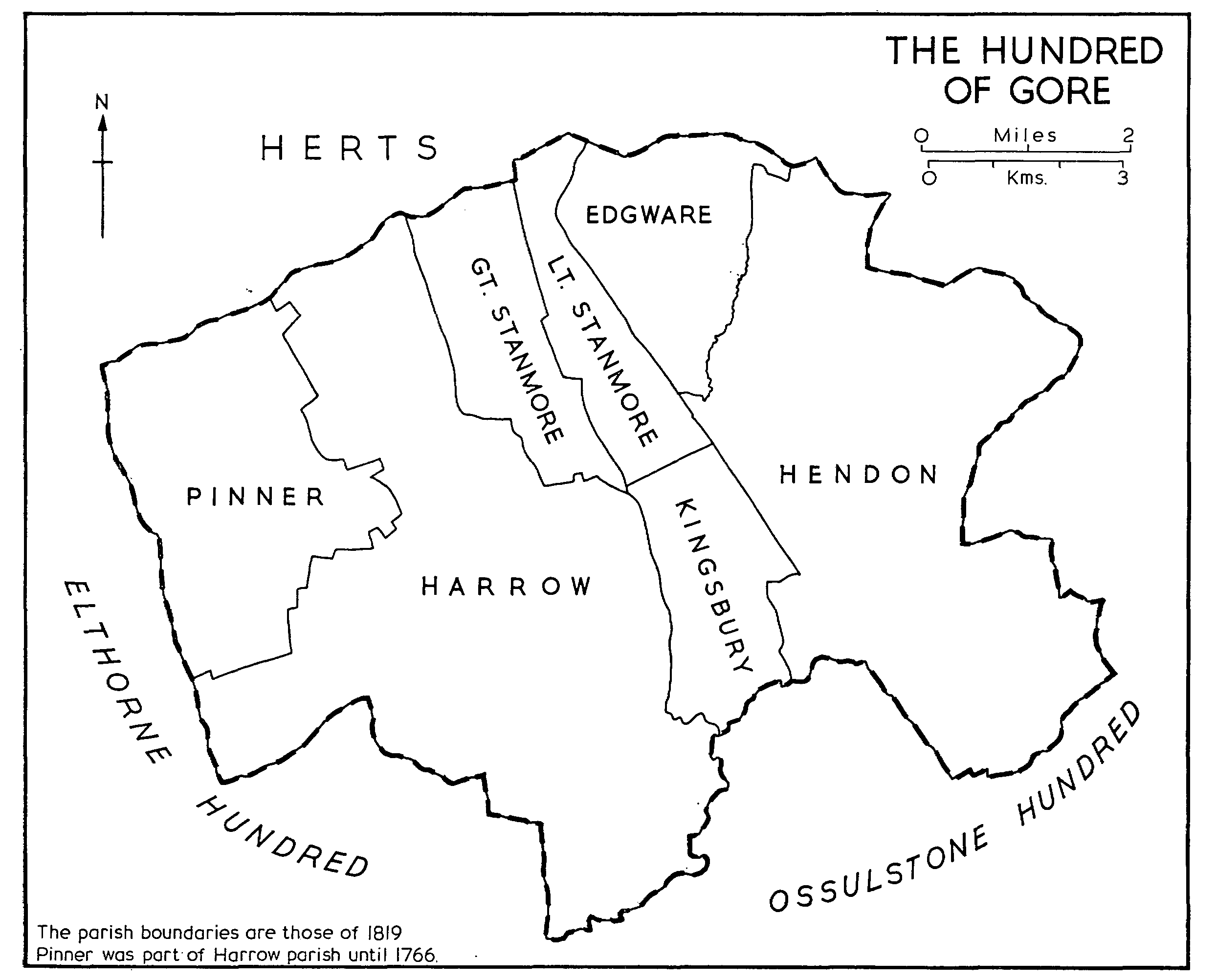
The hundred of Gore lies north of the River Brent on the Hertfordshire boundary of Middlesex. Bisected by Watling Street, it is bounded by Elthorne hundred on the west and by Ossulstone to the south and east. (fn. 1) In 1881 it covered 29,185 acres. (fn. 2)
In 1086 the hundred was assessed at 149 hides, equivalent to one hundred and a half. (fn. 3) It was then made up of five manors: Harrow, Hendon, Kingsbury, and the two manors of Stanmore. The Stanmore estate held at Domesday by Roger de Rames (fn. 4) was that later known as Little Stanmore, Whitchurch, or 'the other' Stanmore to distinguish it from the neighbouring manor and parish of Great Stanmore. The manor of Kingsbury, most of which the Survey assigns to Elthorne, (fn. 5) may be assigned in its entirety to the hundred of Gore in which it was included by the early 12th century. (fn. 6) Edgware, which was included in Gore by 1274, (fn. 7) was not mentioned in 1086. Its omission from the Survey is inexplicable, although it may have been included in the assessment for Little Stanmore or Kingsbury. (fn. 8)
The constituents of the hundred varied little after 1086. By 1316 Edgware was invariably included in surveys of the hundred. (fn. 9) Subsequently the only modification in the composition of the hundred was the occasional inclusion of the so-called manor of Pinner, a member of Harrow manor. (fn. 10) By the end of the 15th century the number of manors in Gore had increased to about 22. (fn. 11) In the early 19th century the hundred comprised the parishes of Edgware, Harrow, Hendon, Kingsbury, Great Stanmore and Little Stanmore. (fn. 12)
From an early date the jurisdiction exercised by the hundred was severely limited. Only Great Stanmore of its constituent manors did not, at some period before 1300, enjoy or claim exemption from the hundred court. Harrow, including Pinner, was included in the franchise owned by the Archbishop of Canterbury, (fn. 13) and until they were alienated about 1150 Hendon and Kingsbury formed part of the franchise of Westminster Abbey: Hendon was regranted to the abbey in 1312. (fn. 14) In 1274 Hendon, Edgware, Great Stanmore, and Little Stanmore were said to owe suit to the hundred court. (fn. 15) In 1293, however, Henry de Lacy, Earl of Lincoln, claimed view of frankpledge and other liberties in his manor of Edgware while the Prior of St. Bartholomew's, Smithfield, was apparently exercising similar liberties in his manor of Little Stanmore. (fn. 16)
A number of place-names suggest that the meeting-place of the hundred was near the border between Harrow and Kingsbury. Gore Field, Gore Mead, Gore Lane, and Gore Farm lay in Kingsbury (fn. 17) and there was also a Gore Field in Kenton. (fn. 18) The headborough of Preston was in mercy in 1421 for failing to prevent an obstruction of the watercourse at Gore hundred, (fn. 19) and land in Preston was described throughout the Middle Ages (fn. 20) by reference to 'le Moothegge' which abutted North Field, to 'Eldestretshote on Goredon', and to the 'Gaderbrok'. The 'Gaderbrok' must have been one of the eastern tributaries of the Lydding Brook and the hundred meeting-place may well have been at the northern end of Preston East Field, between 'Eldestrete' or Honeypot Lane (the north-south route from Stanmore to Kingsbury) (fn. 21) and a small stream which was perhaps the 'Gaderbrok'. (fn. 22) The evidence, which includes the elevation of the site above the surrounding marshy ground, is reinforced by the Harrow map of 1759, (fn. 23) which marks a hedged area in the midst of common fields at this point. A survey of Kenton in 1547, (fn. 24) however, clearly describes Kenton Gore Field as abutting Stanmore and Kingsbury on the north and Preston North Field on the east. Gore Field also lay on the ancient north-south route, and the stream shown as separating Kenton and Preston common fields in the inclosure map (fn. 25) may have been the 'Gaderbrok'. The total disappearance of this area in housing development makes it impossible to trace the site on the ground.
THE HUNDRED OF GORE