The Commissions for Building Fifty New Churches: The Minute Books, 1711-27, A Calendar. Originally published by London Record Society, London, 1986.
This free content was digitised by double rekeying. All rights reserved.
'Illustrative map of London parishes', in The Commissions for Building Fifty New Churches: The Minute Books, 1711-27, A Calendar, (London, 1986) pp. xxxviii-xxxix. British History Online https://www.british-history.ac.uk/london-record-soc/vol23/xxxviii-xxxix [accessed 24 April 2024]
Parishes in London and Westminster, outside the City of London
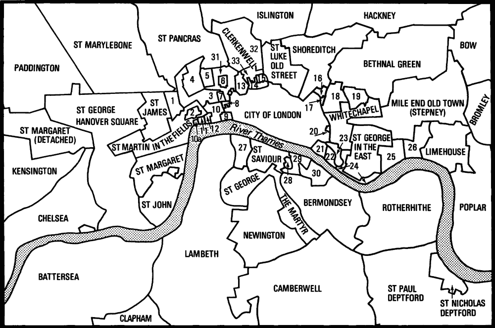
Parishes in London and Westminster, outside the City of London
The map on the facing page has been redrawn from those accompanying W. Loftie's History of London (1884), for which the base map was Rocque's 'Environs of London' (1763).
Key to numbers
1. St Anne Soho
2. St Paul Covent Garden
3. St Giles in the Fields
4. St George Bloomsbury
5. St George the Martyr Queen's Square (Ormond Street)
6. Gray's Inn (extra-parochial)
7. Lincoln's Inn (extra-parochial)
8. Liberty of the Rolls
9. Temple (extra-parochial)
10. St Clement Danes
10a. St Clement Danes (detached)
11. Precinct of the Savoy
12. St Mary le Strand
13. Liberty of Saffron Hill
14. St Sepulchre
15. Charterhouse (extra-parochial)
16. Liberty of Norton Folgate
17. Old Artillery Ground (extra-parochial)
18. Christ Church Spitalfields
19. Mile End New Town
20. Holy Trinity Minories
21. Tower Liberty
22. St Katharine by the Tower (royal peculiar)
23. St Botolph without Aldgate
24. St John Wapping
25. St Paul Shadwell
26. Ratcliff
27. Christ Church Southwark
28. St Thomas Southwark
29. St Olave Southwark
30. St John Horsleydown
31. St Andrew Holborn
32. St James Clerkenwell
33. St John Clerkenwell