A History of the County of Sussex: Volume 3. Originally published by Victoria County History, London, 1935.
This free content was digitised by double rekeying. All rights reserved.
'The City of Chichester: General introduction', in A History of the County of Sussex: Volume 3, (London, 1935) pp. 71-82. British History Online https://www.british-history.ac.uk/vch/sussex/vol3/pp71-82 [accessed 23 April 2024]
THE CITY OF CHICHESTER (fn. 1)
Cesseceastre (ix cent.); Cycester (x cent.); Cicestre (xi cent.); Chichester (xv cent.). (fn. 2)
Chichester stands at the extreme west of the county on the low coastal plain which lies along the south-west shore of Sussex. It is approached by the Roman road from London, a part of the Stane Street which enters Chichester from the north-east by the East Gate. Here the road changes its direction to almost due west and passing out at the West Gate forms the main road to Portsmouth. Converging on this road at the East Gate is a road which a little further east branches to Bognor and Oving. A road from Midhurst, the medieval road from London, enters the city by the North Gate and passes out by the South Gate to Selsey and the villages to the south. The Southern Railway, on the line from London to Portsmouth, has a station to the south of the town, opened in 1846, with a branch single line to Midhurst (opened in 1881). The Hundred of Manhood and Selsey Steam Tramway (fn. 3) (made in 1897) has a station adjoining the railway station. Chichester has become, in the last few years, a centre for motor omnibus traffic. In 1804 coaches ran to London on Mondays, Wednesdays and Fridays only, and returned on Tuesdays, Thursdays and Saturdays; (fn. 4) before 1810, however, there was a daily service to London. (fn. 5) Besides such access by land, Chichester is a port (q.v.) for which ships berth at Dell Quay in the parish of Appledram, about 2 miles to the south-west of the city. The Chichester canal,completed in 1824, (fn. 6) went from Chichester Channel at Birdham to the Arun at Ford. There is also a branch from Hunston Bridge to the canal basin by Chichester station. Between Hunston and Ford it has been disused forty years; and between Chichester and Birdham it is falling into disuse, not having been maintained by Chichester Corporation, to whom it was given by the old Canal Company. (fn. 7)

City of Chichester. Argent sprinkled with drops sable a chief indented gules with a leopard of England therein.
Chichester, being the seat of the bishop, is the ecclesiastical centre of the diocese, and it is also the administrative centre for West Sussex. It is, further, an important trading town, with markets serving a large district around.
The extent of Chichester has altered at various times. Like all ancient towns, it probably covered in early times a large area outside the walls, for purposes of defence and for food supplies. The municipal area before the Conquest is not known, but the chief parish of St. Peter Subdeanery, now known as St. Peter the Great, together with the subordinate parishes of the churches within the walls and those of the churches of St. Pancras and St. Bartholomew without, probably represent the district served by the Saxon minster of St. Peter of Chichester. Martinsgrove, Drayton, Shopwick, Kingsham (Orrea Regis) and 'Egley' also belonged to Chichester until they were granted away by Henry I, who severed them from the city. (fn. 8) Other lands must have been separated from the city in the 12th or 13th century, for in 1260 the limits of the city were carefully defined. It was then stated that the King of the Romans (Richard, Earl of Cornwall) had nothing beyond a distance of 30 ft. outside the walls, that is, to the width of the great ditch. All tenements beyond the ditch were outside his liberty and jurisdiction, and the bailiffs of the city could not exercise their office there. (fn. 9)
At some time after 1278 the city boundaries were considerably extended to the north. We know that the citizens and the bishop held lands in this direction, and possibly the district to the north of Chichester, included in the boundary existing before 1832, (fn. 10) was added at an early date. This boundary approximately went to St. James's Post (fn. 11) and thence to the west to the boundary post (fn. 12) south of the Barracks and so back to the west wall of the city. By the new boundary of 1832 this northern area was retained intact, but the limits of the city were extended to the west, south and east. (fn. 13) The boundaries were again extended in 1893 (fn. 14) to include parts of the parishes of Rumboldswyke, Oving, St. Pancras, St. Bartholomew, All Saints, St. Peter Subdeanery, and St. James (extra-parochial district), and in 1895 (fn. 15) to include further parts of the parishes of St. Peter Subdeanery, St. Bartholomew, and St. Pancras. The city was formerly divided into ten wards, two for each of the four main streets, together with wards for the Pallant and the Vintry, which latter included St. Mary's Hospital and the Grey Friars, (fn. 16) but in 1896 the number of wards was reduced to three. (fn. 17)
In 1753 all the eight parishes of the city were united for purposes of Poor Law administration and the guardians of the poor were empowered to light the city and for a distance of 400 yards from the walls. (fn. 18)
The walls and gates of the city, Roman in origin, have already been described. (fn. 19) The walls, as they now appear, show little or no Roman work, but no doubt the Roman core has been refaced time after time, for there is no reason to suppose the line of the wall has been changed since the Romano-British period.
The duty of keeping the wall in repair was recognised in the 12th century, for when the dean desired to open a way from his garden to his land and orchards between the wall and the River Lavant, he obtained a licence from the king to make a postern gate. (fn. 20) This gate, which can be dated between 1178–1180, is clearly recognisable in the Deanery garden.
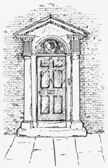
Chichester: Doorway in West Street
Except for the upkeep of the castle, little is heard of the defence of the city until 1261, when the men of the King of the Romans had a grant of murage for five years from the king. (fn. 21)
Questions were constantly arising in the 13th century as to the maintenance and ownership of the ditch. The house of Emeline de Merstone was said to be divided into two messuages, one of which had been built almost in the ditch (quasi de fossato), and therefore was said to owe one penny to the king, as well as 18d. to the lights of the altar of the Blessed Virgin Mary. (fn. 22) There was evidently much dispute as to the relation of these houses to the king and to the earl. It appears that there was a ditch (fossatum) around the part of the city where the castle had been situated, but there was no ditch round the portion where the property of the church lay, save the stream of the Lavant. (fn. 23)
In 1339 the king appointed the Earl of Arundel, Thomas de Braiose and Master William de Fishbourne to survey the walls and put the city in a state of defence at the expense of the mayor, bailiffs and citizens. The bishop (Robert Stratford) and the dean and chapter, in view of the poverty of the city and the heavy expense, agreed to share in the work, the king consenting that such share should not form a precedent. (fn. 24) Again, in 1341, £27 of the fee-farm was remitted, on account of the great charges of inclosing the city. (fn. 25) In 1369 another commission to repair the walls was issued, and the mayor and the dean were to co-operate in seeing that the grant of murage for ten years was applied only for these repairs. All merchants 'who stay there continually and live of their merchandise,' even if they held no tenement, were to contribute. (fn. 26) In 1377 authority was given to the mayor and bailiffs to complete the city ditch newly begun, 50 ft. broad, with its walls, turrets, and gates, and to remove houses and buildings adjacent to the wall or where the ditch ought to be constructed, compensating the owners; the mayor had authority to compel all religious persons as well as secular to contribute. (fn. 27) In 1385 the mayor had power to demolish all buildings and trees within 100 ft. of the walls, and even the suburbs, (fn. 28) when it was necessary for greater safety; he could apparently impress labour for this purpose anywhere within the rape of Chichester, and punish the disobedient. (fn. 29) The last grant of murage is said to have been in 1443, when the wall from the East Gate to the South Gate was substantially repaired. (fn. 30) The walls and ramparts were repaired in 1724 and the walks on the north and east walls were levelled by William Beauclerk, M.P. The elm trees along these walls had been planted in 1701. (fn. 31)
We know little of the medieval gates, except that the North, West and South Gates were taken down in 1772–3, but the East Gate stood until 1783, as it supported the city gaol, which was then rebuilt on the south side of it. (fn. 32) There is a reference in 1374 to the chapel of Our Lady upon the North Gate which is supposed to have been in the upper story of the gateway. (fn. 33)
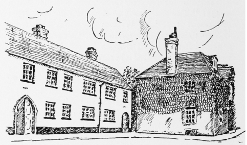
The growth of the city of Chichester is shown by its architecture. The medieval city was probably composed mainly of timber-framed buildings, and indeed, until the 17th century, when brick was employed, with the exception of a few stone houses, other methods or materials were little used. At the turn of the 18th century, however, there was a gradual change in the appearance of the town, and by the end of the century it had been almost entirely rebuilt. Except for the shop-fronts and one or two alterations and replacements (due to fires) it has altered very little since then.
Architecturally the general character of the buildings is rather primitive, but there is some excellent work in the larger houses, the most noteworthy feature being the number of beautiful 18th-century doorways and their fanlights, and the surprising number, ingenuity of arrangement, and excellent detail of the bow-fronted windows in the main streets.
Like all Roman walled towns, Chichester was divided into four quarters by two main roads or streets crossing approximately in the middle of the town. At the crossing and extending up North and East Streets was the Market Place, which has been encroached on considerably during the last 300 years. (fn. 34) Speed's map of 1610, showing East Street extending in width up to St. Olave's Church in North Street, is unreliable; but William Gardner's map of 1769 shows alleys a little south of the church of St. Olave which may indicate the former frontage of the Market Place. Mason in 1810 further states that the cross 'was originally in the centre of a large square, which formed the market place, but has long since been occupied by houses which have encroached much on the space round the cross, particularly on the north side.' He mentions a scheme in his time for purchasing and pulling down the houses on the north side to show the cross to better advantage. (fn. 35)
These encroachments unfortunately spoil the setting of the beautiful Market Cross, which, when first set up, was designed for and stood in a wide open space. The cross was erected by Edward Story, Bishop of Chichester (1478–1503), about the year 1500. In fulfilment of his will, his executors granted to the dean and chapter property in North Kingsham in compensation for land, formerly belonging to the cathedral, upon which had been set up a cross in the midst of the city. (fn. 36) Story left £25 a year for the upkeep of the structure, which ceased to serve its original purpose in 1808, when the present Market House was opened.
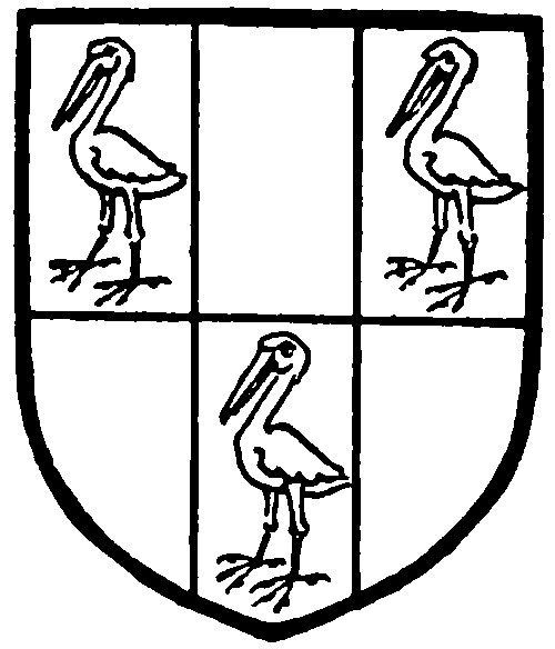
Story. Six pieces argent and sable with three storks close sable.
The cross is an eight-sided building of Caen stone, having a central shaft above which is a cupola, (fn. 37) supported by eight flying buttresses. Internally, the ribbed vaulting springs from the massive central shaft to small pillars at the outer wall. Around the base of the central column is a low stone seat, and the floor is stone-paved and raised on steps. Externally each side has a heavily moulded four-centred arched opening under an ogee-arched hood, having cusped infilling carved with the bishop's mitre and bosses of demi-angels. The finial of the ogee-arched hood supports a cinquefoil-headed niche with an elaborately carved canopy, surmounted by a crocketed finial with iron standard. At the sides of the hood are two rows of ogee-arched panels, and above them is a heavily moulded panelled parapet of four quatrefoil compartments. Each buttress is of two stages terminating in square crocketed and panelled pinnacles supporting iron standards. The eight crocketed flying buttresses support an eight-sided cupola, with carved open ogee-arches on clustered columns. The cornice carries the curved conical roof crowned by a ball and an iron standard weather-vane, added at the 1746 restoration and replacing a square classic finial and clock, which succeeded the original finial containing eight niches for statues. Each side facing a street has no canopy above the niche, but in its place is a clock dial, set in a carved stone surround, resting on the parapet and finished with an ogee-point terminating with a finial and an iron standard which was added in 1746. The east side contains a bronze bust of Charles I in a specially formed niche in the place of a statue of the founder which formerly stood there. The fabric was twice repaired—namely, in the reign of Queen Elizabeth, and again in that of King Charles II, when the bust of his father was added and the finial reinstated, while in 1724 Lady Farrington caused the latter to be taken down and substituted a classic bell-cote and clock. The Duke of Richmond made extensive renovations and alterations in 1746; since that date the cross has remained unaltered. It was railed in in 1809, but the railings were removed in 1872. The cross was carefully repaired and treated with a stone preservative in 1930 and is now scheduled under the Ancient Monuments Act. The iron standards are painted with armorial bearings, notably the Royal Arms (1746) and those of Bishop Story, Lady Farrington and Charles, Duke of Richmond.
Around the Market Place were the houses and shops of the burgesses. It is interesting to note the development of the parishes here which include, as in London and other towns, portions of the main streets with boundaries extending to the ends of the gardens and back premises of the houses on each side of the street.
The south-west quarter of the city was occupied, except for the street frontages, by the precincts of the cathedral, which are described later. The south side of West Street is, along its eastern half, open to the cathedral churchyard. At the east end of the churchyard here was the Cross Gate, or Paradise Tower Gate, and at the Belfry Tower was another gate called Tower Gate, or Sun Gate; between them was the Middle Gate. (fn. 38) In 1205 King John gave licence to the Bishop of Chichester to build shops, 12 ft. in breadth, round the walls of the cemetery, presumably on the soil of the king's highway. (fn. 39) Such buildings facing West Street remained until 1848–52, when they were pulled down and the view of the cathedral opened out. (fn. 40)
Towards the west end of West Street on the north side is Westgate House, now the County Hall and offices of the West Sussex County Council. It was begun by John Edes, who moved to Chidham shortly before 1688. He was the elder son of John Edes of Dedham (co. Essex) and nephew of Dr. Henry Edes (d. 1703), Canon Residentiary of Chichester and an adherent of the Duke of Monmouth. He married Hannah, daughter of Thomas Aylwyn of Chichester, in 1693, when he probably began to consider the building of Westgate House. He died, however, in 1695 before its completion, leaving it to his widow, who finished it in 1696. The lugs of the lead stack pipes bear the initials H.E. for Hannah Edes. Henry, son of John Edes, resided here and, at his death in 1722, left an only daughter Mary, who married the Rev. John Frankland, Canon Residentiary of Chichester. The house was acquired about the middle of the 18th century by Peckham Williams, sheriff of Sussex in 1750, who was succeeded by John his son. John Williams left Westgate House to John Leigh Williams, alias Hollest, of Exeter (d. 1856), whose widow Emily, described as of West Street, sold it in 1860 to William Duke, of Chichester. In 1916 it was purchased by the West Sussex County Council for their offices. (fn. 41) The design of Westgate House has been attributed to Sir Christopher Wren, who visited Chichester to report on the cathedral twelve years earlier. Although the design is one of great dignity and exhibits some of Wren's characteristics, there is no evidence either among the papers he left or other sources that he was its architect. It stands some 8 yds. back from the road behind a 7 ft. high brick wall, and the forecourt is entered through a wrought-iron grill gateway, with panelled stone piers, capped by stone urns holding upright pineapples of excellent conventional design. It is of two stories with basement and attic, and is built of red brick with Portland stone dressings and has a tiled roof. The roof is hipped with lead ridges, and there are dormer windows north and south in the hips. The cornice of wood is heavily decorated and bracketed, but of excellent design. The casement windows are well proportioned with mullions and transoms flush with the wall face; (fn. 42) the sills are of stone. A feature of the building is the number of circular wood-framed windows and elliptical brick basement windows. The south, or street, front shows projecting wings and a stone central portion of slight projection marked by a small pediment. In the brick tympanum of the pediment is a monogram J.H.E. in script capitals (for John and Hannah Edes), surmounted by the crest of the Edes family (a lion's jamb razed holding an olive branch) and flanked by dated stones, the figures 16 on the one side and 96 on the other. The doorway, of poorer design, has a flat arch crowned by a curved pediment broken to receive the coat of arms of the Edes family. The house has been restored in places, notably parts of the ground floor on the north side, while the garden entrance is an entirely modern addition. The chimney-stacks are of brick panelled; two appear to have been rebuilt. Internally the plan is simple. The large central hall gives access to various rooms, including a smaller hall on the axis, with the staircase on the west. The main hall, which has now been divided into two parts by a wooden screen, has the original panelling to a height of 8 ft. 6 in. The east room has the original unvarnished pine panelling intact, and the north-east room has plastered walls with the original cornice and a fireplace of bold design in wood painted, with a panelled overmantel, cornice and broken pediment. The west room is panelled to dado level and the original fireplace remains, but the cornice is missing. The staircase runs from attic to basement, and is lacking in interest. The first floor has a large vestibule on the east side. All the rooms retain their panelling except two; that on the west is a fine room with fireplaces of Sussex marble. All the windows in the west wall are modern. The basement, which formerly contained the kitchens and cellars, has been entirely altered. In the small garden on the north side is a large fluted sundial of unusual merit which is probably contemporary with the house.
Edes. Azure a cheveron engrailed between three leopards' beads argent.
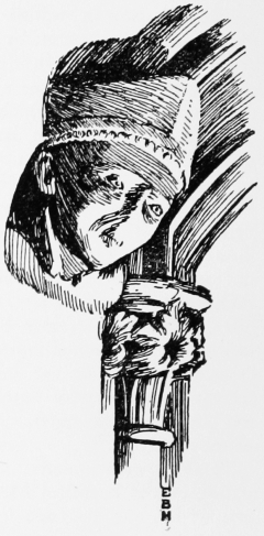
Chichester: Corbel In Prebendal School
Most of the other houses in West Street are of the 18th century; the Dolphin and Anchor Hotel, of that date, is built of brick plastered and is an interesting old coaching house. The Dolphin was already established in 1660 (fn. 43) and in 1670 was returned as containing 23 hearths, a number only equalled by the Bishop's palace. (fn. 44) Further west on the north side is Whitby's Free School, or Bluecoat School, founded in 1702 by Oliver Whitby, but rebuilt in brick with stone dressings in 1904. The Prebendal School, now known as Bishop Story's School, on the south side of the street, founded or refounded by Bishop Story in 1497, in 'the tenement called Furley, alias Ledynporch,' to the west of the tenement of the subdean, (fn. 45) has remains of medieval work, but was largely rebuilt in 1830.
Leading northward from West Street to the city wall are Chapel Street (taking its name from the Providence Calvinist Chapel), formerly called Paris Lane, East Lane and Upper West Lane; and Tower Street (formerly West Lane), (fn. 46) opposite to the bell tower. (fn. 47) The houses in both streets are mostly of the late-18th and early-19th centuries. St. Peter the Great Parish Room, in Chapel Street, is of brick; it was formerly the Independent Chapel (q.v.). It has two entrances from the street and five arched windows. To the south-west of the street, there was an early-17th-century house of timber-framing, removed in 1934. The wool store of Messrs. Prior, in Tower Street, was formerly the Lancastrian School, which was moved in 1910 to new buildings in Orchard Street. The Grange, (fn. 48) on the west of Tower Street, is a 19th-century house standing in a large garden. Some land in the northern part of the north-west quarter seems to have been held in 1107 by the Abbey of Troarn in Normandy. On their property was the chapel of St. Cyriac which is mentioned as early as 1155. (fn. 49) The position of the chapel is not definitely known, but in a 13th-century terrier of lands in Chichester in the Boxgrove Chartulary there is an entry relating to a croft in West Lane (now Tower Street) next the chapel of St. Cyriac, (fn. 50) and about the same time we have a reference to the lane of St. Cyriac. (fn. 51) This lane, it is suggested, ran under the north wall and, if this is correct, the site of the chapel would be at the north end of Tower Street. In 1269 Henry III, who, on account of his reverence for St. Cyriac of Chichester, had allotted 50 marks for the repair and 5 marks for a chaplain celebrating daily in the church (ecclesia) of the saint, appointed Stephen de Midhurst as chaplain. (fn. 52) By 1405 the chapel had become a hermitage (fn. 53) and in 1583, described as the old chapel of St. Cyriac, it was granted by the Crown to Theophilus and Robert Adams and the heirs of Theophilus. (fn. 54) It was rented at 4d. in 1611 and in 1652 it was held by William Cawley, the regicide. (fn. 55) This is the latest reference to the chapel that has been found.
Outside the West Gate the houses are mostly of the 18th century, as the older suburb dating from the 13th century was burnt down during the siege. Westgate Brewery, established about 100 years ago, and Chichester Tannery are on the south side of the road.
It is interesting to note that, with the single exception of the church of St. Peter Subdeanery, all the eight ancient parish churches within the walls of Chichester were situated in the two eastern quarters of the city, and five out of the eight were in the north-east quarter. The great churches and houses of the two orders of mendicant and preaching friars, namely, the Black Friars and Grey Friars, were also in these quarters. This fact may partially account for the smallness of the Chichester parish churches, and the existence of the extensive burial ground, called the Lytten, outside the East Gate, may further be the reason of the smallness of the churchyards.
It is clear that the eastern half of the city was the populous and trading area, and that East Street, between the two quarters, was the busiest part of all. Here are several interesting 18th-century houses, many of them timber-framed but refronted in brick in the 19th century. On the north side, nos. 2 and 3 form a well-designed house with a delicate cornice and architrave to the windows. The town clerk's office (nos. 42 and 43) is a pleasant 18th-century house with a bay window and having a large garden behind. Nos. 71 and 72, on the south side, form a mid-18th-century house also with bow windows. The Corn Exchange built about 1830 on this side, adjoining Baffin's Lane, is now a cinema. It is an example of the Greek revivalist school and is of good proportion. The front on the street consists of an entablature and pediment carried on six Greek Doric columns thrown forward over the pavement to form a narthex. Formerly the city arms took the place of the pediment.
The most important house in East Street stands on the south side of the street near the Cross and forms nos. 92 and 93. The former is now an inn called the Royal Arms, better known as the Old Punch House. The house is built near the site of the church of St. Mary in the Market, and was formerly known as Scarborough House. It has been alleged that John Lord Lumley entertained Queen Elizabeth here in 1591 and made elaborate preparations for her visit. (fn. 56) He was succeeded in 1609 by his kinsman Sir Richard Lumley, created Lord Lumley of Waterford in 1628, and he by his grandson Richard, created Earl of Scarbrough in 1690. The house seems to have passed to James, seventh son of the earl, in 1721 and on his death, unmarried, to his nephew George Montague, Earl of Halifax. Mr. Weller is described as proprietor in 1750, but early in the 19th century (fn. 57) the house became noted for the making and sale of Chichester milk punch by one Parker, from which it obtains its present name of Punch House. The building has been so much altered that it is difficult to assign any definite date to it. The plan is a rectangle along the street front with deep wings east and west; the east wing was the parsonage of the church of St. Mary. (fn. 58) Both these wings have been rebuilt. The original building was timber-framed of oak, having two upper stories, one projecting over the other, and a tiled roof. The present street front is symmetrical, having as a central feature a magnificent three-sided bow window supported on two Roman Doric columns carrying a delicate plaster entablature; the ground floor, converted into a shop about 1800, consists of two bow windows on either side of a door with a good fanlight. The south front is modern. Internally the original external oak brackets are still to be seen, being highly carved and of the same piece of wood as the upright posts. In the south wall is a stone carved with a coat of arms (a cheveron between three roses—probably for Weller). The ground floor is completely altered. The modern lounge is lined throughout with panelling of the late 16th century, transferred from the audience chamber on the first floor. Here is a magnificent moulded coffered ceiling continuing over the bow window and ornamented with the Tudor rose (bosses), the fleur-de-lis and the dragon. Above this room is the guest-chamber, perhaps redecorated in 1591. It is panelled and the ceiling is decorated with shields, those at the corner bearing the three lions of England and in the centre is the Tudor rose. An oak beam discovered during recent alterations bore the name of 'William Holland, 1595,' who was mayor in 1580, 1588 and 1597.
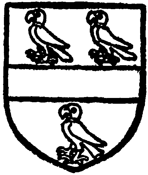
Lumley. Argent a fesse gules between three parrots vert with collars gules.
South Street contains many houses of the 18th century, mostly of brick, and here may be noted again the use of bow windows. The undercroft of the Vicars' Choral Hall is described under the Cathedral Close. No. 22 is a gabled timber-framed house of the late-16th or early-17th century. The most interesting house here is no. 55, Farrington's House, built in the early part of the 18th century by Lady Farrington, widow of Sir Richard Farrington, bart., who was living here at the time of her death in 1739. It was purchased from her executors by Messrs. Baker and Bennett, who pulled down a part of the house on the north side and thus spoilt its symmetry. It is now used for a cinema and shops. The house is built of brick with a carved and moulded wood cornice of excellent design. It is of two stories, attic and basement, and has a tiled roof. The same architect probably designed it who designed Westgate House. The street front has been altered beyond all recognition, as shops were built about 1875 in the forecourt and entirely obscure the entrance doorway and walling. The first floor, reached by a staircase against the north wall, is divided into three rooms which retain the original panelling.
The theatre at the south end of the street was built of brick in 1791. Beyond the South Gate, in what in early days was known as Fore Street, the houses are mainly of the first and later years of the 18th century. The canal, docks and warehouses were built in 1824; and the offices of the Chichester Gas Company in Stockbridge Road in 1903.
Eastward of South Street is the district called the Pallant, which, like the city, is divided into four parts by streets called respectively North, South, East and West Pallant. There was formerly a wooden cross, mentioned in 1479, at the crossing, which was demolished in 1713. (fn. 59) The Pallant seems to have been mainly a residential district, the houses in which were mostly either rebuilt or refronted in the middle of the 18th century. A notable feature is the interesting series of doorways with fine fanlights already referred to. On the east side of South Pallant is Chichester School, founded in 1924. There was a school in the Pallant in 1604, when Alexander Wicksted had licence from the Archbishop to teach boys to read English, to write and calculate, and instruct them in the rudiments of the Latin tongue, in the parish of All Saints. (fn. 60) Behind Chichester School, in a garden, is Cawley Priory, a modern house erected late in the last century and approached through entrance gates crested with hawks statant.
The Pallant House, sometimes called Dodo House from the ostriches on the gate posts, stands on the east side of the North Pallant at the junction of the four streets. It is said to have been built about 1712 by Henry Peckham (1683–1764), commonly called 'Lisbon' Peckham, owing to his interests in the wine trade. He was the son of John, son of Sir Henry Peckham, who was Recorder of Chichester under Charles II and died in 1673. The house came into the possession of William Duke, a solicitor, who occupied it in the middle of the 19th century. The Westhampnett Rural District Council acquired the house for use as an office in 1916. The house is of two stories and basement, built of red brick with cut brick quoins and dressings. Like Westgate House, it has been claimed to be the work of Sir Christopher Wren, but without any justification. The west front has seven window bays and a central doorway with plinth, string and cornice, all in brick and rather heavy. The windows are tall but of good proportion, with wood frames containing sashes flush with the wall-face, and with carved heads and keystones, each bearing an emblem (rose, oak, thistle, fleur-de-lis and harp). The doorway is an excellent piece of work, having two Corinthian pilasters carrying an entablature, of which the top member runs into the stringcourse and is capped by a beautifully carved curved cornice. The chimneys are square, simply panelled, and linking into the panelled parapet on the south side. The east or garden front is symmetrical without quoins; the arched staircase window has two window bays on each side, below which is the garden doorway. Two of the windows on the first floor have curved iron verandas. An additional story was built on the north-west corner later in the 18th century, traditionally by Henry Peckham, as a lookout to see his shipping in Chichester Harbour. The west front has a paved forecourt, and the house stands back from the road behind a low brick retaining wall with stone coping, on which are iron railings of good design. At the entrance are two brick piers on stone plinths of elongated proportion, crowned by the stone crest of the Peckham family, an ostrich proper. The piers formerly carried iron gates, now removed, but the overpiece still remains as an iron grill, bearing the monogram H.P. in script capitals, reading both ways. The room on the south side, now the board room, was formerly two rooms, the panelling and fireplaces of which are later insertions. The committee room, at the north-west corner, was formerly the dining room; it is panelled throughout and has a late18th-century wooden fireplace of delicate design; the mantelpiece is supported on fluted Corinthian pilasters. Behind this room were formerly the kitchens. The main staircase is a good example of the period, being of two flights broken by a landing; the handrail and turned balusters are richly carved and moulded with newel-posts of Corinthian columns, finishing on a curved step. The walls are panelled to handrail level. The first floor has a main landing panelled to the ceiling. Facing the stairs is a wooden partition having a central doorway in an arched surround, flanked by Corinthian pilasters. The central room retains the original panelling to the ceiling, but the fireplace has been replaced by a later marble surround, with a good 18th-century grate. Of the rooms on the south, the east has a good late-18th-century marble fireplace; no doubt the south windows were blocked at this time, possibly on account of the window tax. The house immediately to the north of Pallant House contains a 15th-century groined cellar and a fine 18th-century staircase.
Peckham. Ermine a chief quartered or and gules.
The County Court Office, on the south side of the West Pallant, is one of the earlier houses of the city, built probably at the beginning of the 17th century. It is of three stories with a parapet and cornice above, and was refaced on the north side at the end of the 17th century. The east side shows a double gable, probably timber-framed, but the whole house has now been plastered. Internally the building has been much altered; the staircase is late 18th century, but some rooms exhibit panelling of the early 17th century, notably that on the west of the entrance, where the modern fireplace has an elaborately carved wooden overmantel of the same date.
The eastern part of the south-east quarter, now called New Town, was formerly the site of the precincts of the Black Friars, or Friars Preachers, and hence it is still extra-parochial. It is bounded by East Street on the north, the wall on the east and south, and Baffin's Lane on the west. The friars obtained a site here before 1284 when Edmund, Earl of Cornwall, released to them the rent of it. In 1286 Queen Eleanor gave them a further plot in East Street, lying between the land of Juliana, sister of John the Chaplain son of Nicholas the goldsmith, on the west, and Pouke (or Goblin) Lane, which probably ran down beside the wall, on the east. (fn. 61) In 1289 the friars obtained licence to close the street leading from the church of St. Andrew in the Pallant to the city wall to the east, and also another street running under the city wall from East Gate to South Gate (probably Pouke Lane), upon condition that they made a new road from St. Andrew's in the Pallant to the city wall on the south, (fn. 62) which would be in continuation of Baffin's Lane; this road, however, was closed in 1763 by Mr. Bull. (fn. 63) The Black Friars were dissolved in 1538 and their lands were granted in 1541 (fn. 64) to Edward Myllet, who died in 1549 and was succeeded by his daughter Cecily, who obtained seisin in 1551. (fn. 65) The site passed to Richard Lyne and from him about 1571 (fn. 66) to William Overton, and from William to Richard Overton in 1577. (fn. 67) Richard Overton conveyed it to Edward Bridges in 1580 (fn. 68) and James Colbrande died seised of it in 1600, leaving a son John. (fn. 69) In 1606 it was held by George Gornage (fn. 70) and in 1633 Robert son of Sir Peter Garton died seised, leaving his brother Henry his heir. (fn. 71) Henry died in 1642, leaving an infant son, Walter, and wife Dorothy. (fn. 72) The site was in the family of Page from 1662, and from John Page of Watergate, M.P. for Chichester 1741 to 1761, it descended to his granddaughter Frances Thomas, sole heiress of George Thomas of Watergate House, and wife of Major-Gen. Crosbie. (fn. 73) For some time the site was in the occupation of Mrs. Tuffnell, but at the beginning of the 19th century Gen. Crosbie sold it in building plots. Foundations of the Friary were found in building houses here, and the chapel of St. John is said to stand on the site of the Friary church. (fn. 74) Probably the church equalled in size the great church of the Grey Friars in Priory Park. Many wills refer to burials in the church, and in 1526 William Cooper desired to be buried 'under the yew tree in the churchyard' there. (fn. 75)
North Street has always formed the chief administrative area of the city. Like the west end of East Street, the street at the south end, where the Market was held, has been encroached upon. The houses in the street are principally of the 18th century, and here particularly may be noticed the interesting series of bow windows, so typical of Chichester architecture. No. 21 bears on the rain-water head WPM 1736. No. 43, built in the earlier part of the century, has received its bow window with the Gothic touch of an ogee arch later in the century. Nos. 31, 37, 67 and 83 have interesting examples of 18th and 19th-century bow windows.
Chichester: The White Horse Inn, West Pallant
The Market House, on the east side of North Street, was erected in 1807 from the design of T. Nash. The main hall is of brick, apparently refaced, but the street front is of stone. The façade has five openings between Roman Doric columns carrying an entablature and balustrading, above which is the coat of arms of the city; the cornice is run through to link up the wings, which are of slight projection and have small arched niches. Another story has been added of recent years to house the Technical Institute, which is approached by a doorway formed through one of the niches; in the other niche is the Diamond Jubilee Memorial Fountain presented by Alderman Ballard.
The Council House, on the same side of the street, was erected by subscription in 1731 to replace an earlier timber-framed structure. It is built of brick with stone dressings, and is of two stories. The house consists of an open arcading leading to the hall, beyond which were the kitchens. On the north side of the hall is the staircase to a square landing, off which were the various civic chambers. The central part is brought forward and divided into three bays, carried on solid brick arches, by stone threequarter columns of the Ionic order, supporting an entablature and panelled parapet. The central panel bears a stone inscription and is surmounted by a lion; and below is an arched window flanked by smaller windows. The wings are carried on further arches. The Council Chamber, over the west front, is entered from the west door of the landing. It is a well-proportioned room lit by three windows in the west wall, and one each in the north and south walls. There is a panelled wooden dado and a richly decorated bracketed cornice of plaster 14 feet above floor level, springing from which is a large cove carrying a coffered ceiling. At either end is a highly decorated wooden fireplace with pedimented overmantel panelled to contain a portrait; one of these fireplaces would appear to have been rebuilt. In the room are wood panels, giving a list of mayors from 1532 and various municipal bequests. The furniture has been renewed except the table, which is original. The walls are lined with portraits. The Assembly Rooms, of brick, were added to the east from the designs of James Wyatt in 1783; the approach to the main room is by way of a staircase on the south side, or through an ante-room, formerly a civic apartment. It is a spacious room of three bays, lit by three windows on the north and two on the south. Between the windows, the walls project into the room and have niches containing classical statuary, beneath which are the fireplaces; the ends are similarly treated, the east being apsidal with a raised dais. The double doors south and west are well treated, but the dado, rail and cornice are all rather heavy. Further additions in a similar style were made at the south in 1880, which materially altered the plan.
Chichester: Old Houses in North Street
The offices of the County Education Committee are on the west side of the street (no. 40) in a large mid-19th-century house built of flints with brick dressings; the doorway seems to have come from an earlier building.
Probably adjoining the church of St. Peter the Less, on the east side of North Street, stood the early Gildhall, the history of which is dealt with later.
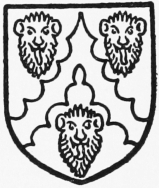
The houses in the north-east quarter are mostly of the 18th century, some perhaps with new fronts disguising an older building. No. 3 St. Martin's Square is an interesting early-17th-century timberframed structure with gable ends and upper story of slight projection and tiled roof. Later in the 17th century, probably about 1680, the house was entirely refaced with brick and stone dressings by Sir John Farrington (d. 1685). The south front is of two stories capped by a heavy wooden cornice and a central doorway with two sash windows on each side. The doorway is of gauged brick with a slight cornice, thrown forward to form a porch in the thickness of the wall. In the keystone are the Farrington arms (quarterly, argent, a cheveron between three leopards' faces gules; and gules three cinquefoils argent). In the middle of the 18th century the house was in the possession of Till Hollier, the collector of customs, who had his office and bonding warehouse in the rear of the house. (fn. 76) Southward of St. Martin's Square is St. Martin's Street, formerly called Hogs Lane, from the Pig Market here.
The Hospital of St. Mary is now situated on the east side of St. Martin's Square. The site was formerly occupied by the Grey Friars, until, in 1269, the Friars moved to the Castle precincts, when it was presented to the hospital. (fn. 77) In 1290 the hospital closed a public path across it, (fn. 78) and this probably indicates the commencement of the existing building, the character of which agrees with this date.
The buildings consist of a gatehouse on the street front, an aisled infirmary hall, two-thirds of which only remain standing, and a chapel at the eastern end. In spite of its incompleteness it is one of the most important and characteristic examples of medieval hospital architecture in the country. The original size of the hall would have been 100 ft. by 45 ft., the internal dimensions of the four existing bays being 79 ft. by 44 ft. 10 in. The chapel measures 45 ft. 8 in. by 22 ft. 5 in.
Chichester: St. Martin's Square
The chapel is divided by buttresses in the north and south walls into two bays, with two windows in the western and one in the eastern bay, making a series of three equally spaced two-light windows on each side. The windows are of two designs, the traceried head in one being formed of a circle of five small circles with trefoil cusping, and in the other of a quatrefoil set within a pierced triangular cusped opening over each light. The lights themselves have trefoil heads. The reveals have wide splays and chamfered rear arches. The east window is of five lights and is modern, but it is a reconstruction of the original design.
The chapel is connected to the hall by a stone twocentred arch of three moulded orders, the jambs having triple shafts with moulded capitals and bases, the abacus being prolonged to take the outer orders. The archmoulds die into the characteristic cylindrical form, used in the early 14th century, above the capitals.
The roof is of seven-sided waggon form, with trusses and moulded tie-beams in the centre of the structural bays, and a moulded wall plate. All the surfaces are panelled with plaster between moulded ribs, and carved bosses at certain of the intersections.
An elaborate contemporary screen of eight compartments, the two centre compartments forming doors, separates the hall from the chapel. Each compartment has in its upper part four open arches on banded shafts, with capitals and bases, carrying tracery within a triangular head, each gable being finished with a crocketed finial and flanked by pinnacles. The uppermost member is a heavily moulded beam, with perhaps later curved scroll-work beneath it. Backing on to the screen are six stalls, and there is a return range of nine stalls on either side, making twenty-four in all. The stalls have carved misericordes and the north and south ranges have backs and return ends with arcading on shafts similar to the screen.
In the south wall of the chapel are three sedilia, with shafts and canopies, each being formed of a twocentred arch with ogee point under a gable, with traceried filling and finial of carved foliage. A piscina of similar design is in the same wall towards the east.
The hall is practically of timber construction, the main weight of the roof being taken by the oak posts which mark the aisles. The external walls are about 7 ft. in height only, whereas the roof rises to 42 ft. at the ridge. There are traces in the walls of the small stone windows that served the original cubicles. In the east wall there is a two-light window with quatrefoil head, similar to the chapel windows, each side of the chapel arch. The west wall is modern.
The roof is of open timber construction throughout and resembles that of the contemporary kitchen in the Bishop's Palace. The posts are 22 ft. high and carry the main tie-beams and purlins, to both of which they are framed by turn braces, stiffened by a strut that bisects the angle of post and beam. A plain king-post connects tie-beam and collar, and is furnished with the usual struts, with additional ones between collar and rafter. A second collar occurs 5 ft. below the apex.
In the 17th century four massive brick chimney stacks were built within the central aisle of the hall, with moulded brick pediments (circular and triangular shaped) over the fireplaces. The one to the south-west bears the date 1680, that to the north-west the initials HOE, doubtless for Henry Edes, custos. At the same time the existing rooms were formed for the alms-women who reside here.
The gatehouse, which formerly adjoined the hall and incorporates part of its west wall, preserves its original inner and outer doorways. It formed the vestibule of the hospital and the porter's lodging. The administrative buildings connected with the hospital have completely disappeared.
Further east is Little London (Litillondon, 1483), at one time called Savary Lane, where the knights of St. John of Jerusalem held property. (fn. 79) At the north end of Little London, occupying all the north-east of the quarter, is what is now called Priory Park. Here is the site of the castle, of the mount and bailey type of the Norman period. It was probably commenced by Roger de Montgomery, and we may imagine he threw up the keep mount which still exists in a fragmentary form. (fn. 80) We have no reference to a stone keep, which, in order to allow for the settlement of the earth, could not have been built for many years after his time. Perhaps nothing but the original timber keep was ever erected. There was a chapel in the castle as early as 1142. (fn. 81) Apparently it was against John, who attempted to seize the Crown during the captivity of Richard I, that in 1193 the castle was victualled with barley, beans, bacon, etc., (fn. 82) the usual stores for a siege, and in the following year payment was made to five knights who garrisoned the castle for 24 days. (fn. 83) We do not know whether John's forces besieged the castle, but in 1194 and 1195 we have accounts for the works of the castle and the repairs of the houses and chapel. (fn. 84) In 1198 a gaol was built there. (fn. 85) The castle was put in charge of William Marshal, Earl of Pembroke and sheriff of Sussex in 1195, and he continued constable until 1208, (fn. 86) when Richard de Mucegros succeeded him. The citizens were ordered in 1215 to carry out the instructions of Matthew Fitz Herbert, the sheriff, for fortifying their city. (fn. 87) The castle was probably never of any great strength and John, fearing it might fall into Louis' hands, ordered its destruction in 1216. The order was not carried out before the death of John, and it surrendered to Louis. (fn. 88) Early in 1217, however, the castle was retaken and Philip de Albini was commanded without delay to throw it down and destroy it to its foundations. (fn. 89) There is nothing now left but the keep mount to mark the place where it stood.
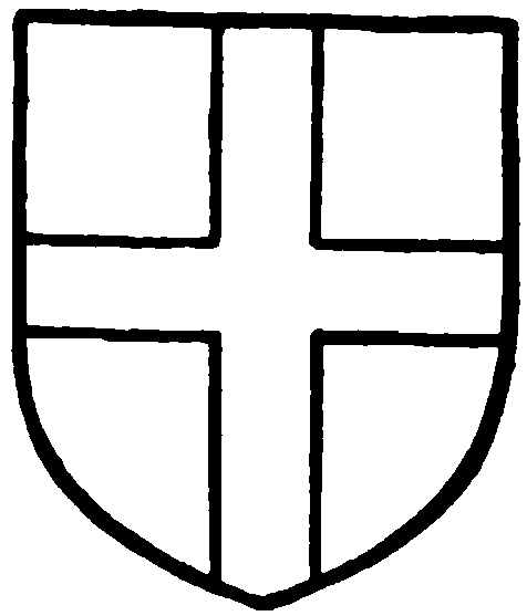
The Knights Hospitallers. Gules a cross argent.
The site of the castle was given, as the place called the Old Castle, by Richard, Earl of Cornwall, about 1269, to the Grey Friars to make their dwelling. (fn. 90) The previous house of the Grey Friars was acquired by Henry de Chikehull and given by him to St. Mary's Hospital. (fn. 91) The Grey Friars were dissolved in 1538, and in 1541 the site was granted to the mayor and citizens, who converted the chancel into a Gildhall and leased the grounds in 1543 to John Knott, who built a house adjoining the church on the south side. Later tenants were William Appleby (1567), John Yonge (1580), Ralph Chandler (1581), George Goring (1582), Sir John Caryll (1602), Christopher Lewkenor (1634), William Cawley (about 1647), Sir Richard May (1674), and Sir Huchins Williams. In 1700 Sir Pier Williams obtained a lease for 999 years, from whom the land and house passed to Sir Booth Williams and then to Mr. Fonnereau, who married a daughter of Sir Huchins Williams. (fn. 92) Later it was held by Admiral Frankland, who, at the end of the 18th century, pulled down some remains of the conventual buildings to enlarge his house. The house was demolished early in the 19th century. (fn. 93) The property was acquired in 1824 by the Duke of Richmond, and in 1851 was held in trust as a Public Recreation Ground. In 1918 the 7th duke presented it to the city for a pleasure ground called Priory Park, as a War Memorial. The Gildhall was used as the Shire Hall for Assizes until 1748 and for election purposes until 1888. (fn. 94)
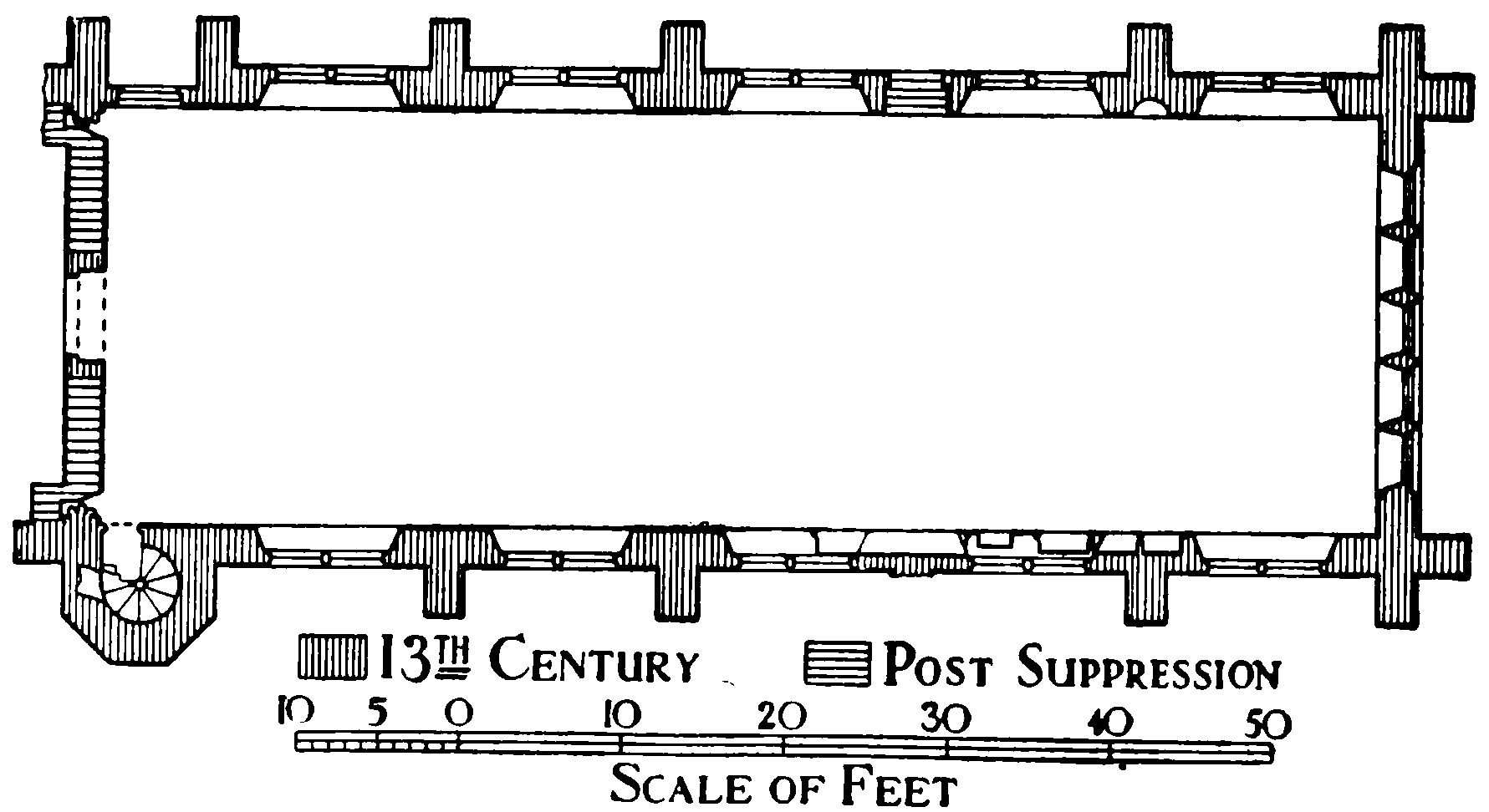
Chichester: Plan of Grey Friars Chancel
The fine chancel of the friars' church and portions of a building to the north-west of it, probably the hospitium or guest house, alone remain. The church would have consisted probably of the existing chancel, possibly a small central tower and a great preaching nave with aisles. (fn. 95) To the north of the nave were probably the cloisters, around which were the living quarters and offices of the friars. The chancel, which was adapted for the gildhall of the city in 1541, was originally built between 1270 and 1280. It was stripped of its fittings and much damage was done in adapting it for secular use. It is built of flint rubble with Binstead and Caen stone dressings and a tiled roof. It measures internally 82 ft. by 31 ft. It is divided into five bays with a half-bay at the west end, each bay, except one on the north side, being marked by buttresses. In the east wall is a very fine late-13th-century window of five lancets divided by delicate detached shafts which rest on a projecting wall. The outer lights are cusped with cinquefoil heads, of 15th-century date. The projecting wall below the window contains a triple arched niche. In each of the five bays, on either side, was a two-centred window of two lights with quatrefoiled head, recently unblocked. Between the first and second bay from the east on the north side is a trefoil-headed niche, and there is a doorway, now blocked, between the second and third bays which takes the place of a buttress here, and another blocked doorway in the last half-bay. The south wall contains, in the second bay from the east, late-13th-century triple sedilia of three trefoil-headed openings on shafts. To the west of the sedilia is a recess with a plain pointed arch, possibly a piscina, and in the third bay a 14th-century recess for a tomb, consisting of a two-centred moulded arch carried on small shafts with a triangular head panelled with tracery and having a carved finial. Within the recess is an 18thcentury doorway. In the south-west corner, down two steps, is a small doorway to a circular stone staircase leading probably to the upper stories of a small central tower. String-courses are carried round the church internally, at the springing line and over the arches of the windows, and there are indications of others below the window sills. The great chancel arch at the west end is simply moulded and carried on clustered columns with plain capitals and bases. The arch is blocked, and in the blocking wall have been inserted a 14th-century doorway and above it a window similar to the windows in the side walls. The floor is paved with stone and a modern mansard ceiling conceals a collar roof of oak in good condition. There are indications of further buildings on the north and south sides, but it is impossible to ascertain their nature without excavation. The building was much altered in the 18th century and restored early in the following century. It is now again being repaired.
Of the building to the north-west only part of the north and east walls are now standing. The former is pierced by two windows, the latter by a segmental arched opening, and part of a heavily moulded window jamb is still intact. The two crocketed finials surmounting the piers of the west entrance gates doubtless came from the friary buildings.
It has been suggested (fn. 96) that there was a Jewry in Chichester; certainly there were several Jews there in the late-12th and early-13th centuries, but there seems no evidence as to a Jewish quarter. The names Leo the Jew, Benedictus, Deulebeneie (of Rising, Norfolk), Cresselinus, Salomon, and Moses recur frequently in connexion with Chichester, and if not all resident there, they were evidently engaged in financial transactions with the citizens.
The extensions of the city outside the walls are mainly modern developments and on the north side are largely occupied by institutions. To the north of the city the land was formerly woodland. The Broyle, which was an inclosed area of woodland stocked with deer or other beasts of the chase, (fn. 97) belonged as forest land to the king, who appointed wardens of it. (fn. 98) This forest land was surrounded by chaces and woods belonging in the 12th and 13th centuries to lords of adjoining manors such as Savary de Bohun, Geoffrey Falconer (the wood of Depemersh), the Abbot of Sées and the Archbishop of Canterbury. These chaces and woods were divided from the King's Broyle by ditches, which may be represented by some of the entrenchments still to be found in this district. The Broyle passed under the grant to Adeliza, Queen of Henry I, in 1121, and William, Earl of Arundel, her second husband, put it in defence. When it came into the hands of Henry II he afforested the chaces of the neighbouring barons, from the Lavant on the east to the ditch which extends from Fishbourne to 'Bichebroc' on the west, and northward from the walls of the city to the lands of Savary de Bohun, apparently on the north, saving the king's demesne wood of 'Bichebroc,' pertaining to the town of Chichester, and the wood of Deepmarsh, called the wood of the Falconer. (fn. 99) In 1227 Henry III granted to Ralph II, Bishop of Chichester, the broyles of Chichester, namely, the broyle called the King's Broyle and the broyle called Deepmarsh, with licence to disafforest, assart, cultivate and inclose them with ditches. (fn. 100) In 1243 the same bishop had a grant of free warren in his lands of Deepmarsh, 'Affedecroft,' 'Castlewey' and 'Quenerude' and in the woods called the King's Broyle, 'Hauedstock' and 'Sumerdal' and in land held by the bishop of Ranulf de Brok in 'Greningwell.' (fn. 101) The manor of Broyle continued to belong to the bishopric and passed under the Parliamentary sale of the Bishop's Palace. (fn. 102)
The development to the north-west of the North Gate is mainly of the 19th and 20th centuries, and to accommodate the increased population here the church of St. Paul was built in 1836 on the west side of the Broyle Road. A little to the north, on the opposite side of the road, is the workhouse, originally built as the Hospital of St. Bartholomew, or the Cawley Almshouses. It was founded in 1625–26 by William Cawley for the maintenance of twelve decayed tradesmen of Chichester. The mayor and corporation, as trustees, in 1681 converted it into a workhouse, and in 1753 it was appropriated by Act of Parliament as the Poorhouse of the eight united parishes of Chichester. The original building is of an E-shape in plan, the chapel forming the main block and the houses the wings. It is built of Sussex bricks, and has a tiled roof. In the wall is a lead plate bearing the initials W.C. for William Cawley and the date 1625. The building was enlarged probably towards the end of the 17th century on the north, and in recent years on the south side. The early building is of two stories and attic with low rooms lit by small three-light mullioned windows, square-headed with leaded lights; the square-headed doors originally had pointed arches. The chapel (27 ft. 6 in. by 15 ft.) consists of a single rectangular room, lit east and west by three-light and two-light pointed windows, with pierced heads, in crude imitation of 15th-century work. There is a single entrance by a pointed arched doorway at the west end. The gable-ends are crow-stepped, while at the apex of the west gable is a clock, surmounted by a small bell-cote. Internally the walls are plastered, and the floor is paved; the ceiling is a simple segment. The fittings are of elm and beech, except for two added deal seats, and remain as originally planned. The box-pews and seats face the central aisle, and against the west wall are two elaborately canopied box-pews facing east. Against the north wall is the reading-desk, a highly carved pew with double seat and book-rest, the frieze bearing the inscription 'W.C. 1626.' The priest's desk is below. Over the doorway is a carved lintel. The altar-table and font are modern. The silver communion cup has two handles and is inscribed 'The gift of Thomas Chaldecott 1796.' (fn. 103)
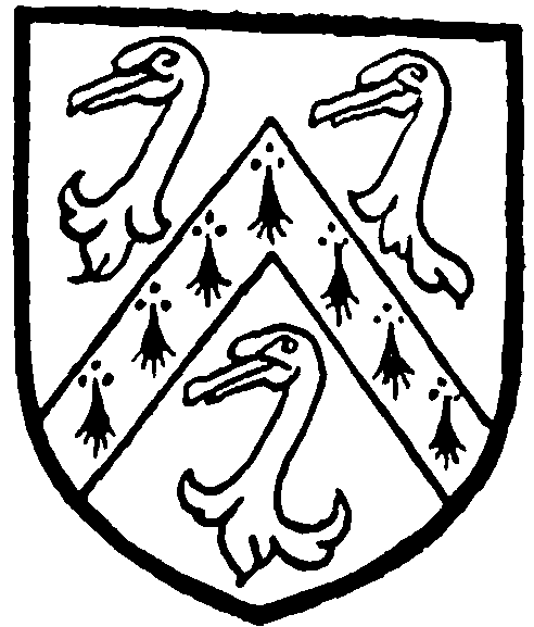
Cawley. Sable a cheveron ermine between three swans' heads razed argent.
Further north, on the west side of Broyle Road, is the Hospital, which began as a Dispensary for Sick Poor, opened in 1784. It was later called the West Sussex Infirmary and, after extensive additions, under the name of the Royal West Sussex Hospital, it was reopened by King George in 1913 as a memorial to King Edward VII. It stands back from the road in its own grounds. The present building, of stuccoed brick with a slate mansard roof, was originally begun in 1825. The main façade is of two stories with basement and an attic lit by dormers. The ends and central portion are of slight projection, the latter having a pediment carried on Roman Doric pilasters; steps lead up to the main door.
Beyond the hospital is a detached portion of the parish of St. Peter the Less.
The Chichester Barracks were built on the east side of the Broyle early in the 19th century, and near them is the West Sussex County Mental Hospital at Graylingwell, which is a large building designed by Sir Arthur Blomfield and built 1895–7. Graylingwell was granted to Ralph, Bishop of Chichester, by Ranulf de Brok in 1231, and the bishop had free warren there in 1243. (fn. 104) As the manor of Graylingwell, it was leased by Richard Fisher and Mary his wife to Nicholas Woolfe in 1631 (fn. 105) and in 1814 it was leased for three lives to Thomas Collins. (fn. 106) Running parallel with the Broyle Road is College Lane, on the east side of which is Bishop Otter's Memorial College for Women Teachers, from which the lane takes its name. The college forms a group of stone-faced buildings erected in 1849–50 from designs by J. Butler. They have since been enlarged. At the south end of College Lane was the Pest House, which was dated 1665. (fn. 107) Spitalfield Lane leads east from College Lane to Stane Street; at the junction of the two roads on the north side stood the Lazar Hospital of St. James and St. Mary Magdalene, from which Spitalfield derives its name. The hospital, which stood on the north bank of the Lavant, about half a mile from the East Gate, was burnt down 13 December 1781. The north wall of a cottage built some years later incorporates part of the original structure, and in the front wall of the cottage is a tablet, erected by the Rev. William Walker, some time master of the hospital, describing the former purpose of the building. The precincts of the hospital formed an extra-parochial district. At the point where Spitalfield Lane meets Stane Street is a stone obelisk dated 1714, known as St. James's Post, probably replacing the St. James's Cross, which marks the former north-east boundary of the city. The Cross itself was overthrown in 1547 by treasureseekers. (fn. 108)
The suburb of St. Pancras outside the East Gate was destroyed at the time of the siege of 1642. To the south of the suburb is the Cattle Market, which was laid out here in 1872.
The Hornet, or Harnet, the street leading to the Oving and Bognor Roads, is composed of houses and shops of the 18th and 19th centuries. The name occurs as 'Hurnett hill' in 1660. (fn. 109)
On the north side of Stane Street was a burial ground, called the Litton, now disused, probably going back to Roman times and still retaining its Saxon name (lych, a corpse). The land here was apparently in the hands of William I, who, before 1086, had given it under the description of land in Stockbridge Hundred for one plough, which had never been assessed in hides, together with a mill, to Ketel or Chetel Esterman (Sturmi, Esturmi). (fn. 110) Ketel exchanged the lands or a part of them with the Earl of Arundel; and Hugh, Earl of Arundel, and Henry, his brother, before 1098 gave them to Ralph de Luffa, Bishop of Chichester, and their gift was confirmed by Henry I. (fn. 111) On part of the land previously held by Ketel Esterman, the king had a garden in 1212 (fn. 112) which he committed to the charge of the Bishop of Chichester in 1226. (fn. 113) In the following year the king granted to the bishop his garden without the walls of Chichester with the chapel built therein and the place where the bodies of the dead were buried. The bishop agreed to place two chaplains to celebrate divine service in the chapel, the one to pray for the soul of the king's father and the other to pray for the king. (fn. 114) The chapel, of which all trace has been lost, was dedicated to St. Michael, and here John Stubbe, wool merchant, and later mayor, with Mabel his wife, founded a chantry at the altar of St. Mary in 1331, which was known as the chantry of the Charnell. (fn. 115) In the 17th century the burial ground was known as 'Michael's Lytton' (fn. 116) to distinguish it from the 'High Church Lyten' or the 'Lighten called Paradise' on the south of the cathedral church.
Outside East Gate is Eastgate Square, in the middle of which is a cross erected in memory of those who fell in the Great War. To the south of the square is a Unitarian, formerly a Baptist, chapel, a small brick building with tiled roof, completed in 1728.
The lands of the city outside the walls on the east side were apparently distributed in three great fields, the North Field, the Portfield, and the Gildenfield; (fn. 117) the latter would seem, geographically, to be a subdivision of the Portfield, and if so, may well correspond with the differentiation of the Merchant Gild from the port or city of pre-Conquest date. The occurrence of these names in 12th-century deeds in a 13th-century cartulary would seem to point to their early origin. The meadow land (the Garston) probably lay to the south, and on the west there was little space for arable land. Outside North Gate was 'Horsedowne,' which belonged to the mayor and citizens in 1569. (fn. 118)
There are several place names of interest, in early deeds, which do not appear to have survived. Among them are the Stielway, (fn. 119) outside the North Gate, the Port-way (fn. 120) between Singleton and Westdean, the Westbrech, (fn. 121) and the East-brech which included both meadow and arable and the land called Castleway, (fn. 122) which Bishop Ralph Neville acquired from the Abbot of Sées.