A Topographical Dictionary of Scotland. Originally published by S Lewis, London, 1846.
This free content was digitised by double rekeying. All rights reserved.
'Dubbieside - Dun', in A Topographical Dictionary of Scotland, (London, 1846) pp. 297-310. British History Online https://www.british-history.ac.uk/topographical-dict/scotland/pp297-310 [accessed 23 April 2024]
In this section
Dubbieside
DUBBIESIDE, or Inverleven, a village, in the late quoad sacra parish of Methill, parish of Markinch, county of Fife, 6 miles (S. E.) from Markinch; containing 348 inhabitants. This village is pleasantly situated on the western bank of the river Leven, near its influx into the Frith of Forth, and is neatly and regularly built, consisting of one principal street intersected at right angles by two smaller streets. The inhabitants are generally employed at their own houses in weaving sheetings, dowlas, and towellings, for the manufacturers in the neighbouring districts; the surrounding scenery is of pleasing character, and the village is connected with the town of Leven, on the opposite shore, by a handsome suspension-bridge across the river. It contains a Secession meeting-house.
Duddingston
DUDDINGSTON, a parish, in the county of Edinburgh; including the villages of Joppa and Easter and Wester Duddingston, and also the late quoad sacra parish of Portobello; and containing 4366 inhabitants, of whom 156 are in Easter, and 200 in Wester, Duddingston, the former 3½ miles (E. by S), and the latter 1½ mile (E. S. E.), from Edinburgh. This place derived its name, anciently Dodinestun, from the family of Dodin, to whom it belonged in the reign of David I., and of whom Hugo, filius Dodini de Dodinestun, appears as witness to a grant of lands to the canons of Holyrood. The manor was subsequently the property of the Thompson family, of whom Sir Thomas was created a baronet by Charles I. in 1637. It afterwards formed part of the possessions of the Duke of Lauderdale, who gave it, with his daughter in marriage, to the first duke of Argyll, from whose successor, the fifth duke, it was purchased in 1745 by the Earl of Abercorn, whose descendant, the Marquess of Abercorn, is the present proprietor. The site on which the town of Portobello has been built, formerly that portion of the forest of Duddingston called the Figget Whins, afforded shelter to Sir William Wallace and his troops on their march to attack the town of Berwick; and during the parliamentary war, the Scottish leaders held a conference with the usurper Cromwell within this parish, previously to the battle of Dunbar. In 1745, the forces of the Pretender lay encamped on a plain near the village of Wester Duddingston, now within the demesnes of Duddingston House, for nearly a month before and after their defeat of General Cope, at Preston; and the house in which Prince Charles Edward slept on the night previous to the battle is still remaining.
The parish is bounded on the west and north-west by the parishes of St. Cuthbert, the Canongate, and South Leith; on the north-east by the Frith of Forth; and on the south by the parishes of Inveresk and Libberton. It extends from the eastern base of Arthur's seat to the Frith, for nearly four miles in length, and increases gradually towards the east from less than one mile to about two miles in breadth, comprising 1812 acres, of which, with the exception of a few acres of woodland and pasture, the whole is arable. The surface is generally a level plain, sloping gradually from the base of Arthur's seat to the Frith. The streams of the Powburn and the Braid intersect the parish, flowing through the pleasure-grounds of Duddingston House to the hamlet of Duddingston-Mills, whence, pursuing their course through a narrow and romantic dell, they fall into the Frith to the west of Portobello. There is also a stream called Brunstane, which separates the parish from Libberton, and joins the Frith near Magdalene Bridge. Duddingston loch, a fine sheet of water about a mile in circumference, at the base of Arthur's seat, adds much to the beauty of the scenery, and, by means of a small canal, supplies the rivulets which flow through the park. The greater portion of the parish was for a long time a barren moor, overgrown with furze, and partly covered with sand. From this unprofitable state, the lands of Prestonfield were first recovered and brought into cultivation by their proprietor Mr. Dick, at that time lord provost of Edinburgh, who, removing at his own expense the accumulated refuse of the streets of the city, employed it as manure for the improvement of his land; and not long afterwards, the whole of the moorlands in the parish were reclaimed, and brought into profitable cultivation.
The soil is generally clay, alternated with sand, and from judicious management has been rendered extremely fertile; the arable lands produce abundant crops of all kinds of grain, turnips, and potatoes, and the grass in the parks is luxuriantly rich. The system of agriculture is in the highest state of advancement, and all the more recent improvements in husbandry, and in the construction of implements, have been fully adopted. One or two cows of the Ayrshire or Teeswater breed are kept on each farm for the use of the family; but scarcely any live stock is reared in the parish. The rateable annual value of Duddingston is £21,896. The principal substrata are, coal, sandstone, and freestone. The coal, which is very abundant, was formerly wrought, but, from the difficulty of clearing the mines from water, the working has been discontinued; the mines, however, have been lately leased to an English gentleman, who has erected a powerful steam-engine, and there is every prospect of their being wrought with success. There are some extensive quarries of good freestone, from which materials have been raised for the erection of the houses of Portobello and Joppa; and in the bed of one of the burns is a stratum of black-coloured stone, of smooth and unctuous appearance, which, from its susceptibility of a high polish, is well adapted for mantelpieces and other ornamental purposes. Strata of limestone and ironstone have been also found on some of the lands. Duddingston House, the seat of the Marquess of Abercorn, is a spacious and elegant mansion in the Grecian style, erected in 1768, after a design by Sir William Chambers, at an expense of £30,000. It is beautifully situated in an extensive park abounding with stately timber, and surrounded with pleasure-grounds tastefully laid out in lawns, shrubberies, and walks, in which are some temples and other ornamental buildings, and enlivened by the windings of the rivulets, in which are artificial islands of picturesque appearance. Prestonfield House, the seat of Sir Robert Dick, Bart., is a handsome mansion situated near the loch, in an ample demesne tastefully laid out, and enriched with plantations; it commands a fine view of the city of Edinburgh, to the southern confines of which the park nearly extends.
The village of Wester Duddingston, where the parish church is situated, was formerly a large and populous place, of which the inhabitants were chiefly employed in weaving. It is at present a small but pleasant village, and consists mostly of detached villas, surrounded with gardens and pleasure-grounds, occupied as summer residences by families of Edinburgh, and some neat cottages inhabited by persons engaged in the various works carried on in the vicinity. Many of the females are employed in washing linen, for which the situation of the village near the loch and its convenience for bleaching render it peculiarly adapted. The vicinity abounds with beautiful scenery, and commands extensive and interesting prospects, embracing Craig-Millar Castle, the Moorfoot, Lammermoor, and Pentland hills, with the city of Edinburgh, and the Frith of Forth in the distance. The village of Easter Duddingston is situated on an eminence near the sea; it consists only of small cottages inhabited chiefly by labourers, and is apparently falling into decay. The hamlet of Duddingston-Mills, near the junction of the Duddingston and Portobello roads, has a pleasingly rural aspect. Extensive mills for flour and barley were erected here a few years since, at an expense of £6000; they are driven by water and by steam, according to circumstances, and contain machinery of the most improved construction. In this hamlet are also situated the parochial school, and the handsome buildings of Cauvin's Hospital. Facility of communication is afforded by excellent roads; a post-office has recently been established at Wester Duddingston, and the Edinburgh and Dalkeith railway, from which a branch diverges to Leith, passes through the parish.
The ecclesiastical affairs are under the superintendence of the synod of Lothian and Tweeddale and presbytery of Edinburgh. The minister's stipend, including £10 for communion elements, is £300, with a manse, and a glebe valued at £15 per annum; patron, the Marquess of Abercorn. The church is a very ancient structure in the Norman style, of which it contains some interesting details, particularly a fine arch separating the chancel from the nave; in 1631, an aisle was added by the presbytery for the Hamilton family and their tenants. It was enlarged and repaired in 1840, and now contains 400 sittings. In the churchyard are some handsome monuments, and an obelisk of marble to the memory of Patrick Haldane, Esq., of Gleneagles. There are places of worship for members of the United Associate Secession, the Relief Congregation, and Independents, and an episcopal and a Roman Catholic chapel. The parochial school is attended by about ninety children; the master has a salary of £34, with a house and garden, and the fees average £40. There is also a subscription library in Wester Duddingston, containing about 400 volumes. Cauvin's Hospital was founded by Mr. Louis Cauvin, a French teacher in Edinburgh, and afterwards a farmer in this parish, who in 1825 bequeathed the greater portion of his estates to the lord provost, the principal of the university, the rector of the high school, and the ministers of Duddingston, Libberton, and Newton, in trust for the erection and endowment of an hospital for the maintenance and education of the sons of poor teachers, farmers, printers, or booksellers, of not less than six, nor more than eight, years of age. The buildings were erected in the villa style, in 1833, and contain the requisite accommodations for twenty-five boys, who are maintained in the hospital for six years, and instructed in the French, Latin, and Greek languages, the mathematics, and the ordinary branches of a commercial education, by masters appointed by the trustees, who were incorporated by charter in 1837. The poor have the proceeds of a bequest of £100 by Mr. Kay, of Edinburgh, architect.
Dufftown
DUFFTOWN, a village, in the parish of Mortlach, county of Banff, ½ a mile (N.) from Mortlach; containing 770 inhabitants. This village, which is situated a short distance from the junction of the rivers Fiddich and Dullan, is of recent growth, having arisen since the year 1817, when the first of its present buildings was commenced. A kind of market for grain is held here, which is occasionally resorted to by the dealers in the neighbourhood, but not on any particular day; and fairs for the sale of cattle are held five times during the year. There is also a daily post; and a small prison has been recently built in the village, for the temporary confinement of delinquents previously to their committal.
Duffus
DUFFUS, a parish, in the county of Elgin; including the villages of Burgh-Head, Cummingston, Hopeman, and the hamlets of Roseisle, College of Roseisle, and Old Roseisle; and containing 2529 inhabitants, of whom 159 are in the village of New Duffus, 5 miles (W. N. W.) from Elgin. The name of Duffus is supposed to be derived from the Gaelic word Dubuist, signifying the black lake, in reference to the lake of Spynie, now drained, or to some other lake of which there is no trace left. The parish was formerly remarkable for its castle, and as the scene of military operations; and there are several monuments of antiquity still remaining, with which its ancient history is closely interwoven. The most interesting relics are those of fortifications at Burgh-Head, by some thought to be Roman, and by others considered as Danish, but most probably originally constructed by the Romans, and afterwards occupied by the Danes. The works were divided into two parts, a higher and a lower, and presented four strong ramparts, built with oaken logs, directed towards the small isthmus upon which the village of Burgh-Head now stands. A few years ago an obelisk was standing nearly in the centre of the parish, thought to have been erected by Malcolm II., in memory of a victory over the Danes under Camus; and not far from it there was once a village called Kaim, supposed to be the same as that mentioned by the historian Buchanan as retaining the memorable name of Camus. The village is now removed, but the place nevertheless retains the appellation of Kaim. The castle of Duffus, of which the picturesque ruins are still visible, was the ancient seat of the lords of that name, a branch of the noble family of Sutherland, and who yet bear the title, recently restored from attainder, though they now possess no property in the district.
The parish is nearly six miles long and three broad, containing 10,000 acres, and lies along the Moray Frith, by which it is bounded on the north. The coast at the east end is rocky and very bold, and contains some large and remarkable caverns; in the western part, however, it consists of a level sandy beach. Along the shore, and for half a mile inland, the surface is mostly meagre pasture, but very generally supposed to have been once richly-cultivated land, and to have been reduced to its present condition by the blowing of sand from the western beach. The remaining part of the parish, with the exception of two slight acclivities, is a continuous plain of good ground in a high state of tillage. The soil in the western district is a black fertile earth, in some places mixed with sand; in the eastern quarter it is a deep rich clay, similar in many respects to the fine soil in the well-known Carse of Gowrie. The number of arable acres is 5381, in pasture 2962, and 310 are under wood; grain is produced to a considerable extent, and greatly predominates in amount over the green crops, the annual value of the former being four times that of the latter. The cattle are mostly the Morayshire breed, which is very similar to the Highland, but more bulky. The best method of cultivation prevails, and many improvements in every department of husbandry have taken place, especially in the breed of cattle; the farm-buildings are generally thatched with straw, but substantial, and of suitable extent. The rocks consist of sandstone and limestone, of each of which there are quarries. The rateable annual value of the parish is £7902. Among the chief residences is Duffus House, a commodious and handsome mansion in the old English manorial style. The village of Duffus is regularly built, and is a neat, clean, and interesting place; the chief communication of the people is with the town of Elgin, to which there is a good turnpike-road, and a light post curricle brings the mail. There are three fisheries carried on, namely a salmon, herring, and white fishery, which generally prove very profitable. The ecclesiastical affairs of the parish are subject to the superintendence of the presbytery of Elgin and synod of Moray; patron, Sir Archibald Dunbar, of Northfield, Bart. The minister's stipend is £232, with a manse, built in 1830, and a glebe of the annual value of £18. The church, situated at some distance from the population, at the eastern extremity of the parish, is an old and ill-constructed edifice, and of unsightly appearance, but with a very picturesque and ancient porch; it was repaired in the year 1782, and is in good condition. There is a chapel of ease at Burgh-Head, where are also two Secession meeting-houses; and near Kaim is an episcopal chapel. A parochial school is supported, in which the classics and mathematics are taught, with the usual branches of education; the master has a salary of £36, a portion of Dick's bequest, about £12 fees, and a house and garden.
Duirinish
DUIRINISH, a parish, in the Isle of Skye, county of Inverness; containing, with the late quoad sacra parish of Waternish, 4983 inhabitants. This place, early in the tenth century, became the property of the Mc Leods, by marriage of the first of the Norman family of that name with the daughter and heiress of Mc Railt, the original possessor of the lands. Frequent feuds between the Mc Leods and the Mc Donalds of Uist, in which the latter made many attempts to render themselves masters of the property, subsisted for a long period; but, with the exception of certain portions of land voluntarily alienated by the Mc Leods, the whole is still in the possession of their descendants. While a number of the Mc Leods were met for public worship in the church, a party of the Mc Donalds, having landed at Ardmore, in the district of Waternish, set fire to the building; and, except one individual, the whole assembly perished in the flames. The inhabitants, however, whom the burning of the church had collected in great numbers, amply retaliated this barbarous outrage, and, attacking the invaders before they could regain their ships, stripped them of their booty, and left the entire party dead upon the shore.
The parish is bounded on the north and north-east by Lochs Snizort and Grieshernish, on the south and south-east by Lochs Bracadale and Carroy, and on the west by the channel of the Minch. It is about nineteen miles in extreme length, and nearly sixteen miles in extreme breadth, comprising more than 50,000 Scotch acres, of which 1900 are arable, 3000 meadow and pasture, 100 woodland and plantations, and the remainder waste. The surface is boldly varied, rising in some parts into hills of considerable height, and in others into mountains, whereof the most conspicuous are the Greater and Less Helvels, which have an elevation of 1700 feet above the level of the sea, and are clothed with verdure to their summits, which form a level plain. On account of their near resemblance in shape, they constitute an infallible landmark to mariners, by whom they are called Mc Leod's Tables. From the larger of the two mountains a range of hills extends northward, terminating in Galtrigil Head, at the entrance of the bay of Dunvegan, a bold and precipitous headland 300 feet in height; and from the smaller of the Helvels a similar chain of hills stretches to the south, terminating in the cliffs of Idrigil and Waterstein, of which the former have an elevation of 400, and the latter of 600 feet. Near the point of Idrigil are three basaltic pillars, rising perpendicularly from the sea, of which one is 200 feet in height, and the two others 100 feet each; they have obtained the appellation of Mc Leod's Maidens, and there was formerly a fourth pillar, which has disappeared. The coast, from its numerous indentations, has a range of more than seventy miles in extent, and is generally precipitous and rocky; but within the many bays and lochs the shore has a moderate declivity, forming commodious beaches for landing. The lochs of Dunvegan and Grieshernish are safe roadsteads for large vessels during all winds; and Lochs Bay, Poltiel, and Carroy, though more exposed, afford good anchorages for ships in ordinary weather. Pol-Roag, a branch of Loch Carroy, is also a secure shelter, but from the narrowness of its entrance is accessible only to vessels of small burthen.
The soil is various, generally peat-moss, with some tracts of clay and gravel; the chief crops are oats and potatoes. The system of agriculture, on the larger farms, has been improved within the last few years; the farm-houses are mostly commodious, and the fences well kept up, but on the smaller tenements, which are held by cottars without leases, the plan of husbandry is still in a very backward state. The black-cattle formerly pastured on the farms have been nearly superseded by sheep of the native Highland breed, of diminutive size, but of very delicate flavour, and remarkable for the fine texture of their fleeces: within the last forty years the black-faced breed have been introduced, but are now giving place to those of the Cheviot breed. The rateable annual value of the parish is £4999. The plantations are of modern date, and are mainly confined to the grounds of the principal landowners; they consist of oak, ash, plane, beech, alder, birch, and larch, and Scotch firs, which last, however, have not succeeded. The substrata are chiefly of the trapstone formation, intersected with veins of basalt; limestone, containing numerous fossil shells; coal, which is not workable; and veins of sandstone. The principal mansions in the parish are, Orbost, Grieshernish, and Waternish, all handsome residences pleasantly situated. Considerable quantities of shell-fish are taken on the beach, and several persons are employed in the fisheries off the coast; the fish generally are cod and ling, which, after being cured, are sent to the markets. The manufacture of kelp is also carried on, to a moderate extent. About three boats, averaging ten tons' burthen each, belong to the parish; but no other vessels visit it for the purpose of trade. A post-office has been established at Dunvegan; and facility of communication is maintained by good roads, about thirty-five miles of turnpike-road passing through the parish.
The ecclesiastical affairs are under the superintendence of the presbytery of Skye and synod of Glenelg. The minister's stipend is £158, of which onethird part is paid from the exchequer, with an allowance of £57 in lieu of a manse, and a glebe valued at £22. 10. per annum; patron, Mc Leod of Mc Leod. The church, erected in 1824, is a substantial and handsome structure in the centre of the parish, and contains 550 sittings, all of which are free. An extension church, containing 330 seats, has been built in the district of Arnizort, about twelve miles from the parish church; and there is a similar church on the west side of the loch of Dunvegan. The parochial school is ill conducted; the master has a salary of £30, with a house and garden, and the fees average about £8. Four schools are supported by the General Assembly, and three by the Gaelic Society. Among the antiquities is the castle of Dunvegan, the ancient baronial residence of the Mc Leods, of which the oldest portion was erected in the ninth century; a portion was added to it in the thirteenth, and the two parts, consisting of lofty towers, were connected by a range of low building, erected by Rory Mor in the reign of James VI. The whole is situated on the summit of a lofty rock, rising precipitously from the sea, and an easier line of approach has lately been opened, by throwing a bridge across the chasm, which separates it from a neighbouring rock. In this castle are preserved, the celebrated banner called the "Fairy flag," taken by the Mc Leods from the Saracens during the crusades; an ancient drinking-cup of hard dark wood, supported on four silver feet, and striped with ribs of highly-wrought silver set with precious stones, of which some are still remaining; and Rory Mor's horn, a drinking-cup of much larger dimensions, containing five English pints, and noticed by Sir Walter Scott. There are numerous caverns in the rocks along the coast, one of which is 120 feet in length, forty feet in height, and ten feet wide; and the cave of Idrigil is resorted to by the fishermen for drying their nets, curing fish, and dressing their victuals. The parish likewise contains many barrows, circular forts, and subterraneous dwellings, in one of which, on the farm of Vatten, a long narrow passage leads into a central room arched with stone, from which branch off several galleries conducting to other apartments, which have not been explored. Some rude sepulchral urns of reddish clay have been dug up; one of these is in the possession of Mc Leod of Mc Leod, and another has been deposited in the Glasgow Hunterian Museum.
Dull
DULL, a parish, in the county of Perth, 4 miles (W. by N.) from Aberfeldy; containing, with parts of the late quoad sacra parishes of Foss and Tenandry, and part of the village of Aberfeldy, 3811 inhabitants, of whom 145 are in the village of Dull. This place, of which the name is descriptive of a plain, appears to have been celebrated for a monastery founded here at a very early period, and which formed one of the only three Abthaneries existing in the kingdom. These peculiar establishments, of which the superior had the title of Abthane, were at Dull, Kirkmichael, and Madderty; and Edgar, King of Scotland, conferred all of them upon his younger brother, Ethelred, then abbot of Dunkeld, whose successor, Hugh, granted the monastery of Dull to the priory of St. Andrew's. The parish, which comprises the districts of Appin, Grandtully, Amulrie, Foss, and Fincastle, is about thirty miles in length, but, from its intersection by other parishes, is of very irregular form, varying from four to twelve miles in breadth, and comprising about 135,000 acres, of which 19,000 are arable, pasture, and meadow, 3000 woodland and plantations, and the remainder moor and waste. The surface is divided throughout its whole length by several parallel ranges of hills, forming part of the Grampians, and gradually diminishing in height towards the north-east, and between which are the beautiful vales of Glenquaich, Appin, Foss, and Fincastle. Of these ranges the highest is the central range, dividing the vale of Appin from that of Foss, and containing a portion of the mountain Schiehallion, which has an elevation of 3564 feet, and is partly in the parish of Fortingal, and the hill of Farragon, which is wholly in this parish, and is 2535 feet above the level of the sea. In this range is the Craig of Dull, a lofty rock, commanding from its summit an extensive and diversified prospect, embracing the richly-cultivated vales of Appin and Fortingal, Loch Tay, the bridge of Kenmore, the noble mansion and wooded grounds of Taymouth, and a great variety of picturesque Highland scenery.
The principal river is the Tay, which, after flowing through the grounds of Taymouth, in the parish of Kenmore, enters this parish, and, pursuing its course along the vale of Appin, which it sometimes partially inundates, runs north of the village of Aberfeldy into the parish of Logierait. The river Lyon, which has its source in Loch Lyon, in the parish of Fortingal, enters this parish at Coshieville, and, taking a south-easterly direction, separates Dull from Weem, and flows into the Tay at the eastern base of the hill of Drummond. The Quaich, rising among the hills in Kenmore, expands, after a course of nearly eight miles, into the Loch Fraochy, in the valley of Glenquaich, on the southern border of the parish. The river Tummel, issuing from Loch Rannoch, flows in an easterly course into Loch Tummel, forming the northern boundary of the parish; and the Garry, which has its source in Loch Garry, in the parish of Blair-Atholl, intersects the north-eastern portion of the lands. These rivers form several interesting and highly picturesque cascades, of which the chief are the falls of Keltnie, Camserney, Tummel, and Moness; and in the Lyon and Tummel are found pearl-muscles, some containing pearls of large size and of brilliant lustre. There are likewise numerous lakes in the parish, of which one of the principal is Loch Tummel, described under the head of Blair-Atholl, on the boundary of which it is situated. Loch Fraochy is about two and a half miles in length, and half a mile in breadth; on the south bank is a shooting-seat, the property of the Marquess of Breadalbane, the demesne attached to which is embellished with plantations. Trout of small size, but of excellent flavour, afford sport to the angler, for whose accommodation there is an excellent inn about half a mile distant. Loch Ceannard, situated in the hills of Grandtully, is nearly a mile in length, and a quarter of a mile wide, and is surrounded with bleak and barren mountains. Nearly in its centre is a small islet, on which are the ruins of an ancient shooting-lodge, almost surrounded with plantations of larch, affording shelter to flocks of black-game; and on the north bank of the loch is a neat modern villa in the cottage style. There are many small lakes in the immediate vicinity, all of which abound with trout, pike, and perch.
The soil in several parts is a rich loam alternated with clay, and in others light and gravelly; in some of the districts is found a thin brownish loam mixed with sand, and in others a wet moss. The chief crops are, oats, barley, potatoes, and turnips; the system of husbandry in the vale of Appin is in a highly advanced state, and elsewhere has been much improved under the auspices of the Highland Society. Great attention is paid to the improvement of live stock, and to dairy-farming. The cattle, of which about 5000 are reared, are generally of the West Highland breed, with a few of the Ayrshire on the dairy-farms; and the sheep, of which more than 18,000 are fed, are of the black-faced breed, with some of the Cheviot and Leicestershire on the lower grounds. The rateable annual value of the parish is £11,649. There are considerable remains of natural wood, consisting of birch, interspersed with oak, ash, hazel, willow, alder, and mountain-ash; and very extensive plantations of beech, ash, plane, elm, oak, Scotch and spruce firs, and larch, which last is predominant, are under careful management, and in a thriving state. The rocks are chiefly of mica-slate, intermixed with quartz, granite, and hornblende; and the principal substrata are whinstone and limestone, the former used for the roads, and the latter, of which a quarry has been opened at Tomphobuil, for manure. An attempt for the discovery of coal has been made, but without success.
Grandtully Castle, the baronial seat for many generations of a branch of the ancient Stewart family, and now the residence of Sir William D. Stewart, Bart., is a venerable turreted mansion on the south bank of the river Tay; and Cluny, Derculich, Foss, and Moness, are all handsome houses, finely situated. In the village of Aberfeldy the woollen manufacture is carried on to a moderate extent, there being a dye-mill, with machinery for carding and spinning; and at the hamlet of Camserney, a carpet manufactory was established by Sir Niel Menzies, Bart., which affords employment to about thirty persons. There are likewise a saw-mill and a wheelwright's establishment, in which latter bobbins are also made, for the Dundee market. Fairs are held at Aberfeldy, for cattle, sheep, and horses, on the first Thursday in January, the Tuesday before Kenmore fair in March, the last Thursday in May, the last Friday in July, the last Thursday in October, and the first Thursday in November (all O. S.). Fairs for cattle and sheep are also held at Amulrie, on the first Tuesday and Wednesday in May and the Friday before the first Wednesday in November; at Coshieville on the last Thursday in October and the day before Fortingal fair in December; at Tummel-Bridge on the last Friday in October; and at Foss on the first Tuesday in March, for horses and general business. A sheriff's court for small debts, which has jurisdiction also over the parishes of Kenmore, Killin, Fortingal, Weem, and part of the parishes of Logierait and Little Dunkeld, is held quarterly at Aberfeldy, and has nearly superseded the justice-of-peace courts at Weem, within which district Dull is comprehended. There is a post-office at Aberfeldy, and a branch office has been opened at Amulrie; facility of communication is maintained by good turnpike-roads.
The ecclesiastical affairs are under the superintendence of the presbytery of Weem and synod of Perth and Stirling. The minister's stipend is £257. 18., with a manse, and a glebe valued at £40 per annum; patron, the Crown. The church, situated in the village of Dull, is an ancient structure, repaired and reseated in 1840, and contains 600 sittings, all free. A church to which a quoad sacra district was for a short time assigned, has been erected at Foss by parliamentary grant. There are also chapels in connexion with the Established Church at Amulrie and Grandtully, under the patronage of the General Assembly, The minister of the former has a stipend of £65, wholly from the Royal Bounty, and the minister of the latter has £90, of which £40 are paid by Sir William D. Stewart, and the remainder from the Royal Bounty; each minister has also a manse, and about five acres of arable land rent free from the proprietors. At Tummel Bridge is an episcopal chapel. The parochial school is well attended; the master has a salary of £34, with a house and garden, and the fees average £14. Of the monastery no vestiges remain, with the exception of a heap of shapeless rubbish near the village of Dull, supposed to be the ruins of the abbey church. The ancient cross, around which was a sanctuary, whose limits were marked out by three crosses of similar form, but recently removed, is still remaining; and there are numerous barrows and tumuli, of which one, at the bridge of Keltnie, now covered with plantations, has every appearance of an artificial intrenchment, and is supposed to have been the site of a battle between the Fingalians and Picts. In 1836, on removing a large barrow of stones between the inn at Coshieville and the river Lyon, Mr. Menzies discovered about twelve stone coffins, rudely formed of slabs, in some of which were found urns containing ashes, and in others ashes and human bones only. In the lands of Croftmoraig are the remains of a Druidical circle, nearly complete; and in the vale of Appin are several upright stones, of which some are in groups, and others standing alone.
Dumbarney
DUMBARNEY, county of Perth.—See Dunbarny.
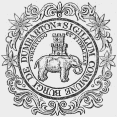
Burgh Seal.
Dumbarton
DUMBARTON, a royal burgh, the county town, and a parish, in the county of Dumbarton, 15 miles (N. W.) from Glasgow, and 58 (W. by S.) from Edinburgh; containing 3828 inhabitants, of whom 3782 are in the burgh. This place derives its name, originally Dunbriton, from an ancient fortress which, though its founders are unknown, became the principal seat of the Strathclyde Britons, who at a very remote period established themselves in this part of the kingdom. The Romans, however, during their invasions of Britain, made themselves masters of this fortress and of the territories adjacent; and there are still some vestiges remaining of a lighthouse they erected on the western peak of the rock on which the castle is built, for the accommodation of their galleys stationed in the Clyde, which flows round its base. After the departure of the Romans, the Britons of Strathclyde quickly repossessed themselves of their previous settlements, which they maintained against all the assaults of the Picts and Scots for nearly a hundred years, till they were finally expelled in 756 by Egbert, king of Northumbria. Some historians identify the place, while in the hands of the Britons, with Alcluyd, supposed to have been the Balclutha celebrated in the poems of Ossian; but this rests upon very doubtful authority.
The castle was made a royal fortress at a very early date, and the town which had arisen under its protection was, in 1222, erected into a royal burgh by Alexander II., who, in 1238, granted a charter to the Earl of Lennox, confirming to him the earldom and its possessions, with the exception of the castle and some lands adjoining. During the disputed succession to the Scottish throne on the death of Alexander III., the castle, which, with many others, had been surrendered to the custody of Edward I. of England, was, in 1298, delivered by that monarch to John Baliol, whom he declared to be the rightful heir to the crown. After various captures and recaptures, the castle again fell into the hands of Edward, who, in 1305, placed it under the government of Sir John Monteith, during whose occupation the heroic Wallace, being treacherously made prisoner, was delivered into the power of his inveterate enemy, and sent to England for trial. The castle was taken by Robert the Bruce in 1300; and during the siege of Dumbarton by the English fleet in 1481, it was bravely defended by its governor, Andrew Wood, to whom, for his services on that occasion, James III. granted the lands of Largo, in the county of Fife. In the beginning of the reign of James IV., the castle had been placed under the custody of the Earl of Lennox, on whose attainder for rebellion his estates and title became forfeited to the crown, and the castle was besieged by the Earl of Argyll, chancellor of Scotland; but its strength resisted all his efforts, and it was not till after a protracted siege by a numerous force, headed by the king in person, that the garrison surrendered. After the disastrous battle of Pinkie in 1547, Mary, the young Queen of Scots, was conveyed for safety to the castle of Dumbarton, where she remained till her embarkation for France; and after her return, she visited the town while on an excursion into Argyllshire. During the hostilities consequent on the deposition of the queen, the castle was held for her by Lord Fleming for a considerable time; but in 1571 it was surprised and taken for the regent by Captain Crawford, who, having learned by bribery the easiest mode of access, succeeded by scaling the walls, and Hamilton, Archbishop of St. Andrew's, was made prisoner, and afterwards hanged at Stirling.
At the commencement of the war in the reign of Charles I., the castle, which was garrisoned by the royalists, was taken by the parliamentarians in 1639, but was soon recovered by the king's forces; it again, however, fell into the hands of the republicans, and the Scottish parliament ordered the fortifications to be destroyed. This order, however, was not carried into effect, and in 1652 it was garrisoned by Oliver Cromwell; and at the time of the union of the two kingdoms, the ancient castle was one of the forts ordered to be kept in repair. The present garrison consists of a governor, lieutenant-governor, barrack-master, store-keeper, and surgeon, with thirty rank and file, and twelve artillery of the royal corps. The buildings are situated on a stupendous rock rising precipitously from the Clyde to a height of 350 feet, and dividing into two conical peaks of nearly equal elevation. The entrance, which is far below the point where the rock divides, is defended by a rampart containing the guard-house and apartments for the officers, whence a long flight of steps leads to the interval between the summits. Here are the barracks for the garrison, a battery, and a well of excellent water, behind which is the governor's house. Above these, on the lower summit of the rock, are several batteries, strongly mounted, and commanding an extensive range of the Clyde, and at high-water the rock is very nearly insulated by the river Leven. The higher summit of the rock, to which the ascent is precipitously steep, still retains the name of Wallace's Seat, and that portion of the castle in which he was confined is called Wallace's Tower. Among other relics of antiquity is a large two-handed sword, said to have belonged to that hero.
The town is situated on the west bank of the river Leven, near its influx into the Clyde, and consists principally of one street in the form of a crescent, from which several smaller streets diverge. It is connected with a suburb on the west side of the Leven by a handsome stone bridge of five arches, nearly 300 feet in length. The houses are well built; the streets are paved, and lighted with gas, and the inhabitants are amply supplied with water. There is a public subscription library, with a collection of more than 2000 volumes, and two reading and news rooms are supported by subscription. The chief manufacture is that of glass, which was formerly carried on to a very great extent, paying at one time duties to government amounting to £119,000 per annum; it is still very considerable, and the principal articles are crown and bottle glass. There are tanneries, rope-walks, and brick and tile works, and various handicraft trades are pursued, for the supply of the neighbourhood; ship-building is also carried on in three commodious yards belonging to the town, and in another in the adjoining parish of Cardross. There are some good salmon-fisheries in the Clyde and Leven. The latter river is navigable at high-water, for vessels of large burthen, to the quay of Dumbarton; but at low tides, a bar and some sandbanks at the mouth of the river, though partly removed, allow access only to steamers and small vessels. The number of vessels employed in the trade of the port is about forty, of 1220 tons' aggregate burthen.
The market, which is on Tuesday, is amply supplied with grain and with provisions of all kinds; and fairs are held on the third Tuesday in March and May, the Thursday before Easter, the first Wednesday in June, which is a large cattle mart, and the second Tuesday in August and November. The post-office has two daily deliveries; and branches of the Commercial and Western banks, and several insurance agencies, have been established in the town. Facility of communication is afforded by steam-boats, which ply thrice a day to Greenock and Glasgow; and in summer there is a daily conveyance for passengers to the Loch Lomond steamers, which touch at Balloch. By charter of Alexander II., extended by several of his successors, and confirmed by charter of James VI., who added a grant of land, the town possesses all the privileges of a royal burgh; and under the Municipal Reform act, the government is vested in a provost, two bailies, a dean of guild, treasurer, and ten councillors. There are five incorporated guilds, viz., the hammermen, tailors, shoemakers, coopers, and weavers, for admission into which the fees are inconsiderable, the highest not exceeding £1. 2. The magistrates have civil and criminal jurisdiction within the royalty, for which they hold courts as occasion requires, assisted by the town-clerk, who acts as assessor; but the business has of late years been chiefly brought before the sheriff of the county, who holds sheriff and commissary courts every Thursday during the session, and small-debt courts every alternate Thursday. The burgh is associated with those of Kilmarnock, Renfrew, Rutherglen, and PortGlasgow, in returning a member to the imperial parliament; the number of qualified voters is 170, of whom 163 are burgesses. The county gaol and court-house are at the end of the main street.
The parish is bounded on the south by the river Clyde, and on the west by the river Leven, which separates it from Cardross; it is from seven to eight miles in extreme length, and from three to four in breadth, and comprises 6529 acres. The surface in the south is level for nearly two miles from the Clyde, but afterwards rises abruptly towards the north, becoming chiefly moorland diversified with small hills of moderate height. The scenery is in many parts beautifully picturesque. The soil, though in some places shallow, is generally fertile, partly clay alternated with gravel, and the lands are in a good state of cultivation; the crops are, wheat, oats, barley, bear, peas, and beans, with the usual grasses. The system of husbandry is improved; the lands are inclosed, principally with fences of thorn, which are well kept, and the farm-houses and offices are substantial, and commodiously arranged. The substrata are chiefly limestone and sandstone; of the former there is an extensive supply at Murroch glen, and on Dumbarton moor are quarries of red freestone. The rateable annual value of the parish is £10,810. The ecclesiastical affairs are under the superintendence of the presbytery of Dumbarton and synod of Glasgow and Ayr. The minister's stipend is £233, with a manse, and an allowance of £16 in lieu of glebe; patrons, the Town Council. The present church, built about 1810, and situated in the town, is a spacious structure containing 1500 sittings. A missionary is established here, who receives a stipend of £52, raised by subscription; and there are places of worship for members of the Free Church and United Associate Synod, and a Roman Catholic chapel. The parochial school is attended by nearly 200 children; the master has a salary of £40, with a school-house, and the fees, though very moderate, are considerable from the number of scholars. The school is under the patronage of the council. Dr. Smollett, author of Roderick Random, received the rudiments of his education in the parish; and Dr. Colquhoun, author of a treatise on the Wealth, Power, and Resources of the British Empire, was born here. The town conferred the title of Earl on the Douglas family, but it became extinct on the demise of the second earl without issue, about the middle of the last century.
Dumbartonshire
DUMBARTONSHIRE, a county, in the west of Scotland, bounded on the north by Perthshire, on the east by the counties of Perth and Stirling, on the south by the Frith of Clyde, and on the west by Argyllshire. It lies between 55° 53' 30" and 56° 19' 40" (N. Lat.) and 3° 54' 50" and 4° 53' (W. Long.), and, including the detached parishes of Kirkintilloch and Cumbernauld, which extend towards the east for 12 miles between the counties of Stirling and Lanark, is about 57 miles in length. It varies from 24 to 2 miles in breadth, and contains an area of 261 square miles, or 167,040 acres; 8369 houses, of which 7985 are inhabited; and a population of 44,296, of whom 22,542 are males, and 21,754 females. This district was originally inhabited by the British tribe of the Attacotti, whose descendants retained their possessions long after the British kingdom of Strathclyde had been subdued by Kenneth Mc Alpine, and subsisted as a distinct race till the middle of the twelfth century. That part of the county bordering on the river Leven obtained the appellation of Levenach, afterwards corrupted into Lennox, and, in the reign of William the Lion, belonged to a powerful Saxon family, of whom Alwyn was by that monarch created Earl of Lennox. The earldom was subsequently raised to a dukedom; and on the demise of the sixth duke without issue, the title and estates were conferred upon Charles Lennox, whom Charles II. created Duke of Richmond. During the disputes relating to the succession to the throne after the death of Alexander III., the county was frequently the seat of war; and the castle of Dumbarton was alternately in the possession of the contending parties. Prior to the Reformation the county was included in the diocese of Glasgow; at present it is in the synod of Glasgow and Ayr, and comprises a large part of the presbytery of Dumbarton, and a portion of that of Glasgow, and twelve parishes. The various courts are held at Dumbarton, which is the county town, and the only royal burgh; there are four burghs of barony, and several villages. Under the act of the 2nd of William IV., the county returns one member to the imperial parliament.
The surface is strikingly diversified with mountains and lakes, and displays an interesting combination of the most beautiful features of Highland scenery, embracing straths of rich fertility and pleasing appearance. The northern part of the county abounds with mountains of majestic elevation, and throughout the whole of that district, which comprises an area of nearly fifty square miles, not more than 400 acres have been subjected to the plough. The southern district, though less elevated, consists of two ridges of hills of considerable height, reaching from east to west, between which is the picturesque vale of Glenfruin, more than five miles in length. The highest of the mountains are Ben-Voirlich, near the north-western extremity of Loch Lomond, rising 3300 feet above the level of the sea; Ben-Cruachanstean, Corafuar, Shantron, Beneich, and Doune, some of which attain an elevation of 3000 feet; and Ben-Finnart, 2500 feet in height. The Kilpatrick braes, in the south of the county, are a beautiful range of hills intersecting an extensive tract of lowland in high cultivation, and have an elevation of 1200 feet, commanding from their summits richly-varied prospects over a most interesting district of the country. The principal lake is Loch Lomond, which, after intersecting a small portion of the county on the north, forms part of its eastern boundary, separating it from Stirling. This noble expanse of water is about twenty-four miles in length from north to south, and seven miles broad in the widest part, and is studded with numerous picturesque islands, of which the chief are, Inch-Murin, Inch-Lonaig, Inch-Tavanach, InchMoan, Inch-Conachan, and Inch-Galbraith, exclusively of other islands in that part of it included within Stirling. The river Leven issues from the loch at its southern extremity, and, after a course of about seven miles, flows into the Frith of Clyde. There are several other lakes in the county, of which Loch Sloy, in the parish of Arrochar, was formerly the rendezvous of the clan Mac Farlane; it is about a mile in length, and half a mile broad. In the parishes of Old Kilpatrick and Cumbernauld are several of considerable extent. There are also two salt-water lakes, Loch Gareloch and Loch Long, between which the parish of Roseneath forms a peninsula; they both extend northward from the Frith of Clyde, the former intersecting the county for about six miles, and the latter forming its boundary on the west.
About one-third of the land is in cultivation, and the remainder is mountain pasture, wood, and lakes. The soil along the borders of the Frith and the river Leven is a deep black loam; in some parts of the county is a gravelly loam, and in others clay, resting on a tilly bottom. The system of agriculture on the best farms is equal to any in the west of Scotland; the land is well drained and inclosed; much waste has been brought into cultivation; the farm-buildings are substantial and commodious, and considerable improvement has been gradually taking place. The mountains afford good pasture for cattle, which are chiefly of the Highland breed, and the cows pastured on the lowlands for the dairy are the pure Ayrshire, with a mixture of the Ayrshire and the Highland breeds. The sheep are generally the black-faced on the hill pastures, and the Cheviot breed on the lowlands. The rateable annual value of the county is £147,080. The substrata are mostly micaslate, limestone, and coal; the mica-slate is wrought at the quarries of Luss and Camstradden, and the seams are frequently traversed by veins of quartz, and abound with pyrites of iron. The limestone is of a deep blue or almost black colour, and is extensively wrought, as is the coal, which is found in seams nearly five feet in thickness; sandstone and trap are also abundant, and columnar basalt occurs in several parts. The woods and plantations are in a thriving condition; the soil appears well adapted to the growth of timber, and the extensive tracts of wood add greatly to the appearance of the scenery. The seats are, Cumbernauld, Roseneath, Rossdhû, Balloch, Tilliechewen, Strath-Leven, Ardenconnell, Auchintorlie, Ardincaple, Cames-Eskan, Garscube, Broomly, Woodbank, and Cameron. The chief manufactures are those of glass and glass bottles; there are also some cotton-printing works, and bleaching-fields for cotton and linen, on the banks of the Leven, the water of which, from its purity, is well adapted to the purpose. Facility of communication is afforded by good roads, which have been greatly extended and improved within the last few years.
Dumbuck
DUMBUCK, or Milton, a village, in the parish of Old Kilpatrick, county of Dumbarton, 2 miles (E.) from Dumbarton; containing 126 inhabitants. It is north of the Frith of Clyde, and on the road between Dumbarton and Glasgow. The population is chiefly employed in manufactures.
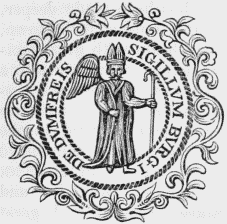
Burgh Seal.
Dumfries
DUMFRIES, a royal burgh, county town, port, and the seat of a presbytery and synod, in the county of Dumfries; comprising the parishes of St. Michael and New-Church, with the villages of Georgetown, Locharbriggs, Lochthorn, and part of Kelton; and containing 11,409 inhabitants, of whom 10,069 are in the burgh; 71½ miles (S. by W.) from Edinburgh. This place is supposed to have derived its name from its situation on an eminence rising from a tract of sterile soil abounding in brushwood or furze. Little is recorded of its early history, though, from numerous relics of antiquity, it would appear to have been of some importance prior to the 8th century. The ancient castle of the Comyns family, of which the site, overlooking the river Nith, still retains the name of Castle-dykes, has long since disappeared; nor is the date of its erection known, though it is noticed as a place of formidable strength before the reign of Edward I. A monastery was founded by Dervorgilla, daughter of Allan, Lord of Galloway, and mother of John Baliol, King of Scotland, about the beginning of the 13th century, for Franciscan friars, on an eminence above the Nith, by which it is washed on the north and west; and a noble bridge, originally of thirteen arches, was erected by the founder over the river, for the accommodation of the brethren. In 1305, Robert Bruce, attended by Roger de Kirkpatrick and James Lindsay, held a conference in the chapel of this monastery with John Comyn, surnamed the Red, and in a dispute with that nobleman, whom he charged with treacherously revealing to Edward I. the designs he had formed for the emancipation of his country from the English yoke, stabbed him with his dagger. Upon this he hastily rejoined his attendants; but Kirkpatrick, resolving to make sure of Comyn's death, returned into the church, despatched the wounded chieftain, and also killed his brother who interposed for his defence. The church, being thus polluted with blood, was soon afterwards deserted, and the friars removed their establishment to the chapel of St. Michael, south-east of the town. There are no remains of the monastery, and the only memorial of it preserved is the name of the narrow street leading to it from the bridge, and which is still called the Friars' Vennel.
In 1307, Edward II. of England, after his coronation, advanced to Dumfries to receive the homage of several of the Scottish nobility; and the town was afterwards repeatedly attacked by the English, by whom it was burnt in 1448, and also in 1536. In retaliation of the latter injury, Lord Maxwell of Terregles, a powerful nobleman, with a body of his retainers, crossed the border, and, penetrating into England, assaulted the town of Penrith, which he reduced to ashes. The Maxwells, who had an ancient castle near the site of the monastery, supposed to have been built in the 12th century, erected a more spacious and magnificent structure, partly out of the ruins, and almost on the site of the deserted friary; and this castle, in 1563, was visited by Mary, Queen of Scots, who, attended by her privy council, came to Dumfries to ratify a treaty of peace with England. In 1565, the disaffected Lords Argyll, Murray, Rothes, and others having assembled a hostile force in the neighbourhood, the queen advanced to the town with an army of 18,000 men; the discontented nobles, on her approach, fled into England, and Lord Maxwell, having incurred her displeasure, conciliated her favour by surrendering his castle, of which, however, he was permitted to retain the government. In 1570, this castle was taken and plundered by the English forces under the command of the Earl of Essex and Lord Scrope, who also laid waste the town.
In 1617, James VI., after his accession to the crown of England, visited his ancient dominions, and, passing through Dumfries, remained for one night in the town. He was received with every demonstration of affectionate loyalty, and presented to the corporation a silver gun, to be periodically contested for as a prize for the successful competitor, among the several crafts, in shooting at a target. The house in which the king lodged was built by a poor labourer who, having found a large treasure while digging peat in the Lochar moss, took a journey to London, where, in a personal interview with the monarch, he was allowed to retain possession of it, and advised to build a house, in which the king promised to lodge when he visited his Scottish dominions. The inhabitants displayed a marked opposition to the union of the two kingdoms in 1706, and to testify their aversion to that measure, burnt a paper containing the articles of union and the names of the commissioners at the market-cross. At the time of the rebellion in 1715, however, they zealously asserted their allegiance to the reigning monarch; and on being apprised of the design of Lord Kenmuir to visit the town with a large body of insurgents, they so completely fortified it where it was most exposed to any attack, that the party were induced to abandon their intention. In 1745 the Pretender, on his return from England, advanced to Dumfries with a body too powerful to be resisted, and took up his quarters in the town. In resentment of the opposition which his troops had experienced on their march into England, he levied a fine of £2000 in money, and a supply of 1000 pairs of shoes; but, being intimidated by a report that the Duke of Cumberland was rapidly marching to attack him, he hastily withdrew, taking £1000 of the fine, and the provost and one of the bailies as hostages for payment of the remainder.
The town is pleasantly situated on the east bank of the river Nith, and is about a mile in length, and a quarter of a mile in breadth; the streets are regular and well formed, intersecting each other at right angles. The houses are uniformly built of red freestone, generally painted of a colour resembling Portland stone; those that are of ancient date are substantial and of handsome appearance, and those of more modern erection are conspicuous for elegance. There are also some handsome ranges of building, of which Queensberrysquare is embellished in the centre with a stately Doric column, erected in 1780 to the memory of the Duke of Queensberry. An elegant and commodious bridge was built over the Nith in 1794, a little above the ancient bridge of thirteen arches, reduced by frequent alterations to seven arches, and now solely appropriated to foot passengers. The streets are all well paved, and lighted with gas from works established in 1828; gas has also been introduced into the shops and most of the public buildings, and the inhabitants are amply supplied with excellent water from springs in the neighbourhood. A public subscription library was founded in 1792, and has a valuable collection on general literature; there are also several circulating libraries, a public newsroom, and four reading-rooms, all supplied with daily journals and periodical publications, besides a mechanics' institution which has a good collection of books. Card and dancing assemblies are held in a handsome suite of rooms recently erected for the purpose in George-street; and a theatre, a commodious and well-arranged building, in which Kean made his first appearance, is open for two or three months during the season. Races take place annually on the Tinwald Downs, and are well attended; a regatta is celebrated by a club established here; and the members of the Caledonian hunt hold their meetings by rotation in the town. The Dumfries and Galloway Horticultural Society, instituted in 1812 for the promotion of improvements in horticulture, also meet here periodically.
The cotton manufacture, consisting chiefly of checked cottons, formerly carried on to a very considerable extent, has been for some time nearly discontinued, and the few spinners of the town who remain are mostly employed by the Carlisle and Glasgow manufacturers. The principal manufactures now are those of hats and stockings; of the former there are three establishments, affording employment to about 200 persons in the aggregate, and in the latter 279 looms are constantly in operation. The tanning of leather is also pursued, and the hides are sent to Glasgow, London, and other parts of the United Kingdom, in large quantities. The manufacture of shoes is very extensive, giving occupation to about 300 persons; and a considerable number are engaged in the making of clogs, or shoes with wooden soles, a trade not now, as formerly, confined to the supply of the south of Scotland, and which has been introduced with great profit. There are also several public breweries, and a large basket-making establishment. A very lucrative trade is carried on in the sale of pork, of which, during the season, commencing about the close of December, and ending about the beginning of April, many thousand carcases are sent to the south to be cured; not less than 700 are sold weekly for this purpose, upon an average, and frequently sales to the amount of £4000 or £5000 have been effected in one day. The foreign trade of the port consists chiefly in the importation of timber from America, in which several large vessels are engaged; the traffic in tobacco, formerly extensive, has been for many years discontinued. The coasting trade is mainly with Liverpool, Whitehaven, Maryport, and other parts of the English and Irish shores. The imports are, timber to the amount of nearly £10,000 per annum, coal, slate, iron, tallow, hemp, and wine; and the exports, cattle, sheep, wool, freestone, oats, barley, wheat, and other agricultural produce. The number of vessels registered in 1843 was 220, of the aggregate burthen of 12,380 tons; the jurisdiction of the port, which includes the Creek of Annan, extends from Sark foot at the head of the Solway Frith, to Glenluce on the Galloway coast, and the amount of duties paid at the custom-house in the year 1843 was £8764.
Since the channel of the river has been made deeper, vessels of considerable burthen can approach the town, by which means the inhabitants obtain with great facility a supply of coal from Whitehaven; there are also a commodious quay near Castle-dykes, another for vessels of greater burthen about a mile below it, and one at the mouth of the river for vessels engaged in the foreign trade. The various improvements connected with the harbour were completed at a cost of £18,530. A steam-vessel plies weekly between Dumfries and Whitehaven, during the summer months, and great quantities of live stock, especially sheep, are thus sent to the English markets. The post-office has a good delivery; and branches of the Bank of Scotland, the National and Commercial banks, and of the bank of the British Linen Company, have been established in the town. The market, which is abundantly supplied and numerously attended, is on Wednesday, when a great amount of business is transacted by cattle-dealers, on an open area near the river, called the Sands; and the fairs, chiefly for cattle, are held at Whitsuntide and Martinmas, and for horses in February and October, at all of which extensive sales are made. At the fair in February, large numbers of hare-skins are sold, averaging generally about 30,000. A cattle-market is also held in September, about the time of the Broughillfair, in Cumberland, when, upon an average, about 4500 head are exposed for sale, mostly three-year-old Galloways, and others of the Highland breed; and on some occasions business to the amount of £30,000 has been transacted. The market for meal is still held in a building appropriated to that purpose; but the shambles for butchers' meat have been long deserted, the butchers finding it more profitable to open shops in different parts of the town.
The town was made a royal burgh by William the Lion, prior to the year 1214. In 1396, Robert III. conferred upon the inhabitants various valuable immunities, which were confirmed by James I., who by charter in 1415 granted additional privileges; and in 1469, James III. gave to the corporation all the lands and revenues which belonged to the monastery of the Grey friars. The corporation consists of a provost, three bailies, a dean of guild, treasurer, twelve merchant and seven trade councillors, these seven being the convener and six other deacons of the incorporated trades; and all the officers are elected under the provisions of the late Municipal Reform act. The incorporated trades are the hammermen, masons, weavers, tailors, shoemakers, skinners, and butchers; the fee for admission as a member is, for a stranger £10, and for the son or sonin-law of a freeman £1. 1. The jurisdiction of the burgh extends over the whole of the royalty; and the magistrates hold courts for the determination of civil pleas and the trial of petty offences, in which they are assisted by the town-clerk, who acts as assessor. The police is under the direction of a body of commissioners chosen by the £10 householders, and of whom the provost, the bailies, and the convener are members ex officio; the number of commissioners is twelve, two of whom have the superintendence of each of the six wards into which the burgh is divided. As the county town, the courts of assize and quarter sessions, the sheriff's courts, and those of the commissary are regularly held here, and the public business of the county transacted. In the centre of the High-street stands what is called the Mid Steeple, a handsome building erected by the celebrated Inigo Jones, and comprising a hall and other apartments for the meetings of the town-council; and opposite to it is the Trades-hall, a neat structure erected in 1804. The County hall, or court-house, is a spacious and elegant edifice, comprising an ample hall for the county meetings, rooms for holding the several courts, with apartments for the judges, and accommodation for witnesses and others connected with the business of the sessions. A building originally intended for a bridewell has been appropriated as a depôt for the county militia, and that which was at first designed for the court-house has been arranged as a bridewell; it is, however, small and ill adapted for classification. Behind the bridewell is the County gaol, erected in 1807, and inclosed with a high wall, in the area between which and the building prisoners for debt have the privilege of exercise: a subterranean passage leads from the prison to the court-room, and by this prisoners are led to trial. The burgh is associated with those of Annan, Kirkcudbright, Lochmaben, and Sanquhar, in returning a representative to the house of commons; the parliamentary boundary includes the whole of the royalty, with the exception of some lands to the south and east of the town, and also includes the suburb of Maxwelltown, a burgh of barony on the west side of the river. The right of election under the Reform act is vested in the £10 householders; the sheriff is the returning officer.
The parish is nearly seven miles in length, and from two to three in breadth, comprising about 9280 acres, of which 7930 are arable, 320 pasture, and the remainder, of which the far greater portion will probably be brought under profitable cultivation, moss and waste land. The surface, though generally level, is diversified by the elevated site of the town, and by a ridge of hills near the southern extremity, of no great height, sloping gradually towards the river on the south-west, and rising abruptly on the north-east. On this latter side, about a mile below the town, is a singular cavity in the face of the rock, named the Maiden Bower; and towards the south-east of the parish is an eminence called Trohaughton, supposed to have been the site of a Roman camp. The river Lochar, which rises in the adjoining parish of Tinwald, and falls into the Solway Frith, bounds Dumfries on the east, forming in the south an extensive tract of marsh called Lochar Moss, partly in this parish, and partly in Torthorwald and Mousewald. There are also several lakes, of which the principal are Black loch and Sand loch, both abounding with trout and perch. The soil in the north and north-east is generally a light reddish sandy loam, resting on a substratum of freestone; and in other parts, and especially near the river, a retentive clay, with a substratum of gravel. The crops are, oats, barley, wheat, turnips, and potatoes; the rotation system of husbandry is practised, and the state of agriculture is much improved. Considerable attention is paid to live stock: with the exception of Ayrshire cows on the dairy-farms, the cattle are usually of the pure Galloway breed. The farm-buildings, though inferior to many others, are still commodious; the lands are well inclosed, and portions of the Lochar moss were some years ago brought into cultivation, yielding abundant crops of oats, potatoes, and rye-grass. Upon this moss, ploughing by steam was first attempted in Scotland, and has proved quite successful; but, although many thousands of pounds have been spent in thus reclaiming the moss by the plough, it is the opinion of many practically acquainted with the subject, that a considerable quantity of sand, clay, or some other solid earthy substance must be laid upon it so as to consolidate it. Some idea of the weight and bulk of the ploughing machinery may be formed from the mention of the fact, that the expense of carting it from Glencaple-Quay, only three miles distant, was as much as £15. There are several quarries of red sandstone in the parish, of which four are extensively wrought; and also some salmon and trout fisheries, the rents of which yield about £500 per annum. The rateable annual value of the parish is £24,743.
For ecclesiastical purposes the parish was divided, in 1727, by authority of the presbytery, with the concurrence of the magistrates of the burgh, into two districts, and an additional church was erected, which still retains the appellation of the New Church, and has a minister appointed by the Crown as patron of both. The minister of the old parish, now the district of St. Michael, has a stipend of £332, with a manse, and a glebe valued at £25 per annum. The church, situated at the south-east end of the town, was built on the site of the ancient structure in 1745; it is a neat edifice with a lofty graceful spire, and contains 1250 sittings. The churchyard, which is spacious, contains a large number of monuments, including many of deeply interesting character. The remains of the poet Burns were originally interred in the northern angle of the burying-ground, under a plain slab placed by his widow; but in 1815 his ashes were removed into a handsome mausoleum erected by his countrymen, at an expense of £1450, and above the entrance of which is a representation of the Genius of Scotland throwing her mantle over the poet while at the plough, finely sculptured in marble by Turnerelli. It has been calculated that the vast number of monuments in this churchyard must have cost more than £100,000. The minister of the New Church district has a stipend of £281. 13., of which £151. 13., including an allowance of £50 in lieu of manse and glebe, are paid by the exchequer. The church, situated at the north-west end of the town, was erected on the site, and partly with the materials, of the ancient castle, at the expense of the town-council, in 1727; it is a neat structure containing 1185 sittings. The subordinate church of St. Mary, fronting the road to England, was erected in 1838, at a cost of £3000, by subscription; it is an elegant structure after a design by Mr. Henderson, of Edinburgh, in the later English style of architecture, with an embattled tower surmounted by a lofty spire strengthened with flying buttresses. An episcopal chapel was erected in 1817, at a cost of £2200; and there are places of worship for members of the Free Church, the United Secession, the Relief Church, Reformed Presbyterians, Independents, and Wesleyans, and a Roman Catholic chapel.
The Dumfries Academy, for which a spacious building was erected by subscription in 1800, is under the superintendence of a rector and four masters, appointed by the corporation. The rector, in addition to the fees, which are moderate, has the interest of £660. 6. 3., and each of the four masters the interest of £204. 8. 10., arising from endowments; and there are also a French and a drawing master, who are paid exclusively by the fees. The course of instruction comprises the Greek, Latin, French, and English languages, the mathematics, geography, arithmetic, book-keeping, writing, and drawing. Two schools, one for the instruction of children of both sexes in reading, writing, arithmetic, and the principles of religion, and the other for teaching girls to sew, and to read the Bible, are supported by the Highland Education Society and some benevolent societies established in the parish; the teachers have each a house rent-free, and the former a salary of £60, and the latter of £20 per annum. There are also two schools for adults, supported by contributions, and an infant school. The Crichton Royal Institution or asylum originated with the late Dr. Crichton, of Friars' Carse, who bequeathed £100,000 to his widow to be appropriated to charitable purposes in Scotland in any mode she might think proper. This establishment, which enjoys the reputation of being the best lunatic asylum in Scotland, is situated on an eminence about three-quarters of a mile from the south-eastern extremity of the town: the building was erected in 1839, after a design by Mr. Burn, in the Grecian style, and is of handsome appearance, and surrounded by ample grounds, very tastefully laid out. A house for poor orphans and aged persons was erected in 1733, with funds bequeathed for that purpose by William Muirhead, merchant, of Carlisle, and his cousin James Muirhead, of Castle-dykes. The establishment, which is further supported by annual subscriptions and donations, is under the direction of a committee chosen from the Kirk Session, the town-council, and others, who meet weekly. The building contains accommodation for twenty children and thirty aged persons, under the care of a master and mistress, who reside in the house. The children are taught writing, reading, arithmetic, and the principles of religion, and when of proper age are apprenticed to trades, or placed out to service; and connected with the establishment are forty-two widows, who receive pensions at their own dwellings. The expenses of the establishment average about £500 per annum.
The Infirmary, with which was once connected a lunatic asylum, was founded in 1776, and is superintended by a committee of subscribers; the medical department is under the inspection of two visiting physicians and surgeons, and a resident house surgeon; and a licentiate of the Established Church officiates as chaplain. The average number of patients in the house is 30, and from 700 to 800 receive advice and medicines at the institution annually. The expenditure is about £1300 per annum, defrayed by bequests, donations, and subscriptions, and liberal contributions from the counties of Dumfries and Wigton, and the stewartry of Kirkcudbright, to all of which it is open. The Dispensary, situated at the western extremity of the town, is supported by public subscription, and administers extensive relief to the indigent poor. On an eminence near the entrance into the town from the English road, might lately be traced the foundations of St. Christopher's chapel, erected by the Bruce in memory of his fatherin-law, Sir Christopher Seton, who was hanged on that spot by order of Edward I. On the left bank of the river, just above the town, is Moat Brae, supposed to have been, during the Saxon era, a place for administering justice. A Roman sandal was found in the eastern part of the parish many years since, and in the river a gold coin, about the size of a sixpenny piece, but much thicker, bearing a Roman head, with the inscription Augustus. Among some scraps of old iron, also, was lately found an ancient seal about two inches in diameter, bearing a lion rampant in a shield bordered with fleurs de lis, with the legend Jacobus Dei. Gra. Rex. Scotorum in characters reversed; it is supposed to have been the privy seal of one of the Scottish kings.
Dumfries-Shire
DUMFRIES-SHIRE, a county in the south of Scotland, bounded on the north by the counties of Lanark, Peebles, and Selkirk, on the east by Roxburghshire and part of the English county of Cumberland, on the south by the Solway Frith, and on the west by the county of Ayr and the stewartry of Kirkcudbright. It lies between 55° 2' and 55° 31' (N. Lat.) and 2° 39' and 3° 53' (W. Long.), and is about fifty miles in length and thirty miles in breadth, comprising 1016 square miles, or 650,240 acres; 14,356 inhabited houses, and 733 uninhabited; and containing a population of 72,830, of whom 34,137 are males and 38,693 females. The county was originally inhabited by the Selgovæ, and after the invasion of the Romans formed part of the province of Valentia; upon the departure of the Romans it was occupied by the Northumbrian Saxons, and subsequently by numerous emigrants from Ireland, who had settled first on the peninsula of Cantyre. In the reign of David I. many of the Norman barons obtained possessions here, among whom was Robert de Brus, who procured a grant of the lands of Annandale, and was ancestor of Robert Bruce, King of Scotland. Previously to the reign of James VI., the county was the scene of numerous sanguinary conflicts between the hostile clans, and, from its situation near the border, was subject to repeated predatory incursions of the English. It was anciently included in the diocese of Glasgow, and comprised the deaneries of Nithsdale and Annandale; at present it constitutes the greater part of the synod of Dumfries, and contains several presbyteries, and forty-two parishes. It includes the royal burghs of Dumfries, which is the county town, Annan, Lochmaben, and Sanquhar; and the towns of Moffat, Lockerbie, Langholm, Ecclesfechan, Thornhill, and Minniehive, which are all burghs of barony. Under the act of the 2nd of William IV., the county returns one member to the imperial parliament.
The surface near the sea-coast is level, rising towards the middle portion into ridges of hills of moderate elevation, intersected with fertile vales, and becoming mountainous in the north. The whole is separated into three principal districts, each deriving its name from the river which flows through it; of these, Eskdale forms the eastern, Annandale the middle, and Nithsdale the western part of the county. The chief mountains in Eskdale are, the Langholm, the Wisp, the Tinnis, and Etterick-Penn, varying from 1200 to 2220 feet in height; in Annandale, Errickstane-Brae, Loch-Skene, and the Hartfell, from 1118 to 2629 feet; and in Nithsdale, Cairn-Kinnow, Queensberry, Black-Larg, and the Lowthers, which have elevations ranging from 2080 to 3150 feet above the level of the sea. From each of the three dales diverge smaller valleys, watered by their several streams, and of which the principal are Moffatdale, Dryfesdale, and Eskdale. The river Esk has its source in the vale to which it gives name, and, receiving in its course the White Esk, which rises on the borders of Selkirk, flows into the Solway Frith. The Annan rises on the borders of Peeblesshire, and, after being augmented by numerous tributary streams, also falls into the Frith; and the Nith, rising in Ayrshire, and pursuing a southeast course, joins the Solway Frith about three miles below the town of Dumfries. The rivers and their tributaries abound with excellent trout. There are also numerous lakes, of which not less than nine are in the parish of Lochmaben; and in the mountain of LochSkene is one that forms the picturesque cascade called the Grey-mare's-tail. There is not much timber of ancient growth: the parish of Tinwald was formerly one extensive forest, but it has long since disappeared; and the woods and plantations are now chiefly those around the houses of the landowners. The soil varies from a rich loam to a light sand; the system of agriculture is in an improved state, and considerable attention is paid to the rearing of live stock. The cattle are chiefly of the Galloway breed, and the cows on the dairy-farms of the Ayrshire; the sheep are generally of the Cheviot and black-faced breeds; vast numbers of pigs are kept, and great quantities of bacon and hams are sent to the Liverpool, Newcastle, and London markets.
The minerals are mostly lead, antimony, iron, and gypsum. The lead is found in great abundance, and mines are in operation at Leadhills and Wanlockhead, from which 48,000 tons have been annually extracted; in the mines at Wanlock the ore contains a considerable proportion of silver, varying from six to twelve ounces in the ton. In these mountains, gold has been found in veins of quartz and in the sand of the streams at their base, and in the reign of James V. 300 men were employed for several summers in collecting gold, which they obtained to the value of £100,000. The search was renewed under the superintendence of Sir Bevis Bulmer, master of the mint to Queen Elizabeth, with the concurrence of James VI.; and particles of gold adhering to pieces of quartz have been since found, the largest of which, weighing nearly five ounces, is in the British Museum. The antimony was discovered in 1760, but was not wrought till 1793, when a mine was opened at Glendinning, from which 100 tons of the regulus were taken annually, valued at £84 per ton. The ironstone occurs chiefly in masses, and the gypsum in thin veins; coal is found in abundance, but of a very inferior kind, and is wrought only at Sanquhar and Canonbie. Sandstone of various colours and of good quality for building is extensively quarried, as is limestone, of which the principal quarries are in Nithsdale and Annandale; there are also veins of slate and marble. The rateable annual value of the county is £291,870. The seats are, Drumlanrig Castle, Kinmount, Comlongan Castle, Raehills, Springkell, Jardine Hall, Maxwelltown, Anisfield, Closeburn Hall, Craigdarroch, Wester Hall, Drumcrieff, Hoddam Castle, Dalswinton, Murraythwaite, Blackwood House, Langholm Lodge, Terregles, Mossknow, and various others. The manufactures are neither numerous nor extensive; the principal are, the weaving of linen for home use, the spinning and weaving of cotton, the woollen manufacture, and the weaving of carpets, which last employs about 100 persons. Salt is made in the parishes of Cummertrees and Ruthwell, and is exempt from duty. Facilities of communication are afforded by good roads, and by bridges over the several rivers, and a railroad in connexion with limeworks has been laid down at Closeburn; steamers, also, navigate the Solway Frith, affording an easy mode of conveying agricultural produce to England. There are numerous remains of antiquity, consisting of Druidical circles, British forts, Roman roads, ancient castles, cairns, mounds, and various other relics. The county contains some mineral springs, of which the chief are chalybeate, and near Closeburn House is a sulphureous spring, issuing from the marshy lands; at Hartfell and Moffat are springs of both kinds, of which the waters are extensively used. The county gives the title of Earl to the Marquess of Bute.
Dun
DUN, a parish, in the county of Forfar, 4 miles (N. W. by W.) from Montrose; containing 581 inhabitants. This place by some antiquaries is supposed to have derived its name from the family of Dun, who were its ancient proprietors, and by others, with apparently greater probability, from its elevation above the level of the river South Esk, which forms its boundary on the south. The parish is about four miles in length, and nearly of equal breadth, and comprises 3480 acres, of which 2600 are arable, 300 meadow and pasture, 550 woodland and plantations, and about 100 uncultivated moor. A small part of the lands, called Fort Hill, is divided from the rest by the estuary or basin of Montrose. The surface is very irregular; near the river and the basin it is level, but towards the north rises gradually to a considerable elevation. Within the limits of the parish is a lake called Dun's Dish, covering about forty acres, and which is supplied from numerous springs in the adjacent grounds, and forms a reservoir for the use of various mills. The scenery is enriched by luxuriant woods and thriving plantations around the demesnes of Dun House and Langley Park. The soil in the vicinity of the basin of Montrose, from the encroachment of which the lands are defended by an embankment, is a loamy clay of great fertility; in the rising grounds a deep rich loam, and in other places light and sandy. The crops are, oats, barley, wheat, peas, beans, potatoes, and turnips; the system of agriculture is improved, and the five and six shift courses of husbandry are generally practised, the former in the upper, and the latter in the lower districts. The lands are well drained and inclosed; the farm-buildings are mostly substantial and commodious. The cattle reared in the parish are mainly of the black Angus breed, resembling the Galloway, and which thrive well, and grow to a great weight. A fishery in the South Esk, in which salmon and trout are plentiful, produces about £100 annually; and there is also a fishery in the sands of the basin of Montrose, chiefly for muscles, and of nearly equal value. Facility of communication is afforded by good roads, of which that from Brechin to Montrose passes through the parish. Dun House, a substantial mansion, built in 1730, and now the property of the Marquess of Ailsa, in right of the marchioness, who is daughter of the late John Erskine, Esq., is finely situated on rising ground, surrounded with old wood, and, having a southern aspect, presents a beautiful object from the opposite side of the South Esk. East of Dun House is Langley Park, the handsome seat of the Cruickshank family. The rateable annual value of the parish is £6818. Dun is in the presbytery of Brechin and synod of Angus and Mearns, and in the patronage of the Marchioness; the minister's stipend is £159, with a manse, and a glebe valued at £15 per annum. The chapel formerly attached to the old mansion-house of the family of Dun having fallen into a dilapidated state, a church was erected in lieu in 1834. The parochial school is well attended; the master has a salary of £34, with £13 fees, and a house and garden. The poor have the interest of money producing £11 per annum.