Survey of London: Volumes 43 and 44, Poplar, Blackwall and Isle of Dogs. Originally published by London County Council, London, 1994.
This free content was digitised by double rekeying. All rights reserved.
'Plate 100: Coldharbour, River Frontage', in Survey of London: Volumes 43 and 44, Poplar, Blackwall and Isle of Dogs, (London, 1994) pp. 100. British History Online https://www.british-history.ac.uk/survey-london/vols43-4/plate-100 [accessed 19 April 2024]
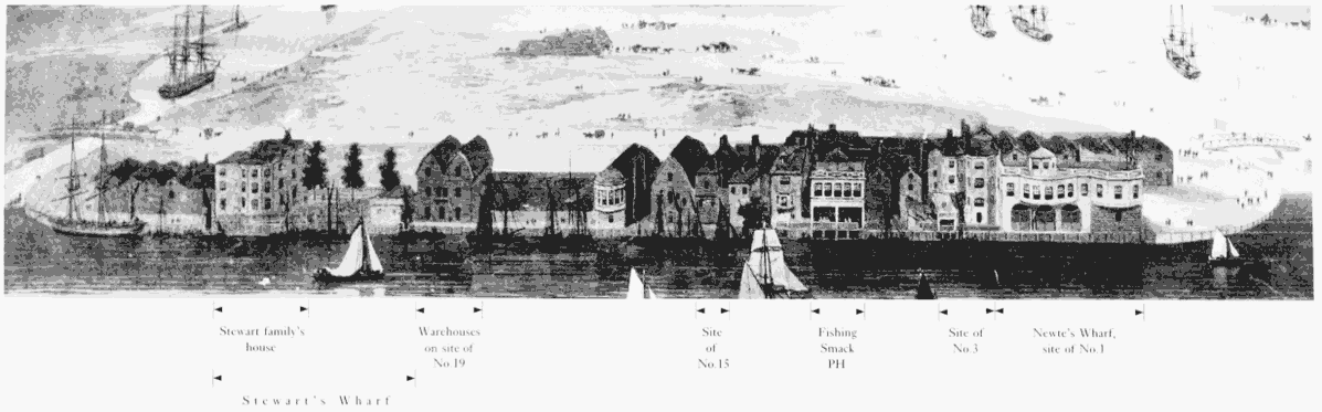
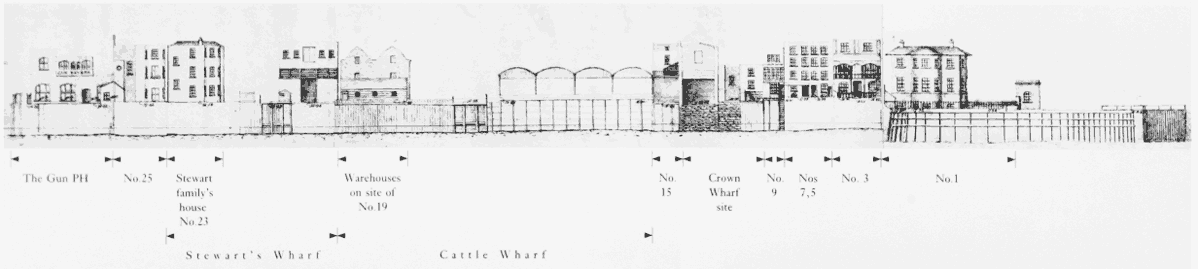
Coldharbour: River Frontage. Above, as depicted by William Daniell in 1802, and, below, as shown on the Thames Flood plans of the early 1880s (p. 609)
Coldharbour: River Frontage
Coldharbour: River Frontage. Above, as depicted by William Daniell in 1802, and, below, as shown on the Thames Flood plans of the early 1880s (p. 609)
Coldharbour: River Frontage
Coldharbour: River Frontage. Above, as depicted by William Daniell in 1802, and, below, as shown on the Thames Flood plans of the early 1880s (p. 609)