Survey of London: Volumes 43 and 44, Poplar, Blackwall and Isle of Dogs. Originally published by London County Council, London, 1994.
This free content was digitised by double rekeying. All rights reserved.
'Plate 112: Bow Creek and west side of Orchard Place in 1986.', in Survey of London: Volumes 43 and 44, Poplar, Blackwall and Isle of Dogs, (London, 1994) pp. 112. British History Online https://www.british-history.ac.uk/survey-london/vols43-4/plate-112 [accessed 18 April 2024]
In this section
a. Bow Creek and the west side of the Goodluck Hope peninsula in 1986, looking towards Acatos & Hutcheson's vegetable-oil refinery
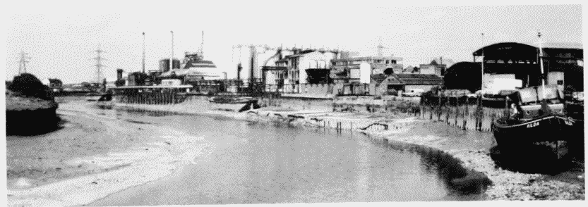
Bow Creek and west side of Orchard Place in 1986.
Bow Creek and the west side of the Goodluck Hope peninsula in 1986, looking towards Acatos & Hutcheson's vegetable-oil refinery
b. Bow Creek and the west side of the Goodluck Hope peninsula in 1935: houses in Creekside right (p. 653), and the galvanized-iron works left (p. 666)

Creekside in 1935.
Bow Creek and the west side of the Goodluck Hope peninsula in 1935: houses in Creekside right (p. 653), and the galvanized-iron works left (p. 666)
c (left). Orchard Place, looking north in c1926 (p. 653)
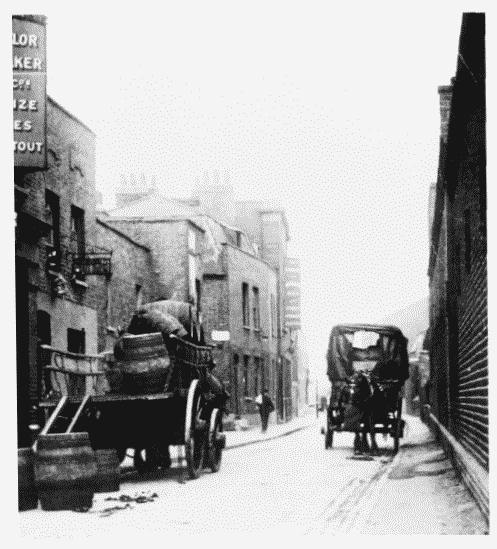
Orchard Place in c1926.
(left). Orchard Place, looking north in c1926 (p. 653)
d. Bow Creek Council School, Orchard Place, in c1925 (p. 668).
Bow Creek Council School in c1925.
Bow Creek Council School, Orchard Place, in c1925 (p. 668).
Demolished