Survey of London: Volume 38, South Kensington Museums Area. Originally published by London County Council, London, 1975.
This free content was digitised by double rekeying. All rights reserved.
'Plate 77', in Survey of London: Volume 38, South Kensington Museums Area, (London, 1975) pp. 77. British History Online https://www.british-history.ac.uk/survey-london/vol38/plate-77 [accessed 26 April 2024]
In this section
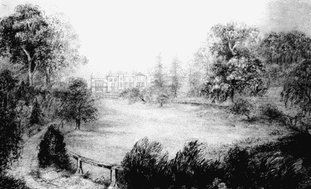
a. Grounds of Grove House, Kensington Gore (P. 12), looking north in c. 1851–5, drawn by the owner's wife.
Grounds of Grove House, Kensington Gore, in c. 1851–5.
a. Grounds of Grove House, Kensington Gore (P. 12), looking north in c. 1851–5, drawn by the owner's wife.
The viewpoint is now in the Aeronautics building of Imperial College
b. Methwold's almshouses and St. Augustine's Church, Queen's Gate, in c. 1871–3 (PP. 5, 351), looking south from what is now the north side of Harrington Road

Methwold's almshouses and St. Augustine's, Queen's Gate, in c. 1871–3.
Methwold's almshouses and St. Augustine's Church, Queen's Gate, in c. 1871–3 (PP. 5, 351), looking south from what is now the north side of Harrington Road
c. View southward across Cromwell Lane in c. 1860–1 with Methwold's almshouses on right (PP. 5, 18).
Cromwell Lane c. 1860–1.
View southward across Cromwell Lane in c. 1860–1 with Methwold's almshouses on right (PP. 5, 18).
The viewpoint is now in Queensberry Mews West, and Harrington Road runs across the middle distance