A History of the County of Warwick: Volume 3, Barlichway Hundred. Originally published by Victoria County History, London, 1945.
This free content was digitised by double rekeying. All rights reserved.
'Parishes: Studley', in A History of the County of Warwick: Volume 3, Barlichway Hundred, (London, 1945) pp. 175-187. British History Online https://www.british-history.ac.uk/vch/warks/vol3/pp175-187 [accessed 11 April 2024]
In this section
STUDLEY
Acreage: 4,305.
Population: 1911, 3,019; 1921, 3,147; 1931, 3,072.
Studley is a large parish, roughly rectangular in shape, and surrounded on the north, east, and west by hills rising to about 500 ft. The River Arrow flows across the south-west corner, through flat ground, but the country north and east of the stream is for the most part undulating and well wooded. The main village lies on the west bank of the river, along the Roman Rykneild Way, which is now the Alcester-Birmingham main road: though the fact that the church and the site of the castle are about half a mile away on the opposite side of the river indicates that the original settlement was, as is usual, at some distance from the Roman road. At Washford, half a mile north of Studley village, the main road bears right from the Rykneild Street and continues through the hamlet of Mappleborough Green and up Gorcott Hill, which marks the northern extremity of the parish. The Rykneild Street (which between Washford and Ipsley diverges considerably from its original line) was, until the end of the 18th century, the main road to Birmingham; the present road between Spernall Ash (on the southern boundary of Studley parish) and Digbeth in Birmingham was turnpiked by an Act of 1721, which, however, remained ineffective for many years. (fn. 1) The section north of Washford may perhaps be the Paunce Lane mentioned in 1665. (fn. 2) At the north end of Mappleborough Green it is crossed at right angles by the road from Redditch to Henley-in-Arden and Warwick, from which, at half a mile eastwards, a bridle road to the right leads back to Mappleborough over the shoulder of Cracknutt Hill. (fn. 3) A mile beyond, at the hamlet of Outhill, another road leads south-west to Studley by Gattax Farm, Clark's Green, and Hardwick. This appears to be mentioned in the 16th and 17th centuries as the highway from Studley to Warwick. (fn. 4)
At the southern extremity of the parish a branch road from the Rykneild Street leads north-west to Astwood Bank, through the hamlet of Littlewood Green, and is connected with Studley village by another, which joins it near the station and is believed to be an ancient saltway from Droitwich. (fn. 5) William Fitz Corbucion's chief holding in Studley in 1086 included a salt-pan rendering 19 loads of salt; (fn. 6) and his descendant, Peter, granted to his newly founded priory at Wicton, soon afterwards removed to Studley, two salt-pans at the Wiche and the tithe of the rest of his salt there. (fn. 7)
The largest house in the village of Studley is the Manor House, at the south end of the street, facing east. This was probably the manor house of Holt, and therefore the residence of the Knottesford family (see below). The doubled monogram, apparently TC, displayed over the iron gates may be that of Charles Knottesford (d. 1697), and Teresa his wife.
The house is of late-17th-century date, of red brick with Ionic pilasters of stone at the angles, stone entablature with a bracketed cornice, and a parapet with five balustraded spaces. The central doorway has stone pilasters and a curved pediment; the tall and narrow windows to the two stories have architraves and key blocks, and sash-frames. The house contains some early-17th-century panelling brought from Castle Cottages. The staircase dates from c. 1740, about which time the interior was renovated after a fire. The forecourt has a gateway with panelled stone piers with moulded caps and urns, and ornamental iron gates and overthrow, in which is an oval panel with the doubled monogram already referred to.
There are several cottages with typical 17th-century chimney-stacks and square timber-framing. The 'Old Barley Mow', an inn facing to Priory Square at the north end of the village, is a long low building facing south with a gabled wing at each end of the front. It still shows some of the original timber-framing, including some close-set studding in the upper story of the wings, probably of the 16th century, and a blocked doorway with a cambered lintel. Much of the original roof remains in place.
The Augustinian Priory of Studley was founded by Peter Corbizun in Stephen's time, and the church was either rebuilt or much enlarged early in the 14th century, being consecrated in 1309. (fn. 8) The Priory Farm, now much modernized, embodies a few fragmentary portions of a conventual building. A gabled west wall of stone rubble contains the remains of a large 14th-century window. The hall that it lighted was about 40 by 20 ft. and forms the main part of the farm-house. The window was mostly destroyed by a projecting stone chimney-stack, dated 1539 (in modern figures); this has three detached square shafts of 17thcentury bricks. The north and south side-walls are of modern brickwork, but at the south-east angle are some ancient stone quoins. The east gable-head and part of the north wall at that end have some early Tudor timber-framing. At this period a ceiling was inserted below the roof, divided into square panels by deep, hollow-chamfered joists; it had an oak cornice on the north and south sides, moulded and carved with billet ornament. The gabled roof above is of subsequent reconstruction. The upper floor and partitions were inserted in the 16th century. The lower west room has chamfered cross-beams and a carved boss (probably reset) with the monogram IHS. A few medieval sculptured fragments are built on to the walls.
The indicated site of a stone coffin, the lid of which is preserved in the parish church, suggests that the original chapel stood to the north-east of the existing building. Nothing else is left beyond a few ditches.
Mappleborough Green, according to Dugdale, was originally known as the Hay Wood; the 'grove of Haia' which, in 1201, Peter Corbizun granted to William son of Geoffrey. (fn. 9) Another Peter Corbizun, in 1341, surrendered all his right in his wood of Mapelberewe and the waste adjoining to Peter de Montfort of Beaudesert. (fn. 10) It remained, until 1824, a part of the common waste of the parish. (fn. 11) The village of Mappleborough, which consists of a number of scattered settlements, must therefore have originated in encroachments on the common, a process which seems to have begun at quite an early date. Moat House Farm, on the east side of the main road between Studley and Mappleborough, was the manor-house of the manor of Mappleborough Green or Studley Hay, being mentioned by name in the conveyance to Dame Mary Shelley, in 1700, of her portion of the Middlemore estates (fn. 12) (see below). The house has some late-17th-century timber-framing in the upper story of the main block. Connected with the south of the house by a narrow annexe is a late-16th-century short wing, evidently part of the earlier house and now reduced in length: it shows in the gabled front a heavy cambered tiebeam and curved braces, and there is original framing at the back; on the south-west side, now of 18th-century brick, is a projecting chimney-stack in which is a disused wide fire-place. The moat, with water, remains to the south-west and south-east sides of the house, but the remainder has disappeared. It is said to have originally continued across the site of the present main road and included a small cottage on the other side which also has some 17th-century framing. North of the Moat House Farm, at the turning eastward towards Cracknut Hill, are some five or six small buildings with 17th-century timber-framing: and west of 'The Haigh' (a 19th-century house) are the remains of a homestead moat, consisting of the fairly broad south side, full of water, and parts of the east and west sides. (fn. 13)
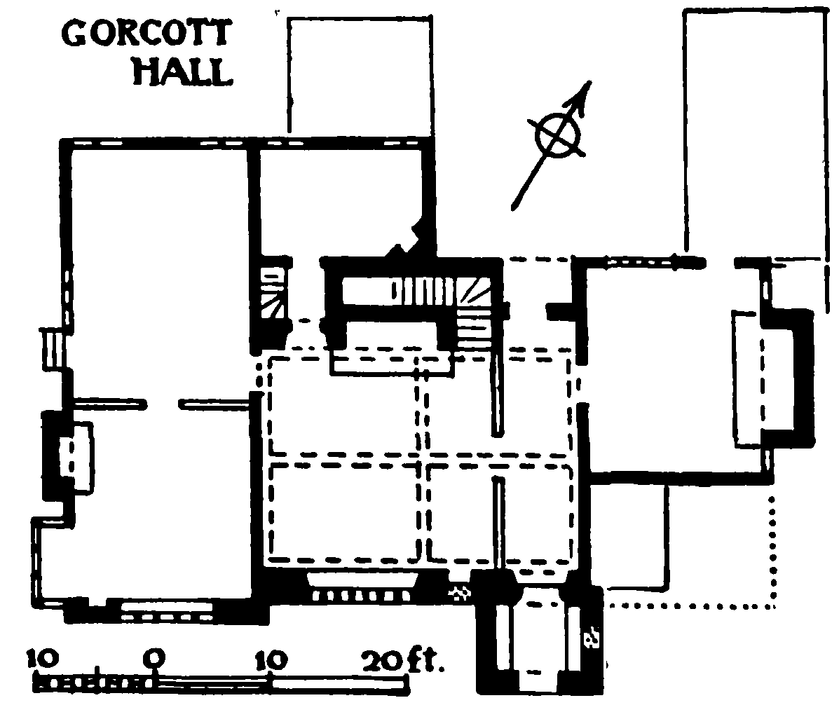
GORCOTT HALL
North-west of the cross-roads and near the centre of the original green is Common Farm, dating from the late 16th century. The original plan is L-shaped, the south-west wing (mostly refaced) being lengthened in the 17th century. The south-east wing has a gabled end with a jettied upper story on a moulded bressummer. The lower story is plastered, but the upper, on either side of the central window, has its timbers arranged in herringbone pattern. The head of the gable has a cambered tie-beam and square panels with geometrical patterns. The two sides of the upper story are of close-set studding. Each wing has a great chimney-stack; the south-eastern, plain above the roof, has an arched fire-place inside. The south-western has a square shaft with V-shaped pilasters, of thin bricks, and a wide fire-place with corner seats, serving a room which has an open-timbered ceiling with stopchamfered beam and joists; the other rooms have similar beams and plastered ceilings. There are four short wings against the long north-east side, three of them retaining remains of late-17th-century framing. South-west of the house is a 17th-century timberframed barn. Lower House Farm, farther north, west of the Birmingham road, is an L-shaped building of the late 16th century, enlarged and much altered, but showing some close-set timber-framing in the upper story at the back. It has a central chimney-stack of three square shafts set diagonally.
Gorcott Hall stands on the west side of the main road, half-way up Gorcott Hill, the hamlet of that name being at the top. In the 16th and early 17th centuries the house was occupied by the Yardley family, Thomas Yardley and his son and heir John, both described as of Gorcott Hill, appearing in the Visitation of 1619. (fn. 14) But by 1662 it had come into the possession of Edmund Chambers (son of John Chambers of Tanworth), (fn. 15) whose descendants lived here until the 1830's, (fn. 16) and owned the house until the family became extinct in 1854. It now belongs to Sir William Jaffray, bart., and is occupied as a farm.
The building is partly of mid-16th-century brickwork and partly of earlier and later timber-framing, and faces approximately south. (fn. 17) The development of the plan and elevations is somewhat abnormal. It began probably with a 15th-century timber-framed house of two fairly low stories, with a middle hall and end cross-wings, jettied in the gabled upper stories on the south front, and with the west wing extending farther at the back than the east wing. About 1540 to 1550 the middle block was entirely rebuilt in brick and its two stories heightened. A great fire-place was built against the back of this part and others added to the outer sides of the wings. A gabled porch-wing was built on the south front next to the east wing, giving direct admission to the lower hall. A passage was cut off the hall afterwards by a partition. A staircase from the hall round the east side and back of the north fire-place is also probably of the same period. A short wing was added at the back in the 17th century next to the inner side of the west wing, which was also reconstructed in part, so that the two gable-ends, flush with each other, are alike in their framing, except for the lower story of the older wing. Another alteration, probably done in the 18th century, was the heightening internally of the stories of the west wing to tally with those of the middle block, but without increasing the height externally. The jettied upper story in front was underbuilt with brick. The front half of the east wing, which overlapped the east side of the 16thcentury porch, has also disappeared and there are traces of other buildings of the 17th or 18th century at the back which have since been removed.
The brickwork of the south front and porch has diaper ornament in blue-black headers, and a chamfered stone plinth. The windows have mullions and transoms, and imitation stone dressings in plaster. The main windows are of seven lights, and the first-floor window of the porch is of three lights with arched heads. The entrance doorway to the porch has an oak arched frame in a square head. The gable-head of the porch is timber-framed and slightly projecting on a stop-chamfered bressummer and curved brackets. The east side of the porch has a blocked doorway into a destroyed building, either part of or joined to the original east wing; on the first floor is a cross-loop peephole. In the main wall, next the porch, is another blocked doorway, an 18th-century entrance to the hall. The exposed part of the gabled east end shows irregular framing, some of it with close-set studs.
The gable end of the west wing is of plain close-set studding in the upper story and head: the lower story is underbuilt with 18th-century brickwork. It contains a five-light window, with wood mullions and transom, the head of which encroaches on the timber-work of the upper story. Against the west side of the wing is a projecting brick chimney-stack of c. 1700, containing a moulded fire-place to the front room. South of it is a square bay-window of framing, with a gabled head, added when the rooms in this wing were heightened: the lights are now bricked up. Above its roof, the main wall shows an earlier small window of two arched lights, also blocked. The walling, to the north of the chimneystack, is of two bays of framing, the lower story of the northern bay being of original close-set studding, but the remainder of square framing, apparently of 17thcentury alteration, with a modern doorway and window, and with a gabled dormer window. The stone walling of the 17th-century cellar appears just above the ground, with the heads of three 5-ft. windows, now blocked. In the back, or north elevation, this wing also has close studding to the lower story, but the rest of it is of square framing and pairs with the 17th-century wing adjoining east of it. The gabled end of the east wing is of close studding and has a 17th-century window and brickwork to the lower story. Flush with it and encroaching partly on it is the wall of the middle block, of early-16th-century bricks, enclosing the staircase that passes behind the hall fire-place. Two tiny loops for the staircase and an arched light in the upper story are original, but a square-headed lobby entrance with a wood lintel, containing the doorway to the screenspassage, is later. The gable-head over the brick-work is of close-set studding and has a stop-chamfered bressummer.
The chimney-stacks above the hall fire-place and the east side of the east wing have square shafts set diagonally. Both fire-places on the ground floor are wide, with oak bressummers. The hall has stop-chamfered cross-beams and wall-beams. The south entrance from the porch has chamfered jambs and a Tudor arch in a square head, and an original panelled door with moulded ribs. The north entrance, opposite, also has an original four-centred door with chamfered ribs. The lower rooms of the west wing, now divided by a modern partition but formerly one chamber, are lined with bolection-moulded panelling of c. 1700.
There are a few quarries of 16th- and 17th-century coloured glass on the south windows, including the Tudor Royal arms with lion and dragon supporters and motto 'vivat rex', a sundial with motto 'sic ætas Fvgit', a spider and fly, birds, and a panel with a Chinese scene.
The south courtyard has a pair of gate-posts, opposite the porch, with brick piers and moulded stone capitals and ball finials, and a west side-wall with a stone coping and two or three ball finials. The space, formerly lawns, west of the house has a west gardenwall also with gate-posts with ball finials. North-west of the house is a late-17th-century granary partly of brick and partly of timber-framing.
On the east side of Gorcott Hill are extensive woods, stretching northwards from Round Coppice near Lower Skilts to Grove Wood on the borders of Oldberrow parish. Part of this woodland is no doubt the 'Wood of Gercete' referred to in the 13th century, and part may include 'Graingcumb Wood', (fn. 18) so called because it belonged to the Prior of Studley's Grange at Skilts. Upper Skilts, about half a mile south-east of Gorcott, is a modern mansion, the seat of Sir William Jaffray, bart.; Lower Skilts, another half-mile to the south, stands on rising ground overlooking the RedditchWarwick road between Mappleborough Green and Outhill. The present building is all that remains of the 'very beautiful house of brick' (fn. 19) with which William Sheldon, c. 1560–70, replaced the Prior's Grange. It is of red brick of three stories, and had a courtyard entered by a north gatehouse which was connected by walls to square buildings at the angles. The remains consist of the east half of the house, the gatehouse, the angle buildings, and a barn west of the courtyard. The main lines of the present plan formed a square, with a narrow projecting wing on the north and adjoining east of this another square wing, now detached on three sides, part of the east side of the square main block having been removed. Adjoining the south half of the east side is a lower two-storied wing containing the kitchen, &c.
The main south elevation is in two bays flanked by buttresses and divided by a narrow recessed bay which forms the side of a great internal chimney-stack, which has a huge (disused) fire-place on the ground floor, lighted by a small 'fire-window'. Higher up is a blocked stone window. The windows in the main bays are modern, but at the west end are remains of original stone windows, mostly destroyed with the missing western half of the house. The house had two parallel suites of rooms from east to west. The present west rooms are probably only parts of the original larger chambers. The west wall, with two gable-heads, is of 18th-century bricks and the stumps of the side walls have been altered to buttresses.
The north elevation is on three planes. The projecting gabled wing on the east half has a ground-floor doorway and a two-light window next it, both restored. The first floor has an original four-light stone window and the second floor one of three lights. Both north and south elevations have plinths with stone mouldings. The small square north-east wing is now used as a staircase, approached by a modern doorway from the courtyard. The brickwork has some diaper in blue bricks. In the east wall is a bull's-eye window to the ground floor, and in each of the two upper stories a blocked two-light window of stone. The head is gabled. The south and west walls formerly had wide archways into the main block. The portion of the east wall of the main block south of this wing has gone, leaving a deep recess. It was of only two stories, as the back wall of the recess contains remains of original windows to the third story. The east end of the south range is of full height and has an ancient window to the second floor and another in the gable-head. Against this bay is the two-storied kitchen-wing, apparently a 17thcentury addition. The east wall has a gable with a moulded coping. On the south side is a chamfered plinth, stopped on either side of a blocked doorway with chamfered jambs and a massive lintel. Internally there are few perceptible remains of age. Besides the great fire-place, another on the first floor in a disused chamber is of moulded stone. Some late-16th-century panelling remains in the south-east chamber and corridor on the first floor. The room over the kitchen has an open-timbered ceiling.
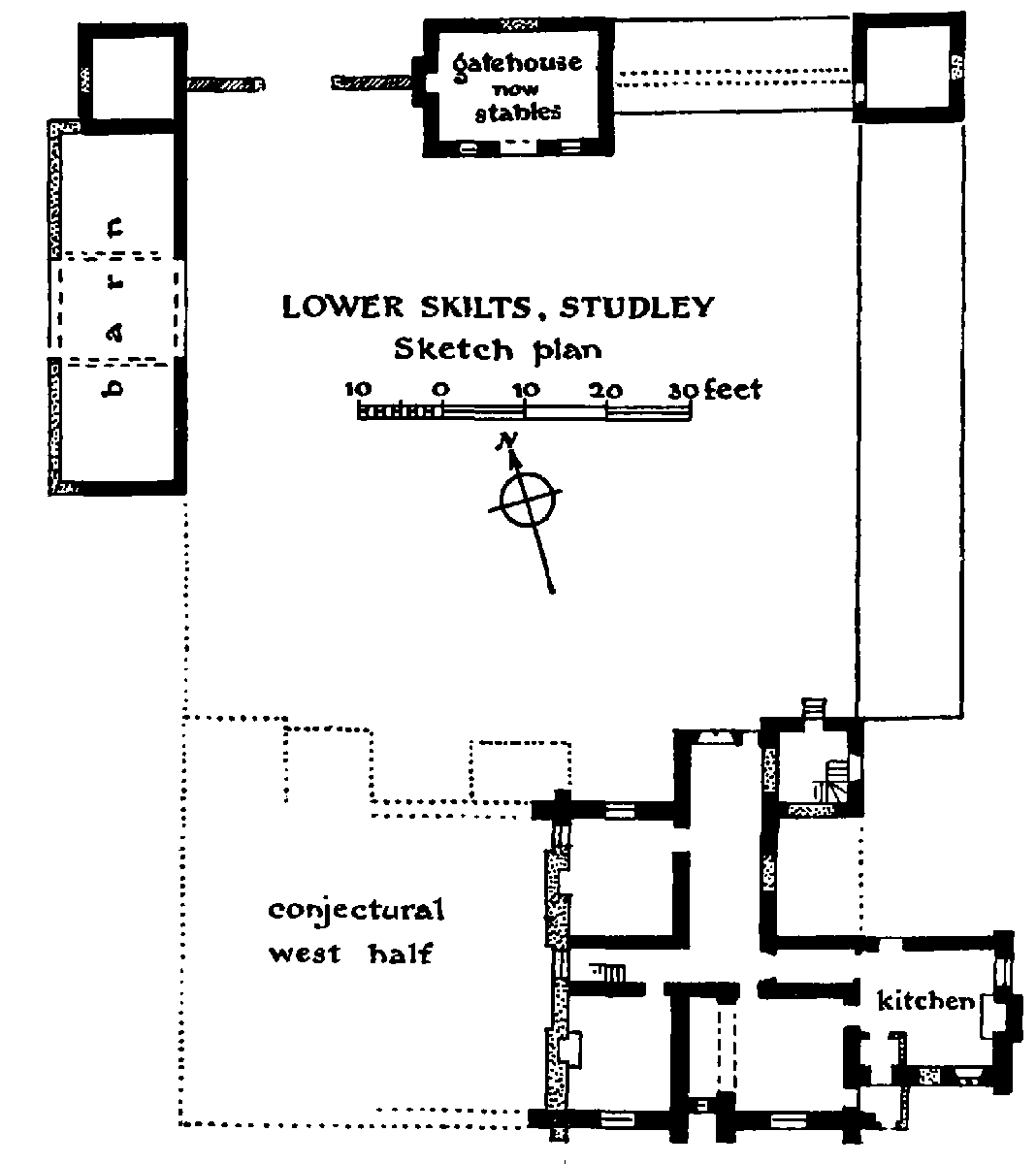
LOWER SKILTS, STUDLEY Sketch plan
The middle building on the north side of the courtyard, now used as a stable and loft, was probably the gatehouse. In the middle of the north side is a stone archway with a four-centred head, now blocked. The opposite entrance is modernized. Above it is a large stone sun-dial. The east and west walls are gabled: the west wall has a projecting chimney-stack. The north-west angle building is of the same height and has gabled east and west walls. In the west wall is an original two-light stone window to each of the two stories, now blocked. The north-east building was similar but has been lowered by a story. Between the middle and west buildings is an original garden wall with a modern gateway to the court. A modern farmbuilding displaces the other walls. All these walls are of ancient brickwork with diaper ornament. Adjoining the south of the west building is a barn of the same brickwork in three bays with large middle doors. The west side of it is of modern bricks.
The ground slopes considerably from north to south, but the space south of the house is levelled and has a tall revetting wall against its south side.
William Corbucion, or one of his descendants, built a castle at Studley, the site of which is marked by a roughly circular rampart and ditch north of the church. Of its architectural history nothing is known, though some ruins of it were still standing in Dugdale's time. (fn. 20) The house which now stands within the inclosure appears to date from the early 16th century and may therefore have been built by one of the Thomas Atwoods, father or son. It was then known as Corpsons (fn. 21) and in the 18th century appears under the name of Church End House. (fn. 22) It was apparently occupied until the present Studley Castle was built in 1834, but is now divided into several tenements called Castle Cottages. The main lines of the plan form an L-shape, the main block facing south-west (called south for the purposes of this description) and the wing projects northwards at the east end. The south and east fronts and the interior have been much altered. A remarkable feature is the large number of ancient gableheads. The north front has four gabled bays, mostly of close-set timbering. The easternmost is jettied in the upper story, and again in the gable-head on a moulded bressummer with shaped brackets. The second was probably for a staircase and has curved braces in the gable. The other two have herringbone framing in the gable-heads. The west elevation has three gabled bays and is jettied on the whole front: the lower half has close-set studding, the upper half and gables have geometrical panels. The first-floor windows are blocked. The south side of this wing is similarly framed, but the jettied story is underbuilt. The next bay on the south front retains herringbone framing in the gable-head, but the remainder of the front is of later brickwork or plaster. Above the west range is a chimneystack of thin bricks with shafts having V-shaped pilasters. Another projects at the north end of the east wing but is partly covered by a later wing. It has stone angle dressings and similar shafts, and a great stone fire-place that is now pierced by a doorway into the later wing. The internal arrangements are mostly modern but in the west range is some late-16th-century panelling, partly with a frieze carved with scroll ornament, and a contemporary chimney-piece. A staircase has flat silhouette balusters. Some of the ancient wall-framing is also exposed inside.
Industries
Studley was one of the earliest centres of the local industry of needlemaking. (fn. 23) Needle-makers are frequently mentioned in the parish registers from 1695 onwards, though the craft may even then have been long-established. The discovery of new scientific processes in the early part of last century brought considerable prosperity to Studley: James Pardow, who first applied steam-power to needle-making, established his mill here in 1800, (fn. 24) and within fifty years the population had doubled itself, Pardow's mill alone employing 250 hands. (fn. 25) The plan and character of the place to-day, half-town, half-village, with its rows of Victorian houses side by side with notable examples of half-timber, and its outlying artisan colonies of Green Lane and Thomas Town, reflect very clearly the impact of the Industrial Revolution on a rural community. Though the centre of the industry has now shifted to Redditch, there are still two large needle-mills here and several smaller concerns which produce fishing tackle.
Among industries that have now died out may be mentioned tanning (fn. 26) and charcoal-burning, both of which flourished here during the 17th and 18th centuries. The earliest reference to the latter may be the place-name, Collday Hill, which occurs in the Manor of St. John of Jerusalem c. 1540. (fn. 27) In the 17th century charcoal-burning was chiefly located at Skilts. 'Colliers' of Skilts occur in the parish registers in 1669 and 1695 and the 'right to coale Trees' is reserved in a lease of land in Skilts Park in 1713 (fn. 28) and at Wallers Hill near Hardwick in 1678. (fn. 29)
Malting and brickmaking were also carried on here during last century, and there is a gasworks, established in 1865. (fn. 30)
There is a railway station serving Studley and Astwood Bank on the L.M.S. line from Birmingham to Evesham, which was opened, as the Alcester-Redditch section of the Evesham-Redditch Railway Co.'s line, in June 1868. (fn. 31)
The fair held on 28 Sept. and known as Studley Mop was in the middle of last century a fair for sheep and cattle (fn. 32) as well as a hiring fair. It has its origin in the Wake which, in Dr. Thomas's time, was held on the Feast of the Nativity of the Virgin (8 Sept.).
The Public Hall was erected in 1889.
Inclosures
The parish was inclosed by an Act of 1817, though the award was not made until seven years later. (fn. 33) This Act was chiefly concerned with the three large pieces of waste—Mappleborough Green, Studley Common, and Littlewood Green—the greater part of the open fields and much of the meadow having already been inclosed by private agreement. A survey of the small manor of St. John of Jerusalem in 1540 shows that 33 out of the 58½ acres comprised in the survey were already inclosed; and whereas land in the common field was said to be worth only 4d. an acre, even the poorest of the inclosed land, described as 'barreyn ground growyng wt. gostes and briars' was valued at 1s. (fn. 34) It is noticeable, too, in many of the 16th- and 17th-century deeds relating to the parish that only a small proportion of the land conveyed appears to be in the open fields. It seems also to have been the custom in the 16th century for the meadow ground, at least in the Castle Meadow, to be held in strips and not in common. (fn. 35) By 1824 six of the open fields survived wholly or in part; Brook Field, Mill Field, Great Dun Field, (fn. 36) Red Hill, Little Red Hill, and Hadway Field: and there are earlier references to two others called Bandlond (fn. 37) and Nether Field. (fn. 38) But owing to the multiplicity of manors here the type of manorial economy practised in the Middle Ages is impossible to determine. In later times at least the holdings of different manors may often have lain within the same field.
Many of the fields in the Tithe Award bear names such as 'Six Days Work', 'Ten Days Work', &c., probably referring to the boon-work performed on the medieval manor. (fn. 39)
Skilts was the birthplace of Sir John Smith (1616–44), the Royalist officer who, by a daring ruse, recovered the king's standard at Edgehill: an exploit for which the rank of knight banneret (one of the last of such creations) was conferred upon him on the field of battle. He was the son of Francis Smith of Wootton Wawen (q.v.) and younger brother of the 1st Lord Carington. He saw service in the Low Countries and acquired a high reputation as a soldier during his brief career. He was killed at the battle of Alresford in 1644 and was buried with military honours in Oxford Cathedral. (fn. 40)
Manors
At the time of the Domesday survey William fitz Corbucion held 4 hides of land in STUDLEY, (fn. 41) and one hide in the hamlet of Mappleborough which Geoffrey held of him. (fn. 42) In Studley William Buenvasleth also held 1 hide which he sublet to another William. (fn. 43) In 1166 Peter de Studley, the descendant of William fitz Corbucion, was returned by the Earl of Warwick as holding 10 knight's fees of him in Warwickshire. (fn. 44) The Earls of Warwick remained the overlords of Studley throughout the Middle Ages, but most of the lands held by Peter de Studley or Corbucion were shortly afterwards dispersed, a fact which accounts for the very complicated manorial history of the parish. References to the family, however, continue for several generations, and in 1316 Peter Corbucion was named one of the lords of Studley. (fn. 45)
Some time during the reign of Henry II Peter transferred to Studley a priory of Austin Canons he had founded at Wicton, Worcs., and endowed it with lands, woods, and a mill there. (fn. 46) In 1290 the Prior of Studley successfully claimed view of frankpledge and assize of bread and ale in his estates in Studley, (fn. 47) which in the following year were extended at 3 carucates of land, worth a mark per carucate, besides 20s. in fixed rents. (fn. 48) In 1316 he was returned as one of its chief lords. (fn. 49) Part of the estates was let to tenants, but the priory retained a farm in Studley named Skilts as the chief of its demesne, and it was never let from the house until the Dissolution. (fn. 50) The estate of the Priory was valued at £42 10s. The demesne, worth £21, was appropriated to the guest house of the monastery and an annual payment of 30s. to the bailiff. A pension of 11s. out of the profits of the manor was also payable to the Prior of St. John of Jerusalem. (fn. 51)
In 1538 the manor, the site of the priory church, pasture land in Studley park, and the advowson of the church were granted to Edmund Knightley, sergeantat-law. (fn. 52) He died childless in September 1542, his heirs being the five daughters of his brother Sir Richard Knightley: Jane, wife of John Knottesford, serjeantat-arms; Susan, later married to Richard Langtree; Anne, wife of George Throckmorton; Mary, wife of Bartholomew Hussey; and Frances afterwards married to James Duffield. (fn. 53) His estates in Studley were divided between them, but Susan died without heirs in 1583, and her share was redivided.
The estate that came to John Knottesford remained in his family for over two centuries. The manor of Holt (see below) was added to it, probably by John Knottesford before his death in 1589. (fn. 54) And in 1640 Fulke Knottesford bought from Sir Thomas Porter the 1/5 share of Anne Throckmorton, (fn. 55) which had passed in 1565 to Fulke Porter her son by her second husband, (fn. 56) in 1570 to Fulke's brother Simon, (fn. 57) and before 1619 to Sir Thomas, who was Simon Porter's son. (fn. 58)
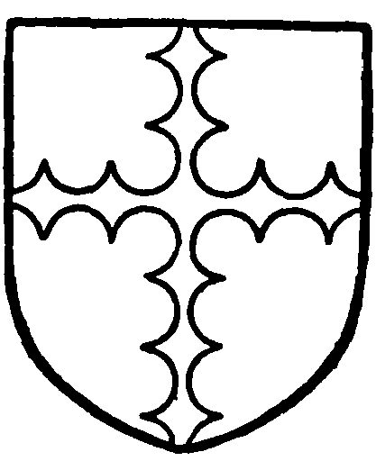
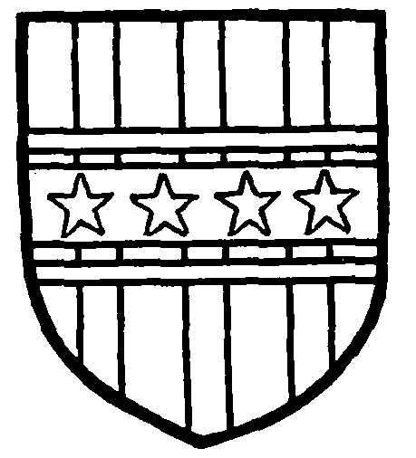
Knottesford. Sable a cross engrailed argent.
The Knottesford property thus came to be known as the chief manor of Studley. It was sold by John Knottesford to Robert Knight, Earl of Catherlough, in 1766. (fn. 59) On the earl's death in 1772 it passed to Robert Knight of Barrels, the eldest of his natural children by Jane Davies, (fn. 60) who died in 1855 leaving, among other children, two daughters; Frances Elizabeth, afterwards married to the Hon. Edward Gooch of Melbourne Hall, Derbyshire, and Georgina, wife of Edward Bolton King of Umberslade. Mrs. Gooch succeeded to the manor of Studley, which she was still holding in 1872. (fn. 61) By 1876 it had passed to Edward Bolton King (fn. 62) in the right of his late wife, and on his death two years later descended to Captain Henry Calverley Cotton, (fn. 63) who had married his daughter, Georgina. Their son, Henry Robert Stapleton Cotton of Wem, Salop., was lord of the manor in 1912 (fn. 64) and shortly afterwards sold the property to Sir John Henry Jaffray, 3rd bart., father of the present owner.
The fifth share of Studley manor which was assigned to Mary, wife of Bartholomew Hussey, probably included part of the Hospitallers' estate, as it came to be known as STUDLEY ST. JOHNS. It was sold in 1564 to Sir John Conway. (fn. 65) In 1593 he resold it to John Walgrave alias Fleet who died in January 1619 having settled the manor on his wife Jane, with remainder to Thomas, his son. (fn. 66) He died in May 1620, (fn. 67) and his son Thomas in 1666. (fn. 68) John, son of this Thomas, died in 1676 leaving two sisters, Magdalene wife of Richard Williams and Anne wife of Ambrose Scudamore, (fn. 69) who in 1680 released their claims on the manor to Sir John Huband. (fn. 70) By 1785 it had come into the possession of Thomas Chambers of Gorcott Hall (fn. 71) and passed on his death in 1799 to three of his daughters, Anna Maria, Elizabeth, and Henrietta, who are cited as ladies of the manor in 1824. (fn. 72) About this time it was acquired by Francis Holyoake of Studley Castle. (fn. 73)
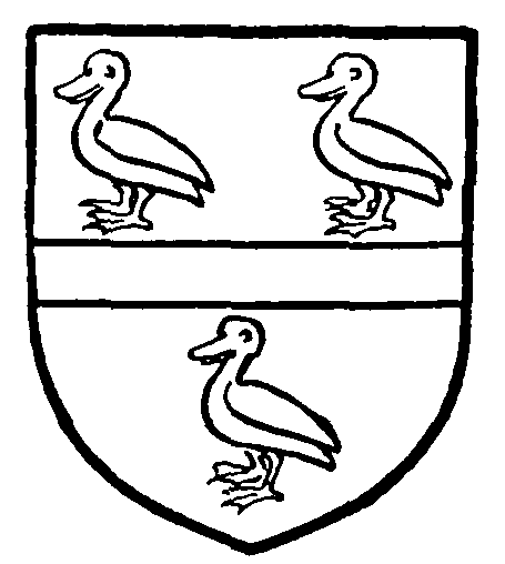
Sheldon. Sable a fesse argent between three sheldrakes proper.
Jaffray of Skilts. Argent three pales sable with a fesse cotised gules over all charged with four molets or.
The chief demesne of the priory called SKILTS and other lands in Studley, were assigned to Frances, wife of James Duffield, (fn. 74) who transferred them to William Est and James Wilkins in 1549. (fn. 75) From them the estates passed to William Sheldon of Beoley, Worcs., who died at Skilts in December 1570. (fn. 76) In 1575 his son Ralph Sheldon, who died in 1613, settled the manor on his son Edward, (fn. 77) and their descendants held the estates until in 1783 Ralph Sheldon sold them to Thomas Willan. (fn. 78) John James Willan held Skilts manor and park in 1820, (fn. 79) and by 1824 he had been succeeded by John Lewis Moilliet of Smethwick Park, Staffs. (fn. 80) Theodore Moilliet is given as lord of the manor in 1860. (fn. 81) He sold it to John Jaffray, who was created a baronet in 1865. Sir William E. Jaffray, 4th bart., is the present owner of Skilts and chief landowner in Studley.
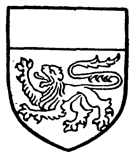
Rishton. Argent a lion passant and a chief sable.
Some time before 1185 Peter de Studley gave some lands and a mill in Studley to the Knights Templars, (fn. 82) who compounded with Amice, widow of William Corbucion, for land there in 1233. (fn. 83) Another small grant was made to the order in 1246 by Richard de la Holte and Agnes his wife. (fn. 84) On the dissolution of the order the property they held, which included two mills and 30s. rent, reverted to the overlord and was held by the Earl of Warwick at his death in 1315. (fn. 85) A few years later the property of the Templars was transferred to the Knights of St. John of Jerusalem, who held this estate in Studley until the reign of Henry VIII. In April 1542 the manor was granted to Sir Edmund Knightley, (fn. 86) but part at least of the estate seems to have constituted the manor of HOLT, of which Richard Rishton was in possession in 1414, perhaps through marriage with the heiress of the Holts. (fn. 87) His descendant Nicholas Rishton held it at his death in 1508, (fn. 88) and in 1549 Henry Rishton died seised of the manor of Holt in Studley which had belonged to the Priory of St. John of Jerusalem. (fn. 89) In 1556 his son John conveyed to his brother Ralph (fn. 90) the reversion of the manor, held for life by Dorothy Southworth, apparently the wife of John and sister of Sir John Southworth, (fn. 91) to whom Ralph transferred it the next year. (fn. 92) By 1613 the manor was in the possession of Fulke Knottesford. (fn. 93) It descended with the chief manor until 1812 when it was sold to Richard Smith of Snitterfield, (fn. 94) and after his death in 1842 it was sold to Sir J. L. H. Goodricke, bart. (fn. 95)
Peter de Studley gave the services of tenants in Studley and the advowson of the priory to William de Cantilupe. (fn. 96) In 1232 Williamson of William Corbucion brought a suit against William de Cantilupe claiming services for lands in Studley. (fn. 97) In 1242–3 William de Cantilupe held ¼ and 1/16 part of a knight's fee in Studley of the Earl of Warwick. (fn. 98) He died in 1255 when his son George was still under age. (fn. 99) On George's death about 1273 his estates were divided between John de Hastings, son of his sister Joan, and his sister Millicent, wife of Eudo la Zouche, who had the advowson of Studley Priory. (fn. 100) In 1346 William la Zouche the elder gave land in Studley to the priory. (fn. 101) In 1290 John de Hastings claimed view of frankpledge in Studley, and that his tenants there were quit of suit at the hundred and county courts as they attended his court at Aston Cantlow. (fn. 102) The Hastings, later Earls of Pembroke, remained mesne lords of these lands, which were later called STUDLEY HAY and STUDLEY PANDONGER, (fn. 103) until the extinction of the male line with the death of John, Earl of Pembroke, in 1375. Many of his English estates went to his father's cousin, William Beauchamp, (fn. 104) and Joan, widow of Sir William Beauchamp, Lord of Bergavenny, held these lands in Studley at her death in 1435. (fn. 105) Her granddaughter Elizabeth, wife of Sir Edward Neville, died seised of the estates in 1476. (fn. 106) The family continued in possession until the end of the 18th century, Henry, Earl of Abergavenny, being cited in 1788 as lord of the manor of Mappleborough Green or Studley Hay. (fn. 107) But twenty years later the manor had passed to Francis Holyoake, (fn. 108) whose son, Sir Francis L. H. Goodricke, bart., is given as lord in 1842. (fn. 109)

Hastings. Or a sleeve gules.
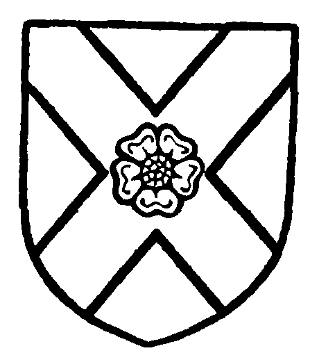
Neville. Gules a saltire argent charged with a rose gules.
In 1313 John de Wolwardynton and his partners held a ¼ knight's fee in Studley Hay of John de Hastings, while Richard fitz Richard held the 1/16 knight's fee in Pandonger. (fn. 110) In 1325 the estate in Studley Hay was held by John son of William de Hay. (fn. 111) The same names are given as being tenants of these fractional fees in 1376 (fn. 112) and 1435, (fn. 113) but it seems probable that they were repeated from the earlier feodary and that the tenures had actually lapsed.
These estates probably came into the possession of the Middlemores of Edgbaston, who were connected with Studley in the 14th century. (fn. 114) Richard Middlemore died in February 1503 holding a manor in Studley of 'the Earl of Pembroke' as a quarter-fee, which he had settled on his son Thomas and Anne his wife. (fn. 115) Thomas died in 1521 while his son Robert was still under age, holding the manor of Lord Bergavenny as of Aston Cantlow. (fn. 116) His grandson Robert Middlemore died in March 1631, being succeeded in Studley by his son Richard (fn. 117) who was buried in Studley church on his death in 1647. His grandson Richard died while still a minor in 1661 and the estates in Studley passed to his sister Mary, wife of Sir John Gage, bart. In 1700 her property was divided between her two daughters, the Studley estates falling to Mary, wife of Sir John Shelley, bart. (fn. 118)
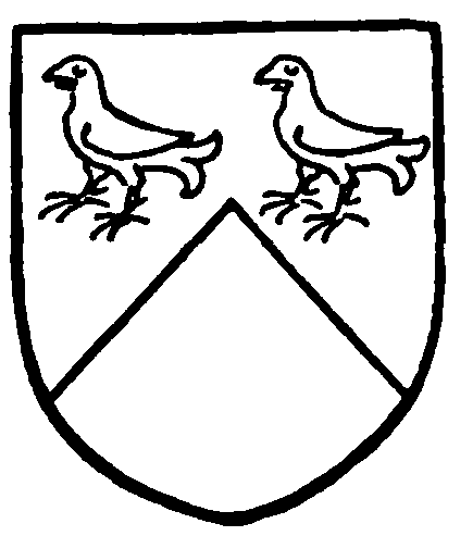
Middlemore. Party cheveronwise argent and sable with two moorcocks in the chief.
The residue of the Corbizun property, including the Castle, remained in the Corbizun family until the middle of the 14th century. The Peter Corbizun, who in 1356 made a grant of pasture in Castle Meadow to the vicar of Studley, was the last male heir and left a daughter Felice, married to John Barret of Shelfield. (fn. 119) The daughter of this marriage brought the estate to the Atwoods of the Woodhouse in Great Alne (fn. 120) (q.v.). In 1523 Thomas Atwood died seised of a capital messuage in Studley called Corpsons (an obvious corruption of Corbizun's) which was held of the king as of the manor of Tanworth, being parcel of the possessions of the late Earl of Warwick; and another messuage here called Blackhall (held of Queen Katherine as of the manor of Feckenham). (fn. 121) In 1543, on the death of his son Thomas, Blackhall is said to belong to Corpsons, and the mention of the pasture in Castle Meadow and a reserved rent of three arrowheads helps to identify the estate with that held by the last Peter Corbizun. (fn. 122) One of the five daughters and co-heiresses of the younger Thomas Atwood married a Hunt, whose descendant was holding the site of the castle in Dugdale's time. (fn. 123) This was probably the George Hunt who sold his estate here to Edward Phillips of Forell in Kings Norton. (fn. 124) Phillips's widow, Joan, married William Fetherston (son of Thomas Fetherston of Packwood), (fn. 125) who is described as of Studley in 1653 (fn. 126) and apparently occupied the castle until his death in 1670, when it reverted to John Phillips, his stepson. (fn. 127) On John's death in 1693 (fn. 128) the estate passed to his second daughter Elizabeth and her husband, Humphrey Lyttelton, of Naunton, Worcs. In 1724 Elizabeth, then a widow, bequeathed it, as the 'Manor or Mansion House called Studley Castle otherwise Church End House' together with Hardwick Farm to her eldest son, Phillips Lyttelton, in tail male. (fn. 129) The direct male line, however, died out with her grandson Phillips (1729–1809), who settled the property on his niece Dorothy Elizabeth (daughter of his brother Robert), married to Francis Holyoake. (fn. 130) The son of this marriage, Francis Littleton Holyoake, succeeded his father and became a baronet in 1835, having assumed, two years previously, the additional surname of Goodricke. (fn. 131) Two years before his death, which occurred in 1865, Sir Francis Lyttelton Holyoake Goodricke sold the castle to Thomas Walker (d. 1887), (fn. 132) whose son, Thomas Edes Walker, sold it about 1895 to Samuel Lamb. (fn. 133) In 1903 the castle and park were purchased by the council of the Lady Warwick Hostel at Reading for a Women's Agricultural College. (fn. 134)
Lands called Gatwyckes in Studley were mortgaged early in the 16th century by Thomas Blakedon or Blakeman of Knowle to William Sheldon and came into the possession of Ralph Sheldon in 1519. (fn. 135) They descended in the family, being described in 1780 as the Manor of SKILTS and GATTACKS held by Ralph Sheldon. (fn. 136) The property was probably sold with Skilts to John Willan, who was lord of the manor in 1783, (fn. 137) and thence descended to the Moilliets. (fn. 138) It occurs as the manor of Gattacks or Gattax at various dates, 1804–60. (fn. 139) The name survives in Gattax Farm and Gattax Wood.
In 1183 John de Doura brought a suit against Robert son of William and William de Arden for lands in GORCOTE and 'Witteshaye' (presumably Wishaw). (fn. 140) Walter of Wolwardinton, about the middle of the 13th century, was holding land in Gorcot in the manor of Studley of Peter Corbizun in socage. On his death the property was confirmed to his widow Margery, in trust for his son and heir Peter, then a minor. (fn. 141) Subsequently Alexander son of John de la More of Studley quitclaimed to Peter and Alice his wife the land that he held from his father in Mappleborough (fn. 142) and Blackland Meadow in Studley; (fn. 143) and Emma widow of Henry de Burle surrendered to him all the land in 'Holde Gorcota' extending from the Wood of Gorcote to the Moor that she held by the gift of her late husband. (fn. 144) He was succeeded by his son Peter, to whom as his lord Robert de Gorcote surrendered between 1328 and 1334 land called the Battes in Gorcote extending from the Gallows at Beoley as far as the Moor. (fn. 145) The estate apparently descended to Peter's grandson and heir, William de Brome (fl. c. 1360) (fn. 146) after which no more is heard of it.
An estate in the hamlets of Hay and Gorcote which included le Hayfeld, Newland and Lady Grove appears 1362–83 as in the possession of Sir William Breton and Joan his wife. (fn. 147)
Bordesley Abbey held a small estate in Studley, valued at 3s. in 1535 (fn. 148) and in 1547, when it had passed into the possession of Richard Frost. (fn. 149)
About 1538 the Gild of the Holy Cross at Stratford bought an estate in Studley worth 22s. a year, the proceeds to be devoted to charitable purposes. The purchase was made by John Combe as Master of the Gild, but after his death his son John claimed the property as his own inheritance. In 1555 the Bailiff and Burgesses of Stratford, in whom the former possessions of the gild were then vested, petitioned against him to the crown. (fn. 150) The result of the dispute is not known.
The Wardens of the Gild of the Holy Trinity at Henley-in-Arden were holding land in Studley worth 12d. yearly as free tenants of the Priory in 1536. (fn. 151) The property, with land in Beoley formerly belonging to the gild, was conveyed by William Mildmay and Thomas Maude senior to John Robins of Claverdon in 1551. (fn. 152)
There were also certain lands in Studley, at the time of the Dissolution, of which the profits, amounting to 11s. 8d., were devoted to the provision of crib lamps by certain gilds within the hundred of Barlichway. (fn. 153)
The relative positions of the various manors within the parish may be roughly determined, mainly from the evidence of 18th-century Court Rolls. The bounds of the chief manor, including the manor of Holt, were probably identical on the south and west with those of the parish. (fn. 154) On the east, in 1770, the Arrow, as far as the junction with Morton Brook, formed the boundary, which can thence be traced northwards, by landmarks still identifiable, to Church End Bridge, Clark's Green, and Cranhills Lane; (fn. 155) turning south-west through Brookfield to Priory Meadow and then north-west by Washford and Putchin's Field to the parish boundary with Ipsley. (fn. 156)
The manor of Studley Castle, including both the medieval and the modern parks, would thus have lain between the Studley-Outhill road (fn. 157) and the eastern boundary of the parish, with Gattax, extending probably on both sides of the road, to the north of it. Skilts occupied the north-eastern portion of the parish, though it must have stretched some distance south of the Redditch-Warwick road, since property near Island Hill (now Highland Hill) is said to be in Skilts in 1784. (fn. 158)
According to Dugdale the lands known as Studley Hay lay next to Mappleborough Green (originally the Hay Wood) (fn. 159) and they may correspond to Geoffrey's Domesday holding in Mappleborough. The manor of Studley Hay probably extended southwards as far as Washford, bounded by the chief manor on the southeast and south-west. To the north we may surmise that Gorcott, at least in medieval times, was included in it.
The Hospitallers' property is the most difficult to identify. A portion of it seems to have become the manor of Holt by the 15th century (see above) and the remainder, in 1540, comprised only 56 acres, a good deal of it, apparently, in scattered holdings. (fn. 160) The site of the manor is extended at 5 acres and had the River Arrow running through it, doubtless in the neighbourhood of Washford bridge, near the mill that had once belonged to the Templars (see below).
Parks
The park in Studley given by Peter Corbizun to Thurstan de Montfort (see above) had probably belonged originally to the castle. By 1296 it was in the hands of John de Montfort's guardian and overlord, the Earl of Warwick, (fn. 161) but by the beginning of the 16th century it had come into the hands of the priory and was being divided up and turned into pasture. (fn. 162) In 1520 Thomas Atwood, then prior, leased a parcel of pasture in Studley Park to Robert Morgan, (fn. 163) whence it came to be known as Morgan's Park. (fn. 164) At the Dissolution it passed to Sir Edmund Knightley and afterwards to Fulke Knottesford, who sold it to Sir Fulke Greville for £2,000 in 1615. (fn. 165) It may already have been disparked, since it is not shown in Saxton's map of 1576. By about the middle of the 17th century part at least of the site of the Park had become reunited with the manor of Studley Castle. (fn. 166) The extent of the Park in 1615 was 140 acres, (fn. 167) and it appears to have lain rather to the north-east of the present Park, in the region of Mars Hill, and to have extended to the eastern boundary of the parish at Morton Brook. The present Studley Park was made when the castle was built in 1834, though it has been considerably enlarged since that time. (fn. 168)
Skilts Park was made, for deer, by William Sheldon the builder of the manor-house, early in Elizabeth's reign. (fn. 169) Owing, no doubt, to the plentiful timber there it became during the 17th century the principal centre of charcoal burning in the parish (see above). By the early 18th century it was being divided up (fn. 170) and by 1730 it had been 'disparkt, and turned into three farms'. (fn. 171) The name, however, survived for some years longer (fn. 172) and the actual inclosure is marked in Sudlow's map as late as 1788. (fn. 173) The Park appears to have extended from the northern boundary of the parish down to the present Redditch-Warwick road. (fn. 174)
Mills
A mill worth 5s. was included in the chief manor of Studley in Domesday. (fn. 175) During the 12th century two mills are mentioned here. One had been granted by Peter Corbizun to the Templars, who were paying 6s. rent for it in 1185. (fn. 176) By 1315 the Templars were said to have held two mills which Guy de Beauchamp, Earl of Warwick, had seized with the rest of their possessions in Studley on the suppression of their Order. (fn. 177) The site of one at least of these mills must have been that of the Hurst Mill referred to in 1708, (fn. 178) which was on the Arrow above Washford Bridge, where the millrace is still to be seen. The Hurst Mill then belonged to Dame Mary Shelley, heiress to the Middlemore estates, and she was involved in a dispute with Sir John Huband who had made a cut from the millpond to his newly erected iron mill in Ipsley.
Another mill was granted by Peter Corbizun in his foundation charter to Studley Priory. (fn. 179) It was known as Cane Mill in 1504 when the prior granted a lease of it, with a house and lands adjoining and a fishery in 'le Dunsell', to William Crawley at a rent of £2 2s. 6d. (fn. 180) After the Dissolution it passed to Sir Edmund Knightley. Three mills known as the Priory Mills in 1712 and 1754 were apparently included in the manor of Holt. (fn. 181) The site and millpond of one of these mills are by the Arrow a little to the south of the remains of the priory.
Church
The parish church of THE NATIVITY OF THE BLESSED VIRGIN consists of a chancel, nave, south aisle, and west tower.
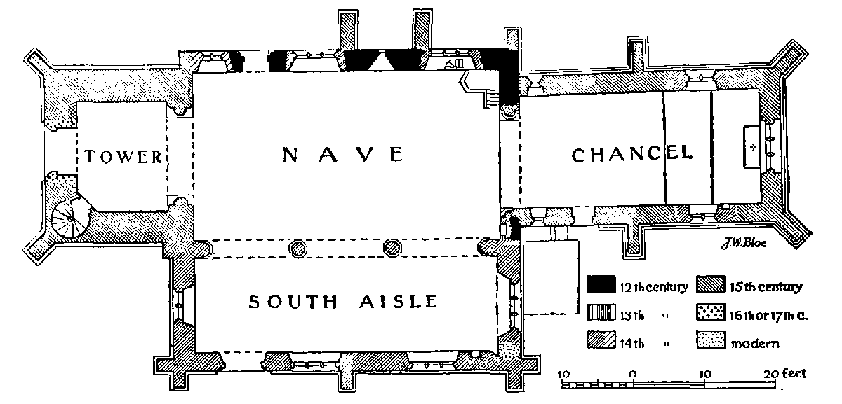
[Plan of Studley church]
The church dates from the early 12th century and the nave preserves the original north wall, with herringbone masonry, a doorway, and a window of the period. Early in the 14th century the south aisle was added with the arcade of three bays. The chancel is probably part of the same work but seems to have been rebuilt, or remodelled, in the 15th century. The west tower was added in the 15th century, but the top part of it is later work of the same century. It seems to have had no doorway before one was inserted in the west in the 16th or early 17th century.
The roofs are hidden by modern ceilings but there is a record on a tablet that the body of the church was ceiled in 1723. The church was restored in 1888, and again in 1935, when the 12th-century window in the north nave wall was discovered.
The chancel (c. 34½ ft. by 16 ft.) is slightly inclined to the north of the axial line of the nave. The east window is a 15th-century insertion and has three cinquefoiled lights and vertical tracery in a four-centred head: the external masonry is of red sandstone. In the north wall are two windows widely apart. The eastern, of the 14th century, is of two trefoiled ogeeheaded lights and a quatrefoil in a two-centred head. The second, close to the west wall, is a single light of the 15th century with a trefoiled four-centred head. In the south wall are two similar windows. Just east of the western is a 15th-century priest's doorway with chamfered jambs and four-centred head and rear-arch. The chancel walls are of red sandstone ashlar in fairly large courses, the upper part much less weather-worn than the lower. At the angles are diagonal buttresses and an intermediate buttress exists on each side. The double plinth is moulded and chamfered, and passes round the buttresses. In the south wall, east of the eastern window, is an early-14th-century piscina with a trefoiled round head and round basin. The roof has a modern wood-panelled ceiling, on the underside of the rafters and cross-braces, with moulded ribs.
The chancel arch is two-centred and of two chamfered orders, the outer continuous from the responds, the inner carried on semi-octagonal pilasters with moulded capitals and chamfered bases of the early 14th century. The pilasters are short but the bases are 4½ ft. high: the lowest 3 ft. forming the sub-base is square and of a brown stone; this in the north jamb may be a relic of the 12th-century chancel arch: the masonry above the sub-base is of white limestone. The south jamb is all plastered, the base being flush with the south wall of the chancel, with only the west half of the reveal above exposed, the chancel wall being sloped back to it. On the west face of the apex of the outer order is a groove worn by the rope of a former sanctus-bell, of which the wooden bell-cote stands above the roof. In the middle of the soffit of the inner order is a square piercing, probably made to receive a fitting in connexion with the former Rood. The east wall of the nave, above the arch, is gabled and has an ancient coping. It is built of rubble, roughly coursed, with some large pieces of coarse-grained stone like that forming the 12th-century north window of the nave.
Reset above the capital of the north jamb of the chancel arch, towards the nave, is a stone, 1 ft. 8 in. square, carved with a Paschal Lamb in a circular panel with fleurs-de-lis in the corner spandrels: it is probably of the 13th century and was discovered and placed here in 1888. South of the arch is a late-13th-century niche, 2 ft. 6 in. high, 1 ft. 7 in. wide, and 10 in. deep. It has lost its arched head, but the jambs have edgerolls with moulded capitals and bases.
The nave (43½ ft. by 24 ft.) has four windows in the north wall. The easternmost and the third are of early-14th-century date, of three lights and cusped intersecting tracery. The first has trefoiled ogee heads and trefoils over them: the third window has plainer tracery, with cinquefoiled heads to the lights. The pointed arches have external hood moulds, and sunkchamfered rear-arches. The windows are mostly of white limestone but the first has brown stone in the jambs. The mullions are restored. Over the apex of the first, outside, is reset a small human-head corbel.
The second window, set high, is an early-12thcentury opening with a round head in one piece and with internal splayed reveals and round arch, covered with plaster and decorated with 13th-century scrolled foliage painting: the external masonry is of a very coarse-grained white stone. The westernmost window is of late-14th-century date and is of two trefoiled lights and a pierced spandrel in a two-centred head. Externally it is mostly of red sandstone. Cut into the wall below and in the window-ledge of the easternmost window is the beginning of the stair to the former rood-loft, six steps in all in semi-winding form.
The north doorway, between the third and fourth windows, is a 12th-century opening, with a 13thcentury inner order with chamfered jambs and pointed head. The original outer order has a cheveron-moulded round arch with a hood-mould enriched with diaper. The jambs have nook-shafts with carved capitals, the western scalloped, the eastern with scrolled strap ornament, and moulded abaci. Over the hood-mould outside is reset a corbel carved as a ram's head.
The masonry of this wall is a striking example of early-12th-century herring-bone work. Two later buttresses flank the original window and there is another at the east end. Between the intermediate buttresses are four courses of herring-bone work, approximately 14 in. high, divided by courses of horizontal stones approximately 6 in. high, rising from the ground to about 6½ ft. in height. West of them up to the doorway the lower courses are continued below the 14thcentury window. In the easternmost bay the coursing is interrupted by later patching, but traces remain up to the same height. Above this line the masonry is of roughly coursed horizontal stones up to about half the height of the small window and over this it is of the same coarse-grained stone as is used in the window itself. Above the doorway is much refacing of squared ashlar, but one stone of the coarse material is probably the east jamb of another original window. The ashlar is mostly of Cotswold brown stone with some yellow and red sandstone.
The south arcade is of three bays, with octagonal pillars and responds to match, having moulded capitals and bases of the early 14th century. The pointed arches are of two chamfered orders, and are mostly of small voussoirs of white limestone, but the upper parts of the outer orders towards the nave are of Cotswold brown stone: the remainder of the arcade (pillars, &c.) is of the white limestone with some slight repairs.
The south aisle (13½ ft. wide) has an early-14thcentury east window of three trefoiled ogee-headed lights and net tracery in a two-centred head with an external hood-mould. The jambs and head and the pointed rear-arch are sunk-chamfered. The two windows, of the same date, in the south wall are similar to the first and third respectively in the north wall and are both of white limestone. The south doorway, west of the second, has a pointed head of two chamfered orders the inner continuous, the outer carried on nook-shafts (modern) with old capitals carved with foliage, now perished, and having moulded bases. The head has a hood-mould and a chamfered segmentalpointed rear-arch. The inner order and interior are mostly of white limestone, the arch mostly of yellow sandy limestone, the hood-mould of white stone. Above the apex of the hood-mould is reset a human-head corbel, defaced. The west window is of two pointed lights and a pierced spandrel in a two-centred head; the sill has been lowered 1 ft. 9 in.
The aisle walls have chamfered plinths and at each angle is a pair of original buttresses, and one midway on the south. A doorway inserted in the east wall against the south wall, which was partly splayed for it, is now replaced by modern ashlar. In the south wall is a 15th-century piscina with a trefoiled fourcentred head and an octofoiled round basin, and an upper shelf: the head originally had a projecting canopy, now cut away.
The roof of the nave has a modern wood barrel vault, but there are three moulded tie-beams of the early 16th century. The aisle roof has an arched barrel vault with an early-16th-century moulded ridge-rib and two cross-ribs dividing it into three bays; at the intersections are carved floral bosses. The wall-plates are moulded and in two places, not quite coinciding with the crossribs, are corbels carved with rosettes and foliage. There are also cross-ribs against the east and west walls. The roofs are covered with tiles.
The west tower (15¾ ft. north to south by 13 ft.) has a moulded plinth and is divided externally into two stages by a moulded string-course. The parapet is embattled and has a moulded string-course and copings returned down the sides of the merlons: above the angles are square pinnacles with crocketed pointed finials. At the west angles are diagonal buttresses of five stages, with moulded offsets, reaching up to the parapet string-course. At the east angles are square buttresses carried on the west walls of the nave and aisle: below the southern the angle of the nave projecting to the west is treated as a buttress to resist the arcade. The masonry of the tower up to about 10 ft. above the string-course is of squared and coursed weather-worn ashlar of white-grey stones in irregular sizes. Above that it is of more evenly sized and less weather-worn ashlar of brown Cotswold stone.
The archway from the nave is two-centred and of two chamfered orders, in white limestone, with moulded capitals to the inner order and plain square bases. The west window is of three cinquefoiled lights and vertical tracery in a two-centred head; it has moulded jambs and head externally and no hood-mould. The window is of the 15th century, but the doorway below it has a Tudor arch, with plain spandrels, which encroached on the bottom of the window: the sill was raised but the original jamb-stones were left in place down to the springing level of the door-head. The doorway has a nail-studded door with applied tracery, but is not used, being concealed inside by modern wall lining to the vestry occupying the base of the tower. In the south-west angle is the stair-vice, entered by a pointed doorway in the splay and lighted by rectangular loops: a square-headed doorway opens on to a gallery before the west window. In the second story, above the stringcourse, is a west window of one trefoiled and squareheaded light and similar windows in the north and south walls. The bell chamber has in each wall a window of two cinquefoiled lights and foiled vertical tracery in a two-centred head. The floor of the bell chamber and the cambered flat roof above have ancient heavy beams. In the head of the south-west window of the chancel is a green ring and some pieces of greenish white glass with cinquefoil flowers, &c.; 15th-century. Besides the 13th-century scrolled pattern in the 12thcentury window-splays there is a fragment of a black letter text on the arcade wall of the nave, probably of the 16th century.
The font in use is modern, but at the east end of the aisle is a disused font of the early 18th century with a gadrooned round bowl and a slender stem with foliage carved on the base. The pulpit has five sides of early17th-century oak panelling, the upper halves rectangular, the lower with round arches carved with foliage, and fluted pilasters. The stone base was made in memory of Sir John Jaffray, June 1909. By the pulpit is an early medieval dug-out chest, 6 ft. 2 in. long by i ft. 6 in. by 1 ft. 2 in. high. It had three locks.
The head of the recess of the north doorway is spanned by an iron bar, presumably for a curtain, and scrolled wrought-iron work above it: it includes a brass oval plate inscribed, 'Court Dewes, Armiger Dedit 1738'. In the chancel, against the north and south walls, are two ornamental scrolled brackets with hooks, probably for lamps, of similar workmanship. The altar rails have turned baluster shafts and are of late-17thcentury date. They have replaced those made for the church by Edward Elvins, carpenter, of Studley, in 1682, (fn. 182) which are now at Rowington (q.v.).
Now standing upright in the chancel against the south wall is a very well preserved late-13th-century coffin lid, recovered from the site of the priory in 1931. It is carved in bold relief with a long cross with a beautiful foliated head and slender stem terminating in a tri-lobed leaf. The edges are chamfered, those on the long sides being incised with the following inscription in a mixture of Lombardic and Roman capital letters:
flos p[ri]or hic morvm decvs ordinis atqve priorvm qvem tegit hec petra sichen transmisit adhethra vt sic pvrgata redeat cvm carne novata et volet ad celos celestes fvndere melos (fn. 183)
In the churchyard north of the tower is another coffin lid with a roll-moulded edge and carved with an early-13th-century raised cross: it is broken into three pieces. There are some eighteen floor slabs of the 17th and 18th centuries.
Four of the five bells, by Matthew Bagley, are dated 1688.
The communion plate includes a cup and cover given by Court Dewes 1736 and a flagon of 1727 by the same donor.
The registers date from 1663.
Advowson
A priest is mentioned in William Corbucion's holding in Studley in the Domesday Survey. (fn. 184) The church was granted in Peter Corbizun's foundation charter to the priory, (fn. 185) which presented until the Dissolution. In 1538 the advowson was granted to Sir Edmund Knightley (fn. 186) and it has descended with the main manor, the present patron being Sir William Jaffray.
The church was valued at £10 6s. 8d. in 1291 (fn. 187) and 1341 (fn. 188) and at £18, of which £8 was appropriated to the vicarage, in 1535. (fn. 189) In 1542 the farm of the rectory was leased to Sir Edmund Knightley for 31 years, at a rent of £9 14s. 4½.d. to the king, and in 1547 was in the tenure of Thomas Knottesford as his assignee. (fn. 190) In 1578 it was granted by letters patent to Edward, Earl of Lincoln, and Christopher Gawff in fee farm for ever. They conveyed it to Thomas Crompton and John Morley of London, who with Bartholomew Kyghtley of South Littleton, conveyed it to William Palmer and Michael Heydon in 1583. It was then still in the occupation of Thomas Knottesford. In 1586 Palmer made over his share to Heydon, who granted it to John Knottesford, Ralph Sheldon, and others in 1593. (fn. 191) By 1616 it was in the possession of Fulke Knottesford (fn. 192) and it has since descended with the advowson.
In 1349 Henry Middlemore endowed a chantry in Studley Church for the souls of his father and mother, John and Lettice; (fn. 193) and in 1406 Thomas Middlemore gave lands to a chaplain to celebrate at the same altar of St. Mary on the south side of the church, (fn. 194) which is still known as the Middlemore Aisle. The chantry was valued in 1535 at £4 13s. 4d. (fn. 195) In 1546 it was stated, says Dugdale, that though the priest still regularly received this sum from Robert Middlemore, 'he did not duly attend here, but sung in other places at his pleasure'. (fn. 196) Chantry lands in Studley were among those granted to the notorious land speculators, Tipper and Dawe, in 1590. (fn. 197)
The Church of the Holy Ascension at Mappleborough was erected by Sir William Jaffray in memory of his wife in 1888.
The Roman Catholic Chapel was opened in 1853 and there is a Baptist Chapel dating from 1848. A Wesleyan chapel is mentioned here in 1833, (fn. 198) but the present chapel was built in 1872.
Charities
The Parish Lands formerly consisted of about 30 acres in nine separate parcels acquired at different times with money given by Lord Abergavenny, Thomas Robbins, Edmund Court (17th century), — Kendal (1684), William Moore (1714), William Eyres (1739), William Mortiboys (1733), Thomas Slipper and Joseph Slipper (1711). The endowment (fn. 199) now consists of a farm or land at Clarks Green, Studley, containing 30 acres and let at an annual rent of £43.
William Featherston, who died 30 June 1670, by will devised certain lands at Merce Green, Studley, upon trust that four dozen penny loaves of white bread should be distributed every Lord's day by the overseers to such poor of the parish as should be present at church. (fn. 200) The endowment is now represented by a yearly payment of £10 8s. issuing out of lands at Merce Green.
Edmund Court, by will dated 13 March 1671, gave to the poor householders of the parish 20s. per annum issuing out of his meadow called Round Meadows and 32 ridges or selions of land lying in Red Hill Field, Studley. The charge is regularly paid out of land at Red Hill.
Court Dewes's Charity No. 1. Court Dewes, by will dated 25 October 1721, gave to poor householders of the parish 20s. per annum issuing out of his farm called Putchin's Fields.
Court Dewes's Charity No. 2. The endowment of this charity consists of a yearly rent charge of £8 issuing out of Putchin's Fields Farm which by deed dated 28 December 1753 was vested in trustees to apply the same in the manner expressed in an intended new will of Court Dewes, viz.—to be laid out in clothing poor people of the parish.
John Hobbins, by will dated 24 April 1735, gave 20s. a year from a close in Great Alne called Brook Meadow to find two gowns to be given to two poor widows of the parish yearly.
John James, by will dated 21 June 1774, bequeathed £100, the interest to be expended in Bibles and Testaments to be given to the poor inhabitants of the parish. The legacy is now represented by £152 10s. Consols producing £3 16s. annually in dividends.
Nathaniel George Petre, by will dated 5 May 1789, gave £27 10s. 4 per cent. Consolidated Annuities to the minister and churchwardens, the interest to be laid out in bread and distributed to industrious poor people of the parish. The endowment now produces 15s. annually in interest.
The above-mentioned charities are regulated by a Scheme of the Charity Commissioners dated 28 March 1882, under the title of The Parish Lands and other Charities. The Scheme appoints a body of 10 trustees to administer the charities and directs that £20 a year out of the net income shall be applied towards the maintenance and repair of the parish church, the net income of the charity of John James shall be applied in the purchase of Bibles and Testaments to be distributed amongst the poor inhabitants, the remaining income to be applied for the benefit of deserving and necessitous inhabitants in accordance with the provisions of the Scheme. The income amounts to about £69.
Helena Agnes Blundell, by will proved 13 July 1914, gave her three cottages in New Road, Studley, for use as Almshouses for poor deserving aged Roman Catholics, being residents in the parish. The donor also gave her house in Watts Road, Studley, the rents and profits to be applied towards the maintenance and repair of the Almshouses. This house was sold and the net proceeds invested, producing £5 15s. 4d. annually.