A History of the County of Chester: Volume 5 Part 2, the City of Chester: Culture, Buildings, Institutions. Originally published by Victoria County History, London, 2005.
This free content was digitised by double rekeying. All rights reserved.
'Economic infrastructure and institutions: Roads and road transport', in A History of the County of Chester: Volume 5 Part 2, the City of Chester: Culture, Buildings, Institutions, (London, 2005) pp. 73-83. British History Online https://www.british-history.ac.uk/vch/ches/vol5/pt2/pp73-83 [accessed 24 April 2024]
In this section
ROADS AND ROAD TRANSPORT
Roads
Chester has always lain at the convergence of many roadways, both national and local, which have both reflected and reinforced its standing as a regional capital. It was the focal point of Roman military roads in northwest Britain, (fn. 1) several stretches of which remained in use in later centuries, often together with river crossings, notably the Dee Bridge in Chester itself. (fn. 2) East of the city Roman roads crossed the river Gowy at Stamford and Trafford, later the site of fords and eventually, by the 13th century, of bridges. (fn. 3) In the Middle Ages political considerations made Chester an important staging post for north Wales and Ireland. (fn. 4) The Gough map of c. 1360 depicted the London-Chester-Caernarfon and the Bristol-Chester roads, the latter one of the few non-London roads shown. (fn. 5) The most important local roads were the saltways connecting Chester with Northwich, Middlewich, and Nantwich. (fn. 6) The main roads were improved and in some cases realigned under turnpike Acts passed between 1743 and 1787. They generally became the trunk and major roads of the 20th century, the busier ones being replaced by motorways or dual carriageways from the 1970s. (fn. 7)
The London Road
The Roman road to London left Chester by the south gate of the fortress, bridged the Dee, and recrossed the river at Aldford. A direct line took it to Wroxeter (Salop.) on Watling Street and thus to London. In Cheshire the few lengths followed by modern roads include that between Handbridge and Eaton park. (fn. 8) The Roman road was disused by the 14th century, when the London road went instead over Stamford Bridge to Nantwich, Woore (Salop.), and Stone (Staffs.), where it converged with the road from Carlisle and the North to become one of the main national thoroughfares. (fn. 9) In 1676 and 1780 carts set out via Stamford Bridge but riders used an alternative 'horse road' through Christleton, crossing the Gowy further south at the bridge called Hockenhull Platts before rejoining the main road at Duddon heath. (fn. 10)
The London road was turnpiked from Staffordshire southwards by the 1720s, and from Chester to the Staffordshire border in 1743. (fn. 11) The Cheshire portion came under a separate turnpike trust in 1755. (fn. 12) The Acts of 1743 and 1755 prevented the trustees from building a tollgate anywhere between Nantwich and Chester, severely restricting the trust's income. As a result the condition of the road, which was heavily used, remained poor until an Act of 1769 empowered the trust to make further improvements. (fn. 13) The road was disturnpiked in 1883. (fn. 14) Designated the A51 in the 20th century, it remained the main London road until the m6 and m1 were fully opened in 1972. Access to the southbound m6 from Chester was improved when a new link road to the motorway east of Nantwich was built in the mid 1980s. Thereafter the shortest route to London followed the old road via Tarvin, Tarporley, and Nantwich, all three of which were bypassed in the 1980s. (fn. 15)
The Holyhead Road and North Wales
The Roman roads into north Wales left the London road some way south of the fortress at Chester in order to avoid the marshes around Saltney. (fn. 16) The more southerly of the two routes, to Caer Gai (Merion.), is largely marked by modern roads. The more northerly ran parallel to the north Wales coast from Balderton to Holywell (Flints.), then turned west across the mountains to Caernarfon. (fn. 17)
By the 14th century the route instead followed the coast to Flint, Rhuddlan (Flints.), Conwy (Caern.), and Bangor (Caern.). (fn. 18) In the later 16th century it took a long inland detour from Flint to Denbigh and back to the coast at Conwy. (fn. 19) By the 1670s the road left Chester by the Dee Bridge and Hough Green, crossed Saltney heath to Bretton (Flints.) and proceeded thence through Hawarden across Halkyn mountain to Denbigh. From there it followed what in the 20th century were minor and mostly unclassified roads, heading north-west to Bettws-yn-Rhos (Denb.), and then west to the Conwy ferry and eventually Holyhead (Ang.). (fn. 20)
In the turnpike era the mountainous stretches beyond Denbigh were abandoned by most traffic in favour of a more northerly route to Conwy through St. Asaph and Abergele (Denb.). (fn. 21) The stretch from Chester via Northop to Holywell and beyond was turnpiked in 1756, and the Chester-Northop road came under a separate district in 1828. (fn. 22) As a whole the ChesterHolyhead road was described in 1822 as 'very imperfect': poorly surfaced, hilly, and under the divided management of seven turnpike trusts. (fn. 23) Responsibility for its maintenance remained divided, and the Chester district was disturnpiked in 1883. (fn. 24) The road to Bangor, later designated a trunk road, the A55, was improved in stages from the late 1960s. (fn. 25)
Even before Thomas Telford's improvement of the Holyhead road through mid Wales there was an alternative to the London-Chester-Holyhead road via Shrewsbury, Llangollen, Llanrwst (both Denb.), and Bangor, described in 1778 as 'a hard, smooth, level road . . . 27 miles nearer than by Chester', (fn. 26) and by 1789 passable in all weather. (fn. 27) Further improvement by the Holyhead Road Commissioners and Telford had by 1822 made the London-Chester-Holyhead route superfluous, though local traffic from Chester still used it. (fn. 28) Chester's significance as a centre for road traffic was thereby very much reduced.
The Dee fords at Blacon Point and Shotwick provided another route into north-east Wales. (fn. 29) After the canalization of the river in the 1730s and the reclamation of Sealand, new roads were laid out by the Dee Company under the River Dee Act of 1743 to serve the ferries which replaced the fords. (fn. 30) The main road ran the length of Sealand from the end of New Crane Street in Chester to the Lower King's Ferry (later Queensferry), and other roads branched from it to the Higher Ferry, Great Saughall, and Shotwick. They were transferred from the management of the Dee Company to the local authorities in 1894. (fn. 31) Roads leading to the Lower Ferry were effectively turnpiked between 1826 and 1838; under the last Act a new through road was made from the Mersey ferries to Queensferry, taking away from Chester all the direct traffic between Liverpool and north Wales. (fn. 32) The Lower King's Ferry Turnpike Trust expired in 1882. (fn. 33)
After a bridge was opened at Queensferry in 1897 (fn. 34) Sealand Road became a busy route between Chester and the industrial districts of Deeside. Use of the Queensferry bridge as a western Chester bypass for traffic to and from north Wales increased when a new road leading to it (the A5117) was built in the early 1930s from Helsby on the Chester-Warrington road. (fn. 35)
The Welsh Borders
In the Middle Ages the important road south from Chester through the Welsh Marches steered east of the Roman road from Wroxeter to Caerleon (Mon.) to take in Shrewsbury, Worcester, Gloucester, and Bristol. Between Chester and Shrewsbury the route c. 1360 was through Overton (Flints.) and Ellesmere (Salop.), but c. 1480 went instead further east through Malpas and Whitchurch. (fn. 36)
The Whitchurch road was diverted by stages over most of its length away from the Roman line. The ancient ford at Aldford, still used c. 1070, (fn. 37) had been abandoned by c. 1200, when the way from Chester to Aldford went instead by the Eastgate and the right bank of the Dee. (fn. 38) In later centuries it served only as a minor road connecting Chester with the villages in the Dee valley and the bridge over the Dee at Farndon. It was a turnpike as far as Worthenbury (Flints.) between 1854 and 1877. (fn. 39)
By 1315 the main Whitchurch road bypassed Aldford altogether, following a line through Boughton and Christleton and then east of the modern main road to No Man's Heath. (fn. 40) That remained the route in later centuries, (fn. 41) heavily used by traffic for Shrewsbury and London. A few miles in Cheshire were a turnpike 1705–26, (fn. 42) and the entire road from Chester to Whitchurch and Birmingham was turnpiked in 1759. (fn. 43) The trust was wound up in 1877. (fn. 44) In the 20th century the road was designated a trunk road as the A41 and remained the main road between Chester and Shrewsbury. It was also the way to Bristol (fn. 45) until the M6 and M5 were opened between the mid 1960s and 1971. (fn. 46)
The other principal way to Shrewsbury and the Marches was via Wrexham. That road left the city by the Dee Bridge and Handbridge and branched west from the Roman road to Aldford along what was called Bromfield or Wrexham Lane. (fn. 47) In the 17th century the road led on beyond Wrexham to mid Wales, Brecon, and Cardiff, (fn. 48) but the Chester-Wrexham part was turnpiked in 1756 as an extension of the Shrewsbury and Wrexham turnpike, whose trust supervised other roads which gave access from Chester to Flint, Holywell, and Mold. (fn. 49) Beyond Handbridge a new stretch was built west of the original line. The ChesterWrexham road was under a separate trust from 1828 (fn. 50) and was disturnpiked in 1877. (fn. 51) In the 20th century it was numbered the A483, which continued to Oswestry, Newtown (Mont.), and Brecon. By the early 1990s the whole route from Chester to Oswestry and beyond had been replaced by a fast new road, mostly dual carriageway. (fn. 52)
East and North-East
The Roman transpennine road from Chester left the fortress at the east gate, crossed the river Gowy at Stamford Bridge and headed in an almost straight line to cross the Weaver at Northwich before turning north for Manchester. (fn. 53) Most of that road remained in use as a primary route in 2000. In the Middle Ages the Northwich-Chester section, diverted through Kelsall and Tarvin, was a saltway also known as 'Lynstrete', 'the road to the Lyme'. (fn. 54) In the late 16th century it was regarded as the way not only to Manchester but to cross the Pennines. (fn. 55) Its condition may have been poor, since by the late 17th century the preferred route to Manchester went instead through Frodsham, Warrington, and Salford (Lancs.). (fn. 56) The road via Northwich and Altrincham was turnpiked in stages between 1753 and 1769 and thereafter the two routes were probably regarded as alternatives. (fn. 57)
The route to Manchester through Frodsham and Warrington followed what was probably a Roman road (fn. 58) to cross the Mersey by Warrington bridge. (fn. 59) In the 1370s the road left Chester by the Northgate and turned right along Bag Lane (later George Street), (fn. 60) but later the route went from the Eastgate along Cow Lane, a road which in the 19th century was successively renamed Warrington Street and Frodsham Street. (fn. 61) Beyond Flookersbrook bridge the original course was along the line later taken by Kilmorey Park, Newton Hollows, Mannings Lane, and the Street as far as Trafford Bridge. (fn. 62) The road was realigned through the villages of Hoole and Mickle Trafford when it was turnpiked as far as the existing turnpike at Warrington in 1786. (fn. 63) It was disturnpiked in two parts in 1870 and 1883. (fn. 64)
The turnpiking of the Warrington-Stockport road in 1820 (fn. 65) added another possible route between Chester and Manchester, and it was that, via Frodsham and Altrincham, which was designated the A56 in the 20th century. The road was improved in the 1960s and superseded in the 1970s by the M56 motorway, which also provided the main access from Chester to the m6 northbound and the M62 into Yorkshire. (fn. 66)
In the Middle Ages the saltway from Middlewich to Chester went via Winsford bridge to join the Northwich-Chester road just east of Kelsall. (fn. 67) It remained in use in the 20th century.
Wirral
Stretches of a Roman road from the Northgate along Wirral have been discovered, presumably leading to the anchorage at Meols. (fn. 68) After the medieval decline of the harbour there the roads into Wirral were of no more than local importance. Their main function as roads to Chester market is implied by the name Portway, which in the 13th and 14th centuries was applied to at least three of them, from West Kirby, Whitby, and Ince. (fn. 69) Perhaps more important was 'Blakestrete', which in 1357 led from Chester to the Mersey ferry at Birkenhead. (fn. 70) The Dee fords at Blacon Point and Shotwick and the Wirral outports were reached by the sands at low tide or by rough tracks along the coast. (fn. 71)
In the early 18th century it took a day to travel to Liverpool and back, via Eastham, (fn. 72) but the rise of Liverpool and the emergence of Parkgate as a resort and harbour for Ireland demanded better roads into and across Wirral. Existing roads to Parkgate and the Mersey ferries were turnpiked in 1787, the latter being regarded as a main route from Liverpool to the south. (fn. 73) The Wirral roads were disturnpiked in 1883. (fn. 74)
In the 20th century, the road from Chester to Birkenhead increased in importance, taking traffic generated by the growth of Ellesmere Port, the suburbanization of mid Wirral, and the opening of the first Mersey road tunnel between Birkenhead and Liverpool in 1934. (fn. 75) As the route between Liverpool and Chester it was, however, entirely superseded when the M53 Wirral motorway, connected to the second Mersey road tunnel at Wallasey, was opened in 1971 north of Childer Thornton and extended by 1984 to the outskirts of Chester. (fn. 76)
Bypasses
In the 20th century Chester was besieged by through traffic (Fig. 36) and a ring-road outside the city boundary was agreed upon as a necessity as early as 1922. (fn. 77) Planning began in 1924 and a short section in Lache was opened in 1928 and named Circular Drive. A longer stretch between Moston and Long Lane east of the city was open by 1950. (fn. 78) The completion of the road was impeded by protracted negotiations with neighbouring authorities, cuts in local government expenditure in 1931, the reduction of the central government grant for road-building in 1934, the outbreak of the Second World War, post-war lack of funds, and the failure of the Ministry of Transport to make it a priority in the 1960s. (fn. 79) In the end the idea of a complete ring-road was given up in favour of a dualcarriageway southerly bypass, opened in 1977, which linked the eastern bypass with the improved A55 and other roads into north Wales. The eastern bypass was itself bypassed when the M53 was linked to the southern bypass in the early 1990s. At about the same time a partial western bypass was constructed linking Liverpool Road, Parkgate Road, and Sealand Road. (fn. 80)
Bridges and Other River Crossings
Dee Bridge
Chester was the lowest bridging point on the Dee from earliest times. Almost certainly the Romans built a bridge on or near the site of the later structure; its remains were identified on the river bed in 1984 and a massive stone wall in Lower Bridge Street has been interpreted as part of a causeway leading to it. (fn. 81) Its fate after the Roman army left Chester is uncertain.

Heavy traffic in Bridge Street, 1930s
By 1066 there was again a bridge, the burden for the repair of which fell upon the men of Cheshire as a whole. (fn. 82) In 1182–3, when the earldom was in royal wardship, work was done on that bridge or its successor, but by 1227 it was claimed that it had collapsed. (fn. 83) Money was again spent on repairs in 1241–2 and between 1250 and 1254. (fn. 84) Further work, including the erection of a brattice in the middle of the bridge, was carried out in the 1270s, (fn. 85) but in 1279 or 1280 the entire structure was allegedly carried away by a sea flood. (fn. 86)
Until 1280 the responsibility for repairing the bridge rested firmly with the comital administration and was paid for out of the revenues from the county as a whole. (fn. 87) By 1285, however, the men of Cheshire were claiming that the city of Chester ought also to contribute to the costs, (fn. 88) and in 1288 it was agreed that the landholders and inhabitants of the liberty would sustain the southern part of the bridge provided the county continued to take care of the rest. The terms of the agreement make it clear that by 1288 the bridge comprised stone piers and a timber superstructure together with a causeway of compressed earth and stone at the southern end. (fn. 89)
The destruction of the bridge in 1279 or 1280 led to proposals that Chester abbey should also contribute towards its maintenance. Although in 1284 the abbot obtained a royal order in support of any exemption proved by his charters, the matter was raised again after a fresh collapse in 1316, when Abbot Thomas Birchills complained that the sheriff of Cheshire had improperly distrained oxen at his grange of Little Sutton to enforce a contribution to the repairs. Examination of the county records showed that the abbey had never so contributed and judgement was given in favour of the abbot. (fn. 90)
By 1346 the bridge once more required attention. Responsibility for its repair was again disputed and a claim against the abbot of St. Werburgh's was revived. (fn. 91) In 1347 the Black Prince's mason and surveyor, Henry of Snelson, was charged with oversight of the work, and in 1348 payment was made to the justice of Chester, Sir Thomas Ferrers, for repair to the piers and arches of the bridge, and to the tower which by then stood at the southern end. (fn. 92) Nevertheless, in 1351 it was still 'in such plight that no one [could] pass over it'. (fn. 93) In that year it was agreed that the abbot and the shire should contribute for a final time to the repair and thenceforward be discharged of the responsibility for ever. (fn. 94) A quarry was purchased to obtain the stone necessary to complete the work, and by 1354 the bridge was once more open. (fn. 95) During its closure a ford and a ferry were maintained by the keeper of the passage of Dee. (fn. 96) Evidently, however, work still remained to be done, for in 1357 and 1358 it was found necessary to order the mayor and citizens to make all speed with that part of the bridge which was their responsibility, and to complete the work in stone to match the rest. (fn. 97)

Dee Bridge from east, 1810s
In 1387, when the bridge was once more 'destroyed and broken', the entire responsibility for its repair was apparently placed upon the citizens of Chester; to assist in the work they were granted a murage (a special tax usually assigned to the repair of the city walls), together with 'all the profits of the passage of the said water at Dee'. (fn. 98) The new work was protected by an order, promulgated in 1394 and still in force in 1533, forbidding the passage of carts with iron-bound wheels. (fn. 99) It included a tower at the southern end, to finish which it was decided in 1407 to devote half the income from the ensuing five years' murage. (fn. 100) That end of the bridge was again repaired or renewed at the end of the 15th century. (fn. 101)
Almost certainly the bridge which still spanned the river in 2000 was substantially that reconstructed after 1387. Built of the local red sandstone, it originally consisted of eight arches, later reduced to seven (four segmental and three pointed), surmounted by a carriageway with a stone parapet; (fn. 102) the southern gatehouse, which survived until the 1780s, stood between the sixth and seventh arches from the Chester side. (fn. 103)
By the later 16th century the bridge was described as ruinous, (fn. 104) and from the 1570s to the 1590s leases of the gatehouse at the southern end obliged the tenant to carry out repairs, apparently to the bridge itself as well as to the buildings upon it; in 1594, for example, the lessee Thomas Lyniall undertook to repair the structure and to build 'fair and beautiful houses' on the tower and south side. (fn. 105) Nevertheless, its condition remained a matter of civic concern and the Assembly appointed surveyors for its repair in 1623. (fn. 106)
During the siege of Chester the bridge seems to have sustained no permanent damage. Charles I crossed it twice in 1645, protected from the besiegers' view on his return journey by specially erected blinds; and the parliamentarians, unable to shake the citizens' hold over it, bypassed it by building a bridge of boats a short distance upstream. (fn. 107) Maintenance remained a civic concern and further repairs were carried out in 1660 and 1704. (fn. 108)
Towards the end of the 18th century anxiety was expressed about the narrowness and inconvenience of the bridge and its approaches. The steep descent in Lower Bridge Street was eased, the Bridgegate rebuilt, and the gatehouse at the Handbridge end demolished. (fn. 109) Nevertheless, the structure itself remained 'very narrow and dangerous'. (fn. 110) The canalization of the Dee had, no doubt, exacerbated the inconvenience to travellers, since the heavily used fords lower down the river had been replaced by less convenient ferries. Fresh complaints were voiced at a public meeting in 1818, and for some years it was debated whether the better solution would be to widen the existing bridge or to build another. (fn. 111) Both policies were eventually adopted. In 1824 the corporation decided that care of the old bridge should be vested in the trustees of the planned new bridge, and improvements were carried out in 1826. The bridge was widened by 7 ft. on the upstream side by adding an iron-plate footpath and railings, and the road surface was macadamized. (fn. 112) Tolls taken at the bridge tollhouse were let for over £3,000 in 1826 and 1827, but in 1829 the city judged it more profitable to retain direct control and a paid collector was appointed. (fn. 113) Tolls continued to be levied until 1885. (fn. 114)

Grosvenor Bridge from west, soon after opening
The opening of the Grosvenor Bridge in 1832 created a new and much more convenient route out of the city towards north Wales, leaving the old Dee Bridge mainly to local traffic. It was adequate for such use, (fn. 115) but improvements carried out at Handbridge in the 1920s gave it a new lease of life as a thoroughfare, and in 1933 the city council's improvement committee began to consider a further widening. (fn. 116) By 1935, however, it had been agreed that it would be preferable to install traffic lights to restrict traffic using the bridge to one direction at a time. (fn. 117) Lights remained there in 2000.
Grosvenor Bridge
In 1818 a committee was elected at a public meeting at the Exchange to promote a Bill for an additional bridge over the Dee at Chester and to commission an architect for it. The bridge was to be situated on a new road to run from the Wrexham road, south of the river, to the Two Churches in Bridge Street, a scheme which involved the destruction of St. Bridget's church. Thomas Harrison was chosen as architect and Thomas Telford and Marc Isambard Brunel were also consulted. (fn. 118) An Act of 1825 established commissioners to implement the scheme. (fn. 119) The elderly Harrison resigned as architect in 1826, to be succeeded by one of his pupils, William Cole junior. Harrison's final scheme for a bridge with a single stone span of 200 ft. was apparently adopted with only one significant amendment: plain abutments with niches and pediments were substituted for the paired columns in the original plans. (fn. 120) The bridge was opened by Princess Victoria in October 1832. Built largely of Peckforton and Chester sandstone, with granite voussoirs, it was believed to be the largest single-span stone bridge then in existence and impressed contemporaries by its elegance and as a feat of civil engineering. (fn. 121) The work also involved the construction of tollhouses and gates and substantial embankments along the approaches. Grosvenor Bridge remained under the control of the Dee Bridge Commissioners until 1885, when they were bought out by the city corporation and the tolls were abolished. (fn. 122)
Suspension Bridge
Another ornament to the city was the pedestrian suspension bridge built by James Dredge in 1852 to link the Groves with the new residential suburb of Queen's Park. (fn. 123) Having become unsafe, it was taken over by the corporation, which replaced it with a new structure in 1923 (Fig. 39, p. 80.). (fn. 124) It survived in 2000.
Medieval Fords and Ferries
Besides the Dee Bridge, there were other crossing points within or near the city liberties in the Middle Ages. By the later 13th century a ford downstream from Chester and just outside the liberties at Blacon Point was in the custody of the Mainwaring family in time of war. (fn. 125) Perhaps, too, the ford known later to have been located upstream at Boughton was already used. (fn. 126) By the mid 14th century a ferry in Chester itself functioned under the control of a comital keeper at periods when the Dee Bridge was not passable. (fn. 127)

Suspension bridge of 1923, from the Groves
Queens Ferry, mid 19th century
Below the Dee Bridge and Blacon ford was Shotwick ford, of strategic importance in the early 14th century when it carried a road used by the king's army called 'Saltesway', which began on Hoole heath and bypassed Chester to the north. (fn. 128) Because the route from Chester by the Dee Bridge into north Wales involved a long detour through Lower Kinnerton to avoid the Saltney marshes, travellers preferred the fords down river, especially since they thereby escaped the tolls charged at the bridge. Nevertheless, a journey across the estuary's shifting sands was hazardous, and many were drowned making the crossing. (fn. 129)
Later Ferries and Bridges
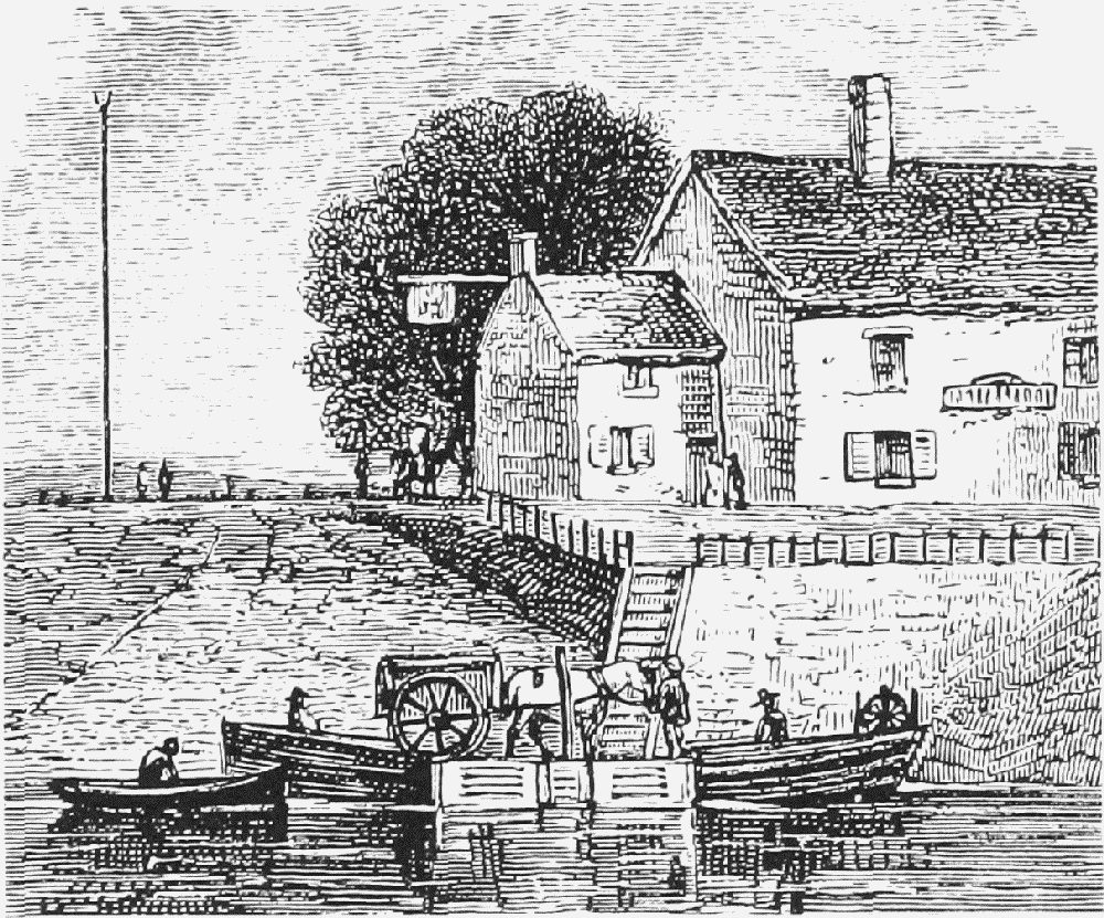
The Dee fords downstream from Chester were destroyed by the cutting of a new river channel in the 1730s, and were replaced by two ferries. Under an Act of 1744 the River Dee Company was to supply the boats and maintain the roads leading to them. The Higher Ferry was at Saltney; the lower ferry was originally called King's Ferry, but was renamed Queen's Ferry (later giving rise to the place name Queensferry) after Victoria's accession. (fn. 130)
Both ferries were eventually superseded. The Victoria Jubilee toll bridge opened in 1897 to replace the lower ferry. In 1926 it was rebuilt and made free of toll and in 1962 it was supplemented by the Queensferry bypass bridge a little to the east. (fn. 131) The higher ferry, at Saltney, was replaced by a footbridge in 1968. (fn. 132)
Other Bridges within the Liberties
The northern boundary of the liberties, formed by the stream known variously as Flooker's brook, Newton brook, and Finchett's Gutter, was crossed from an early period by stone bridges at Portpool, where it drained into the Dee, and on the Mollington road. One of the 13th-century names for the former was Wyardesbridge, possibly from a pre-Conquest personal name. To the south of the Dee, a bridge carried the road to Eccleston across the watercourse which formed the limit of the city liberties. (fn. 133) At Saltney, too, the boundary between the city and Flintshire was marked by a stone bridge in the late Middle Ages. (fn. 134) A little to the east at Hough Green a further bridge was built by the city corporation in 1598–9 to ease the passage of loaded horses, carts, and waggons through the Hollow Way. (fn. 135)

Carriers' waggons at Falcon Inn, Lower Bridge Street, c. 1830
In 2000 no trace remained of any of those bridges. They appear to have survived until the 17th century or later, and indeed in 1691 the bridge at Hough Green was repaired. The stone bridge at Portpool probably disappeared with the canalization of the Dee, while the others were presumably made redundant when the streams which they crossed were covered over. (fn. 136)
Long-Distance Road Transport
By the 1580s regular carriers by waggon and packhorse plied between Chester and London, then an eight-day journey. (fn. 137) In the 1710s mail carriers ran from Chester to Liverpool, Manchester, Kendal (Westmld.), St. Asaph (Flints.), Oswestry (Salop.), and Oxford, among other places. (fn. 138) By the 1790s there were three main depots for long-distance waggons, the Wool Hall in Northgate Street and two inns in Foregate Street, the Blossoms and the Hop Pole. Between them they sent goods daily to London, Birmingham, and Liverpool; thrice weekly to Wrexham, Whitchurch (Salop.), Warrington, Manchester, and Middlewich; and weekly to Oswestry and Shrewsbury. There was also a dense network of carrying services throughout north Wales, running weekly or less frequently to market towns as far distant as Beaumaris (Ang.), Caernarfon, Pwllheli (Caern.), Bala (Merion.), and Welshpool (Mont.). They used a different set of inns, especially the King's Head in Whitefriars and the White Bear and the Falcon in Lower Bridge Street. (fn. 139) Such services survived until the railways were built in the early 1840s. (fn. 140)
Nearby market towns without a direct railway link had road carriers to Chester for much longer. In 1855 services were advertised to Hawarden (Flints.), Mold (Flints.), Denbigh, Ruthin (Denb.), Cerrig-y-Drudion (Denb.), Farndon, Malpas, Whitchurch, Tarporley, Northwich, Runcorn, Warrington, Neston, and Parkgate. (fn. 141) As the railway lines became denser, many of those were also discontinued, but carriers still ran to Hawarden, Malpas, and Neston in the 1890s and to Farndon and Tarporley as late as 1923. (fn. 142)
For passengers, a stage-coach service between Chester and London was first projected in 1653 by the operators of the London-York coaches. (fn. 143) A service had certainly been started by three London partners before 1657. It ran thrice a week in summer, travelling via Stone (Staffs.) and taking four days, but only once a week in winter. Alternative routes were evidently used in the early, experimental years of the service, one via Stone, Lichfield, and Coventry, and another via Newport (Salop.), Wolverhampton, and Birmingham. (fn. 144) In the 1660s it settled into a pattern which remained stable into the mid 18th century. The journey took four days in summer and six in winter and mostly stopped at the same inns for dinner and lodgings. As with other early stage-coach services, the different partners in the business were each responsible for one stretch of the road. In the 1680s, for example, the Londoner John Holloway operated the Chester end from premises at Whitchurch (Salop.), where he had two coaches and three teams of four horses. He clearly ran the same sort of service as that taken between Chester and London by Nicholas Blundell of Little Crosby (Lancs.) in the summers of 1717 and 1723: dinner on the first day at Whitchurch, the first night's lodging at Newport, and dinner on the second day at the Welsh Harp at Stonnall (in Shenstone, Staffs.), where the next partner's part of the service began. Blundell's stops further south were at Coventry (lodgings), Northampton (dinner), Woburn (Beds.) (lodgings), and St. Albans (Herts.) (dinner). (fn. 145)

Coach at Albion Hotel, Lower Bridge Street, 1852
From the 1770s services to London (now taking only two days on improved roads) and other major towns proliferated, reaching a peak in the 1830s. (fn. 146) In the later 1770s competition on the London service brought prices down and offered alternative routes, thus making a direct connexion between Chester and a much larger range of provincial towns. The first regular coaches to Liverpool, via Eastham ferry, ran in 1784, (fn. 147) and by 1818 there were as many as eight a day. Manchester could be reached directly by road or by a connecting packet boat on the canal at Preston Brook. At the high point of the coaching era in the 1830s there were also direct coaches at least daily to Shrewsbury, Birmingham, Welshpool, Wrexham, and Oswestry. The main coaching inns were the White Lion and the Pied Bull in Northgate Street and the Yacht in Watergate Street. (fn. 148)
Long-distance coaching was destroyed by the railways, but horse-drawn omnibuses continued to ply local routes not served by rail. In 1855 there were daily services for passengers to Mold, Ruthin, Flint, and Holywell (Flints.); Tarvin, Northwich, Knutsford, and Manchester; and Malpas and Whitchurch, all setting out from the Eastgate Inn. (fn. 149) Tarporley, Tarvin, and Kelsall still had horse omnibuses from Chester twice a week in 1880. (fn. 150)
The first motor bus service from Chester began in 1911 to Ellesmere Port, which was not served directly by rail. (fn. 151) The service was operated by Crosville Motor Co., which had been founded in 1906 by George CroslandTaylor to build motor cars but quickly abandoned that enterprise. Passenger transport became the sole business, other routes were soon added, and the company expanded first by putting on workmen's services to munitions factories on Deeside during the First World War, and then hugely after 1918 by aggressive business tactics against its rivals in a largely unregulated market. The company was bought by the London, Midland, and Scottish Railway in 1929 and passed to Tilling-B.A.T., the national bus company, a year later. By 1935 Crosville was one of the biggest bus operators in the country, with 47 depots and 1,000 vehicles carrying 100 million passengers on routes concentrated in north and mid Wales, Cheshire, and south-west Lancashire. The company had offices and engineering works at Crane Wharf and a depot at Liverpool Road.
By 1927 Crosville ran 48 routes from Chester, reaching throughout west Cheshire and north-east Wales. (fn. 152) At first there were numerous other small bus operators from the city, mostly based in the villages around Chester, but Crosville gradually bought them up or forced them out of business, so that its only long-term local rival was the Wrexham & District Transport Co., which ran a few services into Wales. The city council normally refused to license rival operators on routes which already had a good bus service, reinforcing Crosville's near-monopoly, though the policy also protected small operators where they survived. (fn. 153) Crosville started coach services to London in 1928, (fn. 154) and in the 1930s began running many excursions and tours. (fn. 155)

Delamere Street bus station
When bus services were deregulated in 1986 Crosville was split up, but both the Welsh and the Merseyside companies which were formed passed into the successive ownership of British Bus plc and the Cowie Group, emerging after 1997 respectively as Arriva Cymru and Arriva North West, which between them provided services from Chester to nearby towns in Cheshire, north-east Wales, and Merseyside. (fn. 156) The Liverpool Road bus depot, however, belonged in 2000 to a rival bus company, First Group.