Ancient and Historical Monuments in the County of Gloucester Iron Age and Romano-British Monuments in the Gloucestershire Cotswolds. Originally published by Her Majesty's Stationery Office, London, 1976.
This free content was digitised by double rekeying. All rights reserved.
'Doynton', in Ancient and Historical Monuments in the County of Gloucester Iron Age and Romano-British Monuments in the Gloucestershire Cotswolds, (London, 1976) pp. 45. British History Online https://www.british-history.ac.uk/rchme/ancient-glos/p45 [accessed 14 April 2024]
DOYNTON
(28 miles S.S.W. of Cirencester)
Undated 'fortifications and intrenchments' are said to have existed in the 18th century on each bank of the R. Boyd (about ST 704732); (fn. 1) by the late 19th century the earthworks on the E. bank, in this parish, were untraceable and remain unconfirmed. (fn. 2) An unpublished sketch of unknown date and origin purports to show them. (fn. 3)
(1) 'Royal Camp', (fn. 4) (ST 723713), possibly a linear dyke and probably of Iron Age date, unexcavated, extends, partly in Cold Ashton, for some 600 yds. along the S.W. side of Freezing Hill on the forward edge of a spur of the Cotswold escarpment, 1½ miles S. of Doynton village. It is called 'eald dic' in Saxon charters (Grundy (1935–6), 93, 205; Sawyer, No. 414).
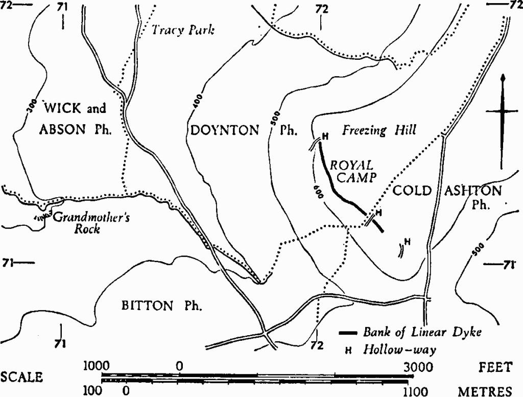
Monuments in Doynton and Cold Ashton.
The bank, 24 ft. wide and 2 ft. high, stands on the edge of the escarpment; the ditch, also 24 ft. wide, lies 9 ft. below it. At either end the dyke terminates at hollow-ways leading down the slope. It is interrupted at the parish boundary, where bank and ditch are cut by a deep hollow-way and are over-ridden by an associated boundary bank. Playne and Witts refer to an internal ditch, and Witts shows a N.E. continuation of the dyke, but neither of these features can now be traced. Plan, p. 46.
Playne (1876), 220, No. 45a. Witts (1883), 22, No. 45, and map.