Ancient and Historical Monuments in the County of Gloucester Iron Age and Romano-British Monuments in the Gloucestershire Cotswolds. Originally published by Her Majesty's Stationery Office, London, 1976.
This free content was digitised by double rekeying. All rights reserved.
'Charlton Kings', in Ancient and Historical Monuments in the County of Gloucester Iron Age and Romano-British Monuments in the Gloucestershire Cotswolds, (London, 1976) pp. 23-24. British History Online https://www.british-history.ac.uk/rchme/ancient-glos/pp23-24 [accessed 26 April 2024]
CHARLTON KINGS
(12 miles N.N.W. of Cirencester)
'Battledown' or 'Hewletts Camp' (SO 970220), (fn. 1), on a hill capped with Middle Lias, seems best interpreted as a group of gullies, scarps and ridges, natural in origin.
A Romano-British inhumation discovered in 1939 during gravel-digging at Sandy Lane is not precisely located (map, p. 77, s.v. Leckhampton). Five iron nails lay beside the skeleton of an adult male unaccompanied by grave-goods; there was no trace of a coffin. (fn. 2)
(1) Probable Settlement (about SO 95461972), Iron Age and Romano-British, lies W. of Sandy Lane (map, p. 77, s.v. Leckhampton). Material recovered from the face of a sand pit c. 1950 included some 70 sherds and numerous animal bones. Further investigation in 1971 showed that the Iron Age and Roman material is contained in a deposit of hill-wash. The Iron Age pottery found c. 1950 included fragments with incised geometric motifs, with some white inlay.
TBGAS, 69 (1950), 197–9. Other information supplied by the Committee for Research into the Iron Age in the N.W. Cotswolds.
(2) Linear Dyke (SO 99172195), 300 yds. N.W. of Arle Grove, unexcavated, extends for about 350 ft. on gently sloping ground between 850 ft. and 875 ft. above O.D. It is 20 ft. wide and nearly 3 ft. high.
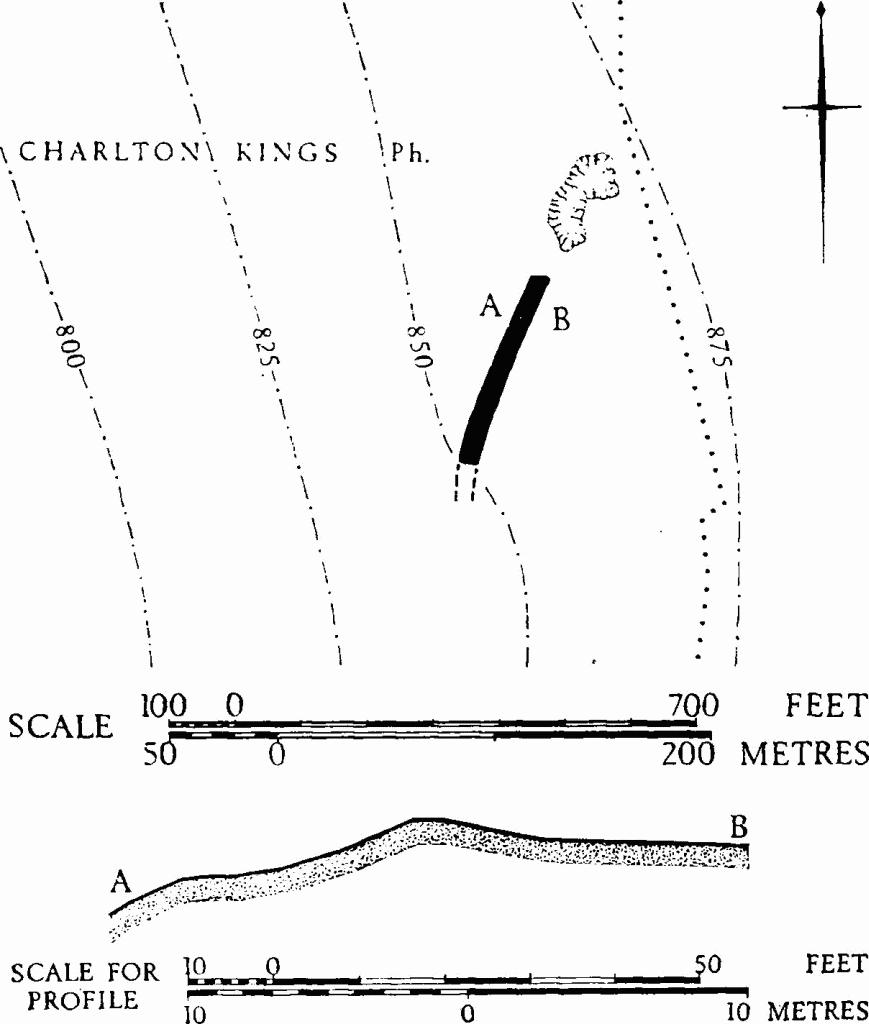
Charlton Kings. (2) Linear Dyke.