A Topographical Dictionary of Scotland. Originally published by S Lewis, London, 1846.
This free content was digitised by double rekeying. All rights reserved.
'Faifley - Fifeshire', in A Topographical Dictionary of Scotland, (London, 1846) pp. 411-428. British History Online https://www.british-history.ac.uk/topographical-dict/scotland/pp411-428 [accessed 12 April 2024]
In this section
F
Faifley
FAIFLEY, a village, in that part of the parish of Old Kilpatrick which formed the late quoad sacra parish of Duntocher, county of Dumbarton, 2¼ miles (E. N. E.) from Old Kilpatrick; containing 321 inhabitants. This place is in the vicinity of Duntocher, and is one of several villages within a mile of each other on the northern side of the Clyde, owing their prosperity to the recent introduction of the cotton and woollen manufactures, and the erection of mills, steam-engines, and other machinery and facilities for their production, chiefly through the spirit and enterprise of Mr. William Dunn, a resident proprietor of land here. About the year 1812, Mr. Dunn purchased the mill of the Faifley Spinning Company, by whom this branch of business had been carried on for some time previously, but on a limited scale; and having made large additions to the buildings, and invited the industry of the inhabitants by the most liberal encouragement, the village soon increased in extent and population. Besides the spinning and weaving of cotton, the chief product of the place, there are iron-works, in which spades, shovels, and other articles are made; and some minor manufactures. The principal stream in the parish, which issues from two lochs behind the Kilpatrick braes, passes here, and falls into the Clyde at Dalmuir. There are two small schools.
Fair
FAIR, an island, forming part of the parish of Dunrossness, in the county of Shetland; and containing 232 inhabitants. It lies between the Orkney and Shetland groups, and is about three miles in length and nearly two in breadth, rising into three lofty promontories, and encompassed with precipitous rocks. The island is every where inaccessible, except upon the south-east, where, lowering itself a little, it affords a safe station for small vessels. The Sheep Craig, one of the promontories, is nearly insulated, rising from the sea in a conical shape to an elevation of 480 feet. The soil is moderately fertile, and the hills are clothed with excellent pasturage for sheep; the place is thickly peopled, and the inhabitants are chiefly engaged in the taking of saith, about forty tons of which, when dried, they send annually to the Leith market: the ling and cod fishing formerly prosecuted has been discontinued on account of its distance from the island. The houses are clustered together on the southern shores in the form of small hamlets, or, as they are here called, towns, and are named respectively Seutter, Taing, Shirva, Leogh, Bousta, and Gelah. A substantial church, capable of accommodating 120 persons, was built by the proprietor of the isle many years ago, at a cost of £150, and is distant from the parish church thirty-five miles. There is also a good school. In 1588, the flag-ship of the Duke de Medina-Sidonia, the admiral of the Spanish armada, was wrecked on this island, and tradition points out the humble residence of the shipwrecked commander.
Fairlie
FAIRLIE, a village, and lately a quoad sacra district, in the parish of Largs, district of Cunninghame, county of Ayr, 3 miles (S. by E.) from Largs; containing 521 inhabitants. This district consists of the southern division, and comprehends about one-third, of the parish of Largs; it is bounded on the west by the Frith of Clyde, and the land rises rather abruptly from the shore, and terminates in two distinct chains of bills on each side of the Kelburn. The loftiest of these hills attains an elevation of nearly 2000 feet, and their substrata are red and white freestone to the height of between 300 and 500 feet, and whinstone on the upper range: at the division of the hills, pudding-stone abounds. Of 5000 acres, not more than 200 or 250 are under tillage, and about the same quantity in natural wood and plantations; the low parterres of Kelburn, the richest in Ayrshire, let at from five to six pounds per acre. The chief owner of the soil is the Earl of Glasgow, whose seat of Kelburn is a beautiful mansion, of which the more substantial part was built in 1556, and the principal modern additions in 1715.
The village of Fairlie is seated on the coast of the Clyde, and on the line of the turnpike-road from Greenock to Ayr; it is a very pleasant little place, much frequented during the summer and autumn by visiters who resort hither from the large and populous towns for the benefit of the sea air and for bathing. The climate is remarkably salubrious; and the retired and picturesque character of the vicinity, ornamented with numerous villas and much beautiful scenery, renders it a popular and very favourite spot, preferred by many strangers to the bustling town of Largs, also a well-frequented watering-place. There is much cod, ling, and haddock fishing, and herrings are occasionally caught: at Kelburn is a salmon-fishery. Steam-boats from Glasgow and Greenock call at the village daily in summer. The ecclesiastical affairs are under the presbytery of Greenock and synod of Glasgow and Ayr, and the patronage is vested in the Managers and Communicants: the stipend is £75, arising from seat-rents and from ordinary, and two special, collections. The church was built in 1833–4, at an expense of about £650, and contains 300 sittings. The members of the Free Church have a place of worship. There is an excellent school-house, of which the master has the interest of £300, bequeathed by Lady Jane Boyle, sister of the Earl of Glasgow, and of £100 added by Glasgow gentlemen who have summer residences around Fairlie: the noble proprietor of Kelburn has also given him a house. Attached to the church is a library, and another to the school. Of Fairlie Castle, a strong square building, said to have belonged to Hardicanute, the walls are still entire; and near it, but in West Kilbride parish, are remains of an ancient chapel round which are some fine old trees. Kelburn confers the title of Viscount on the Earl of Glasgow.
Fala and Soutra
FALA and SOUTRA, a parish, partly in the county of Haddington, but chiefly in that of Edinburgh containing, with part of the village of Faladam, 393 inhabitants, of whom 112 are in the village of Fala 8½ miles (S. E.) from Dalkeith. The name of Fala is derived from Fah, in the Anglo-Saxon, "speckled," and law, the description of hill upon which the church stands: Soutra signifies "the hamlet with a prospect.' In 1164, an hospital for the relief of pilgrims, dedicated to the Holy Trinity, was founded at Soutra by Malcolm IV., who conferred upon it the privilege of sanctuary; and its endowments, which were very extensive, embraced the churches of Soutra, Wemyss, in Fife, St. Giles of Comiston, and several others. The revenues were subsequently vested in Trinity College and Hospital in Edinburgh, and afterwards, about 1560, in the town council of that city. The patronage of the church of Fala, of which the history is very obscure, belonged previously to the Reformation to the family of Edmestown; and in the year 1618, on the 20th February, the two parishes were united, and the property after some time descended to the Hamiltons of Preston, and the estate of Fala, through their heiress, to Sir John Dalrymple, of Cousland: the present proprietor of Fala proper is the Earl of Stair. The church of Soutra, having been abandoned, became a ruin; and the walls of one of its aisles, and some occasional irregularities of surface indicating prostrate dwellings, are now the only vestiges of the former village, once so considerable and populous.
The parish is about five miles in length, from east to west, and three and a half in breadth, from north to south. The western division of it consists of a ridge of the Lammermoor hills, laid out, with the exception of some patches in tillage, for the pasturage of sheep; and the eastern division, which is chiefly of a clayey soil and of an undulated surface, is in good cultivation, producing all the crops common to the district of the Lothians. There are considerable tracts of moss and moorland, and a large extent of marsh, whence issues a sheet of water on Fala muir, called the Flow. The prevailing scenery, however, is very beautiful, and includes many objects of interest and admiration. Among these may be mentioned, Soutra hill, which forms the western point of the Lammermoors, and is upwards of 1200 feet above the sea; the mansion and lands of Woodcot; Costerton House, very romantically situated; the rich fields and wooded inclosures around the ancient halls of Hamilton and Fala; and the cascade of Linndean, and several intersecting rivulets. The wider prospect from Soutra hill presents numerous handsome residences, the highly-cultivated plains of the Lothians, the Pentland hills, and castle of Edinburgh, with the Frith of Forth and the coasts of Fife in the distance.
The system of husbandry in the parish has been latterly much improved; the lands have been partly drained, and inclosed, chiefly with hedges of thorn; and material advantage will arise from the drainage of Fala Flow, a measure already in progress. The sheep, of which considerable numbers are reared on the moorland farms, are mostly a cross between the Gala-water and Tweedsmuir breeds, with a few of the Cheviot; and a moderate number of black-cattle, and a few horses for the plough, are also reared. The rateable annual value of the Edinburghshire portion of the parish is £1583, and of the Haddingtonshire portion £1298. The village of Fala is situated on a commanding eminence, and in its immediate vicinity are the commodious inn and hamlet of Blackshiels, the post-place of the district: a little northward of the latter is Faladam, partly in the parish of Crichton. The great road between Edinburgh and Lauder affords a facility of communication. The ecclesiastical. affairs are under the superintendence of the presbytery of Dalkeith and synod of Lothian and Tweeddale; the stipend of the minister is £169, of which more than one-half is received from the exchequer, and there is a manse, with a glebe valued at £25. 10. per annum. The patronage is vested in the Earl of Stair and the Town Council of Edinburgh. The church, which is pleasantly seated on an eminence overlooking the village, is a plain and unpretending edifice, affording accommodation to 250 persons. There is a place of worship for Burghers. The parochial school is attended by about eighty children; the master has the maximum salary, with a house and garden, and the fees average about £25 per annum. A good parish library has been formed by the contributions of the inhabitants. On Soutra hill are some ruins of the hospital; and the aisle of the ancient church is used as the burial-place of a neighbouring family.
Faladam
FALADAM, a hamlet, partly in the parish of Crichton, and partly in that of Faln, county of Edinburgh; containing 64 inhabitants. It lies on the road from Lauder to Edinburgh, and is distant about half a mile north-west from the village of Fala. The population is employed in tending sheep and cultivating the soil.
Falkirk
FALKIRK, a burgh, market-town, and parish, in the county of Stirling; including the villages of Barleyside, Bonnybridge, Camelon, Glen, and Laurieston, with part of the late quoad sacra district of Grange-mouth; and containing 15,621 inhabitants, of whom 8209 are in the town, 11 miles (S. E.) from Stirling, and 24 (W. by N.) from Edinburgh. This place, which is situated on the ancient boundary between the Roman territories on the south, and those of the Caledonians on the north, is supposed to have derived its former name, Eccles-brae, from the position of its church on the brow of a bill, of which that appellation is accurately descriptive. According to some writers, the present name arose from the place being near the wall of Antonine, and was originally Wall-Kirk, of which the term Falkirk is a modification. From its situation, it became at a very early period the scene of numerous sanguinary conflicts, in one of which, between the Roman forces and those of Fergus II., in the year 415, Robert de Graham, the commander of the king's army, was slain, and his remains interred in the churchyard, from which circumstance that portion of the wall within the parish received the appellation of Graham's Dyke. In 1298, a battle took place to the north of the town, near the present village of Grahamston, between the army of Edward I. of England and the Scots under William Wallace, in which Sir John Graham of Dundaff, and Sir John Stewart of Bonkill, who commanded divisions of the Scottish army, were both killed; the Scots, dispirited by the fall of their leaders, and overpowered by numbers, were compelled to give way, and, after a dreadful carnage on each side, crossing the river Carron, retreated northwards. Sir John Graham and Sir John Stewart were interred in the churchyard, where their grave-stones are still preserved. In the reign of James III., the town was for some time in the possession of the discontented nobles who had risen in rebellion against their sovereign and assembled a numerous army at this place; but, previously to the arrival of the royal troops, which were on their march to attack them here, the rebel forces advanced to Sauchie-Burn, near Stirling, where a battle took place, which terminated in the defeat and death of that monarch. In 1543, a meeting was held at Callendar House, the seat of Lord Livingstone, in this parish, between the Earl of Arran, regent of Scotland, and Cardinal Beaton and the Earl of Moray, when a treaty was concluded, which put an end to the projected union of the Princess Mary, afterwards Queen of Scots, and Prince Edward, the son of Henry VIII. of England. Callendar House was frequently visited by Mary, who, with part of her retinue, halted here on her route to the north in 1562, and in 1565 became sponsor at the baptism of the infant son of William, the sixth Lord Livingstone. In 1567, the queen, with her infant son, afterwards James VI., spent a night at Callendar, on her route to visit her husband, Lord Darnley, at Glasgow; and also, on her return, accompanied by Darnley, spent a day here, and on the following morning proceeded to Edinburgh. After the queen's escape from the castle of Lochleven, Lord Livingstone welcomed her arrival at Niddry Castle; and at the battle of Langside, after distinguishing himself for his fidelity and valour at the head of his vassals, accompanied her in her flight from the field, and, with Lady Livingstone, attended her in the various prisons in which she was afterwards confined by Elizabeth. These faithful adherents of the queen, and companions of her misfortunes, died in England in 1573, and their remains were conveyed for interment in the church of Falkirk.
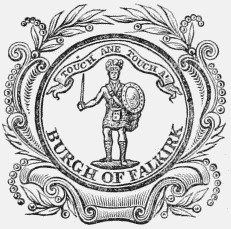
Burgh Seal.
During the minority of James VI., the Earl of Morton, who had resigned the regency of Scotland, having seized the person of the king, and obtained possession of the castle of Stirling, assembled a considerable army of his friends, and encamped at Falkirk, where, also, the army of his opponents soon arrived to offer him battle; but, just as the engagement was about to take place, a truce was agreed to on both sides, and a treaty was subsequently concluded, which was published at the market-crosses of Stirling and this town in 1578. In the parliamentary war in the reign of Charles I., James, the first earl of Callendar, who was a firm adherent of the king, became a commander in the army which marched to his relief when a prisoner in the Isle of Wight, attended by a large body of his Falkirk retainers. On the defeat of these forces, the earl retired to Holland; and the inhabitants of this place, forcing their way through the ranks of the victorious parliamentarians, returned home. After the battle of Dunbar, in 1650, Cromwell marched to the Torwood, in the vicinity of Falkirk, in pursuit of the royal army, and on his route stormed and took possession of Callendar House, in which a garrison had been placed. The siege was carried on with great obstinacy, and many fell on both sides before the garrison surrendered; the houses in the town were plundered by the troops of Cromwell, and the church was occupied by his soldiers as stabling for their horses. On the removal of the old gates of the mansion of Callendar, by the late proprietor, numerous remains of those who fell during the siege were discovered. During the rebellion of 1745, a battle occurred on the moors to the south-west of the town, between the forces under General Hawley and a party of Highlanders in the service of the Pretender, in which the numbers on each side have been estimated at 8000. The combat terminated in the total defeat of the royal forces, of whom nearly 300 were left dead on the field; and among those who fell were Sir Robert Munro of Foulis, and his brother, Dr. Munro, to whose memory a monument was raised nearly in the centre of the churchyard. The titles of Linlithgow and Callendar became united in James, the fifth earl of Linlithgow and fourth earl of Callendar, on whose joining in the rebellion of 1745 they became extinct; the estates had been sold in 1720 to the York Buildings' Company, and on its dissolution were purchased by the late William Forbes, Esq., father of the present proprietor. The lands of Kerse, in the parish, were bought in 1683 from Sir William Livingstone, of Kilsyth, a branch of the Callendar family, by Sir Thomas Hope, king's advocate, from whom they descended to his second son, one of the lords of session, and afterwards lord justicegeneral. They were subsequently purchased by Lawrence Dundas, Esq., of Edinburgh, whose son, Sir Thomas, was created a peer in 1794 by the title of Lord Dundas; on his demise they passed to his son, Lawrence, who was created Earl of Zetland in 1838, and they are now the property of Thomas, the second earl.
The town is situated on the road from Linlithgow to Glasgow, and consists of one principal street, nearly a mile in length, and of several smaller streets parallel with it, or diverging from it in various directions; the houses, of which many are of modern date, are handsome and well built. In the High-street is the townhouse, erected in 1813, on the site of an ancient steeple built in 1697, and taken down in 1803; the present edifice has an elegant spire 140 feet high, and forms a great ornament. The town is well paved, lighted with gas, and amply supplied with water. Owing to its situation on an eminence, from which is a gentle declivity on both sides, it is always dry and clean; and, admitting a free circulation of air, it is regarded as a healthful place of residence. From the main street, a street called the Kirk Wynd extends for more than a mile to the north, connecting the town with the villages of Grahamston and Bainsford, and has handsome ranges of modern houses on each side. About a mile to the west of the town is the populous village of Camelon; and nearly at the same distance to the east is Laurieston, beyond which, close to the junction of the Forth and Clyde canal with the river Carron, is the populous and flourishing town and port of Grangemouth, which, with the various other villages in the parish, is noticed under its own head. There are several libraries in the town, supported by subscription, of which the principal, established in 1792, has a collection of more than 3000 volumes; a circulating library contains 1200, and a Relief-Church library 1000 volumes. Public subscription reading and news rooms are also well supported. A school of arts was founded in 1827, and has continued to increase; it possesses a library of 600 volumes, and lectures on natural history and the arts and sciences are delivered weekly by the members. A horticultural society has been for some time established in the town, under very extensive patronage; the members hold meetings four times during the season, when exhibitions of fruits and flowers take place.
Many of the inhabitants are employed in the Carron iron-works, a most important concern in the adjoining parish of Larbert; the principal manufactures carried on in Falkirk parish are in the immediate vicinity of the town, and in the several villages. Of the establishments in the vicinity of the town, the most extensive are the Falkirk iron-works, seated on each side of the Forth and Clyde canal, about half a mile distant, and in which about 700 persons are occupied in the manufacture of small castings of every description, including pans, kettles, stove-grates, and various other articles for the home trade and for exportation. There are four tanneries near the town, in three of which the currying of leather also takes place, and in the other the dressing of sheep and lamb skins; they together afford employment to about fifty persons. The weaving of muslin and coarse linen, formerly much more extensive, is carried on by about forty of the inhabitants, chiefly for the Glasgow manufacturers: in the town is a large brewery for porter and ale, of which latter considerable quantities are sent to London: several persons are also employed in building vessels for the trade on the canal, for which there is a yard upon its banks. The making of nails is carried on at Camelon, where is also a distillery; at Castlecary, Bonnyside, and near Bainsford, are extensive saw-mills; and at Grahamston are works for the manufacture of pyroligneous acid. From its vicinity to the Carron iron-works, from the extensive collieries around, and the great cattle trysts which are held on Stenhouse Muir, Falkirk derives its chief traffic; and it is generally the resort of the dealers attending those markets, and of numerous persons connected with the works in the vicinity, who make it their head-quarters, and for whose accommodation there are numerous commodious inns, and shops amply supplied with stores and merchandise of every variety. The post-office has two daily deliveries from Edinburgh and Glasgow, and one from Stirling, Alloa, and the neighbouring towns; and there are branch offices at Grangemouth, Camelon, Grahamston, and Laurieston. The old Falkirk Bank has been superseded by a branch of the Bank of Scotland; there are also branches of the National Bank and Clydesdale Banking Company, and the Commercial Banking Company have a concern here, for which a very handsome building has been erected in the High-street.
Facilities of communication are afforded by numerous good roads that intersect the parish, by the Forth and Clyde and the Union canals, and by the Edinburgh and Glasgow railway, which passes south of the town, for eight miles through the parish. The Forth and Clyde canal was commenced in 1768, under an act of parliament enabling the company to raise a capital of £150,000, in shares of £100 each, and was completed in 1790 by a grant of £50,000 from government; the whole length is thirty-eight and a half miles, from Grangemouth, in this parish, to the Clyde at Glasgow. The summit level is 141 feet above the sea, and is attained by twenty locks on the east, and nineteen on the western side; the breadth of the canal at the surface is fifty-six feet, and at the bottom twenty-seven feet, and the average depth nine feet. It is navigable for vessels of eighty or ninety tons, and passes through the entire length of the parish. The Union canal, extending to Edinburgh, was commenced in 1818, and completed in 1822; the breadth is forty feet at the surface, and twenty feet at the bottom, and its mean depth is five feet; it enters the parish on the east, and runs through it for about three miles to its junction with the Forth and Clyde canal. The Edinburgh and Glasgow railway enters the parish from Polmont, on the east, and passes through it in a direction almost parallel with the Union canal, over which, near the termination of the canal, it is carried by an arch of 130 feet in span; and its progress is continued at Callendar by a tunnel 845 yards in length, twenty-six feet in width, and twenty-two feet in height. A branch from the line is in contemplation to the town of Falkirk, about half a mile distant. The market, which is amply supplied with grain and provisions of all kinds, is on Thursday; and exclusively of the great cattle trysts on Stenhouse Muir, in the adjoining parish of Larbert, nine fairs are held in the town, on the first Thursdays in March, April, and November, the second Thursdays in June and July, the third Thursdays in May and August, and the last Thursdays in January and October; they are chiefly for cattle and horses, and are very numerously attended. The inhabitants received a charter from James VI., erecting the town into a free burgh of barony; and in the reign of Charles II., the Earl of Callendar obtained a charter constituting it a royal burgh, with liberty to elect magistrates, create free burgesses, to hold courts, and to have a prison, and the privilege of two weekly markets and four annual fairs. The controul has been for many years vested in two separate bodies, called the stent-masters and feuars; the stent-masters are twenty-four in number, of whom four are chosen by the merchants, and two by each of the several trades. Both these bodies elect from among themselves a president and treasurer; the former attend to the lighting of the town and the supply of the inhabitants with water, and the latter principally to the tolls and customs, and the management of the town estates. The burgh exercises no magisterial jurisdiction; courts of justice are held monthly under the superintendence of a sheriff-depute who resides here. By act of William IV, the town received a municipal charter vesting the government in a provost, three bailies, a treasurer, and seven councillors; but, no funds having been assigned for defraying expenses, the corporation do not interfere with the established management. The police is under a constable appointed by the sheriff of the county, and in cases of emergency the town is watched by a body of the inhabitants, called the town guard; the only prison is a small apartment for temporary confinement, in the town-house. Under the act of the 2nd and 3rd of William IV., the town is associated with the burghs of Airdrie, Hamilton, Lanark, and Linlithgow, in returning a member to parliament.
The parish, which is situated in the eastern division of the county, is mostly bounded on the north by the Carron, though, from some alteration in the course of that river, a few small portions are now on its northern bank. It is about nine miles in length, and varies from two to five miles in breadth, comprising an area of nearly 15,000 acres, of which 11,000 are arable, 2000 meadow and pasture, 1800 woodland and plantations, and the remainder waste. The surface from the banks of the river to the town is an extended plane of level carse land, in the most luxuriant state of cultivation, with a gentle acclivity towards the town, to the south of which the ground rises gradually to an elevation of 600 feet above the sea, and towards the east and west is pleasingly undulated. The higher parts command extensive and beautifully-diversified prospects over the adjacent country, comprising various towns and villages, with numerous elegant mansions and pleasant villas, encircled by the heights of Kilsyth and Denny, with the Ochil and Saline hills, and, to the north-west, the far distant and lofty mountains of Benledi and Benvoirlich. The river Carron, which flows in a winding course for about fourteen miles through the parish, into the Forth a little below Grangemouth, is navigable for vessels of 200 tons to the village of Carronshore, beyond which it is a limpid stream abounding with trout, perch, and eels. At Castlecary, on the west, a rivulet dividing the parish from Cumbernauld, in the county of Dumbarton, forms in its progress a picturesque cascade of eighty feet, a little to the north of which it joins a stream called the Bonnywater, falling into the Carron near the village of Bonnybridge. The Grange burn separates the parish for nearly two miles from that of Polmont on the east, and afterwards flows into the Carron; and near the village of Camelon, the Lightwater burn, now a small streamlet, runs through the centre of a wide channel which appears to have been once the bed of a very considerable river, the banks, with their several windings, being clearly defined. The adjacent lands have every appearance of a coast indented with bays, and marked by projecting headlands; and in the immediate vicinity is the site of an ancient town, supposed to have been the city of Camelon, which, according to tradition, was a sea-port: indeed, fragments of anchors and boats of antique form have at various times been found imbedded in the soil. There are three small lakes in the higher portion of the parish, but they are not distinguished by features of importance.
The soil is generally fertile, and in the lower lands luxuriantly rich; the system of agriculture is in a very advanced state, and has been brought to great perfection under the auspices of the Agricultural Association of the eastern district of the county, which was established here in 1839, and of which the Earl of Dunmore is patron, and Mr. Forbes, of Callendar, president. The crops are, wheat, beans, barley, and oats, with rye-grass and clover. The breed of cattle has been much improved; the farm houses and offices are substantial and commodiously arranged, and the lands are well inclosed. Lime is extensively used, and considerable quantities of other manure are supplied from Grangemouth; tiledraining is generally practised, and belonging to the Earl of Zetland are three kilns for the manufacture of the tiles. The parish abounds with coal, particularly in the higher districts, where are several collieries, producing not only an abundant supply for the vicinity, but also for exportation; ironstone, limestone, and sandstone are also plentiful, and veins of silver, copper, lead, and cobalt have been found, but not in any considerable quantity. Freestone is extensively wrought, and there are not less than seven quarries in operation, affording employment to 160 men; a whinstone quarry has also been recently opened, from which blocks were raised for the railway. The rateable annual value of the parish is £28,748. The woodland at Callendar is supposed to have formed a portion of the ancient Caledonian forest which, during the time of the Romans, occupied a considerable tract of this part of the country. The timber is generally oak, beech, ash, hazel, and birch; and the plantations, which are chiefly Scotch fir and larch, are under good management, and in a thriving state, adding greatly to the variety and beauty of the general scenery. Callendar House, the seat of William Forbes, Esq., is a spacious and ancient mansion, with walls of great thickness and turrets of antique character, retaining much of its original baronial magnificence, though in some parts modernised by the late proprietor. It is situated in a park of more than 500 acres, embellished with timber of venerable growth; and within the grounds is the family mausoleum, a handsome circular building of the Grecian-Doric order, in which are the remains of the late Mr. Forbes. Kerse House, the seat of the Earl of Zetland, is a very ancient mansion with numerous additions of more modern date, and chiefly in the Elizabethan style, which forms its prevailing character; it is beautifully seated in a wellwooded park forming the chief ornament of the eastern carse lands, and the pleasure-grounds are tastefully laid out. Bantaskine House is a handsome modern mansion on an elevated spot about half a mile from the town, and ornamented with thriving plantations; the grounds command some extensive prospects.
The parish, which was formerly much more extensive, including the parishes of Denny, Slamannan, Muiravonside, and Polmont, separated from it at various times, is ecclesiastically in the presbytery of Linlithgow and synod of Lothian and Tweeddale. The minister's stipend is £339, with a manse, and a glebe valued at £20 per annum; patron, the Crown. The church was originally founded by Malcolm Canmore, in 1057, and was a cruciform structure with a central tower; the present church, rebuilt in 1810 with the exception of the ancient tower, the area under which now forms a porch, is of quadrangular shape, and contains 1300 sittings. Churches have been erected at Camelon and Grangemouth; and a place of worship once belonging to the Old-Light Associate Synod, is now in connexion with the Independent body. There are also places of worship for the Free Church, United Secession, the Relief, and Baptists; and a splendid Roman Catholic chapel, opened in the summer of 1843. Two parochial schools are maintained, in one of which are taught the Latin, Greek, and French languages, and in the other only the English language, writing, and arithmetic, with the usual branches of general education; the master of the former has a salary of £17, with a house and garden, and fees averaging £35 per annum; the master of the English school has a salary of £34, with a dwelling-house and garden, and fees amounting to £48. There are numerous other schools in the parish, together affording instruction to more than 1200 children: one of these, at Falkirk, is exclusively for the gratuitous instruction of the poor, of whom about eighty are in attendance, and the master has a salary of £40, arising from an annual collection at the parish church, and private donations. The remains of several of the forts erected by Agricola may still be seen in the direction of the vallum built afterwards by Antoninus. At Castlecary, a small hamlet at the western extremity of the parish, the site of one of these forts, a field of six acres in extent, now covered with grass, may be distinctly traced; a part of the vaulted foundations is remaining underneath the surface, and many of the stones belonging to the fort have been used in the inclosure of the field. The old tower of Castlecary, which is a very ancient structure, and said to be Roman, is still tolerably entire, and is inhabited by the Earl of Zetland's forester: at this hamlet, also, is a landing-place for passengers by the canal boats. Stones with various inscription, now preserved in the museum of the college of Glasgow, have been dug up in various parts of the ditch which defended the Roman wall, and of which portions are yet discernible in Callendar Park, and in the grounds of Bantaskine House. Vestiges remain of a Roman road that entered the parish at Castlecary, and passed along the south side of the wall, nearly to Roughcastle, crossed the wall, and led to the fort at Camelon, and thence to The river Carron, where it entered the parish of Larbert; and in excavating the Forth and Clyde canal, at no great distance, a Roman granary has been discovered, in which was wheat of a blackish colour. Part of the vertebræ of a whale has been found imbedded in the clay at Grangemouth, while making excavations there; also in the brick-field of the Earl of Zetland, about three miles from the sea; and in excavating the tunnel for the Edinburgh and Glasgow railway in 1840, the trunk of a petrified tree, about five feet in circumference, was discovered at a depth of 129 feet below the surface.
Falkland
FALKLAND, a royal burgh and parish, in the district of Cupar, county of Fife, 10 miles (W.) from Cupar, and 24 (N. N. E.) from Edinburgh; containing, with the villages of Balmblae, Freuchie, and Newton, 2886 inhabitants, of whom 1313 are in the burgh. This place, anciently called Kilgour, signifying in the Gaelic language the "Hill of Goats," is situated in a secluded spot at the northern base of the East Lomond hill, and was one of the principal strongholds of the Macduffs, thanes of Fife. In the castle here David, Duke of Rothesay, eldest son of Robert III., was starved to death by order of his uncle, the Duke of Albany, on whose attainder in the year 1424 it was, together with the lands attached to it, forfeited to the crown, and from the forest in the vicinity became a favourite hunting-seat of the Scottish kings. The present palace was erected on the site of the ancient castle by James V., who made it his occasional residence, and died here in 1542; the queen regent was staying at the palace when she was informed of the destruction of the cathedral of St. Andrew's; and with Mary, Queen of Scots, it was also a place of favourite resort. James VI. passed much of his time here while pursuing the diversion of the chase; and it was from Falkland that the Earl of Bothwell, in 1593, decoyed him to Perth, to obtain possession of his person. Charles II., while in the power of the Covenanters, resided at the palace for some days: subsequently to his restoration to the throne, the building was considerably damaged by an accidental fire. After the battle of Sheriffmuir in 1715, the palace was seized by Rob Roy Mc Gregor, who, with his party, kept possession of it for a time, and laid the country around it under contribution. The buildings at present consist of one side, and portions of some of the angles and other sides, of a quadrangle which in its appearance is similar to those of Holyrood House and Stirling: the original ceiling of the hall, or grand audience-chamber, is still entire, and displays some splendid specimens of elaborate carving and exquisite paintings. Notwithstanding the injuries to which it has been exposed, the palace has been partially restored by the family of Bruce, who purchased the estate, and it is now inhabited by their agent.
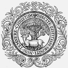
Burgh Seal.
The town consists principally of one spacious street, in which are the market-place and town-hall, and from which diverge several narrow and irregularly-formed streets in various directions. The houses are generally of antique appearance, with thatched roofs, intermixed with several of modern erection, built of white freestone, which have greatly improved the aspect of the place; and the inhabitants are amply supplied with water. The only important trade carried on is handloom weaving, in which most of the people are employed at their own houses. The post-office has a good delivery; the market is well supplied with provisions of every kind; and fairs, chiefly for cattle and horses, are held on the second Thursday in January, the last in February and April, the third in June, the first after the 12th of August, the fourth in September, and on the Friday before the Edinburgh Hallow fair in November. The town was erected into a royal burgh by charter of James II., granted in 1458, and confirmed by James VI. in 1595; the government is vested in three bailies, a treasurer, and a town council of fifteen persons, chosen agreeably with the regulations of the Municipal Reform act. The magistrates exercise civil and criminal jurisdiction over the whole extent of the royalty; but very few cases are brought under their decision, except debts to a trifling amount, and petty offences against the police. The town-hall, situated in the market-place, is a neat building containing the requisite courts and an assembly-room.
The parish is about four miles in length, and nearly of equal breadth, comprising an area of 10,000 acres, of which about 300 are woodland and plantations, and the remainder arable, meadow, and pasture. The surface is partly flat, including an extensive tract formerly the Park of Falkland, and partly diversified with bills, of which the highest is the East Lomond, fully 1200 feet in height, and fertile to the very summit. The principal river is the Eden, which flows through the parish; and numerous springs of excellent water issue from the hills: the lake to the east of the palace, in which were several inlets, has been drained, and the land brought into cultivation. The soil is various, partly a light brown loam, partly sand and gravel covered with heath and furze, and partly a deep black moss: the whole length from east to west between the plain and the Lomond hill is a rich loam, producing abundant crops. The system of husbandry has been greatly improved under the auspices of Mr. Bruce and other landed proprietors; a large tract of common has been converted into fine arable fields, and most of the other waste has been reclaimed and brought into profitable cultivation. Draining and inclosing are extensively practised, and the various farms under beneficial leases have been carried to the highest state of productiveness. The Lomond hill abounds with limestone, and lead-ore has been discovered recently; coal, marl, and fullers' earth are also found in various parts. The rateable annual value of the parish is £8606. Falkland House, the seat of the family of Bruce, is an elegant mansion beautifully situated, and embellished with thriving plantations. The ecclesiastical affairs are under the superintendence of the presbytery of Cupar and synod of Fife: the minister's stipend is £252. 8., with a manse, and a glebe valued at £18 per annum; patrons, the family of Bruce. The church, erected in 1620, and repaired in 1770, is a plain structure containing 687 sittings. There are places of worship for members of the Free Church, the United Secession, and Baptists of Free Communion. The parochial school is well attended; the master has a salary of £34, with allowance for house and garden, and the fees average about £50. On the Lomond hill are vestiges of an ancient camp supposed to be of Roman origin. The town gives the title of Viscount to the Cary family, a dignity created in the person of Sir Henry Cary, K. B., who was appointed lord lieutenant of Ireland in 1622, and on his death in 1633 was succeeded in the title by his son, Lucius, one of the most learned and accomplished men of his age, slain at the battle of Newbury in 1643.
Fankerton
FANKERTON, a village, in the parish of Denny, county of Stirling; containing 68 inhabitants. It lies in the north part of the parish, on the road from Denny to Fintry, the Carron water running here in nearly a parallel direction. A part of the population is employed in the Herbertshire mill, a considerable paper manufactory, on the opposite bank of the Carron, in the parish of Dunipace.
Fans
FANS, a village, in the parish of Earlstoun, county of Berwick, 3 miles (E. N. E.) from Earlstoun; containing 153 inhabitant. The village lies in the northern part of the parish, and a short distance from the river Eden. A school is supported chiefly by George Baillie, Esq., of Mellerstain, by whom the teacher is also allowed a dwelling.
Faray
FARAY, an isle, in the parish of Walls, county of Orkney. It is of small extent, lying to the east of the island of Hoy, of which the southern portion, with this isle, and the isles of Flota, Cava, and Græmsay, constitutes the parish. There is some good pasturage for sheep.
Farnell
FARNELL, a parish, in the county of Forfar, 4 miles (S. E.) from Brechin; containing 620 inhabitants. This place derives its name, of Gaelic origin, from its having been anciently the resort of swans. The parish is about three miles in length, and two in breadth; it is bounded on the north by the river South Esk, and comprises 5540 acres, of which 3330 are arable, 560 woods and plantations, 600 undivided common, and the remainder forest land, called Monteithmont muir. The surface, though generally flat, rises towards the north, and on the south side is marked by a ridge of hills of no great elevation, extending into the parishes of Marytown and Craig. The river, which has its source in the Grampian hills, separates the parish from the town of Brechin, and falls into a small bay of the sea, on the west of Montrose; it abounds with salmon and small trout, and in that part of its course which skirts the parish it runs between banks of great beauty, richly wooded, and along which a road has been constructed, commanding several highly-picturesque prospects. A small rivulet that flows near the church, occasionally, after rain or the melting of the snow, swells into a torrent, bursting its banks, and inundating the adjacent meadows; its channel has, however, been deepened, and other means adopted to confine it within its due limits. The soil in the higher lands is of rather inferior quality, but in the lower a rich loam intermixed with clay, of great fertility, and well adapted for the growth of wheat. The crops are, wheat, oats, barley, peas, beans, turnips, and potatoes; the system of agriculture is in a very advanced state; the lands are drained and inclosed, the farm-houses and offices of very superior character, and all the more recent improvements in husbandry are practised. There are two mills for meal, and two saw-mills, one of which latter is occasionally used for making bone-dust, as manure for turnip land. The ordinary kinds of live stock are reared with great attention, and the farmers of the parish have obtained many of the prizes awarded by the Forfarshire Agricultural Association. The rateable annual value of the parish is £5246.
The plantations are chiefly larch and Scotch fir, occasionally intermixed with various kinds of forest-trees, and are judiciously managed and in a flourishing condition. Kinnaird Castle, the seat of Sir James Carnegie, Bart., is a spacious and handsome mansion of quadrangular form, with a square tower at each of the angles, and has an imposing grandeur of effect; the demesne is tastefully laid out and richly wooded, and the lawn in front of the house is embellished with some very stately timber. Every facility of communication is afforded by good roads kept in repair by statute labour; and a turnpike-road has recently been constructed from Forfar to Montrose, which passes for two miles through the parish. Farnell is in the presbytery of Brechin and synod of Angus and Mearns, and in the patronage of the Crown; the minister's stipend is £250. 10., with a manse, and a glebe valued at £20 per annum. The church is a handsome edifice in the early English style of architecture, with a finely-vaulted roof, and is adapted for a congregation of about 330 persons. The parochial school is well attended; the master has a salary of £30, with about £20 fees, and a house and garden. The poor have the interest of bequests to the amount of £500, producing £25 a year. Near the church, and within the glen from which the parish takes its name, are the remains of the ancient castle of Farnell, the baronial seat of the Ogilvys, of Airlie; it is still in good repair, and part of it is appropriated, rent free, as dwellings for infirm and aged persons.
Farr
FARR, a parish, in the county of Sutherland, 19 miles (W. by S.) from Thurso; containing, with the late quoad sacra district of Strathy, 2217 inhabitants. The name of Farr, or Far, as it is sometimes written, may be derived from the Gaelic word Faire, implying a "watch" or "sentinel," and doubtless arose in reference to the Dun, or circular tower, standing on the coast, about half a mile north of the parish church, and which formed the first and most important of a regular chain of such ancient buildings extending for more than twentyfour miles into the interior. These towers are thought to have been erected by a race called in Gaelic Cruinnich, from a word signifying "circular," or one denoting "a gathering together." There are also numerous tumuli in the neighbourhood, which are generally considered to have been the burying-places of invaders, especially Danes, who fell in the fierce and bloody conflicts so frequent with the native inhabitants; the sepulchres of the chieftains are usually at a little distance from the ordinary burying-places, and marked out by some signal and more permanent memorial. In the churchyard of Farr, for example, is a large erect stone, curiously sculptured with pagan devices, and traditionally reported to note the burial-place of some Dane of distinction, by many supposed to be a prince; it is two feet in breadth, six feet above the ground, and as many beneath. Several of the tumuli are said to be the depositaries of those who fell in the battle between Reginald, King of the Isles, and Harold, Earl of Orkney and Caithness. In times less remote, the ancient clan of the Mackays made a very considerable figure here, their principal residence during the 15th, 16th, and 17th centuries being Strathnaver, of which Farr formed a part. Subsequently, upon the marriage-alliance between the earls of Sutherland and the Gordons, some of the latter came to reside in the district; and about one hundred years ago there were few persons in the parish but Mackays and Gordons, which names, indeed, are still the most numerous among the population. The ancient castle, probably built by the Norwegians, is supposed to have been the seat of the Mackays of Farr before they were created barons under the title of Lords Reay.
The parish lies in the northern extremity of Scotland, and is about forty miles long, varying in breadth from eight to twenty miles, and containing 300,000 acres; it is bounded on the north by the Northern Ocean. The general aspect of the parish is mountainous, the surface having in most parts a very thin shallow soil, and in others exhibiting only bare rock. The principal mountain is Bein Chlibrig, of conical shape, and the loftiest in Sutherland, of which the southern side is partially covered with heath and grass, but the northern is bare and rocky; it is situated in the south-western part of the parish, and attains to 3200 feet above the level of the sea, attracting great numbers of ptarmigan, who locate themselves about the summit. The other hills, nearer the sea-coast, reach different degrees of elevation, but are all inferior in height to the Chlibrig. There are several picturesque valleys, also forming striking features in the scenery; the chief are those called Strathnaver and Strathrathy, which both in extent and beauty far exceed all the rest. The former extends from the coast in a south-west direction for about twenty-eight miles, including the ground along the river Naver, the loch of Naver, and the water of Mudale, beyond the loch; and is considered, for the richness of its pasture and the variety of its scenery, the most interesting Highland vale in the county. Strathrathy runs immediately south from the sea for twelve miles, and lies about ten miles north-east of Strathnaver, between which and this valley are situated the less commanding but still pleasing straths of Kirktomie, Armidale, Swordly, and Clachan, in the last of which stand the church and manse. The parish comprises about thirteen miles of sea-coast, reaching from Naver bay in the west to Baligil burn in the east; it is for the most part abrupt and precipitous, and dangerous to mariners, but contains the bays of Naver, Farr, Kirktomie, Armidale, and Strathy, where boats may safely land in moderate weather. The headlands are, Airdniskich, Aird of Farr, Aird of Kirktomie, and Strathy head, from the last of which the lights of Cape Wrath and the promontory of Dunnet Head are seen on a clear day. There are, besides, numerous caves, natural arches, and fissures, along the coast, as well as in the interior, some of which are visited with considerable interest by the curious; the chief caves by the sea-side are those in the Aird of Kirktomie and Strathy-point, and at Farr is a very fine natural arch.
There are many springs of excellent water in the parish, and several fresh-water lakes of considerable extent and beauty, the largest of which are, Loch Naver, Loch Coir-na-fearn, and Loch Strathy. The first of these, seven miles long, about a mile and a half broad, and in some parts thirty fathoms deep, is by far the most striking and important; its shore at different parts exhibits all the varieties of rock, pebbles, and sand. The rivers are the Naver, Borgie, and Strathy, the first of which, the largest in the county, issuing from the loch of the same name, is joined near Achness by a stream rising in Loch Coir-na-fearn, and, after receiving many other waters in its meandering, and sometimes rapid and sometimes apparently quiescent, course through the strath, falls, about eighteen miles from its source, into the sea. The river Strathy flows from Loch Strathy, and, when augmented by the swellings of its tributaries from the several hills and marshes, becomes a powerful stream. The Borgie, which issues from Loch Loyal, in the parish of Tongue, forms a boundary of this parish, and joins the ocean within a mile of the Naver, at Torrisdale; there are salmon-fishings in it, which for a long time past have belonged to the Sutherland family. Indeed, all the larger lakes and rivers contain a plentiful supply of salmon; and in the smaller, trout are taken in considerable quantities.
The soil differs greatly; a very large portion of it in the interior, especially in the vicinity of the lochs, except Loch Naver, is a deep moss; while that on the borders of the rivers Strathy and Naver consists of sand, gravel, and moss. Along the coast it is found to be light and sandy, and in the neighbourhood of the bays, in addition to this, to contain some alluvial deposits. About 800 acres in various parts are under wood, and about 700 on the coast are cultivated by small tenants: with these deductions the whole land is laid out in extensive sheep-walks. The herbage is of many kinds, varying principally according to the elevation of the land. The common red heather, deer-hair, and the long tough grass called flying-bent are commonly found on the mountains, hills, and moors; and in the softer marshes is a profusion of the species known by the name of cotton-grass. The trees growing here are of much variety, and, with some trifling exceptions, are indigenous; the alder attains a considerable size on the grounds watered by the Naver, where, also, the birch is most flourishing and abundant. About 22,000 sheep of the Cheviot breed are annually grazed in the parish. The land occupied by the small tenants is generally uneven in the surface, and capable of great improvement by draining, inclosing, and ploughing; the crops consist of oats, bear, and potatoes. The rateable annual value of the parish is £808. The rocks and stone in the district, which are abundant in every direction, are chiefly coarse granite, gneiss, and sandstone. On the coast near Kirktomie is a considerable quantity of red sandstone, mixed with conglomerate, and in the vicinity of Strathy is some superior limestone, from which lime is obtained; also a large quarry of white sandstone, easily convertible to purposes of utility from the readiness with which it is dressed by the chisel. At Strathy the strata of freestone and limestone are horizontal; in the rest of the parish the strata of rock are nearly vertical, or form an angle of from five to thirty degrees with the perpendicular. Cattle trysts are held at Aultnaharrow on the 14th September, and at Bettyhill on the first Wednesday in November. Salmon are taken in considerable quantities at three stations on the coast, and about eighteen boats are engaged in the herring-fishery during the season, from May till September; the salmon are sold to a company who have a curing establishment here. Turbot, cod, ling, haddock, and other fish are also obtained. There is a post-office connected with the market-town of Thurso, thirty-two miles distant; and the inhabitants have some facility of communication by means of a mail-diligence carrying four passengers, which runs to and fro, three times a week, between Thurso and the neighbouring parish of Tongue, between which places there is also a weekly carrier. The road from Bonar-Bridge to Tongue passes through the heights, and about sixteen miles of the line from Tongue to Thurso near the coast: on the river Naver is a chain-boat, and over the different parish roads are two bridges of three arches each, and twelve of one arch.
The ecclesiastical affairs are subject to the presbytery of Tongue and synod of Sutherland and Caithness; patron, the Duke of Sutherland: the stipend of the minister is £167, with a good manse, built in 1818, and a glebe valued at £8 per annum. The church, situated near the coast, is convenient for the population, the greater portion of whom reside in its vicinity, the remoter district being peopled only by an inconsiderable number of shepherds in the employ of the great sheep-farmers. It was erected in 1774, and is a plain building, with substantial walls, and seats about 750 persons. There is a government church at Strathy, ten miles east from the parish church, built in 1826, and accommodating about 350 persons. The members of the Free Church have also a place of worship. There is a parochial school, in which instruction may be obtained in the classics, mathematics, and all the ordinary branches of education; the master has the maximum salary, with about £5 fees, a house, and £3 in lieu of a garden. Three other schools are supported respectively at Strathy, Armidale, and Clarkhill, in all which the classics, mathematics, and the usual branches are taught, with the exception of the school at Clarkhill, which is under a female teacher. The master of the school at Strathy, a parliamentary one, has a salary of £25, with about £4 in lieu of fees. The Committee of the General Assembly give a salary of similar amount to the teacher at Armidale, the fees being £3; and the mistress of Clarkhill receives £5 from the Society for Propagating Christian Knowledge, and the fees. The masters have excellent accommodations, including each a house and garden, and a croft of land from the heritor. The Duke of Sutherland derives his title of Baron Strathnaver from the vale in this parish: the dignity was conferred upon his Grace's ancestor as early, it is supposed, as the beginning of the 13th century.
Faskine
FASKINE, a village, in the parish of Old Monkland, Middle ward of the county of Lanark, 1½ mile (S.) from Airdrie; containing 408 inhabitants. It is situated in the eastern extremity of the parish, and is one of the numerous villages that owe their rise to the minerals or manufactures of the district. Faskine is the seat of an extensive colliery, and it was here that the coal called the Splint, or Lady Anne coal, was first found, the seam deriving its name from Lady Anne Stirling, the wife of A. Stirling, Esq. In the neighbourhood of the village are four ironstone mines.
Fearn
FEARN, a parish, in the county of Forfar, 8 miles (W.) from Brechin; containing 404 inhabitants. The word Fearn, signifying in the Gaelic language "an alder tree," appears to have been used in the present instance on account of the numbers of that tree growing in the parish or neighbourhood. The place is not remarkable for any striking historical events; but the existence of some of those curious stone circles of large dimensions which are also found in other parts, proves the very ancient occupation of the soil by inhabitants concerning the origin or character of whom we are left in doubt. Upon the banks of the river Noran are the ruins of the castle of Vane, formerly the residence of the celebrated Cardinal Beaton, who is said to have appropriated it to a Lady Vane, a name originally Bane, or Bain, denoting "fair." The lands formerly belonged to the Earl of Crawford; and tradition states that John Collessie, knight of Balnamoon, with a party of horsemen, before the commencement of the battle of Brechin in 1452, asked of him, as a reward for his services, the possession of the barony of Fearn; and that, upon refusal, the earl and his followers were defeated through Collessie's defection from his cause.
The parish is nearly seven miles long, and is three broad; about 3100 acres are under culture, 330 are plantations, and the remainder is heath and sheepwalks. It is bounded on the north by the parish of Lethnot and Navar, on the south and west by that of Tannadice, and on the east by Menmuir and Careston. The surface consists of two parallel ridges, rising one above the other, between the valley of Strathmore and the Grampian hills, and inclosing two sweeps of low ground, the southern range of which is suited to tillage, and the northern to pasturage. The rivers are, the Cruik, having its source at the foot of the Grampians, and the Noran, watering the lower valley, and marking in its course the south-west boundary of the parish. The soil of the cultivated grounds is a fine rich loam, and the land is distributed into sixteen farms, varying in size from fifty to 300 acres, and each comprising certain portions of moor or pasture; a large part of the district called the barony of Fearn is waste, covered with whins and broom. Wheat, barley, and oats are the grain usually sown. The recent introduction of bone-dust manure has been of great service to husbandry, and much benefit has resulted from the many improvements made within the last forty years in the farm-houses. The live stock reared for the market consists of black-cattle and sheep, to which much attention is paid, the open pastures and the plentiful herbage provided by the extensive cultivation of turnips affording great facilities. The rocky strata differ considerably in different parts. The southern declivity of the lower ridge is sandstone; and upwards, towards the north, to the middle of the slope of the other ridge, is a large sweep of argillaceous rock, of an iron cast, called kalm by the natives of the district. Above this, the sandstone again appears; and not far distant, the ordinary greywacke is to be seen. The estates of Auchnacree, Deuchar, and Noranside have convenient and substantial mansions, surrounded by good gardens and plantations; and the house of the last of them, encompassed with beautiful scenery, commands a view over the vale of Strathmore to the distance of 100 miles. The rateable annual value of the parish is £4270. The ecclesiastical affairs are directed by the presbytery of Brechin and synod of Angus and Mearns. The minister has a salary of £155, with a manse, and a glebe of 10 acres, valued at £19 per annum; patron, the Crown. The church, built in 1806, stands on the summit of a natural mound, in the middle of a dene, and is conveniently situated for the population. There is a parochial school, the master of which has a salary of £28. 12. 6., with a house and garden, and £13. 10. fees.
Fearn
FEARN, a parish, in the county of Ross and Cromarty, 5 miles (S. E.) from Tain; containing, with the villages of Balintore and Hiltown, 1914 inhabitants. The Gaelic name of this parish, Fearnn, signifies "the alder-tree," and was applied in consequence of the great number of alders growing at Mid-Fearn, in the parish of Edderton, in the neighbourhood. An abbey was founded there in the reign of Alexander II., by Farquhar, first earl of Ross; but a bull was afterwards obtained from the pope for removing the establishment to a fertile plain in this parish, on account of the comparative sterility of the lands in Edderton. The abbey was not only a place of worship before the Reformation, but was used as such until October, 1742, when suddenly, during the performance of service, the roof fell in, and thirty-six persons were instantly killed, eight others dying soon afterwards. The parish, which is about two miles wide, and several miles in length, stretches along the western shore of the Moray Frith, and is bounded on the north by the parish of Tain, on the south by that of Nigg, and on the west by Logie Easter. The surface is nearly level, with the exception of a few eminences; about three-fourths are arable, and the rest partly green, and partly covered with heath. The coast for about a mile is flat and sandy, especially where the fishing village of Balintore lies; but Hiltown, another fishing station, half a mile from the former, is skirted by a coast altogether bold and rocky. The loch of Eye, the only water of consequence, is about two miles long, and half a mile broad.
The soil is a deep loam in the centre of the parish; the loans of Fearn to the south, and the lands of Allan to the west, are a deep clay; and in the other parts the soil is gravelly or sandy. The greater portion is cultivated, or occasionally in tillage; 158 acres are under wood, and the remainder is waste or pasture. Many improvements have taken place in agriculture within the last thirty years, by trenching, draining, and levelling; green crops are extensively raised, and some of the best wheat in Scotland is grown here. The produce is sent to the Leith and London markets; and a monthly market for swine is held on the Hill of Fearn. Fisheries of grey fish and herring are carried on to a considerable extent by the villagers residing on the seashore. The rateable annual value of the parish is £5229. The ecclesiastical affairs are directed by the presbytery of Tain and synod of Ross; patron, the Crown. The stipend of the minister is £206, with a good manse, and a glebe of five acres, worth about £12. 10. per annum. The church is of early English architecture. There is a parochial school, the master of which has a salary of £36, including £2 for garden, with a house, and about £10 fees. At Balintore is also a school, in which Gaelic is taught, and of which the teachers are supported by the Society for Propagating Christian Knowledge. There are several Druidical temples in the parish, but the chief antiquities are the ruins of the old abbey, the castle of Lochlin, situated on the eastern head of the lake of the same name, and the vestiges of the very ancient castle of Cadboll. Here is buried Sir John Lockhart Ross, of Balnagown, vice-admiral of the Blue, a distinguished naval hero, who died in 1790.
Fenton
FENTON, a village, in the parish of Dirleton, county of Haddington, 4 miles (S. W. by W.) from North Berwick; containing 201 inhabitants. This place consists of East and West Fenton, and lies in the southern part of the parish, a short distance from the Peffer burn, its boundary in that direction. A part of the lands in this neighbourhood formerly belonged to the powerful family of De Vallibus, or De Vaux. In 1606, James VI., having given the castle of Dirleton to Sir Thomas Erskine, captain of the English guard, for his valour in preserving him from the traitorous attempt of Gowrie, created him Baron Dirleton, and afterwards Viscount Fenton, this being the first dignity of viscount created in Scotland: in 1619, he was raised to the title of Earl of Kellie. Some years since, upwards of thirty pentagonal basaltic pillars were laid bare on the farm of West Fenton.
Fenwick
FENWICK, a parish, in the district of Cunninghame, county of Ayr; including the villages of Kirktown and Upper Fenwick, and containing 2018 inhabitants, of whom 355 are in Upper Fenwick, 4 miles (N. N. E.) from Kilmarnock. This place in ancient times formed part of the parish of Kilmarnock, from which it was separated in the year 1642, and called New Kilmarnock, its present appellation having been subsequently derived from Fenwick hill, in the vicinity of the church. The parish is nine miles in length, and upwards of six in breadth, and is in figure nearly an oblong, the surface rising gradually from the south to the north, and reaching an elevation of about 700 feet near the part where it joins the Mearns moor. The climate is moist, and rain is very frequent, and the soil to a great extent unproductive, several large tracts consisting of deep moss, which, at many seasons in the year, are impassable without risk of life. The lower division contains most of the population, and the land here produces good average crops; the higher grounds, bordering on Renfrewshire, are chiefly pastoral, and of excellent quality, and the stock grazed upon them is of a good breed, and in superior condition. The process of draining has been for some time attended to, and much land once entirely useless is now under tillage, and affords good returns. Limestone is abundant, and is quarried in several places; coal has recently been discovered in much larger quantities than those formerly obtained, and iron has also been found in the same locality in considerable abundance, one bed measuring five feet in thickness. The parish contains several small hamlets; the inhabitants generally dispose of their produce at the markets of Glasgow and Kilmarnock: coal is procured from the neighbourhood of the latter place, and peat is obtained plentifully from the mosses in the district. The public road from Glasgow to Kilmarnock and Ayr passes through the parish. The rateable annual value of Fenwick is £9366. The ecclesiastical affairs are under the presbytery of Irvine and synod of Glasgow and Ayr, and the patronage vested in the Earl of Glasgow; the minister's stipend is £123, of which a part is received from the exchequer, with a manse, and a glebe of eight acres, valued at £24 per annum. The church, seated on the right bank of one of the two streams which intersect the parish, is a plain cruciform structure, built in 1643, and containing between 700 and 800 sittings, all free. There is a place of worship for members of the United Secession. The parochial school affords instruction in the ordinary branches; the master has a salary of £28, with a good house, built in 1805, a rood of garden, and £20 fees. There is a second school, with an endowment of £10 per annum; and the parish contains a subscription library. The Earl of Glasgow takes the title of Baron Boyle, of Fenwick, from this place.
Fergus, St.
FERGUS, ST., a parish, in the county of Banff, 5 miles (N. N. W.) from Peterhead; containing 1391 inhabitants. This parish, which is locally situated in Aberdeenshire, though annexed to Banffshire, was formerly called Langley; it took its present name, in honour of its patron saint, in the year 1616, when the church was removed from its ancient site, the downs called the Links of St. Fergus, where it had been erected as a vicarage by the abbot of Aberbrothock. The lands formed part of the great earldom of Buchan till its forfeiture by the Cumyns in 1308; they afterwards came into the possession of the ancient family of Cheyne, who built the castle of Inverugie, and who, being heritable sheriffs of Banff, wished this property to be placed under their own jurisdiction, for which purpose they obtained an act of the legislature. The Carmelite friary in Aberdeen was founded and endowed by one of this family, Reginald le Cheyne, who secured to it, by deed, £2 annually out of the lands of Blackwater, in this parish. His son, Sir Reginald Cheyne, was lord chamberlain of Scotland in 1267; and another son, named Henry, was bishop of Aberdeen in 1281. Sir Reginald was succeeded in his property by a son of the same name, who was made prisoner at the battle of Halidon Hill in 1333, and who died about 1350, leaving two daughters, Mary and Mariot, by the marriage of the latter of whom with John de Keith, of Raven's-Craig, the parish of St. Fergus passed into the family of the Keiths. John de Keith was second son of Sir Edward Keith, marischal of Scotland; and the issue of his marriage with Mariot Cheyne continued a separate branch of the Keiths until, in 1538, the families became united by the marriage of William, fourth earl-marischal, with the heiress of Sir William Keith of Inverugie. The property escheated to the crown in 1715, by the attainder of the then earl, and was sold by the crown to the York Building Company. It was purchased, however, from the trustees of the company by George, son of the attainted earl, in 1761; and in 1764 the family disposed of it to James Ferguson, Esq., one of the senators of the College of Justice, with whose descendants it has since remained.
The parish is five and a half miles in extreme length, and its greatest breadth is three and a half miles; it contains 7878 acres, and is bounded on the south by the river Ugie, and on the east by the German Ocean. The shore is marked only by one point of any note, called Scotstown Craig, the beach being generally low and sandy; but at a small distance from the coast, a line of hills runs along, covered with a thick bed of drifted sand, overgrown with grass, and which divides the shore from the interior land, and forms a natural and efficient rampart against the drifting of the sands into the country by the violence of the east wind. These hills, varying in breadth, form the fine pasture land known by the name of the Links of St. Fergus, and afford, perhaps, the finest grazing for sheep and young cattle of any downs in the country. In the lower part of the parish, to the extent of a mile from the shore, the ground is flat and uniform; but afterwards it rises towards the western extremity in a succession of graceful undulations, exhibiting the pleasing aspect of a well cultivated surface. The only high land approximating to the character of an eminence is the Castle hill, in the vicinity of Inverugie Castle. The climate, on account of the exposure to the sea, is cold, and the impervious character of the subsoil renders it damp; yet it is not found to be unhealthy. There are some good springs in the lower lands which yield a constant supply of water; but in the upper part a drought sometimes occurs, especially in the hot summer months.
The soil near the shore is a sandy loam mixed with moss, requiring but little labour for cultivation; it produces turnips, potatoes, and heavy crops of grain, which, however, is not so fine in quality as that grown on the stronger lands. The middle portion of the parish is a tenacious clay, yielding excellent grain: the soil in the western district is not so good, being chiefly clay and moss, and having not very long ago been a moor. The larger part of the land is arable, scarcely more than a sixth consisting of pasture, moss, and plantations. The Aberdeenshire and Buchan cattle, which, with their several crosses, formerly prevailed here, have within these few years yielded to a great extent to the Teeswater. The unfitness of the soil generally for the growth of turnips rather discourages the breeding of cattle; but the easy communication recently opened with the London market has stimulated the attempts to overcome this natural obstacle, and the number of oxen, cows, and sheep is now very considerable. Many improvements have taken place by the formation of main drains and ditches, the planting of hedges, and the construction of various kinds of fences; the farm-buildings, also, are much better than formerly, and the houses on the best farms are generally slated, and the offices tiled. The rateable annual value of the parish is £6172. The rocks consist of granite, trap, gneiss, greywacke, and quartz, and these are seen in all kinds of combinations: limestone is also found, frequently mixed with gneiss and granite. There are some tracts of peat-moss, in which remains of oak, hazel, and birch are imbedded; the antlers of full-grown stags have been found, and large quantities of marine testacea.
The parish contains three mills, at one of which, called Stone mill, were produced in a recent year, 1508 sacks of meal, of two and a half hundred-weight each, sent to the London market, 314 forwarded to Shetland, and 200 for home consumption; 613 sacks of flour and 100 sacks of barley, also, were prepared for domestic use. There is a salmon-fishery on the Ugie, but it has been much injured by a sand-bank thrown up by the sea at the mouth of the river, and which prevents the fish from entering, unless it happens to be driven back by the force of a land flood. Considerable numbers of black-trout, and the pearl muscle, are found in the river; but the pearls are not of great value, being dingy and opaque. The neighbouring seas, also, abound with fine fish, consisting of turbot, sole, ling, dog-fish, whiting, herring, plaice, flounder, cod, and halibut; but the most valuable of these are seldom taken, as the fishermen have no nets suitable for the purpose. There is a small village, independently of the kirktown; but the larger part of the population is scattered throughout the rural districts. The turnpike-road from Fraserburgh to Peterhead runs along the parish from north to south; and over the Ugie is a bridge for it, built in the latter part of the seventeenth century, and connecting St. Fergus with the parish of Peterhead. The ecclesiastical affairs are subject to the presbytery of Deer and synod of Aberdeen; patron, the Crown: the stipend of the minister is £217, with a manse, and a glebe valued at £18 per annum. The church, erected in 1763, is a convenient structure, tastefully decorated in the interior, and having three galleries; it contains 610 sittings. There is a small meeting-house belonging to the Baptists; and a parochial school is supported, in which Latin, mathematics, and the usual branches of education are taught, the master receiving a salary of £34 per annum, with about £20 fees. A good parish library was founded in 1829, and a savings' bank in 1824. The chief relic of antiquity is the ruin of Inverugie Castle, formerly the residence of the earls-marischal of Scotland, and the birthplace of Field-Marshal Keith, who fell at the battle of Hochkirchen in 1758: one of the towers, of great antiquity, is called Cheyne's, but the greater part of the fabric is said to have been erected by the earl who founded Marischal College, Aberdeen. The churchyard, on the coast, is a very ancient cemetery, and of such singular interest, partly on account of the loneliness of its situation, that the late Dr. Beattie often expressed a wish to have his remains deposited here.
Fergushill
FERGUSHILL, a village, in the parish of Kilwinning, district of Cunninghame, county of Ayr; containing 279 inhabitants. This village has sprung up within the last few years owning to the extension of coal-mines in its vicinity, the population being principally engaged in the works; and it has already become one of the chief villages of the parish.
Fernie Easter
FERNIE EASTER, a hamlet, in the parish of Monimail, district of Cupar, county of Fife, 3 miles (W.by N.) from Cupar; containing 44 inhabitants. It lies nearly in the centre of the parish; and in its vicinity is Fernie Castle, which is supposed to have been one of Macduff's castles, and was evidently of great strength.
Fernigair
FERNIGAIR, a hamlet, in the parish of Hamilton, Middle ward of the county of Lanark, 1 mile (S. E. by E.) from Hamilton; containing 74 inhabitants. It is situated in the eastern part of the parish, and on the turnpike-road from Hamilton to Larkhall: the Clyde flows at a short distance from the village.
Ferryden
FERRYDEN, a village, in the parish of Craig, county of Forfar; containing 921 inhabitants. This is a considerable village, situated on the south bank of the South Esk river, immediately opposite the harbour of Montrose, and is a prosperous place, with a rapidly increasing population, chiefly fishermen and their families. Between twenty and thirty boats are engaged in the white-fishery alone, which here consists principally of cod, haddock, and skate, all taken in great quantity; and much salmon is also caught at the mouth of the Esk, the various kinds of fish from this quarter largely supplying the Edinburgh and London markets. There is a good harbour, with a safe roadstead; and here, previously to the erection of bridges higher up the river, was a ferry to Montrose. In the village is a school, supported by an endowment, bequeathed by a benevolent lady, lately deceased.
Ferryport-On-Craig
FERRYPORT-ON-CRAIG, a parish, in the district of St. Andrew's, county of Fife, 11 miles (N. E. by N.) from Cupar; containing 1741 inhabitants, of whom 1556 are in the village. This place formed part of the ancient lands of Craig, belonging to Archbishop Sharp, of St. Andrew's, who, by authority of the pope, granted them on lease to the Scotts, of Balwearie, in Fifeshire, from whom, to distinguish them from others in the county, of the same name, they received the appellation of Scotscraig, which they still retain. The name of the village is obviously derived from the establishment of a ferry over the Tay to the opposite shore at Broughty, to which ferry, previously to the erection of a pier for their better accommodation, passengers had access only by means of a platform of timber extending to the boats from the rugged rocks which girt the coast. The lands are supposed to have been part of the parish of Leuchars previously to the year 1606, when, by act of James VI., they were erected into a distinct parish; and in confirmation of that opinion, one of the fields is still called the Chapel, probably from the existence of a chapel of ease to the mother church prior to the separation. There was a castle at this place, but at what time or by whom it was founded, does not appear: from the style of the building, as far as can be ascertained from the small portions of it still remaining, it seems to have been adapted for the use of cannon, and to have been erected to defend this pass of the river, in conjunction with the castle of Broughty, in Forfarshire. The parish is bounded on the north by the river Tay, which washes its coast for nearly five miles before it falls into the German Ocean; it differs greatly in breadth, not exceeding in the widest part a mile and a half, and comprises 2600 acres, of which 1400 are arable, 120 woodland and plantations, and the remainder rough pasture and waste. The surface is abruptly varied, being in the eastern parts flat and low, and in others rising into ridges of craggy rock. Its rugged aspect has under recent improvements been considerably softened, and many rocks near the village, which is situated on the shore, have been removed; but to the westward the lands are still precipitous, and very irregular. Except the Tay, there is no stream of any consequence; but numerous springs in the higher grounds, descending to the low lands, afford an abundant supply of excellent water. The soil in the lower parts of the parish is a light loam, resting on a bed of sand; and in the higher, a rich black loam, on a substratum of whinstone. The agricultural district is under good cultivation, and extremely productive; the crops are, barley, oats, rye, and wheat, with potatoes, of which considerable quantities are raised for the London market, turnips, and the usual green crops: flax was formerly grown to a good extent, but for many years has been totally discontinued. The pastures maintain large numbers of sheep and cattle, the former chiefly a cross between the Cheviot and Leicestershire breeds, and the latter a mixture of the Fife, Angus, and Ayrshire: there is a small undivided common of about twenty acres, on which all the inhabitants have a right of pasturage. The woods consist mainly of larch and oak, which latter, though of recent introduction, appears to thrive well. The farm-buildings are in general substantial and commodious, and some, of more modern erection, are of very superior order; but little progress has hitherto been made in inclosing the lands, which, with the exception of a few fields, are wholly open. The rateable annual value of Ferryport-on-Craig is £3191.
The principal proprietor in the parish is the owner of Scotscraig, whose mansion, erected in 1807, is a spacious structure, beautifully situated in grounds tastefully laid out, and embellished with plantations. The village consists of more than 300 neatly-built houses, chiefly one story in height, with a few of two stories, and some larger houses of recent erection, which are handsomely built, and roofed with blue slate. The shore has been greatly improved by the levelling of various eminences that impeded the communication between the village and the river. Two piers have been constructed at the ferry, at the larger of which vessels laden with coal and other necessaries land their cargoes for the supply of the neighbourhood, and whence grain, potatoes, and other agricultural produce are shipped for the London market; the smaller pier is the landing-place for passengers by the ferry-boats. There is an extensive salmon-fishery belonging to the proprietor of Scotscraig, and extending along the coast for the whole length of the parish; it formerly produced an annual rental of £2000, but, since the disuse of stakenets, which were formerly employed, it yields only about £600. Many of the inhabitants of the village and parish are employed in hand-loom weaving for the manufacturers of Dundee, to which, during the winter months, they devote their chief attention, in the summer resuming their agricultural labours. A fair, once very numerously attended, is still held in the village on the first Tuesday in June (O. S.), but is now resorted to only by a few dealers in general merchandise. Facility of communication between this place and the neighbouring towns is partly afforded by an excellent line of road extending for about three miles from the village to Newport, which was formed in 1830, at the sole expense of Robert Dalgleish, Esq., at that time proprietor of Scotscraig; and regular intercourse with Dundee is maintained, either by steamers from Newport, or by sailing-packets which leave the ferry here daily. A library, established in the village very recently, contains a valuable collection; and in 1836, a savings' bank was opened, which has proved successful. The parish is in the presbytery of St. Andrew's and synod of Fife; the minister's stipend is £159. 13., with a manse, and a glebe valued at £35 per annum. The church, rebuilt in 1825, is a neat and substantial edifice situated in the village, and adapted for a congregation of 900 persons. There are also places of worship for members of the Free Church and the United Secession. The parochial school affords an extensive course of instruction; the master has a salary of £30, with £19 fees, and a good house and garden. Five free scholars are taught in consideration of a bequest for that purpose by William Dalgleish, Esq.; they are nominated by the proprietor of Scotscraig and the incumbent of the parish, and remain in the school for five years. There are also several Sabbath-evening schools, supported by contributions collected at the church. Some vestiges of the Archbishop of St. Andrew's palace here are yet remaining.
Fetlar and North Yell
FETLAR and NORTH YELL, a parish, in the county of Shetland; containing 1745 inhabitants, of whom 761 are in Fetlar, 36 miles (N. by E.) from Lerwick. This parish, which is situated nearly at the northern extremity of the Shetland isles, consists of the island of Fetlar and the northern part of that of Yell. The former is bounded on the north by the channel separating it from the islands of Unst and Uyea, on the south by the wide channel which divides it from Whalsey island and the Mainland, on the east by the German Ocean, and on the west by Colgrave Sound, separating it from the island of Yell. The latter district, North Yell, is bounded on the west and north by the northern ocean, and on the east by the frith called Blue Mull Sound, which divides it from the island of Unst. Fetlar is seven miles in length and four in breadth, and comprises 786¾ merks of land under cultivation (each merk being about three-quarters of an acre), and between 10,000 and 12,000 acres which, with the exception of 1200, are undivided common; North Yell is six miles long and five broad, and contains 634 merks of cultivated, and from 12,000 to 15,000 acres of uncultivated land.
The situation is bleak, and the surface hilly; but there are no lofty elevations, the highest grounds not rising more than 300 feet above the level of the sea, and being, in each district, alternated with tolerably fertile valleys. The islands are singularly irregular in figure, and the coast is indented with fissures, creeks, and bays of various extent. Of the last the principal, in Fetlar, are those of Aith, Tresta, Strand, Mowick, Funzie, a lingfishing station, Gruting voe, and Urie bay, where a kind of pier has lately been erected; but none of these are considered safe harbours. North Yell, in this respect, has much the advantage, the bays of Basta voe and Cullivoe forming excellent retreats and landing-places; besides which, it has the bays of Papal, Gloup voe, and other inlets. Colgrave Sound, encompassing Fetlar from south-west to north-west, is a rapid and dangerous channel, about nine miles across in the widest, and three miles in the narrowest, part. Blue-Mull Sound measures in the narrowest part about a mile across, and the Sound between the islands of Fetlar and Unst is five miles broad; in both these channels, but especially in that of Blue-Mull, the tide runs with great force, and the passage is often hazardous. The rocks on the coast are frequently covered with sea-fowl; wild pigeons are numerous, and flocks of wild swans often visit the islands. There are many small lakes, abounding with trout, the largest of which is one in Fetlar, near the manse, about three-quarters of a mile in length, and a quarter in breadth.
The inhabitants are employed in agriculture and fishing, the latter occupation engaging most of their attention. The soil in Fetlar comprises sand, clay, and marl; that in North Yell is chiefly a peat-moss: each produces good oats and potatoes, but barley is cultivated only to a very limited extent, and wheat is rarely seen, the want of inclosures to protect these kinds of grain, and of sun to ripen them, being the chief obstacles. The rotation system is partially practised; but the ground is generally turned with a spade, the number of ploughs being very small; and the state of agriculture throughout the two districts indicates strongly the want of resources, and much more attention and skill, to place it on a respectable footing. In North Yell, many plots of common ground have recently been brought under cultivation, and a few in Fetlar. The sheep and cattle are mostly of the native breed, small but hardy, and appear to thrive better than any others: a mixed breed of sheep, introduced some time since by Sir Arthur Nicolson, has not been found well suited to the climate, and a few cows of a larger growth which have been tried, have in the same manner proved unequal to meet the severity of the district. The ponies bred are of the same size, vigorous spirit, and untiring strength, as those in the other isles of Shetland. The rocks comprise mica-slate, quartz, chlorite-slate, gneiss, clayslate, and serpentine containing chromate of iron, the last of which, formerly exceedingly abundant, was for long occasionally quarried in the island of Fetlar. With the common stone from the same locality, a mansion-house has been recently built by Sir Arthur Nicolson, and another by Mr. Smith, a heritor; and quarries in the island of Yell have supplied a material for the erection of the houses of Gloup, Greenbank, and Midbrake, the dressings, however, being of free-stone brought from Lerwick. The rateable annual value of the parish is £806.
The fisheries of ling and herrings, which are among the principal, occupy much of the time of the inhabitants; in addition to which, tusk, cod, saith, and other kinds are taken nearly all the year round. The fish caught in winter are salted, and preserved in vats till spring, when they are dried and exported to Leith; the fish taken in summer are preserved in the same manner, and sent, not only to the market of Leith, but also to Ireland and Spain: the produce of the herring-fishery, which is carried on to a tolerable extent in August and September, is forwarded, when cured, to Leith and to Ireland. The stations for the ling-fishery are, Funzie, on the eastern side of Fetlar, and Gloup, on the north side of Yell, towards the northern ocean; and Urie, Strand, and Aith banks, in Fetlar, and Cullivoe and Bayanne, in North Yell, are stations for the curing of herrings. A large quantity of skate, halibut, haddock, sillock, piltock, and whiting, is also taken, furnishing the inhabitants with a considerable portion of their subsistence; and there are oysters at Basta voe, and a good supply of several other kinds of shell-fish. The parish is entirely destitute of conveyances and roads; and the intercourse with Lerwick, the only markettown of the Shetlands, is so uncertain and dangerous, that, although the post-office in North Yell communicates twice a week with that place in fair weather, letters are often delayed for a long time on their route. The ecclesiastical affairs are under the presbytery of Burravoe and synod of Shetland, and the patronage vested in the Earl of Zetland; the minister's stipend is £180, including the sum for communion elements, with a manse, and a glebe valued at £9 per annum. There are two churches, both very near the sea-shore; that in Fetlar was rebuilt in 1790, and accommodates 269 persons, and that in North Yell was built in 1832, and contains sittings for 390. The Wesleyans have a place of worship in Fetlar. The parochial school is in North Yell, and affords instruction in reading, writing, arithmetic, book-keeping, and navigation; the master has the minimum salary, and receives a few pounds in fees. In Fetlar is a school of much longer standing than the parochial school supported by the Society for Propagating Christian Knowledge; the master, who teaches the same branches as those taught in the other school, receives a salary of £15, and a small amount in fees. There is also a small subscription library. The antiquities comprehend the remains of several chapels and forts, a Roman camp at Snawburgh, several fonts, which have been dug up at Aithsness, and a few urns containing ashes and bones.
Fetterangus
FETTERANGUS, a village, in the parish of Old Deer, county of Banff, 1½ mile (N. N. E.) from Deer; containing 225 inhabitants. This place is locally situated in the shire of Aberdeen, and is a modern village, erected on the estate of Mr. Ferguson, of Pitfour: the population is employed chiefly in the linen manufacture. A little east of the village is the great road from Fraserburgh to Aberdeen.
Fettercairn
FETTERCAIRN, a burgh of barony and a parish, in the county of Kincardine, 15½ miles (W. S. W.) from Stonehaven; containing 1793 inhabitants, of whom 372 are in the burgh. This place is supposed to have derived its name from several cairns on the ascent of one of the mountains by which it is bounded on the north, raised over the remains of the warriors who fell in battles which, according to tradition, were fought in this pass of the Grampians. The only event of historical importance connected with the parish, is the murder of Kenneth III., King of Scotland, which took place in the castle of Fenella about a mile to the west of the village. The details of this occurrence, though variously recorded by historians, ascribe the murder to Fenella, the proprietor of the castle, in resentment of the death of her son, whom that monarch had sentenced to execution for rebellion. The lands of Fettercairn were formerly the property of the Middletons, of whom John, the zealous adherent of Charles I. and II., was, after the Restoration, created Earl of Middleton and Viscount Fettercairn; and the estates continued in the possession of that family till 1777, when they were purchased by Sir John Stuart, Bart., maternal grandfather of the present proprietor.
The village, though possessing the privileges of a burgh of barony, is not distinguished by any features of importance. There are two libraries, of which one, of about 500 volumes, is the property of the Fettercairn Club, and the other, containing nearly an equal number, is parochial, and supported by subscription. At Nethermill, adjoining the village, is a distillery of whisky from malt only; and at Arnhall, on the banks of the North Esk, is a mill for carding and spinning wool, and for the manufacture of coarse woollen-cloths. The post-office, under that of Montrose, has a daily delivery by a messenger from that town; and facility of communication is afforded by good roads, kept in repair by statute labour, and which pass through the village, and intersect the neighbourhood in various directions. The parish, which is situated in the western portion of the county, on the south of the Grampian hills, is bounded on the south-west by the North Esk river for about three miles, and is nearly eight miles in length and four and a half in breadth, comprising an area of 13,000 acres, of which 7500 are arable, 1800 woodland and plantations, and the remainder pasture, moss, and waste. The surface rises gradually, in gentle undulations, to the base of the Grampian hills, of which the highest within the parish has not an elevation of more than 1600 feet above the level of the sea. There are numerous springs, some with a chalybeate property; but the only river is the North Esk, over which is the romantic bridge of Gannachy, connecting the parish with that of Edzell, a structure of one arch thirty feet in height and fifty-two feet span, springing from two precipitous rocks, and built in 1732, by Mr. Black, of Edzell. The soil is various, in some parts alluvial, in some a stiff clay, and in others a deep moss alternated with gravel; the crops are, wheat, barley, oats, potatoes, and turnips. The system of agriculture has been considerably improved under the auspices of the Fettercairn Club, who hold their meetings in the village; much of the waste land has been reclaimed by draining; the farm-buildings are comfortable and substantial, the lands well inclosed, and on most of the farms threshing-mills have been erected. Much attention is paid to the improvement of live stock; the sheep, with the exception of a few Cheviots, are generally of the black-faced breed, and the black-cattle of the Angusshire, with some of the Aberdeenshire and Ayrshire. Considerable numbers of swine are also reared, all of the Chinese breed. The rateable annual value of the parish is £9107.
The plantations, which are extensive, consist of the usual varieties, the most conspicuous being the ash, beech, and fir; they are under careful management, and in a thriving state. The principal substrata are, red freestone, whinstone, and limestone; and porcelain clay of fine quality is found on the banks of a small burn, at Balnakettle. Fettercairn House is an ancient edifice, to which large additions have been lately made by the proprietor. Fasque is a spacious house in the castellated style, beautifully situated on an eminence, in diversified grounds, in which is a fine sheet of water twenty acres in extent, which, with the stately approach to the house, was formed by the present owner. The Burn House is a handsome modern mansion, on the banks of the North Esk, in a richly-planted demesne, tastefully laid out in walks, and commanding much picturesque scenery. Balbegno Castle is an ancient and spacious building, on the parapet of which are various sculptures and the date 1509; the interior contains a noble hall, of which the lofty roof of stone is richly groined, and divided into sixteen compartments, in which are emblazoned the armorial bearings of sixteen peers of Scotland. The ecclesiastical affairs are under the superintendence of the presbytery of Fordoun and synod of Angus and Mearns. The minister's stipend is £232, with a manse, and a glebe valued at £20 per annum; patron, the Crown. The church, erected in 1804, and enlarged in 1839, is a handsome structure, with a tower, and spire rising to the height of 104 feet; it is beautifully situated, and contains 1000 sittings, of which the number may be easily augmented. The members of the Free Church have a place of worship. The parochial school is well conducted; the master has a salary of £34, with a house and garden, and the fees average about £30 per annum, to which may be added £1. 15., the rent of a bequest in land. A female school in the village is supported by Sir John Stuart Forbes, who provides a school-room and house rent-free for the mistress, to whom he pays a salary, in addition to the school fees. An almshouse has been built by Mr. Gladstone for eight people, to each of whom he allows a room and garden. Dr. Ramsay, of Barbadoes, bequeathed £500; Provost Christie, of Montrose, £50; James Black, the builder of Gannachy bridge, 200 merks; George Cooper, of Slateford, £20; R. Valentine, of Bogindollo, £50; Anthony Glen, of Luthermuir, £20; and James Smith, of Fettercairn, several houses; all intended for the relief of the poor of the parish. In the village is preserved the ancient cross of Kincardine, an octagonal column to which is an ascent of six stone steps; on the capital are the arms of John, Earl of Middleton, with his coronet and initials. Greencairn, the supposed residence of Dame Fenella, is now a heap of shapeless ruins.
Fetteresso
FETTERESSO, a parish, in the county of Kincardine; containing, with about two-thirds of the town of Stonehaven, 5212 inhabitants. This place, of which the name, in the Celtic language, is perhaps descriptive of the marshy nature of its lands, is of very remote antiquity, and is distinguished as the site of a station occupied either by the Caledonians or the Romans. The latter people, having, under Agricola, subdued the southern portion of the country, advanced with an army of 26,000 men towards the north, and, near the Grampian mountains, and most probably in this neighbourhood, encountered the Caledonians under Galgacus, their king, who, with 30,000 men, defending his country against the invaders, routed their ninth legion, but was finally subdued. The remains of this station, which inclosed an area of seventy-one acres, and was defended by a vallum and fosse, are still nearly entire; and till within the few last years, there were existing the remains of another camp near Stonehaven, about three or four miles distant from the former. The ancient forest of Craigie, and subsequently the whole of the lordship of Cowie, in this parish, together with numerous other lands in the counties of Aberdeen and Kincardine, were granted by Robert Bruce to his steady adherent, Sir Alexander Fraser, who signalised himself at Bannockburn, and was killed in the battle of Duplin, in 1332. Upon his death the principal lands descended to his son, whose only daughter and heiress conveyed them, by marriage, to Sir William de Keith, the great marischal of Scotland, and ancestor of the family of the earls-marischal, whose chief residence in this part of the country was for many ages the castle of Fetteresso, in which James VII., after his landing at Peterhead in 1715, was for some time hospitably entertained. On the attainder of the last earl, the estates were forfeited to the crown; and in the year 1782, the castle and property of Fetteresso were bought by the late Admiral Duff, in whose family they still remain. A portion of the lands, now the barony of Ury, was inherited by Sir William, a second son of Sir Alexander Fraser, who sold it in 1413 to William de Hay, lord of Errol, and constable of Scotland; and it was subsequently purchased by the Marischal family, who, in 1647, sold it to Colonel David Barclay, whose descendant is the present proprietor.
The parish, which is bounded on the east by the German Ocean, is about ten miles in length, and between five and six in breadth, comprising an area of 24,914 acres, of which about 10,000 are arable, 2000 woodland and plantations, and the remainder meadow, pasture, and waste. The surface is abruptly varied, though not rising into mountainous elevation; and the scenery embraces much diversity of character, in some parts enriched with thriving plantations and being pleasingly picturesque, in others dreary and barren. The river Carron, which separates the parish from that of Dunnottar, forms its southern boundary for about five miles, and falls into the sea at Stonehaven; and the Cowie, which flows through the parish in a direction nearly parallel, falls into the sea at the small bay of Cowie, to the north. The surface is also intersected by two rivulets, Muchalls and Elsick, which though generally inconsiderable, are sometimes swollen by the accession of numerous streamlets, and inundate the adjacent lands. The soil is extremely various; in the east and south, rich and fertile; in other places, of very inferior quality; and in some parts wholly unprofitable. The system of agriculture was greatly improved by the late Mr. Barclay, who, by great perseverance, brought it to its present state of perfection: several of the lands have been carefully drained. The chief crops are oats and barley, with some wheat, which is not however in extensive cultivation, and turnips, of which very considerable quantities are grown: several portions of land are let in small lots annually, for raising potatoes, which are partly shipped from Stonehaven for London. The pastures are very extensive, and there are numerous herds of cattle, chiefly of the Angus, with some of the Teeswater or short-horned breed; nearly 400 are fattened annually, and sent to the different markets in the district, and to London and other distant parts by steamers from Aberdeen. The horses are chiefly reared for agricultural uses, and but little attention has been paid to the improvement of the breed. The sheep are of various kinds, and part of them of the Leicestershire breed, of which a few are shipped for the London market; they are mostly fed upon turnips on the several farms, but some are pastured on the hills, though not to so great an extent as formerly. The dairy-farms are well managed; and large quantities of butter, cheese, poultry, and eggs are forwarded to Aberdeen and Stonehaven. The farm-buildings have been much improved, and on most of the farms are threshingmills, of which many are driven by water, and one by steam-power. The woods and plantations are extensive; the former, though in parts unproductive from the nature of the subsoil, still contain a good deal of valuable timber, and the latter, with the exception of the larches on some particular lands, are generally thriving. The rateable annual value of the parish is £19,209.
Fetteresso Castle, the ancient seat of the Marischal family, beautifully situated on the north bank of the Carron, was partly rebuilt by the late Mr. Duff; it is a spacious mansion, surrounded by an extensive and well-wooded park, in which is some stately timber, and the gardens and pleasure-grounds are tastefully laid out. Ury, originally built by the Hay family, is situated on a steep acclivity of the river Cowie; it is of moderate extent, but of great strength, with vaulted roofs of stone. The park is extensive, and contains many trees of venerable growth, and some thriving modern plantations; the grounds are well disposed, and the gardens, formed on terraces, add greatly to the beauty of their appearance. Netherley and Muchalls are handsome mansions: the latter, a fine old edifice, for ages the residence of the Burnet family, is on an eminence near the sea. Elsick is also an ancient mansion, formerly belonging to the Bannermans; Cowie is a small but handsome house. There are several fishing-villages on the coast; one at Cowie, where eight boats are engaged, each with a crew of five men; one at Sketteraw, employing seven, and one at Stranathro, having four boats. At these stations are small harbours, well adapted for the purpose. The chief fish taken off the coast are, haddock, cod, and ling, of which great quantities, especially of haddock, are dried and smoked, and sent for the supply of the neighbouring towns, and by steamers from Aberdeen to London. The inhabitants of these villages are during the season employed in the herring-fishery, in which about fifteen boats are usually engaged. There are also some salmon-fisheries in the parish, let to tenants whose aggregate rents, however, do not exceed £100 per annum; the greater number of the salmon are forwarded to London. Woollen-cloth for domestic use is woven by several families in the parish, and there is a small mill for spinning the yarn; many of the females, also, are employed in knitting woollen-hose for the manufacturers of Aberdeen. Facility of communication is afforded by good roads, of which the turnpikeroad from the south to Aberdeen passes through the parish, and by the Aberdeen and Edinburgh steamboats, which touch here on their way. Fairs, chiefly for cattle, are held at Muchalls frequently during the year.
The ecclesiastical affairs are under the superintendence of the presbytery of Fordoun and synod of Angus and Mearns. The minister's stipend is £253. 11., with a manse, and a glebe valued at £16 per annum; patron, the Crown. The present church, erected in 1813, on a site near Stonehaven, is a handsome structure containing 1400 sittings: some remains exist of the ancient church, to which is attached an extensive cemetery, still used. There is a chapel of ease at Cookney, on the lands of Muchalls, a neat building with 700 sittings, the minister of which derives an income from the seatrents; and on the same lands is an episcopal chapel. Two parochial schools are maintained, one in the northern, and one in the southern district of the parish; the master of the former has a salary of £34, with fees amounting to £20 per annum, and the latter a salary of £17, and £10 fees, one of them having also a house. A school was established at Cairn Hill by the Rev. Dr. Morison, who endowed it with a house and garden for the master, and the interest of £100. The poor have the proceeds of some charitable bequests, among which is a legacy of property supposed to be worth £500, by two females of the name of Duns. There are Druidical remains in several parts of the parish. Various pieces of ancient armour, chariot wheels, and other relics have been found at Kempstone Hill, the supposed field of battle between the Caledonians under Galgacus and the Romans; and in the vicinity of the camp near Stonehaven, sepulchral urns were not long since discovered. A tumulus on the lands of R. W. Duff, Esq., is said to have been erected over the remains of Malcolm I.; and at no great distance were discovered, in 1837, a skeleton, an urn about twenty-eight inches in circumference and six inches in depth, and more than 100 jet beads, all in a tomb about three feet in length and two feet wide. On the summit of a rock near the sea, at Cowie, are some remains of an ancient building thought to have been a castle.
Fiaray Isle
FIARAY ISLE, in the parish of Barra, county of Inverness. It is one of the Hebrides, lies about a mile northward of Barra, and is uninhabited.
Fidrey Isle
FIDREY ISLE, in the parish of Dirleton, and county of Haddington. This is a small and beautiful island, situated at the mouth of the Frith of Forth, about half a mile distant from the coast, and opposite to Dirleton. On it are the ruins of a building, an ancient chapel, or a lazaretto for the sick, which was dedicated to St. Nicholas.
Fife-Keith
FIFE-KEITH, a village, in the parish of Keith, county of Banff; containing 578 inhabitants. This village is on the banks of the Isla, adjoining to and opposite Old Keith, and is of very recent origin, having been commenced by Lord Fife, from whom it takes its name, about 1817. It is connected, by two bridges over the river, with Old and New Keith, the three places being now considered as one town.—See Keith.
Fifeshire
FIFESHIRE, a maritime county in the east of Scotland, bounded on the north by the river Tay, on the east by the German Ocean, on the south by the Frith of Forth, and on the west by the counties of Perth, Kinross, and Clackmannan. It lies between 56° 3' and 56° 25' (N. Lat.) and 2° 35' and 3° 38' (W. Long.), and is about 48 miles in length and 18 in extreme breadth, comprising an area of 504 square miles, or 322,560 acres; 30,548 houses, of which 29,036 are inhabited; and containing a population of 140,140, of whom 65,715 are males, and 74,425 females. This county anciently formed part of the extensive district of Ross, which derived its name from its peninsular shape, and included the present counties of Kinross and Clackmannan, with portions of the counties of Perth and Stirling, all under one common jurisdiction. The lands of Clackmannan were first separated from this district, and erected into a distinct county; and subsequently, in 1425, that portion forming the head of the peninsula was made a county under the appellation of Kinross. The remainder, including a small part previously belonging to Perthshire, almost entirely constitutes the modern county of Fife, of which the name is of obscure and doubtful origin. The district, originally inhabited by the ancient Caledonians, became subject to the Romans, who penetrated into its most secluded retreats, and subsequently to the Picts; but the particular details of its history during these periods are not distinctly recorded.
After the subjugation of the Picts, and the union of the two kingdoms under Kenneth II., that monarch, in acknowledgment of the eminent services rendered to him by Macduff, a powerful chieftain who had contributed greatly to his victory, conferred upon him all the lands he had conquered from the Picts. These extended from Fifeness to Clackmannan, and from the rivers Tay and Erne on the north, to the river Forth on the south; and of this territory the king also appointed him hereditary thane. Though occasionally subject to Danish incursions, the district, from its central situation between the northern and southern divisions of the kingdom, enjoyed almost undisturbed tranquillity under its thanes, of whom Duncan Macduff, having aided in the destruction of the usurper Macbeth, and in the restoration of Malcolm Canmore, was created Earl of Fife by that sovereign, and invested with many privileges, which were made hereditary in his family. Among these, the most important were, the placing of the Scottish kings in the chair of state at the ceremony of their coronation, the honour of leading the van of the royal army, and the liberty of compromising for manslaughter by the payment of a fine proportioned to the rank of the victim. This last immunity was commemorated by the erection of a stone pillar called Macduff's cross, a certain area around which afforded sanctuary. After the death of Duncan, the twelfth earl, Murdoch, Duke of Albany, by marriage with his only daughter, succeeded to the earldom of Fife, which, on his attainder in 1425, reverted to the crown. It was subsequently revived as an Irish peerage in the person of William Duff, of Braco, who was created Baron Braco of Kilbride, and Earl of Fife, in 1759; James, the second earl, was made Baron Fife in the peerage of Great Britain in 1790, and the title is now vested in his descendant, the present earl.
Prior to the Reformation, the county was included in the archdiocese of St. Andrew's; it is at present in the synod of Fife, and comprises the presbyteries of St. Andrew's, Cupar, Kirkcaldy, and Dunfermline, and about sixty parishes. The shire is divided into the districts of Cupar, Kirkcaldy, St. Andrew's, and Dunfermline: a sheriff's court is held at Cupar for the three first-named, and one at Dunfermline for the last-mentioned district. The justices of the peace hold petty sessions in all the districts, their decisions being subject to revision by the courts of quarter-sessions, which are held at Cupar, the county town. Besides the county town, Fife contains the royal burghs of St. Andrew's, Dunfermline, Inverkeithing, Burntisland, Kirkcaldy, Kinghorn, Pittenweem, East and West Anstruther, Dysart, Kilrenny, Crail, Auchtermuchty, Falkland, and Earlsferry; the towns of Leven, Largo, Limekilns, Pathhead, Ferry port-on-Craig, Newport, Aberdour, Markinch, and Newburgh, with numerous smaller towns and villages. Several of the towns have been royal residences, and many of them are sea-ports with tolerable harbours at high-water; but the best harbour is that at Burntisland, where a pier was built in 1844, at which steamers and other vessels may land goods and passengers at all times of the tide. The principal port of the county is Kirkcaldy: at Dysart is a wet-dock, in which vessels are always afloat. Under the act of the 2nd of William IV., Fife returns one member to the imperial parliament; and there are also two districts of burghs within the county, each of which sends a representative; while Dunfermline and Inverkeithing join with Culross, Stirling, and Queensferry, in sending another.
The surface is pleasingly diversified with gentle undulations, and in some parts with hills of lofty elevation; and is separated by ranges of hills into several beautiful and extensive vales, of which the principal, called the Howe of Fife, is watered by the river Eden, described below. The chief hills are, the East and West Lomond, of which the former has an elevation of 1260, and the latter of 1280 feet above the level of the sea; the Largo Law, 1020 feet in height; and the Kelly Law, which is 800 feet. Most of the hills are covered with verdure almost to their summit. The rivers are, the Leven, the Eden, the Orr, and the Lochty: the Leven issues from the lake of that name, in the county of Kinross, and, flowing through a richly-cultivated strath, falls into the Frith of Forth at Leven. The Eden has its source in the confluence of several small streams in the parish of Strathmiglo, and, taking an eastern direction, runs by the town of Cupar, and joins the German Ocean at St. Andrew's bay. The river Orr rises in a lake now drained, and, pursuing a south-eastern course, in which it is joined by streams from Loch Fittie and Loch Gellie, and by the Lochty, flows into the Leven near Cameron Bridge. The principal lakes are, Loch Lindores, about a mile in length, and varying in breadth, abounding with pike and perch, and beautifully situated in a richlywooded spot; Loch Kilconquhar, in the parish of that name, about two miles in circumference; Loch Gellie, three miles round; and Kinghorn loch, a natural reservoir situated near that town, which supplies the mills with water.
The soil is exceedingly various; along the Frith of Forth, a deep rich loam alternated with clay and gravel; from the mouth of the Eden, along the shore northward, a fine light, dry, and sandy soil; to the south of the Eden, of inferior quality. West of St. Andrew's are tracts of moor and moss, with some intervening portions of fertile land; towards the river Tay, a rich soil, resting on whin rock; and on the slopes of the hills, a productive clay, with loam and gravel. The system of agriculture is in a highly improved state; the extent of the farms varies from fifty or sixty to 400 or 500 acres; the buildings are generally substantial and well arranged, and on most of the farms are threshing-mills, of which some are driven by steam. The lands have been drained, and are inclosed with walls of stone, or hedges of hawthorn. The chief crops are, oats, wheat, barley, turnips, and potatoes; much attention is paid to the rearing of cattle, and the number of sheep is exceedingly great. The number of horses employed in agriculture, in 1844, was 8158, and otherwise, 2466: occasionally, numbers of pigs are fed. The plantations are very extensive, but chiefly of modern growth: on the lands of the Earl of Leven is a forest of Scotch firs, several miles in length; but little ancient timber is found except in the grounds of some of the principal mansions. The prevailing substrata are coal and limestone, both of which are of good quality, and largely wrought. Freestone of different colours, from a dark red to a beautiful white, of compact texture, and susceptible of a high polish, is also abundant; and in the northern districts, whinstone, of which the rocks principally consist, is predominant, and of excellent quality for the roads. Ironstone is found in various parts; in some places in seams too thin to remunerate the labour of working it; in others in veins of greater extent, and yielding from thirty-three to forty per cent. of ore, wrought for the Carron Iron Company. Lead and copper have been found in several places; the former, principally in the Lomond hills, has been wrought, but not with any profitable result, and the works have been discontinued. The seats are, Falkland House, Leslie House, Melville House, Crawford Priory, Donibristle, Balcarras, Broomhall, Dunnikeir House, Raith, Wemyss Castle, Balcaskie, Bethune, Balbirnie, Craigsanquhar, Dysart House, Elie House, Pitmilly, Dunbog, Rankeillor, Lathrisk, Pitferran, Torry, Inchdairny, Strathendry, Mugdrum, Rossie, Pittencrieff, Largo House, Newton-Collessie, Durie, Innergelly, Mount Melville, Kelly House, Cambo, Scotscraig, Fordel, Balgarvie, Lochore, St. Fort, Kemback, Fernie, Kilconquhar, Charlton, Kilmaron, and others. These mansions are for the most part handsomely built, and, with their surrounding grounds, form a striking feature in the scenery.
The principal manufacture is that of linen, which is carried on throughout the county; the fabrics are, damasks, diapers, Osnaburghs, Silesias, and the plainer kinds of brown linens, ticking, checks, and sail-cloth, which are made in most of the villages. The spinning of flax is carried on to a great extent; and at Dunfermline, Kinghorn, Abbotshall, Leven, and other places, are large mills for the purpose. The manufacture of paper, soap, candles, and glue, is also extensive; and there are several iron-founderies, tanneries, potteries, brick and tile works, numerous bleachfields on the Leven, a vitriol-work, breweries, distilleries, malting establishments on a very large scale, and various other works. Shipbuilding is carried on at the several sea-port towns on the south. The commerce of the county consists chiefly in the export of cattle and sheep, grain, potatoes, and other agricultural produce, coal, limestone, and lime; and in the importation of timber, bark, hides, tallow, flax, hemp, tar, iron, slates, groceries, and other articles. Facility of communication is afforded by good roads; at Newport is a commodious ferry across the Tay to Dundee, and steam-boats ply daily from Largo, Leven, and Dysart, to Mid Lothian. There are two ferries, also, of great importance across the Forth; one connecting Burntisland, in Fife, with Granton; and the other, higher up the Frith, connecting North and South Queensferry. The total annual value of real property in the county, assessed to the Income tax for the year 1842, was £508,923, of which amount £381,572 were for lands, £74,654 for houses, £22,564 for mines, £4797 for quarries, £1159 for fisheries, and the remainder for other kinds of property not comprised in the foregoing items. There are numerous remains of antiquity, among which are the ruins of the ancient abbey and palace of Dunfermline, the abbey of Lindores, the palace of Falkland, the tower and chapel of St. Regulus, Cardinal Bethune's Castle, the Castle of Macduff, the Castle of Ravenscraig, Rosythe Castle, and the Castle of Lochore, with various others, which are noticed in articles on the places where they are situated.