An Inventory of the Historical Monuments in Dorset, Volume 1, West. Originally published by Her Majesty's Stationery Office, London, 1952.
This free content was digitised by double rekeying. All rights reserved.
'Chelborough, East', in An Inventory of the Historical Monuments in Dorset, Volume 1, West, (London, 1952) pp. 90. British History Online https://www.british-history.ac.uk/rchme/dorset/vol1/p90 [accessed 11 May 2024].
"Chelborough, East", in An Inventory of the Historical Monuments in Dorset, Volume 1, West, (London, 1952) 90. British History Online, accessed May 11, 2024, https://www.british-history.ac.uk/rchme/dorset/vol1/p90.
"Chelborough, East", An Inventory of the Historical Monuments in Dorset, Volume 1, West, (London, 1952). 90. British History Online. Web. 11 May 2024, https://www.british-history.ac.uk/rchme/dorset/vol1/p90.
In this section
27 CHELBOROUGH, EAST (D.c.)
(O.S. 6 in. (a)XXI, N.W. (b)XXI, S.W.)
East Chelborough is a parish 6 m. N.E. of Beaminster. The earthwork on Castle Hill is the principal monument.
Ecclesiastical
a(1) Parish Church of St. James, Lewcombe, stands in the extreme N.E. angle of the parish. The walls are of local rubble with some ashlar and dressings of the same material; the roofs are slate-covered. There was a church here in the 12th century, but the present church consisting of Chancel and Nave seems to have been rebuilt not earlier than the 16th century. It was altered in the 18th century when the W. wall was rebuilt or refaced and the bell-turret added.
Architectural Description—The Chancel and Nave (38½ ft. by 15 ft.) are structurally undivided. In the E. wall is an 18th-century round window. In the N. wall are two late 16th or 17th-century windows, of three four-centred lights in a square head. In the S. wall are two late 16th or 17th-century windows, the eastern of two and the western of three four-centred lights in square heads; between them is the W. jamb of a destroyed doorway, probably of the 16th century. The W. wall has a square-headed 18th-century doorway with architrave and cornice and a round window of the same date above it.
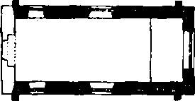
The Church, Plan
Fittings—Font: moulded octagonal bowl with baluster-stem, 18th-century. Monuments: In nave—on N. wall, (1) to Robert Dawe, 1727, and Joan, his wife, 1743, slate wall-tablet. In churchyard—W. of church, (2) to Mary, daughter of William Dawe, 1683 (?), and to Mary . . ., headstone; (3) to William Dawe, 1690, table-tomb.
Secular
b(2) Earthwork, on Castle Hill near the middle of the parish, presumably represents a mediæval castlesite. The work occupies a ridge-top (about 600 ft. above O.D.) on the W. side of the road. An irregular shaped bailey has been formed, with a motte in the S.W. angle apparently constructed by steepening the natural scarp of the summit of the hill. There are traces of a narrow ditch round the base of the motte towards the E. and S. The motte rises about 30 ft. above the bailey and is an oval of about 90 yards by 70 yards; the top and sides have been much disturbed and there is a path running up the S.W. slope. The ground falls rapidly on the W. side of the bailey and there is a slighter slope on the E. which is bordered by the deeply sunk roadway. To the S. of the scarp of the bailey is a large rhomboidal enclosure. To the N. of the motte is a quarry which has much damaged the work. There seems to be no historical evidence of the existence of a castle here, but the analogous work (3) in the lower land to the E. may indicate that a castle was first constructed there, with subsequent removal to the ridge-top owing to the dampness of the first site.
b(3) Earthwork, 150 yards E. of (2), appears to be the much damaged remains of a motte and bailey castle. The motte, at the W. end, is of very irregular shape, now 39 yards by 50 yards, and only about 6 ft. high on the N. but considerably more to the S. where the ground slopes away. There are no definite traces of a ditch, but to the E. are the scarps of an irregularly shaped bailey of about 2 acres.
b(4) Stake Farm, house nearly 1¼ m. S.S.W. of the church, is of two storeys with attics; the walls are of rubble and the roofs are covered with thatch and slate. It was built in the 17th century and has a later addition at the back. There are some original windows and a doorway reset in the addition. There is also a reset stone with the initials and date D.D. 1607. Behind the house is a 17th-century cottage with an original window of four lights with a label. There is also an original fireplace with a chamfered head-beam.
b(5) Stake Dairy-House, house 320 yards S.S.E. of (4), is of two storeys; the walls are of rubble and the roofs are thatched. It was built in the 17th century and retains an original four-light window with a label. Inside the building are an original muntin and plank partition, an original fireplace and some exposed ceiling-beams.
a(6) House, just south of the church, has walls built of rubble and the roofs are tiled. It was built late in the 17th or early in the 18th century. The windows in the W. front are of three lights and retain their original wood frames.
b(7) Horsey Farm, nearly 2 miles S. of the church, has rubble-built walls, in places plastered, and the roofs are thatched. It was built late in the 17th or early in the 18th century. It retains its original wood-framed windows of three lights.