An Inventory of the Historical Monuments in the County of Cambridgeshire, Volume 1, West Cambridgshire. Originally published by Her Majesty's Stationery Office, London, 1968.
This free content was digitised by double rekeying. All rights reserved.
'Plate 28: Pictorial Estate Maps', in An Inventory of the Historical Monuments in the County of Cambridgeshire, Volume 1, West Cambridgshire, (London, 1968) pp. 28. British History Online https://www.british-history.ac.uk/rchme/cambs/vol1/plate-28 [accessed 18 April 2024]
Pictorial Estate Maps
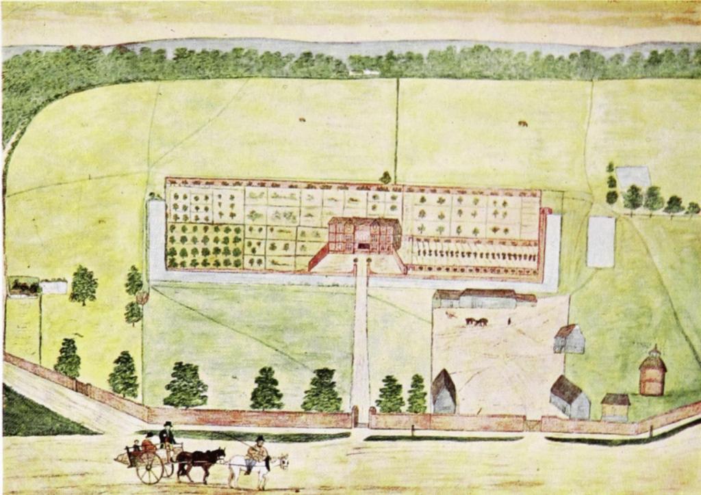
Haslingfield. (2) Haslingfield Hall. Watercolour by R. Relhan, c. 1814. (C.A.S. Library)
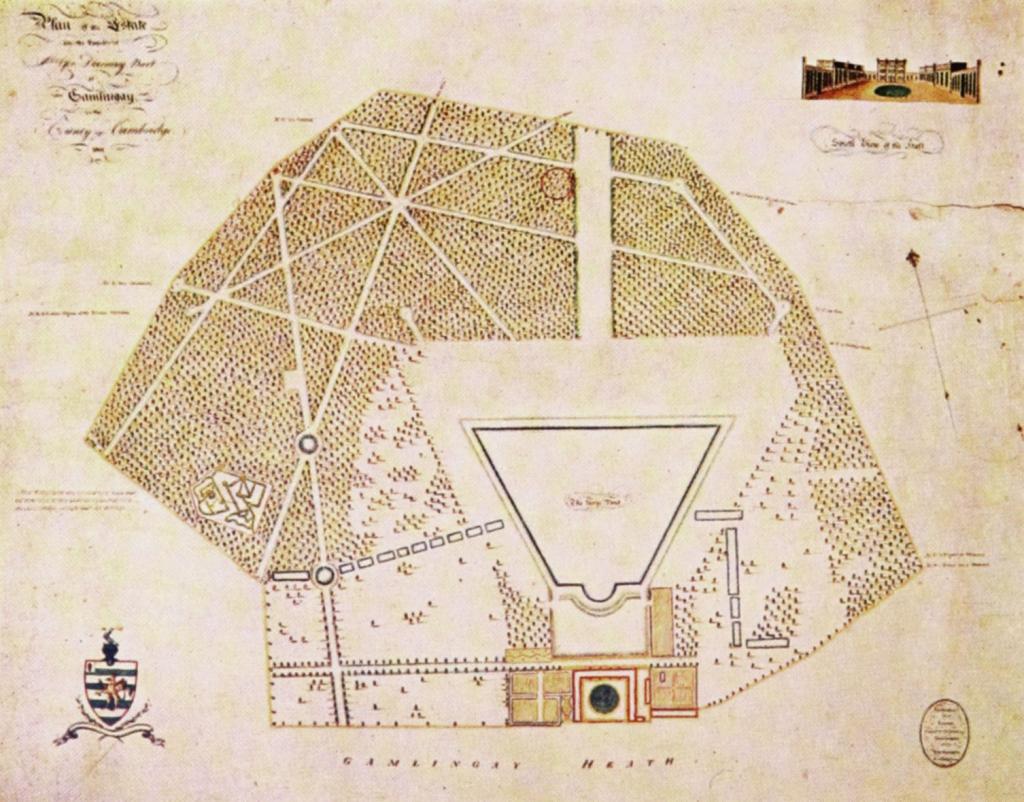
Gamlingay. (61) Gamlingay Park. Plan of estate, 1801. (Downing College, Cambridge) Scale 1″ to 1000′