Ancient and Historical Monuments in the County of Gloucester Iron Age and Romano-British Monuments in the Gloucestershire Cotswolds. Originally published by Her Majesty's Stationery Office, London, 1976.
This free content was digitised by double rekeying. All rights reserved.
'Hatherop', in Ancient and Historical Monuments in the County of Gloucester Iron Age and Romano-British Monuments in the Gloucestershire Cotswolds, (London, 1976) pp. 64. British History Online https://www.british-history.ac.uk/rchme/ancient-glos/p64 [accessed 27 April 2024]
HATHEROP
(8 miles N.E. of Cirencester)
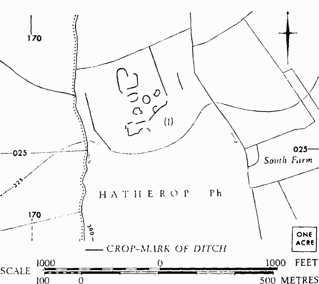
Hatherop. (1) Probable Settlement.
(1) Probable Settlement (SP 173027), undated, shows as crop-marks N.W. of South Farm. The area is defined by linear ditches on E. and W. and covers 6 acres or more.
C.U.A.P., OAP AYI 9–10.