A History of the County of Somerset: Volume 6, Andersfield, Cannington, and North Petherton Hundreds (Bridgwater and Neighbouring Parishes). Originally published by Victoria County History, London, 1992.
This free content was digitised by double rekeying. All rights reserved.
'Aisholt', in A History of the County of Somerset: Volume 6, Andersfield, Cannington, and North Petherton Hundreds (Bridgwater and Neighbouring Parishes), (London, 1992) pp. 68-69. British History Online https://www.british-history.ac.uk/vch/som/vol6/pp68-69 [accessed 24 April 2024]
AISHOLT
Aisholt c.1838
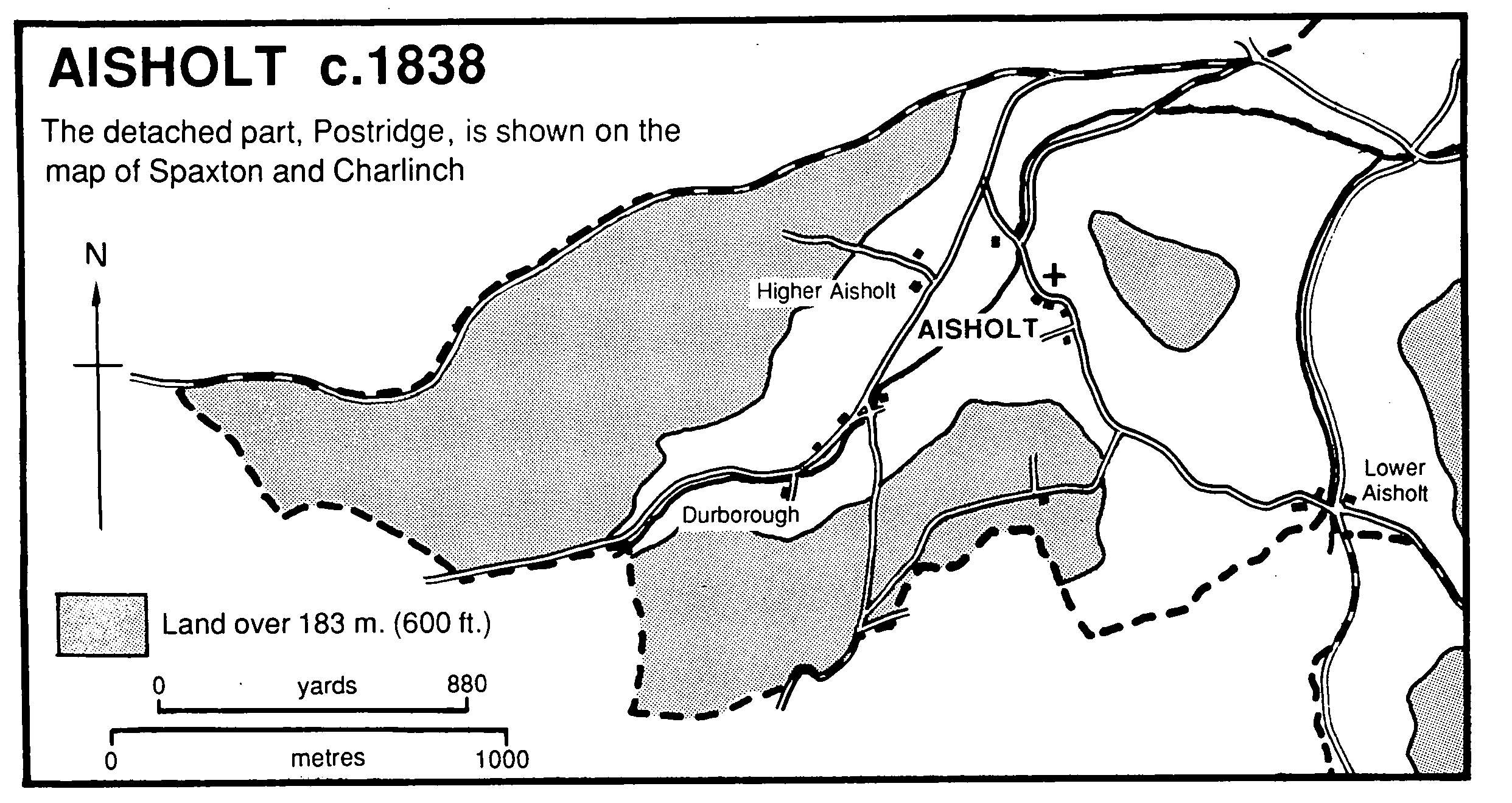
THE ancient parish of Aisholt or Asholt lay in two parts: the larger included Aisholt village on the eastern side of the Quantock ridge 4 km. south of Nether Stowey; the smaller was 4.5 km. north-east of Aisholt village, east of Spaxton village. The larger area, irregular in shape, measured 3.5 km. from east to west and 1 km. from nsorth to south, the smaller was roughly oval, 1.7 km. east to west. (fn. 1) In 1885 the smaller area (11 houses, 53 persons) was transferred to Spaxton, leaving the civil parish of Aisholt with 875 a. (fn. 2) In 1933 the civil parish was absorbed into Spaxton. (fn. 3)
The larger part of the parish is divided into three by two streams which flow in steep-sided valleys, the land between rising at Black Knap on the Quantock ridge to 335 m. In the centre it reaches 198 m. at Aisholt wood, and in the east 220 m. on Hawkridge Hill. The valley bottoms, converging in the north-east where Hawkridge reservoir was completed in 1964, (fn. 4) lie at 30 m. above sea level. The land is largely on Cutcombe slates with bands of limestone, but Aisholt common is on Hangman grits. (fn. 5) The parish boundary on the east and south followed a footpath, lanes, and a stream, on the west an earth bank, (fn. 6) and on the north Parsons' Lane, probably an ancient route to the Quantock ridgeway. (fn. 7)
The smaller area, on the more fertile lower slope of the Quantocks, included a shallow valley watered by a tributary of the Durleigh brook, between the 61-m. and 30-m. contours bounded on the south by the Durleigh brook, on the west by the road between Enmore and Four Forks, and on the east by a lane. (fn. 8) It lies on marl with pockets of gravel. (fn. 9)
Aisholt village, named from its position in or near an ash wood, lies sheltered on the side of a valley called Holcombe running north-east. It comprises the church, the former rectory house, and a few cottages. Holcombe was the name of an estate with at least eight households in 1086, (fn. 10) and West Holcombe, possibly a settlement around Durborough Farm at the head of the valley, was named in the 15th century. (fn. 11) Holcombe Street was recorded in the 18th century (fn. 12) and several cottages stood at the upper end of the valley in 1833. (fn. 13) By the 20th century only Durborough Farm and two cottages, one probably medieval, the other with 16th-century origins, survived. (fn. 14) Durborough Farm is a Tshaped house in which the short central arm appears to survive from a house of the late 16th or the early 17th century and the long range was rebuilt in the late 17th or the early 18th century. Lower Aisholt comprises a farm and a cottage on the Nether Stowey road.
In the smaller part of the parish a Roman villa west of Roughmoor Farm was occupied in the 3rd and 4th centuries. (fn. 15) There were two farms at Postridge in the Middle Ages, and a smallholding called Longthorns, on the road towards Bridgwater, recorded c. 1461. (fn. 16) Roughmoor and Crossfield farms had emerged by the 18th and 19th centuries respectively. (fn. 17) Several houses were built along the Four Forks to Enmore road; they included two rows built in the later 19th century behind a house called Barford Villa (fn. 18) and demolished in the later 20th.
At Holcombe in 1086 15 a. of woodland were recorded. (fn. 19) Field names current in the 19th century suggest former coppices and woodland cleared and converted to arable. (fn. 20) In 1791 the parish was described as well wooded (fn. 21) but by 1842 Aisholt wood and small plantations covered only 50 a. in all. (fn. 22) By 1905 there were over 100 a. (fn. 23) William de Reigny was granted free warren in his demesne of Aisholt in 1268. (fn. 24) In the 17th century there were commons at Hawkridge Hill and at Holcombe, later called Aisholt common, small areas of which were ploughed, including c. 23 a. in 1602. (fn. 25) By 1696 a quarter of Hawkridge common was let. (fn. 26) In 1721 a lessee was required to plant an oak, ash, or elm sapling every year. (fn. 27) In 1842 inclosed areas of former common were called Breaches, but there were still 240 a. of common at Aisholt common and Hawkridge Hill. (fn. 28) Aisholt common measured c. 171 a. in 1920 and 1986. (fn. 29)
In 1652 a woman was licensed to continue her limekiln for three years. (fn. 30) In 1842 there was a quarry near Durborough and quarries and kilns on Hawkridge Hill, beside Parsons' Lane, and by the road to Lower Aisholt. (fn. 31) Quarrying and limeburning continued on the side of Hawkridge Hill until 1930 or later. (fn. 32) Marl was dug at Postridge. (fn. 33) There was some mining in the early 18th century. (fn. 34)
There was a licensed victualler in the parish in 1657. (fn. 35)
Thirty-one households were recorded in the later 17th century. (fn. 36) In 1801 the population was 136; it rose to a peak of 228 in 1831 and then fell steadily to 180 in 1871 and more rapidly to 121 in 1881. By 1921 the population of the reduced parish was 60. (fn. 37)
The poet and author Sir Henry Newbolt (1862-1938) lived in the Old School House in Aisholt from c. 1927 until his death. (fn. 38)