A History of the County of Middlesex: Volume 10, Hackney. Originally published by Victoria County History, London, 1995.
This free content was digitised by double rekeying. All rights reserved.
'Hackney: Clapton', in A History of the County of Middlesex: Volume 10, Hackney, ed. T F T Baker (London, 1995), British History Online https://www.british-history.ac.uk/vch/middx/vol10/pp44-51 [accessed 30 April 2025].
'Hackney: Clapton', in A History of the County of Middlesex: Volume 10, Hackney. Edited by T F T Baker (London, 1995), British History Online, accessed April 30, 2025, https://www.british-history.ac.uk/vch/middx/vol10/pp44-51.
"Hackney: Clapton". A History of the County of Middlesex: Volume 10, Hackney. Ed. T F T Baker (London, 1995), British History Online. Web. 30 April 2025. https://www.british-history.ac.uk/vch/middx/vol10/pp44-51.
CLAPTON
CLAPTON, so spelt in 1593, (fn. 1) was from 1339 until the 18th century normally rendered as Clopton, the 'farm on the hill'. The Old English clop, 'lump' or 'hill', presumably denoted the high ground which rises from the Lea. (fn. 2) Later to cover the north-eastern quarter of the parish, Clapton grew up along the way which in 1745 was called Hackney Lane, part of which ran through the waste of Broad (later Clapton) common. In the 19th century building spread to meet streets east of the high road and north of Homerton. The area treated below includes Hackney Downs and, towards the Lea, the terraces north of Clifden Road. Manorial courts from c. 1800 distinguished the parts north and south of Lea Bridge Road as Upper and Lower Clapton, and those names soon passed into general use. (fn. 3) Hackney Lane came to be known as Lower and Upper Clapton roads, until in the late 19th century the stretch through the common to Stamford Hill was named Clapton Common. (fn. 4)
Clapton Street, on a local route still in the 1720s a 'back road', (fn. 5) was recorded in 1378 and a high street in 1447. (fn. 6) In 1605 Clapton's 32 contributors to church rates compared with 34 for Church Street and 49 for Homerton. (fn. 7) Clapton in 1664 was assessed for hearth tax with districts farther west; in 1672 it was assessed on 74 houses, a number exceeded only by 78 for Mare Street and 113 for Homerton. (fn. 8)
Brooke House, formerly a royal seat called King's Place, (fn. 9) was centrally placed, on the later border between Upper and Lower Clapton. Early growth was probably densest along Lower Clapton Road. The 17th-century Flower de Luce (fn. 10) has not been identified; the White Hart, rebuilt in the 19th century, was one of four inns licensed in 1722. (fn. 11)
Other buildings in Lower Clapton Road included Wood's almshouses east of where the road widened by a pond, the Wood family's 16th- or 17th-century house, later the Powells' Clapton House, to the north, and the school which became Newcome's to the south. (fn. 12) On the west side a house with 1½ a. was conveyed in 1714 by John Coram, lately a timber merchant of London, to Markham Eeles, who in 1715 was licensed to inclose roadside waste. (fn. 13) It was probably rebuilt as a five-bayed house by Eeles, a china merchant from whom it was nicknamed Piss Pot Hall, and as no. 179 Lower Clapton Road was to become the British Asylum for Deaf and Dumb Females. (fn. 14) Near the modern junction of Rowhill Road a gabled house apparently of c. 1600 was acquired with c. 4 a. in 1715 by Samuel and Bucknall Howard, merchants who conveyed it in 1727 to John Howard, a London upholsterer; it was the birthplace of his son John (d. 1790), the philanthropist. (fn. 15) Another large and apparently early 18th-century house stood in the south angle of a way from Clapton field (later Clapton Passage). (fn. 16) Sir Matthew Holworthy had a house with 14 hearths in 1672 which in 1713 was described as in Clapton Street. (fn. 17) Brooke House ceased to be an aristocratic seat in 1677 (fn. 18) but at the south-eastern end of the village another rich citizen's residence was rebuilt in 1728 as Hackney House, the grandest of its kind in Clapton. (fn. 19)
Growth continued in the 18th century. Seventyone residents of Clapton paid poor rates in 1720, 100 in 1735, 157 in 1761, and c. 200 in 1779. (fn. 20) Seven of the parish's 36 select vestrymen lived there in 1729 and eight in 1740. (fn. 21) The turnpiking of the road from Hackney to Stamford Hill may have drawn residents to Upper Clapton after 1738 and the construction of Lea Bridge Road brought more traffic to Lower Clapton from 1758. (fn. 22)
In 1745 buildings fronted most of Lower Clapton Road from its right-angle bend northward to a little way beyond Brooke House. (fn. 23) They did not extend along lanes leading east or west, nor along Back Lane (a forerunner of Clarence Road), a short cut from Church Street to the heart of Clapton village by the pond. The stretch which came to be Upper Clapton Road ran through fields, past buildings at the junction with the later Mount Pleasant Lane and a forerunner of Spring or Spring Hill House (fn. 24) and across Broad common to the turnpike at Stamford Hill. Isolated houses stood near the ferries: Jeremy's, Smith's, and Morris's, (fn. 25) of which Morris's had an inn by c. 1725. (fn. 26)
Behind the main road frontage the only substantial building in 1745 was Hackney House. (fn. 27) It was put up for Stamp Brooksbank, M.P. (d. 1756), governor of the Bank of England, whose father Joseph (d. 1726), a London haberdasher, had lived in Clapton or Homerton in 1712. (fn. 28) The house, apparently finished by 1732, was designed with a plain façade by Colen Campbell; it was approached along the line of Tresham Avenue (in 1992 marked by Tresham Walk on the Jack Dunning estate) and commanded a vista, with ornamental waters, south to Homerton Row. (fn. 29) The estate, mainly freehold, in 1775 stretched to the Hackney cut, in part bordering Pond Lane (from 1887 Millfields Road), and contained c. 122 a., besides c. 97 a. in the marsh. (fn. 30) It was sold by Brooksbank's heirs to John Hopkins of Hornchurch (Essex) (d. 1772) (fn. 31) and by Hopkins's son-in-law Benjamin Bond Hopkins to Samuel Stratton, who sold most of it to Thomas Hubbard. A large part along Pond Lane was bought by Christopher Alderson and the house itself in 1786 for the dissenters' Hackney or New College. An east wing was added in 1788 by John Howard's friend William Blackburn (fn. 32) and a west wing in 1789, but demolition followed the college's closure in 1796. College House, put up nearby for the resident tutor Abraham Rees (d. 1825), (fn. 33) the cyclopaedist, survived until c. 1883-4. (fn. 34)
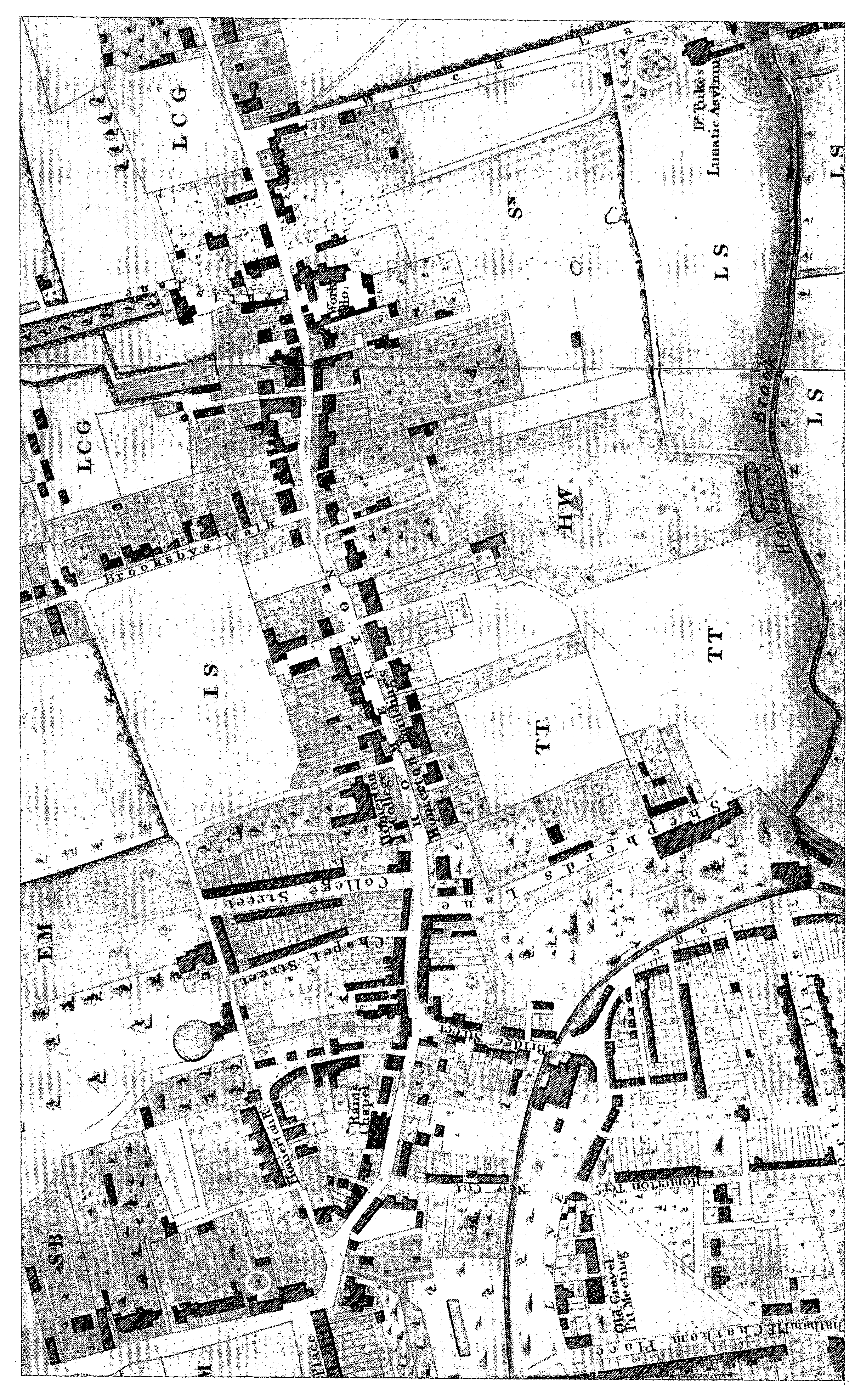
High Street, Homerton, c. 1830
The destruction of Hackney House may not have been followed by the rebuilding of some substantial roadside villas (fn. 35) known as the Five Houses, a name also applied to that part of Lower Clapton and to the last surviving house. (fn. 36) In 1799 they stood back between the later junctions with Tresham Avenue and Powerscroft Road. Occupants included Christopher Alderson (d. 1810) and his great-nephew Christopher Alderson Lloyd (d. 1845), who took the surname Alderson, and Thomas Boddington, a purchaser of much of the college's land. (fn. 37) Reputedly the houses were built out of materials from the mansion, but Boddington had acquired a large residence with 4 a. in 1785. (fn. 38) The middle house passed to his son Benjamin and in 1822 was sold to William Amory, who rebuilt it as the Hall, of five bays and with a central Ionic pediment, which he sold in 1830 to John Berger. (fn. 39) East of the Hall stood the castellated Priory, probably contemporary with the Five Houses, which was approached from a lodge at the north end of Brooksby's Walk in Homerton. (fn. 40)
Development of the Tyssens' lands north of Hackney village led in 1816 to the laying out of Clapton Square. In 1817 residents on its west side included the manorial steward Thomas Tebbutt, (fn. 41) and in 1821, when building was still in progress, 15 householders included the surveyor William Hurst Ashpitel (d. 1852) in a detached villa at the north-east corner near Clapton Passage. Clapton Place, facing the main road east of the square, had 17 householders in 1821, including Joshua Watson. (fn. 42) Smaller houses called Down Terrace, some occupied by tradespeople, lined part of Back Lane (later Clarence Road) by 1821. Hackney Church of England grammar school of 1829 stood alone, opposite them, in 1831, when houses around the square, almost opposite in Portland Place, Lower Clapton Road, and in Clarence Place linked Lower Clapton with Hackney village. (fn. 43)
Immediately north of the Five Houses, Newcome's school made way for the impressive London Orphan Asylum, opened in 1825. (fn. 44) To the north detached houses in 1831 stretched past the entrance to Laura Place as far as Pond Lane, beyond which denser building including St. James's Terrace faced Clapton pond and continued past Clapton House and Lea Bridge Road. Most building was on the Powells' land, as was that on the west side of the main road as far north as the Brooke House estate, (fn. 45) where a terrace called Brooke House Row had been occupied from 1760. (fn. 46) Farther south houses on the west side were built on land leased in 1822 and 1823 to John Maitland; they included seven which he sold in 1827 as Maitland Place. (fn. 47)
Meanwhile building had slowly spread towards the desirable heights of Stamford Hill. Beecholme House, opposite Brooke House, may have been the family home of Maj. John André (d. 1780), who was executed in the American War of Independence. (fn. 48) Beyond Kates Lane the Tyssens' land south-west of the road through the common was still open in 1765, although three isolated rows had been built between the modern Oldhill Street and Portland Avenue. (fn. 49) They stood on fields of Thomas Webbe, who in 1742 had succeeded his grandfather John Webbe and whose family had held land since 1664 or earlier. (fn. 50)
Planned development in Upper Clapton began on Webbe's 24 a., (fn. 51) where by 1774 Oldhill Street (then Chapel and Hill streets) had rows of 4 and 10 cottages. A proprietary chapel (later St. Thomas's church) (fn. 52) stood in the street's north angle with the main road, separated by building land from 11 houses in Clapton Terrace, behind which were mews and a brickfield. In the south angle the King's Arms, apparently short lived, adjoined four houses; to the south-east were the driveway to a house which served as an academy, in the 19th century called Avenue House, and a terrace of four more by the main road. In contrast the Tyssens' land remained empty, save for the White Swan (later the Swan) near the north end of Clapton Terrace, in 1785. (fn. 53)
Below the common, part of Upper Clapton early in the 19th century became as urban as Lower Clapton. It was most crowded near the junction with Lea Bridge Road and along Kates Lane and in short streets built after 1790 on Conduit field in the lane's northern angle with the main road. (fn. 54) Over 70 labourers' families lived in Kates Lane in 1821, when construction was in progress. (fn. 55) Complaints were made about drinking, Sunday shopping, and gambling in the brickfields there in 1827. (fn. 56)
By 1831 the north end of Upper Clapton was a genteel area. (fn. 57) Many houses were detached, such as those north and south of Warwick Road, although terraces faced both sides of the common. They included Summit Place north of the Swan and, opposite, the long four-storeyed Buccleuch Terrace of c. 1825, (fn. 58) with Buccleuch Cottages on the slope behind; the villas later represented by Stainforth House and the Woodlands lay to the north and Cintra House and the pair forming Bellevue and Surrey House to the south next to Spring Hill, while West Springfield and Cedar Lodge lay in the southern angle of Spring Hill with the main road. A gap, soon to accommodate Champion Place, (fn. 59) stretched farther south almost to the corner of Spring Place (later Springfield). Terraces in such a setting were criticized in 1832 as 'formal, united, and destitute of all allusion to country pursuits'. (fn. 60) The connoisseur James Wadmore (d. 1853) lived on the west side of Upper Clapton Road. (fn. 61)
Lines of building did not reach far from the main road except along Kates Lane, almost to Newington common, and behind the proprietary chapel past Stamford Grove East and West to where Hill Street joined Grove Place (later Lynmouth Road) from Stamford Hill. A few detached villas lay along part of the south side of Spring Place. Individual seats included the first Summit House north-west of Summit Place, with its garden bordering the north side of a lane which became Portland Avenue; (fn. 62) a field to the west and the grounds of Craven Lodge to the north (fn. 63) still separated the houses around Clapton common from those on Stamford Hill. East of the common were the residences later known as Spring Hill House, south of Spring Hill, Springfield House, north of Spring Place, (fn. 64) and Springfield Cottage, in the angle between Spring Place and Mount Pleasant Lane or Big Hill. (fn. 65)
Riverside settlements grew up at Lea bridge, High Hill ferry, and the high bridge at the foot of Spring Hill. (fn. 66) Lea bridge had 21 householders in 1821 and Lea Road, presumably Lea Bridge Road, had 22, all tradesmen or labourers. (fn. 67) The Jolly Anglers at Middlesex wharf, on the site of Smith's ferry, and a dock to the north may have been included in those numbers. High Hill ferry was reached circuitously by Mount Pleasant Lane, part of which had 19 working-class households, or more directly by Spring Place; as Hilly ferry it had 44 householders in 1821, several of them dyers. (fn. 68) At the foot of Spring Hill Thomas Webbe had owned c. 39 a. in 1774, including Horseshoe Point and islands to the north, a tileyard, a calico printer's, and three wharves on a creek later called Giles's dock. (fn. 69) Premises adjoining the dock were leased by John Webbe Weston to a varnish maker in 1806. (fn. 70) Tile kilns in Spring Lane near the head of the dock were presumably those where 34 householders dwelt in 1821. (fn. 71)
In 1865 building along Lower and Upper Clapton roads, almost continuous to the northwest end of Clapton common, was still separate from that along the high road or by the Lea. (fn. 72) In Lower Clapton, Laura Place formed a 'respectable row' north of the orphan asylum by 1842. (fn. 73) Opposite Clapton House the Revd. T. B. Powell gave a cottage and land called the strawberry garden as a site for St. James's church in 1840. (fn. 74) To the south a large house with grounds stretching back to Love (later Downs) Lane was for sale in 1861 and taken for Powell and Heyworth roads. (fn. 75) The south-eastern end of Lower Clapton was affected by the growth of Homerton, in particular by the proximity of the East London union's institution and the projected Eastern fever hospital. (fn. 76) The Hall and the Priory were for sale in 1860 and were bought in 1863 by the Cannock Chase & Ogley Land Co. and then by the London & Suburban Land & Building Co., which in 1866 also bought the Alderson estate. (fn. 77)
Hackney Downs, previously amid fields, by 1865 was edged north by Downs Road, bordering the Powells' land offered for sale in 1861, (fn. 78) and south by Downs Park Road, in both of which building had started. A few middle-class rows already led northward from Hackney Downs, along London Road (later Clapton Way), and Avenue (later Midhurst), Oak Field, and Nightingale roads to the planned line of Kenninghall Road. Farther north a cartway behind Brooke House was still called World's End; by 1868 it was the east end of Brooke Road, which continued as a footpath between brickfields to Stoke Newington common. (fn. 79) Upper Clapton remained much more open, although villas lined Warwick Road to where Mount Pleasant Lane approached the steep streets south of High Hill ferry.
Lower Clapton spread quickly as the London & Suburban Land Co. laid out Chatsworth Road along a field path from Brooksby's Walk to Pond Lane, filling the space between that and Lower Clapton Road with the western ends of Clifden, Glenarm, and neighbouring roads between c. 1867 and 1870. Farther east 61 a. were leased to a market gardener for 5¾ years in 1867, before they too were taken for the east part of the company's Clapton Park estate. (fn. 80) Plots in Elderfield Road were conveyed to Edward Withers for its Clapton Park No. 2 estate in 1872-3. (fn. 81) On the main road the Aldersons' house made way for the striking Round Chapel, founded in 1869 to meet recent 'enormous immigration'. (fn. 82)
Growth was stimulated by the opening of Clapton railway station in 1872, followed closely by the arrival of tramways at Lower Clapton and their extension in 1875 to Clapton common. (fn. 83) The spread of building, however, was limited by public control of the Mill fields, Hackney Downs, and Clapton common from 1872. (fn. 84)
The main road below the station became more urban. By 1880 there were many shops at its southern end, including a new range called Clapton Pavement, (fn. 85) and at the junction with Lea Bridge Road, which from 1892 carried trams, and south of Kenninghall Road. (fn. 86) Clearance north of the almshouses made way for Newick Road and St. James's Villas c. 1890; to the south, part of St. James's Terrace similarly made way for Mildenhall Road. (fn. 87) Between Laura Place and Pond Lane the Powell estate offered Durham House and nearby houses for sale in 1882, with nursery land in Pond Lane; Cromwell Lodge soon made way for Atherden Road. (fn. 88) Farther south the last of the Five Houses was superseded c. 1884 by Lesbia Road. (fn. 89) Shops open in Clarence Road by 1880, the municipal baths or King's hall of 1897, a skating rink (later Clapton Rink cinema), and the Salvation Army's Mothers' hospital of 1913 signalled the extension of central Hackney into Lower Clapton. (fn. 90) Purpose-built flats first appeared as Cavendish Mansions and St. John's Mansions, at the north-east corner of Clapton Square, in 1899-1901. In the main road Northumberland Mansions were opened south of Laura Place c. 1904, by which date St. Andrew's Mansions stood on the west side and Kinnoul and Rowhill Mansions, built by W. Andrews of Wood Green, in Rowhill Road. (fn. 91)
East of Lower Clapton Road, Chatsworth Road had shops from the beginning and many more by 1880. (fn. 92) Modest terraces reached the Hackney cut south of Millfields Road by 1894, although Mildenhall Road and parallel roads to the north extended only to the modern line of Cornthwaite Road. (fn. 93) Farther north James Stone and William Cooke had contracted for very small houses or maisonettes in Southwold Road in 1885 but G. R. Woodruff did not begin building in Gunton Road until 1894. (fn. 94) To the west shops by 1880 were mainly at the north end of Rendlesham Road, in Upper Clapton Road from Kenninghall Road northward to Rossington Street, in Northwold Road, and, serving Clapton common, in Hill Street. (fn. 95) Almost all the land between Hackney Downs and Clapton common was filled with terraces, mostly on the Tyssen estate in continuation of development around Stoke Newington common and Stamford Hill. Thomas James was to build in Ickburgh Road in 1883 and William Osment in Chardmore Road in 1890. (fn. 96)
Clapton common in 1894 was still separated by private grounds from the summit of Stamford Hill and, to the north-east, from the Lea. (fn. 97) Building, however, covered almost all the land to the south-west and had started on the Craven Lodge estate: Olinda Road was wholly and Castlewood Road partly built up, and Egerton, Rookwood, and neighbouring roads had been planned. Riverside settlement at Lea bridge and Lea dock had been restricted by the Mill fields. At High Hill ferry houses had spread higher up the slope since 1865 and the old village c. 1890 survived in a 'veritable Alsatia' where the workforce depended largely on summer pleasure-seekers. (fn. 98) Although premises were often flooded, (fn. 99) visitors delighted in the pastoral scene: poplars bordering the Essex reservoirs evoked comparisons with Lombardy, while the heights of Clapton offered a view as fine as that from Richmond hill. (fn. 100)
Building approached its modern limits with additions to Clapton Park south of Redwald Road towards Homerton c. 1900, (fn. 101) when Meeson Street was named. They were followed by the construction of an electricity station and its appendages in Millfields Road and by expansion between Clapton common and the Lea north and south of Springfield park. (fn. 102) Infilling included Knightland Road off Mount Pleasant Lane, where G.R. Woodruff was leased sites in 1904. (fn. 103) Springfield park, opened in 1905, was created out of the grounds of Spring Hill House, the Chestnuts in Spring Lane (both demolished), and Springfield House. (fn. 104) Some building followed the demolition of Summit House in 1902 (fn. 105) but much of the Craven Lodge estate was still undeveloped in 1910. (fn. 106) Flats called Stamford Mansions and Stamford Grove Mansions were built at the ends of Stamford Grove East and West c. 1904. (fn. 107)
Clapton common remained select into the 20th century. From Buccleuch Terrace members of the Neilson family, West India merchants previously at Summit House, walked to the City until the 1880s. Stainforth House was given in 1879 by Richard Foster, a church benefactor, to William Walsham How (d. 1897), suffragan bishop for London's east end and styled bishop of Bedford, who also acquired the Woodlands as a boys' home. (fn. 108) How's successor was followed at Stainforth House by Frederick Janson Hanbury, of the chemists Allen & Hanbury, who made a large collection of plants. Although the slope behind was acquired for Ashtead and Lingwood roads, Stainforth House was saved on its purchase in 1909 by C. H. Turner, bishop of Islington, who lived there until 1923 while his son lived at the Woodlands. (fn. 109) About 1908 a novel portrayed the area as a 'far northern suburb overhanging the Lea', where merchants' grave old houses surrounded a sleepy common. (fn. 110) An attempt by the Elizabeth Fry refuge to buy no. 22 Clapton Common was treated in 1912 as a threat to high-class property values. (fn. 111)
The far northern and eastern fringes of Clapton were less exclusive. At Lea bridge some unhealthy houses in Middlesex wharf were demolished in 1912, as were others at High Hill ferry by 1915. (fn. 112) Piecemeal development east of Stamford Hill was served by Craven Park board school, in 1911 isolated with a 'particularly hideous row of houses', which ran out at the crest of a slope marking the edge of London and seeming like the edge of the world. (fn. 113)
Between 1918 and 1939 scattered premises were adapted for industry. In 1928 most were towards the Lea, but Upper Clapton Road and Clapton common had 25 houses partly used as clothing workshops, 11 of them recently converted. (fn. 114) Conversions were also made in Clapton Square. (fn. 115) In 1933 large houses on the east side of Rectory Road were rescheduled for light industry after the Tyssen estate had warned that restriction to residential use would lead to multioccupation. Similar rescheduling of houses in Upper Clapton Road near Warwick Road was refused, despite a claim that they could be let far more profitably for business than for private use. (fn. 116)
Commercial development included Hackney's electricity showrooms in Lower Clapton Road from 1925 (fn. 117) and the conversion of a football stadium for greyhound racing. (fn. 118) Houses of the 18th and early 19th century near Clapton pond were demolished, including the end of St. James's Terrace with Bow House at the entrance to Mildenhall and Millfields roads in 1930 and the pedimented Sion House, the terrace incorporating Byland House, (fn. 119) and the Deaf and Dumb asylum in 1933. (fn. 120) Durham House, partly used as shops, survived a little longer. (fn. 121) A foretaste of change in Upper Clapton was the demolition of the northernmost house of Buccleuch Terrace in 1932. (fn. 122) Buildings of the late 1930s included Beaumont Court, with flats over shops, near Clapton station. (fn. 123)
Extensive rehousing by Hackney M.B. began in 1925 near the Mill fields, with 48 maisonettes in Fletching Road. By 1928 a further 79 houses were ready west of Casimir Road and 69 maisonettes on the borders of Clapton Park and Homerton around Daubeney Road. Work had started on 100 flats in Southwold Road, on maisonettes south of Mount Pleasant Hill, and, for the first time west of the main road, on Newcome House in Powell Road. St. James's Vicarage, no. 58 Kenninghall Road, was being subdivided. (fn. 124) The five-storeyed blocks of Powell House, replacing the Deaf and Dumb asylum and its neighbours, contained 198 flats opened in 1934. (fn. 125)
The east end of Northwold Road, with early 19th-century cottages built on Conduit field, was declared unhealthy in 1929. (fn. 126) The L.C.C. acquired 7¼ a., naming Woolmer House in Upper Clapton Road in 1934 and others in 1936. It also opened Charnwood House and Ettrick House in 1937, before renaming Caroline Street as Charnwood Street and Conduit Street as Rossendale Street. With 459 flats, Northwold in 1938 was the L.C.C.'s largest estate in the borough. (fn. 127) Hackney M.B. contributed 26 flats in Woodfield House, Rossington Street. (fn. 128)
Mount Pleasant Lane was recalled as deteriorating in the 1930s, when its upper end was the better. (fn. 129) Flooding in 1928 affected 78 houses and in 1930 caused Middlesex wharf and High Hill ferry to be designated for clearance. (fn. 130) On 4 a. divided by Harrington Hill the L.C.C. built five-storeyed blocks, on its High Hill estate; Ferry House and Lea House were named in 1937 and Harrington House in 1938. (fn. 131) A little to the west, houses in Warwick Road (from 1938 Warwick Grove) and Springfield made way c. 1939 for the five-storeyed brown-brick ranges of Wren's Park House and Lea View House, 'uncommonly well designed' by Messrs. Joseph, and for a start on the estate called Wigan House. (fn. 132)
Farther north, Hackney M.B. built 120 flats on the site of nos. 124-8 (even) Cazenove Road in 1937-8. Inroads around Clapton common began with the opening of 65 flats in Fawcett House on the site of nos. 20 and 22 in 1937, when the relatively high cost of land had led to the building of blocks rather than cottage dwellings. (fn. 133) Large old houses had become less desirable: the nearby Buccleuch Terrace was badly maintained and mostly split into flats. (fn. 134) Cottages off Oldhill Street were condemned in 1937 (fn. 135) and part of Stamford Grove East was cleared for Oldhill Street (later Tyssen) primary school. (fn. 136) Private flats at Rookwood Court were built at the north end of the common c. 1936. (fn. 137)
War damage robbed Clapton of Brooke House and neighbouring shops, which made way for a school, and of what remained on the east side of Clapton Square. (fn. 138) Piecemeal changes continued on and near the main road, including the building by 1981 of offices for Hackney's social services department in Clapton Square and later of a health centre at the corner of the low-rise Jack Dunning estate in place of Lesbia Road. (fn. 139) In the bomb-damaged Linscott Road the former Orphan Asylum was partly demolished after its abandonment in 1970 by the Salvation Army for a new hall at the corner of Laura Place. (fn. 140) Early 19th-century villas on the north side of Laura Place were demolished in 1975-6. (fn. 141) Closure of the Mothers' hospital in 1986 brought refurbishment at Maitland Place and rebuilding as houses and flats in Mothers' Square behind. (fn. 142) Shops at the junction with Lea Bridge Road were cleared in the early 1970s for a roundabout. (fn. 143)
Much municipal housing was built in relatively spacious Upper Clapton. (fn. 144) Buccleuch Terrace was demolished and Buccleuch House, a sixstoreyed range for single women, opened in 1951. (fn. 145) On or near the same side of the common there was more building on Hackney's Fawcett and Wigan House estates and, by 1958, on the new Webb estate and at the end of the common, where one block of Tower Court was ninestoreyed. On the west side the Summit estate had been built by 1957, Broad Common estate by 1960, and, nearer Stamford Hill, the Gardens by 1961. In Ravensdale Road, Priestley Close had been built by 1958.
Building east of the main road included the Chatsworth estate, additions to Wren's Park House, Keir Hardie estate in Springfield, and Pond Farm in Millfields Road, all of the 1950s, Beecholme in Prout Road by 1961, and the Mount at the corner of Southwold Road by 1962. The L.C.C.'s Nye Bevan estate, including a 12-storeyed tower, had been built between Glyn Road and Pedro Street by 1964 and many more low-rise flats to the south by 1975. The east end of Rushmore Road was taken for a shopping precinct, which also served the 19storeyed Willington Court and its neighbours of c. 1970. The low-rise yellow-brick Millfields estate replaced Clapton stadium c. 1980.
On the west side of the main road Hendale House was open by 1954 and Hackney M.B. had built many flats, as in Narford, Kenninghall, Evering, Brooke, and Maury roads, by 1961. Schemes included the Ickburgh estate of the 1950s and the sixteen-storeyed Gooch House by 1964. The G.L.C. built its large Nightingale estate, replacing roads leading north from Hackney Downs with towers of up to 21 storeys, between 1967 and 1972. (fn. 146) The Dachtler estate, behind Clapton Terrace and named after a vicar of St. Thomas's, was built c. 1979.
Powell House and Lea View House were described as slums by 1980. The first was demolished but the second had been renovated by 1986. (fn. 147) Wren's Park House was also renovated; work on the Fawcett estate was in progress in 1987 (fn. 148) but unfinished in 1992. The 19-storeyed Norbury and Ambergate courts, in Mandeville Street and Daubeney Road, were demolished in 1993. (fn. 149) Declining municipal development in the 1970s was balanced by increased private activity in both Lower and Upper Clapton. Most work consisted of refurbishment, but by 1985 a national firm was building middle-class houses at Baker's Hill. (fn. 150) At Hackney's north-eastern extremity a private road called Watermint Quay was laid out from Craven Walk to the Lea and opened, with terraces by Kentish Homes, in 1988. (fn. 151)
Clapton's main artery in part serves as a continuation of Mare Street, with shops that have led Lower Clapton to be described as the 'hub of Hackney'. (fn. 152) In Upper Clapton they give way to housing estates, some of them nearer the shops of Stamford Hill. Clapton Square conservation area, designated in 1969, extends southward into Hackney village and Homerton. (fn. 153)
The garden of Clapton Square retains its original wall and railings. (fn. 154) No. 17 Lower Clapton Road is early 19th-century and rendered; demolitions have separated it from stock-brick houses of a similar date in Clapton Square. On the west side nos. 8 and 9 have four storeys and basements and have been converted as flats, and nos. 10-13 form a terrace of three storeys, attics, and basements. Nos. 14-19 are three linked pairs, taller and slightly later. On the north side the larger no. 20 is distinguished by pilasters above its stuccoed ground floor and nos. 21-24 are a detached house and terrace of three storeys, attics, and basements. They form a group with the partly rebuilt terrace nos. 1-7 Clarence Place and with no. 8, which is said to have been the coachhouse of no. 20 Clapton Square.
Lower Clapton Road has a few early 19th-century town houses, as offices, among its shops. Two pairs, of multicoloured stock brick with stucco details, stand back between the police station and the Art-Deco electricity showroom; no. 6 and no. 8 (Hackney urban studies centre) have three storeys, attics, and basements, nos. 10-12, have no attics, and all save no. 10 retain their Doric porches. Together with nos. 26-28, a large three-storeyed pair with similar porches, they are all that remains of Portland Place. Farther north the health centre lowers the line of buildings, continuing past the tree-shaded Round Chapel and Linscott Road, which affords a view of the truncated shell of the Orphan Asylum resembling a majestic stage set. Opposite, the three-storeyed no. 143 is late 18th-century and under repair in 1992. Also being restored were nos. 145 to 153 (odd), large pairs of three storeys and basements, with later stuccoed linking sections. Together with a slightly later grey-brick block to the north, they constituted Maitland Place and served until 1986 as the front buildings of the Mothers' hospital. Behind lies Mothers' Square, laid out with semicircular ends, where the three-storeyed blocks designed by Hunt Thompson Associates combine neo-Georgian and Palladian features. A large early 19th-century house of three-storeys and basement, with an Ionic porch, formerly the Salvation Army's Crossways, survives at no. 13 Laura Place. (fn. 155)
A conservation area includes Clapton pond and its ornamental garden where the road widens, Wood's almshouses, Clapton's oldest buildings, and St. James's church. (fn. 156) The almshouses form a group with the only reminders nearby of early 19th-century elegance: Pond House at no. 162, with its stable building, and nos. 158-160, left from St. James's Terrace. Pond House is a stuccoed villa of c. 1800, of two storeys, attic, and basement, with a semicircular Doric porch; nos. 158-160 are stock-brick, of four storeys and basements. (fn. 157)
Upper Clapton Road retains few notable buildings. The main road, although its northern stretch is less commercial than Lower Clapton Road, has none. Clapton common, where the road curves through grass partly lined with mature trees, is overlooked chiefly by housing estates. A conservation area embraces the common and buildings along part of its south side, where St. Thomas's church stands at the end of Clapton Terrace, renamed as nos. 37-69 (odd) Clapton Common, a red- and brown-brick row of c. 1790; the houses are three- or four- storeyed with basements, some with pedimented doorcases and two with pillared porches. (fn. 158) To the north, the Swan is a solitary mid 19th-century survival, refronted in 1993. Behind St. Thomas's church the early 19th-century Grove House, of two storeys and basement, and its wing called Grove Cottage, stand derelict in Stamford Grove East. Three pairs and a half, of two storeys and basement, form an early 19th-century group in Stamford Grove West. Springfield House, spared on the creation of Springfield park, is a five-bayed stuccoed villa with a Tuscan porch. (fn. 159)
Many buildings house Jewish institutions, as at Stamford Hill. On the north side of Clapton common they include the former Deaf and Dumb asylum at no. 26, (fn. 160) Stainforth House, and Woodland Mansions at no. 98. Although they are not advertised, their patrons, like those of Jewish shops in Oldhill Street, dress distinctively, giving north-western Clapton a special character.