Survey of London: Volumes 31 and 32, St James Westminster, Part 2. Originally published by London County Council, London, 1963.
This free content was digitised by double rekeying. All rights reserved.
'Plate 5: Blome's map of the parish of St. James, c. 1720', in Survey of London: Volumes 31 and 32, St James Westminster, Part 2, (London, 1963) pp. . British History Online https://www.british-history.ac.uk/survey-london/vols31-2/pt2/plate-5 [accessed 24 April 2024]
Revised edition of Blome's map of the parish of St. James, c. 1720
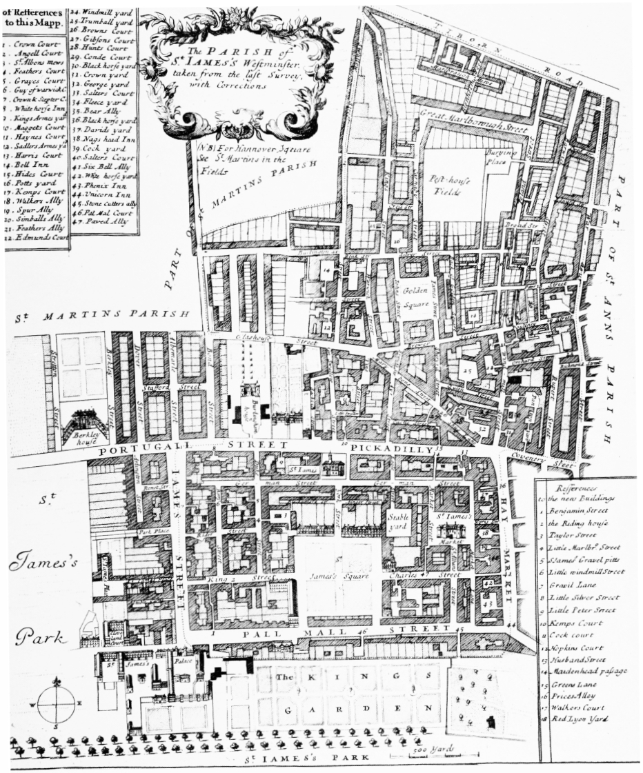
Blome's map of the parish of St. James, c. 1720.
Revised edition of Blome's map of the parish of St. James, c. 1720