A History of the County of Essex: Volume 6. Originally published by Victoria County History, London, 1973.
This free content was digitised by double rekeying. All rights reserved.
'Leyton: Introduction', in A History of the County of Essex: Volume 6, ed. W R Powell (London, 1973), British History Online https://www.british-history.ac.uk/vch/essex/vol6/pp174-184 [accessed 30 April 2025].
'Leyton: Introduction', in A History of the County of Essex: Volume 6. Edited by W R Powell (London, 1973), British History Online, accessed April 30, 2025, https://www.british-history.ac.uk/vch/essex/vol6/pp174-184.
"Leyton: Introduction". A History of the County of Essex: Volume 6. Ed. W R Powell (London, 1973), British History Online. Web. 30 April 2025. https://www.british-history.ac.uk/vch/essex/vol6/pp174-184.
LEYTON
Manors and Other Estates, p. 184. Economic History, p. 197. Marshes, p. 203. Forest, p. 204. Local Government and Poor-Relief to 1836, p. 205. Local Government after 1836, p. 208. Public Services, p. 211. Parliamentary Representation, p. 214. Churches, p. 214. Roman Catholicism, p. 223. Protestant Nonconformity, p. 223. Judaism, p. 233. Education, p. 233. Charities for the Poor, p. 239.
Leyton, the 'tun' on the river Lea, lies about 5 miles north-east of London between the river and Epping Forest. It is part of the London borough of Waltham Forest. (fn. 1) It is mainly a dormitory suburb of small houses built between 1870 and 1910, interspersed with modern block and tower housing. Industry is dispersed, apart from the Temple Mills railway complex in the southwest and a concentration of factories in the north-west. The ancient parish was known as Low Leyton, because part of it lay low by the Lea. In 1868, at the request of the vestry, the directors of the Great Eastern Railway agreed to rename Low Leyton station 'Leyton'. (fn. 2) The civil parish remained Low Leyton until 1921, when the prefix was dropped. (fn. 3) The parish was about 2 miles long from north to south. Its northern boundary, shared with Walthamstow, ran straight for 3 miles from forest to river, by Forest Rise to Whipps Cross, along Chestnut Walk (now part of Lea Bridge Road), then on the line of the modern Boundary Road to Mark House, and on to the river near Mount Wharf. (fn. 4) A suggestion that this long straight boundary may coincide with the line of a former Roman road (fn. 5) has not been confirmed by archaeological evidence. The east boundary marched southward with Wanstead, skirting the Eagle Pond and Bushwood in Wanstead, to Tinkers Lane (Harrow Road). The Wanstead ditch formed the southern boundary with Wanstead and West Ham. The west boundary followed the old course of the river Lea as it existed before the Lea Navigation bypassed it in 1767, (fn. 6) from Mount Wharf southward to the fork in the river, where the boundary continued to Temple Mills along the Temple Mills or Lead Mill stream. This was known in 1602 as the Shire stream, (fn. 7) and after 1835 as the Waterworks river; it ran alongside Quartermile Lane, but was filled in in 1952. A small piece of Hackney lies on the east side of the river just above Lea Bridge.
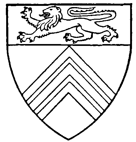
Leyton Municipal Borough. Or, three chevronels gules, on a chief gules a lion passant, or.
The ancient parish comprised 2,271 a. Its northernmost part, of 588 a., was separated from the rest by the Walthamstow Slip. This 3-mile corridor belonging to Walthamstow parish varied in width from about 50 to 100 yards (fn. 8) and contained 98a. Its origin is uncertain, though various traditions exist. (fn. 9) It ran from the Eagle Pond, behind Forest House, across King's End (Leyton Green), south of Capworth Street, through the grounds of Leyton House, to the river just below the Horse and Groom. On maps of 1699 and later (fn. 10) it is shown cutting across fields straight from mark to mark, usually regardless of natural boundaries. It is not known whether the Slip became detached from Leyton or the northern portion of Leyton from Walthamstow, leaving this narrow remnant on the south. But as the Slip was part of Walthamstow Tony manor, (fn. 11) the attachment of its tithes to Walthamstow parish probably dates from the early 12th century, when Walthamstow manor, church, and tithes were held by Ralph de Tony and his wife Alice. (fn. 12) The Slip's boundary marks were often disputed or, as in 1723, deliberately altered. (fn. 13) In 1858 Leyton challenged Walthamstow's attempt to establish its course through the most valuable part of the waterworks company's filter beds. (fn. 14) In 1873 the newlyconstituted Leyton urban sanitary district included the Slip, which was also amalgamated with Leyton civil parish in 1878. (fn. 15) The Wanstead Slip (about 207 a.) was added to the district in 1875, but constituted a separate civil parish (Cann Hall) in 1894. (fn. 16) Minor boundary adjustments with Wanstead followed in 1887 and 1900. Leyton became a municipal borough in 1926. In 1961 its area was 2,595 a. (fn. 17) It became part of Waltham Forest in 1965, the year taken for most purposes as the terminal point of this article.
Leyton rises from the marshland of the Lea valley to over 100 ft. at Whipps Cross and the High Stone on the edge of the forest. (fn. 18) Between the alluvial marshes and the forest are terraces of valley gravel overlying brickearth. (fn. 19) Three principal watercourses run through the parish. The Wanstead ditch, also known as the river Holt, entered the parish from Walthamstow on the extreme north-east, crossed into Wanstead above the High Stone, reappeared in Leyspring flowing south to Tinkers Lane, and then south-west by Sauls Green to Holloway Down and west to Temple Mills. (fn. 20) Once an open sewer (fn. 21) it is now culverted. The Phillebrook or Fillebrook, 'Phepes Broke' in 1537, (fn. 22) entered Leyton from Walthamstow west of Whipps Cross, flowing south and south-west to join the Dagenham brook west of Ruckholts. In 1868 it was still open, (fn. 23) but by 1904 it was piped from James Lane to the sewage works in Auckland Road; the last open stretch from West End Avenue to James Lane was closed in soon after. (fn. 24) The valley eroded by the Phillebrook (fn. 25) is recognizable in Leyton High Road beside the Coronation Gardens, where once there was a ford. The Dagenham brook, flowing from Higham Hill in Walthamstow, divided marsh and upland. (fn. 26) North of Marsh Lane it was joined by a tributary, the Shortlands sewer, also flowing from Walthamstow, but farther to the west. (fn. 27) This formed the boundary between the inclosed marsh and lammas lands and is now incorporated in the flood relief channel flowing direct to the Lea. Since the occlusion of the Waterworks river the brook, too, has been diverted to the Lea. The Lea was apparently still tidal as far as Lockbridge in the 16th century. (fn. 28)
Palaeolithic implements and fossil bones found along the gravel terraces show that early man lived and hunted in Leyton. (fn. 29) There was a Roman cemetery south of Blind Lane, and massive foundations of some Roman building, with quantities of Roman brick, were discovered in the grounds of Leyton Grange. (fn. 30) The High Stone, near the eastern boundary of the parish at the junction of the roads from Woodford and Woodford Bridge, is a restored 18th-century obelisk set up on an earlier stump, but is traditionally described as a Roman milestone. It may occupy the site of one, if the Roman road from Dunmow to Chigwell continued to London, crossing the Lea by stone causeways discovered in Leyton between Temple Mills and Marsh Lane. (fn. 31) Tradition also explains that Leytonstone is the part of Leyton which was near the High Stone. (fn. 32)
In 1086 the recorded population was 43. (fn. 33) The medieval population remained small. In 1523–4 only 49 persons, including 18 labourers and 10 servants, were assessed to the subsidy. (fn. 34) In 1670 there were 83 houses in the parish, 23 of them in Leytonstone. (fn. 35) By 1778 there were said to be over 300. (fn. 36) In 1801 the population numbered 2,519. (fn. 37) Apart from an increase between 1841 and 1851 caused by the erection of the Union workhouse, there was no unusual growth until the 1860s, when the population doubled, from 4,794 in 1861 to 10,394 in 1871. By 1881 it had risen to 23,016 in the civil parish, and to 27,068 in the new sanitary urban district, which included the Walthamstow and Wanstead Slips. Between 1881 and 1891 the population of the district rose by 133.3 per cent, to 63,056, a larger proportionate increase than that of any other English town with over 50,000 inhabitants. (fn. 38) Rapid growth continued to 1911, when the figure was 124,735, reaching its peak in the next few years. In 1921 128,430 was recorded. Since 1931 (128,313) the population has declined, to 105,978 in 1951 and 93,959 in 1961.
The Domesday evidence suggests that settlement in 1086 was mainly in the centre and south of Leyton, with the densest woodland in the north-east. (fn. 39) Creation of the Haliwell priory estate in 1201 probably fostered settlement further east at 'Ladune' (Hollywell, later Holloway Down), while by the early 14th century a hamlet existed at 'Leyton atte Stone'. (fn. 40) In the later Middle Ages, as woodland was cleared in the north-east of the parish, settlement developed at Knotts Green and Diggons Cross, both mentioned in 1537. (fn. 41) Knotts Green probably originally comprised the waste between Leyton High Road and its right fork to the forest (Leyton Green Road). Diggons Cross was probably near the junction of Shernhall Street (Walthamstow) and the highway to the forest, for in 1454 Degonesbraches (Diggon's 'clearings') abutted north on this highway, by Leyton bridge. (fn. 42)
By the 18th century, when the parish is first shown on detailed maps, (fn. 43) Wallwood and Whitings Grove were cleared, and the pattern of the parish, much as it remained until the mid 19th century, was complete. On the west lay undeveloped marshland, and on the extreme north-east Leyton heath and the forest, the haunt of highwaymen. (fn. 44) Two principal roads, now Leyton High Road and Leytonstone High Road, ran approximately north and south through the parish. Along these lay the two main settlements, Low Leyton to the west and Leytonstone to the east. In Low Leyton, about a quarter of a mile west of the high road, stood the parish church with the manor house of Leyton Grange beside it. The high road, with local roads branching off it, was a continuation southward of Hoe Street (Walthamstow), by Knotts Green and Ruckholts to Angel Lane, Stratford. By the 18th century most of Knotts Green was inclosed, forming the triangle bounded today by the High Road, Lea Bridge Road, and Leyton Green Road. But its north-east corner was still waste, and Knights Green (now Leyton Green) at its southern apex was probably also a remnant of the original green. Low Leyton village lay mainly along Leyton Street, as the high road was usually known from Lea Bridge Road to Moyers Lane; the most crowded stretch, between Lea Bridge Road and Knights Green, was sometimes called Gossups Green. (fn. 45) Frog Row, an island of cottages, narrowed the high road at its junction with Forest (later James) Lane. Farther south a group of houses, later called Blue Row, clustered opposite the vicarage and a large triangle of waste where the road branched west to the church (Church Road). The neighbourhood south of Blue Row, where the road forded the Phillebrook, was usually known as Phillebrook. Several lanes led eastwards off the high road. Wide Street, mentioned in 1537, (fn. 46) later also called Wild Street, ran along the north side of Knotts Green, then continued as the Broad Lane (later Chestnut Walk) to Whipps Cross: both are now part of Lea Bridge Road. The Broad Lane existed in 1454 and is named in 1649. (fn. 47) It was described as 'the walk with trees' in 1726, and the chestnuts, planted before 1814 and cut down in the 1930s, are commemorated by the Chestnut Tree public house. (fn. 48) A lane (Leyton Green Road) linked Knights Green with Chestnut Walk. Forest (or James) Lane led from Frog Row to Buryfield (mentioned about 1484) (fn. 49) and Forest House. About 1968 it was partly renamed Fletcher Lane, commemorating Mary Fletcher. Moyers or Wallwood Lane, previously known as Masters Lane (fn. 50) (now Hainault Road), led to Wallwood and the nearby locality called Geylewere, first mentioned in 1449 and repeated in various forms up to 1867. (fn. 51) The name may have originated as a gallows site. Westward from Knotts Green Butterfield Lane (Welstret in 1537 and 1645, but sometimes also called Wide or Wild Street, and now part of Lea Bridge Road) (fn. 52) led to Markhouse Lane, which was the way from Higham Hill, Walthamstow, to Leyton church and high road. From this junction Hemstall Lane, mentioned in 1601 and described in 1630 as a chase lane, continued westward to Hemstall or Hemstead Green, where a bridge crossed the Dagenham brook. (fn. 53) Vestiges of the green remained in 1777 on either side of the new Lea Bridge Road, which crossed it, and inclosures from it can be traced on the tithe map. (fn. 54) Hughes farm, sometimes called Hemstall Green farm, (fn. 55) lay south of the lane. From Markhouse Lane Church Lane (now Road) led south and east to the high road. Capworth (earlier Capport) Street linked Church Lane and Knights Green; another form, Copper Street, may suggest some association with Copping Down which lay south of it. South of Phillebrook two roads led off the high road to Temple Mills, one through Ruckholts, the other, Temple Mills Lane, on the parish boundary.
Leytonstone High Road, on the east side of the parish, was part of the main highway from Epping to London. It left the forest at the Green Man inn (mentioned in 1668) and ran southward to Sauls (later Harrow) Green, Holloway Down, and Stratford. From the Green Man Phipps Cross Lane (Whipps Cross Road), mentioned in 1492, (fn. 56) linked Leytonstone with Whipps Cross. Behind the Green Man was an unsavoury group of hovels called The Crib (fn. 57) and south of it Back Lane (Browning Road) led east from the high road to the forest. The houses of Leytonstone hamlet straggled southward from the Green Man. On the west side of the high road a chapel of ease to the parish church was in existence from the middle of the 18th century. More houses fringed Sauls Green farther south and clustered at the junction with Hollewell Lane. From upper Leytonstone a road (Church Lane and Grove Green Road) twisted south-west across the parish to Grove Green, then on to Ruckholt and Temple Mills. (fn. 58) Knaves Lane (Cathall Road) linked Sauls Green and Grove Green. 'Sales' Green is mentioned in 1577 (fn. 59) and Grove Green in 1571. (fn. 60) Hollewell or Blind Lane (later Union, now Langthorne Road) linked Holloway Down and Leyton High Road. Tinkers Lane (or Withies, from the osiers bordering the Wanstead ditch) (fn. 61) led east from Sauls Green to Woodhouse and the lower forest (now Wanstead Flats); it is now known as Harrow Road. Further north a short road (Davies Lane) also led from the high road to the lower forest.
Leytonstone High Road, as a link in the London-Epping route, was by 1594 more important than Leyton High Road. (fn. 62) In the 17th century the inhabitants were presented at quarter sessions on several occasions for not repairing it. (fn. 63) In 1721 it was taken over by the Middlesex and Essex turnpike trust, which maintained it until 1866. (fn. 64) Both high roads carried market carts and waggons. (fn. 65) The road through Leytonstone also carried long-distance coach traffic (fn. 66) and in 1686 there were 17 beds for guests and stabling for 57 horses there. (fn. 67)
Foot and horse traffic crossed the Lea to Hackney, by Lockbridge and the adjoining ford to Clapton, and by Temple Mills to Homerton and Hackney Wick. Lockbridge is mentioned in 1486–7. (fn. 68) It was reported in 1551 that it was broken down, and that Lord Wentworth, lord of the manor of Hackney, ought to repair it sufficiently for foot traffic. (fn. 69) It was listed by Norden in 1594 among the most useful bridges in Middlesex, (fn. 70) but collapsed finally between 1612 and 1630, and was replaced by the ferry later known as Hackney or Jeremy's ferry. (fn. 71) The ford was still called Lockbridge in 1646. (fn. 72) Before Lockbridge collapsed a wooden causeway comprising 12 footbridges led from Blackbridge, which crossed the Shortlands sewer west of Hemstall Green, over the marsh to Lockbridge. In the 16th century this causeway was built or repaired by George Monoux (d. 1544), and repaired by Lady Laxton, probably about 1580, when it was reported in ruins. They did this 'of charity', having no lands in Leyton themselves. (fn. 73) When the bridges were again dangerously decayed in 1611–13 the county disclaimed responsibility for them, and by 1694 only the ruins remained; these were still visible in the 19th century. (fn. 74) Jeremy's ferry, and a second smaller one, called Smith's ferry, a little to the north, are shown on maps of 1747–8. (fn. 75) As both, with the adjoining land, belonged to the lord of the manor of Hackney, (fn. 76) Lockbridge and the ferries are probably the origin of the portion of Hackney which lies on the east side of the river above Lea Bridge to this day. The maps show two tracks to Jeremy's ferry. One, Water Lane, led south from Marsh Street, Walthamstow, joined on the way by another lane from Low Hall. Water Lane crossed Walthamstow Marsh, which lay partly in Leyton parish; vestiges of it remained in the 19th century. (fn. 77) From Leyton a track led north-west from the bottom of Marsh Lane across Leyton Marsh. No way to the ferry is shown from Hemstall Green. Perhaps the risk of drowning, combined with the extortionate charges of the ferryman, had diverted to Stratford the passengers from other parishes and counties who used to travel that way. (fn. 78) Under the Lea Bridge Turnpike Act, 1757, the old route by Hemstall Green and Blackbridge was restored, to link Clapton with the Middlesex and Essex turnpike road at the Eagle pond. Jeremy's ferry was closed and the near-by ford destroyed. Lea Bridge was built, with a road across the marsh by Hemstall Green to Markhouse Lane; and Butterfield Lane and Broad Lane were widened. (fn. 79) In 1802 Leyton and Hackney settled their boundaries in relation to Lea Bridge, the land and buildings just above the bridge on the Leyton side remaining in Hackney, but the centre of the river forming the boundary from the upper side of the bridge southwards, leaving the Horse and Groom to Leyton. (fn. 80) The bridge was replaced in 1821 by an iron one. (fn. 81) On cessation of the turnpike trusts in 1871 the Essex half of the bridge was adopted by the county. (fn. 82)
There was a less important crossing to Hackney at Temple Mills where a 'common open way for horses' existed in the 1690s. (fn. 83) The bridge over the mill-stream was maintained by the occupants of the mills. (fn. 84) In the present century better communications between South Hackney and Leyton became necessary. (fn. 85) In 1908 the Leyton U.D.C. and Essex county council completed a broad road from Ruckholt Road railway bridge to the Waterworks river, and in 1912 the London county council completed a bridge over the river to meet it. (fn. 86) This bridge, which was vested in the two authorities, became part of the scheme, first recommended in 1915, for an Eastern Avenue leading out of London through Leyton. (fn. 87) The bridge was demolished soon after 1952, when the Waterworks river was filled in and replaced by a roadway. (fn. 88) Plans still existed, however, in 1965 to build an Eastern Avenue extension through Leyton linking Eastway (Hackney) and Ruckholt Road with Cambridge Park. (fn. 89)
Leyton Bridge, mentioned in 1454, crossed the Phillebrook in Broad Lane. It is not mentioned after 1698. (fn. 90) Marks Bridge crossed the Dagenham brook west of Mark House. (fn. 91)
Road development after 1850 took place within the framework of the ancient road system. The only important new thoroughfare was Francis Road, leading from Leyton High Road to Grove Green Road. (fn. 92) By the 1960s the existing main roads in Leyton were carrying heavy through traffic north-eastwards from London. Improved road junctions had been constructed at Whipps Cross, the Green Man, and Ruckholt Road, but congestion was often severe in the built-up shopping streets, particularly in Leytonstone High Road.
No very ancient building survives in Leyton, and there are no structural remains of the medieval parish church. Moyer House and Cross House, both in Leyton village, may have been medieval but were pulled down early in the 19th century. There was a pre-Dissolution Ruckholt Hall, but in the late 16th century it was replaced by a new one, which was demolished in its turn in the 18th century. The vicarage standing in 1537 was in ruins by 1650. The grange or manor house of Leyton which existed in the 1470s had probably disappeared by the late 1640s. Knotts, and the house at Diggons Cross in 1537, (fn. 93) were both replaced in the 18th century or earlier. Godsalves, occupied about 1547 by Sir John Godsalf, (fn. 94) was a large quadrangular building surrounded by a high wall and moat. By the 18th century it was derelict, its materials robbed to build other houses. One of these was probably the Bowling Green mentioned in 1658. This occupied part of the site before it was inherited about 1756 by Edward Rowe Mores the antiquary and printer who built on it the house in Church Road now known as Etloe House. (fn. 95) Leyton's oldest surviving building, the present Essex Hall, is structurally of the 16th century. (fn. 96) The first Forest House, built between 1537 and 1579, stood little more than 100 years. A Rose inn in Leytonstone is mentioned in 1585. (fn. 97)
No secular building which is known to date from the 17th century has survived in Leyton. Among buildings erected in the later part of the century were a new vicarage, the alms-houses next to the church, and a new Forest House. Lea Hall in Capworth Street, built in 1626, was occupied by Sir Richard Hopkins (d. 1735) and by the Quaker Joseph Hunton, who was hanged for forgery in 1828. It later became a girls school and was a branch of the county lunatic asylum in 1894 shortly before it was pulled down. (fn. 98) Drawings of the garden front suggest that it had been rebuilt or remodelled in the 18th century. (fn. 99) Ive Farm, south of Etloe House, was a two-storeyed brick house, probably built late in the 17th century. It survived, much altered, but retaining its original staircase, to the 1940s. (fn. 100) The Ferry House inn mentioned in 1702 and described as ancient in 1757 probably dated from the collapse of Lockbridge in the earlier 17th century. Later known as the Horse and Groom it was demolished in the 1850s when the waterworks filter beds were built. (fn. 101) Other inns named in the 17th century were the Harrow (1651), Green Man (1668), and Robin Hood (1670), all in Leytonstone. The Robin Hood became the Red Lion by 1766. The Three Blackbirds, Leyton, existed by 1705. (fn. 102) All these have been rebuilt, together with the Bell and the Lion and Key, both mentioned in the 18th century. (fn. 103) The house in Leytonstone High Road called Andrews (fn. 104) became known as Royal Lodge after 1821, when it ceased to be occupied as a school. It was burned down in 1878, rebuilt, and converted into the Rex cinema about 1928. The original Assembly House in Whipps Cross Road, in which London merchants were said to have transacted their business during the plague of 1665, was demolished about 1840 and replaced by a tall redbrick building. (fn. 105)
After the Restoration Leyton became increasingly a 'pretty retiring place from London' for wealthy merchants, bankers, and professional men. (fn. 106) They built fine houses or rebuilt existing ones, and established large households, including the 'blackamoor' servants whose births and burials are entered in the parish registers from 1667 to 1778. (fn. 107) In 1670 of the 83 houses in the parish 19 had 8 or more hearths. (fn. 108) By 1766 some 50 to 60 gentlemen's families were said to be living in the parish. (fn. 109) They included men of intellect and taste, such as the printers William Bowyer the elder (d. 1737) and his son, William (d. 1777), and David Lewis (d. 1760) the poet, and friend of Alexander Pope. (fn. 110)
Most of the large residences were situated on the higher ground in the centre and north of the parish with a particular concentration in Low Leyton village. They stood, often in extensive grounds, at Knotts Green and in High Road, Church Lane, and Capworth Street. At least eight houses in this area were connected at one time with substantial estates, including the manor of Leyton, and are therefore described in another section; (fn. 111) of these buildings only Essex Hall and Grove House were still standing in 1970. The only other surviving house of any size is Etloe House in Church Road, which was built c. 1760. At the rear of its three-storeyed central block are sash windows and two full-height bays of the original date. The house was evidently enlarged by the addition of two flanking wings in the early or mid 19th century, perhaps as late as 1856 when Cardinal Wiseman moved there; at the same time the front was remodelled in a Tudor style with mullioned windows, embattled parapets, and a porch with Gothic arches. Two turrets with crocketed finials may have been part of the original house which, in 1796, was known as Etloe Place and described as 'whimsical'. (fn. 112) Also in Church Road was Leyton House, which disappeared c. 1910. It was built about 1706 by David Gansel and the elaborate layout of its grounds is shown on Rocque's map. It was a three-storeyed red-brick building with a front of seven bays and a scrolled pediment to the central doorway. The front faced a walled forecourt with entrance gates on the east and two flanking stable blocks. The site is now occupied by the London Electric Wire Works. (fn. 113) Other demolished houses in the area which were largely of 18th-century date were Suffolk House in Capworth Street, and Chingford Hall, Salway House, and Leyton Park (formerly Phillebrook House), all in High Road. In Leyton Green Road were the White House, demolished before the Second World War, and Cedar Lawn, which survived into the 1960s. (fn. 114) No. 669 High Road, a smaller village house, was still standing in 1970; built in the later 18th century it has three ogee-headed 'Gothick' windows to the first floor and a pedimented doorcase between Victorian bay-windows.
Forest House and Wallwood House stood at the edge of the forest on or near the sites of more ancient buildings. Both belonged to large estates and are described elsewhere. (fn. 115) In the 18th century the scenic attractions of the forest led to the building of new residences in this part of the parish. In the extreme north-east corner was the house, later known as Forest Edge or Buxton House, in which Isaac Buxton died in 1782; it had probably been built by his father-in-law, Thomas Fowell. Sir Edward North Buxton lived there in 1840–7. It was demolished shortly before 1939 and blocks of flats have been built on the former garden. (fn. 116) Near by, in a road now called The Forest, two smaller houses of 18th century origin, Marryats Lodge and Gwydir Lodge, are still standing, together with two early 19th-century terrace houses. On the south side of Whipps Cross Road, also overlooking forest land, a row of about twelve middle-class dwellings was built in 1767. (fn. 117) It was known as Assembly Row from the Assembly House at one end of it, and later as Forest Place. Six of the houses (nos. 133, 135, 139, 143, 153, and 155 Whipps Cross Road) survived in an altered form in 1968. They were originally twoand three-storeyed structures of brown brick, some terraced and some detached. They had mansard roofs, dormers, sash windows, pedimented doorways and, in a few cases, two-storeyed projecting bays.
Leytonstone contained fewer large residences than Leyton. One of the earliest was The Pastures in Davies Lane, the larger of Mary Bosanquet's two houses. It was built by Daniel van Mildert about 1686–7 but was remodelled and refaced in the 18th century. It contained staircases of both dates. After bombing in the Second World War it stood derelict until its demolition in the 1960s. The Pastures youth centre now occupies the site. (fn. 118) Park House, in Leytonstone High Road, was used as a branch library from 1908 until it was pulled down in 1934. It was a square three-storeyed building of the early 18th century with rusticated quoins, a modillion eaves-cornice, and a hipped roof. The central doorway had an open segmental pediment with the arms of Parry-Segar in the tympanum. (fn. 119) The elevation to Granleigh Road, which had been given a veranda and a balcony in the earlier 19th century, became the principal entrance front after the railway was constructed near by. Among other 18th-century houses which have now vanished were Dyers Hall, built on a small estate devised to the Dyers Company in 1739 for charitable purposes, (fn. 120) and Leyspring House, burnt down about 1870. (fn. 121) Norlington House was in High Road and Bushwood House stood by the pond near the Green Man. At the north end of High Road, however, a few buildings have survived from the former hamlet. Leytonstone House, now part of a mental hospital, was built c. 1800 and was the home of Thomas Fowell Buxton in 1857. The three-storeyed central block of five bays, which has a modillion cornice and a Doric portico, is flanked by two-storeyed wings; like so many Georgian houses in the area, it has fullheight bay-windows at the rear. (fn. 122) To the south a smaller and much altered house of c. 1700 stands at right angles to the road. Farther south again were the grounds of Sycamore House, an 18th-century building with later extensions; it was demolished in 1958 (fn. 123) when the Presbyterian Church of Wales was built on the site. On the opposite side of High Road, behind the Green Man, several irregular groups of early-19th-century cottages have survived in Browning Road. Facing High Road was a terrace of three red-brick 18th-century houses with shops built over their front gardens. One, in which Sir Morell Mackenzie was born in 1837, is still standing. Farther south a later and more imposing threestoreyed terrace also has its frontage concealed by modern shops. It consists of three houses, each of five bays, with ground floors of rusticated stucco and central Doric porches.
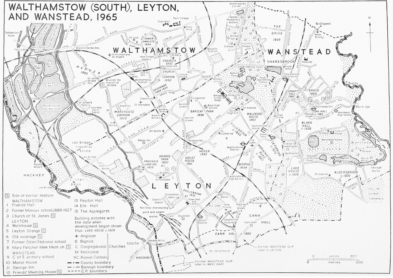
WALTHAMSTOW (SOUTH), LEYTON, AND WANSTEAD, 1965
A few surviving buildings in the parish date from the period immediately before its rapid mid-19th-century development, including St. John's church, Leytonstone (1833). A typical smaller residence, standing in its own garden, is Gainsborough Lodge in Leytonstone High Road. There are also small houses and cottages in Church Road, Leyton, and near the north-east end of Lea Bridge Road (formerly Chestnut Walk). The main front of the massive West Ham Union workhouse (now Langthorne hospital), built in 1840, (fn. 124) has stone dressings and is surmounted by a balustraded parapet with twin classical urns. In Lea Bridge Road the London Master Bakers' benevolent institution stands round three sides of a court, the fourth side open to the street and bounded by railings with wrought iron gates. It was designed in an elaborate Italianate style by T. E. Knightley and built in stages between 1857 and 1866. (fn. 125) The two-storeyed ranges are of grey brick with stone dressings and contain 52 alms-houses, known as 'villas'. Architectural features include two square turrets at the angles between the ranges, small low-pitched gables, and rows of projecting porches.
Leyton and Leytonstone remained rural until the mid 19th century. (fn. 126) Then came the opening of railways to London with stations at Lea Bridge (1840), Low Leyton and Leytonstone (1856), followed by the provision of other forms of cheap and speedy transport. This coincided with the expansion of opportunities for employment in offices, in industry, and in public undertakings, particularly railways, in London and in neighbouring districts, such as West Ham. The effect was to transform two villages by the end of the 19th century into a suburban dormitory for clerks and workmen mostly employed outside the area. (fn. 127) In contrast, however, to the spread of building over most of the parish, the forest land in the extreme north-east remained largely untouched. Its survival was ensured by the Epping Forest Act of 1878 by which over 200 acres in Leyton were preserved for public use. (fn. 128) This area, with its established trees, ponds, glades, and open spaces, provided ample opportunities for outdoor recreation.
Development began in the district nearest to Lea Bridge station, and included Park Place in Church Road, and an estate laid out by the Freehold Land Society comprising Park, Grange, Shaftesbury, and Carlisle Roads, on which all plots were sold by 1853, and houses built and occupied by 1857. (fn. 129) In 1860 the Grange Park estate was sold to the British Land Co. (fn. 130) comprising roughly the rest of the district bounded by Park, Church, Vicarage, and Thornhill Roads. By 1867 Holloway Down was being laid out and the better-class district between Mornington Road and Leytonstone High Road. (fn. 131) Some of the early Holloway Down development, near the union workhouse and West Ham boundary, was of low standard, soon overcrowded, and insanitary; (fn. 132) the worst was demolished by the borough council in the 1960s. In the 1870s building was in progress on the Fillebrook (Wallwood farm) estate, bounded by Hainault, Fairlop, Colworth, and Fillebrook Roads, and on the Leyspring estate; also, farther south, on the Leyton Park and Phillebrook farm estates, north of the railway line, and in the Cann Hall district, which was almost entirely built over by 1895. The Cowley (Ruckholt manor) estate was sold off piecemeal from the late 1860s, including land in Grove Green Lane and 31 a. between Leyton railway station and Stratford sold in 1878–81. (fn. 133) Building accelerated on established schemes in the 1880s, and spread as the Great House estate, with 50 a. between Francis Road and Norlington Road, and the Leyton Manor estate (Palamos, Malta, and Waterloo Roads), came on the market. Development of the Wallwood Park estate, bounded by Colworth Road, Forest Glade, and the railway line, slow in the 1880s was completed in the next decade. In the 1890s most of the remaining estates were sold, including Dyers Hall, Lea Hall, (fn. 134) The Poplars, Moyer, and the Bourne nursery ground. In 1898 the Barclay Park sale made available another 100 a. Among the last developments, in the early 1900s, were the Forest Lodge (fn. 135) and Etloe House estates, the Warner estate west of Markhouse Road, and the site of the Great House itself (1905). In 1912 only 250 a. of undeveloped building land remained, mainly represented by the Barclay Park estate and Fraser's Lea Bridge nursery ground. These remained undeveloped until the 1920s. (fn. 136)
Beyond the fringe of all this speculative development a bungalow town of 69 shacks, with wells and earth closets, and a wooden mission church, sprang up in the 1880s at Lea Bridge Gardens, west of Lea Bridge station. (fn. 137) The occupants reared ducks and grew vegetables. These buildings were demolished in the 1930s and the site is now mainly industrial.
By 1903 little remained apart from the forest to recall 'leafy Leyton's' former character, though the district council tried to restore it by mobilizing the unemployed to plant thousands of trees in the new streets in 1909–11. (fn. 138) Only the council's recreation grounds, and the Drapers Ground, a disused brickfield laid out in 1894 as a playing field for their school by the Drapers Company, relieved the prevailing monotony of brick. (fn. 139)
Once speculative development had begun, Leyton ceased to attract wealthy residents in search of rural seclusion. As a result there are no Victorian or Edwardian mansions in the area. The new houses were mainly yellow-brick two-storey terraces and villas, ranged in rows, their bow-windows and doorways freely ornamented with mass-produced cement foliage and tracery. The elaboration of the Red Lion inn and shops, designed by W. D. Church in 1890, (fn. 140) exemplifies on a larger scale the ornate features popular with the terrace builders. Retail shops, which became increasingly necessary for the growing population, were almost entirely confined to the main thoroughfares, long stretches of which were built up as shopping streets in the later 19th century. The new frontages were of two or three storeys with shops on the ground floor and living accommodation for their owners above. Later, as demand grew, residential terraces were brought into use, shops being built over their small front gardens. Public buildings dating from this period include the first town hall (1882), of yellow brick, with a corner clock-tower, now a library, and the present town hall (1896), designed by J. Johnson. This vivid red-brick building, with Portland stone bands and dressings, was said to be in the 'English Renaissance' style. (fn. 141) Whipps Cross hospital, then the Union infirmary, was completed in 1903. The Carnegie Library in Lea Bridge Road (1906), and girls high school in Colworth Road (1911) were designed by W. Jacques. The most striking churches built at this time were All Saints, Capworth Street (1864), the Mary Fletcher Memorial Methodist church (1877), St. Andrew's, Forest Glade (1887), Gainsborough Bridge Primitive Methodist church (1902), and St. George's Presbyterian church (1893), Hainault Road.
During the First World War about 1,300 houses were damaged by bombing during airship raids in 1915–16. (fn. 142) Though there was little building between the two wars, notable new buildings included Leyton high school for boys in Essex Road (1929), Connaught Road school (1932), the High Road baths (1934), Emmanuel church (1934–5), and the Christian Science church (1937). During the Second World War hardly a house in Leyton escaped damage. (fn. 143) After 1945 municipal redevelopment began on vacant and cleared sites. (fn. 144) First schemes provided houses and bungalows of conventional design, such as those in the Borthwick Road and Ellingham Road area, or three- and four-storey blocks of flats such as Beaumont House (1947), Mills Court (1950), and Thornhill Gardens (1955). Villiers Close (1957) represented a new approach, grouping varied blocks in one development. The eleven-storey Slade Tower, completed in 1961 as part of the Leyton Grange development, was the first outcome of the council's new decision to build upward at higher population densities. The Slade Tower was followed by others, which now dominate the surrounding streets to a height of up to 17 storeys. The Beaumont Road development, under construction in 1965, comprised 444 dwellings in mixed blocks, including bungalows, grouped around the multi-storey All Saints Tower.
Public buildings completed after 1945 include the Harrow Green branch library, George Tomlinson primary school, and Ruckholt Manor school. The only modern church of note is the Welsh Presbyterian church in Leytonstone High Road.
In 1693 the parish was subsidizing a local stage coach. (fn. 145) In 1707 a stage coach service linked Leyton and Walthamstow. (fn. 146) By the late 18th century several coaches a day passed through the parish. (fn. 147) In 1839 five coaches ran daily to London from Leyton, and the Wanstead, Epping, Harlow, and Clare coaches stopped at Leytonstone. (fn. 148) The Northern and Eastern railway line from Stratford to Broxbourne opened in 1840 with a station at Lea Bridge, (fn. 149) and the Eastern Counties (later Great Eastern) branch line from Stratford to Loughton with stations at Leyton and Leytonstone in 1856. (fn. 150) The Midland railway's Tottenham and Forest Gate branch, crossing the parish from north-west to south-east, with stations in Leyton and Leytonstone was opened in 1894. (fn. 151) In 1947 the line from Stratford through Leytonstone to Woodford was electrified, as an extension of the Central London line. (fn. 152)
The North Metropolitan Tramways Co. in 1874 built tramcar construction works in Union Road, connected with the company's system at Stratford by a short length of horse tramway in Leytonstone High Road. (fn. 153) This was extended to the Green Man in 1878. The company used this route to experiment, in 1877 with the Merryweather steam tram, in 1881 with a car driven by the Beaumont compressed air engine, and in 1882 with an electric tram run on a battery. (fn. 154)
The Lea Bridge, Leyton and Walthamstow Tramways, incorporated in 1881, opened a single-line horse tram service along Lea Bridge Road in 1883. (fn. 155) Though the promoters failed in 1885, the undertaking was bought in 1888 by a new Lea Bridge, Leyton and Walthamstow Tramways Co., incorporated in 1889, and empowered to operate also down Leyton High Road to the railway station. By 1890 trams were operating from Lea Bridge to the Rising Sun in Woodford New Road, and from the Bakers Arms to the Great Eastern railway station. (fn. 156) Under powers obtained in 1898 and amplified in 1904 (fn. 157) the district council in 1905 took over the Lea Bridge company's undertaking, and in 1906 the portion in the district of the North Metropolitan company's, though not their tramcar works. The council's whole system was electrified in 1906–7. (fn. 158) In 1910 the council made joint arrangements with the L.C.C. and other authorities for through tram services, and from 1921 to 1933 their tramways were operated by the L.C.C. (fn. 159)
A horse bus service between Walthamstow and Stratford via Leyton High Road was introduced in 1889. (fn. 160) It was replaced in 1905 by a motor bus service, run from 1906 by the Great Eastern London Motor Omnibus Co. The company built a bus garage at Leyton Green in 1906, when a new service was started from the Bakers Arms to Oxford Circus via Lea Bridge Road. The London General Omnibus Co., which had also established motor bus routes between London and the Bakers Arms by 1908, took over the Great Eastern in 1911, and rebuilt and enlarged the Leyton Green depot in 1912. (fn. 161) In 1933 the buses and trams were taken over by the London Passenger Transport board. (fn. 162) Conversion of the tramways to trolley bus working was completed in 1939. (fn. 163) Since 1952 omnibuses have replaced trolley buses. (fn. 164)
In 1692 letters were collected and delivered at Low Leyton once daily by the London Penny Post's footpost. (fn. 165) By 1794 there was a receiving house with three daily deliveries, also a sorting office. (fn. 166) The Munn family, grocers in Leyton Street, were receivers continuously from before 1832 until about 1878. (fn. 167) In 1856 Leyton became a sub-office in the north eastern district, later merged with the eastern district. (fn. 168) The sub-office at Leyton Green in 1863 was known as the 'higher office'. (fn. 169) The sorting office at no. 713 High Road was established c. 1893; (fn. 170) in 1917 Leyton became the E.10 London delivery district. (fn. 171) As the number of sub-offices increased, to 11 by 1926, the Leyton Green office continued to be termed the 'higher office', (fn. 172) but there was no branch office until 1934 when the present one was built in Lea Bridge Road. (fn. 173) A telegraph service was available by 1870. (fn. 174) The National Telephone Co. extended their system to Leyton in 1892 (fn. 175) and had opened an exchange by 1906. (fn. 176) The district is now served by the Leytonstone exchange.
In Leytonstone letters were collected and delivered in 1692 once daily. (fn. 177) There was a receiving house by 1794. (fn. 178) In 1856 Leytonstone was assigned to the north eastern (later eastern) district. (fn. 179) There was still only one sub-office in 1870, but another had opened at Harrow Green by 1874. (fn. 180) About 1912 a branch office was opened at no. 801 High Road; this remained the urban district's only branch office until 1934. (fn. 181) Soon after 1964 it was replaced by an office at no. 783 High Road. (fn. 182) Since about 1939 there has also been a branch office in Cathall Road, Harrow Green. (fn. 183) A sorting office, established in Church Lane in 1883, (fn. 184) moved to its present site in Fillebrook Road about 1912. (fn. 185) In 1917 Leytonstone became the E.11 delivery area. (fn. 186) Telegraph facilities were available by 1870. (fn. 187) The National Telephone Co. opened the Leytonstone exchange in 1908; (fn. 188) it was taken over by the G.P.O. in 1912. (fn. 189)
Leyton has been the birthplace or home of many notable persons. Some are mentioned in the sections which follow; others are listed in another volume. (fn. 190) Lady Margaret Bryan, governess to the children of Henry VIII, died at Leyton. (fn. 191) Thomas Lodge, (d. 1625) a leading physician, lived there (fn. 192) and Sir Morrell Mackenzie (d. 1892), the throat specialist, was born at Leytonstone, where his father, Stephen, practised as a surgeon. (fn. 193) The poet and dramatist John Drinkwater (d. 1937) was born in Leytonstone. (fn. 194) Among the more unusual of Leyton's worthies was John Henry Pepper (d. 1900), the illusionist, exhibitor of 'Pepper's Ghost'. Thomas Bowdler (d. 1856), Shakespeare's expurgator, was curate at Leyton in 1803. William Cotton Oswell (grandson of Joseph Cotton), accompanied Livingstone in his search for the Great Lake, and was with him in 1851 when the Zambesi was sighted.
In the 19th century the Lea was popular for boating, fishing, and bathing; several rowing clubs existed by 1880. (fn. 195) The Eastern Mercury, founded in 1887, paid special attention to sport, including football, cricket, cycling, and lacrosse. (fn. 196) Organized football was introduced in 1859, when the Forest Association football club was formed, playing its first games in Leytonstone on the forest adjoining Wanstead orphanage asylum. Among amateur clubs Leyton football club dates from 1868 and Leytonstone F.C. from 1886. The professional club, Clapton Orient, founded in 1881, moved to Leyton to the Brisbane Road stadium in 1936–7, and became known as Leyton Orient. (fn. 197) The Essex county cricket club in 1886 bought a permanent ground in Leyton High Road, where they played until it was sold in 1933. It is still a sports ground. Leyton cricket club, in existence by 1895, was by 1906 one of the strongest in Essex and a nursery for the county team. (fn. 198) In 1906–7 there were 20 cricket and football clubs in Leyton and in 1931 15 cricket clubs, over 20 football clubs, and a number of tennis, netball, swimming, athletics, cycling, motoring, and gymnastics clubs. (fn. 199) Since 1905 the Hollow pond, deepened by the unemployed, has been used for sailing model yachts, boating, and skating. (fn. 200)
In 1806 a Women's Union society was meeting at the Red Lion. (fn. 201) By 1897 many societies existed, including masonic lodges, literary, camera, choral, orchestral, and phrenological societies. (fn. 202) They met in public houses, church halls, or schools, and, from 1896, in municipal halls, (fn. 203) of which there were six in 1965. (fn. 204) In 1955 there were over 50 societies in the district. (fn. 205) Three picture palaces were built in 1910–11. (fn. 206) One of Leytonstone's cinemas in 1917 was also a skating rink. (fn. 207) By 1932 there were eight cinemas; one of these, the Rex, in Leytonstone High Road, was converted to a bowling alley about 1962. (fn. 208) A Leyton Eisteddfod was organized by the public library committee from 1924 to 1939. (fn. 209) In 1947 Leyton took the lead among London boroughs pressing for more extensive permissive powers for local authorities in the entertainment field; these, as a result, became incorporated in the Local Government Act, 1948. (fn. 210)