A Topographical Dictionary of Scotland. Originally published by S Lewis, London, 1846.
This free content was digitised by double rekeying. All rights reserved.
Samuel Lewis, 'Kirkcolm - Kirkoswald', in A Topographical Dictionary of Scotland(London, 1846), British History Online https://www.british-history.ac.uk/topographical-dict/scotland/pp98-121 [accessed 2 May 2025].
Samuel Lewis, 'Kirkcolm - Kirkoswald', in A Topographical Dictionary of Scotland(London, 1846), British History Online, accessed May 2, 2025, https://www.british-history.ac.uk/topographical-dict/scotland/pp98-121.
Samuel Lewis. "Kirkcolm - Kirkoswald". A Topographical Dictionary of Scotland. (London, 1846), British History Online. Web. 2 May 2025. https://www.british-history.ac.uk/topographical-dict/scotland/pp98-121.
In this section
Kirkcolm
KIRKCOLM, a parish, in the county of Wigton, 6 miles (N. by W.) from Stranraer; containing 1793 inhabitants, of whom 391 are in the village. The word Kirkcolm is evidently corrupted by usage from Kirk-Columba, a name at first applied to the church, which was dedicated to St. Columba, and afterwards used as a proper name for the parish. The place is of great antiquity, the original church having been built at, or shortly after, the time when the saint flourished to whom it is dedicated. It is doubtful whether St. Columba was of Irish or Scottish origin; but he was in high repute in Scotland in the 6th century. He fixed his residence in the isle of Icolmkill, or "the chapel of Columba," and spent his whole life in endeavouring to convert the natives to Christianity, and in sending out missionaries into the western parts of Scotland for the same purpose. The remains of Corswall Castle, said by Sympson, who wrote in 1684, to be then a heap of ruins; an ancient church dedicated to St. Bride; and the chapel of the Virgin, called Kilmorie, also testify to the great antiquity of the parish.
Kirkcolm is about five and a half miles in length and four in breadth. It forms a small peninsula, being bounded on the north and west by the sea; on the east by the bay of Loch Ryan; and on the south by the parish of Leswalt. The surface, in its general appearance, is irregular, sloping gently towards the west. From Portmore bay northward, then westward round Corswall point, and southward along the Irish Channel, the scenery is varied by the bold rocky elevations of the coast. There is a considerable stream, turning the mill of Corswall; and near the middle of the parish is Loch Connel, about a mile in circumference. Springs of good fresh water are found in every direction. The soil in the interior is a productive loam; but near the coast which encompasses the larger extent of the parish it is poor, and so thin as scarcely in many parts to cover the rock. The number of acres under cultivation is between 10,000 and 11,000; there are upwards of 1200 acres waste and pasture, and between 100 and 200 planted. The crops of wheat, oats, and barley on lands covered fifty years back with whins and heath, show the great progress of the parish; but the climate is bleak and rainy, and not favourable to the highest improvement of the soil. The farm-houses, with few exceptions, are substantial and comfortable dwellings. The best black Galloway cattle without horns are numerous; but the cross of the Ayrshire cow with the black Galloway bull is generally preferred in the dairy-farms. The subsoil is gravelly and rocky; the rocks are of the greywacke transition class, and there are considerable quantities of red sandstone, as well as greywacke-slate, clay-slate, and pure clay. Quartz and granite are also sometimes found. The rateable annual value of the parish is £6267. Corswall House, standing in an elevated position on the margin of Loch Ryan, in the midst of spreading plantations, is seen from a distance as a pleasing object. The only village is Stewartown, where the young women, as in most other parts of the parish, are chiefly employed in embroidering muslin webs. Little traffic is carried on; but the basin called the Wig, on the coast of Loch Ryan, is a convenient and safe retreat for vessels, two or three of which, under forty tons' burthen, belong to Kirkcolm. Corswall lighthouse, finished in 1816, and situated on a rocky projection on the western side of the parish, is a noble and commanding structure; it is built of whinstone, and has a revolving light on the top of the tower, which is eighty-six feet high, and embraces a very extensive view, comprehending a large part of the Irish coast.
The ecclesiastical affairs are subject to the presbytery of Stranraer and synod of Galloway; patrons, James Carrick Moore, Esq., &c. The stipend of the minister is £216, with a good manse, and a glebe of ten acres, valued at £15 per annum. The church is a commodious and substantial edifice, accommodating 650 persons; it was built in 1824, and is in good repair. There is a parochial school, in which reading and writing, English grammar, arithmetic, and book-keeping, with mensuration, navigation, and Latin, are taught; the master has a house and garden, with a salary of £27, and about £ 18 in fees. Among the relics of antiquity are the ruins of Corswall Castle, distant a mile from the sea, in the northern part of the parish: a cannon seven feet long, a gold ring, some coins, and a silver plate with an inscription, were found here some years since. About a mile from this castle are the foundations of the ancient church dedicated to St. Bride; and on the southern part of the coast of Loch Ryan are the ruins of a wall belonging to the chapel of Kilmorie. A stone from this chapel was placed over the west door of the old church of Kirkcolm when it was repaired in 1719, and left in the churchyard when the church was taken down in 1821. It is a rude specimen of ancient sculpture, so much worn by time that the figures can scarcely be traced with any accuracy. One side appears to bear a shield, with an animal sculptured on it, and, on the top of the shield, a large cross; the other side is distinguished by a figure having the arms extended on a cross, with another figure beneath. The stone is of grey whinstone.
Kirkconnel
KIRKCONNEL, a parish, in the county of Dumfries, 4 miles (N. W. by W.) from Sanquhar; containing 1130 inhabitants, of whom 500 are in the village. St. Connel, to whom the church was dedicated, appears to have given the name to the parish. The church at one time belonged to the monks of Holywood, who received the tithes, establishing a vicarage for the due performance of divine service. At the Reformation the revenues were held by Lord Crichton, of Sanquhar, on the payment of £20 Scots yearly to the monks; but after that event, the patronage and tithes, with other property of the abbey, were vested in the crown, and granted by it to John Murray, of Lochmaben. In the reign of Charles II. the patronage was transferred to the Duke of Queensberry; and upon the death of the last Duke, William, it came, with the title, into the family of Scott, to whom nearly the whole of this parish, with very extensive property in the neighbouring districts, now belongs. The parish is about fifteen miles in length and eight in breadth, and contains upwards of 26,000 acres. It is bounded on the north and north-east by the parish of Crawfordjohn, in the county of Lanark; on the north-west and west by New Cumnock and Auchinleck, in the county of Ayr; and on the south-east and south-west by the parish of Sanquhar. The surface throughout is irregular and hilly. The ground gradually rises for some distance on each side of the river Nith, which intersects the parish from west to east, after which it forms a continued range of hills, of considerable elevation, distant from the river on each side about two or three miles, and affording good sheep pasture. Beyond these hills, to the north and south, the land consists of peat-moss covered with heath and grass, or cold and swampy land, intersected with narrow valleys and deep ravines.
The soil under cultivation in some parts is a light gravelly mould; in other places it is a loam or clay, and sometimes a mixture of moss and clay. Occasionally there is a deep rich earth, especially upon the holm lands at the banks of the river. About 6300 acres are arable; about 19,100 are hill pasture, 542 low pasture, and 178 under wood: grain and green crops of all kinds are raised, but barley and wheat are sown in but small quantitles, on account of the great distance from a regular market. The sheep, of which 11,000 or 12,000 are kept, are chiefly of the native black-faced breed, as being the most hardy, and the best suited to the bleak exposure of hill pasturage: about 7000 lambs are annually reared, 5000 of which are sent to market. The cows, which are principally kept for the dairy, are of the Ayrshire or Cunninghame breed. Improvements in every branch of agriculture have been extensively carried on, chiefly by the noble proprietor of the parish; and the rateable annual value of Kirkconnel now amounts to £5647. Limestone and ironstone are found in this district; but it is chiefly celebrated for its coal, which is of the best quality, and was extensively wrought until the mining operations were transferred to the neighbouring parish of Sanquhar, for more general convenience. There is an iron-plating forge upon a small scale, employing eight or ten men. A great public road runs through the upper district, upon which the Glasgow and Carlisle coach passes and repasses daily: the parish roads are in good repair, but bridges are much wanted on the great road. The village is principally inhabited by labourers. The ecclesiastical affairs are subject to the presbytery of Penpont and synod of Dumfries; patron, the Duke of Buccleuch and Queensberry. The stipend is £221, with a good manse and convenient offices, and a glebe valued at £18 per annum. The church, a plain structure bearing the date 1729, has been enlarged and repaired within the present century, and is in very good condition. There is a parochial school, in which English, writing, and arithmetic are taught; the master has the minimum salary, with a house, and about £34 fees. On the farm of Rigg are two mineral springs, useful in stomachic complaints, but owing to the want of accommodation they are not much frequented; the waters, however, are often sent to distant parts of the country.
Kirkcudbright
KIRKCUDBRIGHT, a royal burgh and a parish, in the stewartry of Kirkcudbright, of which it is the capital, 28 miles (S. W. by W.) from Dumfries, and 100 (S. W.) from Edinburgh; containing 3526 inhabitants, of whom 2692 are in the burgh. This place is supposed to have derived its name, originally Kirk-Cuthbert, from the dedication of its ancient church to the Northumbrian saint of that name; and a cemetery about a quarter of a mile to the east of the town still retains the appellation of St. Cuthbert's churchyard. Prior to the time of the Romans, this part of the country contained a chain of forts belonging to the Selgovae, of which Caerbantorigum, the principal border garrison of that people, and situated here, was taken by Agricola about the year 82. His successors retained possession of the district for nearly three centuries, and here formed the Roman station Benutium. During the minority of Malcolm IV., son of David I., Fergus, lord of Galloway, whose baronial castle was situated on an island in Loch Fergus, near the town, threw off his allegiance to the Scottish crown, and exercised a kind of sovereignty as an independent prince. Malcolm twice invaded Galloway, with a view to reduce him to obedience, without success; but, having greatly increased his army, he again attacked him in his dominions, and obtained a triumphant victory. Fergus resigned the lordship of Galloway in 1160, and, retiring into the abbey of Holyrood, upon which he had bestowed the churches and lands of Dunrod and Galtway, within the present parish of Kirkcudbright, died in the following year. He had married Elizabeth, daughter of Henry I. of England, and was ancestor of the families of Bruce and Baliol. Fergus was succeeded in the lordship by his two sons, Uchtred and Gilbert, between whom, according to the Celtic law, his dominions were equally divided. The former, who gave the church of Kirk-Cuthbert to the monks of Holyrood, resided in the castle of Loch Fergus; but in 1174 he was attacked there, and inhumanly murdered, by his brother Gilbert. The last of the male line of the ancient lords was Allan, who died in his castle of Kirkcudbright, and was interred in the abbey of Dundrennan, founded by Fergus, his great-grandfather.
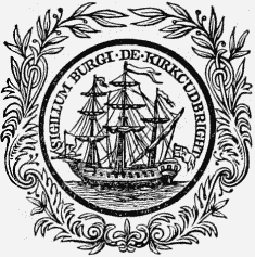
Burgh Seal.
During the competition for the crown of Scotland between Bruce and Baliol, the castle of Kirkeudbright was delivered, by mandate of Edward I. of England, who had been appointed umpire, to Baliol, to whom he awarded the crown. The next event of importance relates to Wallace, who, subsequently to his defeat at the battle of Falkirk, sailed from this town for France, accompanied by Mac Lellan of Bombie, and fifty of his adherents; and soon after, Edward, with his queen and court, remained for ten days in the castle of Kirkcudbright, whence he shipped large quantities of grain into England and Ireland, to be ground for the supply of his army. Some time afterwards, Edward Bruce, having subdued Galloway for his brother, received, in acknowledgment of his services, the lordship, together with the castle of Kirkcudbright and the whole of Baliol's forfeited possessions; the lordship passed subsequently by intermarriage to the family of Douglas. In the reign of James II., a sanguinary battle took place near the town, when the retainers of Sir John Herries, who, assisted by Mac Lellan of Bombie, had invaded the territories of Douglas to recover compensation for robberies committed by the dependents of that powerful chieftain, were totally defeated. Sir John was made prisoner, and executed; and the conquerors, having obtained admittance into the castle of Raeberry, the residence of the Bombie family, seized the chieftain, whom they carried off to Threave Castle, and beheaded. The king, about three years after this event, visited Kirkcudbright, while making preparations for the siege of Threave Castle, the last stronghold of the Douglases, in which siege he was assisted by the inhabitants; and for this service he conferred upon the town, which had been previously a burgh of regality, all the privileges of a royal burgh, by charter dated at Perth, the 26th October, 1455. After the battle of Towton in 1461, the town afforded an asylum to Henry VI. of England and his queen, who resided here till their departure for Edinburgh; and on the 16th April, 1462, the queen, with a convoy of four Scottish ships, sailed from this port to Bretagne, leaving Henry with a small retinue, who returned to England in 1463.
James IV., in one of his pilgrimages to the shrine of St. Ninian, at Whithorn, visited the town, in 1501. In 1507, it was nearly destroyed by the Earl of Derby, who, at the head of a large body of Manxmen, made a descent on the shores of Galloway. James again visited the town in 1508, and was hospitably received by the burgesses, to whom he granted the castle of Kirkcudbright, and the lands appertaining to it, which had reverted to the crown, on the forfeiture of the Douglases. In 1513, many of the inhabitants, under the command of Sir William Mac Lellan of Bombie, attended James to the battle of Flodden, and fell with their leader on the field. In 1523, the Duke of Albany, Regent of Scotland, landed here from Brest, and was joyfully received. During the minority of Mary, Queen of Scots, the town was summoned by the English forces who had gained possession of Dumfries to acknowledge the authority of Edward VI. This summons, however, the inhabitants refused to obey; and having barred their gates, and secured their dykes, Mac Lellan of Bombie, at the head of a party of his retainers, attacked the assailants, who, having made some unavailing efforts, retired to Dumfries. After the battle of Langside, Mary, accompanied by Lord Herries and his followers, retreated into Galloway, and remained for three days in the district, previously to proceeding to England. James VI. visited the place while in pursuit of Lord Maxwell, who had arrived here from Spain to arm his followers in aid of the Spanish descent; and the king presented to the corporation a miniature silver musket, to be given as a prize to the most successful competitor in shooting at the target, in order to induce improvement in the use of fire-arms. Charles I., on his visit to Scotland, conferred upon Sir Robert Mac Lellan of Bombie the title of Lord Kirkcudbright, and granted to the burgh a new charter, vesting the government in a provost, two bailies, a treasurer, and thirteen councillors, which charter is still partially in force.
The town, which anciently consisted only of one irregular street leading down to the harbour, and was encompassed by a wall and fosse, of which there are still some vestiges remaining, has been greatly extended and improved, and, being surrounded by a tract of richly-wooded country, has a pleasing appearance. It now consists of several well-formed streets, intersecting each other at right angles; the principal are, High-street, Castle-street, and St. Cuthbert's and Union streets, the two former leading to the river Dee, which bounds the town on the west. The houses, most of which are modern, are neatly built; and among them are many handsome residences of opulent families, contributing greatly to the appearance of the town. The streets are lighted with gas, from works established by a company in 1838; and the inhabitants are amply supplied with excellent water from springs about half a mile distant, conveyed by pipes laid down in 1763. A public library, founded in 1777, is still supported by subscription, though containing a very small collection of volumes; and two circulating libraries are remaining, but nearly superseded by the publication of cheap periodicals. A public reading and news room, also, is supplied with Scottish and English newspapers. Although formerly celebrated for its extensive manufactures of gloves, boots and shoes, soap, candles, and leather, the town has at present very little trade; and the only manufactures now carried on are, that of hosiery, and the weaving of cotton, upon a limited scale: there is now no brewery. As a sea-port, however, the town derives a moderate traffic from the importation of coal and other commodities for the supply of the neighbouring district.
There are two harbours, both commodious and safe. The one at the town, formed by the river Dee, which is here about 500 feet wide, has a depth of thirty feet at spring, and of from twenty to twenty-five feet at neap, tides; and below it is a ford across the river, which at some particular times has only a depth of a foot and a half of water. Vessels frequently deliver their cargoes on the beach, and take in their lading in a dock which is partly of wood and partly of stone. The other harbour is at Torr's or Manxman's lake, about two and a half miles from the mouth of the river, where almost any number of vessels may ride in safety: in front of the entrance, however, there is a bar, over which ordinary vessels cannot pass till half-flood, when there is a depth of ten or twelve feet water on it. A lighthouse on the island of Little Ross, of which the lantern, about fifty feet above the level of the sea at high water, exhibits a revolving light visible at a great distance, forms a guide to the entrance; and by keeping this and two towers in a right line, strange vessels may safely enter the haven. The number of vessels registered as belonging to the port is twenty-six, of the aggregate burthen of 922 tons; and according to the custom-house returns, fifty-four vessels, of 2069 tons in the aggregate, entered the harbour, and the creeks of Kirkcudbright, in a recent year. The chief imports are, coal and lime from Cumberland, and groceries, haber-dashery, iron, lead, slates and freestone, bone-dust, guano, and various wares, from Liverpool and other ports; there is no foreign trade, and seldom more than one cargo of wood is annually imported. The exports are, corn, meal, potatoes, turnips, beans, black-cattle, sheep, wool, salmon, and grass-seeds; the amount of wool shipped in 1842 was 7840 stone, and in the same year were exported 721 head of black-cattle and 12,000 sheep. A little above the harbour is a ferry across the river, for horses and carriages, for which a convenient flat-bottomed boat has been constructed.
The Dee abounds with excellent salmon, for which there are three fisheries. One of these, belonging to Alexander Murray, Esq., produced some short time since a rental of £700 per annum; another, the property of the Earl of Selkirk, £150; and the third, belonging to the burgh, a rental of £80. Considerable quantities, also, of cod and other fish are taken off the coasts. A market is held weekly, on Friday, but is not much frequented; and a market for provisions every Tuesday. Fairs, chiefly for hiring servants, are held on the last Friday in March and September; and for general business on the 12th of August, if on Friday, otherwise on the Friday following. There are branches of the Bank of Scotland and the Western Bank established in the town; also a branch of the National-Security Savings' Banks. The post-office has two deliveries daily; and facility of communication is afforded by roads kept in excellent order, and by two bridges over the Dee between Kirkcudbright and Tongland, the one, which is still in good repair, erected about the year 1730, at an expense of £400, and the other, of one arch of 110 feet in span, erected in 1808, at an expense of £7350. Two steamers sail weekly to Liverpool in summer, and every fortnight during the winter, and are of great benefit.
The burgh, under its charter, is governed by a provost, two bailies, a treasurer, and a council of thirteen members, chosen under the provisions of the Municipal Reform act; and the municipal and parliamentary boundaries, which are nearly identical, comprise the whole of the royalty. There are six incorporated trades, the squaremen, tailors, clothiers, hammermen and glovers, shoemakers, and weavers; the fees of admission as members vary from £1 to £1. 10. for sons and apprentices of freemen, and from £3 to £6 for strangers. The revenues of the corporation, arising from lands, the fishery, ferry, and harbour dues, average about £1000 per annum. The magistrates exercise civil and criminal jurisdiction; but, as the seat of the sheriff's court is within the burgh, very few cases of the former are brought under their consideration, and the latter kind of jurisdiction is chiefly confined to petty cases of misdemeanor. The burgh is associated with those of Dumfries, Annan, Lochmaben, and Sanquhar, in returning a member to the imperial parliament; the right of election is vested in the £10 householders, of whom there are 150, and there are about 205 whose rents are above £5 and under £10. The county-hall and gaol, erected in 1816, at an expense of £5000, form a handsome range of building in the castellated style, with a lofty tower; the hall and court-room are elegantly decorated, and the gaol is under excellent regulation. On the opposite side of the High-street are the old gaol and courthouse, a curious building, near which is the ancient market-cross, with a pair of jougs for the punishment of delinquents, and the date 1054.
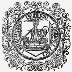
Ancient Seal.
The parish includes the ancient parishes of Galtway and Dunrod, which, on the dilapidation of their churches, were annexed to it in 1683. It is bounded on the south by the Solway Frith, and is about eight miles in length, and three and a half in breadth, comprising an area of 15,000 acres, of which 3000 are arable, 500 meadow and pasture, 500 woodland and plantations, and the remainder hilly moor, affording tolerable pasturage for sheep and cattle. The surface is diversified; on the shores of the Dee it is tolerably level, but in some other parts rises by continued undulations to a height of 400 feet above the level of the sea. The river, after uniting with the streams of the Deugh and the Ken, forms a boundary of the parish, and joins the Frith at Kirkcudbright bay; it flows through a romantic tract of country, between banks of rugged and precipitous rocks clothed with wood, and makes some picturesque cascades. It is navigable for ships of any burthen to Kirkcudbright, and to the lower bridge of Tongland for vessels of 200 tons. There are several burns in the parish, in which are found abundance of yellow trout, and, towards the end of autumn, sea-trout and herling; and near the farms of Culdoch and Jordieland is a lake abounding with trout equal to those of Loch Leven.
The soil is principally a clay loam, alternated with moss; in some parts of a dry and gravelly quality, and in others of unrivalled fertility. The crops are, oats, barley, wheat, potatoes, and turnips; the system of agriculture is improved; the lands have been well drained and inclosed, and the farm-buildings generally are substantially built. The cattle are mostly of the Galloway breed, and are reared in considerable numbers, as are also the sheep, which are mainly the Leicestershire breed. The substrata of the parish are chiefly greywacke, porphyry, and trap; and near the shore are found boulders of granite and greenstone. There is but little indigenous wood. The plantations are usually oak, ash, elm, beech, plane, Spanish chestnut, larch, spruce, and Scotch and silver fir; they are well managed, and in a thriving state, and on some of the lands are various other varieties, including walnut, birch, alder, maple, laburnum, poplar, and willow. The rateable annual value of the parish is £11,541. St. Mary's Isle, the seat of the Earl of Selkirk, is beautifully situated a mile to the south of the town, on what was formerly an island, but is now a peninsula projecting into the bay of Kirkcudbright; it was the site of a priory founded by Fergus, lord of Galloway, for Augustine monks, and dedicated to St. Mary. There are still remaining some portions of the ancient priory, incorporated in the present noble mansion, which is embosomed in a demesne enriched with stately timber, and commanding some highly-interesting and diversified prospects. The houses of Balmae, Janefield, St. Cuthbert's Cottage, and Fludha, are handsome residences finely situated.
The ecclesiastical affairs are under the superintendence of the presbytery of Kirkcudbright and synod of Galloway. The minister's stipend is £281. 10., with an allowance of £50 in lieu of manse, and a glebe valued at £18 per annum; patron, the Crown. The church, which is one of the most elegant ecclesiastical structures in the country, was erected in 1838, at an expense of £7000, towards which the Earl of Selkirk contributed more than £4000; the interior is well arranged, and contains 1500 sittings. There are places of worship for members of the Free Church, and the United Secession. The Kirkcudbright academy is under a rector and two other masters, all appointed by the corporation, who pay to the rector a salary of £60, and to each of the others £50, in addition to the fees. The course of instruction includes the classics, mathematics, and the whole routine of a commercial education; the number of scholars is 200 on the average. The buildings, which were erected in 1815, on a site given by the Earl of Selkirk, were completed at an expense of £1129, and contain three large class-rooms, a library, and other apartments: in front is a piazza, for the use of the pupils in unfavourable weather. Two parochial schools are maintained, of which the masters have a salary of £25. 13. each, with a house and garden. There are also a school for females, of which the mistress receives £20 per annum from the funds of the burgh; and a school, of which the master has £10 per annum paid jointly by the burgh and by the Countess of Selkirk; with various other schools partly endowed; and a Sabbath school under the superintendence of the minister, in which are about 300 children. Some vestiges remain of the ancient churches of Galtway and Dunrod, of which the cemeteries are still used as places of sepulture. Loch Fergus has been drained, and nothing is now left of the original castle of the lords of Galloway; but there are some remains of that of Kirkcudbright, also a fortress of the lords. The castle at Bombie, from which the Mac Lellans took their title, is now a heap of ruins; they had a second castle at Raeberry, situated on a precipitous rock overhanging the Solway Frith, but the site and fosse alone remain. There are numerous vestiges of British forts; a Roman vase was lately discovered at Castledykes; and near Drummore Castle was found, about the commencement of the last century, a plate of pure gold, valued at £20.
Kirkcudbright
KIRKCUDBRIGHT, Stewartry of, a district, in the south of Scotland, bounded on the north and north-east by the county of Dumfries; on the north and north-west by the county of Ayr; on the south and south-east by the Solway Frith; and on the south-west by the county and bay of Wigton. It lies between 54° 43' and 55° 19' (N. Lat.) and 3° 33' and 4° 34' (W. Long.), and is forty-eight miles in length, from east to west, and thirty miles in extreme breadth; comprising an area of about 882 square miles, or 564,480 acres; 8485 houses, of which 8162 are inhabited; and containing a population of 41,119, of whom 18,856 are males, and 22,263 females. This district, which, from its ancient teuure, is called a stewartry, though to all purposes a county, occupies the eastern portion of the ancient province of Galloway; and prior to the Roman invasion of Britain, was principally inhabited by the British tribe of the Novantes. The Romans, on their invasion of the island, erected several stations in the district of Galloway, and constructed various roads; but, though they maintained something like a settlement in this part of the country, which they included in their province of Valentia, they were not able completely to reduce the original inhabitants under their dominion. After the departure of the Romans from Britain, the county, owing to its proximity to the Isle of Man and the Irish coast, became the resort of numerous settlers from those parts, who, intermingling with the natives, formed a distinct people, subject to the government of a chieftain that exercised a kind of subordinate sovereignty under the kings of Northumbria, or kings of Scotland, to whom they paid a nominal allegiance. Upon the death of Allan, Lord of Galloway, in the thirteenth century, the country, distracted by the continual struggles of the various competitors for its government, fell under the power of Alexander II., King of Scotland; and on the subsequent marriage of Devorgilla, one of Allan's daughters, with the ancestor of Baliol, King of Scotland, it became the patrimonial property of that family. During the contest between Baliol and Bruce for the crown, the province was the frequent scene of hostilities; and from the attachment of the inhabitants to the cause of Baliol, it suffered severely. Ultimately it became the property of the Douglas family, on whose attainder it escheated to the crown, and was divided by James II. among several proprietors.
The stewartry of Kirkcudbright was for some time included in the county of Dumfries, and was under the jurisdiction of the same sheriff; but every vestige of that connexion was lost prior to the time of Charles I., since which period it has, to all intents, formed a distinct and independent county, though still retaining its ancient appellation. Previously to the Reformation, the district was part of the diocese of Galloway; it is now mostly included in the synod of Galloway, and comprises the presbytery of Kirkcudbright and parts of others, and twenty-eight parishes. For civil purposes, it is under the jurisdiction of a sheriff, or stewart, by whom a stewart-substitute is appointed. The courts of quarter-session are held at Kirkcudbright in March, May, August, and October; there are courts at the same place for the recovery of small debts, on the second Tuesday in every month. Small-debt courts are held also at New Galloway, Maxwelltown, Castle-Douglas, and Creetown; and there are different courts of other descriptions. Kirkcudbright, which is the chief town, and New Galloway, are royal burghs in the stewartry; and in addition to the towns above-enumerated, are the town of Gatehouse of Fleet and some inconsiderable hamlets. By the Act of the 2d and 3d of William IV., the stewartry returns one member to the imperial parliament; the number of qualified voters is 1336.
Of the lands, about one-third are arable, and the remainder principally mountain pasture, moorland, and waste. The surface is strikingly varied, and towards the coast is diversified with numerous hills of moderate height, generally of bleak and rugged aspect, and interspersed with masses of projecting rock. In other parts are mountains of lofty elevation, of which the principal are, the Criffel, rising 1900 feet above the level of the sea, and the Cairnsmore and Cairnbarrow, nearly of equal height. The mountainous district is intersected with valleys of great fertility, and in a high state of cultivation. Many of the hills are easy of ascent, and afford rich pasturage for cattle and sheep; and some, which are of more moderate elevation, are cultivated to their summit. The rivers are, the Dee, the Ken, the Cree, and the Urr. The Dee has its source in the western part of the stewartry, on the confines of Ayrshire, and, flowing south-eastward, pursues an irregular course for about forty miles; it forms in its progress some picturesque cascades, becomes navigable at Tongland for vessels of 200 tons' burthen, and falls into the bay at Kirkcudbright. The Ken rises in the north-west part of the stewartry, and, after a south-easterly course of several miles, expands into the loch to which it gives name, and shortly forms a confluence with the Dee. The river Cree has its source on the confines of Ayrshire, and, flowing south-easterly, forms a boundary between the stewartry and the county of Wigton; it runs past Newton-Stewart, on the east, and falls into the creek at the head of Wigton bay. This river abounds with smelts; and, for several miles in the latter part of its course through a district abounding with romantic scenery, is navigable for small vessels. The Urr has its source in the lake of that name, on the northern boundary of the stewartry, and, after a course of nearly thirty miles through a pleasant and richly-wooded strath, falls into the Solway Frith nearly opposite to the island of Hestan. There are various lessimportant streams, of which some are navigable for small craft; the chief are the Fleet, the Tarf, the Deugh, and the Cluden. Numerous lakes, also, adorn the county, but few of sufficient extent to require particular notice; the principal is Loch Ken, nearly five miles in length, and about half a mile in breadth.
The whole of the district appears to have been at a very early period in a forward state of cultivation; and during the war of the Scots with Edward I. of England, it furnished the chief supplies of grain for the subsistence of the English army after the conquest of Galloway. In the subsequent periods of intestine strife, however, it fell into a state of neglect, in which it remained till the commencement of the eighteenth century, since which time it has been gradually improving. The soil is generally a brown loam of small depth, alternated with sand, and resting usually on a bed of gravel or rock. In some parts a clayey loam is prevalent; in others are large quantities of flow-moss of considerable depth, which are supposed to be convertible into a rich soil, a very wide tract of such land having been rendered productive within the last thirty years. The crops are, oats, barley, potatoes, turnips, and the different green crops; the farms on the arable lands vary from 150 to 500 acres in extent, and those on the moors from 4000 to 5000 acres. The rotation plan of husbandry is adopted; the lands have been drained, and inclosed principally with stone fences, called Galloway dykes. Some of the farm-buildings, however, are of rather inferior order, and only roofed with thatch. The cattle, of which more than 50,000 head are annually pastured, are of the Galloway breed; and great attention is paid to their improvement. The sheep, of which upwards of 180,000 are fed on the moorland farms, are of the Highland black-faced breed, with some of the Lowland breeds, of small stature, white-faced, and bearing very fine fleeces; these are supposed to be of Spanish origin. Great numbers of swine are also reared, and form a valuable stock; the horses, of which more than 6000 are bred, though not pure Galloways, are much esteemed. Numbers of horses, cattle, and sheep are shipped off for various markets.
There are no remains of the ancient forests with which the district formerly abounded, except a few trees on the banks of some of the streams; but considerable plantations have been formed on the lands of the various proprietors, and in other parts, which have added greatly to the appearance of the country. The minerals, on account of the scarcity of coal, have not been rendered available to any profitable extent; copper is wrought near Gatehouse of Fleet by an English company, and lead-mines were formerly in operation in the parish of Minnigaff. Iron-ore is found in abundance, but, from the want of coal, is of little value; the limestone and coal used here are all brought from Cumberland. Indications of coal, and also of limestone, have been perceived on the lands of Arbigland, in the parish of Kirkbean; but no mines have as yet been opened. The manufacture of linen, cotton, and woollen goods is carried on to a considerable extent in the towns and villages; but the principal trade of the district, which is almost entirely pastoral or agricultural, is the large export of cattle, sheep, and grain, for which the facility of steam navigation affords ample opportunity. The salmon-fisheries at the mouths of the various rivers are highly productive, and the Solway Frith abounds with fish of every kind; but little benefit is derived from this source, and comparatively few fishermen's cottages are to be found upon the shores. The coast is generally precipitous, with intervals of low shelving sands; and the navigation is for the most part dangerous, though some of the bays afford safe anchorage. The harbour of Kirkcudbright is easy of access, and affords secure shelter from all winds; it has a considerable depth at high water. About two miles from the small island of Little Ross, at the mouth of Kirkcudbright harbour, and on which a lighthouse has been erected, is a fine bay called Manxman's lake, in which 100 vessels of large burthen can ride in safety. Communication with Liverpool is maintained by steamers, which sail regularly from the port. The rateable annual value of the real property in the county is £193,801, of which £182,926 are for lands, £9444 for houses, £1204 for fisheries, and £227 for quarries.
Kirkden
KIRKDEN, a parish, in the county of Forfar, 5 miles (E. by S.) from Forfar; containing, with the village of Friockheim, 1483 inhabitants. This place, which was anciently called Idvie, from the situation of the glebe lands in that barony, derives its present name from the position of its church in a deep and narrow valley. It appears to have been the scene of a sanguinary conflict with the Danes in the reign of Malcolm II.; and near the spot are the remains of an obelisk erected by that monarch in commemoration of their defeat, not far from which, in a tumulus raised over the slain, have been found several urns containing ashes. In the adjoining plain, also, numerous stone coffins ranged side by side, and each containing an entire skeleton, were discovered towards the close of the last century. The parish is about seven miles in length, from east to west, and of very irregular form, varying from less than a quarter of a mile to two miles in breadth, and comprising an area of 4514 acres, of which 3000 are arable, 1300 woodland and plantations, and the remainder meadow, pasture, and waste. The surface is boldly undulated, and towards the south rises to a considerable acclivity, forming part of the termination of the Sidlaw hills, and commanding an extensive and richly varied prospect over the surrounding country, with the vale of Strathmore and the passes of the Grampian hills. The small river Vinny flows for three or four miles along the northern border of the parish, and, uniting with the Lunan, afterwards intersects the parish, and frequently, in rainy weather, inundates the lower lands; both these streams abound with excellent trout, and in the latter pike are also sometimes found, and occasionally a few salmon.
The soil is mostly a friable clay, but has been greatly improved by a mixture of marl found in the lakes in the vicinity, and by good cultivation has been rendered generally fertile. The crops are, grain of all kinds, with potatoes and turnips; and considerable attention is paid to the management of the dairy-farms, and to the improvement of live stock: the breed of cattle is principally of the polled or Angus kind. The lands are inclosed chiefly with stone fences. Within the last few years, a very large portion of ground has been reclaimed from absolute sterility, and brought into profitable cultivation, by draining; the farm-buildings are in good condition, and on most of the farms threshing-mills have been erected. The woods consist of oak, ash, elm, plane, and beech; and the plantations, which are comparatively of modern growth, of larch, and spruce and silver firs. The substratum is partly sandstone, of durable texture and of a greyish colour; and in the southern part, trap-rock, which is a continuation of the Sidlaw hills, is prevalent. Freestone of good quality is also found; and there are two excellent quarries, which, when in operation, employ a considerable number of men. The rateable annual value of the parish is £4012. Gardyne Castle is a spacious baronial structure of venerable aspect, beautifully situated on the steep acclivity of a deep and picturesque dell watered by a streamlet; the demesne attached to it is richly planted, and laid out with great taste. Middleton is a handsome modern mansion, seated in a wooded plain, near the banks of the Vinny; Pitmuies is also a modern mansion, similarly situated in grounds tastefully embellished.
There are two villages; the one, Cot-town of Gardyne, consisting of a few scattered cottages inhabited by about eighty persons; and the other called Friockheim, which has arisen in consequence of the increase of the linen manufacture, and contains 805 inhabitants. The people of both are chiefly employed in the weaving of Osnaburghs by hand-looms, and in mills for spinning flax, of which there are three within the parish. Facility of intercourse with the neighbouring districts is afforded by numerous roads, of which the Arbroath and Forfar road passes for nearly three miles through the parish; and the Arbroath and Forfar railway intersects the eastern portion of it. The ecclesiastical affairs are under the superintendence of the presbytery of Arbroath and synod of Angus and Mearns. The minister's stipend is £157. 18., of which nearly one half is paid from the exchequer, with a manse, and a glebe valued at £13 per annum; patron, the Crown. The parish church, erected in 1825, on the site of the former, is a neat and commodious structure containing 525 sittings; and a church has been built in the village of Friockheim. The members of the Free Church have also a place of worship. The parochial school is well attended; the master has a salary of £25. 13. 10., with a house and garden, and the fees average about £12 per annum. A school at Friockheim is supported by subscription. A parochial library was established in 1827, by James Douglas, Esq., who presented a collection of seventy-two volumes, chiefly on religious subjects; and the number has been greatly augmented by James Mudie, Esq. The poor till lately received the proceeds of a fund of £260, and of bequests by Miss Gardyne and her sister of £14 and £20 respectively. There is a weak chalybeate spring at the extremity of the parish, in considerable repute. On the lands of Idvie and on the estate of Gardyne are conical mounds called respectively Bractullo and Gallows Hill, supposed to have been anciently places for the trial and execution of criminals; they are both planted with trees. Upon the farm of Bractullo were recently found some stone coffins containing human bones, with strings of beads apparently of charred wood.
Kirkfield
KIRKFIELD, lately an ecclesiastical district, in the parish of Gorbals, within the jurisdiction of Glasgow, county of Lanark; containing 2835 inhabitants. This place, which is situated on the south bank of the river Clyde, is inhabited principally by persons employed in the several factories connected with the city of Glasgow. The parish, which was of moderate extent, was separated for quoad sacra purposes, by act of the General Assembly in 1834: the ecclesiastical affairs are under the presbytery of Glasgow and synod of Glasgow and Ayr. The minister's stipend is £150, without either glebe or manse, and is paid from the seat rents by the proprietors of the church, who are patrons. The church, originally the parish church of Gorbals, and subsequently a chapel of ease, was purchased by the proprietors in 1813, at a cost of £1200, and contains 1023 sittings. There are places of worship for members of the Free Church, and of the United Secession.
Kirkfield-Bank
KIRKFIELD-BANK, a village, in the parish of Lesmahago, Upper Ward of the county of Lanark, 1 mile (W. by S.) from Lanark, containing 1023 inhabitants. This place is situated in the eastern extremity of the parish, and on the west side of the river Clyde, which flows at a short distance from it, and is crossed by a bridge of three arches. The population is chiefly employed in hand-loom weaving for the manufacturers of the district; and in the neighbourhood is a distillery. There is a regular communication with Glasgow by means of coaches and carriers. In the village is a school, to the master of which the heritors make a small annual allowance.
Kirkgunzeon
KIRKGUNZEON, a parish, in the stewartry of Kirkcudbright, 9 miles (S. W.) from Dumfries; containing, with the village of Gateside, 638 inhabitants, of whom 40 are in the village of Kirkgunzeon. This place is supposed to have derived its name, anciently Kirkwynon, from the dedication of its church to St. Wynnin; and this opinion is corroborated by the name of a spring near it, which still retains the appellation of St. Wynnin's well. In the reign of David Bruce, the church and lands belonged to the abbey of Holm-Cultram, in Cumberland; but in 1369, the abbot, having sided with the English against that monarch, was dispossessed of his property in Scotland. The abbey lands were then conferred by the king upon Sir John Herries, of Terregles, from whose family they passed to the Maxwells, of Nithsdale, whose descendant, Marmaduke Constable Maxwell, of Terregles, Esq., is now the principal proprietor in Kirkgunzeon. The parish is about five miles in length, and nearly three in average breadth, comprising an area of 7600 acres, of which 5000 are arable, meadow, and pasture, 400 woodland and plantations, and the remainder moor and waste. The surface is irregularly broken into hills of moderate elevation, abounding with grouse and black game. The lower grounds are intersected by a nameless river, which has its source in two lakes in the parish of Newabbey, and, flowing through the centre of this parish, after a course of nine miles, falls into the Urr, about a mile below the village of Dalbeattie. The river abounds with trout, and, in the deeper parts, with perch and pike; and during the spawning season some very large trout, of excellent quality, and weighing from four to six pounds, are taken at the outlets of the lakes in which the stream has its source. Partridges and hares are found in abundance, and occasionally pheasants, but in much smaller numbers.
The ground along the banks of the river is level, and in various other places also flat, and well adapted for the plough; the soil on these lands is rich and fertile, but of lighter quality on the upland districts. The crops are, barley, oats, and a small quantity of wheat, with potatoes and turnips. The system of agriculture is improved; the farm-houses are substantial and well built, chiefly of granite, and roofed with slate; the lands are well inclosed, and the fences kept in good repair; and all the more recent improvements in husbandry are generally practised. The cattle, of which considerable numbers are pastured on the hills, are mostly of the Galloway breed; and Highland bullocks are bought in at Falkirk, at the end of harvest, and during the winter fattened for the markets. Comparatively few sheep are reared; and on two farms only are shepherds kept to tend the flocks. The plantations, which, within the last few years, have been greatly extended, are in a thriving state. Granite, of which the rocks are principally composed, is the only stone found. The rateable annual value of the parish is £4084. The village is very inconsiderable, consisting only of a few houses around the church. There is a post-office at Dalbeattie, about four miles from the village, which has a daily delivery; and facility of communication is afforded by the turnpike-road from Dumfries to Kirkcudbright, which passes through the parish. The ecclesiastical affairs are under the superintendence of the presbytery and synod of Dumfries. The minister's stipend is £158. 6. 6., of which nearly one half is paid from the exchequer, with a manse, and a glebe valued at £30 per annum; patron, Mr. Maxwell, of Terregles. The church, situated in the centre of the parish, was erected in 1790, and is a plain neat structure containing 224 sittings. The parochial school is well attended; the master has a salary of £34, with a house and garden, and the fees average £15 per annum. There is also a small school at the lower end of the parish, for which a building was erected by the farmers, at their own expense; and in addition to the fees, £4 are allowed out of the parochial salary, to the master, who lives by turns with the parents of his pupils. There are still the remains of two ancient houses, formerly seats of the Herrries family, and both of which appear to have been places of strength; parts are left also of the tower of Drumcoltran. On the farm of Glaisters was a large cairn, of which the stones have been removed for building dykes, and in which were found many urns containing human ashes that crumbled into dust on exposure to the air. A beautiful gold coin of James V., in good preservation, was found some years since on the lands of Lochend; and within the last few years was discovered in the glebe, a silver medal, supposed to have been struck on the dispersion of the Spanish Armada.
Kirkhill
KIRKHILL, a village, in the parish of Penicuick, county of Edinburgh, ½ a mile (N. E. by E.) from Penicuick; containing 315 inhabitants. It is situated on the west bank of the North Esk river, on which are considerable mills for the manufacture of paper. The population is chiefly engaged in these mills, and in weaving.
Kirkhill
KIRKHILL, a parish, in the Mainland district of the county of Inverness, 6 miles (W.) from Inverness; containing 1829 inhabitants. This place, which consists of the two united parishes of Wardlaw and Farnua, derives its name from the situation of its church on a hill; its Gaelic name refers to the dedication of its church to the Virgin Mary. The parish, which is bounded on the north by the Beauly loch and the Frith of Moray, and on the north-west by the river Beauly, is about eight miles in length, varying from one mile to three miles in breadth. The surface is diversified with hills, of which those in the south-eastern portion of the parish rise to a considerable elevation, and are mostly covered with heath, affording scanty pasture for sheep and cattle. The river, which skirts the parish for nearly three miles, is navigable for vessels of sixty tons to the village of Beauly, in the parish of Kilmorack, and abounds with salmon, and trout of various kinds. Herrings are taken in moderate quantities during the season in the Beauly loch; and on the shore, at Fopachy and Wester Lovat, are landing places where vessels deliver cargoes of lime and coal for the supply of the parish.
The soil in the valleys, and along the Frith, is a strong clay, and on the rising grounds a rich loam. The crops are, wheat, barley, and oats, with potatoes and turnips; the system of husbandry is improved, and the lands are generally in a state of profitable cultivation. Considerable portions of moor have been rendered fertile by draining; the farms are partly inclosed, and the buildings are mostly substantial and commodious. There are some natural woods, chiefly of alder and birch, of which the former is predominant; and extensive plantations have been formed, consisting of firs and the various kinds of forest and ornamental trees, all in a thriving state. The rateable annual value of the parish is £6807. The mansions are, Moniack, Newton, Lentran, Auchnagairn, Fingask, Reelick, and Bunchrew, the birthplace of President Forbes. The village, or Kirktown, is pleasantly situated on the bank of the Beauly river; and facility of communication is afforded by the road to Inverness, which passes through the whole length of the parish. The ecclesiastical affairs are under the superintendence of the presbytery of Inverness and synod of Moray. The minister's stipend is £247, with a manse, and a glebe valued at £20 per annum.; patron, Hercules Scott, Esq. The church, originally erected in 1220, on Wardlaw or St. Mary's Hill, was taken down, and rebuilt near the former site, in 1791, and is in good repair. The members of the Free Church have a place of worship. The parochial school is well attended; the master has a salary of £30, with a house and garden, and the fees average from £15 to £20 per annum. There is also a school supported by the Society for Propagating Christian Knowledge. On the summit of Wardlaw Hill, and on the site of the old church, is a chapel, the burial place of the Fraser family, and which contains elegant monuments to Thomas and Simon Fraser, Lords Lovat.
Kirkhill
KIRKHILL, a village, in the parish of Cambuslang, Middle ward of the county of Lanark; containing 216 inhabitants. This is one of thirteen villages in the parish, and is among the largest. It has about forty-three families, of whom thirty-two are engaged in the manufactures of the district, chiefly hand-loom weaving for the Glasgow houses.
Kirkibbost
KIRKIBBOST, an isle, in the parish of North Uist, county of Inverness; containing 25 inhabitants. This isle lies on the south of Uist, and west of the island of Balishear; and is about a mile in length, but of no great breadth, and insulated only at high water. It is composed of fine sand; and being exposed to the westerly gales, a great tract has been blown away, and the sea now covers fields which produced good crops of barley and other grain. The suppression of sand-drift has, however, been effectually secured here, as in other parts of the parish, by sloping the sand-banks, and covering them with sward from neighbouring places; and bent is also employed for this purpose.
Kirkiboll
KIRKIBOLL, a village, in the parish of Tongue, county of Sutherland, ½ a mile (W.) from Tongue; containing 92 inhabitants. This is a pretty village, situated on a bay of its own name, which opens into the Kyle of Tongue: it contains the manse, and a commodious inn; and at a short distance is Tongue House.
Kirkinner
KIRKINNER, a parish, in the county of Wigton; containing, with the hamlets of Marchfarm and Slohabert, 1769 inhabitants, of whom 229 are in the village of Kirkinner, 3 miles (S. by W.) from Wigton. This place, which is of very remote antiquity, derives its name from the virgin saint Kinneir, by whom its ancient church was consecrated, and who suffered martyrdom at Cologne in the year 450. The church was granted by Edward Bruce, Lord of Galloway, to the priory of Whithorn; and on its resignation by the brethren of that establishment to James V., in 1503, in exchange for the church of Kirkandrews, it was attached to the chapel royal of Stirling. Subsequently, it formed the benefice of the sub-dean of the chapel. The original parish included the whole of the district now forming the parish of Kirkowan, after the separation of which, the ancient parish of Longcastle was united to Kirkinner on the decay of its church, which fell into ruins in 1630. The early history of the place is not distinguished by any other events of importance. The old castle of Baldoon, for nearly two centuries the seat of the Dunbar family, and which furnished Sir Walter Scott with incidents for his tale of the Bride of Lammermoor, passed, by marriage with the heiress, to the Hamiltons, and then to the Douglases, with whom it remained till 1793, when the estate was purchased by the Earl of Galloway.
The parish is bounded on the east by the bay of Wigton, along which it extends for about three miles, and on the north by the river Bladenoch; and comprises 15,000 acres, of which 13,500 are arable, 300 woodland and plantations, and the remainder hill pasture, moor, and moss. The surface along the shore of the bay is perfectly level, but in most other parts is diversified with gentle undulations, and hills of moderate height, sometimes covered with verdure, or crowned with plantations, which add much to the beauty of the scenery. The bay is here from seven to eight miles in width at high water, but retires, at the ebb of the tide, to a considerable distance from the shore, leaving a level tract of sand more than a mile in breadth. The river Bladenoch has its source near the borders of Ayrshire, and flows in a winding course into Wigton bay; it abounds with salmon, trout, and sperlings, and is navigable for nearly two miles from its mouth. The other streams in the parish are the Malzie and the Mildriggen; the former joins the Bladenoch soon after that river enters the parish, on the west, and the latter flows north-eastward through the grounds of Barnbarroch and Baldoon park, into the Bladenoch near its influx into the bay. At the south-western extremity of the parish is the lake of Dowalton, or Longcastle, a sheet of water about two miles in length and a mile and a half in breadth, of which the larger portion is in the parish of Sorby. Pike and perch are found in this lake; and on the Kirkinner side, at a small distance from the shore, are two small islands, one of which is thirty acres in extent. There are numerous springs of excellent water in various parts of the parish, and also some of which the water is strongly impregnated with iron; the principal of these is on the lands of Barnbarroch, and was formerly much rosorted to by invalids.
The most prevailing soil is of a gravelly nature; on the low lands of Baldoon are some large alluvial tracts. In other parts are patches of moss; but the lands generally have been greatly enriched by the use of shellmarl for manure, of which abundant supplies are obtained from the shores of the bay. The crops are, oats, wheat, barley, potatoes, and turnips, with the various grasses; the system of husbandry is in an improved state, and a due rotation of crops is carefully observed. The lands have been drained, and inclosed partly with fences of thorn and partly with dykes of stone; the farm-houses and offices are substantial and well-arranged, and many of them of superior order. The cattle reared are usually of the Galloway breed, and great attention is paid to their improvement; large numbers are annually fattened for the Liverpool market, and shipped at Wigton. Few sheep are bred; but many of the Highland kind, purchased at the Falkirk tryst, are fed on turnips during the winter and spring, and afterwards sent to Whitehaven and Liverpool, where they find a ready sale. The plantations, which are mostly of modern growth, consist of firs, interspersed with various sorts of forest trees, for which the soil is well adapted; they are under careful management, and in a thriving state, especially the beech, ash, plane, and Huntingdon willow, of which many have attained a luxuriant growth. The prevaling rocks are of the transition kind, and boulders of granite are found in some places; but stone of good quality for building is very scarce, and there are not any mines or quarries. The rateable annual value of Kirkinner is £10,997. Barnbarroch House, the seat of the Agnew family, is a stately modern mansion, situated nearly in the centre of the parish, in an extensive and richly-planted demesne. The village is on the road that leads to Wigton; a few of the inhabitants are employed in weaving linen by hand-looms at their own dwellings. A post-office has been established here, and has a daily delivery; and facility of communication is maintained by good roads, which intersect the parish, and by bridges over the various streams, of which that across the river Bladenoch is a substantial structure. At Baldoon is a small harbour, for the accommodation of vessels bringing supplies of coal and other articles required in the district, and for the shipment of grain, cattle, and other agricultural produce.
The ecclesiastical affairs are under the superintendence of the presbytery of Wigton and synod of Galloway. The minister's stipend is £230, with a manse, and a glebe valued at £20 per annum, patrons, the Agnew family. The church, erected in 1828, is a handsome and substantial structure containing 800 sittings, and is situated at a small distance to the east of the village. The parochial school is well conducted, and attended by about 100 children; the master has a salary of £34, with a house and garden, and the fees average £30 per annum. The school-house is a spacious building near the church, and contains a small library for the use of the scholars. At Cairnfield was a Druidical circle, of which the stones have long been removed; and in a cairn near the site, which has also been taken down and the stones used for building fences, were found, inclosed in a coffin of rudely-formed slabs, human bones partly consumed by fire. There are vestiges of two circular camps, of which the history is unknown; and not far from Loch Dowalton are some remains of the ancient church of Longcastle. Numerous ancient coins have been found at different times on the farm of Barness. Of the family of Vaux, formerly proprietors of Barnbarroch, Alexander was consecrated Bishop of Galloway in 1426, and in 1429 was appointed by James I. one of the conservators of peace on the Scottish borders; his cousin, George Vaux, was bishop of Galloway in the reign of James III. Sir Patrick Vaux, the last distinguished member of the family, was made a lord of session by James VI., and was subsequently sent by that monarch as ambassador to the court of Denmark.
Kirkintilloch
KIRKINTILLOCH, a burgh of barony and a parish, in the county of Dumbarton, 7 miles (N. E. by N.) from Glasgow, and 40 (W.) from Edinburgh; containing 8880 inhabitants, of whom 6698 are in the burgh. This place, during the time of the Romans, formed part of the province of Valentia; and the vestiges of three forts on the line of the Roman wall, which passed through the whole length of the parish, may be still distinctly traced. The barony was granted by charter of William the Lion to William Cumyn, lord of Lenzie and Cumbernauld; and the town, under the appellation of Wester Lenzie, was, by charter of the same monarch, erected into a burgh of barony in 1184. The ancient castle of the Cumyns, of which no vestiges are now remaining, appears to have been of great strength in the beginning of the 14th century, when, on the forfeiture of John Cumyn, it was bestowed, together with the barony, by Robert Bruce, upon Sir Robert de Fleming, in reward of his eminent services during the struggles in which Bruce had been engaged with England, in asserting his right of succession to the Scottish throne. The present name of the town, Kirkintilloch, supposed to be a corruption of Caer-pen-tulach, signifying in the Gaelic language "the termination of a promontory," is minutely descriptive of the situation of the place at the extremity of a ridge which extends from the south of the parish into a plain on the banks of the river Kelvin. In 1745, the Highland army of the Pretender passed through the town, when a shot from a barn killed one of their men, and the inhabitants, being unable to deliver the offender into their custody, were subjected to a heavy fine. The people suffered severely from the Asiatic cholera, which visited the town in 1832, when many fatal cases occurred; but since that time no event of importance has taken place.
The town is situated on the banks of the river Luggie, near its influx into the Kelvin, and consists of numerous irregularly-formed streets, diverging from each other in various directions; the houses are of indifferent appearance, and built without any regard to uniformity. The streets are, however, lighted with gas from works recently established by a company of shareholders; and the inhabitants are amply supplied with water. A public library is supported by subscription, and has a collection of useful volumes; and there are other libraries in the parish. The environs abound with pleasing scenery, enlivened by gentlemen's seats, of which the grounds are enriched with thriving plantations. From the abundance of coal and ironstone in the immediate vicinity, and the facilities of water carriage, the place has become a seat of manufacture, and has greatly increased in population. The cottonmanufacture is pursued to a very considerable extent, chiefly for exportation to India; the articles are, flowered-muslins, gauzes, and similar fabrics, which afford occupation to about 2000 hand-loom weavers, most of whom are resident in the town of Kirkintilloch. The printing of calico is also carried on, giving employment to 120 persons; about twenty persons are engaged in the manufacture of silk hats, and there are a distillery and an iron-foundry. The quantity of whisky produced annually from distilleries, until recently, averaged 116,500 gallons. The market is on Saturday, but is not numerously attended: fairs, chiefly for cattle, are held on the second Tuesday in May, the last Thursday in July, and the 21st of October. The post-office has a good delivery. Facility of communication is afforded by the turnpike-road from Glasgow to Edinburgh, which passes through the town, and by numerous good roads that intersect the parish in various directions; by the Forth and Clyde canal, which runs for several miles along the northern border of the parish; and also by the Monkland and Kirkintilloch railway, which has its northern terminus in the town, and connects the rich coal districts in the parishes of Old and New Monkland with the canal. The act for the construction of this railway was obtained in 1824: the original capital, £32,000, was increased to £52,000 in 1833, and to £124,000 in 1839; and by an act passed in 1843, the company were empowered to increase their capital to £210,000, to enable them to form additional lines. The government of the burgh, under the charter of William the Lion, confirmed by Malcolm Fleming, who, in 1525, granted to the burgesses the lands of the burgh, a gift ratified by his successors, the earls of Wigton, is vested in two bailies, a treasurer, and twelve councillors, assisted by a town-clerk. These officers are annually elected by the burgesses, twenty-two in number, who derive their qualification from the feudal tenure of one of the twenty-two portions, called Newland Mailings, into which the rural district of the burgh is divided: the tenure of the lands whereon the town is built affords no right to vote in the election of the officers. The magistrates are invested with all the jurisdiction of royal burghs, which in civil cases they exercise to an unlimited amount, but in criminal cases only as to petty offences; the town-clerk acts as assessor, but courts are held only as occasion may require. The court-house, to which a prison is attached, is a substantial building with a spire; it is situated at the market-cross, and was erected in 1814.
This parish and that of Cumbernauld were originally one, under the appellation of Lenzie, and continued as such till 1659, when, a church being built for the accommodation of the eastern portion at Cumbernauld, the ancient chapel of the Virgin Mary became the church of the western portion, which constitutes the present parish of Kirkintilloch. The parish is bounded on the north by the river Kelvin, and is nearly six miles in length, and about three miles and a half in extreme breadth, comprising an area of 10,670 acres, of which 4000 are arable, 300 woodland and plantations, and the remainder meadow, pasture, and waste. The surface, though undulated, is nowhere broken into hills of precipitous elevation. The principal river is the Kelvin: its tributary, the Luggie, intersects the southern portion of the lands, and flows into the Kelvin at a spot north-west of the town: both these streams abound with trout. At Gartshore is a lake called the Bord loch, about four acres in extent. The soil around the town is a light black loam of considerable depth; in the southern portion of the parish, a strong clay: other parts are peat-moss. The crops consist of wheat, barley, oats, peas, beans, potatoes, and turnips, and there is much land cultivated as gardens and orchards: the system of husbandry is improved; the lands have been partly drained and inclosed, and some large tracts of moss and waste have been reclaimed. Considerable numbers of cattle are reared in the pastures, of various breeds; on the dairy-farms the cows are all of the Ayrshire. The plantations, which are principally round the mansions of the landed proprietors, are larch and spruce, and Scotch firs, intermixed with the different kinds of forest trees. The substrata of the parish are chiefly coal, limestone, and ironstone. Coal is wrought extensively on the lands of Barr hill, the property of Mr. Gartshore, at Stron, and at Shirva; and limestone at Orchardstown; whinstone and greenstone, also, are quarried for the roads. The rateable annual value of the parish is £18,071. The mansion-houses are, Gartshore, for many centuries the seat of the ancient family of the Gartshores; Oxgang, Shirva, Unthank, Garngaber, Broomhill, Bellefield, Woodhead, Luggiebank, Merkland, Meiklehill, and Duntiblae.
The ecclesiastical affairs are under the superintendence of the presbytery of Glasgow and synod of Glasgow and Ayr. The minister's stipend is £262, with a manse, and a glebe valued at £20 per annum; patron, J. Fleming, Esq. The parish church, formerly the chapel of St. Mary, was erected in 1644, and, though it has been repaired within the last few years, is still inconvenient; it contains 800 sittings. The church of St. David, to which a district containing a population of 3414 was till lately annexed as a quoad sacra parish, was erected in 1837, at an expense of £2300, raised by subscription; it is a neat substantial structure with 1000 sittings. The minister, who is appointed by the managers and subscribers, derives his stipend chiefly from the seat-rents. There are also places of worship for members of the Free Church, United Secession, Associate Burghers, and Wesleyans. The parochial school is attended by about 120 children; the master has a salary of £34, with an allowance of £8 in lieu of house and garden, and the fees average £30 per annum. There are also a subscription school, and another for which a handsome building was erected by a lady of the Gartshore family; the masters receive salaries of £12 and £4 respectively, in addition to the fees. The wall of Antonine may be traced for nearly six miles through the parish; the three Roman forts already noticed were at Barr hill, Auchendavie, and near the west end of the town, respectively. On clearing the ground near them were found stones with various inscriptions, on one of which was inscribed Legio Secunda Augusta fecit; and a wedge of lead was discovered, weighing eleven stone, on which is stamped, in Roman characters, the date "C.C.L.XX."
Kirkland
KIRKLAND, a hamlet, in the parish of Glencairn, county of Dumfries; containing 71 inhabitants, who are chiefly employed in agriculture.
Kirkland
KIRKLAND, a village in that part of the parish of Wemyss which was included in the late quoad sacra parish of Methill, county of Fife, 1½ mile (W. by S.) from Leven; containing 534 inhabitants. This village, which is pleasantly situated, and neatly built, is chiefly inhabited by persons engaged in the weaving of linen, a very extensive factory having been established here by Messrs. Neilson and Company. The principal articles manufactured are, canvass, sheeting, dowlas, and ducks, in which, and in the spinning of yarn, the dressing of flax, and other branches, nearly 500 persons of the village and neighbourhood are constantly employed. In these extensive works, about 1000 tons of flax and hemp are annually consumed; almost 300,000 spindles are at work, and the average amount of wages paid annually exceeds £12,000. The buildings are spacious, substantial, and handsome; the interior is wholly lighted with gas, and the most approved machinery has been introduced. There is a school in the village, to the master of which the proprietors of the factory give a salary of £30 per annum, for the instruction of the children of their establishment.
Kirkland of Tinwald
KIRKLAND of TINWALD, a village, in the parish of Tinwald, county of Dumfries, 4 miles (N. E. by N.) from Dumfries; containing 116 inhabitants. It lies in the southern part of the parish, and a short distance east of the road from Dumfries to Moffat: it consists for the most part of thatched dwellings, several of them at present in a state of decay.
Kirklane
KIRKLANE, a village, in the parish of Kincardine in Monteith, county of Perth; containing 310 inhabitants.
Kirkliston
KIRKLISTON, a parish, partly in the county of Edinburgh, but chiefly in that of Linlithgow; containing, with the villages of Newbridge, Niddry, and Winchburgh, 2489 inhabitants, of whom 440 are in the village of Kirkliston, 2½ miles (S.) from South Queensferry. This parish, of which about one-fourth lies in the county of Edinburgh, and three-fourths in that of Linlithgow, was formerly called Temple-Liston, an appellation partly acquired from the knights Templars, who obtained the chief lands in the twelfth century. The ancient name of Liston is supposed to have been derived from some considerable family residing here, or from the Celtic term lioston, signifying "an inclosure on the side of a river," and exactly answering to the locality. Authentic information relating to the history of Kirkliston reaches back to the year 995, when a battle was fought between Kenneth, natural brother, and commander of the army, of Malcolm II., king of Scotland, and Constantine, the usurper of the crown. The antique monument here, called the Cat-stane, is said to have been erected in memory of this battle, in which both the generals were slain. In 1298, Edward I. of England, when marching to engage the Scots at Falkirk, rested for some time with his army close to the village of Kirkliston; and the field in which the king's tent was pitched is still shown, immediately to the south-west of the village, on the property of Newliston. Upon the dissolution of the fraternity of Knights Templars, the Knights of St. John of Jerusalem became owners of their large estates in this district, which they held till the Reformation, when the whole were converted into a temporal lordship in favour of Sir James Sandilands, the chief of their order. At an early period, a bishop of St. Andrew's obtained possession of the church, with the village, mill, and some contiguous lands called the Mains, or demesne, and kirk-lands of Kirkliston. Afterwards, the bishops acquired a regal jurisdiction over their estates on the southern side of the Forth, and made Liston the seat of authority, where the hall in which their bailie held his courts was standing so late as the year 1700. On the abolition of hereditary jurisdictions in 1748, the Earl of Hopetoun claimed £1500 for the regality of St. Andrew's south of the Forth. The estate of Newliston, in 1543, fell to the family of Dundas, of Craigton, who enjoyed it till the Revolution, when it came to the Dalrymples, by the marriage of Elizabeth, daughter of Sir John Dundas, with the second viscount of Stair, who, in 1703, was created Earl of Stair and Lord Newliston.
The parish is 5½ miles in length, from east to west, and 4½ in breadth, from north to south; and contains 7722 acres. It is bounded on the north and north-east by the parish of Dalmeny; on the north and north-west by Abercorn; on the west and south-west by Uphall, Mid-Calder, Ecclesmachen, and a detached portion of Dalmeny, named Auldcathie; on the south by Kirknewton and Ratho; and on the east by Corstorphine and Cramond. A detached part of the parish, called Liston-Shiels, and lying on the slope of the Pentland hills, is included for ecclesiastical purposes in the parish of Kirknewton. The river Almond, rising in Lanarkshire, and entering this parish at the south-western point, winds for about four miles and a-half to the village of Kirkliston, and then runs towards the north-east for a mile and a-half, when it passes into the parish of Cramond, and falls into the Frith of Forth at the village of that name. The soil varies throughout from a strong clay to a rich dark mould, in different admixtures and proportions. On the banks of the river, and on the neighbouring haughs, it consists of alluvial deposits, forming in some places a fertile loam, capable, with good husbandry, of producing the best crops. By far the larger part of the ground is under tillage; the wood, plantations, and permanent pasture bearing but a small proportion to the arable districts. On the estates of Newliston, Clifton Hall, Carlowrie, Niddry, Humbie, and Foxhall, a considerable quantity of ancient timber may be seen; and in different parts are some young clumps of beech, ash, elm, and fir; but, with these exceptions, and exclusive of the lawns belonging to the mansions of the gentry, the whole of the lands are cultivated, and distinguished by good inclosures. All kinds of grain, with potatoes, turnips, and the several grasses, are produced. Few parishes have made such rapid improvements in agriculture within the last half century as this, the whole face of the district having been completely changed by the consolidation of small farms, the introduction of extended leases, inclosures, superior drainage, and manuring, with the rotation system, modified to suit every peculiarity of soil. The cattle are generally a cross between the Teeswater and Ayrshire breeds, though Ayrshire cows are preferred for the dairy; the sheep are the black-faced, Cheviots, and Leicesters. Few sheep and cattle, however, are kept, as the ground is turned to better account. The rocks in the parish are chiefly sandstone, limestone, and trap, and ironstone and shale are found in large quantities: coal is supposed to exist, but none has yet been discovered. On the farm of Humbie is a quarry which produces a beautiful and durable stone, suited to a superior class of buildings. The rateable annual value of the parish is £3966.
The mansion of Newliston, the chief seat, and the residence of the Hog family, is a large and elegant house, built at the close of the last century; it stands in the midst of extensive pleasure-grounds and plantations, disposed in a somewhat original style. Clifton Hall, built a great many years since, is the seat of Sir Alexander Maitland Gibson, Bart., a family of considerable antiquity; and Carlowrie, an ancient mansion, is the residence of the Falconers. The principal villages are, Kirkliston and Winchburgh in the county of Linlithgow, and Newbridge in the county of Edinburgh. At the extremity of that of Kirkliston is a distillery, established about 25 years ago; but, with the exception of the hands here employed, and those engaged in domestic trades, the whole population are occupied in agriculture. A fair is held at Kirkliston on the last Tuesday in July, and one at the village of Winchburgh on the first Friday in June, at neither of which, however, is any business transacted. There is a post-office, receiving and despatching letters once every day. Three turnpike-roads run through the parish, viz. the road from Edinburgh to Stirling, and to Glasgow by Falkirk, which passes through the village; the road from Edinburgh to Glasgow by Bathgate; and the road from Queensferry to the last-mentioned road. On all these a number of coaches, as well as carriers, formerly travelled. The Union canal also intersects the parish, and is conveyed over the river Almond by an aqueduct. There are two good bridges, likewise, over the Almond, one of which is on the line of the Stirling road, and the other on the middle road to Glasgow. The railroad between Edinburgh and Glasgow crosses the Almond, near the village of Kirkliston, by a splendid stone viaduct, one of the most extensive works of the kind on the line: this viaduct is 720 yards in length, twenty-eight feet in width, and fifty feet above the level of the water, resting upon thirty-six segmental arches, each of seventy-five feet span, with piers seven feet in thickness, the whole presenting a very noble appearance. At Winchburgh the railway passes through a tunnel 330 yards in length, twenty-six feet in breadth, and twenty-two in height, the second in extent of the five on the line.
The ecclesiastical affairs are directed by the presbytery of Linlithgow and synod of Lothian and Tweeddale, and the patronage is in the Crown. The stipend of the minister is £285. 10. including £5. 11. feu-fees from the lands of Hallyards, an annual gift of the crown; with a manse, built in 1692, and repaired and enlarged in 1838, and a glebe of seven acres of land, valued at £30 per annum. The church, thoroughly repaired in 1822, will accommodate 700 persons, and is furnished with a fine-toned bell, which is rung every evening at eight o'clock, and every morning at five in summer and six in winter. This is an ancient structure, formerly belonging to the Knights of St. John of Jerusalem, and supposed to have been built in the twelfth century. The members of the Free Church have also a place of worship. There is a parochial school, at which the usual branches of education are taught; the master has the maximum salary, with the fees, and a house and garden. In 1798 a friendly society was established, the benefit of which to the sick members and the widows of members has been very considerable. Among the antiquities of Kirkliston, one of the chief is the monument erected to perpetuate the battle between Kenneth and Constantine, already noticed. At Clifton, under an old cot-house, was found, some time since, an earthen money-box containing between 300 and 400 silver coins of England and Scotland; and near this spot was discovered a gold coin, about fifteen feet under the ground, with the inscription Robertus II., Rex Scotorum. In the south-western part of the parish, on the Hopetoun estate, is an ancient baronial residence named II-Liston, supposed to have been a hunting-seat of James II., James IV., and other kings. About two miles west of the village of Kirkliston stands Niddry Castle, a fine ruin, formerly possessed by the earls of Wintoun, and where Queen Mary is said to have slept when on her flight from Lochleven to join her supporters at Hamilton, on the 2nd of May, 1568. Andrew Dalzel, professor of Greek in the university of Edinburgh, was a native of this parish; and the celebrated John, 2nd earl of Stair, who succeeded to the estate of Newliston, in 1725, has left behind him lasting memorials of skill, spirit, and perseverance, in the agricultural improvements introduced here under his immediate auspices. Indeed, the superior state of husbandry attained in this district may be fairly traced to the efforts of this distinguished nobleman. There are several springs in the parish, impregnated with lime, iron, and magnesia.
Kirkmabreck
KIRKMABRECK, a parish, in the stewartry of Kirkcudbright, 3½ miles (E. by N.) from Wigton; containing, with the burgh of Creetown, 1854 inhabitants, of whom 870 are in the rural districts of the parish. This place derives its name from the situation of its ancient church in a brake, at that time overgrown with thorns and brambles. The lands were part of the possessions of the abbey of Dundrennan and the priory of Whithorn, but, after the Reformation, were granted by the crown to different families, and at present are divided among many proprietors. The parish, which includes the greater portion of the ancient parish of Kirkdale, is bounded on the west by the river Cree, and on the south-west by Wigton bay, and is about nine miles in length and five miles and a half in breadth. The whole number of acres is not known; 5030 are arable, 900 meadow, 1000 woodland and plantations, and the remainder moorland pasture and waste. The surface is mountainous in some parts, and in others diversified with hills of only moderate elevation, and fertile valleys. The principal mountains are, the Clints of Drumore, Craig, Pibble, Cairnharrow, and Larg, varying from 800 to 1000 feet in height; and a portion of Cairnsmore, which has an elevation of 2222 feet above the level of the sea, is also within the parish. The coast, which is about six miles in length, is in general flat and sandy; but the shores of Kirkdale are bold and precipitous, and the rocks perforated with numerous caverns and fissures, some of which are identified with the scenes described by Sir Walter Scott in the novel of Guy Mannering. The river Cree has its source in Loch Moan, near the spot where the counties of Ayr and Wigton unite with Kirkcudbrightshire, and flows into Wigton bay, from which it is navigable for small vessels to Carty.
The soil along the banks of the river, and in the valleys, is rich; but on the hills and other parts, of lighter quality, interspersed with tracts of moss. The crops are, wheat, barley, oats, and potatoes; the system of agriculture is in a state of progressive improvement, and the lands in many parts have been rendered fertile by the use of bone-dust and guano as manure. The farm-buildings in Kirkdale are generally substantial and well arranged, but in other parts of the parish many of them are of very inferior order; the lands are inclosed with stone dykes. Much attention is paid to the improvement of live stock: the cattle, of which large numbers are pastured, are of the pure Galloway breed, with some cows of the Ayrshire on the dairy-farms. The sheep are mostly the black-faced, and of small size, with some of the Cheviot and Leicestershire breeds; of the first description about 7000, and of the others 800, are reared in the pastures. There are considerable remains of ancient wood: the plantations of more recent growth are, oak, ash, hazel, alder, beech, sycamore, chesnut, elm, and firs, for all of which the soil is well adapted. The substrata are, clay-slate, greywacke, and granite, of which last the rocks are principally composed. Lead-ore has been discovered in several parts, and pure specimens of galena have been found; a coppermine was formerly wrought, but has been abandoned. There are some extensive quarries of granite, opened by the trustees of the Liverpool Docks about 1830, and in which, in 1834, not less than 450 men were engaged; they are still in operation, but on a smaller scale, employing about 160 persons. The stone, which is raised in large blocks, and split into any required form or dimensions, is of excellent quality and in high repute. The rateable annual value of the parish is £5889. Kirkdale House, a splendid mansion of polished granite, in the Grecian style of architecture, after a plan by Mr. Adam, is finely situated in a demesne tastefully embellished, and abounding with picturesque and romantic scenery. Barholm House is a handsome residence of chaste design, pleasingly situated in grounds to which the approaches are well laid out. Cassencarrie is an ancient mansion, with a tower of interesting character; and Hill House is a substantial building, fronted with polished granite, and commanding some good views. The only village in the parish is Creetown, which is noticed under its own head.
The ecclesiastical affairs are under the superintendence of the presbytery of Wigton and synod of Galloway. The minister's stipend is £249, with a manse, and a glebe valued at £20 per annum; patrons, the Crown and John Mc Culloch, Esq. The church, erected in 1834, at an expense of £2000, is a very handsome structure in the later English style; it is near the burgh, and contains 800 sittings. The ruins of the ancient churches of Kirkmabreck and Kirkdale are yet remaining in their respective churchyards, which are still used as places of burial; and in the latter is the vault of the Hannay family, built of granite. There is a place of worship for members of the Secession. The parochial school is attended by about 100 children; the master has a salary of £34, with a house and garden, and the fees average £30. A second school is supported by the fees and by the heritors, who allow the master a house and garden, and a salary of £10 per annum; and a school of industry, in which thirty girls are taught, is under the patronage of the minister. There are several chalybeate springs in the parish, of which one, at Pibble, is strongly impregnated. Remains of Druidical circles are found in different places; and in 1778, while removing some stones from a tumulus, were discovered a coffin containing a skeleton of gigantic size, an urn inclosing ashes, and an earthen vessel for holding water. In 1809 was found a coffin of rude form, containing a skeleton of large dimensions, the arm of which had been nearly separated from the shoulder by a stone axe: the blade was still remaining in the wound. Cairn-Holy is traditionally said to have been raised over the remains of a bishop of Whithorn, who, with many of his brethren, was slain in a battle with the English on Glenquicken Moor in 1150, and buried here. Dr. Thomas Brown, late professor of moral philosophy in the university of Edinburgh, was born in this parish, of which his father was minister, in 1778; he died in 1820, and was buried in the churchyard of Kirkmabreek.
Kirkmahoe
KIRKMAHOE, a parish, in the county of Dumfries, 3½ miles (N.) from Dumfries; containing, with the villages of Dalswinton, Duncow, and Kirkton, 1568 inhabitants. The appellation of this parish is of doubtful origin; but it is supposed to have been derived from the position of its ancient church in a valley, or near the course of the river Nith. The place is of considerable antiquity. In the fourteenth century, according to ancient records, the monks of Arbroath obtained from David II. a grant of "the church of Kirkmaho, in the diocese of Glasgow," the patronage of which, however, appears to have been retained by the Stewarts, who had succeeded the Cumins in the barony of Dalswinton. In 1429, the rectory was constituted one of the prebends of the bishopric of Glasgow, with the consent of Marion Stewart, the heiress of Dalswinton, of Sir John Forrester, her second husband, and of William Stewart, her son and heir; and the Stewart family long continued to be patrons of this prebend. At the Reformation, the rectory of Kirkmahoe was held by John Stewart, second son of the patron, Sir Alexander Stewart, of Garlies. In the seventeenth century, the patronage passed, with the barony of Dalswinton, from the Stewarts, earls of Galloway, to the Earl of Queensberry, in whose family it remained until, in the year 1810, it came to the Duke of Buccleuch and Queensberry.
The lands were portioned in ancient times into the four large estates of Dalswinton, Duncow or Duncol, Milnhead or Millhead, and Carnsalloch, with which the historical memorials of the parish are mostly interwoven. The estate of Dalswinton, or "the Dale of Swinton," was first possessed by the Cumins: in 1250, Sir John Cumin held this manor as well as that of Duncol, and gave the monks the liberty of a free passage through the lands of the two manors to their granges in the west. On the accession of Bruce, Dalswinton was granted to Walter Stewart, third son of Sir John Stewart, of Jedworth; and it remained in the family till 1680, when, with some exceptions, the barony was disposed of to the Earl of Queensberry. The estate afterwards came to the Maxwells, by whom, at the latter end of the last century, it was sold to the late Patrick Miller, Esq. It contains 4100 acres, and comprehends about one-third part of the parish. The barony of Duncow was forfeited by the Cumins, like that of Dalswinton, on the accession of Bruce, and given to Robert Boyd. In 1550, Robert, Lord Maxwell, was returned as owner of it in right of his father, of the same name and title; and it continued in the family until sixty years ago, when it was sold to various persons. It was in this village that James V. spent the night before he paid the angry visit, recorded by historians, to Sir John Charteris, of Amisfield: the site of the cottage where the king slept, near the Chapel hill, was pointed out by a large stone which remained there till about forty years ago. The estate of Millhead was possessed in 1700 by Bertha, wife of Robert Brown, of Bishopton, and heiress of Homer Maxwell, of Kilbean, from which family it passed, about 1810, to Frederick Maxwell, Esq.: it contains 1061 acres. Carnsalloch, in 1550, belonged to Robert, Lord Maxwell, whose family held it till 1750, when it was sold to P. Johnston, Esq.
The parish is seven and a half miles long, and its extreme breadth is five and a half miles. It contains about 11,840 Scotch acres, and is bounded on the north by Closeburn parish; on the north-east and east by Kirkmichael and by Tinwald; on the south and south-east by Dumfries; on the west by Holywood; and on the north-west by Dunscore. The northern and eastern parts are hilly, the land ascending gradually till it terminates in heights some of which are between 600 and 800 feet above the level of the sea: the hills of Wardlaw and Auchengeith rise to 770 feet, and have a declivity southward. The loftier grounds are covered with heath and coarse grass, supplying pasture fit only for sheep. In the vicinity of Tinwald, also, are some undulations interspersed with low-lying tracts of morass, and which, when not kept in tillage, are soon overspread with furze and broom. Though this is entirely an inland parish, the hills, especially the Watchman's hill, command a fine view of the sea; and in a clear day, the Solway Frith is seen in the distance. The river Nith runs along the western boundary of the parish, and intersects it at one corner. There are also several small streams or burns, which abound in trout, and are in many parts distinguished by romantic scenery: the Duncow burn forms three waterfalls, one of which, in rainy seasons, has a striking and imposing appearance.
The soil on the high grounds consists in numerous places of deep moss, beneath which is a gravelly earth, resting upon a red till or slaty rock. On the sloping grounds it is gravelly, with a considerable mixture of sand, and small round stones; and on the low or holm land the soil is alluvial, mixed with clay. In every direction is a profusion of pebbles, of different sizes, rounded and polished by continued attrition, and many of them variegated with beautiful lines and colours. This is altogether an agricultural parish, and the capabilities of the soil are, for the most part, developed. About 8500 acres have been under the plough, but of these a great portion is now pasture; 600 are wood, and the rest of the parish uncultivated. Grain of all kinds is grown, with the usual green crops. The sheep are Cheviots, crossed with the Leicester; numerous lambs are raised on the hilly grounds, and, with ewes fattened for sale, are sent to the Liverpool market. A considerable stock of calves, also, is disposed of to the Dumfries salesmen, when about six weeks old. The husbandry in the district is of the most approved kind: the land is subject to good surface drainage, and is secured, where necessary, by strong embankments. The farm-houses, likewise, are comfortable dwellings, and suited to the character and circumstances of the highly-respectable tenants who occupy them. Much has been done in the reclaiming of land; and plantations, with neat and elegant villas, are now seen in many places. It was in this parish that an inestimable addition was first made, in 1786–7, to the agricultural products of Britain, by the late Patrick Miller, Esq., of Dalswinton, who, in that year, introduced the Swedish turnip into Scotland. From a couple of ounces of seed, a great part of the now extensive culture of this valuable esculent may be said to have sprung; for, as soon as Mr. Miller had obtained, from the original plants on his own estate, a sufficiency of seed for his neighbours, and his friends in the Lothians and elsewhere, it was sown by them with avidity; and in a short time, extensive breadths of land were laid out in its successful cultivation. Large importations of the seed, it is true, were subsequently made by the British seed-merchants, to supply the increasing demand for it; yet prodigious quantities of the turnip are now raised in both countries, and in Ireland, from the proceeds of the stock sown at Dalswinton. The rocks in the parish consist chiefly of sandstone, frequently impregnated with red iron-ore: white marl has been found in the southern parts; and red soft sand, mixed with gravel and stones, is in some places abundant. The rateable annual value of Kirkmahoe is £9357.
The principal mansions are Dalswinton and Carnsalloch, both modern. The different estates are ornamented with very fine specimens of stately timber, consisting of ash, elm, chesnut, and rows of beech: in one of the parks is a tree of immense size, under whose extended branches there is a space in which, it is said, 1000 armed men might stand without inconvenience. There are five villages, of which Duncow, the largest, has a manufactory for coarse woollen-cloths, wrought by water and steam: the village of Dalswinton is of recent origin. The public road from Dumfries to Closeburn runs for nearly six miles through the parish, and, as well as the bridges, is kept in good repair. The ecclesiastical affairs are directed by the presbytery of Dumfries and synod of Dumfries; patron, the Duke of Buccleuch. The stipend of the minister is £238, with a manse, built in 1799, and a glebe of eight acres of good land, valued at £14 per annum. The church, erected in 1822, is a handsome structure, rendered pleasing and picturesque by the foliage in the churchyard and its vicinity. There was a meeting-house at Quarrelwood, belonging to the Cameronian Presbyterians; but it has been abandoned. Three schools are maintained, each of which is partially supported by a parochial allowance. The master of the school at the village of Duncow receives a salary of £25. 13. 3.; the salary of the master at Dalswinton village is £17; and £8 are given for the support of the third school, situated at Lakehead, a remote corner of the parish. At each of the schools, all the usual branches of education are taught; and instruction is occasionally afforded in the classics and mathematics. The total amount of fees received by the three masters is £80 a year. About £500 have been bequeathed to the poor, and the sum of £5 per annum left by Mrs. Allan, of Newlands, for the gratuitous instruction of fatherless children at the parish schools. In digging for the foundation of the church, some inconsiderable relics were met with. It may be stated, in relation to this parish, that the application of steam-power to the navigation of vessels was first successfully illustrated at Dalswinton, in 1788, by Mr. Miller, of whom mention has been already made. It is also deserving of record, that the introduction, in 1790, of the modern threshing-machine into this district, was effected under the auspices of Mr. Miller, who first used it on his own farm of Sandbed, in the presence of the agricultural classes, whom he had invited to witness its operation, with a view to manifest its efficiency and encourage its adoption. Bishop Corrie, of Madras, was a native of the parish, as was also the late Allan Cunningham.—See Dalswinton.
Kirkmaiden
KIRKMAIDEN, a parish, in the county of Wigton, 16 miles (S. by E.) from Stranraer; containing, with the villages of Drumore and Port-Logan, 2202 inhabitants, of whom 1700 are in the rural districts of the parish. This place, which occupies the southern extremity of Scotland, derives its name from the dedication of its ancient church to St. Medan, to whom some other churches in this part of the country were also dedicated; and the original name, Kirk-Medan, after suffering various modifications at different periods, has since the Reformation invariably retained its present form. From the names of some localities within the parish, it would appear that other churches were founded here at an early period, of which slight vestiges of the cemeteries may still be traced. The principal on record are those of Kirkbride, Kilstay, Kildonnan, Kirkleish, and Kirkdrain; and upon the shore of Maryport bay was an ancient chapel in honour of the Virgin Mary, of which the ruins were standing in 1680. The promontory called the Mull of Galloway, at the southern extremity of the parish, is said to have been the last retreat of the ancient Picts, where, when no longer able to withstand the assaults of their victorious enemies, they leaped from the rocks, and perished in the sea.
The parish is bounded on the east by the bay of Luce, and on the south and west by the Irish Sea. It is about ten miles in length, from north to south, and varies from a mile and a half to nearly four miles in breadth, comprising 13,000 acres, of which 4000 are arable, 6000 meadow and pasture, 300 woodland and plantations, and the remainder moor and waste. The form is very irregular, and the surface greatly diversified. In some parts the ground is low and flat, though interspersed with numerous hills of moderate height, of which some are clothed with plantations; in other parts the lands rise into mountainous elevation, and almost in the centre the parish is intersected by a range of heights extending from the bay of Luce to the Irish Sea. Among the more conspicuous of the hills that diversify the surface, and of which some attain to nearly 900 feet above the level of the sea, are, Montlokowre, Dunman, Cairnhill, Cairn of Dolt, and Grennan Hill, from all of which are obtained extensive and interesting views. The bold rocky promontory of the Mull of Galloway, a peninsula nearly a mile and a half in length, and a quarter of a mile in breadth, is connected with the main land by a narrow isthmus, little more than a quarter of a mile in width, and on which a lighthouse was erected in 1830, displaying an intermitting light, visible at a distance of twenty-three nautical miles. From the balcony of the lighthouse is an unbounded prospect, embracing the mountains of Cumberland, the whole of the Isle of Man, the coast of Ireland from the mountains of Morne to Fairhead, the heights of Dumfries, Kirkcudbright, and Ayrshire, and the summits of Mountjura, in Argyllshire, all of which are distinctly seen in clear weather. The coast on the eastern side of the parish is flat, and the shore gravelly; but on the west, rocky and precipitous, and worn by the waves into caverns of romantic appearance. The principal headland on the east is Killiness Point; on the west are, Crammag, Gounies, and the Mull of Logan. Of the numerous bays that indent the coast the most important are, Chapelrossan, Balgown, New England, Tirally, Grennan, Curghie, Drumore, Culliness, Maryport, and East Tarbet, on the bay of Luce; and West Tarbet, Barncorkrie, Clanyard, Portnessock, and Port Gill, on the shore of the Irish Sea. The harbours are, Port-Logan in the bay of Portnessock, and Drumore. At both of these, commodious quays have been erected, where vessels of any burthen may land and take in their cargoes, and find safe anchorage in the bays; but the former cannot be entered at low water by vessels of great size. Several of the other bays, also, are accessible to small vessels in fine weather; but they are not much frequented. Fish of many kinds are found in abundance off the coast; the most general are, cod, whiting, mullet, mackerel, skate, turbot, soles, oysters, lobsters, and crabs, of which two last great numbers are taken by fishermen from Ireland, for the supply of the Dublin market. Herrings, after having for years abandoned this part of the coast, are beginning to return, and promise to be abundant, in which case the fisheries, not now conducted upon any regular plan, may become a source of much profit to the inhabitants.
The soil, though various, is tolerably fertile, and the lands are in profitable cultivation; the crops are, wheat, barley, oats, potatoes, and turnips, with the usual grasses. The system of husbandry is in a great degree advanced, but is still susceptible of improvement. Thorough-draining has been introduced to a moderate extent, with considerable benefit, and due regard is had to the rotation of crops; the lands, also, have been mostly inclosed. But the fences, which are partly of stone and partly of thorn, are but indifferently constructed; and though the buildings on some of the larger farms are substantial, many are still of very inferior order. The cattle reared are of the Galloway breed, with the exception of the cows for the dairy, which are of the Ayrshire; and great attention is paid to their improvement: the sheep reared in the hill pastures are all of the black-faced, but such as are kept on the farms for domestic use are of the Leicestershire breed. The plantations, chiefly confined to the vicinity of Logan House, consist of ash, mountainash, sycamore, elm, beech, birch, and Huntingdon willow, for all of which the soil is well adapted; and in places sheltered from the sea, pincaster, white-spruce, Scotch fir, holly, and yew, are in a thriving state. The rocks are generally composed of greywacke and argillaceous schist, alternated with portions of granite and gneiss. Slate of tolerable quality for roofing is found in abundance, and in some places has been wrought to a considerable extent; but there are neither mines nor quarries at present in operation. The rateable annual value of the parish is £6396. Logan House, the seat of the principal landed proprietor, is a handsome modern mansion, situated in an extensive demesne richly embellished. No manufactures are carried on; but in the villages of Drumore and Port-Logan, which are separately described, a few of the inhabitants are employed in the requisite handicraft trades. There is a post-office established under that of Stranraer, from which town the mail is conveyed daily to Port-Logan and Drumore, three days in the week by a gig merely, and on other days by a car carrying passengers. A fair is held near the church on the Tuesday after the 21st of November; it was formerly frequented by dealers from various parts of the country, but has recently degenerated into a mere pleasure-fair. Facility of communication is maintained by statute-labour roads, recently much improved, and kept in good repair.
The ecclesiastical affairs are under the superintendence of the presbytery of Stranraer and synod of Galloway. The minister's stipend is £150. 16. 5., of which £5. 7. 8. are paid from the exchequer, with a manse, and a glebe valued at £8 per annum; patron, the Earl of Stair. The church, situated nearly in the centre of the parish, was erected in 1638; it is a very plain structure, with 275 sittings. The parochial school is attended by about ninety children; the master has a salary of £25. 15., with a house and garden, and the fees average £18. A parochial library, containing a collection of 600 volumes, is supported by subscription. There are slight vestiges of ancient fortresses on the hills, supposed to have been of Pictish origin: on the isthmus connecting the Mull of Galloway with the main land, are some traces of a double line of fortifications extending from sea to sea. Upon the coast, near East Tarbet, is a cave thought to have been the retreat of St. Medan; and near it, in the adjoining rock, is a cylindrical well, about four feet in diameter and six feet deep, naturally formed, and supplied with water by the surf breaking over the rock at spring tides. There are some remains of the ancient castles of Logan, Clanyard, and Drumore; and the dinner-bell of the old castle of Clanyard, which, according to an inscription, appears to have been originally cast for the grandfather of the first Earl of Dalhousie, in 1534, is now suspended in the steeple of the parish church. Near Logan is a natural cavity in the rocks, into which the tide enters at every flood, and which is generally stored with various kinds of fish. Andrew Mc Douall, Lord Bankton, author of Institutes of Scottish Law, and Robert Mc Douall, admiral both in the Portuguese and British service, were natives of the parish.
Kirkmichael
KIRKMICHAEL, a parish, in the district of Carrick, county of Ayr; containing, with the village of Crosshill, 2933 inhabitants, of whom 499 are in the village of Kirkmichael, 3 miles (E. by S.) from Maybole. This place, which derives its name from the dedication of its church, appears to have been at an early period part of the possessions of the Kennedy family, to whose ancestor a grant of the lands was confirmed by charter of David II., about the year 1360. By the marriage of Sir James Kennedy with the daughter of Robert III., this family obtained a considerable degree of rank and influence. Gilbert Kennedy, the second Earl of Cassilis, was employed in many of the most important offices of state; he was assassinated at Prestwick by Hugh Campbell, sheriff of Ayrshire. His son, Quintin Kennedy, who became Abbot of Crossraguel, is distinguished for having maintained the tenets of popery in a discussion with the celebrated reformer, John Knox, and on his decease was canonized for his zeal and profound devotion to the Roman Catholic faith. Gilbert, the third earl, was the friend and pupil of the historian, George Buchanan; and John, the sixth Earl of Cassilis, was one of the ruling elders who attended the assembly of divines at Westminster, in 1643. The parish is about twelve miles in length, and rather more than five miles and a half in extreme breadth; it is bounded on the north and north-east by the parish of Dalrymple, on the east by that of Straiton, on the south by Dailly, and on the west and north-west by the parishes of Kirkoswald and Maybole. The surface generally, with the exception of some level tracts along the banks of the rivers, is undulated and hilly, in some parts attaining considerable elevation. The hill of Glenalla is 1612 feet above the level of the sea; and there are several other eminences, of which Guiltree hill commands a beautiful prospect, embracing on one side the valley of the Girvan, with the Galloway hills, and on the other, the bay of Ayr, the peaks of Arran, and the towns along the coast, with the Highlands and Ben-Lomond in the back ground. The river Girvan has its source among the hills of Barr and Straiton, and, running below Blairquhan, enter this parish, which it divides into two nearly equal parts, passing by the grounds of Cloncaird, where it assumes a wide expanse, and presents a finely-picturesque appearance: flowing between richly-wooded banks, it pursues its course to the village of Crosshill, and then forms a boundary between the parishes of Kirkoswald and Dailly. The river Doon passes by one extremity of the parish, about two miles below Patna, washing the base of the eminence on which is situated the stately mansion of Cassilis; and the Dyrock, issuing from Shankston loch, and augmented by the streams of the Barnshean and Spalander, flows by the church and village of Kirkmichael into the Girvan. There are numerous lakes in the parish, of which the principal are, Loch Spalander, about forty-five acres in extent, abounding in excellent trout, and sometimes with char; Loch Barnshean, twenty-eight acres in extent; Loch Croot, ten acres; Shankston loch, twelve acres; Drumore, nine acres; and Kirkmichael loch, about five acres in extent.
The soil in the low lands is extremely fertile, producing luxuriant herbage; in some parts, and especially near the bases of the lower hills, light and gravelly; and in others, clayey, and intermixed with loam. The whole number of acres in the parish is estimated at 15,250, of which about 1130 are in natural woods and in plantations, 500 waste, and the rest arable, meadow, and pasture land. The system of agriculture has greatly advanced; and the lands have been much improved under the influence of the example given by the Rev. John Ramsay, incumbent of the parish about forty years since, and who was the founder of the Carrick Farmers' Society: and also under the encouragement afforded to the tenants by the late Earl of Cassilis and the present proprietors. Furrow-draining has been extensively carried on; and in 1832, Henry Ritchie, Esq., of Cloncaird Castle, erected a work for the manufacture of draining-tiles, which at present produces on the average about 330,000 tiles annually. The farm-buildings are substantial and commodious, and generally slated; and all the recent improvements in husbandry are extensively practised. The substrata are chiefly sandstone, greenstone, and limestone; clay of excellent quality for making tiles is found in abundance, and there are some veins of galena, which appear to have been wrought, and are said to have yielded a considerable proportion of silver. The surface of the land in several parts is thickly strewn with boulders of granite, some of vast magnitude. There are quarries of freestone, at Auchalton, Clonclaugh, Balgreggan, and Glenside, which have been all extensively wrought; and also a quarry of peculiarly fine quality at Trochain, on the lands of Cloncaird. The rateable annual value of the parish is £10,035. Cloncaird Castle, an old castellated mansion, has been entirely new fronted, and is now a very elegant residence, beautifully situated in a highly-embellished demesne abounding with stately timber. Kirkmichael House stands in grounds well laid out, near the lake of that name, which forms an interesting feature. Cassilis House, the property of the Marquess of Ailsa, who bears the inferior title of Earl of Cassilis, occupies an eminence rising from the bank of the river Doon, and is an ancient mansion, supposed to have been built about the fifteenth century; it was enlarged and much improved in 1830, and is now a stately structure, surrounded with trees of noble growth, and with thriving plantations. Under the ancient castle was a subterraneous apartment, which, on being cleared out some years since to form a wine-cellar, was found to be replete with human bones.
The village of Kirkmichael is neatly built and pleasantly situated, and has a post-office dependent on that of Maybole: its inhabitants, in addition to the various trades usually carried on, are employed in weaving for the Glasgow and Paisley manufacturers, and the female population in working muslins, which branches of trade are pursued to a still greater extent at Crosshill. Facility of communication is afforded by numerous good parish roads, and there are about twenty-six miles of turnpike-road. The ecclesiastical affairs are under the superintendence of the presbytery of Ayr and synod of Glasgow and Ayr. The stipend of the incumbent is £261; the manse is a handsome antique building of modern erection, and a very comfortable residence, and the glebe comprises sixteen acres of profitable land. The church, which is pleasantly situated on the Dyrock stream, and surrounded by a spacious burial-ground planted with ash-trees of stately growth, was built in 1787; it is in good repair, and adapted for a congregation of 556 persons. A chapel of ease has been erected for the accommodation of the inhabitants of Crosshill, by the liberal assistance of Sir Charles Dalrymple Fergusson, of Kilkerran, Bart., and others; it is a neat edifice, adapted for nearly 460 persons, and may be considerably increased by the addition of galleries. The parochial school affords instruction to about seventy children; the master has a salary of £34, with a house and garden, and the fees average £30. There is also a school at Crosshill, for which a former proprietor erected a spacious schoolroom; the master once received an annual payment of £3. 10. from the proprietors of the lands, in addition to the school fees. A parochial library is supported by subscription; and two savings' banks have been established. In several parts of the parish are traces of ancient circular forts, about 100 yards in diameter, and surrounded by a ditch fifteen feet broad: on being removed by the plough, fragments of spears, horns, urns, and ashes were found in profusion. There were also till lately some remains of a chapel, supposed to have been subordinate to the abbey of Crossraguel; the well is still known by the name of the "Chapel well."
Kirkmichael
KIRKMICHAEL, a parish, in the county of Banff, 11 miles (E. S. E.) from Grantown; containing, with the late quoad sacra district of Tomintoul, 1576 inhabitants. This parish, named after the saint to whom the church was dedicated, is situated on the Avon, a tributary of the river Spey, and is a bleak Highland district, stretching for more than thirty miles, from north to south, along the banks of the stream, and measuring in average breadth from three to four miles. It comprises, as is supposed, about 140,000 acres, of which 2400 are cultivated; more than 60,000 are comprehended in the forest of Glenavon, and the remainder are waste and pasture. The general aspect of the parish is mountainous, dreary, and barren, it being situated at the base of the Grampian mountains. The main range of the Grampians bounds it on the south, and branches from this skirt it on the east and west, the only vista or outlet being a narrow opening on the north, which forms a passage for the waters of the Avon. The north side of Benmacdui, and the eastern side of Cairngorum, rising respectively 4362 feet and 4060 feet above the level of the sea, and exhibiting throughout the year collections of snow in their chasms, are in the southern portion of the parish. The forest of Glenavon has been lately converted by the proprietor, the Duke of Richmond, into a range for deer; and the mountains and hills in all directions are well stocked with various kinds of game. The inhabited parts of the parish measure only about eighteen miles in length; they consist of the narrow valley of the Avon, and the glens of the Conglass and Kebat on the east, and of that of Lochy on the west. Of this extent, nine miles, with the whole uninhabited portion, belong to the district of Tomintoul. The Avon, a deep, rapid, and pellucid stream, affords trout, and also salmon grilse from June till November: after being increased by numerous tributaries in its course of forty miles, it falls into the Spey at Ballindalloch, in the parish of Inveraven, adjoining Kirkmichael on the north. The pleasant and romantic valley of this river furnishes a beautiful relief to the wild and dreary aspect of the surrounding country. The scenery is also enlivened by several lochs; the principal one is Loch Avon, at the southern extremity of the parish, distant fifteen or twenty miles from any habitation. It is three miles long and one broad, and is encompassed by the loftiest mountains, except at its eastern side, where the Avon finds a narrow outlet; and the whole of the adjacent scenery is imposing and magnificent. Trout, of a black colour and slender form, are found in abundance in its deep water; and at the west end is the celebrated Clachdhian, or Shelter-stone, a ponderous block of granite, resting on two other masses, and thus forming a cave sufficient to contain twelve or fifteen men.
The soil most prevalent is a loam, incumbent on limestone; that bordering on the Avon and its several tributary streams is alluvial. Barley and bear, and the usual grasses and green crops, are raised in considerable quantities, partly under the six-shift course; but the Duke of Richmond, who, and the Earl of Seafield, are the sole landowners, confines his principal tenants to the five-shift course. The climate is an impediment to husbandry; but the soil is in general good, and the lands are well farmed. Draining, inclosing, and the reclaiming of waste ground, have for several years been successfully carried on; and the dwelling-houses and farm-steadings have been much improved. The sheep are of the common black-faced breed; the cattle are mostly the West Highland, the character of which has been lately much advanced by the encouragement of the Highland and Agricultural Society of Scotland. Besides the masses of granite constituting the Grampian range, the substrata comprise sandstone and slatestone, the latter supplying a superior grey slate; and limestone is abundant in every direction. Good plumbago is found in the neighbourhood; and ironstone, which formed an article of profit more than a century since, when it was largely wrought in the hill of the Leacht, in the south-eastern part of the parish, is expected shortly to furnish occupation for a considerable number of persons. The parish is entirely destitute of plantations; the only wood to be seen is the natural birch and alder which ornament the banks of the Avon. The rateable annual value of Kirkmichael is £3325.
The village of Tomintoul, situated about five miles south of the church, contains a population of 530, and has a post-office with a daily delivery; but few roads pass through the parish, or approach its boundaries. Cattle and sheep are sent in droves to the south, and grain to the sea-ports on the Moray Frith; the supply of merchandize is chiefly from Aberdeen. Markets are held in the village, for the sale of cattle and sheep, and some of them also for the hiring of servants, on the last Friday in May, the last Friday in July, the third Wednesday in August, the Friday after the second Tuesday in September, and the second Friday in November; the four last, O. S. The parish is ecclesiastically in the presbytery of Abernethy and synod of Moray, and in the patronage of the Earl of Seafield: the minister's stipend is £121, with a manse, and a glebe of nine acres, valued at £40 per annum. The church, built in 1807, is a plain structure, about four miles from the northern boundary, and contains accommodation for 350 persons. A church was erected by government in 1826, at a cost of £750, in the village of Tomintoul. Its minister's stipend, including communion elements, is £120, and is paid by the government: the manse, the expense of which was £738, has a glebe of about half an acre, with a garden. A Roman Catholic chapel, accommodating 464 persons, was built in the village in 1838; and the members of the Free Church have a place of worship. The parochial school affords instruction in Latin, mathematics, and geography, in addition to the usual branches; the master has the maximum salary, and £10 fees, and also shares in the Dick bequest. There are two schools in the village, the master of the one receiving £30 a year from the crown, with a house and garden from the Duke of Richmond, and the other endowed by the trustees of the late Mr. Donaldson. The poor also enjoy various bequests amounting to £1800.
Kirkmichael
KIRKMICHAEL, a parish, in the county of Dumfries, 8½ miles (N. by E.) from Dumfries; containing 1108 inhabitants. This place, which derives its name from the dedication of its church to St. Michael, includes the ancient parish of Garvald, or Garrel, which, with the exception of some lands now in the parish of Johnstone, was united to it about the year 1670. Sir William Wallace, previously to his assault of the castle of Lochmaben in 1297, occupied a small fortress in this parish, with a party of his followers, and made frequent sallies to annoy the English under Greystock and Sir Hugh Moreland, in one of which Sir Hugh and several of his men were killed. Greystock, enraged at this defeat, and strengthened by fresh supplies from England, advanced with 300 men to give battle to Wallace, who, overpowered by numbers, retreated to the hills: here, the Scots being joined by Sir John Graham and a party of his retainers, a general engagement took place, in which Greystock fell, and Wallace obtained a complete victory. The parish, which is of elliptical form, is about nine miles in length and nearly five in extreme breadth, comprising an area of 17,070 acres, of which 6700 are arable, 300 are woodland and plantations, and the remainder, of which part is convertible into meadow, is sheep pasture, moorland, moss, and waste. The surface towards the south is level, with the exception of a few hills of inconsiderable height; and in the northern part is intersected by two ranges of mountains extending from north to south. The western range, at the hill of Holehouse, its northern extremity, has an elevation of 1500, and at Woodhill, on the south, of 1250 feet above the level of the sea: the eastern range rises at Knock-Craig, on the north, to a height of 1400, and at Kirkmichael fell, the southern extremity, to a height of 1100 feet. From these ranges the surface gradually slopes towards the south; and at Cumrue, near the southern boundary of the parish, the lands are comparatively flat, and only 190 feet above the sea. The river Ae has its source in the hills of Queensberry, in the adjoining parish of Closeburn, and, after flowing for some distance along the southern borders of Kirkmichael, bends its course to the east, and falls into the river Kinnel, at Esby, in the parish of Lochmaben. The Glenkill burn, which rises in the north of the parish, intersects it from north to south, and runs into the Ae near the church. The Garrel burn has its rise in the Garrel craigs, at the northern extremity of the parish, and, taking a southerly course, in which, flowing with a rapid current, it makes some small but very picturesque cascades, joins the river Ae on the confines of Lochmaben. There are several smaller burns and numerous springs, of which latter a few are slightly chalybeate, but not resorted to for medicinal use. The parish also contains some lakes, the principal being Loch Crane and Loch Cumrue; the former is one acre in extent, and of very great depth. Loch Cumrue, though now reduced by draining to little more than four acres, originally comprised an area of about twelve; it is fourteen feet deep, and abounds with pike and eels.
The soil along the banks of the Ae and the river Kinnel, and in the south and west portions of the parish, is richly fertile, but in the more central parts dry and gravelly; the crops are, wheat, oats, barley, potatoes, and turnips, with the usual grasses. The hills afford good pasture for sheep and cattle. The system of husbandry has been greatly improved, especially on the lands of Ross, the property of the Duke of Buccleuch; and a due rotation of crops is generally observed: the lands have been inclosed partly with stone dykes, but principally with hedges of thorn. Most of the farm houses and offices are substantial and commodiously arranged; and many, of more recent erection, are even of elegant appearance. The cattle, of which about 1700 head are reared, are all of the Galloway breed: the sheep, whereof nearly 6000 are fed in the pastures, are chiefly of the Highland and Cheviot breeds. Much attention is paid to the improvement of the stock, and great numbers are sent to the markets of Dumfries, Lockerbie, and Moffat. The plantations, mostly of recent date, consist of larch, and Scotch and spruce firs, interspersed with oak, ash, and elm, all well managed and in a thriving state. There are some considerable remains of natural wood, consisting principally of oak, ash, birch, and alder, stately specimens of which adorn the grounds of Kirkmichael House. The prevailing substrata are of the old red sandstone formation, and the hills are mainly composed of transition rock; veins of ironstone and ochre are found in some places, and an attempt was recently made to discover coal, but without success. The rateable annual value of the parish is £6894. Kirkmichael House is an elegant mansion is the ancient manorial style, recently erected after a design by Mr. Burn, of Edinburgh, and pleasantly situated in grounds tastefully laid out. There are no villages in the parish, neither are any manufactures carried on. A post-office, under that of Dumfries, has been established at a place called Pleasance; and facility of communication is afforded by the high road from Dumfries to Edinburgh, which passes through the parish, and by statute roads kept in good repair.
The ecclesiastical affairs are under the superintendence of the presbytery of Lochmaben and synod of Dumfries. The minister's stipend is £246. 8. 11., with a manse, and a glebe valued at £18 per annum; patron, the Duke of Buccleuch. The church, situated near the south-western boundary of the parish, is a neat cruciform structure, erected in 1815, and containing 500 sittings. The parochial school is well conducted, and attended by about sixty children; the master has a salary of £34, with a house and garden, and an acre and a half of land; and the school fees average £20 per annum. On the bank of the Garrel burn are the remains of the church of Garvald, which was rebuilt in 1617, but, after the union of the parishes, suffered to fall into decay; the cemetery is still preserved, surrounded by a stone wall, and embellished with weeping-birch trees, and others appropriate to the character of the place. On the farm of Wood are the ruins of the old tower of Glenae, which, in 1666, gave the title of baronet to a branch of the family of Dalzell, afterwards earls of Carnwath. Part of the ancient Roman road from Netherby, in Cumberland, to the chain of forts between the Forth and the Clyde, may still be traced to its termination at a fort of which some remains are distinctly visible in the garden of the manse. Near the line of this road were found, in 1785, two vases of copper, whereof the smaller stood upon three feet about an inch and a half high; and in 1833, a similar vase, with a handle and a spout, and supported on three feet two inches and a half in height, was found in a moss near the Mains of Ross. There are several circular camps, in some of which have been discovered ashes, broken querns, and other relics of antiquity, and in one a broken sword. Silver coins of Alexander III, and James I. of Scotland, and Edward I. of England, have also been found. The lands of Ross give the title of Viscount to the Duke of Buccleuch.
Kirkmichael
KIRKMICHAEL, a parish, in the county of Perth, 14 miles (N. W. by N.) from Blairgowrie; containing 1412 inhabitants, of whom 104 are in the village. This parish, the site of which is elevated, and the climate cold, is situated on the great military road from Perth to Fort-George, and is in form nearly a parallelogram, measuring seventeen miles in length, from north to south, and from six to seven miles in breadth. It comprehends the greater part of Strathardle, which is about ten miles long, and between one and two broad; the whole of Glenshee, measuring seven miles in length and nearly a mile in breadth; and a district at the lower extremity of the latter, on the west side of the river called Black Water, nearly semicircular in form, and two miles in diameter. The whole comprises 51,178 acres, of which 4419 are cultivated, 1460 undivided common, 683 wood, and the remainder in a natural state. At the head of Glenshee is a hill called Beinn-Ghulbhuinn, celebrated as the scene of a hunt in which Diarmid, one of the Fingalian heroes, lost his life; and his grave is still shown here, with the den of the wild boar that was the object of the chase. Another hill is Mount Blair, separating this parish from Glenisla; and the chief lochs are Sheshernich and Loch-nanean which are situated among the hills, and afford good trout-angling. Strathardle is watered by the Ardle. Near that river the soil is thin and dry, on a sandy bed, and yields in general light crops; on the higher grounds, as well as in Glenshee and the district of the Black-water, it is wet and spongy, and requires a dry and warm season for the maturity of the crops. In the lower parts the most improved system of husbandry is followed; and lime has been extensively and successfully applied to the land recovered from waste, amounting, within a few years, to 400 acres. The huts on most of the farms have been replaced by neat and comfortable houses, and the interests of agriculture much promoted by the construction of good roads. The rateable annual value of Kirkmichael is now £7993. The parish contains the mansion-houses of Ashintully and Woodhill, and the small village of Kirkmichael. The inhabitants are all engaged in husbandry: some years ago a few were employed at a distillery. An important addition has been made to the facilities of communication by the erection of a handsome bridge of two arches, in 1840, over the Ardle, at a cost of £500, raised by subscription. A cattle-fair is held on the Thursday before the October Falkirk tryst, and another on the Thursday before the May Amulrie fair: the farmers usually dispose of their ordinary marketable produce at Blairgowrie. The parish is in the presbytery of Dunkeld and synod of Perth and Stirling, and in the patronage of Mr. Farquharson, of Invercauld: the minister's stipend is £158, of which two-thirds are received from the exchequer, with a manse, and a glebe of six and a half acres, valued at £10 per annum. The members of the Free Church have two places of worship. There are two parochial schools, affording instruction in the usual branches: the master of the one situated in the village has a salary of £34, with a house, enlarged in 1821, and about £20 fees; the other master, in Glenshee, receives a salary of £15, with £12 fees. The poor in Glenshee enjoy the benefit of a bequest of £200; and there are two other bequests, one amounting to £17 yearly for educating poor children in the parish of the name of Stewart, and the other of £20 per annum for bursaries in any of the Scotch universities, for natives of the parish, or, in case of failure, for those of the neighbouring parish of Moulin. On a large moor is a cairn, once ninety yards in circumference and twenty-five feet high; and at some distance is a Druidical rocking-stone, besides numerous concentric circles.
Kirkmichael and Cullicudden
KIRKMICHAEL and CULLICUDDEN, a parish, in the county of Ross and Cromarty, 7 miles (N. N. W.) from Fortrose; containing, with the village of Jemimaville, and the hamlets of Balblair and Gordon-Mills, 1549 inhabitants, of whom 1410 are in the rural districts of the parish. This place, in some public documents called Resolis, a term implying "a sunny inclined plain," derives its name of Kirkmichael from the dedication of its church to St. Michael. It includes the extinct parishes of St. Martin and Cullicudden, which, after their union, were both annexed, under the denomination of Cullicudden, to the parish of Kirkmichael towards the close of the 17th century. Few particulars of the early history of this place, which appears to be of some antiquity, are recorded; but on account of the greater number of camps once to be found here than in almost any other parish in the north, it must have been of no inconsiderable importance. From their form, these intrenchments are supposed to have been of Danish origin; and owing to their situation partly on an eminence near the shore, commanding prospects in every direction, the invading forces stationed here could easily, upon the approach of the natives in superior numbers, return to their vessels, and land again on some other part of the coast. On the summit of a precipitous rock near the shore of Cromarty Frith are the ruins of Castle-Craig, said to have been originally built by the Urquharts, barons of Cromarty, one of whose descendants having incurred the censure of the Pope, the castle and the lands attached to it fell to the church, and were bestowed upon the bishops of Ross. The castle continued to be the chief episcopal residence of that see till after the Reformation, when the property came into the possession of the Williamsons, by whom it was sold to the Roses, of Kilraveck, owners of a considerable portion of the Black Isle. It subsequently passed to the Gordons, of Newhall, and now forms part of the estate of J. A. S. Mc Kenzie, Esq., the principal proprietor of the parish. Of the castle, five stories in height, nearly one-half is still entire; the walls are of great strength, and the various apartments have vaulted roofs of stone, and were ascended by a spiral staircase which has within the last few years been removed. The roof is in a perfect state; and the eastern gable is defended on each side by a bastion crowned with a turret.
The parish extends along the southern shore of Cromarty Frith for about eight miles, from east to west, and varies from three to four miles in breadth, comprising, exclusively of an extensive tract of common, 14,000 acres, of which nearly 4000 are arable, 1500 meadow and pasture, 350 woodland and plantations, and the remainder moor and waste. The surface rises gradually from the Frith for almost a mile towards the south, and as gradually subsides into a fertile valley including very much of the arable land in the parish, beyond which the ground ascends abruptly to a height of 800 feet above the level of the sea, terminating in the summit of Maole-Buidhe, the southern boundary of the parish. The only stream of any importance is the burn of Resolis, which, issuing from a small lake near the western extremity of the parish, flows eastward through its whole extent, driving several mills, and, after receiving in its course a few tributaries, falls into the Frith at the hamlet of Gordon-Mills. There are several copious springs of excellent water in the south district; but scarcely any are found in the northern parts, the inhabitants of which are supplied from wells dug at their own individual expense. Of one of these, dug by the incumbent in 1836, the water, both in smell and in taste, resembles the mineral water of Strathpeffer.
The soil in general is a light black loam resting on a subsoil of clay, easy to work, but not highly fertile: near the shore of the Frith it is of richer quality, resting on a bed of freestone, but still light, and, even with careful management, producing only moderate crops. The system of husbandry has made comparatively little progress. All the farms, except a few, are occupied by tenants holding but from forty to fifty acres; and with the exception of the lands attached to the houses of the resident proprietors, on which improvements have been made, there is little either in the agricultural or pastoral features of the parish deserving of notice. No natural wood is to be seen, except some patches of birch, ash, and hazel, on the banks of rivulets: the plantations are chiefly Scotch fir and larch, interspersed with a few hard-wood trees; and the soil appears to be tolerably well adapted for them. On the lands of Newhall and Poyntzfield are some very fine specimens of ash, beech, and elm, of nearly a hundred years' growth; and on the same estate, and also on the lands of Braelangwell, very extensive plantations of Scotch fir have been cut down within the last few years. The prevailing substrata are of the old red sandstone formation, of which the rocks are also composed. Coal is supposed to exist; and in 1786 a vein of lead-ore was found by Mr. Gordon, of Newhall, but none has since been noticed. At Cullicudden is a quarry of freestone varying both in quality and in colour, from which materials have been taken for numerous public buildings: the best of the produce is found at a depth of from nine to twelve feet, all lying above that level being more or less friable. The rateable annual value of the parish is £711. Newhall House, the seat of J. A. S. Mc Kenzie, Esq., is a handsome mansion in the modern style of architecture, erected about the year 1805, and situated in a demesne tastefully laid out. Poyntzfield House, an ancient mansion with a tower surmounted by a cupola, and seated on an eminence commanding a very extensive prospect, is approached by an avenue of fine trees; and the grounds, like those of Newhall, are ornamented with plantations of stately growth. Braelangwell House is also a spacious and elegant mansion, recently erected, and beautifully situated in a highly-picturesque demesne.
The village of Jemimaville is described under its own head. The hamlet of Gordon-Mills was erected towards the close of the last century, by Mr. Gordon, of Newhall, from whom it takes its name, and who established a snuff-mill, which has, however, long been discontinued, the premises being now occupied as a mill for carding wool. The small hamlet of Balblair consists of a few rustic cottages. Near Braelangwell is a distillery for whisky. Many of the poorer females in the parish are employed in the spinning of linen-yarn for the manufacturers of Cromarty; and of the males some few are engaged in the salmon-fishery in the Frith, in which they make use of stake-nets. Cockles and muscles are found in abundance; and in August, considerable quantities of cuddie fish are taken; and sometimes herrings. Fairs are held annually at the village of Jemimaville; and facility of communication is maintained by the roads running from Fort-George to Invergordon, and from Cromarty to Dingwall, both which pass through the parish. The ecclesiastical affairs are under the superintendence of the presbytery of Chanonry and synod of Ross. The minister's stipend is £219. 6. 7., with a manse, and a glebe valued at £10 per annum; patron, Mr. Mc Kenzie. The church, erected in 1764, and enlarged and greatly improved in 1839, is a neat plain structure in the early English style of architecture, containing 700 sittings. The parochial school is well attended; the master has a salary of £30, with a house and garden, and the fees average £10 per annum. Some portions of the ancient churches of St. Martin and Cullicudden still remain, consisting chiefly of the gables. In opening a barrow on the farm of Woodhead, about thirty years since, a sarcophagus of rudely-formed slabs was found, containing human bones of large size, which, when exposed to the air, crumbled into dust. An earthen urn of very antique character has been met with in a tumulus near Jemimaville. On the glebe was recently discovered the foundation of an ancient Pictish house; and near it, a vessel of stone in the form of a cup, about four inches in diameter, was found by the incumbent, in trenching a patch of moorland.
Kirkmuirhill
KIRKMUIRHILL, a village, in the parish of Lesmahago, Upper ward of the county of Lanark, 5 miles (E.) from Lanark; containing 242 inhabitants. This village lies in the northern part of the parish, and on the road from Lesmahago to Hamilton, at its junction with that from Lanark to Strathaven. The population is partly engaged in hand-loom weaving for the manufacturers of the district, and partly in agriculture. There is a regular communication with Glasgow by means of coaches and carriers.
Kirknewton and East Calder
KIRKNEWTON and EAST CALDER, a paris, in the county of Edinburgh, 10½ miles (W. S. W.) from Edinburgh; containing 1441 inhabitants, of whom 289 are in the village of Kirknewton, and 419 in that of East Calder. These two ancient parishes, which were united about the year 1750, on the erection of the present church, are bounded on the north by the river Almond, and on the south by the Water of Leith; and the whole district is about six miles in length and four miles in breadth. The surface is comparatively level towards the north, but rises towards the south to a very considerable elevation, by a succession of three terraces, of which the lowest is traversed by the road to Glasgow, the highest by the road to Lanark, and the central forms the site of the church and village of Kirknewton. The lands are watered by numerous streamlets, which intersect the parish in various directions; and there are several springs of excellent water, but none of them possessing any mineral qualities. About two-third of the land are arable and in good cultivation, about 600 woodland and plantations, and the remainder meadow and permanent pasture. The soil of the arable land, which lies chiefly in the northern portion of the parish, is generally a light free mould, with alternations of clay; and the hills, chiefly in the southern portion, afford excellent pasture for sheep and cattle. The crops are, wheat, oats, barley, peas, beans, potatoes, and turnips. The system of husbandry is greatly advanced; the lands have been partly drained and inclosed, and all the more recent improvements in the construction of agricultural implements have been adopted. Considerable attention is paid to the management of the dairy-farms, and great quantities of cheese and butter are sent to Edinburgh, where a ready market is obtained. The cattle are chiefly of the Teeswater and Ayrshire breeds, of which latter are the cows on the dairy-farms; the sheep are of the black-faced, Leicestershire and Cheviot breeds. The plantations, which are extensive, and generally in a thriving state, consist of Scotch, spruce, and silver firs, with elm, beech, sycamore, and chesnut: there are some fine specimens in Hatton Park, an estate partly within the parish. The principal substrata are sandstone and limestone, both of which are quarried to a considerable extent. On the islands of Ormiston, a seam of coal has been discovered by boring, but no mine opened; and on the lands of the Earl of Morton is a seam twenty inches in thickness, though not of quality sufficient to encourage the working of it. The rateable annual value of the parish is £5485.
The seats are, Linnburn, Hillhouse, Meadowbank, Ormiston Hill, and Calderhall. The village of Kirknewton, situated to the east of the church, consists chiefly of numerous detached cottages with gardens: the village of East Calder, on the road from Edinburgh to Glasgow, to the north-east of Kirknewton, forms a considerable range of houses on both sides of the road, with gardens in the rear. Both villages are neatly built; they contain shops amply supplied with the various articles of merchandize requisite for general use, and are inhabited by persons exercising the usual handicraft trades. On the north side of the Glasgow road, about two miles to the west, is the hamlet of Wilkieston, containing eighty-one inhabitants. A post-office in the village of Kirknewton has two deliveries daily; and facility of intercourse is maintained by the turnpikeroads from Edinburgh to Glasgow and to Lanark, by the Edinburgh and Glasgow Union canal, and the railway between those cities. The canal passes three, and the railway five, miles to the north of the parish. The ecclesiastical affairs are under the superintendence of the presbytery of Edinburgh and synod of Lothian and Tweeddale. The minister's stipend is £282. 16. 11., with a manse, and a glebe valued at £20 per annum; alternate patrons, the Duke of Buccleuch and the Earl of Morton. The church is a plain substantial structure, containing 430 sittings, and conveniently situated nearly in the centre of the parish. There are some remains of the ancient churches of East Calder and Kirknewton, of which the churchyards are still used as places of interment. The United Secession have a meeting-house. The parochial school affords instruction to about eighty children; the master has a salary of £34, with a house and garden, and the fees average £40 per annum. At East Calder is a private school, built originally by subscription; and in the parish are schools for females, who have instruction in the branches peculiar to their sex. Among the distinguished persons connected with the parish have been, the eminent physician, Dr. Cullen, proprietor of Ormiston Hill, and his son, Robert Cullen, Esq., a senator of the college of justice, both whose remains are interred in the churchyard of Kirknewton; and Allan Maconochie, Esq., proprietor of Meadowbank, from which he took his title of Lord Meadowbank when appointed lord commissioner of justiciary. The lands of Morton, in the parish, give the title of Earl to the family of Douglas.
Kirkoswald
KIRKOSWALD, a parish, in the district of Carrick, county of Ayr, 4 miles (W. S. W.) from Maybole; containing, with the village of Mardens, 2030 inhabitants. The name of this place is derived from Oswald, a Northumbrian king, who built a church here, in gratitude, it is said, for a victory he had obtained. An abbey called Cross-Regal, or Crossraguel, was founded about the middle of the 13th century, by Duncan, for monks of the Cluniac order: the last abbot was Quintin Kennedy, brother to the Earl of Cassilis. The building still remains, about two miles east of the village, and, being the most entire abbey in the west of Scotland, is preserved with the greatest care. From this institution the celebrated George Buchanan received £500 (Scots) yearly, on which account he denominated himself Pensionarius de Crosragmol. Both the temporalities and the spiritualities of the abbey were annexed to the bishopric of Dunblane by James VI, in 1617. The parish was also formerly remarkable as containing the ancient castle of Turnberry, the seat of the earls of Carrick, and which in 1274 was occupied by Martha, Countess of Carrick, who, in that year, was married to Robert Bruce, Earl of Annandale, from which union sprang the kings of Scotland of the Stuart race. The castle was held in the year 1306 by an English garrison under Percy; it was afterwards stormed by Robert Bruce, and the structure was thus greatly desolated by the contending parties.
The parish, situated in the district of Carrick, and on the shore of the Atlantic Ocean, is six miles in length, from north to south, and comprises 11,000 Scottish acres, of which 7432 are arable, 521 pasture, and the rest under wood. It is skirted nearly for its whole length, by a fine sandy beach; and the shore is covered with verdure almost to the margin. The surface is hilly: but the eminences, of which those called Mochrum and Craigdow are the most considerable, do not attain any great height. From every part fot the coast are interesting and beautiful prospects, compare-hending the Frith of Clyde, with the rock of Ailsa, and the islands of Bute and Arran, and the coast of Ireland. There are two lochs, each about thirty acres in extent; and numerous small streams traverse the parish in different directions, and supply plenty of very excellent water. The whole of the lands are under tillage, with the exception of the summits of the two highest hills, several tracts of moss, and the plantations. Wheat is grown in considerable quantities, and a little barley; but the principal grain is oats, which are of very superior quality. Dairy-farming receives much attention, and the produce is chiefly cheese, disposed of at the Glasgow market, whither also, and to Ayr, many cattle and sheep are sent for sale, having been previously fattened on turnips. Draining is extensively carried on; and three works are established here, producing yearly about 1,000,000 draining-tiles. Sandstone is the prevailing rock; and coal is obtained at Dulzellowlie, the amount of about £1750 annually, thirty persons being generally employed in raising it. The rateable annual value of the parish is £10,556. The principal mansion is Culzean Castle, the seat of the Marquess of Ailsa, built by David, Earl of Cassilis, in the year 1777. This edifice, surrounded by about 700 acres of park and pleasure-grounds, interspersed with thriving plantations, is a splendid pile, situated on a rock projecting a little into the sea, and commanding a beautiful view of the Frith of Clyde; a little below are the gardens of the old house of Culzean, formed on three terraces cut out of a rock, and kept in fine order. The village has about 300 inhabitants, who, with the other part of the population, are chiefly agricultural; but a few persons are employed as cotton-weavers, and obtain work from Maybole, Girvan, and Glasgow; and many females procure flowering-webs from the same places. The agricultural produce is sent chiefly to Glasgow, from the ports of Ayr and Girvan, especially from the latter place, seven miles distant, whither large quantities of potatoes are forwarded, as well as wheat and oatmeal. There is a regular fishing-station; and besides various kinds of shell-fish, many plaice, haddock, turbot, cod, salmon, and herrings are taken, valued at about £360 per annum. The public road from Glasgow to Portpatrick passes through the parish, and steam-vessels are constantly passing.
Kirkoswald is in the presbytery of Ayr and synod of Glasgow and Ayr, and in the patronage of the Crown: the minister's stipend is £213, with a manse, and a glebe of four acres and three-quarters, valued at £6 per annum. A church, on the decay of that of Oswald, was erected here by David I., in the 12th century; the present edifice, a neat structure, was built in 1777. The parochial school affords instruction in the usual branches; the master has a salary of £30, with £40 fees. There is also a school endowed by the Kilkerran family, with accommodations and £12 per annum for a master. The most striking and interesting remains of antiquity, the ruins of the monastery, stand in the middle of eight acres of ground called the Abbot's yard, or the Precinct of Crossraguel, and consist of the sidewalls of the church and choir to the height of fourteen feet. Towards the east is the niche formerly containing the principal altar; and on the right are the vestry and the abbot's court-room, both entire, and handsomely arched; besides which there are several vaults and cells, built of fine dressed stone. At the east end of the abbey is the ruin of the abbots' original house, and on the west are the remains of the last mansion they inhabited. The ruins of the old castle of Turnberry are still to be seen, occupying a promontory on the barony of the same name; and about half a mile to the south-east of Culzean is the castle of Thomaston, built, according to tradition, in 1335, by a nephew of Robert Bruce; it was inhabited towards the close of the last century. Near Culzean Castle are some caves, six in number, supposed to have been originally designed for the celebration of worship. The parish contains also the remains of a vitrified fort, a Druidical temple, and numerous tumuli, cairns, and vestiges of encampments.