A Topographical Dictionary of Scotland. Originally published by S Lewis, London, 1846.
This free content was digitised by double rekeying. All rights reserved.
'Stirling - Stonehaven', in A Topographical Dictionary of Scotland, (London, 1846) pp. 489-500. British History Online https://www.british-history.ac.uk/topographical-dict/scotland/pp489-500 [accessed 24 April 2024]
In this section
Stirling
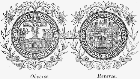
Observe. Reverse. Ancient Burgh Seal.
STIRLING, a royal burgh, sea-port, and parish, mostly in the county Stirling; containing, with the villages of Cambuskenneth, Raploch, and part of Causeway-head, 9095 inhabitants, of whom 8307 are in the burgh, 35 miles (W. N. W.) from Edinburgh. This place, in the more ancient documents called Striviling and Styrlyng, and in the present seal of the burgh designated Oppidum Sterlini, is of remote antiquity, and is supposed to have been a Roman station connected with that of Camelon, whence a road to the north of Scotland passed close to the Castle hill here, on which was one of the numerous fortifications raised by Agricola in this part of the country. On the face of the rock overlooking the road, and commanding the river Forth, which is here of comparatively inconsiderable width, has been found a Roman inscription ascribing to the second legion the erection of this fortress, which is thought to have occupied the site of the present castle, whose precise date has not been distinctly ascertained. Towards the latter part of the 9th century, Ella and Ostricht, princes of Northumbria, having defeated Donald V., King of Scotland, and taken him prisoner, advanced to Stirling, rebuilt the castle, and placed in it a strong garrison, which retained possession till it was restored by treaty to Kenneth III., who, about the year 975, not only recovered his territories in this part of the country, but made himself master of the whole district of Strathcluyd. The castle appears to have attained a considerable degree of importance in the course of the 12th century. It was one of the four principal fortresses of the kingdom delivered to the English in 1174, by William the Lion, as part of his ransom from captivity, and in fulfilment of the treaty by which Henry II. of England was acknowledged superior of the whole of Scotland. This claim of superiority, however, being subsequently renounced by Richard I., the castle of Stirling and the other fortresses were restored to the Scottish monarchs, and remained in their possession till the revival of that claim by Edward I., when, on the defeat of the Scottish army at Dunbar in 1296, the English, in order to secure the conquest of the country during the disputed succession to the throne, made themselves masters of all the chief fortresses of the kingdom. William Wallace, however, the intrepid champion of his country's freedom, recovered Stirling from the English, and afterwards laid siege to the castle of Dundee. While he was engaged in reducing that fortress, the English again assaulted the castle of Stirling; but, the Scottish army taking their position on the north side of the Forth, to dispute the passage of the river by the troops of Edward, which had encamped on the south, Wallace hastened from Dundee to the relief of Stirling, and obtained a signal victory over the English while attempting to cross the river. The result of this battle, in which many of the English were slain, with only a very inconsiderable number of the Scottish forces, was, the temporary delivery of the country from the English invasion.
In the following year, however, Edward entered the kingdom with an army of 80,000 men, and having defeated the Scots at Falkirk, again took possession of Stirling, and repaired the castle, which, in his retreat, Wallace had burnt. The castle was in 1298 besieged by the Scots, to whom, after a series of reverses in the fortunes of Edward, it was surrendered by capitulation; but in 1300 it was again taken by the English after a siege of three months, during which it was bravely defended by the garrison under its governor, Sir William Oliphant. In 1304, Edward, in his progress towards the south, approached to Stirling, and, after a feeble attempt on the part of Cumyn, guardian of the kingdom, to intercept his passage, crossed the river Forth, and laid siege to the castle, which, however, held out so resolutely against his assaults that, when he ultimately obtained possession of it, he refused all terms of capitulation, and sent Sir William Oliphant prisoner to London. In 1314 the castle, which till then had been garrisoned by the English, was invested by Edward Bruce, brother of the King of Scotland, who, after a siege of some months, obtained from the governor a promise of surrender if not relieved within a stipulated period. On the day previous to the appointed time, a detachment of 800 cavalry from the army sent by Edward for the relief of the several garrisons, and of which the main body had been interrupted by Bruce, having advanced by a circuitous route to dislodge the besiegers of Stirling, were pursued by Randolph, Earl of Moray, who, with a body of 500 horse, put them completely to the route. The spot where this conflict took place is still called Randolph Field. After the battle of Bannockburn, which finally established the independence of the Scottish monarchy, the town and castle were evacuated by the English; and the garrison, according to the terms of capitulation, returned unmolested into England. In the reign of James I., Murdoch, Duke of Albany, who had acted as regent of the kingdom during the captivity of that monarch in England, was, with his father-in-law, the Earl of Lennox, and his two sons, beheaded on the Mote hill, a small mount near the castle, pursuant to a verdict pronounced by a jury of twenty-one members of a parliament held for the purpose. In 1437, Sir Robert Graham and several of his associates were executed on the same spot, for the assassination of the king in the convent of the Black Friars at Perth.
The castle about this time had become a royal residence; James II. was born within its walls, and James III. repaired and embellished several portions of the structure that had fallen into dilapidation, and erected many additional buildings. Among these were, the house of parliament, containing a fine hall 120 feet in length, now occupied as a barrack by the garrison; and also the chapel royal, converted into an armoury by the government during the late war, but now in part restored to its original purpose as a chapel, though only for the garrison. A palace was erected within the precincts of the castle by James V., which was completed by Queen Mary; it was a quadrangular edifice surrounding an area in which the king's lions are said to have been kept. The building was profusely embellished with statuary, among which were well-sculptured figures of King James and his daughter, and numerous grotesque figures; it contained several magnificent apartments, and a spacious hall with a roof of oak exquisitely carved. James V. was crowned in the castle; as was also Mary, when scarcely nine months old; and James VI., soon after his birth, was baptized here with great pomp, on which occasion Queen Elizabeth presented a massive font of gold, to be used at the ceremony. Stirling soon followed the example of Perth and St. Andrew's in adopting the reformed doctrines. In 1559, the lords of the congregation took possession of the town, in order to prevent the introduction of a French force which had been sent to the assistance of the Earl of Murray; and in their zeal for the abolition of popery, the inhabitants demolished the abbey of Cambuskenneth and the convents of the Black and Grey Friars. In 1571 Hamilton, formerly archbishop of St. Andrew's, who had assisted at the baptism of James VI., was executed here for his participation in the death of the Regent Murray; and in the same year a parliament was held in the castle by the Earl of Lennox, who was then regent. On the 4th of September, in that year, the town was surprised by the Earl of Huntly and about 400 of his adherents, who, surrounding the houses of the principal inhabitants, carried off the Regent Lennox and ten other noblemen as prisoners. Huntly's party was eventually defeated by the Earl of Mar, and the noblemen were rescued from their power; but the Regent, who had been severely wounded in the conflict, died of his wounds on the following evening, and was interred in the chapel royal. Twenty-six of Huntly's party were brought into the town as prisoners, and two of them publicly executed on the following day. After the resignation of Mary, Queen of Scots, James VI. was crowned in the church of Stirling, after a sermon preached by the reformer, John Knox; and during his minority the castle was the constant residence of the prince, under the tutelage of his preceptor, the celebrated George Buchanan. That monarch held his first parliament in the castle in the year 1578, and, after his marriage to Anne, princess of Denmark, frequently resided here with his queen, who gave birth to the infant prince, Henry, at Stirling. In 1584 the Earls of Angus and Mar, the master of Glammis, and others who had been concerned in the Ruthven conspiracy, took forcible possession of the town. Being expelled by the garrison, they fled into England; but they returned in the following year, and having raised a powerful force, were preparing to besiege the castle, at that time but ill prepared to hold out, when the king sent commissioners to treat with them, and a compromise was effected by the pardon of their rebellion, the reversal of their forfeitures, and the restoration of their eligibility to offices in the state.
On the proclamation, in 1637, of the mandate for the adoption of the Liturgy of the Church of England, the privy council and the courts of session were by royal command removed from Edinburgh to this town, where they continued for many months to hold their meetings. The Liturgy was proclaimed at the market-cross; upon which, the Earl of Home, with other nobles and a number of the ministers, entering a public protestation against its reception, a body of about 2000 Presbyterians assembled in the town in the course of the evening, and on the following morning marched to Edinburgh. After the battle of Dunbar, in 1650, the remains of the Scottish army retreated to this town, in which the magistrates of Edinburgh, and the Committees of Church and State, held their meetings; and the last Scottish parliament in which the sovereign personally presided was assembled in the castle, and afterwards adjourned to Perth. Pursuant to the resolutions at this parliament, an army was collected at Aberdeen, which, after marching to Stirling, and being joined by the troops at this place, encamped at Torwood under Charles II., who commanded in person; but the prince was ultimately compelled to retreat before the troops of Cromwell, and, retiring to Stirling, encamped in the King's Park. Upon Cromwell's retreat soon afterwards into England, he was followed by Charles at the head of this army, which was subsequently defeated at the battle of Worcester. Soon after Cromwell's departure, General Monk advanced to Stirling with a powerful force, and taking possession of the town, erected batteries on the tower of the church, and in the adjoining burying-ground, in order to reduce the castle, which, after a protracted siege, he ultimately obtained by capitulation. During the siege, the registers and national records, which had been for greater security deposited in the castle, were removed to the Tower of London, where they remained till the Restoration; but they were unfortunately lost in a storm that overtook the ship in which they were being brought home. The Duke of Argyll, previously to the battle of Sheriffmuir in 1715, encamped his forces in the King's Park, adjoining the town; and in 1745, during the progress of the Young Pretender's career, the walls were repaired by government, and the castle put into a state of defence. On his return, however, in the following year, the town was occupied for some time by his adherents, who, violating the terms upon which they had obtained admission, pillaged the houses of the inhabitants, and invested the castle, which must ultimately have surrendered for want of provisions, had not the approach of the army under the Duke of Cumberland compelled the Pretender to withdraw his forces from the neighbourhood. On the 13th of September, 1842, this place was visited by Her Majesty, in the course of her tour in Scotland; the royal cortége arrived at the barrier at half past eleven o'clock, and the provost attended by the town-clerk and magistrates, presented the keys of the burgh to Her Majesty, who then proceeded through the town.
Few other events of historical importance have occurred in connexion with this town, of which the history is mostly identified with that of its ancient castle, to whose foundation it is indebted for its origin. In the reign of Queen Anne, the fortifications of the castle, which, according to the articles of the Union, was one of the four principal fortresses guaranteed to be kept in repair, were considerably extended, and the internal arrangements rendered more commodious for the garrison. The garrison now consists of a lieutenant-governor, deputy-governor, fort-major, and other officers, a chaplain, barrack-master, barrack-serjeant, and master-gunner, with a force of infantry generally averaging from 250 to 300 men. The demesnes attached to the castle include the royal park and gardens; the Ladies' Hill; the Valley, a level inclosure in which tournaments and other feats of chivalry were formerly celebrated for the entertainment of the court; the Ballingeich road; the Gowling Hills; and a few houses in that part of the town called the Castle Hill. These, with the exception of the Valley, constitute what is styled the constabulary, under the management of the Commissioners of Woods and Forests. The castle, which for some centuries consisted only of a single tower, has, from frequent additions and improvements, been greatly improved, and is now one of the most splendid buildings of the kind in the kingdom. The principal entrance was once defended by four massive circular towers, of which, however, two only, and those now much reduced in height, are remaining. From its elevated situation on a precipitous rock rising abruptly from the surrounding plain, the view obtained from this entrance is singularly interesting, embracing a vast expanse of Highland scenery including the lofty summits of the mountains of Benvoirlich, Benledi, Benvenue, and Ben-Lomond. The intermediate tracts of country are embellished with stately mansions, villages, and hamlets; enriched with woods and thriving plantations, and enlivened with the meandering courses of the rivers Allan, Teith, and Forth, flowing through a fertile plain bounded on the one side by the Campsie hills, and on the other by the Ochils. This entrance leads into a spacious quadrangle, where are the remains of the stately palace of James V., the parliament house, now converted into barracks, and the chapel royal: in the centre of the quadrangle is a court still retaining the name of the Lion's Den. From this a low gateway leads into the Nether Bailiery, in which are the magazines and offices belonging to the castle, and from which an old gateway, anciently the principal entrance, opens into a narrow path conducting to the town. Between the town and the fortress is the esplanade, on the south and west of which is the King's Park; here the Stirling races are regularly held, the course having been preserved from being ploughed, by a clause inserted in the lease of the tenant. Immediately under the castle walls, on the south side, are the royal gardens, in which is a circular mound of moderate elevation, called the "King's Knot," surrounded by a concentric bank at the distance of a few feet, of nearly equal height: this mound and bank served as seats for the king and the nobility, in the celebration of the sports of the Knights of the Round Table, in honour of King Arthur. Beyond, for some distance, is a plain inclosed by the traces of what was formerly a canal. The banks of the Castle Hill are here richly-wooded, and have been laid out with great taste as a promenade, which, at almost every step, both in its ascent and descent, commands an interesting prospect of picturesque and romantic scenery. The castle itself, also, from the stately magnificence of its remains, and the rich style of its architecture, abounding with beautiful details, as well as from its situation on the acclivities and summit of a rock, forms a striking feature in the landscape.
The town is finely situated on the south bank of the river Forth, and consists of numerous well-formed streets, several of them of modern date and handsome appearance. King-street is a wide and spacious thoroughfare, in which are the market-places, numerous substantial houses, and some of the public buildings; and a new street opened in 1840 forms a communication with Bridge-street, leading to a bridge of five arches over the Forth, to the north of the town, on a line with the great north road. Beyond this, at a little distance, is an ancient bridge of four arches over the same river, which, preserving much of its original character, has a very picturesque aspect. Spittal-street, conducting to St. John's-street, in which are the church and an old hospital; and Baker-street, in a parallel direction; are both good streets, though the latter is in some parts steep and narrow, and contains several houses of very ancient date. Broad-street is spacious, and has at one extremity the unfinished palace of the Earl of Mar, hereditary governor of the castle, commenced in 1570, and built with the ruins of Cambuskenneth Abbey. In the Castle Wynd is the mansion called Argyll House, now occupied as an hospital for the garrison, a spacious quadrangular building erected in 1632 by Sir William Alexander, afterwards Earl of Stirling, and which subsequently became the property of the Duke of Argyll, who entertained James II. of England for some time in it when Duke of York, and whose descendant held his council of war here during the rebellion of 1715. The streets are well paved, and lighted with gas; and the inhabitants are amply supplied with water from public wells, under the superintendence of the corporation.
The Stirling Subscription Library, founded in 1805, and supported by a proprietary of shareholders, has a collection of more than 4000 volumes on general literature, and is annually augmented: this library is kept in the Athenæum, a handsome building with a lofty spire, in King-street, erected in 1817, and of which a part is occupied as a public reading-room. There are also some circulating libraries. The School of Arts was instituted in 1826, for the promotion of mechanical study and improvement in the arts and sciences: it has a library of 1000 well-chosen books, a museum, some philosophical apparatus, and a theatre for the delivery of lectures during the winter; it is well supported by subscription, and has about 200 proprietary members. Two weekly newspapers are published, the Stirling Observer on Thursday, and the Stirling Journal on Friday; and both maintain an extensive circulation in the surrounding district. A medical society has been recently established by the practitioners in the town and vicinity, for the promotion of literature, and the general pursuits of science, connected with the profession. A horticultural society was founded here in 1812, and an agricultural association in 1834; and in 1840, an appropriate building was erected by Messrs. Drummond as an agricultural museum, which contains an extensive collection of specimens of seeds, roots, grains, minerals, implements of every variety, improvements in draining-tiles, and every thing else connected with the study and promotion of husbandry. The approach to the town from St. Ninian's is through a pleasing tract of country, embellished with handsome mansions and picturesque villas, adorned by thriving plantations; and the public promenade called the Back Walk, on the south of the Castle Hill, tastefully laid out in 1723 by Mr. Edmondstone, of Cambus-Wallace, and subsequently much improved, is a favourite place of public resort.
The woollen-manufacture, which since 1830 has very greatly increased, is now the principal branch of trade; while the cotton-manufacture, which was previously extensive, has become inconsiderable. There are three large steam-mills for the spinning of woollen yarn, in which about 170 persons are employed, and nearly 700 are occupied in weaving at their own dwellings; the articles manufactured at present are, tartans, shawl-pieces, and other similar goods. The weaving of carpets is carried on to a moderate extent. There are several dyeing establishments, and rope-making is also conducted on a tolerable scale; coach-building is pursued to a considerable extent, affording employment to more than a hundred persons; there are tanneries and some large malting establishments, and the manufacture of soap and candles is conducted with success. Many of the inhabitants are employed in the various other trades necessary for the supply of the neighbourhood; and there are numerous handsome shops, well stocked with all the articles of merchandise required for the use and convenience of the inhabitants; and also some hotels for the reception of the families and visiters who, during the summer and autumn, make Stirling their temporary residence. Of these, the Royal Hotel, a spacious and elegant building erected in 1840, in front of the Friars' Wynd, and containing very superior accommodations, forms an ornament to the town. The market, on Friday, is abundantly supplied with grain, and with provisions of every kind. Fairs for cattle and horses are held on the Friday before Old Hansel Monday; the first Fridays in February, March, April, May, August, and November; the second Friday in December, the third in September, and the last in May: there are also hiring-markets on the last Friday in March, and the third in October. The Corn Exchange, where the grain market is held, is a spacious edifice of recent erection, containing above the area a stately apartment for public meetings; and the branch establishments of the Commercial Bank, in Spittal-street, the Bank of Scotland, in King-street, and the National Bank, in Baker-street, are all substantial buildings. Facility of communication is afforded by good roads which pass through the town and parish, and by steamers plying constantly between the town and Newhaven, of which never less than two, and often three, are continually in attendance. The port of Stirling, a member of that of Alloa, carries on an extensive trade in grain, of which considerable quantities are shipped from this place; and there is a mode-rate extent of foreign trade, consisting chiefly in the importation of timber from Norway, and bark from Holland. The number of vessels registered as belonging to the port is twenty-two, varying from fifty to 350 tons in burthen; of these, two are employed in the foreign trade, and the others in the coasting-trade, and to ports within the United Kingdom. The harbour is formed by a bend in the Forth, and has a good quay for the loading and unloading of vessels; but the navigation of the river is much impeded by shallows, which retard the approach of vessels of great burthen, and a plan is now being carried out for deepening the river, and consequently improving the trade of the port, and promoting the prosperity of the adjacent district. The salmon-fishery has been long carried on with success, and is still a lucrative pursuit; the rents of the several fisheries in the parish amount to about £770 per annum. Salmon are found also in the river Teith, beyond the limits of the parish; the salmon taken in the Forth are sent chiefly to the Edinburgh and London markets. Several railways have been projected, to pass through or near the town.
The inhabitants received a charter of incorporation from Alexander I., constituting the town a royal burgh, to which he afterwards added the privileges of a merchant-guild; and by another charter he exempted them from tolls and customs throughout the kingdom. These charters were confirmed, with additional grants, by David II.; the fisheries of the Forth, and the right of levying small customs, were added by Robert II.; and subsequently, by charter of James IV., the inhabitants were invested with the customs on salt and leather, and the right of appointing a sheriff within the burgh. By charter of Mary, Queen of Scots, they obtained a grant of lands, tenements, and buildings, and of the churches, chapels, and colleges founded within the liberties, and various other immunities and privileges, all which were ratified by charter of Charles I. in 1641. This charter continued in force till the year 1773, when the burgh was disfranchised by a decree of the Court of Session. It was, however, soon afterwards restored by the king in council, who also made several alterations in the constitution, and vested the government in a provost, four bailies, a dean of guild, a convener, and fourteen other councillors, in all twenty-one, of whom fourteen were chosen from the merchant-guild, and seven from the incorporated trades. By act of the 3rd and 4th of William IV., the government is now vested in a provost, four bailies, a treasurer, and fifteen town-councillors; the provost in all public proceedings is, under charter of James IV., styled the high-sheriff, and the bailies are called sheriffs. They exercise both civil and criminal jurisdiction within the burgh, and hold courts twice in the week, for the trial of offences, and the determination of pleas, in which they are assisted by the town-clerk, who acts as assessor; and one of the magistrates attends daily for the hearing of cases under the police. The revenue of the corporation arises from the tolls and customs of the bridge and port, the markets, and the fisheries; and they have the patronage of the church, the burgh schools, and charitable institutions. There are seven incorporated trades, viz., the hammermen, weavers, tailors, shoemakers, skinners, bakers, and fleshers, the admission fees to which vary from £1. 10. to £3. 10. for sons of freemen, from £5 to £15 for apprentices, and from £20 to £50 for strangers. The police is under the superintendence of the magistrates of the burgh, which is divided for this purpose into four wards, over each of which one of the bailies presides; the force consists of four serjeants and thirty-six constables. The chief officer of the county police has also his principal station in the town.
The sessions for the county are held in the town-hall, a spacious and handsome building in Broad-street, with a lofty steeple in which are a clock and a chime of musical bells. It contains the council-chamber, with the various apartments for transacting the public business of the burgh, and the several court-rooms; and the standard pint measure, called the Stirling Jug, an ancient vessel of brass, in the form of a truncated cone, and weighing 15lb. troy, is preserved here. The old gaol, situated in St. John's-street, though secure, was ill adapted for the classification of the prisoners, and a new gaol has consequently been erected, on a very extensive scale, and in a more eligible situation than the former building. The elective franchise, under the provisions of the Reform act, is vested in the £10 householders resident within the parliamentary boundaries, which include certain parts of the adjoining parish of St. Ninian's. The number of householders of £10 and upwards is about 550, of whom 221 are burgesses; and the number of householders of the value of £5 and upwards, but under £10, is 401, of whom ninety-seven are burgesses. The burgh is associated with Dunfermline, Culross, Inverkeithing, and Queensferry, in returning a member to the imperial parliament.
The parish is two miles in length from west to east, and about one mile and a half from north to south, and comprises an area of 1030 acres; it is of very irregular form, determined by the winding of the river Forth on the north, and on the east deeply indented by the parish of St. Ninian's. The surface is beautifully varied, rising gradually from the south-east to an elevation of more than 200 feet towards the north-west, and terminating in the precipitous rock crowned by the castle, which, especially when viewed from the south and west, presents an object of venerable grandeur. The soil of the rural district of the parish is generally a carse land, but in the King's Park, which has an undulating surface, is warm and dry, and well adapted for oats, barley, and turnips; the whole is in a high state of cultivation, and, with the exception of that portion which forms the constabulary of the castle, is divided into farms of about 100 acres. The farm-buildings are suited to the size of the farms, are comfortable, and in good repair; and under the encouragement of the Agricultural Society, every improvement in draining, manuring, and managing the lands, and in the breeds of sheep and cattle, has been brought to the highest perfection. The prevailing timber is oak, ash, elm, beech, alder, and plane, of which, in various parts of the parish, there are many fine specimens; and the plantations, which are extensive and flourishing, add greatly to the beauty of the scenery. The river Forth, receiving in its approach to this place the waters of the Teith and Allan, attains a tolerable breadth, and, flowing in beautiful windings along the shores, forms a feature of great interest in the landscape; it abounds with salmon, grilse, smelts, pike, perch, trout, eels, and other fish, and is navigable for vessels of seventy tons to the bridge of Stirling. The rocks are of basaltic formation, and coal is abundant, though no mines are in operation within a less distance than two miles; greenstone and sandstone are also found. In the coal formation are thin strata of ironstone, and in the greenstone, veins of calcareous spar. Clay is also abundant, occurring in beds of great thickness, of which one has been ascertained to be more than seventy feet in depth: in this seam were lately found imbedded, at the depth of fourteen feet, the antlers of a deer, and at a depth of twenty feet, the scull of a dog, both in perfect preservation. The rateable annual value of the parish is £15,285.
The ecclesiastical affairs are under the superintendence of the presbytery of Stirling and synod of Perth and Stirling, the former of which has its seat here, and the latter alternately at this place and at Perth. From the time of the Reformation till 1607 the parish was under the care of only one minister; but in that year a second was appointed, to whom a fixed stipend was granted by the corporation in 1643; and subsequently to 1731, upon petition from the inhabitants, a third minister was for some years maintained, who officiated in the western portion of the church, while the first and second ministers did duty alternately in the eastern. Upon the deposition of this third minister, however, in 1740, for secession, the Western church was used only on sacramental occasions, for the accommodation of such as could not find room in the Eastern church, till 1817, when the third charge was revived, and the Western church re-opened. Under the present arrangement, the minister of the first charge officiates in the Eastern church, and the minister of the second charge in the Western: the minister of the third charge till lately officiated alternately in both, as colleague to the first and second ministers; but a new church has been just erected for the third minister, and each has now his own separate congregation and parochial district. The stipend of the first minister is £348. 17. 10., with an allowance of £40 in lieu of manse, and a glebe of about five acres; the stipend of the second minister is £250, and that of the third £200, both paid by the Corporation, who are the patrons. The church of the Franciscan monastery founded by James IV. in 1494, is now appropriated as the parish church; it is an ample and handsome structure in the decorated English style of architecture, with a massive tower rising from the west end to the height of ninety feet. The nave is divided from the aisles by ranges of light clustered columns supporting the lofty roof. The eastern portion, of circular form, and said to have been added to the original structure by Cardinal Beaton, is embellished with a spacious window of elegant design; and the west window of the nave, which is also of large dimensions, is enriched with delicate tracery, and ornamented with stained glass. The building forms one of the finest specimens of its style in this part of the country. The interior was divided in 1656 into two distinct places of worship, called respectively the East and West church, and the whole was put into a complete state of repair in 1817; the East church contains 1187, and the West 1177, sittings. The Spittal-square church, originally belonging to a congregation of the Old-Light Burgher synod, was lately in connexion with the Established Church; the minister was supported by the seatrents and collections. There are also places of worship for members of the Free Church, the United Secession, Cameronians, Independents, Wesleyan Methodists, and Baptists, and an Episcopalian and a Roman Catholic chapel. Stirling has no parochial schools strictly so called, but there are four schools under the patronage of the corporation, in which nearly 500 children receive instruction. Of these, the High or Grammar school is under the direction of a rector, who receives a salary of £50 per annum, and an allowance of £20 for an assistant; the writing-school, in which, also, are taught arithmetic, book-keeping, the mathematics, navigation, and various other branches, is under the care of a master who has a salary of £50 a year; and the masters of the first and second English schools have each a similar sum. These salaries are all paid by the corporation, who appoint the masters. There are numerous other schools in the parish, of which some are partly supported by the corporation, and others exclusively by the fees.
Spittal's Hospital was founded in 1530 by Robert Spittal, who endowed it with funds that were vested in land now producing an income of about £400 per annum, for the relief of decayed members of the several incorporated trades. The objects of the charity formerly lived in the house called the Trades' House in Spittal-square: about seventy-four individuals now receive a weekly allowance each varying from one shilling and sixpence to two shillings and sixpence. Cowane's Hospital was founded in 1639, by John Cowane, merchant, who endowed it with £2222, which sum was vested in the purchase of land now producing £2000 per annum, for the support of twelve decayed members of the merchants' guild, for whose reception a building was soon afterwards erected. As few, however, could be prevailed upon to reside in the house, the income is distributed by the corporation among 140 out-pensioners in weekly payments varying from one shilling and sixpence to eight shillings, and among eleven who receive quarterly payments varying from £1 to £2. 10. The hospital, which is situated close by the church, is a handsome building with a statue of the founder in front, and is crowned with battlements and pinnacles; the lower apartment is used as the guildhall, and the upper as a schoolroom. Allan's Hospital was founded in 1724 by John Allan, who endowed it with £1666. 13., which were vested in lands yielding £300 per annum, for the maintenance, clothing, education, and apprenticeship of sons of indigent tradesmen. A house was built in Spittal-street, in which the boys were formerly boarded, and taught by the master; but this arrangement was afterwards altered, and the lower part of the building is now occupied as schoolrooms, and the upper let out in tenements. About twenty-three boys are educated on this foundation. Alexander Cunningham, merchant of the town of Stirling, in the year 1809, bequeathed the residue of his estate, amounting to £5724. 11. 2., for the maintenance, clothing, education, and apprenticeship of sons of guild-merchants and mechanics, of whom about twenty receive the benefits of the endowment. The dispensary was established in 1830, and is supported by subscription, under the direction of a committee; the medical department is under the management of a surgeon and three consulting physicians, and it is open three days in the week, such of the patients as are unable to attend being visited at their own homes. Among the eminent persons once connected with this place, in addition to those previously noticed, are, Dr. Robert Pollock, the first principal of Edinburgh College; Dr. Henry, the historian; and Dr. John Moore, author of Views of Society and Manners in France, Italy, and the Continent, and father of the gallant General Sir John Moore, who fell at the battle of Corunna.—See the article on Cambuskenneth.
Stirlingshire
STIRLINGSHIRE, a county, in the eastern part of Scotland, bounded on the north by Perthshire and Clackmannanshire; on the east by the county of Linlithgow; on the south-east by part of Lanarkshire; and on the south, and also on the west, by the county of Dumbarton. It lies between 55° 56' and 56° 16' (N. Lat.) and 3° 30' and 4° 14' (W. Long.), and is about 45 miles in length and 18 miles in extreme breadth, comprising an area of about 489 square miles, or 312,960 acres; 16,614 houses, of which 15,813 are inhabited; and containing a population of 82,057, of whom 41,004 are males, and 41,053 females. The early history of this county is involved in much obscurity. Situated on the confines of the territories of the Northumbrian and Cumbrian Britons, and those of the Picts and Scots, it appears to have been alternately in the possession of the most powerful of those people. At the time of the Roman invasion it became a station of importance, and Agricola is said to have erected some fortifications on the hill on which the castle of Stirling was afterwards built, as commanding the Roman road from Camelon to the north of Scotland. In confirmation of this opinion, are adduced the remains of Roman forts in several parts of the county, the traces of the wall of Antonine, and the discovery of coins, weapons, and various other relics of antiquity.
After the departure of the Romans from Britain, the county was frequently the scene of hostilities between the sovereigns of the adjacent kingdoms. The battle in which Kenneth II. of Scotland obtained that victory over the Picts which put an end to their existence as a nation, and united both kingdoms under his dominion, is said to have taken place in a field near Stirling, thence called Cambuskenneth; and two upright stones, yet remaining, are thought to have been raised in commemoration of his success. In the 9th century, this portion of the country became the conquest of the Northumbrian Saxons; and it continued to be included in their territories till the time of Kenneth III., who not only recovered this part of his rightful dominions, but also made himself master of the extensive kingdom of Strath-y-Cluyd. Ever since that period Stirling has formed an integral portion of the kingdom of Scotland. The subsequent history of the county, however, is so intimately blended with that of its castle, which in the reign of the Stuarts became a royal residence, and so closely identified with the general history of Scotland, that any further detail here would be altogether super-fluous. The county is included chiefly in the synod of Perth and Stirling, and contains parts of several presbyteries, and twenty-one parishes. For civil purposes it is under the jurisdiction of a sheriff-depute, who appoints a sheriff-substitute. The general quarter sessions and other courts are held at Stirling, and the ordinary courts for the recovery of small debts take place at Stirling on Friday, and at Falkirk on Wednesday, weekly; the sheriff's small-debt courts are held at Lennoxtown, Drymen, and Balfron. The only royal burgh is that of Stirling, the county town; besides which the shire contains the populous burgh of Falkirk, and the thriving and pleasant towns or villages of St. Ninian's, Airth, Balfron, Bannockburn, Camelon, Carron, Denny, Drymen, Fintry, Grangemouth, Gargunnock, Killearn, Kilsyth, Kippen, Larbert, Lennoxtown, Milngavie, Laurieston, Polmont, and Strathblane. By the act of the 2nd of William IV., the county returns one member to the imperial parliament.
The general surface is diversified with mountains, hills, valleys, and some fine tracts of fertile plain; it abounds with ornamental timber, and the prevailing scenery is beautifully picturesque, and in many parts strikingly romantic. The most conspicuous of the mountains is the ridge called the Campsie Fells, extending from the east of the parish of Denny, through Kilsyth, Campsie, Strathblane, and Killearn, for nearly twenty miles towards the west; they have an elevation varying from 1300 to 1500 feet above the level of the sea, and from the highest of the hills, in the parish of Kilsyth, a most extensive and interesting prospect is obtained, embracing an area of some thousand square miles. Towards Loch Lomond, on the west, which is more especially regarded as the Highland district of the county, rises the majestic mountain of Ben-Lomond, 3262 feet high. Many of the hills in the eastern and southern districts are covered with verdure to their summit, and have a pleasing aspect.
The principal rivers are, the Forth, the Carron, the Endrick, the Blane, the Kelvin, and the Bannockburn. The Forth has its source in two streams near the mountain of Ben-Lomond, of which one, the less important, and called the Duchray water, runs through the western portion of this county, and at Aberfoyle, in the county of Perth, unites with the other. The other rises close to Loch Katrine, and, flowing eastward through part of Perthshire, and receiving various streams in its progress, enters Stirlingshire at Craigforth, where it is augmented by the waters of the Teith: pursuing a winding course through a finely-cultivated country, it attains a considerable breadth at Stirling, where it becomes navigable, and thence gradually expands into the Frith of Forth. The Carron rises in the parish of Fintry; and after a rapid course of about fourteen miles, in which it turns several mills, and forms a romantic cataract called the Linn Spout, it affords a supply for the reservoir of the Carron iron-works, at Larbert, and falls into the Forth at Grangemouth. The Endrick has its source also in the parish of Fintry, and, taking a western direction, and forming, in its course through the vale to which it gives name, some interesting cascades, whereof one, called the Loup of Fintry, has a fall of ninety feet, flows into Loch Lomond at a short distance from Buchanan House. The Blane, a small but pleasing stream, rises in the Lennox hills; it waters the parish of Strathblane, to which it gives name, and, after a course of about twelve miles, in which it forms a pleasing cascade of seventy feet, flows into the Endrick in the parish of Killearn. The Kelvin has its source in the parish of Kilsyth, and flowing in a south-western direction, forms a boundary for some miles between the county of Stirling and those of Dumbarton and Lanark; it falls into the Clyde at Partick, about two miles west of Glasgow. The Bannockburn, celebrated for the memorable battle between the Scots under Robert Bruce and the army of Edward II., rises in the parish of St. Ninian's, and, after a short course through a picturesque glen, falls into the Forth a few miles below Stirling. Numerous smaller streams, descending from the hills, also intersect the surface in various directions; they all abound with trout, and salmon is found in most of the rivers. There are not many lakes, and none are of any great extent except Loch Lomond, which extends for nearly fourteen miles along the western boundary of the county.
Of the lands, about 200,000 acres are arable, 50,000 meadow and good pasture, and nearly 63,000 hill pasture, moorland, and waste. This is, however, exclusive of the parish of Alva, which, though more than four miles distant from the nearest confines of Stirlingshire, and entirely surrounded by the counties of Clackmannan and Perth, has since the commencement of the 17th century been attached to this county. The soil is extremely various, though generally fertile. In the eastern portion of the county is a beautiful expanse of carse land in the highest state of cultivation, consisting of clayey loam, interspersed with tracts of light gravelly soil, and small patches of sand: on the banks of the Forth are more than 40,000 acres of this rich alluvial soil. In different parts are tracts of wet retentive clay; the higher moorlands, of which there are some extensive breadths, are chiefly moss; but most of the hills afford excellent pasture for sheep. The principal crops are, wheat, oats, barley, flax, peas, beans, potatoes, and turnips; vegetables of all kinds are raised in great abundance, and of good quality; and fruit-trees of every description thrive luxuriantly. The system of agriculture, though varying in different parts, according to the varieties of the soil, is in a highly improved state; the lands are well drained, and inclosed chiefly with hedges of thorn and double trenches. The farms on the carse lands are generally about one hundred acres in extent; but many of the hill-farms extend to 4000 acres. The farm-buildings are substantial and commodiously arranged, and every recent improvement in the construction of agricultural implements has been adopted. Few cattle are reared in the county, which is generally supplied from the Highlands. The cows on the dairy-farms, to the management of which much attention is paid, are of the Ayrshire breed; and the horses for draught, chiefly of the Lanark or Clydesdale breed. The sheep, of which many thousands are pastured on the moorlands, are mostly the black-faced or Highland, with some few of the Tweeddale description and other breeds.
The substrata include whinstone and granite, of which the hills are mainly composed, and freestone of various colours, of which some valuable quarries are extensively wrought at Torwood, in the eastern part of the county. In the parish of Killearn are quarries of millstone grit, which is much in request; in the parishes of Campsie, Fintry, and Strathblane, are found fine specimens of basalt, of which there are several extensive rocks displaying ranges of some hundred columns, in different directions. Limestone, ironstone, and coal abound in the eastern districts, the last in such quantity as not only to supply the home demand, but also, by means of the Forth and Clyde canal, to furnish Edinburgh with that article at a very moderate price. The principal mines are in the Lennox hills, and there are mines likewise in the immediate vicinity of the canal. Copper and lead ore, and cobalt, have been raised, but not in considerable quantities; and some veins of silver were wrought towards the close of the last century. There are numerous coppices of natural wood in the county, and at Torwood and Callendar some remains of the ancient Caledonian forest. The timber is chiefly oak, beech, birch, and hazel; some of the oaks are of very large growth, and all the trees thrive well in the soil. There are on the whole about 1350 acres of natural wood. Extensive plantations, also, have been formed in various parts, and are in a very flourishing condition; they consist of oak, ash, elm, beech, pine, larch, and spruce and Scotch firs. The seats are, Buchanan House, Dunmore Park, Callendar, Craigforth, Alva, Gargunnock, Kerse, Kinnaird, Kincaid, Westquarter, Glorat, Airthrey Castle, Lennox Castle, Airth Castle, Leckie, Culcreuch, and numerous others.
The principal manufacture is that of cast and malleable iron goods, for which there is a most extensive and ably conducted establishment on the banks of the river Carron, which is noticed under the head of Carron, where these celebrated works are situated. There are ironworks on a smaller scale at Falkirk, in which about 500 persons are employed; the nail-manufacture is also carried on in several of the villages. The woollen-manufacture is extensive; the chief articles are, carpets, coarse woollen cloths, and tartans. There are also manufactories for cotton goods, and paper; copperas and alum works; distilleries; and other establishments. Facility of communication is afforded by good roads throughout the county, by the Edinburgh and Glasgow railway, and by the Forth and Clyde canal; and much commerce is carried on at the port of Grangemouth, with Norway, Sweden, and the Baltic, in timber, hemp, tallow, iron, flax, and grain. Shipbuilding is pursued there to a considerable extent; and the number of vessels registered as belonging to the port in a recent year was 179, of the aggregate burthen of 26,561 tons. There are a number of vessels, varying from fifty to thirty-five tons, belonging to the port of Stirling; also steam-packets for passengers, luggage-steamers, and other facilities of intercourse. The total annual value of real property in the county, as assessed to the income-tax, is £279,705, of which £181,147 are returned for lands, £63,559 for houses, £16,578 for mines, £16,199 for iron-works, £1203 for fisheries, and the remainder for quarries.
Among the monuments of antiquity are several Roman camps; and a conical building supposed to have been of Roman origin, though from its form it acquired the appellation of Arthur's Oven, remained in a very perfect state till about the middle of the 18th century, when it was removed. Portions of the wall of Antonine are found in various parts, and also traces of Roman roads, of which one of the most perfect leads to Camelon, supposed to have been the principal station of the Romans in this part of Britain. There are numerous Pictish forts, several Druidical remains, and various ruins of ancient castles, of which Castlecary, said to have been originally a Roman fortress, and those of Torwood, Colzium, and Rough Castle, are among the principal. The castle of Stirling, also of great antiquity, and which in the time of the Stuarts was made a royal residence, is still preserved as a royal garrison. There are remains of the ancient abbey of Cambuskenneth, founded by David I., and of several other religious houses founded by succeeding kings of Scotland, among which are the convent of Dominican Friars established by Alexander II., and the Franciscan monastery by James IV. Numerous cairns and tumuli are seen, near which have been found stone coffins containing human bones; and remains of Roman pottery, coins, and other relies of antiquity, have been discovered at various times; all of which are noticed in the accounts of the several parishes where they occur.
Stitchell and Hume
STITCHELL and HUME, two ancient parishes now united, the former in the district of Kelso, county of Roxburgh, and the latter in the county of Berwick; containing together 847 inhabitants, of whom 161 are in the village of Stitchell, 4 miles (N. by W.) from Kelso. The district of Stitchell, which is situated on the north-eastern boundary of Roxburghshire, is supposed to have derived its name, signifying in the Gaelic language "a declivity," from the elevated site of the village at a height of more than 600 feet above the level of the Tweed at Kelso. Towards the close of the 16th century, the lands of Stitchell came into the possession of Robert Pringle, whose grandson, Robert, was created a baronet by Charles II., in 1683; and they are still the property of his descendant, the present Sir John Pringle, Bart. The district of Hume, which adjoins Stitchell on the north, appears to have derived its name, originally Home, from its ancient proprietors, the Homes, descended from the earls of Dunbar and March, and who, in 1605, were raised to the peerage by the title of Earls of Home, which their descendants still retain. The ancient castle of Home, the baronial residence of the family for many generations, and the picturesque ruins of which are seated on the summit of a hill nearly 900 feet above the level of the sea, is intimately connected with many events of historical importance. According to tradition, when James II. went to the siege of Roxburgh, he placed his queen in the castle of Home for greater security; and it is said that, in one of her daily walks to join the king, she was met by a messenger from Roxburgh who informed her of James's death by the bursting of a cannon. This melancholy intelligence, abruptly communicated, is reported to have instantaneously produced the premature birth of a child, of which the queen was delivered on a hill in the neighbourhood, which from that event has since been called the "Queen's Cairn." During the border warfare, the castle was for many years a place of defence for the surrounding districts; and in 1547 it was besieged by the English forces under the Duke of Somerset, against whom it was for a long time valiantly sustained by Lady Home, after the death of her husband, who had been killed a few days before in a general engagement with the enemy. At length the garrison capitulated on honourable terms, and the castle was surrendered to the duke; but in 1549 it was retaken by the Scots, who put the English to the sword. During the sway of Cromwell, the castle was again besieged by the English, under Colonel Fenwick, whom the usurper, after the capture of Edinburgh Castle, had sent to summon the garrison to surrender. The governor, whose name was Cockburn, received the summons in a spirit of contemptuous defiance; but the army of Cromwell, having brought a battery to bear upon the walls, soon made a breach; and the governor, after stipulating for the lives of the garrison, surrendered the castle to the assailants. Of the original buildings, only some trifling fragments are now remaining; the area inclosed by the exterior wall has been converted into a garden, and few traces of the vaults are discernible.
The parish is bounded on the west by the water of Eden, which separates it from the parish of Nenthorn; and is from five to six miles in length, and from three to four miles in breadth, comprising about 5500 acres, of which the whole are arable, with the exception of fifty acres of woodland and plantations and 300 waste. The surface rises gradually from the south towards the north, where it attains an elevation of more than 600 feet above the level of the sea; and towards the western boundary is the hill on which the ruins of Home Castle are situated. The water of Eden, which bounds the parish for about a mile and a half, forms in its course a picturesque cascade, falling from a rock near Newton-Donhouse, forty feet in height: the stream abounds with trout, affording good sport to the angler. The soil is generally strong, in some parts clayey, and on the whole fertile, producing crops of grain of all kinds, for which it is well adapted, and the usual grasses. The system of husbandry is in a very improved state, and the lands under excellent cultivation; the farm-buildings are substantial and well arranged, and the inclosures kept in good repair. The cattle reared in the parish are of a larger size than the usual breed on the north of the Tweed, the late Sir Robert Pringle having introduced, and for several years maintained, a regular supply of bulls from Holland. The sheep are of the customary English breeds, and are noted for the fineness of their wool: during the winter they are mostly fed upon turnips. The grain and other agricultural produce are principally sold at Kelso, whence considerable numbers of cattle and sheep are sent for the supply of the southern markets. The plantations, which are mainly of modern growth, consist of firs, interspersed with the usual varieties of forest-trees, and, though by no means extensive, are generally in a thriving state. The substrata are principally whinstone, of which the rocks are all composed; and at a place near Hardie's Mill, in the district of Hume, is a rising ground called Lurgie Craigs, in which are some polygonal columns of basaltic formation, from five to six feet in height, and about seventeen inches in diameter, closely resembling those of the Giant's Causeway. The rateable annual value of Stitchell is £4033, and of Hume £4011. Stitchell House, the property of Sir John Pringle, a spacious and handsome mansion, situated in a well-planted demesne to the west of the village, is the only seat. The village of Stitchell is neatly built, and inhabited chiefly by persons employed in agricultural pursuits: the small hamlet of Hume, which contains only about thirty inhabitants, derives its only importance from its proximity to the ancient castle. The ecclesiastical affairs of Stitchell and Hume, which, though united in other respects, separately maintain their own poor, are under the superintendence of the presbytery of Kelso and synod of Merse and Teviotdale. The minister's stipend is £219. 14. 7., with a manse, and a glebe valued at £27 per annum; patrons, the Crown, and Sir H. P. H. Campbell, Bart. The church, situated in the village of Stitchell, is a substantial structure, in good repair, and affording ample accommodation for the parishioners. There is a place of worship for members of the United Secession. Two parochial schools, one in the village of Stitchell, and the other in Hume, are attended by about ninety children each: the masters have each a salary of £25, with a house and garden, and fees varying from £20 to £25 annually; each has also £2. 10. from an ancient bequest for the gratuitous instruction of children. The late Sir W. Campbell bequeathed £25 per annum to be distributed in meal and coal to the poor. Sir John Pringle, Bart., president of the Royal Society, was a native of Stitchell; Hume, or Home, gives the title of Earl to the family of Home.
Stobbsmills
STOBBSMILLS, a village, partly in the parish of Borthwick, and partly in that of Temple, county of Edinburgh, 1¼ mile (N. W.) from the village of Borthwick; containing 203 inhabitants. In this place were established in 1794, the works of the first gunpowder manufactory erected in Scotland. The village lies in a secluded vale, through which flows a rivulet tributary to the South Esk, and useful in turning the mills of the factory, which is still conducted on an extensive scale. The gunpowder made here is exported to almost every part of the world.—See Temple.
Stobhill
STOBHILL, a village, in the parish of Newbattle, county of Edinburgh, 3 miles (S. S. E.) from the village of Newbattle; containing 130 inhabitants. It is a small place, situated in the south part of the parish, and on the confines of a detached portion of the parish of Temple. The road from Borthwick to Cockpen passes through it.
Stobhill-Engine
STOBHILL-ENGINE, a hamlet, in the parish of Cockpen, county of Edinburgh; containing 64 inhabitants.
Stobo
STOBO, a parish, in the county of Peebles, 6 miles (W. S. W.) from Peebles; containing 465 inhabitants. This parish, which was considerably increased by the addition of part of the parish of Dawick, on its suppression in 1742, is seven miles in length and five miles and three-quarters in extreme breadth. It is bounded on the east and west by the Lyne and Biggar waters, and comprises 12,583 acres, of which 1255 are arable, 587 woodland and plantations, and 10,741 hill pasture, moorland, and waste, of which about 800 acres might at a moderate expense be brought into profitable cultivation. The surface is divided, by three ranges of hills from north to south, into valleys watered by streams tributary to the Tweed, which intersects the parish. Of the hills forming these ranges, the most considerable are, the Pyked Stane, which has an elevation of 1884 feet; the Benvalla, which has an elevation of 1850; the Binliga, of 1692, and the Flint hill, which has an elevation of 1621 feet, above the level of the sea. The Tweed traverses the parish for nearly seven miles, and in its course receives the waters of the Biggar and the Lyne; the Stobo burn has its rise near the base of the Pyked-Stane, and, after a course of about five miles through the parish, falls into the Tweed. Good trout are found in the Tweed and Lyne; and in the former, salmon also. The soil is various, but chiefly light and gravelly; on the northern parts of the hills, and generally at the base, a stiff clay; and in the meadows on the banks of the Tweed, a rich and fertile loam intermixed with sand. The crops are, oats, barley, wheat, potatoes, and turnips. The system of agriculture is improved; the lands are well drained, and inclosed with stone dykes; the farm houses and offices, substantial and well arranged; and all the more recent improvements in implements of husbandry have been adopted. Considerable attention is paid to the rearing of sheep and cattle, for which the hills afford good pasturage: the chief breed of sheep is the Cheviot, with a few of the black-faced; and the cattle are mostly of the old breed, which in some instances has been recently improved by a cross of the Teeswater and Ayrshire.
The woods and plantations are well managed, and in a thriving condition. The substrata are chiefly whinstone and clay-slate: the latter has been extensively quarried for many years; the slate is of good quality, and very similar to that found in the county of Argyll. The whinstone has been merely wrought where it occurs near the surface, and only for materials for making inclosures. Stobo Castle, for many years the residence of the late Sir James Montgomery, Bart., is a handsome modern mansion, of whinstone with ornaments of freestone. The nearest market-town is Peebles, with which facility of communication is afforded by roads kept in good repair, and by convenient bridges over the various streams. The rateable annual value of the parish is £3367. It is in the presbytery of Peebles, synod of Lothian and Tweeddale, and patronage of Sir Graham Montgomery: the minister's stipend is £158. 6. 7., with a manse, and the glebe is valued at £42; he has also ten bolls of meal, the proceeds of one-half of the glebe of Dawick. The church is an ancient structure in the early English style of architecture, and has been adapted for a congregation of 200 persons. The parochial school affords a liberal course of instruction to the children of the parish; the master has a salary of £32 per annum, with £28 fees, and a house and garden. The poor are partly supported by the interest arising from a fund of £545, which has accumulated from the balances of collections. On a moor in the parish, which was formerly appropriated to the mustering of the militia of Tweeddale by the sheriff, and which still retains the name of Sheriffsmuir, are two upright stones three feet in height, and about six feet distant from each other, which are thought to mark the grave of some chief who fell in an engagement here. There are also some cairns or heaps of stones, supposed to have been raised over the tombs of distinguished persons; and in a circular cavity about 250 feet in circumference, were interred, it is said, the bodies of men slain in battle; but there are no authentic records of any such event having taken place. Lord Chief Baron Montgomery, of Her Majesty's Exchequer in Scotland, who contributed greatly to the improvement of the lands and the agriculture of the parish, was interred in the family burial-place in the churchyard, in 1803. His son, Sir James Montgomery, the second baronet, already alluded to, having been bred to the bar, was appointed lord-advocate of Scotland, which office, however, he resigned two years after, in 1806; he died in the year 1839, and was succeeded by Sir Graham, the present baronet.
Stoer, or Store
STOER, or STORE, lately a quoad sacra parish, in the parish of Assynt, county of Sutherland, 19 miles (W. N. W.) from the village of Assynt; containing, with the village of Clashnessie and the island of Oldeney, 1478 inhabitants. This district was separated ecclesiastically from the parish of Assynt, by authority of the General Assembly, in 1834. The greatest length by computation is fourteen, and its greatest breadth eleven, miles; and the population, which is chiefly collected in a number of small villages and hamlets, is, with a very few exceptions, of the poor and working classes, principally engaged in agricultural pursuits, and occasionally in fishing. The northernmost land is the point of Stoer, eastward of which is the small isle of Oldeney, where are two harbours; and Clashnessie, one of the largest villages in the district, is seated at the head of a bay bearing its own name. The ecclesiastical affairs were placed under the presbytery of Dornoch and synod of Sutherland and Caithness, and the patronage vested in the Crown: the stipend allotted to the minister was £120, paid from the exchequer, with a manse, a glebe of the annual value of £2. 5., and the privilege of cutting peat. The church was built in 1828, by the parliamentary commissioners, and so constructed as to admit of enlargement by the erection of galleries; but it has not been since altered, and at present contains 500 sittings. The members of the Free Church have a place of worship, situated nearly a mile to the north of the parliamentary church, and capable of accommodating 700 persons. The Society for Propagating Christian Knowledge, and the Edinburgh Gaelic Society, each support a day school in the district, the former for teaching English and Gaelic, and the latter for Gaelic only; there is likewise a government parish school, newly established.
Stonefield
STONEFIELD, a village, in the parish of Blantyre, Middle ward of the county of Lanark, 1¼ mile (N. E. by E.) from the village of Blantyre; containing 174 inhabitants. It lies in the north-eastern part of the parish, and on the west bank of the Clyde, which here separates the parish from that of Bothwell. The population of the village is chiefly employed in the manufactures of the district, and a few in common handicraft trades.
Stonehaven
STONEHAVEN, a sea-port town and burgh of barony, partly in the parish of Dunnottar, but chiefly in the parish of Fetteresso, county of Kincardine, 15 miles (S. S. W.) from Aberdeen, and 94 (N. by E.) from Edinburgh; containing 3012 inhabitants, of whom 950 are in that part of the town within the parish of Dunnottar. This place, which is situated on the eastern coast, at the influx of the river Carron into the German Ocean, and at the head of a fine bay sheltered on the north and south by lofty hills, comprises two distinct portions, called respectively the Old and the New Town. The Old Town, on the south bank of the river, consists principally of one spacious street irregularly built; it once belonged to the Earl Marischal Keith, and in 1607 was by act of parliament constituted the head burgh of the county. The New Town, which stands on the north bank of the Carron, on a peninsula formed by that river and the river Cowie, was built about the year 1760, on the lands of Mr. Barclay, of Ury, and consists of several well-formed streets diverging from a square in the centre, in which is the market-house. The two portions of the town are connected by a bridge, and constitute a continued line along the shore of the sea. The houses are well built, and in the New Town have a handsome appearance; the streets are paved, and lighted with gas by a company established in 1837; and the inhabitants are amply supplied with water. There are no manufactures of any importance. The weaving of cotton and linen, however, for the houses of Aberdeen, formerly more extensive, still affords employment to a considerable number of persons, of whom many are females. The Glenury distillery consumes about 6000 quarters of barley annually; a brewery has long been established, which supplies the adjacent districts with ale and beer; and there are some mills for the spinning of woollen yarn.
Burgh Seal.
The trade of the port consists principally in the importation of coal and lime, bone-dust, salt, slates and tiles, paving-stones, and groceries; and in the exportation of grain, of which nearly 14,000 quarters are annually shipped, potatoes, whisky, cured fish, timber, and live-stock. The harbour, in 1825, was placed under the direction of a board of commissioners, who expended £8000 on its improvement, by the removal of a mass of rock at the entrance, the erection of an extensive pier, and the construction of an inner harbour, in which vessels may find shelter from all storms. Lights, also, have been fixed by the Commissioners of Northern Lights, as a secure guide to the harbour, which has the advantage of being easily accessible in easterly gales. The steamers plying between Leith and Aberdeen regularly touch at the port. The exact date of the charter by which the town was erected into a burgh of barony is not known; but it is recognised as such in the act of parliament passed in 1607, transferring the seat of the sheriffdom from Kincardine to this place, which it constituted the county town. The government, under the superior, is vested in two bailies, a dean of guild, a treasurer, and three councillors, chosen by the holders of land within the burgh. The magistrates, however, exercise no jurisdiction in civil matters, and in criminal cases only in petty offences. The county buildings contain a spacious hall appropriated for holding the courts, with committee-rooms, and offices for the sheriff-clerk; and on the basement are cells for prisoners, and apartments for the keeper of the gaol. The market is held weekly, on Thursday, and is abundantly supplied with grain and provisions of all kinds. Fairs are held annually, for cattle and sheep on the Thursdays before Old Christmas-day and Candlemas; for cattle and horses on the third Thursday in June, and the second Thursdays in August and October; and for hiring servants, on the 25th of May and the 21st of November, or, if those days fall on Sunday, on the preceding Saturday. The market-house is a handsome and commodious building, erected in 1827, and comprising also a spacious hall. The post-office has two deliveries; two mails from the south, and two from the north, arriving daily. Facility of intercourse with Aberdeen, Leith, and Edinburgh, is maintained by excellent roads, and by the steamers which call at the harbour.—See Dunnottar, and Fetteresso.