Records Relating To the Barony of Kendale: Volume 2. Originally published by Titus Wilson and Son, Kendal, 1924.
This free content was digitised by double rekeying. All rights reserved.
'Parish map of Kendale', in Records Relating To the Barony of Kendale: Volume 2, (Kendal, 1924) pp. ii. British History Online https://www.british-history.ac.uk/kendale-barony/vol2/ii [accessed 27 April 2024]
Parish map of Kendale
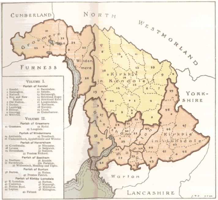
The Territory of Kendale, divided into Parishes, of which the Parish of Kirkbie Kendale, comprising 20 Townships, formed the First Volume of these Records.