A Topographical Dictionary of England. Originally published by S Lewis, London, 1848.
This free content was digitised by double rekeying. All rights reserved.
'Casterton - Castley', in A Topographical Dictionary of England, (London, 1848) pp. 526-531. British History Online https://www.british-history.ac.uk/topographical-dict/england/pp526-531 [accessed 11 April 2024]
In this section
Casterton
CASTERTON, a township and chapelry, in the parish of Kirkby-Lonsdale, union of Kendal, Lonsdale ward, county of Westmorland, 1½ mile (N. E.) from Kirkby-Lonsdale; containing 623 inhabitants. This place, which is supposed to have received its name from an ancient castle, of which every vestige has been removed, is situated on the river Lune, and on the road from Lancaster to Sedbergh. The surface is diversified with mountain, hill, and dale; the soil is of light and fertile quality, and in the valley is limestone rock, of which, and of red conglomerate, there are quarries. The line of the North-Western railway passes through. The living is a perpetual curacy, in the patronage of Trustees: there is a glebe-house. The chapel was erected in 1833, and has a square tower, lancet windows, and a good organ. The Clergy Daughters' school established here in 1823, as a means of assisting clergy of limited incomes in the education of their daughters, is a prosperous and efficient institution, very liberally sustained by donations of the nobility and gentry, and annual subscriptions. About 100 pupils are received from all parts of the kingdom, and are lodged, clothed, boarded, and educated, on the easy terms of £14 per annum; the school is under the management of twelve trustees, the instruction very comprehensive, and many accomplished governesses, among others, have been educated here. A preparatory school for extending the benefits of the Clergy Daughters' school, and rendering the instruction in the latter more effectual, by first training younger pupils for it, was opened in 1837, and is wholly confined to the children of clergymen with the smallest incomes; about 35 children are at present in this school. There are also here, a school for training girls as servants and teachers, which was instituted in 1820, and receives 100 pupils; an infants' school; and a village school. A chapel stood at Chapel-Head Close, near which is a well, called St. Coume's, probably a contraction of St. Columbe, the tutelar saint of the chapel.
Casterton, Great (St. Peter and St. Paul)
CASTERTON, GREAT (St. Peter and St. Paul), a parish, in the union of Stamford, hundred of East, county of Rutland, 2¼ miles (N. W. by W.) from Stamford; containing 376 inhabitants. This was a Roman station, and several coins and the remains of an encampment have been discovered; it was demolished by the Picts and Scots, who ravaged the island as far as Stamford, whence they were driven back to their own territories by the Saxons under Hengist. Its former name was Brig-Casterton, from a bridge over the Gwash, or Wash, here. The barony was held by various lords, until it reverted to the crown in the reign of Henry VIII., in consequence of its possessor, John, Lord Hussey, being attainted of high treason, and beheaded at Lincoln, for joining a commotion raised in Lincolnshire; it is now the property of the Marquess of Exeter. The parish comprises by measurement 2258 acres, of which 2088 are arable and pasture, and 170 woodland. The road from London to Edinburgh passes through the village; and great improvement has been made by lowering a steep hill and constructing a viaduct, at an expense of £5000. The living is a rectory, with that of Pickworth annexed, valued in the king's books at £11. 2. 11.; net income, £686; patron, the Marquess. The tithes were commuted for corn-rents, under an act of inclosure, in the year 1795; and the glebe consists of about 64 acres, with an excellent glebe-house.
Casterton, Little (All Saints)
CASTERTON, LITTLE (All Saints), a parish, in the union of Stamford, hundred of East, county of Rutland, 2 miles (N. W. by N.) from Stamford; containing 132 inhabitants. This parish includes the ancient hamlet of Tolethorpe, where was a college of priests or a chantry, refounded, and endowed with ten marks per annum, in the 36th of Edward III. by William de Burton. The estate was purchased from his descendant, Thomas de Burton, about 1504, by Christopher Brown, ancestor of the Countess Dowager of Pomfret, after whose decease, the reversion of the property, together with the advowson of the living, was purchased by the Earl of Burlington. The parish comprises about 1287 acres, which, with the exception of about 279 acres subject to a corn-rent, are tithe-free. The great north road runs about a mile from the village. Good freestone is quarried. The living is a rectory, valued in the king's books at £6. 15. 5.; net income, £254; patron, the Hon. C. C. Cavendish. The tithes were commuted for land and a corn-rent in 1796; the glebe comprises about 53 acres. The church is a small edifice, partly of later Norman architecture, and partly in the early, decorated, and later English styles; the chancel has been rebuilt. A parochial school is supported chiefly by endowment. At the western extremity of the parish, but now filled up by the formation of a new road, was a deep fosse, part of the Roman camp at Great Casterton. Not far from the manor-house at Tolethorpe, is a spring of carbonated chalybeate water without any mixture of sulphuric acid, similar to the water at Tonbridge-Wells, but less powerful.
Casthorpe
CASTHORPE, a hamlet, in the parish of Barrowby, union of Grantham, wapentake of Winnibriggs and Threo, parts of Kesteven, county of Lincoln, 3 miles (W.) from Grantham; containing 51 inhabitants. It consists of three farms.
Castle-Acre (St. James)
CASTLE-ACRE (St. James), a parish, in the union and hundred of Freebridge-Lynn, W. division of Norfolk, 4 miles (N.) from Swaffham; containing 1495 inhabitants. This place, called Acre at the time of the Domesday survey, is noted chiefly for the remains of its ancient castle and priory, from the former of which it takes the prefix to its name. It appears, from the vestiges of a Roman road leading from Thetford to Brancaster, the discovery of a tessellated pavement, and, lately, of several coins (among which were some of Vespasian and Constantine), to have been a Roman station, on whose site the castle was probably erected. This fortress was built by William Warren, first earl of Surrey, to whom the manor, with 149 others, had been given by the Conqueror, and who made it the head of all his lordships; it was perhaps enlarged by his descendant, who, in 1297, entertained Edward I. here.
The parish comprises 3249 acres, of which 2639 are arable, 461 meadow and pasture, 13 wood, and 79 common; the land is in general rich, and boldly undulated. The village consists of two good streets, on the north bank of the river Nar. Fairs for toys and pedlery are held on St. James's day and August 5th; and pettysessions once a fortnight. The living is a discharged vicarage, valued in the king's books at £5. 6. 8.; patron and impropriator, the Earl of Leicester: the great tithes have been commuted for £610, and the vicarial for £168; the glebe comprises 3½ acres. The church, situated on the crown of the acclivity above the priory, is a spacious structure in the decorated and later English styles, with a lofty embattled tower, and exhibits, in many of its details, fine specimens of ancient architecture; the font, which is said to have been removed from the priory, is surmounted by a beautiful piece of tabernacle work. There are places of worship for congregations of Baptists, Primitive Methodists, and Wesleyan Methodists.
Sufficient remains exist to indicate the extent of the castle, which, with its appendages, comprised an area of more than eighteen acres, inclosed by an embattled wall seven feet in thickness, strengthened by three lofty buttresses built over the broad and deep moat by which the castle was surrounded: the buildings were of a circular form, and on the slope of a gentle eminence. To the east of the castle are the ruins of the priory, established by Earl Warren, in 1085, for monks of the Cluniac order, dedicated to the Blessed Virgin, and subordinate to a similar establishment by the same founder, at Lewes, in the county of Sussex. The revenues, which had become very considerable by successive augmentations, were seized under pretence of its being an alien priory, but were subsequently restored; and in the reign of Edward II., it was secured against further molestation by a royal order, as coming within the class of indigenous establishments. Its income, at the Dissolution, was £324. 17. 5., and, with the site, was granted to Thomas, Duke of Norfolk; it is now the property of the Earl of Leicester. The priory church was a spacious cruciform structure, with two towers at the west end, and a massive central tower; the greater portion of the west front is still remaining, and, with the exception of a large window of later insertion over the entrance, is an elegant specimen of the most enriched style of Norman architecture. The conventual buildings are at present a farmhouse and offices: a large room, called the prior's dining-room, and now a granary, has a fine oriel window. On making excavations within the walls of the chapter-house, in 1841, were found some beautifully embossed tiles, with heraldic devices, and some bulls of the Popes Honorius and Innocent.
Castle-Ashby, county of Northampton.—See Ashby, Castle.
CASTLE-ASHBY, county of Northampton.—See ASHBY, CASTLE.—And other places having a similar distinguishing prefix will be found under the proper name.
Castle-Camps (All Saints)
CASTLE-CAMPS (All Saints), a parish, in the union of Linton, hundred of Chilford, county of Cambridge, 5¾ miles (S. E. by E.) from Linton; containing 854 inhabitants. This place was the seat of the Veres, earls of Oxford, one of whom received it by grant from Henry I., as lord high chamberlain of England; the site of their magnificent castle is now occupied by a farmhouse, but the moat and some slight vestiges are still visible. The estate was subsequently purchased by Thomas Sutton, founder of the Charter-house in London, who made it a portion of the endowment of that institution. The parish is situated near the road from Cambridge to Colchester, and comprises by computation 2800 acres. The living is a rectory, valued in the king's books at £16. 4. 2., and in the gift of the Governors of the Charter-house, the tithes have been commuted for £630, and the glebe comprises 71 acres. The church is a handsome structure, in the later English style. There is a place of worship for Baptists.
Castle-Carrock (St. Peter)
CASTLE-CARROCK (St. Peter), a parish, in the union of Brampton, Eskdale ward, E. division of Cumberland, 4½ miles (S. by E.) from Brampton; containing 351 inhabitants. The parish comprises about 5500 acres, the soil of which on the west is dry, gravelly, and very stony; and on the east, which is rugged and mountainous, good for grazing, resting on extensive beds of limestone and freestone. It is bounded on the east and north by the small river Gelt, which rises in the royal forest of Geltsdale, a hilly tract of moorland. The living is a discharged rectory, valued in the king's books at £5. 12. 11.; net income, £159; patrons, the Dean and Chapter of Carlisle. The tithes were commuted for land in 1801. The church is a neat structure, built of freestone in 1828. The former edifice is supposed to have been built out of the ruins of an ancient castle that stood within an intrenchment near the village, the lines of which are distinctly visible: there is another intrenchment at a short distance. Upon the summit of a long and lofty fell, forming the northern point of the range of mountains extending from Cross Fell, near Alston, are two cairns, one of which, called Hespeckraise, is of considerable magnitude: on the removal of another cairn near Gelt Bridge, about 1775, a human skeleton was discovered in a species of coffin made of rude stones. Near the church is a mineral spring, the water of which is of the same quality as that of Gilsland spa.
Castle-Cary (All Saints)
CASTLE-CARY (All Saints), a market-town and parish, in the union of Wincanton, hundred of Catsash, E. division of Somerset, 11 miles (E. N. E.) from Somerton, and 113 (W. S. W.) from London; containing, with the hamlets of Clanville, Cockhill, and Dimmer, 1942 inhabitants, of whom 50 are in Clanville, and 116 in Cockhill and Dimmer. Castle-Cary probably derived its name from an ancient castle originally belonging to a lord of the name of Carey, which was defended against King Stephen by its owner, Lord Lovell, one of whose descendants having embraced the cause of the deposed monarch, Richard II., it became forfeited to the crown. The site is still called the Camp, and weapons of iron have been found in it occasionally: the only remains are some slight traces of the intrenchments. Charles II., after the battle of Worcester, took refuge in the manor-house. The town is pleasantly situated, and consists of two parts, extending together nearly a mile: the houses are neatly built, and amply supplied with water; the air is salubrious, and the environs abound with pleasing scenery. The market, which is on every alternate Tuesday, is well attended, and supplied with sheep and cattle of all kinds, from October till the spring fairs, which are on the Tuesday before PalmSunday, May 1st, and Whit-Tuesday; a fair is also held on the first Tuesday after the 19th of September, for cattle, broad-cloth, and other merchandise. The parish comprises by admeasurement 2572 acres. The living is a discharged vicarage, valued in the king's books at £11. 16. 3.; patron, the Bishop of Bath and Wells; impropriator, Sir H. R. Hoare, Bart. The great tithes have been commuted for £301. 10., and the vicarial for £378; the impropriate glebe consists of 65 acres, and the vicarial of 10 acres. The church is a handsome structure, occupying an elevated situation; the archdeacon holds his visitations in it. There are places of worship for Independents and Wesleyans.
Castle-Church (St. Lawrence)
CASTLE-CHURCH (St. Lawrence), a parish, in the E. division of the hundred of Cuttlestone, union, and S. division of the county, of Stafford, 1 mile (S. W.) from Stafford; containing, with the townships of Forebridge, and Rickerscote with Burton, 1484 inhabitants. The parish derives its name from the ancient baronial castle of Stafford, to which its church was originally an appendage; and comprehends a portion of the town of Stafford. It is a fertile district, on the south side of the river Sow, and comprises nearly 4000 acres of land. The Liverpool and Birmingham railway passes through. The living is a perpetual curacy, with a net income of £120; it is in the patronage of the Crown, and Lord Stafford and others are impropriators. The church, of which the nave and chancel were rebuilt in 1845, at a cost of £2000, is in the Norman style. At Forebridge is a separate incumbency; and near the town is a Roman Catholic chapel, built in 1822, by the late Edward Jerningham, Esq.
Castle-Combe (St. Andrew)
CASTLE-COMBE (St. Andrew), a parish, in the union and hundred of Chippenham, Chippenham and Calne, and N. divisions of Wilts, 6½ miles (N. W. by W.) from Chippenham; containing 600 inhabitants. The village, which is very considerable, was anciently celebrated for a castle, built in the early part of the thirteenth century, by Walter de Dunstanville, son-in-law of Reginald, Earl of Cornwall, and which was dismantled before the close of the fourteenth; it stood on a hill north of the village, where the remains of its intrenchments are still discernible. A market was obtained by Bartholomew, Lord Badlesmere, which has been discontinued; but the market-cross remains in the centre of the village. The living is a rectory, valued in the king's books at £9; patron, William Scroop, Esq. The church appears to be of very ancient date, and consists of a nave, north and south aisles, and a chancel, with a tower at the west end, about eighty feet high, supported by angular buttresses with pinnacles.
Castle-Dykings
CASTLE-DYKINGS, an extra-parochial place, extending into the parishes of St. Mary Magdalen and St. Paul in the Bail, Lincoln, wapentake of Lawress, parts of Lindsey, county of Lincoln; containing 139 inhabitants.
Castle-Eaton (St. Mary)
CASTLE-EATON (St. Mary), a parish, in the union of Highworth and Swindon, hundred of Highworth, Cricklade, and Staple, Cricklade and N. divisions of Wilts, 3½ miles (S. by E.) from Fairford; containing 312 inhabitants. The parish is bounded by the river Isis. Some vestiges of the ancient castle from which it takes its name, may still be traced; the chief being the moat by which it was surrounded. The living is a rectory, valued in the king's books at £19, and in the patronage of the family of Goddard: the tithes have been commuted for £667, and the glebe comprises 79½ acres, with a glebe-house.
Castle-Morton (St. Gregory)
CASTLE-MORTON (St. Gregory), a parish, in the union of Upton-upon-Severn, Lower division of the hundred of Pershore, Upton and W. divisions of the county of Worcester, 5 miles (W. S. W.) from Upton; containing 855 inhabitants. The parish comprises 3656 acres, of which 677 are common or waste. The living is a discharged perpetual curacy, annexed to the vicarage of Longdon, and valued in the king's books at £5. 8. 6½. The great tithes are appropriate to the Dean and Chapter of Westminster, and have been commuted for £350, and the small tithes for £155; the glebe consists of 3 acres. The church stands at the south end of the village, and is a very ancient structure, with a fine old steeple: opposite to it is an artificial mound fifty feet high, surrounded by a moat, and supposed by some to have been thrown up to protect the church during the civil war in the reign of Charles I. There are charitable bequests for the poor, amounting to £30 per annum.
Castle-Northwich
CASTLE-NORTHWICH, a township, in the parish of Great Budworth, union of Northwich, Second division of the hundred of Eddisbury, S. division of the county of Chester; containing 746 inhabitants. This place, also called Castleton, comprises 120 acres; it is divided from the township of Northwich by the river Weaver, and forms part of the suburbs of the town.
Castle-Rising (St. Lawrence)
CASTLE-RISING (St. Lawrence), a parish, and formerly a borough and market-town, in the union and hundred of Freebridge-Lynn, W. division of Norfolk, 4 miles (N. E.) from Lynn, and 102 (N. by E.) from London; containing 358 inhabitants. Prior to the year 1176, a castle was built by William D'Albini, the first earl of Sussex, on a hill to the south of the town, and, according to the author of the Munimenta Antiqua, on the site of one of King Alfred's great castles, of which some arches, included within the subsequent buildings, are supposed to be remains. In this castle, Isabel of France, queen of Edward II., after the death of Mortimer, was detained in confinement, from the year 1330, until her decease, in 1358. It passed from the family of Albini to the barons of Montalt, the last of whom died without issue, when his widow surrendered the lordship for £400 per annum, to Queen Isabella, at that time regent, who was visited here, in 1340, by her son, Edward III., and his queen. Edward III., on the death of his mother, settled Castle-Rising on his son Edward; it afterwards passed to the Howards, dukes of Norfolk, and subsequently to the Berkshire branch, who, in 1745, succeeded to the title of Earl of Suffolk. The principal remains are the shell of the keep, a square tower, the walls of which are three yards in thickness, with some ornamented doorways and windows in the Norman style of architecture, though greatly dilapidated; the site of the great hall, and some vestiges of the state apartments, may also be traced: the chief entrance is over a ruined bridge of one circular arch, defended by a tower gateway.
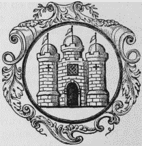
Seal and Arms.
This was once a considerable sea-port, inferior in this county only to Lynn and Yarmouth; but the harbour becoming choked up with sand, its trade declined, and from the consequent decrease of its population, the market, which was held twice a week, has been discontinued for many years. The vicinity was formerly subject to inundations of the sea, to prevent which an embankment has been constructed. The government was originally vested in a mayor, twelve aldermen, and an indefinite number of burgesses, aided by a recorder, high steward, &c.; but the corporation has gradually fallen into decay. Of the rank which the place held as an ancient borough, it still retains a memorial, in the precedence given to the name of the mayor in the commission of the peace for the county. The elective franchise was conferred in the last year of the reign of Philip and Mary, from which time the borough returned two members to parliament till disfranchised by the 2nd of William IV., cap. 45: the right of election was vested in the free burgesses, the number of whom had been reduced to two or three; and the mayor was returning officer. The parish is situated on the road from Lynn to Wells, and comprises 2096a. 2r. 21p., of which 1008 acres are arable, 865 meadow and pasture, and 223 woodland; the soil is of a sandy and clayey nature. A trout stream runs through the parish, called the Rising river.
The living is a discharged rectory, with that of Roydon consolidated, valued in the king's books at £8, and in the gift of the family of Howard. The tithes have been commuted for £320, and the glebe comprises 23 acres, with a glebe-house. The church is an ancient structure, with a tower rising from between the nave and chancel; it exhibits fine specimens of the Norman style, and has an east window in the decorated English style: the entrance is enriched with varied mouldings, and on each side of the large window above it are series of intersecting arches; the font is very ancient, and highly ornamented. Near the church is an hospital, containing thirteen apartments, a large hall, and a chapel, built in 1613, by Henry Howard, Earl of Northampton, who endowed it with a rent-charge of £100 for twelve aged women and a governess. To the west of the castle is a square mount, one acre in extent, and to the east of it a circular mount surrounded by a ditch; the former is by some supposed to have been a Roman camp, though others think both were thrown up by the people of Lynn, when they besieged the castle, and compelled the Earl of Arundel to relinquish his claim to one-third of the customs of their port. There are some chalybeate springs in the parish.
Castle-Thorpe (St. Simon and St. Jude)
CASTLE-THORPE (St. Simon and St. Jude), a parish, in the union of Newport-Pagnell, hundred of Newport, county of Buckingham, 3 miles (N. N. E.) from Stony-Stratford; containing 365 inhabitants. This place derives its name from the ancient castle of the barony of Hanslope, the site of which exhibits traces of very extensive buildings: it was taken and demolished in 1217, by Fulke de Brent, when it had been garrisoned by its owner, William Manduit, one of the barons who were in arms against Henry III. The London and Birmingham railway passes within a short distance. The living is annexed to the vicarage of Hanslope. Thomas Tyrell, one of the judges in the court of common pleas in the reign of Charles II., resided here, and was interred in the chancel of the church, where a handsome monument was erected by his widow.
Castle-Thorpe
CASTLE-THORPE, a township, in the parish of Broughton, union of Glandford-Brigg, E. division of the wapentake of Manley, parts of Lindsey, county of Lincoln, 1½ mile (W.) from Glandford-Brigg; containing 346 inhabitants. The Roman road from Lincoln to Winteringham-on-the-Humber passes a short distance east of the village.
Castleford (All Saints)
CASTLEFORD (All Saints), a parish, in the Upper division of the wapentake of Osgoldcross, W. riding of York; containing 1850 inhabitants, of whom 1414 are in the township of Castleford, 3 miles (N. W.) from Pontefract. This place is by some writers supposed to have been the site of the Roman station Legiolium, or Lagetium, described in Antonine's Itinerary as being situated on the river Aire, where it was crossed by a ford, on the line of the Herman-street between Doncaster and York: Roman antiquities have been frequently discovered, including a scarce denarius of Caracalla, with a lion on the reverse. It is related, that the citizens of York, being pursued by Ethelred's army, in 750, turned at this place, and committed great slaughter on their pursuers. After the Norman Conquest, the parish was given to Ilbert de Laci, the heiress of whose family conveyed it by marriage, with the whole honour of Pontefract, to John of Gaunt, Duke of Lancaster.
The village is situated on the south bank of the river Aire, at a short distance from its junction with the Calder, the latter of which, in 1698, was made navigable to Wakefield, and the Aire to Leeds. The united rivers are crossed by a handsome stone bridge of three arches, which was rebuilt in 1808, and connects Castleford with the village of Allerton-Bywater on the north side of the river. The parish comprises the townships of Castleford and Glass-Houghton, and contains 1534a. 2r. 18p., of which 517 acres are in Castleford; 300 of these are arable, and 213 meadow and pasture. It has a station of the York and North-Midland railway. There is a dock-yard for building sloops, and a dry-dock for repairs: many owners of small craft reside here; and among the manufactories and branches of trade are a timber-yard, some oil and corn-mills, several granaries, a pottery of black and stone ware, a whiting-mill, and glass-bottle works. A court leet, baron, and view of frankpledge, is held in May and October. The living is a rectory, valued in the king's books at £20. 13. 1½., and in the patronage of the Duchy of Lancaster; net income, £555: the tithes were commuted for cornrents, under an inclosure act, in 1816. The church is thought to stand on part of the Roman camp above mentioned; it is a cruciform structure, with a tower rising at the intersection. There is a place of worship for Wesleyans in each of the townships.
Castleton (St. Edmund)
CASTLETON (St. Edmund), a parish, in the union of Chapel-En-Le-Frith, hundred of High Peak, N. division of the county of Derby, 4½ miles (N.) from Tideswell; containing 1500 inhabitants, of whom 941 are in the township of Castleton. This parish consists of the townships of Castleton and Edale. The former is said to have taken its name from a castle built by William Peverell, natural son of the Conqueror, which, from its situation upon a steep and high peak, was called the Castle of the Peak, or Peak Castle; but from various records it appears that a castle existed previously, supposed to have been erected by Edward the Elder, or his heroic sister Ethelfleda, and which, in the reign of Edward the Confessor, was the property of Earl Gundeburne. The castle remained with the Peverells until the attainder of the third William, when it was granted by Henry II. to John, Earl of Montaigne, afterwards King John; and during the absence of the earl's brother Richard I., Hugh Nonant, Bishop of Coventry, held it. In 1204, King John appointed Hugh Neville governor; but the disaffected barons seized it and kept possession until the reign of Henry III., from which period it had various occupiers, until settled by Edward III. upon his son, the Earl of Richmond, commonly called John of Gaunt, who was created Duke of Lancaster, in 1362, when the castle became part of the duchy of Lancaster. The Duke of Devonshire now possesses it, as lessee under the crown. The extent of the ruins evinces the former magnitude of the building; the castle-yard, the walls of which are in some places twenty feet high and nine feet thick, occupying nearly the whole summit of the hill. The keep, consisting of two stories almost entire, and standing at the south-western point of this high and precipitous limestone rock, towering above the mouth of the great cavern of the Peak, is fifty feet in height.
The parish, exclusively of Edale, comprises about 2900 acres, exhibiting a very hilly surface, and several varieties of soil: the township of Castleton occupies the western extremity of the large and deep valley which commences at Mam Tor, and runs eastward to join the valley of the Derwent. The great limestone district of Derbyshire has its northern termination at Castleton, the hills to the north being upon gritstone, and those to the south on limestone: the soil on the south side is very superior. The village, which is situated at the foot of the Castle hill, was fortified by a rampart, and the ditch is still visible, extending from the ravines at the base of the rock, to the outworks connected with the castle. The inhabitants principally derive their support from the mining district by which the village is surrounded. The living is a discharged vicarage, valued in the king's books at £6. 7. 6.; net income, £186; patron and appropriator, the Bishop of Chester. The great tithes have been commuted for £100, and the vicarial for £50; the appropriate glebe consists of 87½ acres, and the vicarial of 22 acres. The church is a small ancient edifice: the arch, with its mouldings entire, separating the nave from the chancel, is a fine specimen of early English architecture, and the pews are of oak curiously carved; but the exterior has been greatly modernised. At Edale is a separate incumbency. There is a place of worship for Wesleyans; and a school is endowed with about £23 per annum, arising from land.
The whole of the district abounds with greater natural curiosities than almost any other portion of the empire. Immediately under the walls of the castle is Peak Cavern, or the Devil's Cave, a succession of vast and magnificent excavations, in the interior of a stupendous rock. The approach to it is by the side of a clear stream, flowing from limestone rocks that here rise to the height of 260 feet on each side and form the entrance to the Cave, which first presents a dark and gloomy recess consisting of a tolerably well-formed arch, 46 feet high and 120 feet wide, and exhibiting a chequered diversity of coloured stones, from which a fluid that soon petrifies is continually dropping. Immediately beyond the arch is a cavern of nearly the same extent, and in depth about 90 feet, where some twine-makers have established a manufactory. Here the light disappears, and the rest of the Cavern must be explored by the aid of a torch. The arch leading to the next chamber is narrow and low, until arriving at a spacious opening called the Bell-house: at the end is a stream of water, 42 feet broad, over which it is necessary that visiters should be ferried. On landing, another vast vault, 200 feet square and 140 feet high, presents itself; at the end of which is another stream generally crossed on foot: here the passage leads to what is termed Roger Rain's House, a projecting pile of rocks on which water is incessantly dropping. The next excavation is the Chancel, which leads to what has been denominated the Devil's Cellar, and then follow numerous other immense cavities, that have received various appellations; such as Half-way House, Great Tom of Lincoln, &c.; the whole extending 2300 feet from the entrance, and supposed to be 645 feet in depth from the summit of the mountain.
About a mile from this is the Speedwell mine, situated at the foot of what is called "the Winnets," from the gusts of wind that constantly prevail here, in consequence of the formation of this mountainous range: the mine was formerly worked for lead. The descent is by about 100 steps, beneath an arched vault, leading to the sough, or level, where a boat conveys the explorer over a very broad stream, bounded by an immense gulf, the depth of which has never been accurately ascertained, though sounded by a line of 350 feet; above, the roof of the cavern is invisible, even with the aid of rockets and Bengal lights. The rushing of the superfluous water through an artificial gate into this profound chasm, which has already swallowed more than 40,000 tons of rubbish, arising from the blasting of the rocks, without the least apparent diminution of its depth, produces an appalling effect. A little further west is the Odin leadmine, said to have been worked by the Saxons, who honoured it with the name of one of their deities, and than which, although it has been in operation for so many centuries, few mines in the county are more productive. At some distance beyond this, raising its majestic head 1300 feet above the vale of Castleton, is the Mam Tor, or Mother-hill, also named the Shivering Mountain from the fragments of shale and gritstone almost continually falling from its south side, and which have formed an elevated mount in the valley, called Little Mam Tor. On its summit are the remains of a camp, supposed to be Saxon, with the greater part of the rampart entire; and on the south-west side are two barrows, in one of which, when opened some years since, were found a brass celt and fragments of an unbaked urn. Near this mountain is the Water Hull Mine, where is procured the beautiful and peculiar fluor-spar, the most esteemed kinds of which are the violet-blue and rose-coloured, which are worked into elegant vases, urns, &c. Here is also found, between the schistus and limestone, a species of elastic bitumen, that burns with a bright flame; another variety, less elastic, is formed of filaments, and is called wood bitumen. About half a mile midway in this mountainous ravine, which exhibits in many places proofs of volcanic origin, is a place called the Cove, where large masses of basaltic rocks are conspicuous, in which are imbedded quartz, crystals, &c. Such an assemblage of natural curiosities renders the neighbourhood of Castleton one of the most interesting districts in the kingdom.
Castleton (St. Mary Magdalene)
CASTLETON (St. Mary Magdalene), a parish, in the union and hundred of Sherborne, Sherborne division of the county of Dorset, 1 mile (E. N. E.) from Sherborne; containing 113 inhabitants. It comprises 50 acres, chiefly pasture, and lies contiguous to the park and residence of Earl Digby, lord lieutenant of the county. The living is a perpetual curacy; net income, £81; patron, Earl Digby.
Castleton
CASTLETON, a township, in the parish and union of Rochdale, hundred of Salford, S. division of the county of Lancaster; including part of the town of Rochdale, and containing 14,279 inhabitants. This place derives its name from a castle which arose here in Saxon times, and which, it is highly probable, was one of the numerous sacrifices in the conflicts between the Saxons and the Danes; the site is still to be traced by a lofty mound called the Castle-hill, the fosse appearing around it in distinct lines. In Edward II.'s reign, Henry de Lacy possessed the manor of Castleton. On the dissolution of monasteries it was granted to the Radcliffs, of Langley, and subsequently passed by purchase to the Holts, of Stubley, who about 1640 took up their residence at Castleton Hall, and by whom the present edifice was built soon after the Revolution. The Chethams, of Turton, succeeded by purchase to the estate in 1713, since which time it has been successively held by the Winstanleys, Smiths (an opulent mercantile family), and Burdetts. The river Roche, which divides the town of Rochdale, bounds Castleton on the north; and the road to Manchester, the Rochdale canal, and the Manchester and Leeds railway, pass through. A large number of the inhabitants are employed in the woollen and cotton manufactures of the vicinity. The parish church and glebe, on which latter the new part of Rochdale is built, are within the township.
Castleton, York.—See Danby.
CASTLETON, York.—See Danby.
Castle-View
CASTLE-VIEW, an extra-parochial liberty, in the union, and adjoining the borough, of Leicester, hundred of Guthlaxton, S. division of the county of Leicester; containing 120 inhabitants.
Castley
CASTLEY, a township, in the parish of Leathley, Upper division of the wapentake of Claro, W. riding of York, 4½ miles (E. by N.) from Otley; containing 110 inhabitants. It comprises by computation 480 acres; and is bounded on the south, and partly on the east and west, by the river Wharfe.