A Topographical Dictionary of England. Originally published by S Lewis, London, 1848.
This free content was digitised by double rekeying. All rights reserved.
'Datchworth - Dean, West', in A Topographical Dictionary of England, ed. Samuel Lewis (London, 1848), British History Online https://www.british-history.ac.uk/topographical-dict/england/pp15-23 [accessed 30 April 2025].
'Datchworth - Dean, West', in A Topographical Dictionary of England. Edited by Samuel Lewis (London, 1848), British History Online, accessed April 30, 2025, https://www.british-history.ac.uk/topographical-dict/england/pp15-23.
"Datchworth - Dean, West". A Topographical Dictionary of England. Ed. Samuel Lewis (London, 1848), British History Online. Web. 30 April 2025. https://www.british-history.ac.uk/topographical-dict/england/pp15-23.
In this section
Datchworth (All Saints)
DATCHWORTH (All Saints), a parish, in the hundred of Broadwater, union and county of Hertford, 2½ miles (N. E. by E.) from Welwyn; containing 581 inhabitants. It is situated on the great road from London to York, and comprises 1922a. 3r. 35p., of which 1491 acres are arable, 230 pasture, 97 woodland, and 60 common or waste; the soil is chiefly gravel, in some parts alternated with clay. The living is a rectory, valued in the king's books at £14. 13. 4., and in the patronage of Clare Hall, Cambridge: the tithes have been commuted for £475, and the glebe comprises nearly 24 acres, with a glebe-house. The church has been enlarged by the addition of 150 free sittings.
Dauntsey (St. James)
DAUNTSEY (St. James), a parish, in the union and hundred of Malmesbury, Malmesbury and Kingswood, and N. divisions of Wilts, 5 miles (S. E.) from Malmesbury; containing 576 inhabitants. The parish is beautifully situated on the river Avon, and comprises by admeasurement 3304 acres, of which 380 are arable, and the rest pasture; the soil is generally a rich loam resting on gravel, and some of the meadow lands are among the richest in the county. The Great Western railway passes through the parish, as do also the Wilts and Berks canal, the road between Malmesbury and Calne, and that between Chippenham and Wootton-Basset. The living is a rectory, valued in the king's books at £13. 16. 3.; net income, £548, with a good house; patrons, the Trustees of the late Earl of Peterborough. The church is a handsome structure, in the later English style, with a stately tower, erected at the expense of the Earl of Danby; the interior is embellished with richly carved oak, and some curious remains of ancient stained glass, and contains a noble monument of white marble to the memory of Henry Danvers, Baron Dauntsey, created Earl of Danby in 1625. A school and an almshouse were founded by the earl, and endowed with £75 per annum. There was formerly a chapel of ease at West-End.
Davenham (St. Wilfrid)
DAVENHAM (St. Wilfrid), a parish, in the union and hundred of Northwich, S. division of the county of Chester; comprising the townships of Bostock, Davenham, Eaton, Leftwich, Moulton, Newhall, Rudheath, Shipbrook, Shurlach, Stanthorne, Wharton, and Whatcroft; and containing 5335 inhabitants, of whom 488 are in the township of Davenham, 2 miles (S.) from Northwich. Davenham derives its name from its situation on the river Daven, or Dane. The parish comprises 8912 acres, of which the greater portion is pasture, being set out in cheese and dairy farms: there is no great extent of wood. The soil is various, comprising sand, clay, and a fine rich mould; and the country of pleasing aspect, the two valleys of the Weaver and the Dane passing through: the former vale, however, is now disfigured by numerous salt-works, the smoke of which blackens every thing on the face of the land for a considerable distance. The river Weaver bounds the parish on the west; the Dane flows from south to north, and the road from Birmingham to Liverpool runs in a nearly parallel direction: the parish is also intersected by the London and North-Western railway, and the Trent and Mersey canal. Salt is the principal manufacture, and is supposed to have been produced here as early as the time of the Romans: the brine-pits are very extensive on both sides of the Weaver.
The living is a rectory, valued in the king's books at £23. 13. 1½., and in the patronage of James France France, Esq., of Bostock Hall. The tithes have been commuted for £850, of which £82 are for the township of Davenham: there is a glebe-house, with about four acres of glebe land. The church was rebuilt, in the decorated style, in 1843-4, at a cost of £2650; it contains 921 sittings, whereof 356 are free: the former church, of which the tower and spire remain, appears to have been erected in the beginning or the middle of the 14th century. Two chapels were built in 1835, both in the Elizabethan style; the one by subscription, and the other at the expense of Mr. France. The ecclesiastical district of Wharton was constituted in 1843; and another district, Dane-Bridge, was formed in 1846, of a part of Davenham parish, and a part of the chapelry of Witton, in the parish of Great Budworth. The Independents, Primitive Methodists, and Wesleyans, have places of worship. There are three boys' schools, three schools for girls, one mixed school for boys and girls, and an infants' school, all in immediate connexion with the Church. On Bostock Green is an ancient oak, which is said to mark the centre of the county.
Davenport
DAVENPORT, a township, in the parish of Astbury, union of Congleton, hundred of Northwich, S. division of the county of Chester, 4½ miles (N. W. by W.) from Congleton; containing 125 inhabitants. This place is said to have had a fort, and to have been captured by the Danes about the year 900; but no military remains are now to be seen. It comprises 717 acres, of a sandy and clayey soil. The tithes have been commuted for a rent-charge of £85.
Daventry (Holy Cross)
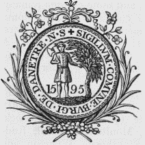
DAVENTRY (Holy Cross), an incorporated market-town, a parish, and the head of a union, in the hundred of Fawsley, S. division of the county of Northampton, 12¼ miles (W. by N.) from Northampton, and 71½ (N. W.) from London; containing, with the hamlet of Drayton, 4565 inhabitants. The British name of this place, Dwy-Avon-Tre, "the town of two Avons," from which its present appellation is derived, originated in its situation between the source of the river Leam, which falls into the Western Avon, and the river Nene, anciently styled the Aufona. According to a tradition, from which the device on the borough seal appears to have been taken, the town, now commonly called Dane-tree, was built by the Danes, who during their irruption in 1006 are supposed to have occupied a station designated the Borough Hill, about half a mile to the south-east. This station had previously been occupied by the Britons when opposed to Ostorius, who, after their reduction, converted it into the Castra Æstiva of his forces; it is identified with the ancient Beneventa of the Britons, and the Isannavaria of the Romans. At the time of the Conquest, Daventry was of considerable importance, and formed a part of the immense possessions given by the Conqueror to his niece Judith, wife of the great Earl of Northumberland. In the reign of John, the manor belonged to Robert Fitz-Walter, who headed the confederated barons who obtained from that monarch the grant of Magna Charta. In 1629, it became the property of the Finch family, in whose possession it remained till 1786, when it was purchased by the ancestor of the present proprietor. During the parliamentary war, the place was the scene of frequent conflicts between the contending parties; in the beginning of 1645, Sir William and Sir Charles Compton, brothers of the Earl of Northampton, with 300 horse of the royalist party, routed 400 of the parliamentarian cavalry, near the town. In the same year the king, having taken Leicester by storm, on his march to relieve Oxford, which was then besieged by the parliamentarians, fixed his quarters in this town, where he remained for six days prior to his departure for MarketHarborough, at which place his vanguard was stationed, and in the neighbourhood of which the battle of Naseby was fought on the day following.
Corporation Arms.
The town is pleasantly situated on a gentle eminence, sheltered on all sides, except the north-east, by hills, and consists of two principal and several smaller streets: the houses are well built and of handsome appearance, though without any regularity of plan. The town is paved, under the provisions of an act obtained in the 46th of George III.; and the inhabitants are supplied with water from numerous springs in the town, and with soft water from several fine springs collected into a reservoir on Borough Hill, and conveyed to the town by pipes. The water of these springs is equalled only by that of Malvern, and no chemical test has yet been able to detect the slightest impurity. The manufacture of whips, which had been carried on here to a considerable extent, fell gradually into decay, till within the last few years, during which it has been rapidly reviving; more than one-half of the population, also, are employed in making shoes. The situation of the town upon a great thoroughfare, and its numerous fairs, contribute to its prosperity; and the purity of the air and healthiness of the neighbourhood are such, that epidemic diseases are seldom known to assume a malignant character. The Grand Junction canal, at the northern angle of the parish, passes through a tunnel 2054 yards in length. The market is on Wednesday; and the fairs are held on the first Monday in Jan., the last Monday in Feb., the Tuesday in Easter week, June 6th and 7th, the first Wednesday in July, Aug. 3rd, the first Wednesday in Sept., Oct. 2nd, 3rd, and 27th, and the first Wednesday in December. The fairs in Easter week and on Oct. 2nd are for cheese, and the others for cattle; on the three Wednesdays next after Michaelmas are statute-fairs for hiring servants. The inhabitants, notwithstanding several attempts to emancipate themselves, are still obliged to bake their bread at a public oven, and grind their malt at a public mill, or to pay fees for exemption. Daventry was originally a borough by prescription; it received a charter of incorporation in the 18th of Elizabeth, which was confirmed by James I. and Charles II., and under which the corporation consisted of a bailiff, twelve burgesses, and a commonalty, consisting of twenty persons, assisted by a recorder, town-clerk, coroner, chamberlain, two head and two under wardens, and two serjeants-at-mace. By the act of the 5th and 6th of William IV., cap. 76, the government is now vested in a mayor, four aldermen, and twelve councillors; and the mayor and late mayor are justices of the peace. The powers of the county debt-court of Daventry, established in 1847, extend over the registration-district of Daventry. The town-hall having become greatly dilapidated, a commodious house was purchased and fitted up for transacting the business of the corporation. The borough gaol and house of correction, lately erected, is a wellbuilt edifice.
The parish comprises 3427a. 3r. 20p., and is bounded on the west by a portion of the county of Warwick. The Living is a perpetual curacy; net income, £344; patrons and appropriators, the Dean and Canons of Christ-Church, Oxford: the tithes, with certain exceptions, were commuted for land and money payments in 1802. The ancient church, originally the church of a priory, was taken down in 1752, and the present structure erected on its site. A chapel of ease, for which Miss Hickman, of Newnham Nell, gave a site, has been built by subscription, aided by a grant of £150 from the Incorporated Society; it is a neat edifice, containing about 500 sittings, of which 250 are free. There are places of worship for Independents and Wesleyans. A free grammar school was founded by William Parker, of London, who left a rent-charge of £20; and in 1729, John Farrer, of Daventry, bequeathed £400 (laid out in the purchase of land producing £35 per annum) the interest to be paid to the master, if in holy orders, on condition of his giving certain assistance to the minister of of the parish. The endowment was further augmented in 1740 by John Sawbridge, who left £150, to which £100 were added by his brother Edward. A charity school, now conducted on the national plan, was established in 1736, by Dr. Edward Maynard; it is endowed with £83 a year, arising from land, and with £700 three per cent. consols. There are various charitable bequests for the benefit of the poor. An academy for dissenters was maintained here by the trustees of William Coward, Esq., of London, till 1789, when it was removed. The union of Daventry comprises 28 parishes or places, and contains a population of 21,467.
About half a mile from the town is Borough Hill, a lofty and commanding eminence, remarkable as the site of the most extensive military intrenchments in the kingdom. On the summit are the remains of an elliptical camp, including an area of about 150 acres, defended on the south and west by a double trench and rampart, and on the north and east sides by four deep trenches and five ramparts. At the distance of 300 yards, and on the south side of the hill, are the remains of a smaller camp, including a quadrilateral area of about one acre, defended by a fosse and vallum: towards the northern extremity of the hill the encampment was divided by two ramparts, extending across the area, and separating from it a circular area of about twelve acres, with a high mount towards the north-east. This mount was explored by Mr. Baker, in 1823, and the remains of the foundations of walls enabled him to trace a great part of the ground plan of the prætorium; fragments of tessellated pavement, and other vestiges of Roman habitations were discovered. A range of tumuli on the hill was also opened, in which were found fragments of crematory urns, bones, charcoal, kists, and other relics of antiquity; from the rude structure of some of the urns, they are supposed to have been British, prior to the invasion of the Romans, by whom the others were evidently deposited. At the foot of the hill towards the south is a remarkable spot, named Burnt Walls, where a variety of walls, foundations of buildings, and vaults, have been discovered, and contiguous to which are vestiges of a fortified place, called John of Gaunt's Castle. The Watling-street passes within a short distance to the north-east of the town. The priory of Daventry was founded in 1090, by Hugh de Leycestre, sheriff of the county, who amply endowed it for monks of the Cluniac order: it was dissolved in the 17th of Henry VIII., by permission of Pope Clement VII., and its revenue, amounting to £236. 7. 6., granted to Cardinal Wolsey, for the endowment of his intended colleges at Ipswich and Oxford: the last remains were taken down in 1826, and their site is now occupied by the borough gaol. John Smith, a celebrated engraver in mezzotinto, was born here in 1740. Daventry gives the title of Baron to the Earl of Winchilsea.
Davidstow (St. David)
DAVIDSTOW (St. David), a parish, in the union of Camelford, hundred of Lesnewth, E. division of Cornwall, 3½ miles (N. E.) from Camelford; containing 408 inhabitants. This place is watered by the river Inny, which has its source near the church, and, after receiving numerous tributaries in its course, falls into the Tamar, at Innisford, to which it gives name. The parish comprises 6756 acres, of which 1136 are common or waste; the soil is fertile, the surface is gently undulated, and the scenery pleasing. The petty-sessions for the division are held once a month, at the village of Hallworthy, in the parish. The living is a vicarage, valued in the king's books at £8, and in the patronage of the Crown, in right of the duchy of Cornwall; impropriator, John Pearse, Esq. The great tithes have been commuted for £166, and the vicarial for £240; the glebe contains 18 acres, with a glebe-house. There are several barrows.
Davington (St. Mary Magdalene)
DAVINGTON (St. Mary Magdalene), a parish, in the union and hundred of Faversham, Upper division of the lathe of Scray, E. division of Kent, half a mile (N. W.) from Faversham; containing 143 inhabitants. From the numerous remains discovered, this place is supposed to have been a Roman station. A priory of Benedictine nuns was founded in 1153, probably by Fulk de Newenham, the revenue of which, in the 17th of Edward III., when the society petitioned to be exempted from the payment of taxes on account of poverty, was only £21. 13. 10.: having been entirely deserted, it escheated to the crown in the 27th of Henry VIII. The remains are considerable, and form an interesting ruin, part being the parish church, which is principally of Norman architecture, and has a beautifully arched doorway. The living is a donative, but there is now no incumbent, nor is divine service held in the church; the parochial rites are generally performed by the minister of Faversham. The parish comprises 495 acres, of which 65 are in wood. Here is a gunpowder manufactory.
Dawdon, or Dawden
DAWDON, or Dawden, a township, in the parish of Dalton-le-Dale, union of Easington, N. division of Easington ward and of the county of Durham, 6½ miles (S. S. E.) from Sunderland; containing 2017 inhabitants. There was once a castle or peel here, which in the first ages after the Conquest was the seat of the family of Escolland, who, it seems, afterwards assumed the name of Dalden, by which term this place was formerly designated, It was also for two centuries a favourite seat of the family of Bowes. A domestic chapel was attached to the structure, as Sir Jordan de Dalden, in 1325, obtained a licence to establish an oratory within his manor-house, on condition that no injury should arise to the parochial church of Dalton. The township comprises about 830 acres of land. A new harbour has been constructed here, which has attracted a great population: the number of inhabitants in 1821 was only 35.—See Seaham-Harbour.
Dawley, Little
DAWLEY, LITTLE, an ecclesiastical parish or district, in the parish of Dawley Magna, union of Madeley, Wellington division of the hundred of South Bradford, N. division of Salop, 4 miles (W. by S.) from Shiffnall. This district is about two miles in extent from north to south, and a mile and a half from east to west; it abounds in coal and ironstone, and at Horsehay are the well-known and very extensive iron-works of the Coalbrook-dale Company. The road from Coalbrookdale to Wellington runs through a part of it. The parish was constituted under the act 6th and 7th of Victoria, cap. 37, and the church was consecrated in October, 1845: it is a neat brick edifice in the Norman style, with a stone turret, and cost about £1500. The living is a perpetual curacy; patrons, the Crown and the Bishop of Lichfield, alternately; net income, £150. The tithes have been commuted for £154. The Wesleyan Methodists have two places of worship here.
Dawley Magna (St. Leonard)
DAWLEY MAGNA (St. Leonard), a parish, in the union of Madeley, Wellington division of the hundred of South Bradford, N. division of Salop, 4 miles (W. by S.) from Shiffnall; containing, with the ecclesiastical parish of Little Dawley and the township of Malin's - Lee, 8641 inhabitants. This parish, which comprises by admeasurement upwards of 3000 acres, is situated in an extensive mining and manufacturing district, and the inhabitants are chiefly employed in mines of iron and coal; lime is obtained in abundance for manure, and there are some tile-works. In connexion with these several works are numerous tramroads, affording every facility for the transport of produce; and a canal passes through the district, connecting it with the Severn in one direction, and with Shrewsbury and Liverpool in others. The living is a perpetual curacy; net income, £160; patrons and impropriators, the Devisees of Revell Phillips, Esq. The church is supported by immense buttresses, which are rendered necessary by the mining operations in the vicinity. A chapel, now a district church, was built in the township of Malin's-Lee, in 1805; and a church at Little Dawley in 1845. There are places of worship for dissenters.
Dawlish (St. Gregory)
DAWLISH (St. Gregory), a parish, in the union of Newton-Abbott, hundred of Exminster, Teignbridge and S. divisions of Devon, 2¾ miles (N. N. E.) from Teignmouth; containing 3132 inhabitants. This place, which is noticed in Domesday book under the name Doelis, was for many years an inconsiderable village, inhabited only by fishermen; but about the year 1790, it began to be distinguished, from the salubrity of the air and the pleasantness of its situation, as a desirable resort for invalids, and since that time it has been progressively improving. It is now one of the most fashionable watering-places on the coast of Devon. The principal part of the village is beautifully situated in a valley extending to the sea-shore, and watered by a rapid stream, designated the Dawlish Water. On the south side of this stream is a row of good houses, called the Strand, chiefly occupied by visiters, with two commodious hotels, and several well-furnished shops; and on the north side is a row of houses of inferior description, irregularly built. Facing the sea is a third range, named the Cross Row, in which the houses are well built and of respectable appearance. The lawn bordering the rivulet has, within the last few years, been planted with evergreens, and laid out in shrubberies and walks, forming an agreeable promenade; and a bridge for carriages, and two foot-bridges, afford communication between the opposite parts of the village. The reading-rooms are situated on the beach, commanding a fine view of the sea; the public baths, which present every accommodation, are on the other side of the rivulet, near the cliff. The new road from Exeter to Torbay passes through the village, and here is a station of the South-Devon railway. A regatta is celebrated, generally in August; and assembly and billiard rooms have been established. The environs afford pleasant walks and rides, and the cliffs that overhang the sea impart an air of grandeur to the scenery which is finely contrasted with the rich fertility of the vale, and the luxuriant foliage of the wood-crowned heights.
The parish comprises 5017 acres, whereof 202 are common or waste; the soil on the hills, which are very steep, is poor and sandy, but in the numerous picturesque valleys luxuriantly rich. A large quantity of cider is produced from the orchards attached to the farms, and potatoes are raised for exportation to Newfoundland; great quantities of mackerel are occasionally taken, off the coast. Mines of cobalt have been discovered in the vicinity. A pleasure-fair is held on Easter-Monday. The living is a vicarage, valued in the king's books at £25. 5., and in the patronage of the Dean and Chapter of Exeter, the appropriators: the great tithes have been commuted for £360, and the vicarial for £440. The church, a handsome and commodious structure in the later English style, with a square embattled tower crowned by pinnacles, was enlarged and beautified in 1824, at an expense of £4000. At Sedwell and Cofton, hamlets in the parish, are the remains of ancient chapels; the latter has been disused only since the year 1715. There are places of worship for Wesleyans, Independents, and Plymouth Brethren. An old house near the churchyard, with walls of extraordinary thickness, is said to have been a monastery of some consideration.
Day, St.
DAY, ST., a chapelry, in the parish of Gwennap, union of Redruth, hundred of Kerrier, county of Cornwall, 7 miles (W.) from Truro. This place is situated on an eminence in the centre of an extensive mining district, and is inhabited chiefly by persons employed in the surrounding works: it is large, neatly built, and supplied with water brought from a distance of three-quarters of a mile, by iron-pipes and machinery laid down in 1828, at a cost of £700. A market for provisions is held every Saturday, in a square area inclosed by a dwarf wall surmounted by an iron palisade; in the centre is a neat stone tower, with a lock-up house, erected in 1831, at an expense of £400. A fair is held on the Tuesday after July 29th. Within half a mile of the village is a railway leading to the port of Deveron, on the Restronget creek, belonging to Falmouth harbour; also a railroad to Portreath, on the Bristol Channel. The living is a perpetual curacy, the net income of which has been augmented by the Ecclesiastical Commissioners to £150; patron, the Vicar of Gwennap; appropriators, the Dean and Chapter of Exeter. The chapel, a neat edifice in the later English style, with a tower and spire, was erected in 1828, by subscription, aided by a grant of £3000 from the Parliamentary Commissioners. There was formerly a chapel dedicated to the Holy Trinity, which has been demolished: the tower was taken down not long before the year 1780. The Baptists, Bryanites, and Wesleyans have places of worship.
Daylesford (St. Peter)
DAYLESFORD (St. Peter), a parish, in the union of Stow-on-the-Wold, Upper division of the hundred of Oswaldslow, Blockley and E. divisions of the county of Worcester, 5 miles (S. W.) from Chipping-Norton; containing 81 inhabitants. This place was exempted from the interdict in the reign of John: the manor, from the time of the Conquest, with the exception of about 70 years, was the property of the ancestors of Warren Hastings, the renowned governor-general of British India. The parish occupies a detached portion of the county, and comprises according to measurement, 650 acres; the soil is fertile, and the meadow and pasture lands are of the richest luxuriance. The cultivation of cinquefoil was begun here in 1650, prior to its introduction into any other place in the kingdom. Stone is quarried for the roads. The living is a rectory, valued in the king's books at £7, and in the patronage of Sir Charles Imhoff: the tithes have been commuted for £200, and there are nearly four acres of glebe, and a newly built glebe-house. The church, one of the oldest structures in this part of the country, and in the Norman style, was, with the exception of two of the arches, taken down and rebuilt with the old materials, in 1816, by Mr. Hastings; it stands north of the village.
Deal (St. Leonard)
DEAL (St. Leonard), a sea-port, market-town, and parish, and a member of the town and port of Sandwich, in the union of Eastry, hundred of Cornilo, lathe of St. Augustine, E. division of Kent, on the coast of which it is situated, between the North and South Forelands, and near the great shipping roadstead, called the Downs, 18 miles (E. S. E.) from Canterbury, and 72 (E. by S.) from London; containing 6688 inhabitants. The origin of this place is involved in obscurity: it has been considered as the spot where Cæsar first landed when he invaded Britain; but this hypothesis is very doubtful. Leland gives the town the name of Dela, and Nennius says that "Cæsar battled at Dola," which Camden supposes to mean Deal; there are no records, however, of any town existing here till several centuries after the Romans had quitted Britain. Perkin Warbeck, who personated the Duke of York, as heir to the crown, in the reign of Henry VII., made an attempt to land here on the 3rd of July, 1495; but finding that a party which he had previously landed was attacked by his enemies, he returned to Flanders, and on Sept. 7th, 1497, landed at Whitsun bay, on the coast of Cornwall. In an ordinance of Henry III., dated 1229, this parish is mentioned as dependent on the port of Sandwich, whose jurisdiction over Deal and Walmer as one of the cinque-ports, was confirmed in the 19th of Henry VI. At that time the town was governed by a deputy and assistants appointed by the mayor and jurats of Sandwich; but in the reign of William III., the inhabitants, notwithstanding the opposition of the corporation of Sandwich, obtained a charter of incorporation from that monarch, though they were still subjected to serve on juries there as before.
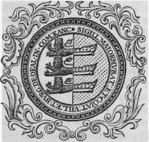
Old Corporation Seal, now disused.
The town consists principally of three long streets parallel with each other, in a direction along the shore, and connected by cross streets which are narrow and inconvenient; the houses, chiefly of brick, are for the most part irregularly built, but in those of recent erection, greater attention has been paid to uniformity of appearance. The streets are paved under the provisions of an act passed in 1790; and the inhabitants are tolerably well supplied with water, for a more ample supply of which for the town and neighbourhood an act of parliament was obtained in 1840. In 1812, an act for general improvement was procured, under which several alterations have been carried into effect. In 1833 the town was lighted with gas; in 1834 an effective police was established; and in 1837 a very important change was made, by removing several houses, widening Beechstreet, and constructing an esplanade, which forms a delightful walk embracing a splendid view of the Downs, the coast between the North and South Forelands, and the coast of France. It is about 600 feet in length and 150 in its greatest breadth, protected from the sea by a substantial concrete wall faced with brick, and cost upwards of £5500, including the purchase of houses, capstan-grounds, &c. The air is pure, and free from the vapours of marshes and fogs; the surface of the land on which Deal and the lower village of Walmer are built, is composed of sand, shingle, and boulders, and retains no moisture after the heaviest rains. Near the esplanade are the Royal Adelaide baths, reading-room, and library, a handsome pile of building, erected in 1836 at an expense of £2500, raised by donations and subscriptions on shares. On the south side of the town is the strong castle built by Henry VIII., who also founded that of Walmer: it consists of a round tower in the centre, connected with four earthworks of a semicircular form, and containing apartments for the captain and other officers; the whole is encompassed by a fosse with a drawbridge, and on the side next the sea are additional batteries.
This being the nearest naval station to the coast of France, and from the number of government vessels which, in time of war, resort to the Downs, the naval and victualling establishment here is of considerable importance: the North Sea fleet, in the last war, chiefly obtained its supply of stores at this place. The Royal Naval Hospital, on the Dovor road, is a noble pile of building, fitted up for the reception of about 300 patients, and completed in 1804. Further on the road, and in the parish of Walmer, are the Deal North Infantry, Cavalry, and South Infantry barracks: the North Infantry barrack has accommodation for 27 officers and 418 non-commissioned officers and privates, with an hospital for 120 patients; the Cavalry barrack is intended for 7 officers, 114 non-commissioned officers and privates, and 90 horses, and the South Infantry barrack for 33 officers, 688 non-commissioned officers and privates, and 16 horses. There is no harbour, but the sea between the shore and the Goodwin Sands forms the fine roadstead for shipping, called the Downs, which is within the jurisdiction of the port, and is of great importance as a station not only for ships of war, but for merchants' vessels, of which from 400 to 500 are frequently seen riding here in safety when wind-bound. The Goodwin Sands, commencing off the North Foreland, extend about ten miles in length to the South Foreland, and form a breakwater when the wind is easterly; according to tradition, the tract was once an island belonging to Godwin, the powerful Earl of Kent in the time of Edward the Confessor, and in the reign of Henry I. was swallowed up by the sea, which at the same time overwhelmed a great portion of Flanders and the Low Countries. An act for the construction of a pier at Deal was passed in 1838. The boatmen of the port are intrepid and excellent seamen, and are particularly active in affording assistance to vessels in distress, which they have frequently rescued from apparently inevitable destruction; the superiority of the boats is almost proverbial. The inhabitants are chiefly employed in maritime occupations: the trade is in coal, slop goods, and articles requisite for the supply of the shipping in the Downs. The making of malt, brewing, and boat-building are carried on; and the boats used by the Deal boatmen in their hazardous employment are all constructed here. An act was passed in 1845 for a branch to this place, 9¼ miles in length, of the Canterbury and Ramsgate railway: the line was opened on the 1st of July, 1847. The market is on Tuesday and Saturday, and is well supplied with provisions; fairs for cattle and general merchandise are held on April 6th and 7th, and October 12th and 13th.
Deal was constituted a free town and borough by charter of the 11th of William III., by which the corporation was styled the "Mayor, Jurats, and Commonalty," and consisted of a mayor, recorder, 12 jurats, and 24 common-councilmen, with a town-clerk and other officers. By the act of the 5th and 6th of William IV., cap. 76, the corporation is now styled the "Mayor, Aldermen, and Burgesses," and consists of a mayor, six aldermen, and 18 councillors, together forming the council of the borough, which is divided into two wards; the mayor, recorder, and four members of the council, are justices of the peace, and exercise exclusive jurisdiction. The recorder holds general sessions of the peace, and courts of record for determining all suits and actions under £100, four times in the year; the magistrates hold petty-sessions every Thursday. The powers of the county-debt court of Deal, established in 1847, extend over the registrationdistrict of Eastry. The freedom of the borough is obtained by birth or servitude, or by marriage with a freeman's daughter. By the 2nd of William IV. the town was united with Sandwich and Walmer in the exercise of the elective franchise: the number of electors here is about 400. The town-hall is a capacious apartment over the market-place, adorned with full-length portraits of William III. and William IV., in their robes of state; it was built in 1803, principally by subscriptions in the nature of loans upon the bonds of the corporation, and with the market-house, gaol, and gaoler's house, cost £2961.
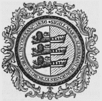
New Corporation Seal.
The parish comprises 860a. 2r. 38p., of which about 533 acres are arable, and 263 pasture; the soil is partly clayey, intermixed with sand, and partly chalky, and the surface is generally flat. Many acres are cultivated as garden-ground, producing abundant crops of the finest vegetables, not only for the supply of the town, but of the district for several miles round. The parish is subdivided into Upper, Middle, and Lower Deal. The Living is a rectory, valued in the king's books at £19. 10.; net income, £429; patron, the Archbishop of Canterbury. The church, in Upper Deal, was enlarged in 1819, at a cost of £1108, and will accommodate about 2000 persons; against the wall is an ancient tomb, on which is a brass effigy of Thomas Boys, who attended Henry VIII. at the siege of Boulogne, and died in 1560. A chapel, in Lower Deal, dedicated to St. George the Martyr, and in the Grecian style, was built at an expense of £1991, raised partly by subscription and partly by a duty on coal and culm; it was consecrated in 1716, and about 200 additional sittings were obtained in 1821, by the erection of galleries, towards the expense of which the Incorporated Society granted £400. The living is a perpetual curacy, in the patronage of the Archbishop; net income, £108. An evening lecturer also officiates at this chapel, whose stipend of £60 per annum, together with the income of the perpetual curate and all other charges, is defrayed out of the pew-rents. There are places of worship for Baptists, Independents, Wesleyans, and Unitarians. Elizabeth Carter, distinguished by her classical attainments, was born here, in 1717: her father, the Rev. Nicholas Carter, was curate of Lower Deal for 56 years. This is also the birthplace of William Boys, an eminent naturalist and antiquary, who was born in 1735. Thomas Gage, author of Travels in New Spain, was, after his conversion from the Roman Catholic faith, appointed rector of the parish by Cromwell; he sailed with Venables and Penn on the expedition to Hispaniola, in 1654, and died there. Anne of Cleves landed at Deal prior to her marriage with Henry VIII; and the present Queen Dowager landed here previously to her marriage with William IV. George II. embarked at the port on one of his visits to Germany.
Dean (St. Oswald)
DEAN (St. Oswald), a parish, in the union of Cockermouth, Allerdale ward above Derwent, W. division of Cumberland; containing, with the townships of Branthwaite and Ullock, 876 inhabitants, of whom 226 are in the township of Dean, 5 miles (S. W.) from Cockermouth. This parish comprises about 6500 acres. The soil of nearly one-half is a wet clay, and the remaining half contains every variety, from the lightest sand and gravel to the richest loam; the surface is pleasingly undulated, and the lower grounds are watered by the small river Marron, which abounds with trout. The substrata are coal, limestone, and iron-ore, and many of the population are employed in mines, and in quarries of a red and white freestone, and a black stone, here called cat-scalp. The living is a rectory, valued in the king's books at £19. 3. 1½.; net income, £318; patron and incumbent, the Rev. Samuel Sherwin. The tithes were commuted for land in 1809; the glebe lands comprise altogether 650 acres, of which the greater portion is of very inferior quality. A free grammar school was founded in 1596, by John Fox, with an endowment of £10 per annum, paid by the Goldsmith's Company, London; the schoolroom was rebuilt in the year 1615, at the expense of his son.
Dean
DEAN, a hamlet, in the parish of Spelsbury, union of Chipping-Norton, hundred of Chadlington, county of Oxford, 3¾ miles (S. E. by S.) from Chipping-Norton; containing 141 inhabitants.
Dean (All Saints)
DEAN (All Saints), a parish, in the union of Basingstoke, hundred of Overton, Kingsclere and N. divisions of the county of Southampton, 5½ miles (W. by S.) from Basingstoke; containing 164 inhabitants. This parish formerly included that of Ashe, which was separated about the middle of the seventeenth century. The present parish comprises 1557 acres by admeasurement: the soil is a strong clayey loam, on chalk; the surface is pleasingly undulated. The South Western railway, and the London and Exeter road, pass through the parish. The living is a rectory, valued in the king's books at £10. 8. 11½., and in the gift of William Beach, Esq.: the tithes have been commuted for £308, and the glebe contains 56 acres, with a glebehouse. The church was rebuilt in the year 1830, at the expense of W. Bramston, Esq., at a cost of about £7000, and is a handsome edifice in the later English style of architecture.
Dean-Bottom
DEAN-BOTTOM, a hamlet, in the parish of Horton-Kirby, union of Dartford, hundred of Axton, Dartford, and Wilmington, lathe of Sutton-at-Hone, W. division of Kent; with 63 inhabitants.
Dean, East
DEAN, EAST, a chapelry, in the parish of Mottisfont, union of Romsey, hundred of Thorngate, Romsey and S. divisions of the county of Southampton, 7¼ miles (N. W. by W.) from Romsey; containing 228 inhabitants. The Salisbury and Southampton canal passes through the chapelry. The tithes have been commuted for a yearly rent-charge of £205, and the glebe contains 4 acres.
Dean, East
DEAN, EAST, a parish, in the union of West Hampnett, hundred of Westbourn and Singleton, rape of Chichester, W. division of Sussex, 8 miles (S. by E.) from Midhurst; containing 433 inhabitants. This parish, the soil of which is fertile, is characterised by an agreeable diversity of scenery, and the village is beautifully situated in a narrow picturesque vale. The living is a discharged vicarage, valued in the king's books at £5. 4. 4½.; net income, £86; patron, the Rev. Thomas White Cogan; appropriators, the Dean and Chapter of Chichester. The church is an ancient cruciform structure, in the early English style, with an embattled tower rising from the centre.
Dean, East
DEAN, EAST, a parish, in the union of Eastbourne, hundred of Willington, rape of Pevensey, E. division of Sussex, 3 miles (W. S. W.) from Eastbourne; containing 360 inhabitants. The parish is situated on the English Channel, by which it is bounded on the south; the coast is bold and rocky, and on a high cliff a lighthouse has been erected within the last few years, immediately below which is a large cave, excavated in the solid rock, and called Darby's Cave. The village is in a secluded valley on the South Downs. The living is a vicarage, with that of Friston annexed, valued in the king's books at £8, and in the alternate patronage of the Bishop and the Dean and Chapter of Chichester, of whom the latter are the appropriators; net income, £276. The church is an ancient edifice, in the decorated English style, with a tower on the north side, of earlier date. On the Downs are several barrows and intrenchments. The Rev. Richard Michell, author of an essay entitled The Forester, was curate of the parish, and lies interred here.
Dean, Forest
DEAN, FOREST of, a liberty, in the hundred of St. Briavell's, W. division of the county of Gloucester, comprising the divisions and walks of Denby, Herbert, Little Dean, Speech-House, Worcester, and York, and containing 10,692 inhabitants: the centre of the Forest is 5 miles (S. W. by W.) from Newnham. This district, extending from north to south twenty miles, from east to west ten miles, and lying between the rivers Severn and Wye, was anciently occupied by the Silures, and probably obtained its name either from the contraction of the Gaelic word Arden, a wood, or from the British Danys Coed, the wood of fallow deer, for which it was famous for many centuries. Within its original bounds were situated the very ancient towns of Tudenham and Wollaston; also, on the margin of the Severn, the Abona of Antoninus, long since reduced to a small village called Alvington; and on the Wye, Breulais Castle, embosomed in an almost impenetrable thicket, and now fallen to decay. In the reign of Henry II., so dark and intricate were its tracts or cross ways, that the most daring outrages and robberies were committed with impunity, until restrained by the discovery of its rich mines of iron and coal, and the consequent establishment of forges by authority of parliament, together with the erection of villages for the residence of the miners and manufacturers; before which, the six lodges for the keepers of the several walks were the only houses in it. All the inhabitants are exempted from rates and taxes, and have free liberty of pasturage and to cut wood, and the privilege of sinking mines, the sixth part of the produce of which is due to the crown, and is collected by the gaveller.
The extent of the Forest, as defined in the 12th of Henry III., and subsequently confirmed, is 23,015 acres belonging to the crown, exclusively of freeholds obtained by grants. Charles I. conveyed the coppices and waste soil of the Forest, except the Lea Bailey, with all mines and quarries, to Sir John Wyntour, for £10,600, and a fee-farm rent of £1950. 12. 8. for ever; at which time there were standing 105,557 trees, estimated to contain 61,928 tons of timber, and 153,209 cords of wood. The civil war putting an end to the patent, the inclosures were thrown open, and the whole reforested. A renewal of the grant, however, excepting the timber fit for naval purposes, was made by Charles II. to the same individual; and on a survey by the parliament, in 1667, it was discovered that he had committed great encroachments upon the property of the crown, to repair which 1100 acres were then inclosed and planted: from this plantation the royal dock-yards are chiefly supplied. There are orchards producing a peculiar kind of fruit called the Styre apple, the cider made from which is of a superior quality, and bears a high price.
The government is vested in a lord warden, who is constable of St. Briavell's Castle; six deputy wardens; four verderers, chosen by the freeholders; a conservator; seven woodwards; a chief forester in fee and bowbearer, which united offices are held by the Wyndham family, in right of inheritance; eight foresters in fee; a gaveller; and a steward of the swainmote. The officers have power to hold a court of attachment every forty days, a court of swainmote thrice a year, and a court called the justice-seat once in three years. The steward presides at the miners' court, assisted by a jury of miners, who judge upon the particular laws and customs by which they are governed, to prevent encroachments upon each other in the coal and iron works. The courts are held at the Speech-House, in the centre of the Forest, the general aspect of which is picturesque in the extreme, being beautifully diversified with hill and valley, interspersed with the rich and varied foliage of the woods. Pursuant to an act passed in the 36th of George III., roads have been opened in various directions through the Forest, which is also intersected by several tramroads, communicating with the Severn and the Wye. There are four ecclesiastical districts in the Forest, formed in 1842, and of which the livings are perpetual curacies, each endowed with £150 per annum; the churches are respectively dedicated to Christ, the Holy Trinity, St. John, and St. Paul, and are within the jurisdiction of the Bishop of Gloucester and Bristol, the three first being in the patronage of the Crown, and the last in that of the Bishop. The buildings were erected by voluntary contributions, and have been endowed with £1333 three per cent. consols. for their repair, by the Commissioners of her Majesty's Woods and Forests; the incomes of the clergy are derived partly from Queen Anne's Bounty, and partly from funds assigned by the commissioners.
Dean, Little (St. Ethelbert)
DEAN, LITTLE (St. Ethelbert), a parish, in the union of Westbury, hundred of St. Briavell's, W. division of the county of Gloucester, 1¾ mile (N. W. by N.) from Newnham; containing 828 inhabitants. The village is situated on the verge of the Forest of Dean, and in its vicinity are considerable mines of coal and iron, in which, and in the manufacture of nails, the inhabitants are principally employed. It had formerly the privilege of a market, and the market-cross is still standing, having a low octangular roof spreading from a central shaft, and surmounted by a pinnacle with niches and statues. Fairs for pedlery are held on Whit-Monday and November 26th. Here is a house of correction. The living is a perpetual curacy, in the patronage of the trustees of St. Bartholomew's Hospital, Gloucester: the tithes have been commuted for £115.
Dean, Mitchell (St. Michael)
DEAN, MITCHELL (St. Michael), a market-town and parish, in the union of Westbury, hundred of St. Briavell's, W. division of the county of Gloucester, 11 miles (W.) from Gloucester, and 113 (W.) from London; containing 665 inhabitants. This place, the origin of which is anterior to the Conquest, derives its name, denoting its situation in a dell, from the Saxon Dene, a dell; and its adjunct from Mycel, Great, in contradistinction to Little Dean, in the neighbourhood. It was the principal town in the Forest of Dean, and consists of three streets, diverging obliquely from a common centre: it was formerly a staple town for the wool-trade; at present the manufacture of leather is carried on to a small extent. The market is on Monday; fairs are held on Easter-Monday and Oct. 10th, for horses, cattle, and sheep. The living is a discharged rectory, valued in the king's books at £10. 16. 0½.; patron, M. Colchester, Esq.: the tithes have been commuted for £173. 13. The church is a spacious structure, built at different periods, and exhibiting various styles of English architecture, with a tower surmounted by an octagonal spire: in the east window of the north aisle are some remains of the stained glass with which the edifice appears to have been generally ornamented; the roof of oak is decorated with flowers and other ornaments, exquisitely carved. A subterraneous passage leads from the church to a wood, about half a mile from the town. A school, now conducted on the national plan, was founded by means of a bequest of £1000 by William Lane, Esq., of Gloucester, in 1789, and one of £300 by his widow, in 1806; these sums, with other benefactions, produce an annual income of £62.
Dean, Nether (All Saints)
DEAN, NETHER (All Saints), a parish, in the union of St. Neot's, hundred of Stodden, county of Bedford, 3½ miles (W. by S.) from Kimbolton; containing, with the hamlet of Upper Dean, 541 inhabitants. The living is a perpetual curacy; net income, £100; patrons, the Dean and Chapter of Worcester; impropriator, J. Cole, Esq. The tithes were commuted for land and a money payment by an act of the 40th of George III. Joseph Neale in 1702 gave some land which, since an inclosure of the common lands, has been augmented to about 74 acres, with a farmhouse, now producing £64 a year, for teaching boys. There is a place of worship for Wesleyans.
Dean-Prior (St. George the Martyr)
DEAN-PRIOR (St. George the Martyr), a parish, in the union of Totnes, hundred of Stanborough, Stanborough and Coleridge, and S. divisions of Devon, 4 miles (S. S. W.) from Ashburton; containing 552 inhabitants. The parish comprises 2707 acres, of which 331 are common or waste. The living is a vicarage, valued in the king's books at £21; net income, £282; patron and impropriator, Sir John Buller Yarde Buller, Bart.
Dean, Prior's
DEAN, PRIOR'S, a parish, in the union of Petersfield, hundred of Barton-Stacey, Petersfield and N. divisions of the county of Southampton, 4¾ miles (N. by W.) from Petersfield; containing 163 inhabitants. This parish comprises 1435 acres: the scenery abounds with sylvan beauty; the soil on the hills is thin and chalky, and that in the lower grounds rich and strong, producing excellent crops and luxuriant pasture. The living is a rectory, united to that of Colemore. The church, which stands in a romantic spot, contains some fine monuments to the Compton and Titchborne families. In the churchyard is a yew-tree which, with one exception, is the largest in England.
Dean-Raw
DEAN-RAW, a township, in the parish of Warden, N. W. division of Tindale ward, S. division of Northumberland, 8 miles (W.) from Hexham; containing 673 inhabitants. Staward-le-Peel, here, was a possession of the Swinburne family at a very early period, and in 1386 was granted, by Edward, Duke of York, to the friars eremites of Hexham, to be held by the annual payment of five marks. The Howards, Sandersons, and Bacons subsequently held it; the last named family, who, in 1828, assumed the name of Grey in addition to that of Bacon, being the present owners. The natural features in the vicinity of Staward-le-Peel are highly interesting, and travellers who have visited the valleys of the Tyrol have stated that the grandeur of the scenery there, is here to be found in miniature. Near the confluence of the Allen and Harsingdale-burn, on the south side of the township, are the remains of the old fortress.
Dean-Scales
DEAN-SCALES, with Ullock and Pardshaw, a township, in the parish of Dean, union of Cockermouth, Allerdale ward above Derwent, W. division of Cumberland, 3½ miles (S. W.) from Cockermouth; containing 350 inhabitants. The manufacture of linenthread is carried on.
Dean, West (St. Andrew)
DEAN, WEST (St. Andrew), a parish, in the union of Westbourne, hundred of Westbourne and Singleton, rape of Chichester, W. division of Sussex, 5 miles (N.) from Chichester; containing, with the tything of Chilgrove, 657 inhabitants. The parish is on the road from London to Chichester by way of Midhurst, and is watered by the river Lavant: it comprises 4600 acres, of which about 900 are down land; the surface is pleasingly diversified with hill and dale, and the soil, abounding with chalk, is fertile. West Dean House, erected in 1804 by Lord James Selsey, is a spacious and handsome mansion. A cottage-allotment society has been for some time established. The living is a discharged vicarage, with the rectory of Singleton and chapelry of Benderton annexed, valued in the king's books at £6. 12.; net income, £262; patrons, the Dean and Chapter of Chichester (who are also impropriators) for two turns, and the Duke of Richmond for one turn. The church is an ancient cruciform structure, in the early English style, with a square embattled tower; the south transept was rebuilt in 1810, by Lord James Selsey, and appropriated to the use of his family. Several small Roman sepulchral urns have been found under the downs, above Chilgrove, at which place was formerly a chapel.
Dean, West (All Saints)
DEAN, WEST (All Saints), a parish, in the union of Eastbourne, hundred of Willington, rape of Pevensey, county of Sussex, 2 miles (E.) from Seaford; containing 129 inhabitants. The parish is bounded on the south by the English Channel, and comprises by computation 2222a. 38p., of which about 1022 acres are arable, 372 meadow and marsh, and 826 down land: along the western boundary runs the river Cuckmere, over which, at Excette, formerly a parish of itself, is a bridge communicating with the Seaford road. The living is a discharged rectory, valued in the king's books at £14. 15. 5., and in the patronage of the Earl of Burlington; net income, £102. The church is in the decorated English style, with an embattled tower surmounted by a low spire: close to the churchyard is the parsonage, an ancient house with a curious winding staircase of stone. At Charlston House was once a chapel.
Dean, West (St. Mary)
DEAN, WEST (St. Mary), a parish, in the union of Stockbridge, hundred of Alderbury, Salisbury and Amesbury, and S. divisions of Wilts, 7 miles (E. by S.) from Salisbury; containing, with the chapelry of East Grimstead, 426 inhabitants. The living is a rectory, valued in the king's books at £19. 4. 4½.; patron, the Rev. H. Glossop. The church contains a curious monument, with copper doors, dated 1669, to the Rt. Hon. Robert Pierpoint, who died during the amputation of his leg; his effigy in marble represents him under this operation, surrounded with figures of angels. There is also a monument, dated 1685, to Sir John Evelyn (relative of the author of Sylva), his wife, and eleven children, who, with the exception of one only, were born blind. There is a chapel of ease at East Grimstead. Part of a Roman tessellated pavement, of which some fragments retain their original position, was found in the village in 1741.