A Topographical Dictionary of England. Originally published by S Lewis, London, 1848.
This free content was digitised by double rekeying. All rights reserved.
'Orby - Ormskirk', in A Topographical Dictionary of England, (London, 1848) pp. 479-483. British History Online https://www.british-history.ac.uk/topographical-dict/england/pp479-483 [accessed 11 April 2024]
In this section
Orby (All Saints)
ORBY (All Saints), a parish, in the union of Spilsby, Marsh division of the wapentake of Candleshoe, parts of Lindsey, county of Lincoln, 7 miles (E. by N.) from Spilsby; containing 381 inhabitants. It comprises by admeasurement 1200 acres, and is situated on the west of the road from Burgh, through Louth, to Great Grimsby, and about four miles from the sea. The living is a discharged vicarage, valued in the king's books at £9. 19. 4.; net income, £160; patron and appropriator, the Bishop of Lincoln: there is a glebe-house, with about 42 acres of land. The church is a neat edifice in the early English style. Here are places of worship for Methodists and Baptists; also a national school.
Orchard, East
ORCHARD, EAST, a parish, in the union of Shaftesbury, hundred of Sixpenny-Handley, Shaston division of Dorset, 5 miles (S. S. W.) from Shaftesbury; containing 173 inhabitants, and comprising by admeasurement 789 acres. The living is annexed to the vicarage of Iwerne-Minster. The church is a small plain edifice, built about two or three centuries since.
Orchard-Portman (St. Michael)
ORCHARD-PORTMAN (St. Michael), a parish, in the union of Taunton, hundred of Taunton and Taunton-Dean, W. division of Somerset, 2 miles (S. S. E.) from the town of Taunton; containing 114 inhabitants. The living is a discharged rectory, valued in the king's books at £7. 11. 5., and in the gift of Lord Portman: the tithes have been commuted for £115. 16., and the glebe comprises 24 acres.
Orchard, West
ORCHARD, WEST, a parish, in the union of Shaftesbury, hundred of Sixpenny-Handley, Shaston division of Dorset, 3 miles (N. E. by E.) from Sturminster-Newton; containing 157 inhabitants. It is situated on the river Stour, in the vale of Blackmore, and comprises about 650 acres, of which 548 are pasture, 48 arable, and the remainder orchard land. The living is annexed to the vicarage of Fontnell-Magna. The church is in the later English style.
Orchardleigh
ORCHARDLEIGH, a parish, in the union and hundred of Frome, E. division of Somerset, 2½ miles (N.) from Frome; containing 44 inhabitants. It is situated two miles west of the road between Bath and Weymouth, and comprises about 600 acres, of which 88 are woodland, and 5 arable; the soil is loamy earth, resting on limestone. The greater portion of the parish is included in the Park, comprising a beautifully undulated and wellwooded surface, improved by an artificial lake covering about twenty-eight acres. The living is a discharged rectory, valued in the king's books at £2; net income, £167; patron, T. S. N. Champneys, Esq. The church is a plain ancient edifice, of small dimensions, and in the Norman style.
Orcheston (St. George)
ORCHESTON (St. George), a parish, in the union of Amesbury, hundred of Heytesbury, Salisbury and Amesbury, and S. divisions of Wilts, 12 miles (S. S. E.) from Devizes; containing, with the hamlet of Elston, 234 inhabitants. The parish is on the road between Salisbury and Devizes, and comprises by admeasurement 2363 acres. The living is a rectory, valued in the king's books at £19. 7. 6., and in the gift of Wadham College, Oxford: the tithes have been commuted for £493. 13. 4., and there is a glebe-house, with 36 acres of land. The church was completely restored in 1833, and is now an elegant and commodious edifice, with eastern and western windows of stained glass.
Orcheston (St. Mary)
ORCHESTON (St. Mary), a parish, in the union of Amesbury, hundred of Branch and Dole, Salisbury and Amesbury, and S. divisions of Wilts, 11½ miles (S. S. E.) from Devizes; containing 113 inhabitants. It is situated near the road from Devizes to Salisbury, and comprises 1871a. 3r. 10p. A small meadow in the parish is remarkable for a peculiar grass, producing a stalk between seven and ten feet long, the strong succulent shoots from which, fall, run along the ground, and take root at the knots. The living is a rectory, valued in the king's books at £13. 13. 9.; patrons, the Master and Fellows of Clare Hall, Cambridge: the tithes have been commuted for £350, and the glebe comprises 38 acres. The church and glebe-house have been rebuilt, the latter, as well as the chancel of the church, at the entire cost of the rector.
Orcop (St. Mary)
ORCOP (St. Mary), a parish, in the union of Dore, Upper division of the hundred of Wormelow, county of Hereford, 9½ miles (W. N. W.) from Ross; containing 570 inhabitants. The parish is considerably elevated, and consists of 2371 acres. Limestone is obtained. The living is a donative curacy, in the patronage of William Palmer, Esq. (the impropriator), with a net income of £31: the tithes have been commuted for a rent-charge of £220.
Ordsall (All Saints)
ORDSALL (All Saints), a parish, in the union of East Retford, Hatfield division of the wapentake of Bassetlaw, N. division of the county of Nottingham, 1½ mile (S.) from East Retford; containing 955 inhabitants. The parish comprises by admeasurement 1925 acres, the soil of which is a rich sandy and gravelly earth: about the close of the last century, it was chiefly open forest-ground, some parts of which were not inclosed till 1804. The Worksop and Chesterfield canal and the river Idle pass through, and on the latter is a paper-mill. The village is old, and irregularly built on the west bank of the Idle, which divides the lordship of Ordsall from that of Thrumpton; these two places make up the entire parish, and the latter includes the neat hamlet of Whitehouses, on the great north road, Whinney moorrow, Storcroft-terrace, and several handsome modern dwellings forming the southern suburbs of East Retford. The living is a rectory, valued in the king's books at £19. 10. 7½., and in the gift of Lord Wharncliffe: the tithes have been commuted for £480, and the glebe comprises 18 acres, with an excellent parsonage-house. The church is chiefly in the later English style, with a lofty tower, which was greatly injured by lightning in 1823; the interior of the building was thoroughly repaired in 1831. The poor have the benefit of two or three small bequests.
Ore (St. Helen)
ORE (St. Helen), a parish, in the hundred of Baldslow, union and rape of Hastings, E. division of Sussex, 2½ miles (N. N. W.) from Hastings; containing 1228 inhabitants. The parish is situated on the road from Hastings to Battle: the surface is agreeably diversified with hill and dale, and tolerably well wooded, especially on the estate of Coghurst. John of Gaunt, Duke of Lancaster, resided at the mansion of Ore Place, which has been nearly rebuilt by its present proprietor, Sir H. Elphinstone, Bart.; and near the estate are the remains of a religious establishment. Good sandstone is found. The living is a discharged rectory, valued in the king's books at £3. 0. 2½.; net income, £178; patrons, Trustees: there is a glebe-house, with about 8 acres of land. The church is principally in the later English style, and consists of a nave, chancel, and south aisle, the last of which was erected only a few years since. The union workhouse is situated in the parish. There is a chalybeate spring.
Orford (St. Bartholomew)
ORFORD (St. Bartholomew), a parish, having separate jurisdiction, and formerly a representative borough and market-town, in the union, and locally in the hundred, of Plomesgate, E. division of Suffolk, 20 miles (E. by N.) from Ipswich; containing, with the hamlet of Raydon, 1028 inhabitants. This was a place of some trade and importance, but has been reduced to a state of comparative insignificance. It is situated on the river Ore, and the inhabitants are well supplied with water; the houses are scattered and indifferently built. On the east of the parish, between the river and the sea, are two lighthouses, designated the Orford Ness Lights. An oyster-fishery is carried on, under licence from the corporation; and coal is imported, and corn exported, the river being navigable up to Aldeburgh quay, for vessels of 300 tons' burthen. A toy-fair is held on June 24th. The inhabitants received a charter of incorporation prior to the reign of Richard III., by which monarch, and also by Elizabeth and James I., their privileges were confirmed. Under the charter granted by King James, the corporation consists of a mayor, eight portmen, and twelve capital burgesses, assisted by a recorder, coroner, chamberlain, town-clerk, two serjeants-at-mace, two waterbailiffs, and a harbour-master; the mayor and two portmen are justices of the peace. The corporation are empowered to hold sessions twice a year, or as often as may be requisite, and a court of record for the recovery of debts under 40s. The elective franchise was conferred in the 23rd of Edward I.; the exercise of it was subsequently discontinued till the reign of Henry VI., from which period two members were regularly returned to parliament until the 2nd of William IV., when the borough was disfranchised.
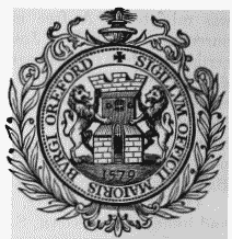
Corporation Seal.
The living is annexed to the rectory of Sudborne: the tithes have been commuted for £317, and the glebe comprises 10½ acres. The church is of great antiquity, and when entire was a spacious and magnificent structure, with a square embattled tower. The chancel, now in ruins, appears to be more ancient than the rest of the building, and is separated from it by a wall built across the east end of the nave; the ruins are in the Norman style, and consist of a double row of massive columns, supporting semicircular arches decorated with zigzag mouldings and other highly-finished carvings. A part of the steeple fell down in 1830, and has not been entirely rebuilt. The edifice contains a font of exquisite workmanship, and numerous figures of brass and inscriptions in different parts, with a monument to the memory of the Rev. Francis Mason, author of Vindiciæ Ecclesiæ Anglicanæ, who died in 1621. At the west end of the town are the remains of a castle supposed to have been built very soon after the Conquest: the keep is still left, a building of eighteen sides, flanked by three square embattled towers, on the north, north-east, and south-east; the lower portion of the walls is solid, and the upper parts contain chambers. An hospital for a master and brethren, dedicated to St. Leonard, was founded in the time of Edward II., and continued until after 1586; and there was likewise a priory of Augustine friars, established about the 23rd of Edward I.: part of the walls of a monastery, and the burial-ground, yet remain, and in the latter a quantity of bones and of Saxon and Roman coins have been found. Here were also chapels dedicated to St. John the Baptist and St. Leonard. Herbert de Lozinga, the first Bishop of Norwich, is said to have been a native of the town. It confers the title of Earl upon the Walpole family.
Orforth
ORFORTH, an extra-parochial district, in the union of Louth, S. division of the wapentake of Walshcroft, parts of Lindsey, county of Lincoln; containing 22 inhabitants, and comprising about 1000 acres.
Orgarswick
ORGARSWICK, a parish, in the union and liberty of Romney-Marsh, locally in the hundred of Worth, lathe of Shepway, W. division of Kent, 5 miles (N. N. E.) from New Romney; containing 8 inhabitants. It comprises 392 acres. There being no church, the living, a rectory valued in the king's books at £3, is a sinecure; net income, £39; patrons, the Dean and Chapter of Canterbury.
Orgreave
ORGREAVE, a township, in the parish of Alrewas, union of Lichfield, N. division of the hundred of Offlow and of the county of Stafford, 4¾ miles (N. N. E.) from Lichfield; containing, with the hamlet of Overley, 123 inhabitants. It is situated close to the river Trent, and near the Grand Trunk canal; and comprises about 700 acres of land. The Hall, now a farmhouse, with a fine avenue of elms, was formerly the seat of the Adams family, the paternal ancestors of the Earl of Lichfield.
Orgreave
ORGREAVE, a township, in the parish and union of Rotherham, S. division of the wapentake of Strafforth and Tickhill, W. riding of York, 4¼ miles (S. by W.) from Rotherham; containing 52 inhabitants. The township comprises by computation about 500 acres, and consists chiefly of detached and irregularlybuilt houses on the west bank of the river Rother.
Orlestone (St. Mary)
ORLESTONE (St. Mary), a parish, in the union of East Ashford, partly in the liberty of Romney-Marsh, and partly in the hundred of Ham, lathe of Shepway, W. division of Kent, 6½ miles (S. by W.) from Ashford; containing 316 inhabitants. It comprises 1825a. 4p., of which about 700 acres are woodland, and the remainder arable and pasture; the soil is fertile, producing excellent wheat, and the scenery is richly diversified. The Royal Military canal passes within a short distance of the village. The living is a discharged rectory, valued in the king's books at £4. 15. 9., and in the gift of T. Thornhill, Esq.: the tithes have been commuted for £157. 18., and the glebe consists of 48 acres. The church is a neat edifice. There is a place of worship for Wesleyans. Some chalybeate springs rise here.
Orleton
ORLETON, a parish, in the union of Leominster, hundred of Wolphy, county of Hereford, 5 miles (S. by W.) from Ludlow; containing 603 inhabitants. It comprises 2497 acres, of which two-thirds are arable, and the remainder pasture. The Leominster canal and the road from Ludlow to Leominster pass through. There are courts leet and baron in March and October. A large fair for cattle is held on the 23rd and 24th of April. The living is a vicarage; patrons and impropriators, the Governors of Lucton school: the great tithes have been commuted for £145. 14., and the vicarial for £129. 9.; the glebe comprises about one acre, with a house. The church is ancient, has a shingled spire, and contains a curious font. Blount, the antiquary, was a native of the parish, and lies buried in the chancel of the church.
Orleton
ORLETON, a chapelry, in the parish of Eastham, union of Tenbury, Upper division of the hundred of Doddingtree, Tenbury and W. divisions of the county of Worcester, 7½ miles (E. by S.) from Tenbury; containing 111 inhabitants. It is situated in the eastern part of the parish, on the right bank of the river Teame; and consists of 538a. 2r. 31p. of a fertile soil, producing wheat, hops, and fruit. The chapel, dedicated to St. John the Baptist, was rebuilt in 1816, at an expense of £456, and is a plain brick edifice containing 120 sittings. A rent-charge of £128 has been awarded as a commutation for the tithes, and there is a glebe of 5¾ acres.
Orlingbury (St. Mary)
ORLINGBURY (St. Mary), a parish, in the union of Wellingborough, hundred of Orlingbury, N. division of the county of Northampton, 3¾ miles (N. W. by N.) from Wellingborough; containing 351 inhabitants. The parish consists of 1858a. 26p. of productive ground. The living is a rectory, valued in the king's books at £20. 7. 3½.; net income, £268; patron, the Rev. J. Hilton. The tithes were commuted for land and corn-rents, under an inclosure act, in 1808. The Rev. Owen Manning, editor of Lye's Saxon Dictionary, was born here in 1721.
Ormesby (St. Cuthbert)
ORMESBY (St. Cuthbert), a parish, in the union of Guisborough, partly in the E., and partly in the W., division of the liberty of Langbaurgh, N. riding of York, 7 miles (E. by S.) from Stockton; containing, with the chapelry of Eston, and the townships of Morton, Normanby, and Upsall, 851 inhabitants, of whom 383 are in Ormesby township. This parish is in the district of Cleveland, and at the mouth of the river Tees, by which it is bounded on the north. The township of Ormesby comprises 2768a. 3r. 29p. of land, chiefly the property of Sir William Henry Pennyman, who is lord of the manor; the surface is boldly diversified, and the soil generally fertile. Ormesby Hall, the seat of Sir William, is a spacious and handsome mansion, beautifully situated on an eminence commanding fine views of the river and the North Sea, and surrounded with a richly-wooded park. About two miles from the village is Cleveland Port, where formerly a very extensive trade in corn, coal, and other articles, was carried on. The village is pleasantly situated on the road from Redcar to Stockton, and contains several well-built houses. The living is a vicarage, held with the perpetual curacy of Eston, and valued in the king's books at £6. 18. 6½.; net income of Ormesby, £283, and of Eston £80; patron and appropriator, the Archbishop of York. The great tithes of the township of Ormesby have been commuted for £296, and the small for £126; the vicar has a glebe of 2¾ acres. The church, an ancient structure with some interesting details of Norman character, was repaired in 1820 at an expense of £700. There are bequests for distribution among the poor, amounting to £26 per annum. Numerous gold coins of the reigns of Henry VI., VII., and VIII., and Charles I., were dug up while rebuilding the glebe-house in 1838.
Ormsby (St. Margaret)
ORMSBY (St. Margaret), a parish, in the East and West Flegg incorporation, hundred of East Flegg, E. division of Norfolk, 5 miles (N. by W.) from Yarmouth; containing 645 inhabitants. This parish, which is situated on the coast, comprises, with Ormsby St. Michael, 2686 acres. The village is about a mile from the sea, of which it commands an extensive view, and contains many handsome residences; the surrounding country is richly wooded, and the scenery picturesque. The inhabitants had formerly a charter for a market, and they are still exempt from toll and from serving on juries out of the manor. An act for the inclosure of lands was passed in 1842. The living is a discharged vicarage, with that of St. Michael and that of Scratby; it is valued in the king's books at £10. 0. 10.: patrons and appropriators, the Dean and Chapter of Norwich. The appropriate tithes have been commuted for £772. 14., and the vicarial for £290. 17.; the glebes comprise respectively 51 and 65 acres. The church is a handsome structure in the later English style, with a lofty square embattled tower; on the south is a richly-embellished Norman doorway. The Baptists and Wesleyans have places of worship.
Ormsby (St. Michael)
ORMSBY (St. Michael), a parish, in the East and West Flegg incorporation, hundred of East Flegg, E. division of Norfolk, 6 miles (N. N. W.) from Yarmouth; containing 278 inhabitants. The living is united to the vicarage of Ormsby St. Margaret. The church is in the early English style, with a tower, and was thoroughly repaired in 1838. There are some town lands yielding annually £32. 15., of which a portion is distributed in blankets and coal among the poor.
Ormsby, North (St. Helen)
ORMSBY, NORTH (St. Helen), a parish, in the union of Louth, wapentake of Ludborough, parts of Lindsey, county of Lincoln, 5 miles (N. W. by N.) from Louth; containing 132 inhabitants, and comprising about 1650 acres. The living is a discharged vicarage, valued in the king's books at £3, and has a net income of £87; the patronage and impropriation belong to the Misses E. and S. Ansell. The church is a small edifice. A monastery for nuns and brethren of the Sempringham order, was founded here in the time of Stephen, by William, Earl of Albemarle, and Gilbert, son of Robert de Ormesby; it was dedicated to the Blessed Virgin Mary, and flourished till the Dissolution, when its revenue was valued at £80.
Ormsby, South (St. Leonard)
ORMSBY, SOUTH (St. Leonard), a parish, in the union of Spilsby, hundred of Hill, parts of Lindsey, county of Lincoln, 7¾ miles (N. N. W.) from Spilsby; containing, with Ketsby hamlet, 259 inhabitants. The living is a rectory, to which the vicarage of Calceby and the rectory of Driby were united in 1774; it is valued in the king's books at £14. 13. 11½., and is in the gift of the family of Massingberd. The impropriate tithes have been commuted for £92. 11., and the rectorial for £888; the glebe consists of 59 acres. Here are the remains of a Roman exploratory camp.
Ormside (St. James)
ORMSIDE (St. James), a parish, in East ward and union, county of Westmorland, 3¼ miles (S. E. by S.) from Appleby; containing 190 inhabitants. The living is a discharged rectory, valued in the king's books at £17. 17. 3½.; net income, £166; patron, the Bishop of Carlisle. The tithes were commuted for land in 1803; and there is a glebe-house. The church is a small ancient structure, situated on the south bank of the river Eden, which, washing the foundations of the building, in 1689, exposed to view some brazen vessels.
Ormskirk (St. Peter and St. Paul)
ORMSKIRK (St. Peter and St. Paul), a markettown and parish, and the head of a union, in the hundred of West Derby, S. division of Lancashire; containing, with the chapelry of Skelmersdale, and the townships of Bickerstaffe, Burscough, Lathom, and Scarisbrick, 14,608 inhabitants, of whom 4891 are in the town, 13 miles (N. N. E.) from Liverpool, on the road to Preston, 40 (S. by W.) from Lancaster, and 209 (N. W. by N.) from London. Ormskirk is not found in the Domesday survey; but, according to very credible tradition, the parish belonged to Orm, the Saxon proprietor of Halton, who, driven from his possessions in Cheshire, established himself in Lancashire, and, by his marriage with Alice, daughter of Herveus, a Norman nobleman, ancestor of Theobald Walter, obtained large estates in this county. He was the founder, no doubt, of the church; the word kirk, with his own name, constituting the name of the parish. It is certain, that a church, and the name of Ormskirk, both existed in the reign of Richard I., when Robert, son of Henry de Torbock and Lathom, who is supposed to have been a descendant of Orm, founded the priory of Burscough, which was endowed with a great part of the parish, including the manor of Ormskirk. On the dissolution of monasteries, the manor was granted to the Earl of Derby, in whose family it has ever since continued. In the civil war of the 17th century, this place was the scene of a conflict between the royalist and parliamentary forces on the 20th August 1644, in which the former were defeated with considerable loss; and on the 16th October, in the same year, a skirmish took place, which has been denominated Ormskirk fight.
The town, which is situated on an eminence, eight miles from the sea, overlooks the surrounding country, and enjoys a salubrious air and delightful prospects. It is clean and well built, and consists chiefly of four streets diverging at right angles from a central area used as a market-place: the lighting act is in operation. There are, a small silk-factory, three roperies, and a steam flour-mill. The loamy soil around the town produces a great quantity of carrots, which are sent to Liverpool, and the farmers are noted for the culture of early potatoes. The inhabitants have also long been famous for making gingerbread, which is of exquisite flavour; it meets with a rapid sale, and is even exported. The Leeds and Liverpool canal is not more than three miles distant, and here is a station of the Liverpool and Preston railway. The market, granted in the 14th of Edward I. to the prior of Burscough, is on Thursday; and fairs are held on Whit-Monday and Whit-Tuesday, and September 10th and 11th. Petty-sessions take place on the last Friday in every month; and a court leet occurs in October, at which a constable and other officers are appointed for the town. The powers of the county debtcourt of Ormskirk, established in 1847, extend over the registration-district of Ormskirk.
The length of the parish, from Martin Mere on the north-west, to Skelmersdale on the south-east, is twelve miles; the breadth from Lathom on the east, to Ormskirk on the west, between four and five miles; and the area is 30,083 acres. A stream, called the Merebrook, flows from Bickerstaffe, by the south side of Ormskirk, through Scarisbrick, and into Martin Mere. The Tawd brook, rising upon Bickerstaffe Moss, runs between Lathom and Ormskirk, and winds down to the Douglas near Newburgh. The Eller brook, a pellucid rivulet, issues from Lathom, and passing by the priory of Burscough, falls into the Douglas north of Burscough. The Golforden, mentioned by Leland as near Lathom, is now unknown. The soil of the parish is generally a dark vegetable loam, well calculated for the culture of green crops, particularly carrots and potatoes, as already mentioned. From this cause, there is more land in tillage than is usual in the Lancashire parishes; and the arable and pasture may be estimated as in very nearly equal portions. Of the peat-mosses, which abound, the principal are Bickerstaffe Moss, Hosher Moss, Scarisbrick Moss, and Burscough Moss, from all which are frequently dug up trees, chiefly oak and fir, that have been buried for ages, and preserved from decay by the tanning action of the peat earth. Though humid, swampy, and even boggy in many parts, the soil does not affect the salubrity of the climate, longevity prevailing in an unusual degree. Coal is obtainable in Bickerstaffe and Lathom; and stone in other divisions. The township of Ormskirk comprises 214 acres only, of which 174 are pasture, and 44 arable.
The living is a discharged vicarage, valued in the king's books at £10; net income, £367, with a house; patron and impropriator, the Earl of Derby. The original church was probably built by Orm, as before said, soon after the Conquest; the date of the first rebuilding is unknown, but the tower seems to have been raised in the reign of Henry VIII. In 1553, two chantries, which had been suppressed, were restored; and in 1572, the Stanley chapel and vault were constructed in accordance with the will of Edward, the third earl of Derby, surnamed "the Bountiful;" for a cemetery for that noble family, the deceased members of which have been interred here since the Dissolution. Within the chapel, on the south side, is a dilapidated figure of a knight, carved in stone, originally a full-length, but reduced by the operation of time to one-half; and reclining on the same stone is a full-length carving of a lady, now much defaced: on the north side are two similar figures. These effigies are vulgarly called the Kings and Queens of Man. The present body of the church was built in 1729-31; the spire having been blown down, was rebuilt about 1790: the whole edifice was improved and altered in 1828, and the spire, having fallen into decay, was a third time rebuilt in 1832. Another church was erected here in 1848; and at Bickerstaffe, Burscough, Lathom, and Skelmersdale are also incumbencies. There are places of worship for Independents, Unitarians, and Wesleyans; also a Roman Catholic chapel, built about a century ago, and dedicated to St. Oswald: over the altar of this last is a copy by Gainsford, of the Four Marys by Annibal Caracci. The free grammar school was founded about 1614, and is endowed with various benefactions producing £138. 15. per annum. A school in Church-street was built in 1824, at the expense of James, Earl of Derby, for a Blue-coat school, now merged in some national schools; and Roman Catholic schools were built in 1847. The poor-law union of Ormskirk comprises twenty-one parishes or places, containing a population of 34,975.