A History of the County of York North Riding: Volume 2. Originally published by Victoria County History, London, 1923.
This free content was digitised by double rekeying. All rights reserved.
'Parishes: Lythe', in A History of the County of York North Riding: Volume 2, ed. William Page (London, 1923), British History Online https://www.british-history.ac.uk/vch/yorks/north/vol2/pp388-399 [accessed 30 April 2025].
'Parishes: Lythe', in A History of the County of York North Riding: Volume 2. Edited by William Page (London, 1923), British History Online, accessed April 30, 2025, https://www.british-history.ac.uk/vch/yorks/north/vol2/pp388-399.
"Parishes: Lythe". A History of the County of York North Riding: Volume 2. Ed. William Page (London, 1923), British History Online. Web. 30 April 2025. https://www.british-history.ac.uk/vch/yorks/north/vol2/pp388-399.
In this section
LYTHE
Li (xi-xii cent.); Liz, Lihz (xii cent.); Lithe (xiii–xiv cent.); Lieth, Lyeth (xiii–xvii cent.); Leith (xvi cent.).
This parish was composed in 1831 of the townships of Barnby, Borrowby, Ellerby, Hutton Mulgrave, Lythe, Mickleby, Newton Mulgrave and Ugthorpe. (fn. 1) The last three with Ellerby and Hutton Mulgrave were in 1868 formed into the district chapelry of Christ Church, Ugthorpe. (fn. 2) Egton (fn. 3) was also formerly in this parish, but had been separated before 1831. The parish as it was at that date stretched 6 miles inland from the most easterly point of the coast, and was 5¼ miles in length from north to south. The boundary coincided with that of Whitby Strand from East Row, (fn. 4) a hamlet at the mouth of East Row Beck, for nearly 2 miles inland; then, from just south of Swart Howe (fn. 5) Cross, it proceeded very nearly with the high road from Whitby to Ugthorpe Rails, thence to Stonegate, due north to Dale House and north-east to Runswick Bay. The inland area was 14,624 acres of land, of which 5 acres were covered with water, and there were 270 acres of foreshore (fn. 6); 3,561 acres in the parish were arable land, 6,640 acres permanent grass and 930 acres woods and plantations. (fn. 7) The two becks, which flow into the sea through deep ravines at Sandsend and East Row, are bordered by thick woods, the Mulgrave Woods being noted for their old trees. The wood of Briscoe (fn. 8) was given by Joan de Turnham in about 1200 (fn. 9) to Grosmont Priory. (fn. 10) An Inclosure Act was passed for Lythe in 1776. (fn. 11)
The subsoil is inferior oolite and upper lias with a little Oxford clay at Ugthorpe; the soil is various. The chief crops raised are barley, oats and turnips. Alum mines at Mulgrave (probably Kettleness) and Sandsend were leased by the Crown with those of Guisborough (q.v.) to Sir Paul Pindar and others in 1625, (fn. 12) but all rents from the lessees of the alum and all mines and quarries were in 1634 granted to the Earl of Mulgrave with Mulgrave Manor. (fn. 13) In 1660 information was given that for sixteen years the Earl of Mulgrave had 'concealed' an annual rent from these mines of £11,600. (fn. 14) In 1831 there were 120 men employed in these alum works, (fn. 15) but this manufacture, almost disused in 1874, (fn. 16) is now abandoned. Jet, the great object of Whitby industry, is found all along the coast, and there are cement works and a cement mill at Sandsend and near East Row Bridge.
The parish lies very high, the greater part varying from 450 ft. to 725 ft. above ordnance datum. The village of Lythe, which has a station on the Whitby and Saltburn branch of the North Eastern railway, is about a mile inland on the High Street, a road from Guisborough to Sandsend. The king granted Peter de Mauley the second in February 1253–4 a weekly market on Wednesday at his manor of Lythe and a yearly fair there on the eve and feast of St. Oswald and for six days following. (fn. 17) St. Oswald's Church stands nearly a quarter of a mile to the east; Lythe Hall, made the vicarage in 1903 by exchange with the Ecclesiastical Commissioners, is on the south, and still further south are Mulgrave Castle (fn. 18) and its park. Sandsend Beck rises in the west of the parish south of Newton Mulgrave, a cluster of dwellings with the site of the hall. It flows south-west as Dale Beck, then, as Mickleby Beck, passes Mickleby Low Grange, north of which the hamlet of Mickleby lies on both sides of the High Street, with Mickleby High Grange known locally as the Land of Nod. Further on the stream passes Barnby Sleights; Barnby Howe, a tumulus and the site of a beacon stand north of the High Street. The beck turns Foss Mill, (fn. 19) skirts Mulgrave Park and passes Normanby House and the church of St. Mary, Sandsend, before arriving at the little watering-place of Sandsend, (fn. 20) which is built at its mouth. Sandsend water-mill belonged to Mulgrave Manor in March 1633–4. (fn. 21)
Near the source of East Row Beck is the village of Ugthorpe, on the road from the southern moors to Lythe. It is built mainly on the north side of this road, with the hall on the south; still further south are Ugthorpe Grange, the church, vicarage and the farm called the Lawns at the east end. In 1254 the priories of Grendale and Guisborough divided this part of the waste of the manor of Ugthorpe which used to be common to both by these boundaries: 'from the dale called Risumsyc south to Thorinrigsyc (fn. 22) and in breadth from Hulverheved to the east to the public street (publica strata) from Ugthorpe to the moor.' (fn. 23) The miller of Ugthorpe is mentioned in the 13th century. (fn. 24) The hall is said to date from 1586, (fn. 25) but in 1558–9 Christopher Bagshawe had licence to alienate a capital tenement called the Newhall in the park of Ugthorpe. (fn. 26) On Ugthorpe Moor is Wood Dale Houses, by Green Houses Beck. Cucket Nook, (fn. 27) in the extreme south-west of the parish, recalls the ancient manor of Cocket.
Hutton Mulgrave is composed of a cluster of houses south of Mulgrave Park. A lane running north from Lythe to Runswick Bay passes through the hamlet of Goldsborough and of Kettleness, which lies at the mouth of Cat Beck and has a station on the Whitby and Saltburn branch of the North Eastern railway. The Ness, which gives its name to this place, forms the right arm of the bay.
Ellerby stands 1½ miles south-west of the bay. Through it a road leads south to Ellerby Bank Top (628 ft.) on the High Street. West is Newton Mulgrave Moor (700 ft.), from which Birk (fn. 28) Dale Beck descends northwards to Low Borrowby, the water-mill of which is mentioned in 1703, (fn. 29) and then to Dale House. Borrowby with High House is west of the beck. On Tranmire Moor in the west of the parish are Low Tranmire hamlet and Old Castle Farm.
There are Wesleyan Methodist chapels at Lythe (rebuilt 1882), Mickleby and Sandsend, and a Congregational chapel at Mickleby. Ugthorpe, like Egton, is a Roman Catholic centre. It was at Biggin Houses, (fn. 30) about a mile south of Ugthorpe, that the priest Nicholas Postgate was taken during the reign of Charles II, (fn. 31) and in 1690 there were twenty-seven recusants in Lythe and Hutton Mulgrave. (fn. 32) The church of St. Ann, founded in 1679, was built in 1855 to replace an older chapel built in 1812. (fn. 33) There are public elementary schools at Lythe (1849), Ugthorpe (1860) and Ellerby (1882).
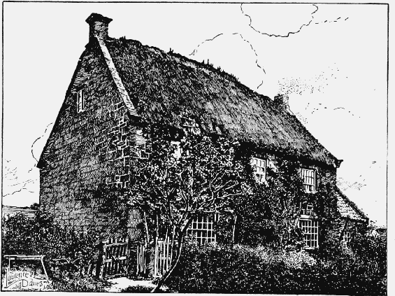
Ugthorpe Old Hall
There are howes or tumuli on Newton Mulgrave, Hutton Mulgrave and Ugthorpe moors, at Barnby and near Runswick Bay; pit dwellings can be traced on Ugthorpe Moor, and there are monoliths near Ugthorpe Mill and the Traveller's Rest Farm at Ugthorpe, another east of Goldsborough and a fourth—'Wade's stone'—east of East Barnby. A prehistoric road runs along the ridge from Lythe westward over Danby Moor, and, according to Professor Boyd Dawkins, 'was one of the most important roads in the district.' (fn. 34) This older road is joined by the Roman road from Cawthorn known as Wade's Causeway at Lease Rigg, whence it proceeds to Grosmont and eastwards to Whitby. (fn. 35) Newton is called 'Understreet' in 1654. (fn. 36) Roman coins were turned up in a field near Ugthorpe Mill in 1792. (fn. 37) This field and the mill, now disused, are the property of Mr. Robert Dobson of Ugthorpe House.
The home of the Wade myth, whoever Wade may have been, seems certainly to have been Mulgrave. (fn. 38) There was a mediaeval romance, now lost, on this subject, and Chaucer's commentator, referring to allusions of the poet, (fn. 39) merely states that he omits the story of 'Wade and his bote called Guingelot, because the matter is so long and fabulous.' (fn. 40) William de Wadhow was a tenant in Barnby in 1348, (fn. 41) but this form seems to have been a variant of the earlier Warthou, (fn. 42) and the earliest written mention of Wade here is probably that of Leland in his description of Mulgrave Castle, which he says 'stondith on apon a craggy hille: and on ech side of it is an hille far higher then that whereon the castelle stondith on. The north hille on the toppe of it hath certen stones communely caullid Waddes Grave, whom the people there say to have bene a gigant and owner of Mougreve.' (fn. 43) Camden (fn. 44) confuses the Saxon general Wada with this hero, relating that after forming an alliance with the murderers of King Ethelred he was routed and fled to Mulgrave, and 'was buried in the hill here between two solid stones near seven feet high, which being 11 feet asunder, people do not scruple to affirm that he was of gigantic size.' About a century ago country people still repeated legends of Wade and his wife Bell.
The remains of earthworks near the Foss Mill possibly represent the Fossard castle of Mulgrave. (fn. 45) Old Mulgrave Castle, described by Leland, lies a mile south-west of the present castle, and is said to have been fortified by the first Peter de Mauley (fn. 46) who acquired Mulgrave before 1220. (fn. 47) The Meaux Chronicler (fn. 48) says it was called 'Multgrefe that is multum grave' by a knight of those parts who had never loved Peter; but part of the name is older than Peter's time. (fn. 49) The castle was said to be ruinous in 1309, (fn. 50) but in 1326 Peter de Mauley was ordered to retire here for the defence of this part of the country. (fn. 51) Garrisoned for the king during the Civil War, it was finally surrendered by Capt. Zachary Steward (fn. 52) before 1645, (fn. 53) and dismantled in 1647, (fn. 54) £1,000 being paid to the Earl of Mulgrave as compensation. (fn. 55)
The old castle of Mulgrave stands on a narrow wooded ridge between the two parallel valleys formed by the East Row and Sandsend Becks. The site, which is not particularly strong by nature, has been improved by the cutting of two deep ditches across the ridge, above and below the castle, to a certain extent isolating it. The fortress was approached on the west side and formed an irregular polygonal inclosure encircled by a curtain wall with towers at intervals. Near the centre of the site rises a square tower or keep, now the only building standing within the circuit, which formerly included numerous other structures. The level of the ground within the castle is considerably above that immediately without and the curtains, which thus became retaining walls, have suffered much in consequence. They now present a patchwork of many periods, heavily buttressed on the outward side to counteract the bulging tendency due to the weight of the earth within. Under these circumstances it is exceedingly difficult definitely to date the various portions. The inclosure of the walls measures approximately 300 ft. from east to west by 200 ft. from north to south and the curtain remains tolerably perfect except for its battlements on the west, north and east sides; on the south, however, the remains are very fragmentary. The wall on the south-west side appears to be the earliest in construction and may date from the late 12th or early 13th century. It is finished with a plain chamfered plinth and is supported at irregular intervals by 16thcentury buttresses of varying form and projection. At a point about 80 ft. south of the gate-house is a stone stair within the walls leading up to the alure and from here the character of the wall alters, the distinguishing feature of the later work being the flat pilaster buttresses regularly spaced and brought out to the face of the plinth. The moulded tabling to these projections indicates that they are of comparatively late date, probably the 14th century. This wall also has given outwards and a massive pier, which is almost a tower, has been added near its southern end, while a modern buttress masks the junction between the earlier and later work just south of the gate-house. This building, which must be assigned to the 13th century, is placed slightly askew to the line of the curtain, the foundations of which are continued right across it. From this circumstance it would appear that this was not the original entrance. The building consists only of two circular flanking towers each about 15 ft. in diameter and built solid at the base. They were apparently both ruined to the inner or castle ground level, but that on the north has been restored to some height. Connecting the two is a retaining wall or sill from which sprang the drawbridge, the abutment on the opposite side of the ditch (now used as a roadway) being still observable. The curtain to the north of the gate-house is in the same patched and repaired condition as that already described. Forty-one feet away are the remains of a hollow projection, some 23 ft. wide, probably a garderobe tower, and 18 ft. further north the base of a circular turret. The northern front also was heavily buttressed in the 16th century and at the north-east angle are signs of extensive alterations. The original wall at this point evidently embraced a larger area, but apparently the ground at this point slipped into the valley, carrying the wall with it and necessitating the building of the later line across the angle. Near the point where this joins the eastern face is a small rectangular tower, two stages high and of the 14th century. It measures internally 14 ft. by 8½ ft. with walls 2½ ft. thick pierced with small single-light windows and loops alternately. On the north side is a small door which must once have opened on to a wooden gallery on the outer face of the adjoining curtain. The floor above is provided with a small fireplace and a garderobe. Adjacent to this tower on the south is a postern cut through the eastern curtain and somewhat altered in modern times. The curtain itself is here some 9 ft. thick with two loops in the length with broad embrasures. At the south-east angle are remains of another tower, in which the base of a stone vice still exists. The line of the curtain on the southern face is traceable only by the difference in ground level within and without the inclosure and by a few fragments of foundations. As has been said, the only building still standing within the circuit is the keep, but during the desultory excavations made by the present Marquess of Normanby on the site the foundations of buildings were everywhere met with. Some of these are yet apparent, but much overgrown and difficult to trace. There was, however, a large building against the southern curtain, between it and the keep, and another block was discovered to the west of the north-east tower. North of the keep also are remains of a structure once standing within a few feet of the existing building. The base court may be presumed to have occupied the space to the east of the gate-house and in the centre of it is the great well of the castle. The keep tower is considerably nearer the southern than the northern curtain. It is a rectangular building 49 ft. from north to south by 48 ft. from east to west externally with circular projections 24 ft. in diameter at the angles. It is of various dates, presenting numerous problems, which in its present ruined condition are by no means easy to solve, especially as a heavy growth of ivy on one side conceals some of the available evidence. It is, however, probable that the original building was a simple rectangular tower, apparently of the early 13th century, and of this portions of the north and south walls remain, including a passage on the north side in the thickness of the wall, blocked up with herring-bone brickwork and used as a fireplace in the 16th century. The first alteration appears to have been the erection of the angle towers and the general refacing of the building, about the end of the 13th century. The whole of the west wall was then rebuilt and the wall passage on the south side added. The entrance porch on the south to the upper floor was constructed during the 15th century and the final alterations to the building, including the insertion of the large mullioned window openings, are of mid16th-century date. The building as it stands is much ruined, the angle towers rising a few feet only above the floor level. There are remains of two stories of the main building each containing one large apartment only. The ground floor is entered by a door on the west with a short corridor, from which a gallery (having a barrel roof of stone) branches off communicating with the angle towers. The main apartment (28 ft. by 22½ ft.) is lit by a large seven-light transomed window of 16th-century date in the east wall, which remains intact, and a similar window of four lights in the centre of the north side, of which the sill only remains. In the west wall is a large fireplace, the external face of the wall immediately behind it being occupied by two 16th-century fourlight windows side by side, which appear never to have been cut through. Externally a deep tabled plinth is carried completely round the building and towers. Of the latter, the south-western has a small fireplace, the north-western the remains of an external door and the north-eastern a large 16th-century window of many lights, carried round on the curve. Of this last, however, only one jamb and part of the sill remain.

Plan of Mulgrave Castle
The first floor was approached by a porch and staircase built on to the south side in the 15th century. One jamb of the porch door remains standing with a short flight of steps outside it. The main apartment on the first floor has a fireplace flanked by two large pointed openings in the west wall. There is no evidence that these were ever fitted with windows and their use is quite obscure. It is likewise uncertain if the angle towers were ever carried up beyond the first stage; if they were, they must have partially blocked these two openings, but there is little or no trace of their junction with the main walls at this level. A 16th-century chimney stack is carried up in the centre of this side. The whole of the east wall of the apartment is occupied by a large seven-light window, similar to and immediately above the one in the floor below. The north and south walls have almost entirely gone at this level and the south-east angle is so obscured by ivy as to provide little evidence of the former arrangement at this point.
The modern castle, which has fine views over sea and moor, was built about 1735 by Catherine Duchess of Buckingham, natural daughter of James II and wife of John Duke of Buckingham. She frequently made it her residence. It is a castellated building of stone with a high tower, and has been greatly improved in the 19th century. (fn. 56)
The old castle in 1309 had an orchard and a park of 2 leagues (leagae) in circuit. (fn. 57) The present deer park contains 200 acres. The late Marchioness of Normanby built a summer-house in the Mulgrave Woods by the beck on the supposed site of the hermitage founded by William de Percy of Dunsley (fn. 58) in the 12th century. This hermitage lay, however, in Whitby parish. (fn. 59)
Thirteenth-century names in Ugthorpe are Pincroft, Roucegrift, Withwayt super Wlvedale and the moor called Kalange (fn. 60); and in 1539 occur: le Park, Yngedale, Netherwood, Store Park, Bigging Field, Woodalle House, Broome Leeze, Sely Croke, le Howe Close, Mersigale Field, New Park, le Brome Dike, le Volse, Nun Side, Chapel Croft, Coke Close, Arthur Bank, le Maye Gates, le Hall Croft. (fn. 61) A place called Grimesbi, now lost, was in 1086 assessed between Newton Mulgrave and Borrowby. (fn. 62)
Manors
The 'manor' and 2 carucates at LYTHE belonged to Swen before the Conquest, and were in 1086 held of the Count of Mortain (fn. 63) by Niel Fossard, (fn. 64) who is said to have been a tenant 'before the Conquest.' (fn. 65) Niel was succeeded by his son Robert, father of William, who left a son and heir William, (fn. 66) a minor. Henry II gave the heir's wardship to William Earl of Albemarle, (fn. 67) who was thus tenant of Lythe in 1179, (fn. 68) the year of his death. (fn. 69) For the betrayal of the earl's sister the heir was obliged to flee the country. (fn. 70) He returned after his guardian's death and is said to have recovered his inheritance, (fn. 71) but from 1180 to 1197 Lythe and its soke seems to have remained in the king's hands, paying tallage with other royal demesnes. (fn. 72) William left a daughter and heir Joan, a minor in custody of the king, who gave her in marriage to Robert de Turnham, (fn. 73) Beatrice widow of William suing for dower in 1199. (fn. 74) Joan was perhaps dead in 1210–12 when Robert de Turnham held thirtyone and a half knights' fees in chief in Yorkshire. (fn. 75) Isabel daughter and heir of Robert and Joan married the Poitevin esquire of King John, Peter de Mauley to whom the king gave her marriage, nominally for the payment of 7,000 marks, (fn. 76) but really, it was afterwards said, (fn. 77) as the price for the murder of the king's nephew Arthur. With the beginning of the Mauley lordship the manor of Lythe (fn. 78) seems to have been merged in the manor of Mulgrave, Mulgrave Castle being the head of the Mauley barony.
At BARNBY (Barnebi, xi-xii cent.; Bernby, xiv cent.) the king in 1086 (fn. 79) held 4 carucates of land which William de Wardehow, (fn. 80) the heir of Matthew Sturmy and Alice le Breton, held of Peter de Mauley in 1302–3. (fn. 81) Peter de Mauley was sole lord in 1316. (fn. 82) Barnby afterwards followed the descent of Mulgrave.
With the 'manor' of BORROWBY (Bergebi, Bergesbi, xi cent.; Berkby, xiv cent.; Borowby, xv-xvi cent.; Boroby, Borabie alias Burrowby alias Lowe Burrowbie, Upperborobye, Over Borobye, xvi cent.) and its berewick Roxby (fn. 83) 6 (or 5) carucates were held by Swen before the Conquest, and these had passed by 1086 to the Count of Mortain and his undertenant Niel Fossard. (fn. 84) From Niel the manor descended to the Mauleys, the fifth Peter holding it in demesne in 1316. (fn. 85) The Mauleys subsequently alienated the manor, and were afterwards merely overlords. (fn. 86)
In 1348 a Henry de Borrowby held 4 carucates of land here, (fn. 87) which were held by John de Borrowby in 1428. (fn. 88) Thomas Redmayne of Bossall (fn. 89) died seised in 1514 of the manors of Borrowby and Newton Mulgrave, which he had previously settled on his younger daughter and co-heir Anne and her husband Thomas (fn. 90) son and heir of Guy Wilsthorpe (fn. 91) of Wilsthorpe in the East Riding. Anne, then a widow, in 1577 conveyed these manors to Cuthbert Redmayne, a younger son of the Redmaynes of Harewood Castle and husband of her daughter Elizabeth, (fn. 92) and John Walton. (fn. 93) Wilsthorpe Redmayne conveyed the manor of 'Borrowby or Low Borrowby' to Henry Bellasis early in 1596–7, (fn. 94) and Henry Bellasis, Ursula his wife and Conyers Darcy joined in 1602 in conveying it to Sir John Hart, kt., (fn. 95) of Scampton, Lincs., son of Ralph Hart of Sproston Court, Yorks., and Lord Mayor of London in 1590. (fn. 96) Sir John died in January 1602–3 seised of the manor-house, grange or capital messuage of Low Borrowby, leaving daughters and co-heirs Joan wife of George Bolles and Judith wife of Edward Cage or Gage. He had, however, left Borrowby by will to John son of George and Joan. (fn. 97) George Bolles received a quitclaim of this manor from George Hart and Joan his wife in 1611. (fn. 98) George Bolles, who was of an old Lincolnshire family, was Lord Mayor of London in 1617–18 (being knighted in 1618), (fn. 99) and belonged to the Puritan party. (fn. 100) He died in 1621; his son and heir John was created a baronet in 1628 and died in March 1647–8, leaving a son and heir Sir Robert Bolles, M.P. for Lincoln from 1661 till his death in March 1663–4. (fn. 101) His son and heir John was succeeded in March 1685–6 by his son Sir John Bolles, the last baronet, M.P. for Lincoln 1690–1702, who died unmarried in 1714 leaving a sister and heir Sarah. (fn. 102) Sarah died unmarried in 1746, (fn. 103) and these manors descended to her co-heirs Sir Cyril Wych, bart., son and heir of John son and heir of Sir Peter Wych by Isabel one of the daughters of Sir Robert Bolles, the second baronet, John Washer of Lincoln's Inn, son and heir of Thomas Washer and Katharine his wife, another daughter of Sir Robert, and Mary wife of John Turton, M.D., of Birmingham, daughter of John Hayes of Ashby de la Zouch and Mary his wife, daughter and heir of George Antrobus and Ann his wife the third daughter and co-heir of Sir Robert. (fn. 104) John Washer left an only child Elizabeth, married to William Wilson in 1750. (fn. 105) In 1751 an order of partition was obtained and the manor of Newton Mulgrave and tenements in Borrowby fell to the share of John and Mary Turton, (fn. 106) but in accordance with the will of Sir John Hart the township of Newton Mulgrave was charged with the yearly payment of £42 to Sidney Sussex College, Cambridge, for ever, John Coppinger and Joseph Turton being made trustees for this purpose. (fn. 107) It is now the property of the Marquess of Normanby.
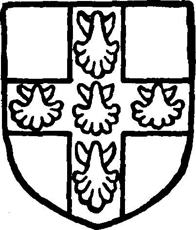
Bolles, baronet. Azure three cups or with boars' heads argent coming out of the bowls.
When first mentioned in the 13th century, COCKET (Cuktwald, xiii cent.; Cokewald, xiv cent.; Cockthwaite, xvi cent.; Cockwith muke, xvii cent.) was in the hands of the Mauleys, finally becoming a parcel of Egton Manor. (fn. 108) It is called a 'ruined manor' in 1383, (fn. 109) but the site (placea) was worth £10 in 1438–9. (fn. 110) Stephen de Mauley claimed to have a park here. (fn. 111)
Siward and Swen held 6 carucates in ELLERBY (Elwordebi, xi cent.; Alwardebi, xi-xii cent.; Elerbi, Elerdeby, Elwerdeby, xiii cent.; Elredeby, xiv cent.; Eldredeby, xv cent.) as two 'manors' before the Conquest, after which they passed to the Count of Mortain and his under-tenant Niel Fossard. (fn. 112) Lands here were part of a knight's fee in Wilton and elsewhere held by Ranulph de Nevill of Peter de Mauley in 1284–5, (fn. 113) but Peter de Mauley was returned as sole lord in 1316. (fn. 114)
Hugh Coatham (Cottom) conveyed the manor to George Conyers (of Boulby) in 1546, (fn. 115) and in 1564 George Conyers conveyed tenements here to Robert Pursglove, clerk. (fn. 116) There seems to be no further mention of the manor.
At GOLDESBOROUGH (Golborg, xi cent.; Goldburg, xi-xiv cent.; Goldeburc, xii cent.; Golde burgh, Goldesburgh, xiii cent.) 2 carucates formed a 'manor' of Swen's before the Conquest, when they passed to the Count of Mortain and his under-tenant Niel Fossard. (fn. 117) Peter de Mauley was assessed at 24s. 10d. in 1301–2 (fn. 118) for this manor, of which this is the only mention found.
Swen held a 'manor' and 3 carucates at HUTTON MULGRAVE (Hotune, Hotone, xi cent.; Hotton, xvi cent.) before the Conquest, when it passed to the Count of Mortain and his under-tenant Niel Fossard. (fn. 119) From Niel these lands descended to the Mauleys. (fn. 120)
Four carucates of land at MICKLEBY (Michelbi, xi-xii cent.; Micchelby, xiii cent.; Mikelby, xiiixvi cent.) were held before the Conquest by Swen as a 'manor' and then passed to the Count of Mortain and his under-tenant Niel Fossard. (fn. 121) Mickleby has descended with Mulgrave (q.v.) to the present Marquess of Normanby. (fn. 122)
The pre-Conquest 'manor' of Swen at MULGRAVE (Grif, xi cent.; Mulegrive, Mulgreve, Mulgrave, xiii cent.; Mulgref, Multgreve, Molgrave, xiv cent.; Mougreve, Muwgrave, xvi cent.), where 6 carucates of land were at geld, had passed by 1086 to Niel Fossard, who held them of the Count of Mortain. (fn. 123)
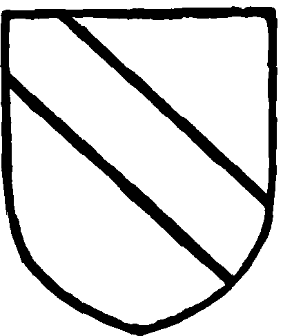
Mauley. Or a bend sable.
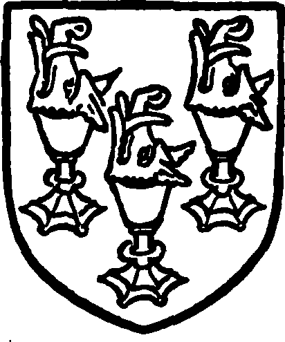
Bigod. Or a cross gules charged with five scallops argent.
The first Peter de Mauley, successor of the Fossards, died in 1221 leaving a son and heir Peter, who in 1241 sailed for the Holy Land. (fn. 124) In the same year the sheriff took his lands into the king's custody during the minority of his son. (fn. 125) This son, the third Peter, did homage in 1247, (fn. 126) and received in 1254 a grant of free warren in his demesnes of Lythe, Great and Little Barnby, Cocket, Ellerby, Hutton Mulgrave, Mickleby and Sandsend, provided they were not within the bounds of the forest. (fn. 127) He died in or before 1279, when his son and heir was Peter, (fn. 128) who in 1284–5 held four knights' fees in Cleveland as the barony of Mulgrave, (fn. 129) and was summoned to Parliament as a baron from 1295. (fn. 130) He died in or before August 1309, (fn. 131) leaving a son and heir Peter, who was born at Mulgrave Castle, and, as one of the heirs of Gilbert de Gant, made proof of age in 1303. (fn. 132) The fifth Peter was pardoned in 1313 as one of the adherents of Thomas Earl of Lancaster. (fn. 133) He died in 1355, leaving a son and heir Peter (fn. 134) 'le syme' (sixième), whose mother took the veil and granted him her dower for payment of 800 marks yearly to her trustees. (fn. 135) The sixth Peter died in March 1382–3, leaving a grandson and heir Peter, aged five, (fn. 136) who was made a K.B. at the coronation of Henry IV. (fn. 137) He died childless in 1415, (fn. 138) the castle and manor having been settled on himself and Maud his wife, who died in 1428, when the Mulgrave inheritance reverted to Constance wife of Sir John Bigod of Settrington, kt., one of the sisters of Peter, and to Sir John Salvin, kt., (fn. 139) son of Elizabeth, another sister. (fn. 140) The division was disputed in 1439, (fn. 141) but eventually the Salvins had Egton (q.v.) and the old Fossard lordship of Doncaster, and the Bigods Mulgrave. Constance died seised in 1450, leaving a son and heir Ralph, a knight. (fn. 142) Sir Ralph's son Sir John died in his father's lifetime, and in March 1461–2 Sir Ralph Bigod was succeeded by John's son Ralph, (fn. 143) who proved his age in 1479–80, (fn. 144) was knighted in 1482, (fn. 145) and died in 1515 leaving a grandson and heir Francis, son of his son John and aged seven. (fn. 146) This is the Sir Francis Bigod of Settrington whose rising in the Pilgrimage of Grace (fn. 147) led to his execution and attainder. (fn. 148) His widow Katharine wrote in 1537 from Mulgrave Castle to the Bishop of Worcester thanking him for his intercession with the king for her feoffment and begging him to continue his efforts for herself and children. (fn. 149) Katharine died seised of the Bigod manors of Mulgrave and Seaton in 1566, when her grandson Francis Radcliffe, son of her daughter Dorothy wife of Roger Radcliffe (still living), was her heir. (fn. 150) The Radcliffes continued for some time to hold Mulgrave, perhaps by grant from the Crown for the life of Francis, who died in February 1591–2 leaving a son and heir Roger Radcliffe. (fn. 151) Roger was born at Mulgrave Castle in 1579 and made proof of age in January 1600–1. (fn. 152) In 1592, however, the manor, castle, park, and advowson of the church of Lythe, possessions of Sir Francis Bigod attainted, were granted in fee farm to Edmund Lord Sheffield of Butterwick, Lincolnshire, and his heirs male, (fn. 153) at the ancient rent of £410 18s. 3d. (fn. 154) Lord Sheffield, who had taken an active part against the Spanish Armada, was Lord-Lieutenant of Yorkshire and Lord President of the North (from 1603 to 1619); he was, in February 1625–6, created Earl of Mulgrave. (fn. 155) He joined with his grandson and heir Edmund (fn. 156) and Roger Radcliffe early in 1633–4 in surrendering the Mulgrave lordship and the advowson of Lythe Church to the Crown, (fn. 157) and received a regrant in tail-male and confirmation of a lease he had made for ninety-nine years of the same with appurtenances in East and West Barnby, Briscoe, Cocket, Hutton, Mickleby, Lythe and Sandsend. (fn. 158) On his death in 1646 (fn. 159) he was succeeded by his grandson Edmund, who was councillor of state to Cromwell and one of the nine peers of the old régime in Cromwell's House of Lords. (fn. 160) He died in 1658 and was succeeded by his only son John, created Marquess of Normanby, co. Lincoln, in 1694 and in March 1702–3 'Duke of the County of Buckingham and of Normanby'; he died in February 1720–1, leaving an only surviving son Edmund who died unmarried in 1735, when these honours became extinct. (fn. 161) His father had married as his third wife (in March 1705–6) Katharine Dowager Countess of Anglesey, illegitimate daughter of James II by the Countess of Dorchester, (fn. 162) and to her he devised his estates. (fn. 163) Her daughter and heir Katharine by James Annesley, third Earl of Anglesey, married William Phipps son of Sir Constantine Phipps, Lord Chancellor 1710–14, and had a son and heir Constantine, who succeeded by lease of George II to the Mulgrave estate on the death of his grandmother in March 1742–3. (fn. 164) He was created Lord Mulgrave of New Ross, co. Wexford, in 1767, and died in 1775, (fn. 165) having in 1774 purchased this estate in fee-tail from the Crown for £30,000 and an annual payment of £1,200. (fn. 166) His son and heir Constantine John succeeded (fn. 167) and was in 1790 created Lord Mulgrave of Mulgrave, Yorks., (fn. 168) an honour which became extinct in 1792 when he died childless and was succeeded by his brother and heir Henry. A fresh creation of the barony was made in favour of this brother in 1794. (fn. 169) Henry was Chancellor of the Duchy of Lancaster 1804–5, First Lord of the Admiralty 1807–10 and Lord-Lieutenant of the East Riding 1807. In 1812 he was created Viscount Normanby of Normanby, co. York, and Earl of Mulgrave in Yorks. (fn. 170) He died in 1831, leaving a son and heir Constantine Henry, born at Mulgrave Castle, who was Viceroy of Ireland 1835–9, created Marquess of Normanby in 1838, (fn. 171) was Colonial Secretary and a foreign ambassador and died in 1863, leaving a son and heir George Augustus Constantine, Governor of Queensland 1871–4, of New Zealand 1874–8, and of Victoria 1879–84. He died in 1890 and was succeeded by his son Constantine Charles Henry Phipps, who took holy orders in 1870, (fn. 172) and is now resident at Mulgrave Castle.
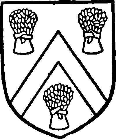
Sheffield, Duke of Buckingham and Normanby. Argent a cheveron between three sheaves gules.
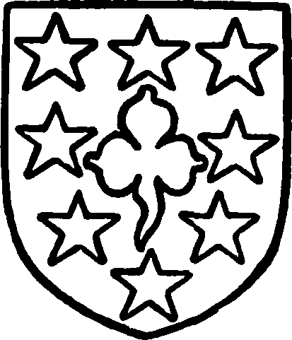
Phipps, Marquess of Normanby. Sable a trefoil in an orle of molets argent.
Complaint was made in 1431 that the lord of Mulgrave claimed a whale cast upon the shore at Lythe, by 'jus regale.' (fn. 173) Wreck of sea was included in the grant to the Earl of Mulgrave in March 1633–4 and at that date mention is made of a rent from the inhabitants of Sandsend to the lord of Mulgrave of seventy couples of salt fish yearly. (fn. 174)
Peter de Mauley was said in 1284–5 to have set up a claim to gallows. (fn. 175)
Three carucates of land in NEWTON MULGRAVE (Newetune, Neutone, xi cent.; Niweton, xii cent.; Neuton in Whitby Strand, xiii-xiv cent.) were soke of Borrowby in 1086, (fn. 176) and the manor was held of Ralph Bigod in 1514. (fn. 177)
Richard de Thweng and Robert son of Nicholas de Acklam received a grant of free warren in this manor in 1261, (fn. 178) and Ralph de Thweng and Robert de Acklam were joint under-tenants in 1284–5, (fn. 179) as were Richard de Thweng and Robert in 1302–3. (fn. 180) The Thwengs seem afterwards (fn. 181) to have only held services here, and by 1428 had been replaced by the Wilsthorpes. (fn. 182) An inquisition was held at the suit of the Prior of Guisborough in 1342 to discover if Nicholas de Clyf, Peter son of William de Acklam and William Bell of Newton were lords of this vil, (fn. 183) although in 1348 Robert Acklam and Richard de Thweng were still returned as joint-tenants. (fn. 184) In 1428 John Wilsthorpe, William Wilsthorpe and Margery Acklam held separately in Newton and Ellerby the 4 carucates 'that Richard Thweng and Robert Acklam formerly held.' (fn. 185) In 1514 this manor was in the hands of the owner of Borrowby (q.v.), with which it afterwards descended (fn. 186) until it was adjudged to the Turtons. It has since descended with the Turtons' manor of Upsall, (fn. 187) and is now in the possession of Mr. Edmund Russborough Turton.
In 1278–81 Robert de Acklam claimed that the manor had always been quit of suit at wapentake or trithing. (fn. 188)
Before the Conquest Ligulf and Game each held 2 carucates of land at UGTHORPE (Vghetorp, Vgetorp, xi cent.; Uggethorpe, xii–xvi cent.; Uggelthorpe, 1276); this was land of the king in 1086. (fn. 189) Ugthorpe does not seem to have formed part of the Fossard fee, (fn. 190) though Peter de Mauley strengthened the position of Guisborough Priory by a fictitious suit and quitclaim of the manor in 1280. (fn. 191)
In 1202 William Wirfauc of Hinderwell, (fn. 192) perhaps as overlord, granted or confirmed the grant of Robert de Everingham of 3 carucates of land here to the priory. (fn. 193)
The families of Argentein and Munceaux were probably joint mesne lords. (fn. 194) In the 12th century Alan de Monceaux and Gilbert and Ingram his sons granted the priory 1 carucate of land here, and Robert son and heir of Ingram confirmed it. (fn. 195) Robert de Everingham with consent of Hawise his wife gave 2 carucates which they held of William de Argentein; and Peter Cordevill gave 1 of that fee of which William de Hamby was mesne lord, a grant confirmed by Henry II in 1182. (fn. 196)
Henry III in 1263 granted the priory free warren in all their demesnes here, (fn. 197) and the prior was the only tenant returned for this place in 1284–5 and sole lord in 1316. (fn. 198)
The priory held the manor until the Dissolution, (fn. 199) after which, in 1541, it was granted to William Stafford, esquire of the body, in fee in exchange for the manor of Henden near Hever, Kent, (fn. 200) and in the same year William granted it to Roland Shakerley, citizen of London. (fn. 201) Roland Shakerley and Ann his wife in 1552 conveyed the manor to Robert Pursglove, suffragan Bishop of Hull (fn. 202) and founder of the hospital at Guisborough (q.v.). He in February 1564–5 alienated the manor to Roger Radcliffe (fn. 203) of Mulgrave. Roger, who died in 1588, settled it on his daughter Katharine and her heirs with reversion to his son and heir Francis. (fn. 204) Katharine lived here and died a spinster in February 1614–15, when the manor reverted to her nephew Roger son of Francis, aged thirty. It had, however, been previously settled on Katharine's brother William Radcliffe for life with remainder to his seven sons in turn, then to his daughters, and then to Charles Radcliffe and Ralph Harding. (fn. 205) Roger Radcliffe had livery in February 1629–30 (fn. 206); early in 1635–6 the manor was conveyed by William Radcliffe, jun., and Jane his wife to Francis Thornhill, jun., and his heirs and James Coates. (fn. 207) The manor is now in the possession of the Marquess of Normanby.
The priory in 1284–5 claimed toll and team, soc and sac and infangentheof by charter of Henry III. (fn. 208) Grendale Priory held tenements in the 13th century (fn. 209) and granted permission to the Prior of Guisborough to move his vaccary from Wood Dale (Wlvedale) and construct another in Wythewayth (fn. 210); in 1262 an agreement was made between the two Houses by which Grendale quitclaimed all its land here to Guisborough in return for a yearly rent of 28 quarters of wheat reasonably well threshed. (fn. 211) By a similar agreement in 1269 Guisborough Priory was to pay 26 quarters of wheat yearly for the lands of Grendale at Biggin Houses (Percy Biggin). (fn. 212) A payment representing 58 quarters of corn was still made at the Dissolution. (fn. 213)
Churches
The church of ST. OSWALD stands at a little distance to the east of the village about 350 ft. above sea level on the edge of the high ground, where it begins to fall rapidly towards the coast. It consists of a chancel 28 ft. 6 in. by 14 ft. 9 in. with a vestry on the north and chapel on the south side, nave 55 ft. by 15 ft. 6 in., north and south aisles, south porch and west tower 15 ft. 6 in. square, all these measurements being internal. The tower is surmounted by a short stone spire 32 ft. in height. With the exception of the north wall and the east end of the chancel the church was entirely rebuilt in 1910–11, (fn. 214) previous to which it stood pretty much as it had been left at the end of the 18th century after undergoing extensive alterations and rebuildings, which had made the recovery of its original plan difficult. In the demolition of the building in the summer of 1910 a large number of pre-Conquest fragments were found built into the walls, chiefly in the tower, which had been reconstructed in 1769. These fragments, which consist mainly of portions of cross heads and shafts and of hog-back stones, are apparently of 10th and 11th-century date, and are over thirty in number, (fn. 215) one of them being a recumbent monument in the form of a double-edged stone with cable moulding along the ridges. A few fragments of later date were also found, one being part of a carved tympanum and two others of less size showing sculptured forms. A stone coffin was also discovered. These fragments point to a building or buildings older than any part of the existing church, all the original architectural features of which were preserved in the recent rebuilding.
The east end of the chancel is of 13th-century date, together possibly with some portions of the north aisle wall. (fn. 216) Two small buttresses near the east end of the aisle proper may be the same age as the oldest part of the wall, but others of greater size have been added at a not very distant date, those at the angles being of large size and diagonal in plan. An addition, probably the sacristy, was made on the north side of the chancel, perhaps in the late 14th century, with diagonal angle buttresses, leaving a space to the west between it and the aisle of about 12 ft., which was afterwards thrown into the church, the wall being built flush with the others. An enormous buttress nearly 7 ft. in width was later built against the sacristy (now the vestry) wall, which, together with other smaller ones of similar type along the north wall, gives the building a rather strange and irregular appearance on that side. A two-light square-headed window with hood mould and the fragment of a second are apparently of 15th-century date, but they may be insertions. The north doorway, which is about 20 ft. from the west end, has a rather flat pointed chamfered head and is also of late date.
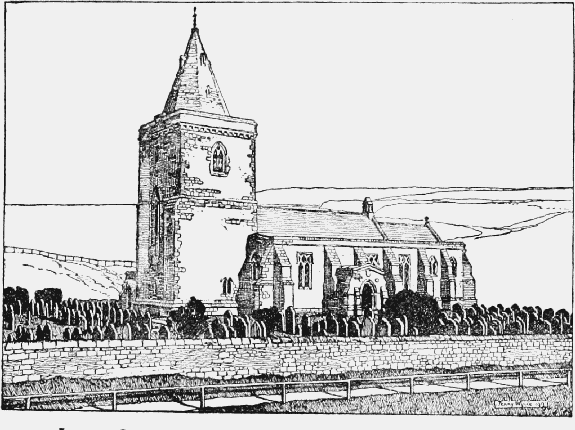
Lythe Church from the South-west (after Restoration)
In 1742 a faculty was obtained to remove two small arches and to erect one large arch instead, (fn. 217) which seems to indicate some tampering with the arcade at that date. In 1768 'the top of the steeple was taken down for fear of its falling upon the church,' (fn. 218) and in the year following the remaining part was 'taken down to the foundation and rebuilt.' (fn. 219) The tower then built stood till 1910, and was of two stages with an embattled parapet and angle pinnacles. A gallery was erected in 1788, (fn. 220) and in 1818 the pews were renewed and the roof covered with slates instead of lead. (fn. 221) The whole of the south wall of the nave, which stood only very slightly in front of the tower, had been entirely modernized, and was of the same height as and in line with that of the chancel. The south porch was an addition between two older buttresses. The building was covered by a roof of single span, probably of 18th-century date, which threw the ridge to the north of the centre line of the chancel, nave and tower, and produced an awkward lop-sided effect externally at the east end by throwing the apex of the gable to the north of the chancel window. The walls terminated in a straight parapet the full length of the building, and such of the old windows as remained had been modernized by the insertion of barred wooden frames. Separate new stone slated roofs of different height have now been erected over the chancel and nave, the east gable rebuilt in its proper form, and the walls of the vestry reduced in height. A south aisle has been added, the west wall taken down and rebuilt and a new tower erected.
The chancel is lighted in the east end by two original lancet lights high up in the wall, with external hood moulds, and has three buttresses of two stages, one at each angle and one between the windows, all with gabled heads and tall plinths, the ground falling rapidly to the east. On the north side the chancel wall is blank except for the doorway to the vestry for about half its length, beyond which it is open to the old organ chamber. On the south side there is a short length of original walling at the east end containing a trefoilheaded piscina with two floreated bowls and a mutilated credence recess with angle shafts and trefoiled head. Above the piscina is a modern window, and further west the chancel is open to the chapel, which is a continuation of the south aisle, by two moulded arches in the style of the 13th century, filled in with a richly carved screen. The chapel is 19 ft. 6 in. long by 20 ft. 6 in. wide and has a vaulted stone roof in two compartments. The chancel arch is modern, and the organ is now placed in a gallery over the chancel screen in front of the arch. The new south aisle is 10 ft. 6 in. wide, but that on the north retains its original width of 8 ft. 6 in., though the arcade has been rebuilt.
The rest of the building being modern is of no antiquarian interest. It is faced inside with ashlar, and the nave consists of five bays with alternate circular and octagonal pillars carrying pointed arches. The tower is open to the nave by a lofty pointed arch springing from corbels and contains a gallery. The font and all the fittings are modern. There are a number of mural tablets from the old church in memory of the Sheffields and others.
The tower contains two bells, one inscribed 'Gloria in Altissimis Deo, 1682,' and the other 'Sanctus Oswel Deo.'
The plate consists of a cup of 1634 with cover paten of the same date, the bowl inscribed, 'Belongeing to the Parish of Lythe in Yorke: shier 1635,' and on the bottom of the cover, 'Lythe Church in Yorkeshier 1635'; a chalice of 1872, silver gilt, of mediaeval design, inscribed, 'Ad majorem Dei Gloriam et in usum ecclesiae St. Oswaldi de Lythe a.d. mdccclxxii,' with paten of the same date; and a chalice and paten of 1869. There is also a pewter chalice and paten. (fn. 222)
The registers begin in 1637.
The churchyard was enlarged in 1887 at the west end and a lych-gate erected on the south side.
CHRIST CHURCH, Ugthorpe, consecrated in 1857, is built of stone in 13th-century style, and consists of chancel, nave, transepts, north porch and small spire containing one bell. The living is a vicarage in the gift of the Archbishop of York.
The church of ST. MARY, Sandsend, built in 1869, is of stone in early 14th-century style, and consists of chancel, nave and vestry. It is worked as a mission in connexion with Lythe Church.
The mission church of ST. JOHN BAPTIST, Kettleness, was built in 1872. There are also mission chapels at East Barnby and Ellerby, the latter being dependent on Ugthorpe.
Advowson
In the 12th century Robert Fossard and William his son gave the church and 10 oxgangs in Lythe to the priory of St. Oswald, Nostell. These lands were afterwards made a prebend in York Cathedral, and confirmed to the priory by Henry I, Henry II, Richard I, John, Henry III and Edward I. (fn. 223)
In March 1344–5 the Prior of Nostell was cited to the court of Rome at the suit of the parson of Lythe as to the 36 marks rent he claimed from this church, but the king, 'not being able to tolerate this,' ordered all parties to appear before him. (fn. 224) The priory had £24 pension at the Dissolution. (fn. 225)
In 1202 Robert de Turnham sued the prior, who claimed the advowson by charters of the Fossards, (fn. 226) and the advowson subsequently descended with the manor of Mulgrave (fn. 227) until the attainder of Sir Francis Bigod. (fn. 228) The advowson and rectory were granted to the Archbishop of York in 1543, with licence to appropriate, (fn. 229) and are still held by the archbishop. (fn. 230)
The parson, Thomas de Thweng, had licence to found a chantry in 1352–3. (fn. 231)
'Chapels' appurtenant to this church are mentioned in 1291. (fn. 232) There seems to have been a chapel at Newton from the 12th century at least (fn. 233); it was granted by the Crown in 1572–3 to Edward Forth and others, (fn. 234) in 1613–14 to James Cook and others. (fn. 235)
Charities
A customary payment of £3 per annum for the poor of Lythe was formerly paid by the lessee of the tithes from the Archbishop of York. The annual sum of £2 is now received from the Ecclesiastical Commissioners in respect of this charity, which, with £1 received from Michael Hill's charity, mentioned below, is carried to the poor and sick and needy fund.
By a scheme of the Charity Commissioners of 24 May 1898 the following charities for the benefit of Ugthorpe were consolidated under the title of the Charities of Belwood and others, namely:—Jane Belwood, 1700, £42 19s. 9d. consols with the official trustees; Michael Hill, by will 1657, yearly sum of £1, part of rent-charge of £2 on Poor Folks' Close; Cuthbert Hodgson, 1688, yearly sum of 18s., part of rent-charge of £1 7s. on land in Mickleby, the remaining 9s. being for the poor of Mickleby; John Hudson, 1672, a yearly sum of 10s. payable out of land called Arthur Banks; William Marshall, by deed 1640, a yearly sum of 2s. payable out of a rent-charge of £2 on lands in the township of Glaisdale (see under Egton). By the scheme the vicar and two representatives nominated by the parish meeting were appointed trustees, by whom the aggregate income of the charities, amounting to £3 11s. 4d., is distributed in money to poor people, chiefly women, in sums varying from 9s. to 18s.
For the charity of Thomas Woodill see under Loftus. £2, a moiety of the rent, is duly distributed.