Survey of London: Volume 25, St George's Fields (The Parishes of St. George the Martyr Southwark and St. Mary Newington). Originally published by London County Council, London, 1955.
This free content was digitised by double rekeying. All rights reserved.
'New Kent Road', in Survey of London: Volume 25, St George's Fields (The Parishes of St. George the Martyr Southwark and St. Mary Newington), ed. Ida Darlington (London, 1955), British History Online https://www.british-history.ac.uk/survey-london/vol25/pp117-120 [accessed 30 April 2025].
'New Kent Road', in Survey of London: Volume 25, St George's Fields (The Parishes of St. George the Martyr Southwark and St. Mary Newington). Edited by Ida Darlington (London, 1955), British History Online, accessed April 30, 2025, https://www.british-history.ac.uk/survey-london/vol25/pp117-120.
"New Kent Road". Survey of London: Volume 25, St George's Fields (The Parishes of St. George the Martyr Southwark and St. Mary Newington). Ed. Ida Darlington (London, 1955), British History Online. Web. 30 April 2025. https://www.british-history.ac.uk/survey-london/vol25/pp117-120.
CHAPTER 16: NEW KENT ROAD
It being an inherent tendency in human nature, clerical or otherwise, to take short cuts where possible, there is little doubt that soon after the monks of Christ Church obtained possession of Walworth in the 11th century they began, when the state of the ground permitted, to find a way across the fields from the Canterbury road (Old Kent Road) to Walworth Manor to avoid making the detour up to St. George's Church and down Borough High Street (or Blackman Street) to Newington Causeway.

Gate pier, the Paragon
The path probably became a well-defined green road after the Archbishop made his London residence at Lambeth and the ferry at Lambeth came into general use. On the 1681 plan of Walworth Manor (Plate 49) the field north of Walworth Common Field has the legend "King's high Way" written across it, and by a series of gates, the path can be traced across the neighbouring fields to Newington Butts. Rocque's map of 1761 shows the old path and a new straight road cutting right across it. This was the New Kent Road built under the Act of 1751 (fn. 325) by Turnpike Trustees appointed under an earlier Act. Towards the end of the century terraces of two- and three-storey houses, Rockingham Row, Rodney Buildings, Dover Place, etc., began to appear on either side. Many of them still survive, and their plain brick façades and the simple decorative treatment of the fanlights, door surrounds and ironwork, though frequently repeated, give them a certain dignity even in decay. The road also has a spaciousness lacking in many of its 19th century counterparts, for the 1751 Act stipulated that the road should be not less than 42 feet wide and many of the older houses still retain their front gardens.
A pleasing variety was given to the original street frontage by the setting back of County Terrace half-way along the north side and by the formation of Union Crescent and the Paragon on opposite sides of the way at the eastern end. On a pedestal in the garden, which has replaced the stretch of water in front of County Terrace, the Dickens Fellowship have recorded that it was there that David Copperfield paused to rest on his flight to his aunt at Dover. Union Crescent (Plate 88a) was pulled down to make room for the St. Saviour's and St. Olave's Grammar School for Girls in 1903.
The Paragon (Plate 86), of which a plan is given on p. 123, was designed by Michael Searles and built in 1789–90 for the Rolls family. Searles also designed the Paragon at Blackheath, and John Summerson comments that in both cases the name was given point by "strict architectural regularity on a rather unusual and decorative plan." (fn. 197) Nos. 1–12 were built under Searles' direction, Nos. 13–15 being added by William Chadwick in 1825 after Searles' death. It is unfortunate that the only house to survive is one of these later ones, No. 15 (Plate 87), which since 1902 has been the rectory of St. George the Martyr, Southwark. The rest of the Paragon was demolished in 1898 for the erection of a school. The rusticated gate piers in artificial stone at the entrance to each side of the Paragon still remain, the gardens having been formed into a small public open space.
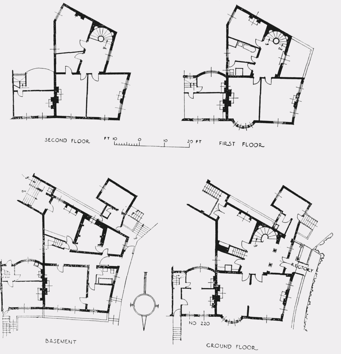
St. George's Rectory and No. 220 New Kent Road
Residents in the Paragon include:—At No. 3, in 1840–50, William Oke Manning, a legal writer and, in 1855–63, George R. Corner, who published a number of papers on the history of Southwark; at No. 4, in 1789–91, Michael Searles; at No. 6, in 1829–55, Bryan Donkin, civil engineer and the inventor, among other things, of a method of packing meat and vegetables in airtight containers; at No. 8, in 1802–04, John Rolls, the lessee of the ground and owner of the Rolls Estate (see p. 122), in 1805–09, George Gwilt the elder, architect, surveyor to the County of Surrey and district surveyor of St. George's, Southwark. William Chadwick, who built many of the houses in Trinity Street and Square, lived at No. 15 between 1826 and 1832. (fn. 326)
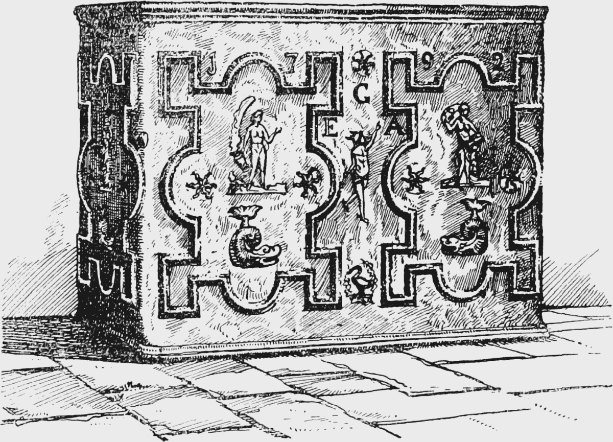
Lead cistern from the Paragon
Nos. 214–218 next to the Paragon were built by Samuel Harrison on ground leased to John Rolls by St. Bartholomew's Hospital and formerly part of the Lock Hospital property (fn. 327) (see the footnote on p. 122). Nos. 154–170, 182–204 and 220–232 on the south side of the road all date from about the same period. Several of the houses have good fanlights. Nos. 279–283 and 289–295 at the east end of the north side are slightly smaller. They are set back from the road.
At the end of the street nearer the Elephant and Castle most of the original houses have been replaced by modern buildings; while shops have been built over the front gardens of those which remain. (fn. n1) Adjacent to Gurney Street are two six-storey blocks called The Palatinate, erected in 1875, and designed "to provide convenient and healthy dwellings at moderate rents" to enable those "of a grade higher in the social scale" than the working class to live near their work. (fn. 328) They were built by Messrs. Sutton and Dudley, who were also responsible for most of the houses on the site of the Surrey Gardens off the Walworth Road. At the time they were put up they were a progressive experiment in housing, and the shops on the ground floor facing New Kent Road were an unusual feature. They form a solid contrast to the lighter and more open blocks of three-and four-storey flats now being erected by the London County Council to replace terraces in the street destroyed by enemy action.
Except in the Paragon there have been few notable residents in the road. The Rev. Charles Haddon Spurgeon lived at No. 217 in 1856–57, a fact recorded on a tablet on the house.