Survey of London: Volumes 43 and 44, Poplar, Blackwall and Isle of Dogs. Originally published by London County Council, London, 1994.
This free content was digitised by double rekeying. All rights reserved.
'Plate 36', in Survey of London: Volumes 43 and 44, Poplar, Blackwall and Isle of Dogs, (London, 1994) pp. 36. British History Online https://www.british-history.ac.uk/survey-london/vols43-4/plate-36 [accessed 25 April 2024]
In this section
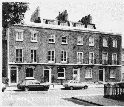
a. Nos 5–12 Mountague Place in 1950 (pp. 184–6)

Nos 5–12 Mountague Place in 1950.
Nos 5–12 Mountague Place in 1950 (pp. 184–6)
b. Nos 45–51 (odd) Bazely Street in 1986 (pp. 188–9)
Nos 45–51 (odd) Bazely Street in 1986.
Nos 45–51 (odd) Bazely Street in 1986 (pp. 188–9)
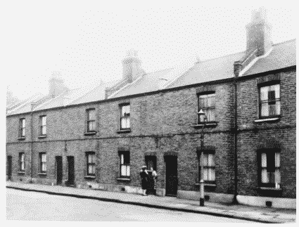
c. Nos 1–6 Grove Villas in c1930 (p. 175).
Grove Villas in c1930.
Nos 1–6 Grove Villas in c1930 (p. 175).
Demolished
d. Nos 12 and 13 Woodstock Terrace in 1987 (p.173)

Nos 12–13 Woodstock Terrace in 1987.
Nos 12 and 13 Woodstock Terrace in 1987 (p.173)
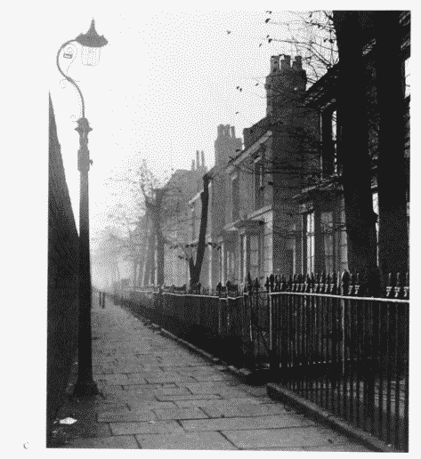
e. East side of Cottage Street in 1954 (p. 175).
East side of Cottage Street in 1954.
East side of Cottage Street in 1954 (p. 175).
Demolished