Survey of London: Volumes 43 and 44, Poplar, Blackwall and Isle of Dogs. Originally published by London County Council, London, 1994.
This free content was digitised by double rekeying. All rights reserved.
'Plate 98: Manchester Road', in Survey of London: Volumes 43 and 44, Poplar, Blackwall and Isle of Dogs, (London, 1994) pp. 98. British History Online https://www.british-history.ac.uk/survey-london/vols43-4/plate-98 [accessed 24 April 2024]
In this section
a. Manchester Road looking north in c1918.

Manchester Road in c1918.
Manchester Road looking north in c1918.
Wall of the Canal Dockyard on right (p. 603), No. 412 in distance (p. 603) and Glen Terrace left (pp. 604–6)
b. Nos 581–585 (odd) Manchester Road, part of Glen Terrace, in the 1920s.
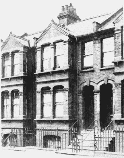
Nos 581–585 Manchester Road in the 1920s.
Nos 581–585 (odd) Manchester Road, part of Glen Terrace, in the 1920s.
George Larman, builder, 1888–90 (pp. 604–6)
c. Nos 613 (left) and 615 Manchester Road in the 1920s (pp. 605, 606)
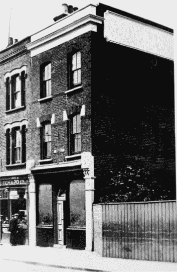
Nos 613 and 615 Manchester Road in the 1920s
Nos 613 (left) and 615 Manchester Road in the 1920s (pp. 605, 606)