A Topographical Dictionary of England. Originally published by S Lewis, London, 1848.
This free content was digitised by double rekeying. All rights reserved.
'Scackleton - Scartho', in A Topographical Dictionary of England, (London, 1848) pp. 26-30. British History Online https://www.british-history.ac.uk/topographical-dict/england/pp26-30 [accessed 18 April 2024]
In this section
Scackleton
SCACKLETON, a township, in the parish of Hovingham, union of Malton, wapentake of Bulmer, N. riding of York, 10 miles (W. by N.) from Malton; containing 189 inhabitants. It comprises 1460 acres of land, of which a portion is in wood. The village is on the road from Wiganthorpe to Coulton.
Scaftworth
SCAFTWORTH, a township, in the parish of Everton, union of East Retford, North-Clay division of the wapentake of Bassetlaw, N. division of the county of Nottingham, 1¼ mile (S. E. by E.) from Bawtry; containing 100 inhabitants, and comprising 1049a. 3r. 34p. The tithes were commuted for land and a money payment in 1772. During the inclosure of the common several Roman antiquities were found.
Scagglethorpe
SCAGGLETHORPE, a township, in the parish of Settrington, union of Malton, wapentake of Buckrose, E. riding of York, 3 miles (E. by N.) from Malton; containing 249 inhabitants. It is bounded on the north by the navigable river Derwent, and comprises 1220 acres, of which 700 are in tillage, and the rest in grass; the soil runs through several varieties, between a strong clay and a sandy loam. The slope on which the village stands commands extensive views towards the south-west. The tithes were commuted for 43 acres of land, and a modus of £60 a year, in 1725. There is a place of worship for Wesleyans.
Scalby
SCALBY, a township, in the parish of Blacktoft, union of Howden, wapentake of Howdenshire, E. riding of York, 6¼ miles (E. by N.) from Howden; containing 131 inhabitants. It comprises about 1100 acres, part being on Walling fen. The village, which is scattered, is on the road from North Cave to Howden.
Scalby (St. Lawrence)
SCALBY (St. Lawrence), a parish, in the union of Scarborough, Pickering lythe, N. riding of York; containing, with the chapelry of Cloughton, and the townships of Burniston, Newby, Stainton-Dale, and Throxenby, 1886 inhabitants, of whom 612 are in Scalby township, 3¼ miles (N. W. by W.) from Scarborough. The parish comprises by computation upwards of 12,000 acres, of which the township contains 2485. A small rivulet winds through the village, and discharges itself into the sea near Scalby mill, where are some tea-gardens resorted to by the visiters at Scarborough. Timothy Hardcastle, Esq., has a beautiful seat here, from which are fine views of the sea and Scarborough Castle. The living is a discharged vicarage, valued in the king's books at £6. 13. 4., and in the patronage of the Dean and Chapter of Norwich, with a net income of £302, and a neat parsonage-house: the tithes, with the exception of those for Stainton-Dale, were commuted for land in 1771. There is a chapel of ease at Cloughton. A girdle of pure gold, 35 inches in length, weighing 2½ ounces, and twisted like a cord, each end forming a hook, was lately found on the estate of Mr. Hardcastle.
Scaldwell (St. Peter and St. Paul)
SCALDWELL (St. Peter and St. Paul), a parish, in the union of Brixworth, hundred of Orlingbury, N. division of the county of Northampton, 8½ miles (N. by E.) from Northampton; containing 416 inhabitants. The parish stands elevated, and comprises about 1152 acres, of which three-fourths are arable, and the remainder pasture; it has a red light soil, suitable for turnips and barley. The living is a rectory, valued in the king's books at £14. 0. 10.; net income, £357; patron, the Duke of Buccleuch. The tithes were commuted for land and a money payment in 1775; the glebe altogether comprises 150 acres. The church is an ancient structure, with a tower, and has a fine eastern window. There is a place of worship for Independents; and a school is supported by endowment. A Roman urn was dug up in 1838.
Scaleby (All Saints)
SCALEBY (All Saints), a parish, in the union of Longtown, Eskdale ward, E. division of Cumberland; containing 584 inhabitants, of whom 230 are in East Scaleby, 6½ miles, and 354 in West Scaleby, 5½ miles (N. E. by N.) from Carlisle. Richard Tilliol, called Richard the Rider, received a grant of this territory from Henry I., and built a castle here with materials brought from the Picts' wall. In the early part of the civil war, Scaleby Castle was garrisoned for Charles I.; in 1645 it surrendered to the parliamentarians; in 1648 it again fell into the hands of the royalists, but it was soon after recaptured, and kept for the parliament. It is an interesting monument of antiquity; the more ancient part is in ruins, but a portion has been rebuilt and is inhabited. The parish comprises 3100 acres, of which 136 are common or waste land. The living is a discharged rectory, valued in the king's books at £7. 12. 1.; net income, £107; patron, the Bishop of Carlisle. The church was repaired in 1827. The Rev. William Gilpin, author of the Lives of the Reformers, Forest Scenery, &c., was born in the castle in 1724.
Scales,with Bromfield and Crookdale
SCALES,with Bromfield and Crookdale, a township, in the parish of Bromfield, union of Wigton, Allerdale ward below Derwent, W. division of the county of Cumberland, 5½ miles (S. W. by W.) from Wigton; containing 364 inhabitants, of whom 94 are in the hamlet of Scales.
Scales, with Newton.—See Newton.
SCALES, with Newton.—See Newton.
Scalford (St. Egelwin the Martyr)
SCALFORD (St. Egelwin the Martyr), a parish, in the union of Melton-Mowbray, hundred of Framland, N. division of the county of Leicester, 4 miles (N. by E.) from Melton-Mowbray; containing 517 inhabitants. The parish is beautifully situated on a brook called the Skeld or Scald, and comprises about 2420 acres, whereof 500 are arable, and the remainder pasture. The surface is gently undulated, and the soil clay, alternated with sand; the substratum abounds with stone, which is quarried for building and for the roads. The air here is very salubrious, and the parish particularly healthy. In the village are two springs of the purest and softest water, from the larger of which not much less than fifty gallons run per minute, at all times and in all seasons. The living is a vicarage, valued in the king's books at £8. 1. 10½.; net income, £300; patron and impropriator, the Duke of Rutland. The tithes were commuted for land in 1765; the glebe comprises about 200 acres, with a good substantial residence. The church is a handsome structure in the later English style, with a square embattled tower. There are places of worship for Primitive Methodists and Wesleyans.
Scalthwaiterigg, with Hay and Hutton-i'-th'-Hay
SCALTHWAITERIGG, with Hay and Hutton-i'th'-Hay, a township, in the parish, union, and ward of Kendal, county of Westmorland, 2 miles (N. E.) from Kendal; containing 408 inhabitants, of whom 222 are in Scalthwaiterigg, 115 in Hay, and 71 in Hutton-i'-th'Hay.
Scamblesby
SCAMBLESBY, a parish, in the union of Horncastle, N. division of the wapentake of Gartree, parts of Lindsey, county of Lincoln, 6¾ miles (N. by E.) from Horncastle; containing 500 inhabitants. The living is a perpetual curacy; net income, £71; patron, the Bishop of Lincoln.
Scammonden
SCAMMONDEN, a chapelry, in the parish and union of Huddersfield, Upper division of the wapentake of Agbrigg, W. riding of York, 7½ miles (W.) from Huddersfield; containing 972 inhabitants. It comprises 1711a. 13p. The surface is mountainous and wild; on the west is the lofty ridge of Blackstone Edge, and several parts of the chapelry command extensive views over a country abounding with romantic scenery. About 900 acres were inclosed in 1820, and have been brought into profitable cultivation; but many of the hills are still uncultivated, affording only rough pasturage. There are excellent freestone-quarries. The roads from Elland and from Huddersfield to Manchester pass through the chapelry. The chapel was rebuilt in 1813, at a cost of £1000, and is situated on an acclivity, in a romantic dell watered by a small rivulet called Black Brook: the living is a perpetual curacy; net income, about £170; patron, the Vicar of Huddersfield. Here is a place of worship for Baptists.
Scampston
SCAMPSTON, a chapelry, in the parish of Rillington, union of Malton, wapentake of Buckrose, E. riding of York, 6 miles (N. E. by E.) from Malton; containing 251 inhabitants. It is bounded on the north by the navigable river Derwent, and comprises 2382 acres, of which 1199 are arable, 1026 pasture, and 157 woodland. The surface is level. Scampston Hall is a handsome mansion, situated in an extensive park, in which is a fine sheet of water crossed by a bridge. The living is a perpetual curacy; net income, £80; patron, the Vicar of Rillington. A new chapel, built by William St. Quintin, Esq., was opened in April 1846.
Scampton (St. John the Baptist)
SCAMPTON (St. John the Baptist), a parish, in the wapentake of Lawress, parts of Lindsey, union and county of Lincoln, 5¾ miles (N. N. W.) from Lincoln; containing 224 inhabitants. It comprises by measurement 2147 acres of profitable land. The substratum contains limestone, which is quarried for building and for the roads, and also burnt into lime. The living is a discharged rectory, valued in the king's books at £8. 16. 8.; net income, £82; patron, Sir George Cayley, Bart.: the glebe comprises an acre of ground, with a residence. Some remains of a Roman villa were discovered about the year 1800. Scampton was the residence of Archdeacon Illingworth, author of a curious work on its antiquities.
Scarborough (St. Mary)
SCARBOROUGH (St. Mary), a borough, markettown, and parish, having separate jurisdiction, and the head of a union, locally in Pickering lythe, N. riding of York, 39 miles (N. E.) from York, and 216 (N.) from London; containing, with the township of Falsgrave, 10,060 inhabitants, of whom 9515 are in Scarborough township. The origin of this town has not been satisfactorily ascertained: it is supposed to have derived its name from the Saxon Scear, a rock, and Burgh, a fortified place. The earliest authentic record of it is a charter of Henry II., conferring certain privileges on the inhabitants; and in the reign of Henry III., a charter was granted for making a new pier at Scardeburgh, as the place was then called. Prior to the construction of the pier, the town had begun to rise into importance, and was defended by walls and a fosse, of which some vestiges may still be traced. In the reign of Stephen, a castle had been erected by William le Gros, Earl of Albemarle and Holdernesse, which that nobleman was compelled to surrender to Henry II., who made considerable additions to it. Piers Gavest on, favourite of Edward II., took refuge here from the attacks of the confederate barons, and for a considerable time maintained the fortress against their assaults, till a scarcity of provisions obliged him to surrender. In the same reign the town was burnt by the Scottish forces, which, headed by Robert Bruce their king, made an irruption into England. Robert Aske, the leader of the insurrection called the "Pilgrimage of Grace," made an unsuccessful attempt to gain possession of the castle in 1536; and during Wyat's rebellion in 1553, it was surprised and captured by a party headed by Thomas, second son of Lord Stafford, who had disguised themselves as peasants; but it was soon retaken by the Earl of Westmorland, and Stafford and three of his accomplices being made prisoners, were sent to London, and executed.
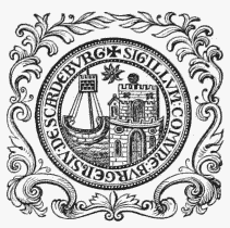
Corporation Seal.
During the civil war in the reign of Charles I. the parliamentarian forces, commauded by Sir John Meldrum, besieged the castle, which held out under its brave governor. Sir Hugh Cholmley, for more than twelve months. At length, on the death of Meldrum, who fell in an assault, the command devolved upon Sir Matthew Boynton, to whom, after the exhaustion of its military stores, the fortress was surrendered in 1645, upon honourable terms. Colonel Boynton, who succeeded Sir Matthew in the command of the castle, having declared for the king, it came again into the possession of the royalists; but it was finally surrendered to the parliament in 1648, and soon afterwards dismantled. George Fox, founder of the Society of Friends, was confined in it in 1665. During the rebellion in 1745, the building was put into a state of temporary repair; since which time batteries have been erected for the protection of the town and harbour: within the inclosure are barracks for the accommodation of 120 men. This once formidable fortress comprised within the boundary walls an area of more than nineteen acres, and occupied the summit of an eminence 300 feet above the level of the sea. It is surrounded by the sea on all sides except the west, by which it is connected with the town; on the north, east, and south is a vast range of perpendicular rocks. The entrance is through an arched gateway, on the summit of a narrow isthmus, flanked by bastions, and formerly defended by two drawbridges within the gates, and a deep fosse. The principal parts remaining are, the keep, a square tower whose walls are twelve feet thick; and portions of the semicircular towers that defended the ramparts, now falling rapidly to decay: some slight remains of the chapel, also, are still discernible within the walls. The castle and its precincts are extra-parochial.
The town is romantically situated in the recess of a fine open bay, on the coast of the North Sea; and consists of numerous streets, rising in successive tiers from the shore in the form of an amphitheatre. The beach, of firm and smooth sand, slopes gradually towards the sea. Belvoir Terrace, and the Crescent, form elegant ranges of mansions; and on the cliff are many handsome private residences, and lodging-houses for the accommodation of visiters, who repair hither, either for the convenience of bathing, for which the sea here, unimpaired in its quality by the influx of any considerable stream of fresh water, is peculiarly favourable; or for the benefit of the mineral springs, whose efficacy has been for more than two centuries in high repute. These springs, which are saline chalybeates, varying in the proportions of their several ingredients, were for some time lost by the sinking of a large mass of the cliff in 1737, but were recovered after a diligent search. The water was analysed in 1840, by Sir Richard Phillips; and one imperial gallon of the north spring was found to contain, of chloride of sodium 26.64 grains, crystallized sulphate of magnesia 142.68 grains, crystallized sulphate of lime 184 grains, bicarbonate of lime 48.26 grains, and bicarbonate of protoxide of iron 1.84 grains, with 6.3 cubic inches of azotic gas. Of the south spring, a gallon was found to contain, chloride of sodium 29.63 grains, crystallized sulphate of magnesia 225.33 grains, crystallized sulphate of lime 110.78 grains, bicarbonate of lime 47.80 grains, and bicarbonate of protoxide of iron 1.81 grains, with 7.5 cubic inches of azotic gas. The old spa-house was washed away during a tremendous storm in 1836, and in 1839 a new building, in the castellated style, was erected from a design by Henry Wyatt, Esq.; the saloon is 75 feet in length, and 17 feet wide, and is approached by beautiful walks cut in the cliff. In the vicinity is a fine terrace, one hundred feet above the level of the sands, forming a pleasant promenade, and, by an iron bridge of four arches on stone pillars, connecting the dissevered cliffs, in the chasm between which runs the stream called Millbeck. The bridge, which was erected in 1827, is 414 feet in length and 75 feet in height, and constitutes one of the principal ornaments of the town. There are several large bathing establishments; and a general sea-bathing infirmary is supported by subscription, for poor invalids. The Agricultural and General Library, on King-street Cliff, was established in 1801, and has a collection of more than 3000 volumes. The theatre was patronized by the late Stephen Kemble. The environs are diversified with hill and dale, and include much picturesque and romantic scenery: Olivers' Mount, about a mile from the town, approached by a gradual ascent, forms a magnificent natural terrace, 500 feet above the level of the sea, commanding an interesting view of the castle, town, harbour, and piers, on one side, and overlooking the ocean on the other. The rides on the sands and in the vicinity are pleasant; and the salubrity of the air, and the numerous objects of interest which the neighbourhood contains, render Scarborough a favourite place of fashionable resort. The town is supplied with fresh water by pipes from the hill, two miles distant, and by a reservoir capable of containing 4000 hogsheads: an act for its better supply was passed in 1845. A branch of the York and North-Midland railway was opened to Scarborough in July of the same year.
The port, to which the privilege of bonding was granted in 1841, is a member of that of Hull. Its limits extend from the most eastern part of Flamborough Head, in a direction northward, to Peasholme Beck, including all the sea-coast to fourteen fathoms of water at low-water mark. The foreign trade is principally with France, Holland, and the Baltic, from which the port receives wine, brandy, geneva, timber, deals, hemp, flax, and iron; and it carries on a considerable trade in corn, butter, bacon, and salt fish, with Newcastle, Sunderland, and other places on the coast, and with the port of London in groceries. The number of vessels of above 50 tons' burthen registered at the port is 157, and their aggregate tonnage 31,010. The harbour, though confined at the entrance, is easy of access, and safe and commodious within. It is protected by two piers, one of which, enlarged by act of parliament, obtained in the 5th of George II., is 1200 feet in length, and 42 feet broad at the extremity, and in the intermediate lines varies from thirteen to eighteen feet in breadth. This pier having been found insufficient to prevent the accumulation of sand in the harbour, an act was procured for the construction of a new one: the breadth of this at the foundation is 60 feet, and at the curvature, where it is most subject to the action of the waves, 63; it is 40 feet high, 42 in breadth at the top, and 1200 in length. In 1843, an act was passed for the further improvement of the harbour. Several steam-packets touch at the port every week, on their passage between London and Edinburgh. The fishery, formerly carried on to a considerable extent, and a source of great profit to the town, has for some years declined, but many boats are still employed; the principal fish taken are herrings, turbot, soles, ling, cod, plaice, lobsters, and crabs. Near the town is an establishment for curing the herrings, which are quite equal, if not superior, to the Yarmouth bloaters. There are several manufactories for cordage, and a yard for shipbuilding. The market-days are Thursday and Saturday, the former for corn; the fish-market is held on the sands near the harbour. The fairs are on Holy-Thursday and Nov. 23rd, and chiefly for cattle.
Scarborough is a borough by prescription. It received its first charter from Henry II., in 1181, and the grant was subsequently confirmed and extended by various sovereigns; the corporation now consists of a mayor, six aldermen, and 18 councillors, under the act 5th and 6th of William IV., cap. 76. The borough is divided into two wards; the municipal boundaries are co-extensive with those for parliamentary purposes, and the number of magistrates is eight. The town first exercised the elective franchise in the 23rd of Edward I., since which time it has regularly returned two members to parliament: the right of election was extended by the act 2nd of William IV., cap. 45, to the £10 householders; the mayor is returning officer. The corporation hold quarterly courts of session, for all offences not capital; a court of pleas, for the recovery of debts to any amount; and manorial courts. Petty-sessions, also, take place. The powers of the county debt-court of Scarborough, established in 1847, extend over the registration-district of Scarborough. The borough gaol was rebuilt in 1842.
The parish comprises about 2160 acres. The living is a discharged vicarage, valued in the king's books at £13. 6. 8.; net income, £205; patron, Lord Hotham: the impropriation once belonged to the corporation, who allowed the tithes to be redeemed by individual proprietors, so that the parish is now nearly tithe-free. The church, which was connected with a Cistercian monastery here, and was a magnificent cruciform structure with three noble towers, sustained considerable damage during the sieges of the castle, in the time of the parliamentary war, and retains but few portions of its ancient character. The present steeple stands at the eastern end, and occupies the site of the original transept tower, which fell down in 1659. Christ-church, a handsome edifice in the later English style, with a square embattled tower crowned by pinnacles, was erected in 1828, by the Parliamentary Commissioners, aided by a local subscription of £3000, and a gift of the stone from Sir John V. B. Johnstone, Bart.: the living has a net income of about £200; patron, the Vicar. Another church, called St. Thomas, was erected in 1840, by private subscription, aided by a grant of £300 from the Incorporated Society; it is a neat edifice in the later English style, and contains 440 sittings, of which 320 are free: the living is also in the gift of the Vicar of the parish. A chapel called the Bethel, formerly the townhall, is attended chiefly by fishermen; and there are places of worship for Baptists, the Society of Friends, Independents, Primitive Methodists, and Wesleyans; and a Roman Catholic chapel.
The grammar school is of remote origin. In 1648, the corporation ordered the south transept of St. Mary's church to be fitted up and appropriated to its use, the expense being defrayed by the sale of the Charnel Chapel, or old school-house. The seamen's hospital, erected in 1752, by the ship-owners of the town, for the support of aged seamen, their widows and children, is supported by a contribution of sixpence per month from the owner of every vessel belonging to the port, for each person on board during the time the vessel is at sea, or in actual service. It is under the superintendence of a president and trustees annually elected; and the income, arising from donations, is about £200 per annum. The building consists of a centre and two wings, with a court in front, and contains 25 apartments for poor seamen, or seamen's widows. The Trinity-house, originally established by subscription, for similar purposes, in 1602, was rebuilt in a substantial manner in 1832. Wilson's Mariners' Asylum, a beautiful range in the Elizabethan style, for the reception of 14 married persons, was erected and endowed in the lifetime of the founder, in 1837. Taylor's free dwellings for the poor were built in 1810. St. Thomas' hospital was founded by Hugh de Bulmer, in the reign of Henry II., for aged and infirm persons; the buildings are low and of ancient appearance. There are several charitable bequests for distribution among the poor generally. The union of Scarborough comprises 33 parishes or places, and contains a population of 21,305. To the north of St. Sepulchre's street is the site of a Franciscan convent, supposed to have been founded about the 29th of Henry III. Among other monastic establishments anciently existing here, were, a monastery of Dominicans, established in the reign of Edward II. by Adam Say, Knt., or by Henry Percy, Earl of Northumberland; and a house of Carmelite friars, instituted by Edward II., in 1319. Scarborough gives the title of Earl to the family of Lumley.
Scarcliffe (St. Leonard)
SCARCLIFFE (St. Leonard), a parish, in the union of Mansfield, hundred of Scarsdale, N. division of the county of Derby, 6 miles (N. N. W.) from Mansfield; containing 582 inhabitants. The parish comprises the villages of Scarcliffe and Palterton, and the hamlets of Scarcliffe-Lane, Stockley, and Riley; and contains 3772 acres, of which 400 are wood. The surface is diversified by hill and dale; the soil in some parts is a calcareous loam, and in others a calcareous clay: there are some quarries of limestone. The village of Scarcliffe is situated on the Rotherham road. The living is a discharged vicarage, valued in the king's books at £5; net income, £68; patron, the Duke of Devonshire; impropriator, Earl Bathurst. The glebe consists of 14 acres of arable land, and there is a glebe-house. The church is situated on a gentle hill, in the centre of the village. The exterior of the nave is disfigured by alterations made in the two last centuries: the spire, which was unsafe, was taken down in 1842, and a tower erected in its place, at a cost of £500; it is a plain structure, in the Norman style, with pointed arches. In the chancel are a piscina, a tomb of the 13th century, and a statue of the 11th century. The last is of a lady, with her child, and is formed of a block of stone: she is represented in robes, with a coronet on her head, and from her breasts downwards is an inscription in Latin, in Lombardic characters. Tradition says, that this lady, whose name was Constantia, lost her way while journeying through a neighbouring forest, and that, attracted by the sound of the curfew at the church, she reached the village, where she died in childbirth, leaving property in jewels to purchase land to pay for the curfew being rung for ever. Some land belonging to the parish, said to have been purchased in consequence, now lets for £4. 10. a year. In the village is a school endowed with £6. per annum by Mrs. Vaughan, and having £6 yearly from Earl Bathurst.
Scarcroft
SCARCROFT, a township, in the parish of Thorner, Lower division of the wapentake of Skyrack, W. riding of York, 6¼ miles (S. S. W.) from Wetherby; containing 218 inhabitants. It comprises by computation 950 acres. Near the village is a large mound supposed to have been the site of a Roman camp; and from the discovery of various relics, the Romans are thought to have had works here for the smelting of iron.
Scargill
SCARGILL, a township, in the parish of Barningham, union of Teesdale, wapentake of Gilling-West, N. riding of York, 3½ miles (S. W. by W.) from GretaBridge; containing 106 inhabitants. It comprises about 4880 acres of land, of which a considerable portion is high moor. The village is situated on the south side of the Greta, near Rutherford-bridge.
Scarisbrick
SCARISBRICK, a township, in the parish and union of Ormskirk, hundred of West Derby, S. division of Lancashire, 2 miles (N. W.) from Ormskirk; containing 1957 inhabitants. In the reign of Edward II. the manor appears to have been in the possession of a family of the local name, with whom it continued until conveyed, about the commencement of the present century, by the heiress of the Scarisbricks, to the Ecclestons, who assumed the name of Scarisbrick. The township includes the hamlets of Bescar and Snape-Green, and parts of Martin Mere; and comprises 7819 acres, whereof 2560 are arable, 5121 pasture, and 138 wood. The Leeds and Liverpool canal passes through. Scarisbrick Hall is said to have been erected in the 11th century: it was inhabited by the family in 1567; and was improved, and re-cased in stone, in 1814. Hurlston Hall, built in the reign of Edward VI., is a lath-andplaster house, originally the abode of the Hurlston family. The tithes have been commuted for £970 payable to an impropriator, and £94 to the rector of Hallsall. In 1814 a Roman Catholic chapel was built at Bescar.
Scarle, North (All Saints)
SCARLE, NORTH (All Saints), a parish, in the union of Newark, Lower division of the wapentake of Boothby-Graffo, parts of Kesteven, county of Lincoln, 10 miles (W. S. W.) from Lincoln; containing 490 inhabitants. This parish, which is bounded by the river Trent, comprises about 1600 acres; the surface is flat, the soil clayey, and clay of good quality for making bricks is obtained in abundance. The living is a discharged rectory, valued in the king's books at £4. 17. 3½., and in the patronage of the Crown: the tithes have been commuted for a rent-charge of £259. 10., and the glebe consists of 32 acres. There is a place of worship for Wesleyans.
Scarle, South (St. Helen)
SCARLE, SOUTH (St. Helen), a parish, in the union, and N. division of the wapentake, of Newark, S. division of the county of Nottingham, 7½ miles (N. E. by N.) from Newark; containing, with Besthorpe chapelry, 525 inhabitants, of whom 198 are in the township of South Scarle. The living is a discharged vicarage, with the perpetual curacy of Girton annexed, valued in the king's books at £5. 2. 5., and in the gift of the Prebendary of South Scarle in the Cathedral of Lincoln; impropriators, G. Hutton, Esq., and others. The great tithes have been commuted for £190. 11., and the vicarial for £54. 18.; the impropriate glebe comprises 112 acres. At Besthorpe is a chapel of ease.
Scarning (St. Peter and St. Paul)
SCARNING (St. Peter and St. Paul), a parish, in the union of Mitford and Launditch, hundred of Launditch, W. division of Norfolk, 2 miles (W. S. W.) from East Dereham; containing 613 inhabitants. It comprises 3300 acres, and is situated on the road from Dereham to Swaffham. The living is a discharged vicarage, endowed with a moiety of the rectorial tithes, and valued in the king's books at £9. 19.; net income £389; patron, and impropriator of the remainder of the rectorial tithes, E. Lombe, Esq. There is a glebe of 10 acres, with a house. The church is in the later English style, with a square embattled tower, and contains some curious relics. A free school was founded and endowed by William Seeker, in 1604; the income is £150 per annum.
Scarrington
SCARRINGTON, a parish, in the union, and N. division of the wapentake, of Bingham, S. division of the county of Nottingham, 12½ miles (E. by N.) from Nottingham; containing 230 inhabitants. The living is annexed to the vicarage of Orston: the tithes were commuted for land and money payments in 1780. There is a place of worship for Wesleyans.
Scarthingwell, Yorkshire.—See Saxton.
SCARTHINGWELL, Yorkshire.—See Saxton.
Scartho (St. Giles)
SCARTHO (St. Giles), a parish, in the union of Caistor, wapentake of Bradley-Haverstoe, parts of Lindsey, county of Lincoln, 2¼ miles (S.) from Great Grimsby; containing 199 inhabitants. The living is a discharged rectory, valued in the king's books at £8. 10. 10.; net income, £231; patrons, the Principal and Fellows of Jesus College, Oxford.