A History of the County of Durham: Volume 3. Originally published by Victoria County History, London, 1928.
This free content was digitised by double rekeying. All rights reserved.
'The city of Durham: Fortifications', in A History of the County of Durham: Volume 3, (London, 1928) pp. 91-93. British History Online https://www.british-history.ac.uk/vch/durham/vol3/pp91-93 [accessed 24 April 2024]
FORTIFICATIONS
Besides the castle fortifications the city of Durham was protected by and inclosing wall. Indications of earthworks on the east and south sides of the peninsula may represent pre-Conquest earthen defences; any defences of this date on the north side are now obliterated. It is to Bishop Ranulf Flambard (1099–1128), however, that the inclosure of the city with masonry walls must be attributed. (fn. 1) These walls followed the lines of the banks of the peninsula on all sides, except on the north. Here was an outer moat within which was a wall of great strength which varied from 30 ft. to 50 ft. in height. In places where good foundations could not be obtained for the walls, relieving arches were used to carry them, which were filled up to make the wall solid. The walls were strengthened with square and octagonal flanking towers, and round the sharp southern bend there appear to have been a series of buttress turrets between the greater towers both to give increased strength and a better defence. Some of the lower portions of these towers remain, but most of them have been destroyed. Prior Laurence describes three gates, the King's Gate at the bottom of Bow Lane, the Water Gate or Porte-du-Bayle, at the south end of the Bailey, and the North Gate, which stood at the top of Saddler Street. (fn. 2) What little is known of these gates has already been described. Flambard further inclosed the space called the Palace or Place Green by a wall running from the east end of the Norman cathedral church northward to the keep, thus forming an outer ward. Another wall went from the Kingsgate along Bow Lane and Dun Cow Lane with a gateway spanning the North Bailey. This wall divided the civil from the ecclesiastical part of the hill. The gateway crossing the North Bailey was later annexed to the church of St. Mary le Bow until it fell in 1637.
The burgesses of the Borough or those living around the Market Place and the streets leading out of it, although subject to Scottish raids, had no protection until after 1312, when Brus sacked the town. This disaster led to the building of the wall inclosing the Market Place from the tower on Framwellgate Bridge round the Market Square to the tower on Elvet Bridge, with gates on the northern line of the wall opening on to Claygate and Walkergate. This later wall probably did not possess any great military value, but was merely of sufficient strength to keep off raiders. The city walls became neglected in the 16th century and were allowed to fall into disrepair and so have gradually disappeared.
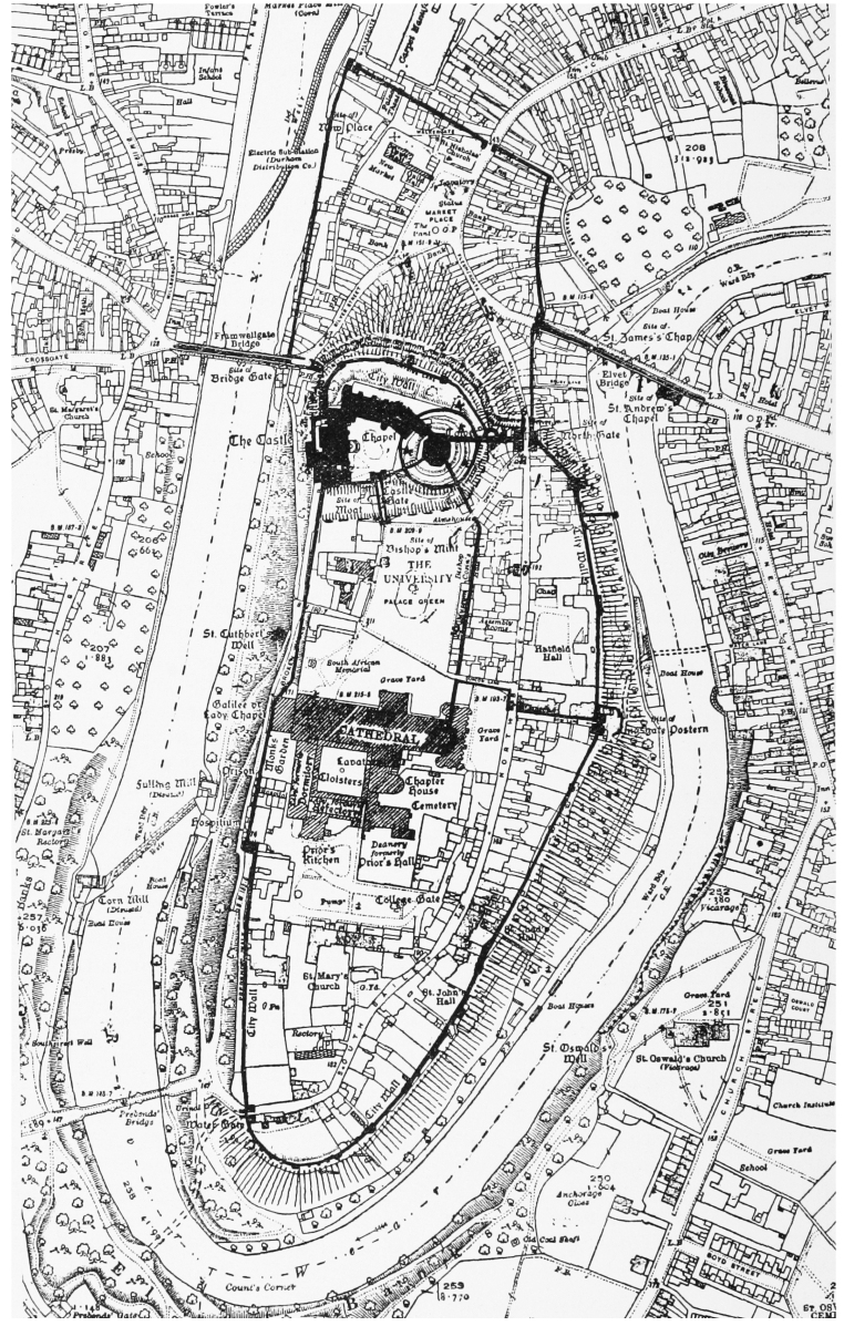
Plan of the Ancient Fortifications of Durham City
(Based upon the Ordnance Survey Map with the sanction of the Controller of H.M. Stationery Office)