A History of the County of Oxford: Volume 14, Bampton Hundred (Part Two). Originally published by Victoria County History, London, 2004.
This free content was digitised by double rekeying. All rights reserved.
'Curbridge: Introduction', in A History of the County of Oxford: Volume 14, Bampton Hundred (Part Two), (London, 2004) pp. 190-201. British History Online https://www.british-history.ac.uk/vch/oxon/vol14/pp190-201 [accessed 19 April 2024]
In this section
CURBRIDGE
Introduction
Curbridge, a largely rural township occupying the south and south-west of Witney parish, was centred on Curbridge village, 1½ miles (2.4 km) south-west of the town; (fn. 1) for much of its history it also included parts of the town which lay outside the original borough, notably the west end of Corn Street, the area north-west of the borough around Woodford (later Witney) Mills, and, on the south, Witney's manor house, church, and rectory house. (fn. 2) In the south-west of the township Caswell House, a moated manor house surrounded by anciently inclosed fields, marks the site of a former hamlet; Caswell lay mostly in Witney parish and, after the hamlet's depopulation in the Middle Ages, the inclosed estate attached to Caswell House was treated as part of Curbridge township. (fn. 3)
After the creation of Witney borough around 1200 Curbridge's open fields probably absorbed the earlier fields of Witney: certainly the bishop of Winchester's manorial demesne, presumably once part of Witney's fields, lay almost wholly in Curbridge in the Middle Ages. (fn. 4) Also within the township was the bishop's park, created in the mid 13th century. (fn. 5) By the 18th century the amalgamated demesne and Witney park had become large inclosed farms occupying most of Curbridge's east side, but open fields survived in the centre of the township until the mid 19th century.
Curbridge had its own officers by the 16th century and was responsible for its own poor-relief. From the mid 19th century it was a separate civil parish, but although it had its own church from 1836, for ecclesiastical purposes it remained part of Witney parish. (fn. 6) In 1877 it comprised 2,983 a.; (fn. 7) smaller acreages recorded earlier in the century were clearly inaccurate, since the boundaries were almost identical. (fn. 8) Successive boundary changes from the later 19th century reflected Witney's suburban expansion. Around 116 a. transferred from Curbridge to Witney in 1898 included, south of the town, the church and rectory house, Mount House (the former manor house), the railway station, Church Leys, and the Crofts, and on its north-west side the Witney Mills area. (fn. 9) In 1932 a broad swathe (488 a.) on the township's east side, from the river Windrush to the Ducklington boundary south-east of Burwell Farm, was also lost to Witney, whilst 193 a. south of the town, including a large tongue of river meadow by then almost detached from the rest of Curbridge, was transferred to Ducklington. In 1963 48 a. (19.5 ha.) designated for new housing immediately north-east of Burwell Farm was transferred to Witney, followed in 1985 by 39 ha. in the south-west part of the Burwell estate, reducing Curbridge to 827 ha. (2,043 a.). (fn. 10) The loss to Witney of industrial sites adjoining Downs Road in 2001 left Curbridge with 633 ha. (1,564 a.). (fn. 11)
Township Boundaries
The boundaries on the south-east, south, and west were those of Witney parish and remained largely unchanged from those described in grants of the Witney estate in 969 and 1044 (see Fig. 68). (fn. 12) Part of the boundary in the south-east remained effectively undefined until the 19th century, since Curbridge meadow was shared with Ducklington until the open fields of both were inclosed, and the meadow was included in Curbridge. (fn. 13) There were minor 19th-century realignments of Curbridge's boundary with Brize Norton at Black Moat, south of Caswell House, and on the western boundary northwest of Caswell House. (fn. 14)
By the mid 10th century Curbridge was part of a 30-hide Witney estate, but earlier seems to have formed, at least temporarily, a distinct 17-hide estate. (fn. 15) Its original north and east boundaries, like those on the west and south, were probably dictated largely by natural features, the river Windrush presumably dividing it from Hailey. The short boundary with Crawley, giving Crawley a foothold south of the Windrush, was probably the result of a deliberate, perhaps later, allocation of river meadow. Curbridge's original eastern boundary may have been the roughly north-south section of Colwell brook, before the line was shifted eastwards when Witney's fields were reorganised on the creation of the borough: thereafter all land south and west of the Windrush which was not in the borough was deemed to lie in Curbridge. The borough's original west boundary, probably running behind the burgage plots on High Street, was later, perhaps in the 16th or 17th century, moved west to Emma's dyke to include the west end of Corn Street which was built up in that period. The extension into Curbridge formed a large bulge, its irregular north and south edges suggesting that it respected existing furlong boundaries and therefore pre-dated the inclosure of that area, apparently achieved before 1662. (fn. 16) A single house and garden on the north side of Corn Street (No. 166) survived as a detached part of Curbridge until it was absorbed into the urban district after 1898: it was linked to a holding of former demesne just outside the borough north of Corn Street (Clay piece and Quarry ground), but no explanation has been found for its enduring link with Curbridge. (fn. 17)
Despite the frequent movement of Curbridge's eastern boundary to keep pace with Witney's western expansion (fn. 18) some industrial estates and large areas of new housing, notably the Deer Park estate, remained in Curbridge until the end of the 20th century. They were finally taken into Witney in 2001 when the town was extended as far west as Downs Road, removing from Curbridge an area bounded on the north by Burford Road and on the south by the Witney bypass. The township's northern, western, and south-western boundaries remained those of the ancient parish of Witney. (fn. 19)
Landscape and Geology
The landscape is fairly flat, rising gently from low-lying southern parts near Lew heath and Caswell (75–80m.) to some 110m. on Curbridge down and along the ridge followed by the Witney—Burford road, before descending into the Windrush valley on the north. Springs on the higher ground feed several small streams which run south and south-eastwards through the township, the most substantial being Colwell brook. (fn. 20) Much of the northern part of Curbridge lies on cornbrash, but the former Witney park occupied an area of Kellaways sand and clay. Forest Marble borders some of the streams, and there is a patch of gravel beneath part of Curbridge village around Manor and Charity Farms. The southern part of the township, including Caswell, lies mostly on Oxford Clay, with alluvium along the brooks and around Caswell House. (fn. 21) There was plentiful meadow land along the river Windrush and some of the smaller streams.
Opinions on the farming qualities of the cornbrash and clay varied greatly. In the early 20th century the cornbrash was regarded as excellent for sheep and barley, (fn. 22) but earlier was noted to be frequently thin, while the 'cold clay' was evidently difficult to work before the introduction of modern ploughs. Much of the grass was poor unless properly drained, and areas such as Curbridge heath were left as rough pasture until the 19th century. (fn. 23)
The 13th-century Witney park may have been established in an area of ancient woodland, and certainly oaks and elms were regularly felled there in the Middle Ages. (fn. 24) By the later 16th century, however, park timber was yielding only 6s. 8d. a year, and by the 18th century the only surviving woodland in that area seems to have been a small coppice south of the former park. (fn. 25) There was woodland at Caswell in the 13th century, (fn. 26) and coppicing was practised there on some scale in the 18th century. (fn. 27) By the early 19th century the only woodland in Curbridge was on the Caswell estate, where there were only 16 a. in scattered copses. (fn. 28) Elm disease in the 1980s severely depleted the formerly well-timbered fields around Caswell House.
Roads
Until the Witney bypass was built just north of Curbridge village in the 1970s the principal road through the township was the Witney-Burford road, an ancient east-west ridgeway which in the mid 13th century dictated the northern limit of the newly created Witney park (see Figs. 3 and 68). (fn. 29) It formed part of the great road from London to Gloucester and was turnpiked in 1751 and disturnpiked in 1870; (fn. 30) when Curbridge was inclosed in 1845 a toll house was added at the turnpike's junction with the new Downs Road. (fn. 31) Further east the road continued into Witney along Mill Lane, and branched south-eastwards to enter the town along Corn Street; before the 13th century the Corn Street branch may have followed valley contours across the later park, but certainly thereafter followed its modern course along Tower Hill to form the park's eastern boundary. (fn. 32) In modern times the branch road was variously called Union Hill, from the workhouse of 1836, Razor Hill, from stone-cutting machinery in the adjacent quarries, (fn. 33) and finally Tower Hill, from the water tower built at its north end in 1903. (fn. 34)
On the west the ancient Wood Lane, which formed Witney's Saxon boundary with Minster Lovell, (fn. 35) became part of an alternative route on the turnpike: it was known as Back Pike and Minster Pike, and had a toll gate near Curbridge's western boundary. (fn. 36) Part of the township's southern boundary with Lew followed another ancient and largely abandoned route, Abingdon Lane. (fn. 37) A road southwards from Witney towards Ducklington, Standlake, and the important Thames crossing at Newbridge (fn. 38) passed through the township's east side.
Just east of Curbridge village was the Witney— Bampton road, turnpiked in 1771 and disturnpiked in 1874. (fn. 39) There was a toll gate on Curbridge heath, just within Lew parish, and another was added ½ mile north-east of the village in the early 19th century. (fn. 40) It seems likely that the Witney—Bampton road once entered rather than bypassed Curbridge village, its line perhaps preserved in the lane running from Manor Farm to the village street, and continuing southwards as a footpath (now blocked by a house) to rejoin the Bampton road. By the 17th century the road followed its present line; (fn. 41) its staggered junction with the road from Ducklington, south-east of Charity Farm, was moved slightly further eastwards in the mid 20th century when the Witney—Bampton road was straightened and given priority. (fn. 42)
The village's main street lies on an east—west road from Ducklington to Brize Norton, whose western section is the only survivor of several roads which connected Curbridge with settlements to the west and north. Of those the chief was an evidently ancient lane which ran west from Curbridge on the line of the surviving track past Peashell Farm, forming the southern boundary of Minster Lovell parish before joining the Witney—Northleach ridgeway near Asthall barrow. In Curbridge it was called Burford road, (fn. 43) and its continuation along the Minster Lovell boundary was part of the turnpike loop called Back Pike mentioned above. East of Curbridge the road connected in later times only with Ducklington, but there are signs that its main, probably pre-Saxon, line passed south-west of Ducklington village, perhaps connecting with a ford on the river Windrush south of Ducklington Mill. (fn. 44) It seems likely that this ancient south-easterly route influenced the siting and layout of Curbridge village.
A probably ancient lane connecting Enstone and Bampton crossed the river Windrush at Crawley, ran south down Dry Lane, formed the western boundary of Witney park, and as Crawley Way continued south to enter Curbridge along a lane known in the 1840s as Hollow Way; it then followed Well Lane southwards to join the Bampton road. Another ancient lane ran westwards from Corn Street in Witney, formed the southern boundary of the medieval park, crossed the Crawley road north-west of the village at a junction called in 1814 Gib's cross, and continued south-westwards to Brize Norton on the line of the surviving road. (fn. 45) The lane's eastern end was perhaps the 'gallow way' implied by the field name Galloway (later Galley) Hill field, the site of Witney cemetery, raising the possibility that Gib's cross preserved the memory of a gibbet. (fn. 46) In the 18th century another road, whose precise line is uncertain, ran north-westwards across Curbridge down towards Minster Lovell, joining the Witney—Burford road at the township's western boundary. (fn. 47)
At inclosure in 1845 both turnpikes, the Witney— Standlake road, the roads from Curbridge to Brize Norton and Ducklington, the Dry Lane section of the Crawley road, and Abingdon Lane across Curbridge Heath were all retained as public roads. Other ancient lanes in the township were abandoned or reduced to footways, and a new straight public road (Downs Road) was laid out from the Brize Norton road west of the village to the Witney—Burford turnpike. (fn. 48) The junction of Downs Road and the Brize Norton road was altered in the 1970s when the Witney bypass was built. (fn. 49)
Early Settlement
Prehistoric Finds
A flint axe of c. 3000 BC was found in Curbridge near Emma's dyke, the relict stream south-west of Witney. (fn. 50) There are signs of low-density Neolithic and early Bronze-Age occupation north of Curbridge village near Downs Road and on both sides of Colwell brook. (fn. 51) Another area of prehistoric occupation may be indicated by crop marks on the former Curbridge heath on the township's southern edge. (fn. 52)
Iron-Age and Romano-British Settlement
An Iron-Age 'banjo' enclosure is the principal feature of fairly extensive crop marks west of the village, near the lane to Peashell Farm. (fn. 53) A small Iron-Age farmstead, including a round-house, and probably occupied between the 3rd and 1st centuries BC, was found near the centre of the former Witney park. (fn. 54) Construction of Witney bypass in 1975 revealed part of a substantial Romano-British settlement ¼ mile north-east of Curbridge, between Colwell brook on the south-east, a tributary stream on the south, and Curbridge road on the north-west: the site, occupied from the 1st or early 2nd century and probably abandoned in the 4th, included a cemetery in which some of the burials may indicate a transition from pagan to Christian rituals. (fn. 55) The choice of site was probably influenced by the subsoil which, in contrast to the Oxford Clay east of Colwell brook, was a mixture of sandy clay and pebbles. The excavated site, in a former open-field furlong called Long Miskin (dunghill), lay immediately south of a field called in the 13th century Old Field, perhaps in recognition of a pre-Saxon origin. (fn. 56)
Anglo-Saxon Settlement
When Curbridge was first mentioned in 956 it was the centre of a substantial estate. (fn. 57) The place name, combining the Anglo-Saxon personal name Creoda with 'bridge', (fn. 58) implies that a river-crossing was a major feature of the early settlement. The small, unnamed brook traversing Curbridge near the junction of the village street and Well Lane seems an unlikely site for a significant early bridge: only a mile downstream, however, the brook in the 10th century not only formed the boundary of an important estate centred on Ducklington but was also substantial enough to have acquired a stone ford or bridge. (fn. 59) Another possible site for Creoda's bridge was just north-east of the village, where the probably ancient Witney-Bampton road crossed Colwell brook and a tributary stream, near the Romano-British settlement mentioned above. While such an apparently important early bridge might be expected to be on the much larger river Windrush, it seems unlikely that the township took its name from a bridge on its boundary rather than one in or near the centre of settlement.
Population
By the early 13th century there were 26 villein tenants of Witney manor at Curbridge, and at least three freeholders may have been resident in Curbridge or Caswell. (fn. 60) By 1279 there were 4 freeholders, 32 villeins, and 2 cottars at Curbridge, and 4 tenants at Caswell. (fn. 61) In 1327 there were 32 Curbridge taxpayers, including at least two at Caswell, and probably most were resident householders. (fn. 62) Mid 14th-century plagues had a long-term effect at Curbridge, where in 1377 poll tax was paid by only 55 adults. (fn. 63) Evidence of amalgamated holdings confirms that the reduction of population was permanent: the 30 villein yardlands held at the Black Death by 19 Curbridge tenants were held by only 11 in 1470. (fn. 64) There were also a few resident freeholders, demesne lessees, and millers, but from the later Middle Ages heavy emphasis on sheep-farming and the consequent inclosure of land probably restrained population growth: in the mid 16th century there were only 17 taxpayers in Curbridge, of whom 7 were of the Wenman and Brice families, prominent inclosing landlords. (fn. 65)
For hearth tax in 1662 only 33 Curbridge householders were assessed. (fn. 66) An estimate in 1738 that there were only 24 inhabited houses in Curbridge perhaps related only to the village: certainly there were 44 named tenants of Curbridge manorial land in 1716, although only 25 Curbridge males were named in what seem to be lists of suitors to mid 18th-century courts. (fn. 67) By 1801 there were 65 families in 65 houses, a total population of 353, and there was little change by 1841 when, excluding the inmates of the Union workhouse, 387 people occupied 71 houses. (fn. 68) By 1871, partly because of building on the western fringes of Witney, the population had risen to 453. Presumably because of the agricultural depression it then fell to 393 in 1881, recovering by 1891 to 492. (fn. 69) The transfer to Witney of much of the township's 'urban' part in 1898 reduced the population by 1901 to only 339 in 77 families.
By 1931 Witney's continued expansion had increased the number of houses in Curbridge to 189 and the population to 807, but after further transfers of land to Witney in 1932 and 1963 the population in 1971 was only 485 in 160 houses. Thereafter, despite another major transfer of built-up areas to Witney in 1985, dense residential development in the Deer Park area brought the population in 1991 to 1,489 in 635 households, reduced by further transfers to Witney in 2001. (fn. 70)
Growth of Settlement
Development before the 19th Century
The village was established along the east-west road from Ducklington to Brize Norton (Main Road), with a second distinct nucleus ¼ mile to the south on the Bampton road. Houses along Well Lane, now providing an unbroken link between the two centres, were not built until the 20th century, and the connecting stretch of the Bampton road was never built up. (fn. 71) The early nucleus of the settlement was perhaps towards the east end of the surviving main street, where, as suggested above, (fn. 72) the Witney—Bampton road may have run further west to a crossroads near Charity Farm. No medieval church or chapel is recorded at Curbridge, but a house and land at that suggested central site (now Stanhope Cottage) belonged anciently to the rector of Witney's glebe, and was probably the house and pasture let separately from the rest of the glebe in the 17th century: (fn. 73) possibly it was an early chapel site. The southern part of the village, south of the convergence of the ancient Bampton road and Well Lane, may also have been settled early: the surname 'at heath', borne by several early medieval Curbridge landholders, (fn. 74) suggests a distinct settlement in that area, which bordered Curbridge heath, and one of the principal farms there retains a medieval barn. (fn. 75)
There was early settlement in outlying areas of the township at Caswell, on the mill sites, in the parts of the town technically in Curbridge, and in the park, where there was a medieval lodge on the site of the later Witney Park Farm. (fn. 76) Curbridge's open fields were worked from Witney manor house and from farmhouses in the village. The large inclosed farm created in the east of the township when the demesne was taken out of the open fields was worked chiefly from the manor house until the 18th century, after which the former demesne was worked from Witney Park Farm and Burwell Farm. (fn. 77)
After the depopulation of Curbridge in the later Middle Ages some larger farms were built up, (fn. 78) and their farmsteads dominated the small village until the later 20th century. In the 1660s, however, the largest houses in the township stood outside the village: Caswell House (assessed for tax on 22 hearths), Witney rectory and manor house (11 and 9 hearths), and Park Farm (8 hearths). Other substantial houses included one of 6 hearths, three of 5, five of 4, and two of 3 hearths; apart from Woodford Mill (5 hearths) they were probably all in the village. A further 18 of the 33 households assessed had only one or two hearths. (fn. 79)
In 1814 there were only some 30 house sites in the village, divided fairly evenly between the northern nucleus along the main street and the southern group on the Bampton road; outside the village were Caswell House, Witney Park Farm, Burwell Farm, Woodford Mills and associated cottages, a few houses on the western fringes of the borough, and the small group at Witney's southern end. (fn. 80) Some of the Curbridge houses were evidently occupied by more than one household, since there were over 65 occupied houses in the township. (fn. 81)
In the village the houses were widely spaced, the larger sites occupied by farms established in the 17th century or earlier. On a short lane running north from the main street were those known later as Manor and Charity Farms, and on the south side of the main street Curbridge Farm; the farmstead of the smaller Dog farm was on the corner of Well Lane. In the village's southern part the chief sites were the farmhouse later called Dutton's, the Herd of Swine (later the Lord Kitchener) inn, and a farmstead attached to the glebe estate, later Parsonage Barn. In the angle between Well Lane and the Bampton road was the farmstead of a long-lived smaller farm, held by the Wright family from the 17th century until the late 19th; called Garston farm in the 19th century it ceased as a working farm in the early 20th, and the site remains derelict. (fn. 82)
Domestic Buildings Before 1800
A high proportion of the houses mapped in 1814–1816 survived, much altered, into the 21st century. The predominant building materials were stone and stone slate, but thatch survives on a small, 1½-storey cottage of c. 1700 on Main Road. The oldest identifiable building is a probably 15th-century barn, part of Dutton's farm, on the Bampton road; it is of 5 bays, with raised crucks and medieval buttresses flanking a doorway with a stopchamfered timber lintel. Curbridge Farm, dating from the 16th century or earlier, is treated below. (fn. 83) Charity Farm, so called from its association with Witney's Holloway charity from 1724 to 1907, was earlier the farmhouse of a 6-yardland estate held by the Newman family. (fn. 84) The 2½-storey house, of two units with a central doorway, is probably of the early 17th century, and retains stone-mullioned windows with labels; the doorway and some windows are of the mid and later 19th century. The associated farm buildings are of high quality, and include a stable and granary block, and a 5-bay barn of the early 19th century. The adjacent Manor Farm, not manorial but anciently part of the largest copyhold estate in the township, was held by the non-resident Hacker family from the early 17th century until the 1830s. (fn. 85) The large L-shaped house of 2½ storeys has a symmetrical three-window front with gabled roof dormers and a central doorway and stone bracketed hood, probably all of the early 19th century; behind is a two-storey wing of the late 17th or early 18th century. Manor Farm's extensive 18th- and 19th-century farm buildings were rebuilt as houses in the late 20th and early 21st century.
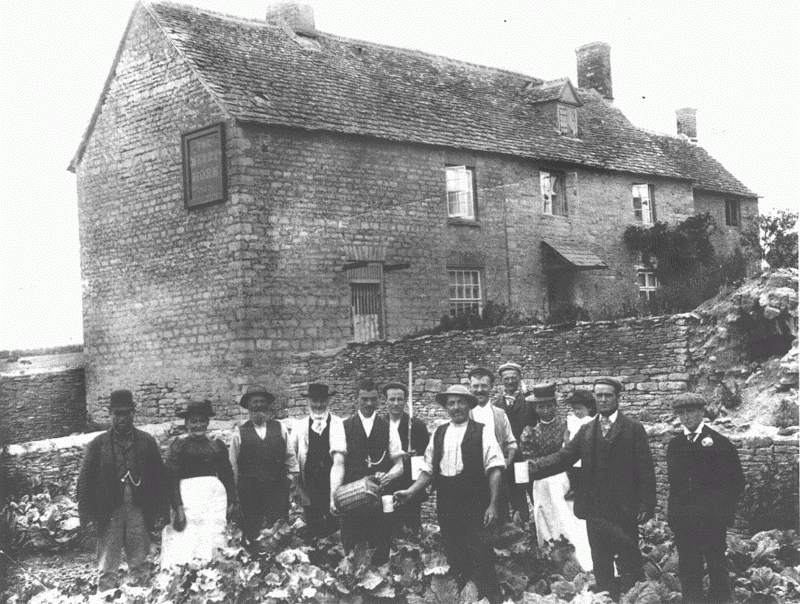
65. Curbridge: the Merry Horn public house, c. 1900.
Farm buildings in the angle of Main Road and Well Lane, similarly converted and rebuilt c. 2000 as Packhorse Barn, were earlier attached to Dog Farm, which ceased as a working farm in the earlier 20th century. In the 17th century the farm was a 2-yardland estate attached to a house called the Black Dog, presumably an inn, and later became a 3-yardland farm. (fn. 86) The farmhouse survives as Packhorse Cottage, a 1½-storey building of coursed rubble, probably 18th-century in origin. Another farmhouse typical of a smaller estate is Willow Cottage, on the south side of Main Road, a coursed rubble 2-storey late 17th-century house retaining chamfered lintels and beams. (fn. 87) Malthouse Farm, on the north side of Main Road, is named from a malthouse, mentioned in 1699, attached to a farm held by the Dalton family from the 16th century to the 19th. (fn. 88) In 1814 the malthouse seems to have been on the site of the surviving farmhouse. (fn. 89) It was held in the later 19th century by the Smith family, poulterers, (fn. 90) and the house, built or rebuilt in the 1880s probably by John Smith, (fn. 91) may incorporate the earlier malthouse. At the west end of the village the former Merry Horn public house, probably built as a farmhouse, dates from the early and mid 18th century; it is a 2½-storey building of coursed rubble and stone slate, altered and extended in the 19th century but retaining early 18th-century beams and roof timbers. The Lord Kitchener on the Bampton road, probably an inn by the earlier 18th century, may have been rebuilt or extended soon after the road was turnpiked, and by 1814 was similar in size and shape to the surviving building; it is of stone and stone slate, with a central 2½-storey block flanked by two-storey ranges. (fn. 92)
Park Farm, houses at Caswell and at Witney's southern end, and the mills, are all treated below. The only other surviving early house outside the village is Burwell Farm, which from the 18th century until the later 20th was the farmhouse for one of largest farms in the township, at times comprising some 350a. of former manorial demesne, held usually on long leases. (fn. 93) It is a substantial house of coursed limestone with ashlar dressings, notably the angle quoins which have a vertical roll-moulding. The main block, which has a symmetrical classical south façade but at the back only a single cellar window, is a single-pile five-bayed house of two storeys with dormers to garrets. Attached on the east is an east-facing service block of two storeys, with a hipped roof and a basement under the north end. The surviving house is evidently the 'newly built' farmhouse mentioned in 1756, when Burwell farm was first leased by the duke of Marlborough after he became lessee of Witney manor in 1751, (fn. 94) although the house seems to have been built in the first quarter of the 18th century and incorporates earlier windows in the cellar and service wing: the latter has 3-light windows with mullions which are ovolo-moulded internally but chamfered externally, both their placement and treatment suggesting re-use. Since there was apparently no house or other building on the Burwell site in 1662 such early windows were presumably imported, perhaps from Witney manor house, which was probably derelict before its demolition in the 1750s. (fn. 95) The main block of Burwell Farm, as first built, had two heated rooms on each floor; the south front was remodelled in the early 19th century, and a central staircase hall was created: the staircase incorporates earlier 18th-century newel posts. Most of the extensive farm buildings were demolished after Burwell ceased as a working farm, but a timber and stone-slated granary of c. 1800, rebuilt in 2002, survives. The lease of 1756 included a 'little dwelling house' or 'cottage for servants', probably identifiable as the stone-rubble core of a much extended farm cottage (later Witneylea cottage) on the south-east edge of the farmstead site. (fn. 96)
Nineteenth-Century Development
Between 1814 and the 1840s, when Curbridge's open fields were finally inclosed, there were few changes, reflecting the lack of population growth. (fn. 97) No additional house sites were established in the village, but in 1835–6 a church with attached schoolroom was built near the parish pound on the north side of Main Road; it stood some 40 yards south of the present church, by which it was replaced in 1906. (fn. 98) In the township's eastern part the Union workhouse was built in 1835–6 on the later Tower Hill, (fn. 99) and Rock House, a substantial early 19th-century villa residence, stone with a stuccoed symmetrical front and pillared portico, was built by Henry Salmon, wool stapler, in the angle of Mill Street and Puck Lane. (fn. 100)
At inclosure the principal farmers acquired contiguous fields which could be worked from existing farmhouses, but one new outlying farmhouse, Downs Farm, was built around 1840 on the Burford road at the township's western edge; it is a typical purpose-built farmstead of the period, with large stone barns and cattle sheds arranged around a central yard (Fig. 46). Dutton's Farm on the Bampton road, bought in 1836 by a Witney draper, William Dutton, was rebuilt shortly afterwards as a villa residence in Georgian style; for a time in the mid 19th century it was called Curbridge Hall. (fn. 101) It is a two-storeyed, double-depth house of coursed and squared stone with ashlar dressings, a Welsh slate roof, and a symmetrical front with trellised porch. An outlying farm cottage, presumably built to serve a detached part of Dutton's farm, was on the site of Peashill or Peashell Farm by the 1860s, but did not develop as a separate, and eventually substantial, farm until the early 20th century. (fn. 102)
In the mid 19th century several cottage rows were built in the village, notably Church Row and Batts Row on Main Road. (fn. 103) A new schoolhouse (now Laureston Cottage) was built on the south side of Main Road in 1871 and a small, wooden, Primitive Methodist chapel opened in the 1870s on the west side of the Bampton road, south of the junction with Main Road; it was replaced by the surviving chapel on Main Road in 1902 and later demolished. (fn. 104) In the east of the township mid 19th-century cottage rows were built at Razor Hill (in patterned brick) and north-west of Dark Lane (in stone and Welsh slate), and in 1857 Witney's cemetery with two chapels was laid out in the angle between Tower Hill and the Curbridge road. (fn. 105) A few more stone cottages were built on Cemetery Hill and on the Curbridge road in the later 19th century, notably, in 1887, a pair of cottages built by the Blenheim estate for Burwell farm, with tall chimneys, gables, and barge boards. On the west side of Tower Hill a pair of stone cottages with brick dressings and stacks were also built by the Blenheim estate in 1887; they were for Park Farm and stand at the end of its former entrance driveway. (fn. 106) By the 1890s there were more than a dozen cottages on or near the Witney Mills site; most were transferred to the urban district in 1898, together with five cottages built in Pound (later Station) Lane in the 1850s, and twelve built in the Crofts in the 1880s. (fn. 107) In 1873 the railway line from Witney to Fairford (Glos.) was built across the township, passing south of Curbridge village; the line was closed in 1962. (fn. 108)
Twentieth-Century Development
In the early 20th century suburban expansion into Curbridge was at first minimal: a pair of villas was built at the north end of Dark Lane in 1902 and a few others near the cemetery about 1900, while houses, mostly detached, began to be built on the south side of the Burford road east of Tower Hill. Later, however, the airfield established during the First World War on Curbridge down, and increasing motor transport along the Burford road, encouraged development in that area. In the 1920s and 1930s the north end of Tower Hill was built up, chiefly with detached houses in brick and pebbledash, and more were built on the south side of the Burford road. A council estate (Moor Avenue) was inserted between that road and Dark Lane, and another begun at Mirfield Road west of the cemetery. A few detached houses were built on Ducklington Lane and along the Curbridge road, notably an isolated house at Coral Spring built for the Barrell family of Witney in the 1930s. (fn. 109) In the village itself the only substantial addition before the Second World War was a group of eight council houses at the north end of Well Lane. (fn. 110) The village had mains water and electricity by the late 1930s, although the outlying Park Farm was not connected to the electricity supply in 1948. (fn. 111)
The rapid spread of Witney into the east side of Curbridge in the second half of the 20th century is treated elsewhere. (fn. 112) One result was that two of the largest farms in the township, Witney Park and Burwell, were entirely covered by housing, their farmhouses surrounded by densely packed estates. The extent and rapidity of the loss of agricultural land was unforeseen, since as late as 1960 a new farmhouse was built at New Leys on the Curbridge road, to work surviving fields in the Burwell area: it is a large stone house in traditional style, with mullions and dripmoulds. (fn. 113) By the 1990s, however, New Leys farm, too, was given over to housing, its farmhouse surrounded.
Other outlying parts of Curbridge, though remaining technically outside Witney's boundary, became effectively part of the urban area in the late 20th century. The airfield, which became an industrial site and later an industrial and commercial estate, is treated elsewhere, as are the public and private recreational and leisure facilities developed in the north west of Curbridge by the end of the century. (fn. 114) Chief among them was a golf course constructed on 130 a. of former farmland near Downs Road in 1993, developed over the next few years into an extensive leisure complex including an hotel, business centre, sauna, and swimming pools. (fn. 115)
From the 1950s the village was transformed by the insertion of new houses, mostly for commuters: in 1960, for example, the rural district council approved the building of 17 bungalows on Main Road and Well Lane. (fn. 116) By the 1970s Well Lane was lined throughout its length with a mixture of private and public housing, and most available sites along Main Road had been filled by detached houses and bungalows. A few detached houses and a garage had been built at the southern end of the village. At the west end a large complex of concrete agricultural buildings to serve Curbridge farm was erected in 1968. (fn. 117)
In the late 20th century infilling continued, and most of the old houses were altered and extended, their barns converted into houses; no large estates were established, but housing density increased as plots behind street frontages began to be developed. Building materials included brick, concrete, reconstituted stone, and a wide variety of concrete tiles.
Caswell
Caswell, a deserted medieval settlement, became the centre of an inclosed estate occupying the south-west corner of Witney parish and of Curbridge township. In 1824 the part of the estate within Witney parish comprised some 365 a.; (fn. 118) probably its extent had changed little from the Middle Ages, since it was surrounded by Curbridge's open fields. Part of the adjoining east side of Brize Norton parish was also called Caswell, and was similarly inclosed early, but followed a different descent until merged with the Witney estate from the 16th century: (fn. 119) in 1824 the Brize Norton part comprised another 180 a. (fn. 120) The early boundaries of the Witney estate were probably, on the west, the brook dividing Witney from Brize Norton (Norton ditch), on the north the ancient lane from Curbridge to Burford (past Peashell Farm), and, on the south, Curbridge heath. The medieval eastern boundary probably followed a brook which ran from the Burford lane southwards along the edge of Curbridge's open fields to Curbridge heath, then turned westwards to join Norton ditch. (fn. 121)
The medieval settlement stood south of the surviving Caswell House Farm, next to Norton ditch and on a small tributary stream rising ¼ mile to the north, perhaps the 'cress stream' to which the name Caswell is thought to refer. (fn. 122) In 1279, when surveyed as a separate component of Witney manor, Caswell comprised 12 freehold yardlands with at least 5 tenants. (fn. 123) In 1327, when Caswell was taxed with Curbridge, one of its two identifiable taxpayers, Richard of Standlake, was notably wealthy, and it may be that Caswell's depopulation and transformation into a single estate had already begun. (fn. 124) In the later Middle Ages Caswell was held by a succession of men involved in the wool and cloth trades, among them Thomas Fermor or Ricards (d. 1485), who certainly lived there. (fn. 125) His stepson Richard Wenman, merchant of the Staple, was indicted in 1500 for inclosing activities at Caswell, but probably the estate had long since been turned into an inclosed sheep farm, and the Brize Norton Caswell estate was already inclosed when it, too, was acquired by the Wenmans in 1554. (fn. 126) The Curbridge part of Caswell, called a manor by the early 16th century, was thereafter worked or let as a single farm centred on Caswell House, while the Brize Norton part was worked from Lower Caswell Farm, ¼ mile to the south. (fn. 127)
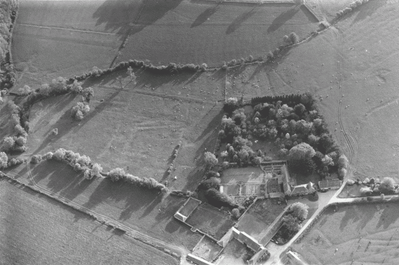
66. Caswell House Farm from the east in 1990, showing old inclosures and probable house platforms to its south.
Of the medieval settlement only Caswell House remains (Figs. 66–7). (fn. 128) In a field immediately south of its grounds are signs of hollow ways and possible house-platforms, (fn. 129) and an irregular three-sided moat or ditch where a cottage stood until the mid 20th century. (fn. 130) Close by to the south, on the boundary brook, is the small, rectangular Black Moat, (fn. 131) possibly the site of a medieval house attached to the Brize Norton Caswell estate. Lower Caswell Farm in Brize Norton, a substantial house of unknown date, stood immediately west of Black Moat, and was demolished in the early 20th century. (fn. 132)
Witney Park
In the mid 13th century the bishop of Winchester created a park west of the borough in Curbridge township; in 1279 he was found to have a free park for which no warrant was known. (fn. 133) A park was mentioned in the late 1240s, (fn. 134) but the work of laying it out seems to have been undertaken mainly in 1251 when some £48 was spent on digging a perimeter ditch (8ft. wide and 6 ft. deep) and putting up stake fencing. (fn. 135) The following year the park was stocked with deer from Wychwood forest provided by the king, and from 1253 a keeper was employed and the park fishponds stocked. (fn. 136)
There is no indication that any cultivated land was lost to the park, which was on clay soil in an otherwise cornbrash area and may already have been wooded. (fn. 137) It comprised some 180 a., bounded on the north by the ancient ridgeway towards Burford, and on the west by an ancient lane from Enstone and Bampton; the eastern boundary was the later Tower Hill, perhaps diverted at the park's creation, or perhaps a pre-existing road. (fn. 138)
There may have been some park wall by 1274, (fn. 139) and in 1285 the whole north side (231 perches) was walled in stone. (fn. 140) In 1286 large quantities of oak and elm were cut to improve park fencing against thieves. (fn. 141)
A hall or hunting lodge, probably on the site of the later Park Farm, was mentioned in 1254, (fn. 142) and the park 'mansion' or 'keeper's lodge' was repaired regularly thereafter. (fn. 143) There were great and little park gates, the main entrance probably, as later, on the Burford road near the centre of the northern boundary. (fn. 144) The fishponds were on Colwell brook in the south-west corner. (fn. 145)
Deer were kept in the park until the 16th century; in 1346 the king and other donors augmented the bishop's stock with 36 does, and most park expenditure in the later Middle Ages was on fodder or the maintenance of walls and deer leaps. (fn. 146) Horses were bred in the park into the 14th century, and throughout the Middle Ages timber for demesne buildings was felled there. (fn. 147) In the 13th century pasture rights in the park were let regularly; income from agistments later ceased because of the 'wild beasts', but frequent references to granges, a byre, and a sheephouse in the park indicate continued agricultural use. (fn. 148) A tithe modus of 10s., agreed at an unknown but probably late-medieval date, was later acknowleged to apply only to the deer park proper (c. 140 a.), (fn. 149) and to exclude Park Piece (some 38 a. within the walled area east of Park Farm) (fn. 150) which was presumably under cultivation when the modus was agreed.
In the 15th century the park pasture was sometimes let and sometimes kept in hand for the bishop's flocks. (fn. 151) In 1488 the manorial steward, Thomas Mayow, was paying 10s. a year for agistment in the park, and before 1500 he acquired a life-lease or farm of the park for £3 6s. 8d. a year. (fn. 152) He was succeeded before 1508 by another steward, Peter Hunsden, and in 1520 the park lease was granted for 98 years to Richard Wenman of Caswell. (fn. 153)
In 1593 local witnesses agreed that the park had ceased to be a deer park some 20 or 30 years earlier. (fn. 154) The land became part of a large inclosed farm centred on the former lodge, and although it was still partly wooded in the early 17th century when there was concern over excessive felling of timber there, (fn. 155) by the early 19th century it contained no woodland. (fn. 156) Thomas Wenman claimed in 1574 that he stocked the park with only a small herd of cows and a few fattening sheep, (fn. 157) though in 1591 a neighbouring farmer was grazing 100 ewes there. (fn. 158)
Stephen Brice, the Wenmans' subtenant in the park from c. 1583, bought the lease from Thomas Fisher and his wife Jane (formerly Wenman) in 1585. (fn. 159) On its expiry in 1618 the lease was renewed to the Brice family for 80 years, still at the traditional rent of £3 6s. 8d. (fn. 160) Stephen (d. 1620) and his son Stephen (d. 1643) lived at the house in the park, (fn. 161) while other Brices, notably Thomas, son of Stephen (d. 1620), and Robert, probably Thomas's son, occupied Witney manor house. (fn. 162) When the bishop of Winchester's Witney manor was sold by the Parliamentary Commissioners in 1649 the unexpired park lease was held by Martha Brice, widow of Stephen (d. 1643), but it was not mentioned after the bishops of Winchester recovered their estates at the Restoration. (fn. 163) The Brices' connection with the park was broken permanently when Martha's son, Capt. Stephen Brice, a Royalist compounder, moved to Eynsham in 1654. (fn. 164) After the Restoration a Capt. Robert Wharton briefly occupied the house, (fn. 165) but later both house and park formed the core of one of Curbridge's principal farms, held by the long-established farming families the Hornes, the Bushes, and the Staleys. (fn. 166)
In the mid 19th century parts of the former park boundary were clearly visible. Sections of 'massive and lofty' wall associated with a 'deep and wide' ditch were noted, and a 'fosse' on the Burford road, marking the northern park boundary, survived into modern times. (fn. 167) In the 1960s a dry ditch there was some 6 ft. deep in places, but was later filled in. (fn. 168) Slight signs of a bank and ditch in the south-west, and of walling related to a field barn (formerly Pryor's barn) on the southern boundary, were visible in the 1980s, and remains of the medieval fishponds survive on Colwell brook. (fn. 169)
Park Farm
By the late 20th century Park Farm, entirely surrounded by housing, was derelict; (fn. 170) after its conversion into three houses not much more than the shell of the old building remained. The house and its extensive farm buildings had changed little in plan between the early 19th century and the later 20th. (fn. 171) By 1988 the L-shaped house, of coursed rubble with an ashlar front, had a mixture of concrete tile and Welsh slate roofs, with brick end stacks. (fn. 172) The symmetrical 2½-storey south front, 3-windowed with a central doorway, was probably built in the late 18th century for the prosperous Bush family; a lower service wing on the east was of similar date. Parts of a rear range and a north—south extension date from the early and later 17th century, retaining 2- and 3-light stone mullioned windows with dripmoulds. Despite intensive modern building-work at the house and in its grounds no remains of the medieval park lodge have been recorded. (fn. 173)
Social Life
In the 1870s Curbridge feast, held on or near 25 September, included a cricket match and races; (fn. 174) whether or not the celebration was traditional is unknown. Earlier the township was closely concerned in Witney feast (beginning the first Sunday after 8 September), which in the 18th century included horse races on Curbridge down on the Monday and Tuesday. (fn. 175) The races ceased in 1840 when the down was inclosed. (fn. 176)
A Curbridge Friendly Society and Savings Club existed in 1842, (fn. 177) and in the later 19th century there was a village choir. (fn. 178) Most social life centred on the church, the chapel, and the inns. There was no village hall, but in the 1960s and 1970s the parish council and a Good Companions club met in the Methodist chapel. (fn. 179) In 1978, when it closed as a chapel, villagers observed that it was their only public meeting room; (fn. 180) it was acquired by the parish council and used for meetings, social events, and by the village band and other groups.
Inns
Curbridge's only surviving inn, the Lord Kitchener, was so named from the first decade of the 20th century; (fn. 181) earlier it was the Herd of Swine. (fn. 182) In the 18th century, known familiarly as the Hogs, (fn. 183) it was Curbridge's principal inn; its licensee from 1753 until 1797, Mary Andrews, was probably the successor of Leonard Andrews, innholder, recorded at Curbridge in 1717, (fn. 184) and the Andrews family still owned but let the inn in 1814. (fn. 185) Later, and for much of the 19th century, it was held by another long-established family, the Lords. (fn. 186)
Other early inns included a 17th-century Black Dog, (fn. 187) and in the later 18th century a Coach and Horses, a Bell and Ball, and a Ball, but by the early 19th century only the Herd of Swine was licensed. (fn. 188) By 1840 and until the 1880s the Merry Horn at the village's west end was run by the Busby family as an alehouse combined with a butcher's shop, (fn. 189) and the Ayris family were publicans there from the 1880s until the 1930s. (fn. 190) The Merry Horn closed in the 1990s. (fn. 191)
Thomas Beecham
The pill manufacturer and founder of a firm which became a major pharmaceutical company was born in Curbridge in 1820: (fn. 192) his father Joseph, a farm labourer, was tenant of a cottage at the south end of the village, later rebuilt as Beecham Cottage. (fn. 193) In 1841 his mother Sarah, who had remarried after Joseph's death in 1839, was living there with five of her seven Beecham children, (fn. 194) but Thomas, her eldest, had long since left Curbridge. After working as a shepherd in Cropredy and a gardener in Kidlington he made and sold pills in Witney and Bampton, moving in 1847 to Lancashire where he made his fortune. (fn. 195)