A History of the County of Somerset: Volume 4. Originally published by Victoria County History, London, 1978.
This free content was digitised by double rekeying. All rights reserved.
'Parishes: Seavington St. Mary', in A History of the County of Somerset: Volume 4, (London, 1978) pp. 198-210. British History Online https://www.british-history.ac.uk/vch/som/vol4/pp198-210 [accessed 19 April 2024]
In this section
SEAVINGTON ST. MARY
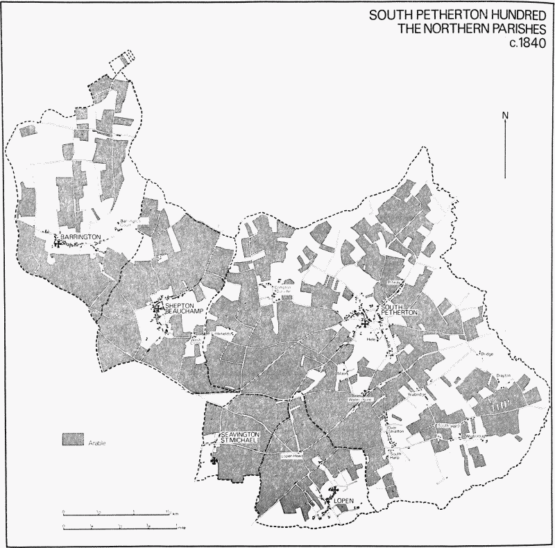
The ancient parish of Seavington St. Mary, about 2 miles south-west of South Petherton, is roughly L-shaped. Its ancient southern, western, and northern boundaries were all followed by roads, the western forming part of the Whitelackington park bank in Park Lane and the southern part of Boxstone Hill. The northern boundary with Shepton Beauchamp and South Petherton was marked by the narrow sunken Muckleditch and Fouts lanes, until the late 18th century part of the main IlchesterTaunton road. (fn. 1) Seavington St. Michael, which fits into the 'L' in the east is divided from Seavington St. Mary largely by hedge-boundaries and by most of Water Street, the link between the two villages. The Foss Way cuts across the southeastern extremity of the parish at Crimbleford Knap, but in no way affects the boundary. (fn. 2) In 1875 a detached part of Ilton around Hurcott in the north-west was added to the ecclesiastical parish, and a small piece of meadow at Ilford Bridges was transferred from Seavington to Whitelackington. (fn. 3) The parish measured 994 a. in 1841 and 1,106 a. after the inclusion of Hurcott. (fn. 4)
The southern half of the parish is dominated by the limestone ridge of Easterdown hill which rises to 249 ft. A quarry and limekiln stood just south of the village on the north side of the hill. (fn. 5) North and south of the hill bands of Yeovil Sands give way to alluvium along the Lopen brook and its tributary, forming on the south-east the largest area of meadow. North of the village, on the ground which rises to 301 ft. on Boxstone Hill, are wide bands of Pennard Sands and a junction bed of limestone. At Hurcott are the beginnings of more Yeovil Sands. The landscape in the north is characterized by large open fields divided by banks and sunken lanes. (fn. 6)
The northern half of the parish is served by two north-south roads: Boxstone Hill forms the western boundary and leads to Hurcott and Shepton Beauchamp, and a lane from Seavington St. Michael through Seavington Abbots runs to Green Lane End and thence also to Shepton. The southern part of the parish is crossed by two east-west routes, the more northerly from Seavington St. Michael to Whitelackington. From the northern end of Water Street to West Street Farm it is known as New Road, having been constructed in 1829. (fn. 7) This new route diverted the London-Exeter traffic away from Seavington St. Mary village. The village street forms the second east-west route, continuing west towards Furzey Knap, Longforward Lane, and Park (later Bread and Cheese) Lane in the extreme west of the parish on the borders with Kingstone and Whitelackington. (fn. 8) There was one minor route south of the village over Easterdown hill to Dinnington via Dark and Sawpit lanes or Rooks Meade lane. Before 1829 the parish church was isolated at the end of Church Lane north of the village street.
An interpretation of the place-name as seven settlements seems appropriate if Seavington St. Michael is included. (fn. 9) The two main settlements of the medieval period were Seavington St. Mary and Seavington Abbots or Upton. The name Oppetone Abbe occurs in the 13th century, and Seavington Upton or simply Upton in the seventeenth. (fn. 10) The name continues in Upton House. Hurcott, a mile north-west of Upton, lay until 1884 in Ilton parish. There was a settlement there by 1260. (fn. 11) There seems also to have been a small settlement in the south of the parish at Crimbleford, possibly the successor to the Roman villa overlooking the Foss. (fn. 12)
Field- and furlong-names survived to the 19th century to indicate the general position of open arable fields. Pitfurlong, on the northern boundary, Higher, Middle, Bird's Lane, and Court fields, and Middle and Stone furlongs still survived in the area north of New Road, largely farmed from Hurcott and Upton farms. (fn. 13) West and south of Seavington village in the 1840s lay Merfield, West, Rye, Middle, Harrison, Little, Southway, and Lower fields. (fn. 14) Most of this land was confined to the Seavington farms, but Upton farm had meadow in the south-east, known in the 19th century as Upton mead and in the 16th as South mead. (fn. 15)
The oldest buildings in the parish seem to date from the 17th century and include Hurcott and Upton farm-houses. Hurcott Farm probably dates from the earlier 17th century and is a substantial house of two storeys and attics. There are extensive farm buildings, some of stone and thatch, which appear to date from the 17th century and later. Upton House, another substantial stone house, appears to date from the 18th century and has later extensions. The present Rectory was until 1890 also a farm-house. Its north and west walls incorporate parts of a building of the earlier 17th century, but the house is now largely of the mid 18th century although much altered in the 19th. The roof was then heightened to provide more attic space, a service wing added on the west, and the south front re-glazed. There may also have been some internal re-planning. Subsequent alterations have included c. 1954 the demolition of the service wing. The house now lacks all its original fireplaces and ceilings.
In 1754 four men were licensed to sell beer in the parish, including Richard Upsteel in Seavington Abbots. The Travellers' Rest in Muckleditch Lane, on the Taunton road, is traceable to the mid 18th century and survived until the end of the 19th. (fn. 16) The former West Street Farm was converted to a restaurant called the Pheasant in 1971. (fn. 17)
In 1563 there were 27 households in the parish. (fn. 18) In 1801 the population was 269. In the next decade it rose rapidly, and again in the 1820s, reaching a total of 390 in 1851. During the next half century there was the normal decline for the area, and low points of 218 and 219 were reached in 1901 and 1931. The figure was 213 in 1961 and 212 in 1971. (fn. 19)
MANORS AND OTHER ESTATES.
Mauger de Cartrai held an estate called Sevenehantona of the count of Morain in 1086 in succession to Alwin. (fn. 20) As in the manor of East Stoke in Stoke sub Hamdon (fn. 21) the overlordship passed by 1284–5 to Isabel de Forz, countess of Aumale, though whether through the counts of Aumale or from the Reviers family is not known. (fn. 22) From Isabel it descended to the Courtenays: Hugh, later 1st earl of Devon (d. 1340), held ½ fee there in 1303 (fn. 23) and his son, also Hugh, died in 1377 possessed of 10 fees there and at Ashill. (fn. 24) The fees passed successively to Thomas Courtenay, earl of Devon (d. 1458), and then to his son and successor Thomas (d. 1461), (fn. 25) but they are not traceable thereafter. In 1431 the manor was said to be held of Lord Zouche as of Castle Cary in socage. (fn. 26)
Alice Vaux, the first known tenant of the manor of SEAVINGTON VAUX, occurs in the late 12th or early 13th century. Her son Robert was certainly in occupation in 1212, (fn. 27) and occurs elsewhere between 1206 and 1222. (fn. 28) Before 1236 he had been succeeded by his son Hubert, who held both Ashill and Seavington. (fn. 29) Maud, probably Hubert's daughter and wife of Thomas de Multon, succeeded by 1252 (fn. 30) and retained a life interest until her death in 1293, though both manors were held from her son James from 1283. (fn. 31) James was sole occupier in 1303 (fn. 32) but had died by 1316 when settlement was made by his brother Thomas on his own sons John, Thomas, and James successively. (fn. 33) John succeeded c. 1317, (fn. 34) was apparently resident there in 1327, (fn. 35) and survived probably until after 1363. (fn. 36) By 1377, however, he had been succeeded by his son-in-law Sir John Streche, husband of his daughter Margaret. (fn. 37) Streche died in 1390 leaving two daughters as coheirs: Elizabeth, wife of Thomas Beauchamp, and Cecily, wife successively of Thomas Bonville and Sir William Cheyney of Brook, Westbury (Wilts.). (fn. 38) Cheyney occupied the manor in 1412 and died in 1420. (fn. 39) His widow survived until 1430 and, having just outlived her son Sir Edmund Cheyney, was succeeded by three young granddaughters, Elizabeth, Anne, and Cecily. (fn. 40) Cecily died six months later, (fn. 41) and the manor passed to Elizabeth, wife of Sir John Colshull (d. 1483), who herself survived at least until 1483. (fn. 42) Margaret Colshull, widow, was said to be lady of the manor in 1486, (fn. 43) but the descent is thereafter uncertain until 1542, when the manor was in the hands of Walter Willoughby, grandson of Robert, 1st Baron Willoughby de Broke, himself the eldest son of Anne Cheyney by John Willoughby. (fn. 44) Walter Willoughby made over the manor in 1542 to John Bowyer. (fn. 45) Bowyer and Sir Fulk Greville, husband of Elizabeth, Baroness Willoughby de Broke (d. 1560), were in possession in 1544–5, (fn. 46) and in 1547 Greville sold the 'manor or lordship of Seavington Vauce alias Mary Seavington' to John Thynne. (fn. 47) Before 1553 the manor had passed to Sir Edward Seymour, son of Protector Somerset, Thynne's patron; in that year Seymour sold it to the Crown in exchange for Berry Pomeroy (Devon). (fn. 48)
The manor remained in the hands of the Crown until 1574–5, (fn. 49) when it was granted to Laurence Hyde. In 1624 the property was said to be held of Robert Hyde, (fn. 50) but the manor must earlier have reverted to the Crown since in 1604 it was granted by James I to John Erskine, earl of Mar (d. 1634). (fn. 51) Mar's son, also John (d. 1653), sold it in 1652 to John Davis of Westminster and he in the following year conveyed it to Henry Dunster, a London merchant. (fn. 52) Dunster, or a son of the same name, sold it in 1680 to Simon Welman, M.D., of London. (fn. 53) Simon left the property to his brother Isaac (d. 1716), of Poundisford, in Pitminster, and it descended successively through his son Thomas (d. 1757), his grandson Isaac (d. 1782), and his great-grandson Thomas (d. 1829) to Charles Noel Welman of Norton Fitzwarren. (fn. 54) Welman sold the property, incorrectly described as 'the manor or lordship of Seavington Abbott and Hurcott etc.' in 1876 to Vaughan Hanning Vaughan Lee, M.P., of Dillington. (fn. 55) The ownership in 1973 was vested in the Dillington Estates.
King Cnut gave to Athelney abbey between 1027 and 1032 an estate measuring two 'manses' in Seofenempton. (fn. 56) This holding measured two hides in 1086 and was still described as at Seovenamentone. (fn. 57) By 1284–5 the abbey's estate was called Oppetone Abbe and by 1260 Herdecote, both names persisting until the 19th century. (fn. 58) The abbey held the property at the Dissolution as part of its estate at Ilton, (fn. 59) and it was held by the Crown between 1539 and 1600 when it was granted, under the name of the manor or manors of HURCOTT and SEVENHAMPTON ABBOT, to William and Robert Offley. (fn. 60) Robert Offley, a London haberdasher, sold the property in 1605 to Sir George Speke of Whitelackington (d. 1637). (fn. 61) It descended in the Speke family (fn. 62) to John Speke who sold it in 1699 to Simon Welman, owner of Seavington Vaux. (fn. 63) The property was held by the Welman family until 1871 when, described as Hurcott farm and measuring 160 a., it was sold by C. N. Welman to Vaughan Hanning Lee, then of Lanelay, in Llanharan (Glam.). (fn. 64) It subsequently became part of the Dillington Estates.
In 1260 the prebendary of Ilton had a barn within the court of the abbot at Hurcott, which he exchanged for a site for a new barn further north to build another. (fn. 65)
The church of South Petherton and its dependent chapelries including Seavington St. Mary was granted by the Crown to Bruton priory at the end of the 12th century. (fn. 66) Under an ordinance of Archbishop Pecham (d. 1292) Bruton had all the great tithes in Seavington St. Mary and found a resident chaplain to serve the chapel; (fn. 67) an agreement of the early 13th century increased the priory's rights of pasturage and provided a messuage and curtilage, presumably for the chaplain and clerk to serve the church. (fn. 68) A composition made with Athelney abbey in 1285 confirmed their right to take a proportion of the crop in a specified area, presumably at Hurcott. (fn. 69) Bruton retained what was thus the rectorial estate until the Dissolution in 1539. (fn. 70) In 1542 the holding, which involved also the rectory of South Petherton and the other dependent chapelries, was granted to the chapter of Bristol. (fn. 71) It was subsequently leased by the chapter to successive members of the Poulett family for the sum of £17 a year. (fn. 72) By 1617 the real property of the rectory in Seavington was a yard of ground, known as Parsonage Plot, with a house 'near the road . . . lately built'. (fn. 73) This house replaced an earlier one apparently damaged by fire c. 1557 and later converted to a barn. (fn. 74) Sub-leases of the tithes in the parish in the late 18th century included a dwelling-house. (fn. 75) In 1842 the tithes were commuted to a rent-charge of £350, payable to Earl Poulett, lay rector since his purchase of the property from the chapter of Bristol in 1802. (fn. 76) The dwelling-house then stood on the north side of the village street at the corner of Church Lane; the site was occupied in 1973 by Allenby House. (fn. 77)
ECONOMIC HISTORY.
The two estates in the parish in the 11th century were predominantly arable and measured 9 hides. The demesne on the estate of Mauger de Cartrai measured 5½ hides out of a total of 7 hides in the holding; the Athelney demesne amounted to half the property. Together the owners had 46 a. of meadow, but 10 a. of wood and 25 a. of 'moor' and meadow had been lost to South Petherton. (fn. 78) By 1349 the demesne of Hurcott, the Athelney holding, amounted to about 66 a., of which 55 a. were arable, 7 a. meadow, and 4 a. pasture. Two parts of the arable were then sown. Rents of 32s. were taken from the remainder. (fn. 79) In the 19th century this same former demesne was represented by the 100-a. Hurcott farm, and the remainder by the 106 a. which paid tithe to the prebendary of Ilton. (fn. 80) In terms of valuation, the Athelney holding was assessed at 30s. in 1086, (fn. 81) £7 6s. 3d. in 1291, (fn. 82) and £3 11s. 6d. in 1349. (fn. 83)
As many as 156 sheep were recorded on the demesne estates in 1086. (fn. 84) In the early 13th century the convent of Bruton acquired rights of common from the lord of the manor for 40 sheep and other beasts. (fn. 85) Meadow was comparatively limited. The 80-a. holding of John Kaynes in the manor in 1384 included just ½ a. of meadow, though that of John Geffereys in 1487 amounted to 60 a. of arable and 10 a. of meadow. (fn. 86) The Buller family, tenants from the 14th century, held meadow at the 'Farthyng' which they exchanged with their lord for similar property at 'Landemede' and elsewhere. (fn. 87)
The Bullers were successors to a number of substantial families which held small freeholds in the parish. Walter de Thornhull had an interest in a virgate in 1268; (fn. 88) the Brooks, lords Cobham, were there in 1505, (fn. 89) and the Seymours, in the persons of Sir John and Sir Edward Seymour, between 1528 and 1560. (fn. 90) Robert Buller (d. 1506) occupied a capital messuage in Seavington Vaux manor, (fn. 91) and John Buller held it at his death in 1592. (fn. 92) Among the lesser tenants were Joan Sylvayn and Humphrey Kail, the most substantial in 1327, the latter also holding half the manor of Cudworth and land in Chaffcombe and Knowle St. Giles. (fn. 93) The Crymelford family held land in the south of the parish and in Dinnington and Allowenshay in the later 14th century. (fn. 94)
In 1553 the manor of Seavington Vaux was valued for fee farm at £29 7s. 8d., a figure which included perquisites of 25s. 8d. (fn. 95) The rent was payable after 1630 to the Whetstone Almshouses, Ilton. (fn. 96) By 1680 the manor was valued at £458. (fn. 97) The Speke property was assessed at £10 by office and £20 by certificate in 1637. (fn. 98)
In 1680 the manor acquired by Isaac Welman, amounting to some 560 a., was shared between 20 tenants holding for one, two, or three lives. (fn. 99) Most farms were of 20 a. or 40 a., though they varied much in value. The largest was the 80-a. holding of Iron Dunster, followed by Elizabeth Dunn's 60 a., and Stephen Hutchings's 52 a. Only the Hutchings family seem to have survived on a similar economic level to the 1770s, holding not only the later West Street farm, but also other lands including Kails, after the 14th-century occupier. (fn. 100) Thomas Hutchings, resident in Barrington, from 1788 shared the lease of the tithes from Lord Poulett. (fn. 101) Other prominent farmers in 1772 were Thomas Poole and Richard Bullen, with smaller properties held by non-residents such as Robert Stuckey and John Helliar. (fn. 102)
The southern part of the parish paid tithes to Lord Poulett. In 1778 tithes, moduses, and compositions together produced an income of over £113. John Poole paid £8 15s. as occupier of the inclosed Meade farm, and also held just over 100 a. elsewhere in the parish. The crops in the parish as a whole were probably reflected in the proportions in this more restricted area. Wheat (160 a.) and barley (129 a.) predominated; grassland amounted to 108 a. Other arable crops were beans (32 a.), flax (32 a.), clover (25 a.), peas (17 a.), hemp (12 a.), potatoes (11 a.), and oats (5 a.). Tithes of sheep and wool amounted to £3 16s. and of cows £1 1s. 6d. (fn. 103)
The main farms in the early 19th century were held by the Naish, Hutchings, and Poole families. (fn. 104) By 1841 John Naish of Upton farm (171 a.) and William Naish of Home farm (173 a.) were followed by J. and W. Stephens of Hurcott (100 a.), Thomas Harding of Middlefield farm (99 a.), and Robert Poole of Meade farm (over 70 a.). West Street and Water Street farms were over 60 a. and a similar holding was based on the present Rectory. (fn. 105) By 1851 John Naish of Upton farm had 325 a. and employed 26 labourers and William Naish 190 a. with 14 workers. (fn. 106)
Traces of strip cultivation survived in the south of the parish in the 1840s in Rye, South Way, Middle, and Little fields, and in the north at Pit Furlong. Lower mead was also not permanently divided. Parts of Hurcott were inclosed by the 1520s, (fn. 107) and although Wheathill, Huish, and Bremblegaston were still open in 1560, (fn. 108) consolidation was then taking place. Final traces of strips in the south still survived into the 1880s. (fn. 109) By 1905 more than half the parish was arable, (fn. 110) and in the 1970s there was still slightly more arable than grass.
Agriculture provided most employment during the 19th century, roughly one sixth of the total population being employed as farm labourers in 1851. As many as 62 women and girls were employed as glovers in their homes. (fn. 111) Just after the turn of the century young girls found employment at a collar factory in Ilminster. (fn. 112)
Early in the 13th century Robert Vaux granted a windmill and 6 a. of land in Seavington to Montacute priory. (fn. 113) No further trace of the mill has been found.
LOCAL GOVERNMENT.
The two parishes of Seavington St. Mary and Seavington St. Michael appear to have formed two tithings in the 14th century, known as Seavington Dennis and Seavington Abbots, not necessarily coterminous with parish boundaries. (fn. 114) The same division occurs in the 15th century, (fn. 115) but by 1539 there were four separate areas for musters, known as Seavington, Seavington Abbot, Seavington Dennis, and Seavington Vaux. (fn. 116) There were still three units in 1569, Seavington Mary, Seavington Abbot, and Seavington Dennis, (fn. 117) but by 1652 the 'several tithings of the three Seavingtons' were held by one man of the Crown (fn. 118) and were thus regarded as one fiscal unit. (fn. 119) Seavington Abbot tithingman was appointed in the manor court of Hurcott, (fn. 120) and extracts of court rolls survive for 1528–9, 1542, and 1560. (fn. 121) Courts were presumably still held for Seavington Vaux in 1553 (fn. 122) though no rolls have survived. There is an extract of a court baron for the manor of Seavington Mary alias Vaux for 1698. (fn. 123)
There were two overseers from the 17th century, (fn. 124) but often only one churchwarden, Thomas Hutchings holding the office alone from 1814 until 1852. (fn. 125) One warden was appointed by the parish from 1852. (fn. 126)
There was a parish house next to Parsonage Plot in 1617. (fn. 127) In 1853 the vestry agreed to the request of the Chard Union (in which the parish had been incorporated since 1836) to sell ten cottages formerly used for the poor, standing at a number of points on the waste north of the village street. (fn. 128)
CHURCH.
The church of Seavington St. Mary, a dependent chapel of South Petherton, augmented if not founded by the Vaux family, occurs early in the 13th century. (fn. 129) In 1389 it acquired burial rights. (fn. 130) The canons of Bruton until 1539 and the successive tenants of the chapter of Bristol as farmers of the tithes provided curates until 1809 when the benefice became a perpetual curacy on the first vacancy after the impropriation was purchased by Earl Poulett. (fn. 131) The sale to the earl excepted the patronage (fn. 132) but he and his successors presented during most of the 19th century. The chapter resumed its rights by 1888 (fn. 133) and since c. 1923, when the living was united with Seavington St. Michael, has shared the patronage. (fn. 134)
The canons of Bruton as rectors agreed to maintain a resident chaplain and clerk in the early 13th century. (fn. 135) In the 1560s the church was served by curates paid £3 a year. (fn. 136) In the early 17th century chaplains were paid £6 13s. 4d. under the will of Sir Anthony Poulett to preach four times a year, (fn. 137) presumably in addition to the £15 to serve the cure paid at least from the 1650s until the end of the 18th century. (fn. 138) The curacy was augmented by lot in sums of £200 in 1750, 1809, 1817, and 1824; (fn. 139) in 1815 it was said to be worth £43 a year, and in 1831 £50. (fn. 140) It was further augmented in 1872 by rent-charges formerly paid to the prebendaries of Ilton and Ashill, and in 1875 by a rent-charge from Hurcott when the hamlet was transferred to Seavington parish. (fn. 141)
The benefice was often held in plurality, and there was no house for the curate until 1890. (fn. 142) In 1630 Thomas Stuckey also held Seavington St. Michael and Dinnington; in the early 1650s ministers served several Poulett chapelries for a few weeks at a time. (fn. 143) Thomas Evans (curate 1809–30) was also incumbent of Chillington and lived at Shepton Beauchamp, where he was curate; (fn. 144) in 1840 the church was held with Stocklinch Ottersay, (fn. 145) in the 1850s with Whitelackington, and then with Stocklinch Ottersay again. (fn. 146) From 1871 it was always held with Seavington St. Michael. (fn. 147)
There were several complaints during the 16th century about the disrepair of the chancel, (fn. 148) there was no Bible in English in 1547, (fn. 149) and no pyx in 1554. (fn. 150) A woman 'suspected to be a sorcerer' disturbed her neighbours in church in 1577. (fn. 151) There were 6 communicants in 1776. (fn. 152) In 1815 and 1840 services were held on alternate Sundays, morning and afternoon, and in 1840 Holy Communion was celebrated eight times a year. (fn. 153) On Census Sunday 1851, during a vacancy, there was only an evening service attended by 75 people. (fn. 154) Holy Communion was celebrated nine times a year by 1853. (fn. 155) A weekly service and sermon was still the practice in 1870, with Holy Communion every six weeks. (fn. 156) A surpliced choir was introduced in 1880. (fn. 157)
In 1680 there was a church house belonging to the manor of Seavington Vaux. (fn. 158)
The church of ST. MARY is built of rubble with ashlar dressings and has a chancel, nave with south porch, and west tower. The nave and chancel appear to be of 13th-century origin but only the chancel arch, with its flanking recesses towards the nave, is relatively unaltered. The nave was given at least one new window in the 14th century and was otherwise refenestrated, heightened, and provided with a porch in the 15th or early 16th century. At about the same time a new east window was put into the chancel and the tower was built. The latter was heightened or the upper stage rebuilt later in the 16th century, and church and churchyard together were consecrated in 1543. (fn. 159)
The fittings include a 12th-century font, which may be evidence for an earlier building, a 14th-century aumbry, and a bier dated 1694. The church was galleried by 1816, and was restored in 1880 and 1882. (fn. 160)
There are six bells. Before 1906 there were three, all by George Purdue of Taunton and dated 1621. (fn. 161) One was recast and three new ones were added by Taylors of Loughborough. (fn. 162) There is a chalice of c. 1715 and a paten of 1851. (fn. 163) The registers of baptisms date from 1716, of burials from 1741, and of marriages from 1759. (fn. 164)
NONCONFORMITY.
Claims were made by the curate of Seavington St. Mary that a conventicle had been held by a Mr. Butler in 1672, (fn. 165) and a number of those involved were fined. Licences were issued for meetings from 1689 onwards, at first without stated denomination but from 1735 for Presbyterians. Licences then and in 1752 were for houses in Seavington Abbots. (fn. 166) By 1776 there were three or four families of Presbyterians in the parish. (fn. 167) Wesleyan Methodists began worshipping in the parish in 1812 and in 1841 had 8 members. (fn. 168) The present chapel, of Ham stone standing on former waste ground beside the road, was built in 1885. Several people contributed to the Bible Christian circuit in 1829 but no formal group seems to have been created until 1834. There were 10 members in 1841 and 37 attenders and members a year later. Some of the congregation removed to Seavington St. Michael parish in 1843 but from 1846 those in Seavington St. Mary alone remained. (fn. 169) Beulah chapel was erected in Dark Lane, south of the village, in 1859. It was closed before 1929 and was known in 1973 as Beulah House. (fn. 170)
EDUCATION.
In 1818 Wesleyan Methodists had a Sunday school in the parish and the curate and others supported another for c. 30 children. (fn. 171) By 1835 there was a day-school for 11 children. (fn. 172) Children attended the day-school at Seavington St. Michael from 1844 until its closure in 1968. (fn. 173) A Mrs. Butler kept a girls' school in 1875. (fn. 174)
CHARITIES FOR THE POOR.
None known.