Survey of London: Volume 36, Covent Garden. Originally published by London County Council, London, 1970.
This free content was digitised by double rekeying. All rights reserved.
'Plan pocket: Map of the Parish of St. Paul, Covent Garden', in Survey of London: Volume 36, Covent Garden, (London, 1970) pp. 1. British History Online https://www.british-history.ac.uk/survey-london/vol36/p1 [accessed 18 April 2024]
Map of the Parish of St. Paul, Covent Garden
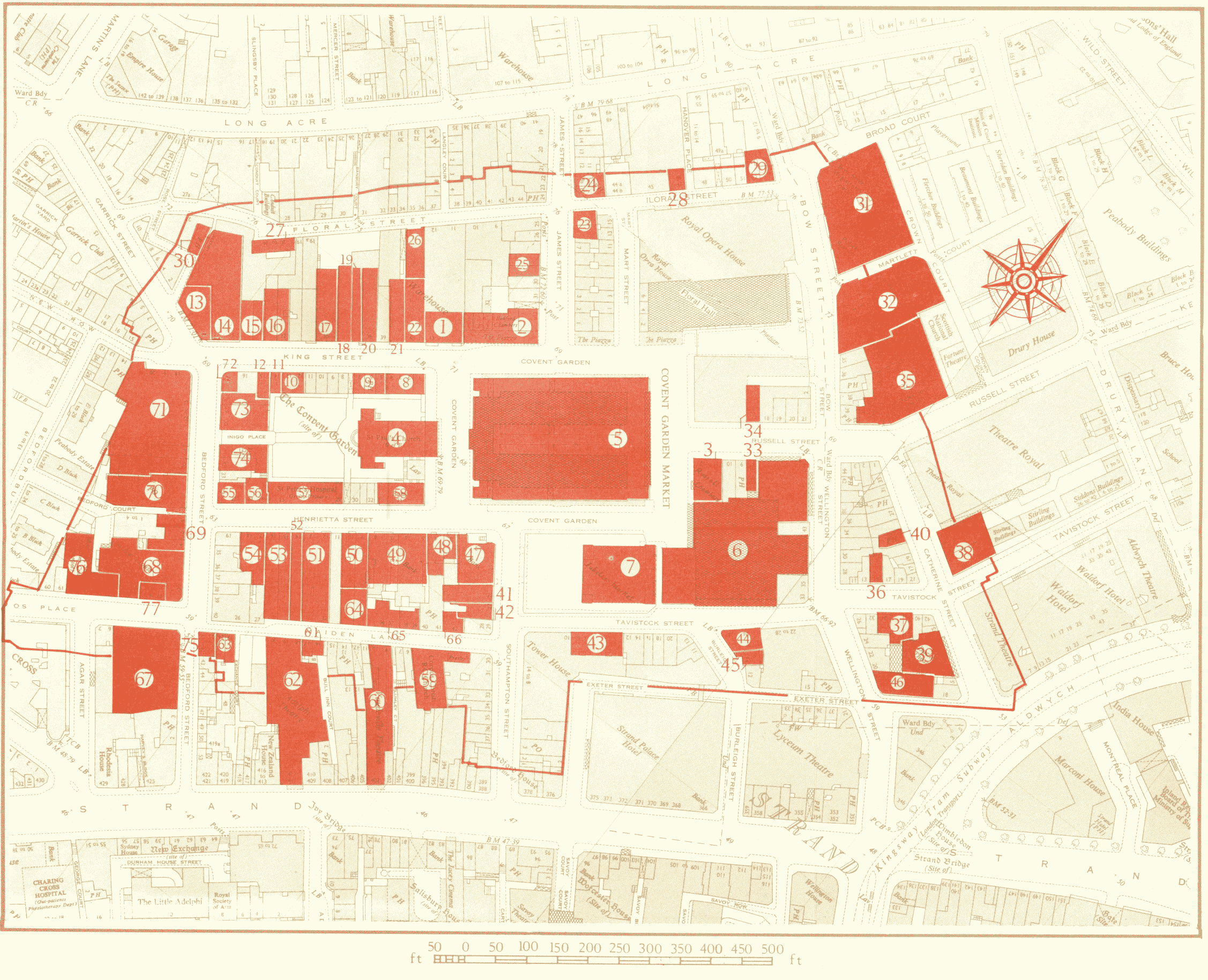
Map of the Parish of St. Paul, Covent Garden
The recorded buildings are coloured red; the numbers correspond
with those in the margins of the text. The Theatre Royal, Drury
Lane and the Royal Opera House, Covent Garden are described in
volume xxxv of the Survey of London
Reproduced from the Ordnance Survey Map with the Sanction of the Controller to H. M. Stationery Office