A History of the County of Chester: Volume 5 Part 2, the City of Chester: Culture, Buildings, Institutions. Originally published by Victoria County History, London, 2005.
This free content was digitised by double rekeying. All rights reserved.
'Leisure and culture: Open spaces and parks', in A History of the County of Chester: Volume 5 Part 2, the City of Chester: Culture, Buildings, Institutions, (London, 2005) pp. 298-304. British History Online https://www.british-history.ac.uk/vch/ches/vol5/pt2/pp298-304 [accessed 25 April 2024]
In this section
OPEN SPACES AND PARKS
Roodee
Chester's principal public open space is the Roodee, a flat, low-lying expanse south-west of the medieval walls. In the 20th century it covered 63 a., and the Little Roodee to the south-east, definitively severed from the Roodee when the embanked approach to Grosvenor Bridge was made in the late 1820s, covered 6 a. (fn. 1) In the Roman period the Roodee was part of the tidal salt-marsh at the head of the Dee estuary, the main river channel lying east of its present course under the line of the medieval walls. (fn. 2) Silting shifted the channel and gradually turned the marsh into meadowland but c. 1195 it was still covered by every tide. (fn. 3) A century later it may have been normally dry: by 1284–5 there was a way from the nunnery across crofts to the Eye (meaning the Little Roodee), (fn. 4) and in December 1288, a month when the river may well have been high, citizens were practising archery on the Roodee. (fn. 5) The name Roodee means 'the meadow with a cross' (rood eye), (fn. 6) and refers to a cross towards the south end which marked the boundary of Holy Trinity and St. Mary's parishes and of which the weathered pedestal and stump survived in situ in 2000. (fn. 7) Parish boundaries can hardly have been determined or the cross put up until the meadow was permanently dry, a period which can therefore probably be dated by the addition of the prefix 'rood' to the name of the meadow at some time between the 1280s and 1364. (fn. 8)
Presumably because it was land naturally reclaimed from the estuary the Roodee has always belonged to Chester corporation, and in 1401 it was declared tithefree. (fn. 9) The mayor and citizens used it as security to raise a loan of £500 in 1697–8. (fn. 10) It was liable to regular winter flooding before an embankment alongside the Dee, called the Cop, was raised between 1706 and 1710 as part of the works to improve navigation on the river. The Roodee was still occasionally inundated in later centuries. (fn. 11)
By the 15th century the corporation was leasing the summer grazing (called the ley) on the Roodee, normally from early May to Michaelmas. (fn. 12) In the 1570s the rate was 10s. for a cow, with a total stint of 40 beasts, (fn. 13) but in later centuries horses were also grazed there and larger numbers of animals were permitted. The mayor and treasurers made the arrangements for the ley and were recompensed with an entitlement to 'horse grass', evidently the right to graze one horse for free. The rector of Holy Trinity parish also had horse grass, perhaps originally in lieu of tithes. A keeper of the Roodee, employed by the Assembly, was housed probably from 1607 in the rooms under the Pentice on the Roodee. Briefly from 1711 the Assembly leased the grazing as a whole to an innkeeper for a total of £350 over three years, but then restored the previous arrangements. (fn. 14) Payments for grazing were set in 1736 at 40s. for a horse and 30s. for a cow, and in 1759, when the rate had gone up by 5s. an animal, 54 horses and 44 cows were kept, bringing in almost £200. The number of horses kept on the Roodee later fell, so that by the 1820s there were up to 90 cows but never more than 10 horses. (fn. 15) In the 1840s the spring ley ran for a fortnight in April and the summer ley from mid May to early October; lessees then paid £4 to graze a cow and £5 for a horse, the cattle being served by a bull provided by the corporation. (fn. 16) By 1904 only sheep were grazed there, (fn. 17) but during the drive for national self-sufficiency in the Second World War they numbered as many as 600. (fn. 18)
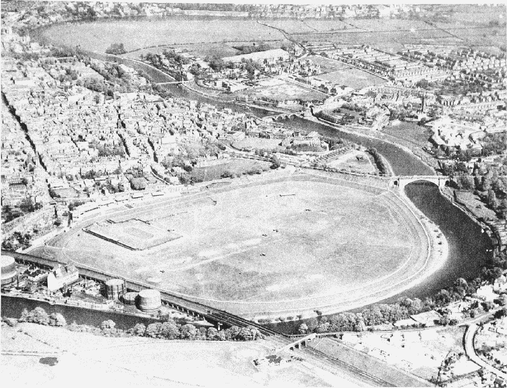
The Roodee from west, 1950
The Roodee originally extended north from the Watergate as far as the New Tower, but only as a narrow strip of land between the city walls and the river. North of the New Tower was land called the Saltgrass, never considered part of the Roodee proper. The first phase of work before 1710 to improve the Dee navigation entailed moving the course of the river between the Watergate and the New Tower 300 yd. to the west and building a new wharf. Samuel Taylor, who held corporation leases of both the northern end of the Roodee and the Saltgrass, built a new walled road from his existing warehouse outside the Watergate, which was now no longer on the river bank, to the new wharf. In 1708 he was given a permanent grant of the land over which the road was built but gave up everything to the south. Although flooding in 1720 destroyed the new wharf and probably Taylor's road, the renewal of navigation works in the 1730s allowed both to be restored and thus permanently closed off the Roodee on the north. Indeed thereafter the name Saltgrass was applied to what had formerly been the northern part of the Roodee, north of the Watergate and the wharf. (fn. 19) To the south-east the Little Roodee was already by 1765, and perhaps from 1710, walled off from the Roodee and leased separately, first to the Glovers' or the Skinners' guild as an extension of their working area on the river bank south-east of the castle, and later to private individuals. (fn. 20)
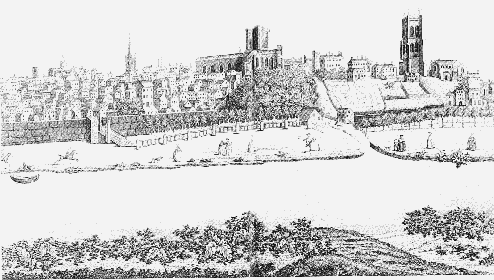
The Groves in 1760
On the north-west side of the Roodee proper the permanent success of the navigation works of the 1730s made the land along the river bank south of the new wharf, outside the Cop, desirable for commercial purposes. A timber merchant briefly had part of it in 1742–3 and the workhouse was built there in 1759, but it was intensively occupied only from the early 19th century. The viaduct for the Chester-Holyhead railway was built behind the riverside premises in the 1840s, narrowing the Roodee permanently on that side. (fn. 21)
The Roodee has been put to a great variety of uses besides grazing. It was the setting for civic pageantry in the later Middle Ages and afterwards, (fn. 22) for the races from their inception in 1540, (fn. 23) and for informal recreation of all kinds from archery in the 13th century to illegal rabbit coursing in the 20th. (fn. 24) In 1353, remarkably, it was the scene of a revival of the long outdated procedure of trial by battle, an occasion probably attended by the Black Prince and his household. (fn. 25) About 1600 it was used for archery, bowls, and walks by the Dee. (fn. 26) During the parliamentary siege of Chester in 1643–4 it was where the city's defenders were mustered. (fn. 27) One or more turns around the Roodee was the favourite walk of the church lawyer Henry Prescott in the early 18th century. (fn. 28) In 1823 there were ox-roasts for the birth of an heir to Robert Grosvenor, Viscount Belgrave, and for the coming of age of his political opponent Col. Roger Barnston's son. (fn. 29) In the 1850s the buttercups in full bloom were prized as 'a picturesque scene of superlative floral beauty'. (fn. 30) Later in the century thousands of militia Volunteers were reviewed, the 1858 Royal Agricultural Society show was staged, (fn. 31) and cattle which died in the 1866 plague were buried. (fn. 32) In the early 20th century the artillery Volunteers drilled, (fn. 33) local clubs played hockey, cricket, soccer, and polo, (fn. 34) balloons ascended, (fn. 35) racehorses were trained, (fn. 36) Lord George Sanger put on his circuses and Messrs. Barnum and Bailey their Wild West shows, (fn. 37) and parties of excursionists from trade unions, workplaces, and political and friendly societies in Liverpool and Birkenhead held sports days and rallies. (fn. 38) Meanwhile the Little Roodee was used for a pleasure fair during race week, pierrot shows over the summer, and also for touring circuses. (fn. 39) During the First World War the council had the Little Roodee seeded and was still letting it for grazing sheep in the winter of 1920–1, but in 1921 it was laid out as a parking ground for charabancs and other motor vehicles, complete with public lavatories. The race week fair and occasional circuses were still held there. (fn. 40) The Little Roodee remained a municipal car park in the later 20th century, when entertainments staged on the Roodee proper included sports meetings, circuses, and caravan rallies. (fn. 41)
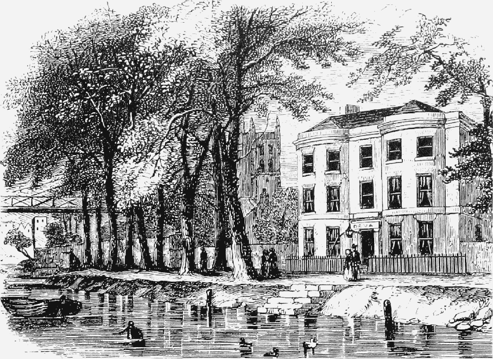
The Groves, eastern end, 1856, with suspension bridge (left)
The Groves
The riverside below St. John's church was also corporation property and used as a public walk by 1717. (fn. 42) In 1726 it was leased to Charles Croughton, who secured the river bank and planted an avenue of trees for the public benefit. (fn. 43) In 1745 the Dee Side walks extended from Souters Lane to a point east of St. John's. (fn. 44) By 1783 the promenade was called the Groves. (fn. 45) In 1881 the river bank from Souters Lane to the Dee Bridge was faced with rubble from the fallen tower of St. John's church, and the avenue was extended to the west, an improvement carried out at the expense of Charles Brown to commemorate his mayoralty. (fn. 46)
Boating excursions upstream from landing stages at the Groves, to visit the newly completed Gothic Eaton Hall, were an attraction by 1821. (fn. 47) In the mid 19th century the rise of tourist excursions to Chester turned the Groves into a popular resort. Pleasure boats could be hired on the river by the 1850s, (fn. 48) and in the later 19th century band concerts throughout the summer became a major attraction. (fn. 49) The concerts were at first arranged by a private committee, which built a bandstand in 1913, (fn. 50) but were taken over by the city council in 1927, (fn. 51) when it also built kiosks for letting to traders. (fn. 52)
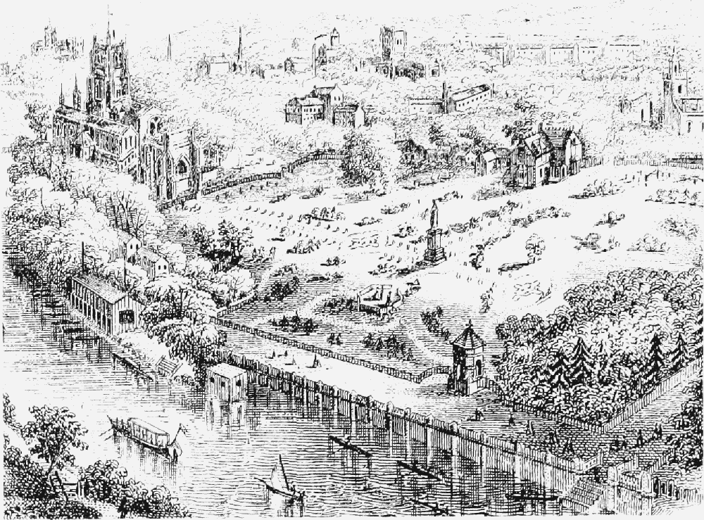
Grosvenor Park from south-east, 1867
Public Parks
The grounds at the foot of the Water Tower were laid out as an ornamental garden in 1859 by the Chester Mechanics' Institution, which had run a museum in the tower since 1838. (fn. 53) In 1863–4 Roman columns and a hypocaust excavated in Bridge Street were re-erected there, (fn. 54) creating what the novelist Henry James called 'one of those odd fragments of public garden, a crooked strip of ground called to social account . . . adorned with mossy fragments of Roman stonework'. (fn. 55) They were removed in 1949. (fn. 56) The city council extended the grounds in 1922, opening bowling greens and tennis courts. (fn. 57)
Grosvenor Park, 14½ a. north of the Groves, was presented to the city in 1867 by the 2nd marquess of Westminster with an endowment for its upkeep. (fn. 58) It was one of the first public parks in Britain outside the big industrial cities. (fn. 59) The park was designed by Edward Kemp and the black-and-white entrance lodge by John Douglas; (fn. 60) a statue of the donor, by Thomas Thorneycroft, was put up in 1869 by public subscription. (fn. 61)
In Handbridge, 2¼ a west of the Dee Bridge was laid out as a public park at the expense of the first duke of Westminster, who presented it to the city in 1892 with an endowment of £1,000 for its upkeep. At his insistence the long-established name of Kettle's Croft was abandoned in favour of the alternative name Edgar's Field, perpetuating the bogus antiquarian tradition that it contained the site of a palace of King Edgar. (fn. 62) It did include a Roman shrine to Minerva, long known to antiquaries, (fn. 63) which was restored in 1992.
Hoole urban district council opened a 6-a. park and recreation ground in 1904, (fn. 64) adding 3 a. fronting Hoole Road and renaming it Alexandra Park in 1911. (fn. 65)
In 1946 the 2nd duke of Westminster gave the city 46 a. between Hough Green and Lache Lane for a park to be called Westminster Park. (fn. 66) Two bowling greens were opened there in 1950 (fn. 67) and plans were in hand from 1955 for playing fields, (fn. 68) but most of the land was let to a farmer while a scheme for an athletics track, cricket pitch, and grandstands was foiled by the duke's stipulation against large buildings and numerous spectators. (fn. 69) Only in 1972 did the council commit itself to building a golf course, (fn. 70) which was opened in 1973. (fn. 71)
The Roman remains at Water Tower gardens were moved in 1949 to a 'Roman Garden' laid out between the city wall and Souters Lane. (fn. 72)
The Meadows
Agricultural land at the Meadows within the bend of the Dee upstream from the Groves was scheduled in 1926 to be acquired for public playing fields. In 1929 Mr. and Mrs. H. F. Brown gave the money to buy 64½ a. of low-lying ground, rather than the higher land intended. (fn. 73) It was used for football pitches and became a popular place for weekend recreation in the 1930s, but plans for an open-air swimming pool and a suspension bridge from Boughton foundered on lack on public money and the unsuitability of the site. (fn. 74)
Hough Green
Recorded from 1503 as waste ground belonging to the corporation, (fn. 75) Hough Green lay west of Handbridge in the southern part of the liberties and seems originally to have stretched from the Old Wrexham Road westwards for almost a mile. It thus covered the area on either side of the western part of the modern Overleigh Road as well as the road still called Hough Green. The name Hough indicated a hollow in higher ground, and the main road from Chester into north Wales crossed the eastern part of the green as a hollow way. (fn. 76) The green was bounded to the north by a steep slope down to the Dee, and north-west and south by farmland belonging respectively to the Brewer's Hall and Overleigh estates. Much of the corporation's interest centred on maintaining the road. It built a bridge across a watercourse on the green in 1598–9 and appointed overseers of highways for Handbridge and Hough Green in 1629. (fn. 77) By the late 17th century the road was paved and was referred to indifferently as the pavement and the causeway. (fn. 78) The Assembly was considering how to finance repaving it for carts as far as the city boundary at Saltney marsh from 1729, and in 1732 ordered that 20 roods (160 yd.) of paving be laid each year until the scheme was complete. (fn. 79) The road passed into the control of a turnpike trust in 1756 and the toll gates were a prominent feature until the road was disturnpiked in 1883. (fn. 80)
Stone was probably quarried on the green from an early period, but the first specific reference to a quarry was in 1700. In the earlier 18th century the Assembly allowed various bodies to take stone: the churchwardens of St. Peter's, the undertakers of the navigation works in the Dee estuary, and the murengers (for repairs to the city walls), as well as some private individuals. (fn. 81) In 1720 it refused to allow an old quarry to be used for storing iron ore on its way to furnaces near Ruabon on the grounds that the city might still need to cut stone there. (fn. 82) A request for a 99year lease on an existing quarry was turned down in 1763. (fn. 83) Most of the quarrying was evidently at the north-east corner of the green, occupied in 2000 by the rough ground called the Dingle and by the original part of Overleigh cemetery. Hough Green was also an importance source of brick earth, probably first put to heavy use when the rebuilding of the city after the Civil War siege began in the 1650s. (fn. 84) In 1670 the Assembly ordered that no bricks were to be made there without written permission and that those permitted should pay 6d. per thousand bricks made and level the ground afterwards. (fn. 85) Brick making continued on the green until the 1840s but was evidently intermittent, presumably subject to fluctuations in the building trade locally. (fn. 86)
There was a windmill on the green by the 1650s which stood until 1708 or later. (fn. 87) Other uses in the 18th century, intended or actual, included stacking the gorse used as firing by the city's bakers in the 1710s, limekilns on the river side at the east end of the green in 1755, and storage space for timber in the 1770s. (fn. 88)
Piecemeal inclosures of small plots for industrial purposes or housing were taking place from the 1650s, but the Assembly did not always agree to the petitions which it received. New buildings included a house and smithy in 1665, a small dwelling house 'many years' before 1678, a larger house owned successively by two aldermen, a stable, and buildings associated with a ropewalk after 1698. (fn. 89) The Cowper family, owners of Overleigh Hall from c. 1660 and long prominent in civic affairs, encroached steadily on the south-east corner of the green. In 1700 the Revd. John Cowper had permission to inclose sufficient land to make a walled carriage drive from the highway to Overleigh Hall, and more land between the house and the road was taken into the grounds by his son, Alderman William Cowper, in the 1760s. (fn. 90)
In 1737 the Assembly resolved to inclose the green on the north side of the highway; work was apparently put in hand but rioters destroyed the new hedges and ditches, and the order to inclose was not renewed until 1751. The fences were again torn down, and were ordered to be rebuilt only in 1759. (fn. 91) A further part of the green, towards the Saltney end, was inclosed in 1800 for the benefit of the poor, and in the following year eight cottages were built on the north side of the road. (fn. 92) The corporation sold land on the south side in 1834 to the marquess of Westminster, who had recently bought the Overleigh estate and demolished Overleigh Hall, and in the following year decided to dispose of all the remaining common land. (fn. 93) It sold off building plots lining the north side of the highway from 1848, (fn. 94) after which Hough Green survived only as a road name for the stretch west of the new Grosvenor Bridge approach road and the Wrexham turnpike.
Zoo
Chester zoo was opened in 1931 on 9 a. at Oakfield, a house in Upton Heath, by George Mottershead, who had previously kept a small collection of animals at Shavington near Crewe. (fn. 95) The city council had refused planning permission but had been overruled by the government. (fn. 96) Mottershead formed the North of England Zoological Society to take over the zoo in 1934 and remained its director until his death in 1978. The zoo was firmly established as a visitor attraction by 1939 and expanded quickly and almost continuously between 1945 and the mid 1970s. Mottershead's successful breeding programmes and innovative ways of displaying animals (especially the large open-air enclosures divided from spectators only by wet or dry moats) exerted an international influence. The number of visitors grew to almost 500,000 a year in the early 1950s and a million a year between 1963 and 1973. His policies were continued by his successor as director, Michael Brambell. By 1994 the Society owned 400 a., of which 110 a. was used for the zoo, and had a permanent staff of 150, employing as many more during the summer. Visitor attractions (besides the animals) included extensive gardens, which were laid out from the early 1950s, waterbuses plying along a canal from 1957, and an overhead monorail from 1991.