Survey of London: Volume 5, St Giles-in-The-Fields, Pt II. Originally published by London County Council, London, 1914.
This free content was digitised by double rekeying. All rights reserved.
'Boundary of the parish of St. Giles-in-the-Fields', in Survey of London: Volume 5, St Giles-in-The-Fields, Pt II, (London, 1914) pp. 1-2. British History Online https://www.british-history.ac.uk/survey-london/vol5/pt2/pp1-2 [accessed 12 April 2024]
BOUNDARY OF THE PARISH OF ST. GILES-IN-THE-FIELDS.
The earliest mention of the parish boundary of St. Giles-in-theFields occurs in a decree of 1222, terminating the dispute between the Abbey of Westminster and the See of London respecting the ecclesiastical franchise of the conventual church of St. Peter. According to this the boundary of the Parish of St. Margaret, Westminster, began at the watercourse of Tyburn and stretched towards London as far as the garden of the Hospital of St. Giles, "thence as the way beyond the same garden extends as far as the boundaries dividing Marshland and the parish of St. Giles." (fn. 1) This is pretty clear evidence that in those early days the southern portion of the western boundary of St. Giles passed along the thoroughfare bounding the Precinct and Marshland on the west, thus agreeing precisely with the limits at the present day.
Although, however, there does not seem to have been any change in that comparatively small part of the parish boundary, in many other respects the limits of the parish have undergone serious modification. The first considerable alteration took place in 1731, when the Parish of St. George, Bloomsbury, was formed out of the old parish, and made to include all that part which lay to the north of High Holborn and east of Dyot Street and of a line drawn northwards from the latter's termination in Great Russell Street (see Plate 6). This northward line was afterwards slightly modified. Again, quite recently, the parish was further curtailed as a result of Orders made under the London Government Act, 1899. The south side of Lincoln's Inn Fields, and the area lying between Wild Street and Drury Lane, were thereby taken from St. Giles, a give-and-take line was adopted between the west side of Lincoln's Inn Fields and the junction of Kemble Street and Wild Street, and certain small additions to the parish were made at Francis Street on the north and Broker's Alley on the south.
The stone tablet, illustrated on the next page, is a relic of the old boundary line of the parish. It was built into the wall of No. 2, Sheffield Street, which premises were demolished in 1903 in connection with the formation of Kingsway. The stone was preserved by the London County Council and has been lent to the London Museum.
The boundary between the parishes of St. Giles-in-the-Fields and St. George, Bloomsbury, cuts through Bedford Square in such a way that although the greater part of the square is in the former, all the houses on the east side and a few on the south side are in the parish of St. George. As it was felt that there were advantages in dealing with the square as a whole it was decided that, as had been done in the case of Lincoln's Inn Fields, (fn. 2) the entire square should be treated in one volume.
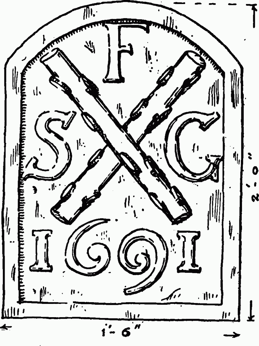
Stone Boundary Tablet (1691) from No. 2, Sheffield Street