Survey of London: Volume 25, St George's Fields (The Parishes of St. George the Martyr Southwark and St. Mary Newington). Originally published by London County Council, London, 1955.
This free content was digitised by double rekeying. All rights reserved.
'Plate 36: Part of Horwood's Map of London (1813) showing Bethlem Hospital.', in Survey of London: Volume 25, St George's Fields (The Parishes of St. George the Martyr Southwark and St. Mary Newington), ed. Ida Darlington (London, 1955), British History Online https://www.british-history.ac.uk/survey-london/vol25/plate-36 [accessed 30 April 2025].
'Plate 36: Part of Horwood's Map of London (1813) showing Bethlem Hospital.', in Survey of London: Volume 25, St George's Fields (The Parishes of St. George the Martyr Southwark and St. Mary Newington). Edited by Ida Darlington (London, 1955), British History Online, accessed April 30, 2025, https://www.british-history.ac.uk/survey-london/vol25/plate-36.
"Plate 36: Part of Horwood's Map of London (1813) showing Bethlem Hospital.". Survey of London: Volume 25, St George's Fields (The Parishes of St. George the Martyr Southwark and St. Mary Newington). Ed. Ida Darlington (London, 1955), British History Online. Web. 30 April 2025. https://www.british-history.ac.uk/survey-london/vol25/plate-36.
PART OF HORWOOD'S MAP OF LONDON, 1813
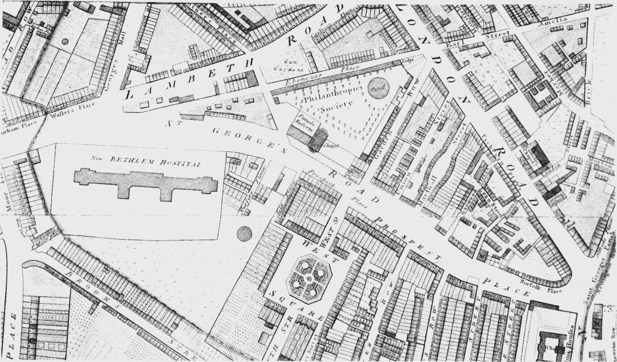
Part of Horwood's Map of London (1813) showing Bethlem Hospital.