An Inventory of the Historical Monuments in the County of Northamptonshire, Volume 3, Archaeological Sites in North-West Northamptonshire. Originally published by Her Majesty's Stationery Office, London, 1981.
This free content was digitised by double rekeying. All rights reserved.
'Flore', in An Inventory of the Historical Monuments in the County of Northamptonshire, Volume 3, Archaeological Sites in North-West Northamptonshire(London, 1981), British History Online https://www.british-history.ac.uk/rchme/northants/vol3/pp91-93 [accessed 1 May 2025].
'Flore', in An Inventory of the Historical Monuments in the County of Northamptonshire, Volume 3, Archaeological Sites in North-West Northamptonshire(London, 1981), British History Online, accessed May 1, 2025, https://www.british-history.ac.uk/rchme/northants/vol3/pp91-93.
"Flore". An Inventory of the Historical Monuments in the County of Northamptonshire, Volume 3, Archaeological Sites in North-West Northamptonshire. (London, 1981), British History Online. Web. 1 May 2025. https://www.british-history.ac.uk/rchme/northants/vol3/pp91-93.
In this section
31 FLORE
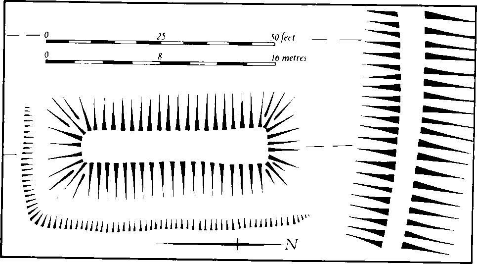
Fig. 71 Fawsley (6) Pillow mound
(OS 1: 10000 a SP 66 SW, b SP 66 SE, c SP 65 NW, d SP 65 NE)
The large parish, of over 1090 hectares, includes the former lands of the deserted village of Glassthorpe (4). It is unusual in that, of the parishes which lie close to Watling Street, it is the only one with boundaries at no point determined by the Roman road. Instead, the W. boundary follows a tributary of the R. Nene; the Nene itself forms the S. boundary. Apart from the high ground in the E. where the Northampton Sand of Glassthorpe Hill rises steeply to 125 m. above OD, the greater part of the parish is a flat area of Upper and Middle Lias Clay and Marlstone sloping gently S. at about 100 m. above OD and cut by S.-flowing streams. On the W. and S. edges of the parish the land falls steeply to the valleys of the R. Nene and its major tributary here flowing at about 75 m. above OD, and in this area there are expanses of glacial sands and gravels as well as of alluvium.
The major monument is the deserted village of Glassthorpe (4) which was ploughed over with ridge-and-furrow at some time after its abandonment. The lands of Glassthorpe extended into Brington parish (Fig. 73).
Prehistoric and Roman
A crudely chipped axe, listed as Mesolithic, and part of a Neolithic polished axe have been found in the parish. Another polished Neolithic axe was found in a garden in Brickett's Lane in 1974 (SP 64276004; Northants. Archaeol., 10 (1975), 150; NM). A Roman coin of Constantius I is also recorded (OS Record Cards; NM).
a(1) Enclosure (SP 646620; Fig. 72), S.E. of Flore Fields House, in the N. of the parish, on Marlstone Rock at 103 m. above OD. Air photographs (in NMR) show cropmarks of the S.E. section of a large enclosure. The S.E. end, which is roughly semicircular, appears to have an entrance in it (Northants. Archaeol., 8 (1973), 26).
a(2) Enclosure and ditches (SP 636607; Fig. 72), in the W. of the parish, N. of Flore Hill Farm, on sand and gravel at 110 m. above OD. Air photographs (in NMR) show cropmarks of a sub-rectangular enclosure, 90 m. long and 45 m. wide, with a ring ditch 16 m. in diam. within it. To the S.W. a curved length of ditch is faintly visible (BNFAS, 4 (1970), 31; 6 (1971), 11; Northants. Archaeol., 8 (1973), 26).
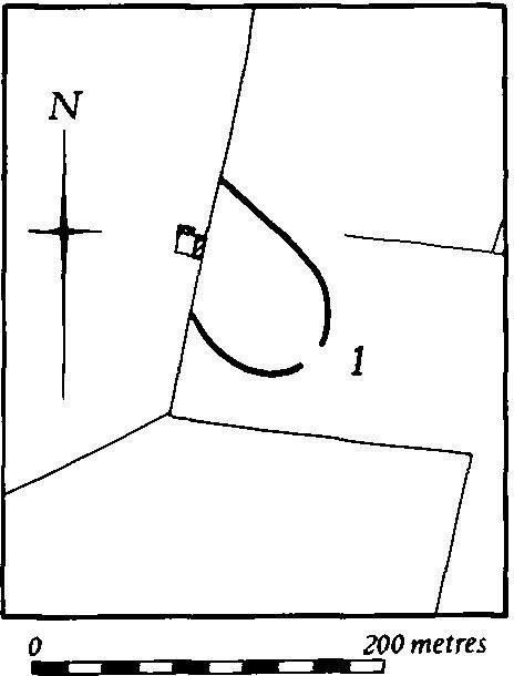
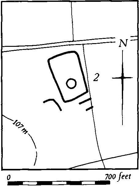
Fig. 72 Flore (1, 2) Cropmarks
b(3) Enclosure (SP 668608), on Glassthorpe Hill in the S.E. of the parish, on Northampton Sand at 140 m. above OD. The cropmark of a rectangular enclosure has been noted (BNFAS, 6 (1971), 11).
Medieval and Later
b(4) Deserted village of Glassthorpe (SP 662617; Figs. 73 and 74; Plate 10), lies in the N.E. of the parish, on land sloping W. to a small S.-flowing stream, on Upper Lias Clay and Marlstone between 105 m. and 90 m. above OD. The boundaries of the land of this village are depicted on the Tithe Map of Glassthorpe (NRO, 1850) which shows that the N. part extended into the parish of Brington (Fig. 73).
Glassthorpe is first mentioned in 1086 though its pure Scandinavian name indicates an older origin (PN Northants., 83). In Domesday Book the place is listed as a small manor with a recorded population of five (VCH Northants., I (1902), 325). The 1301 Lay Subsidy lists 14 taxpayers for the vill (PRO, E179/155/31). It is mentioned by name in the 1316 Nomina Villarum and appears still to have been inhabited in 1371. In 1515 one manor there was bought by the Spencer family of Althorp and by 1547 a place called 'Classthorpe Pasture' grazed 200 sheep. In the early 18th century Bridges (Hist. of Northants., I (1791), 510) said that it had been 'long depopulated' and that only one shepherd's house remained. This house, which is shown on a map of 1758 and on the Tithe Map of 1850 (NRO), still stands though it is no longer occupied. In 1850 the N. part of the site was called Berry Meadow and the S. part House Ground (K. J. Allison et al., The Deserted Villages of Northants. (1966), 40).
The remains of the village are preserved under permanent pasture and have suffered no recent damage but they are extremely difficult to interpret as almost the whole area was overploughed with ridge-and-furrow at some time after desertion. The site can be divided into two areas. The S. part, which is based on a continuous hollow-way, is roughly trapezoidal; a further hollow-way runs down the slope westwards from its S.W. corner, and here there is later damage by extensive quarrying. On both sides of these hollow-ways there are faint traces of former closes bounded by low banks and scarps or by very shallow ditches. Most are likely to be the sites of former houses and gardens, but ploughing has destroyed all but the basic outlines.
Further N., and apparently quite separate from the southern part of the village, is a much mutilated hollow-way running E.–W. At its E. end it turns N. and may have also turned S. towards the S. part of the site though this is not certain. On the S. side of the main hollow-way are two or three raised platforms 1.5 m. high with a broad depression to the W. These may be interpreted as a courtyard farm and crewyard, recognized on many deserted village sites and usually dated to the end of the medieval period. To the N. of the hollow-way are long closes bounded by ditches and extending as far as the stream. At their S. ends, near the hollow-way, are a number of low platforms and scarps which might be former building sites (CUAP, LT6, 7; AWQ62–4).
c(5) Settlement remains (SP 643598), formerly part of Flore village, lie immediately E. of Flore church, on land sloping to the R. Nene on clay at 85 m. above OD. Fragments of at least one and perhaps two enclosures bounded by low banks are the only visible earthworks but these, in conjunction with existing features of the village, contribute to an understanding of the village's development. Flore village is made up of six lanes extending S. in a rather irregular form from the main E.–W. High Street, here the A45 Daventry-Northampton road. There are traces of a former triangular green, now encroached upon, at the N. end of Sutton Street and another area called The Green lies further S. The parish church is oddly situated in the S.W. corner of the village beyond the main built up area. This layout suggests that the village has either gradually moved towards the High Street from the area around the church or has been deliberately planned anew. Apart from the earthworks described all the land to the S. and W. of the church is permanent pasture or parkland with no visible indications of former settlement. However any future ploughing may reveal new evidence (air photographs in NMR).
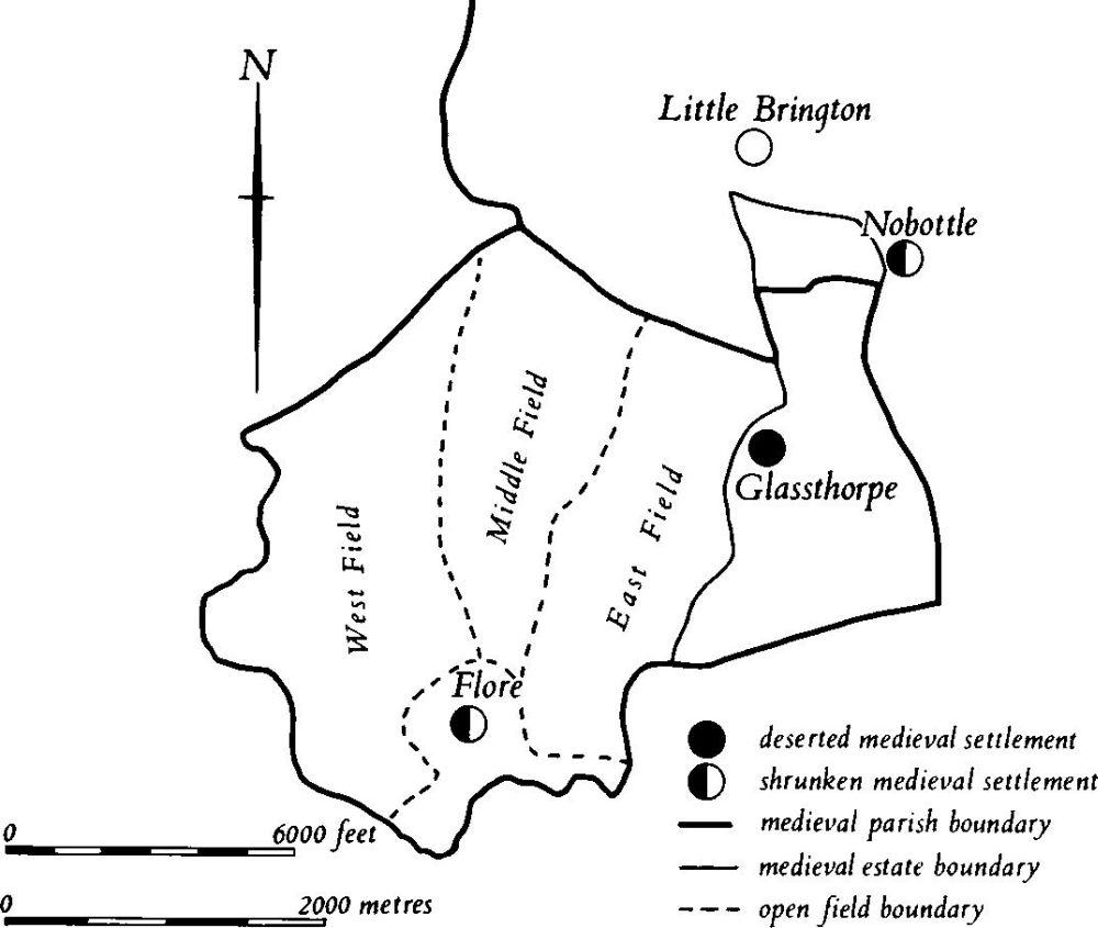
Fig. 73 Flore and Brington Medieval settlements and estates
(6) Cultivation remains (Fig. 73). The common fields of the village of Flore were enclosed by an Act of Parliament in 1778. Though no Enclosure Map is known to survive it is clear from the Award (NRO) that there were at that time three open fields, East Field lying between the Glassthorpe boundary and Brington Road, Middle Field between Brington Road and the road to Brockhall, and West Field covering most of the W. of the parish. Ridge-and-furrow of these fields exists on the ground or can be traced on air photographs over large parts of the parish. It is arranged mainly in end-on or interlocked furlongs though on the steep valley sides and spurs along the W. and N.W. sides of the parish it is arranged in a radiating pattern down the slopes. Large areas still survive in the pasture N. of the village at the S. end of the former Middle and West Fields, as well as further N., S.W. of Flore Fields House (SP 642620), in the former West Field.
The date of the enclosure of the common fields of Glassthorpe is unknown but it had certainly taken place by 1758 (Map in NRO) and, by implication, by 1547 (see (4) above). Ridge-and-furrow survives on the ground or can be traced on air photographs over almost the whole area of the land of Glassthorpe, arranged mainly in interlocked furlongs running across the contours. In the N. of the area three furlongs cross the modern parish boundary with Brington (around SP 668628); the latter boundary is completely undefined. This indicates that the northern part of the land of Glassthorpe was always within Brington parish.
Ridge-and-furrow of unknown date, but perhaps post-medieval in origin, covers almost the whole of the deserted village of Glassthorpe (4) (RAF VAP CPE/UK/1994, 1261–8, 3252–6).