Survey of London: Volumes 31 and 32, St James Westminster, Part 2. Originally published by London County Council, London, 1963.
This free content was digitised by double rekeying. All rights reserved.
'Plate 83: No. 29 Old Burlington Street, west elevation, ground- and first-floor plans', in Survey of London: Volumes 31 and 32, St James Westminster, Part 2, (London, 1963) pp. . British History Online https://www.british-history.ac.uk/survey-london/vols31-2/pt2/plate-83 [accessed 9 May 2024]
In this section
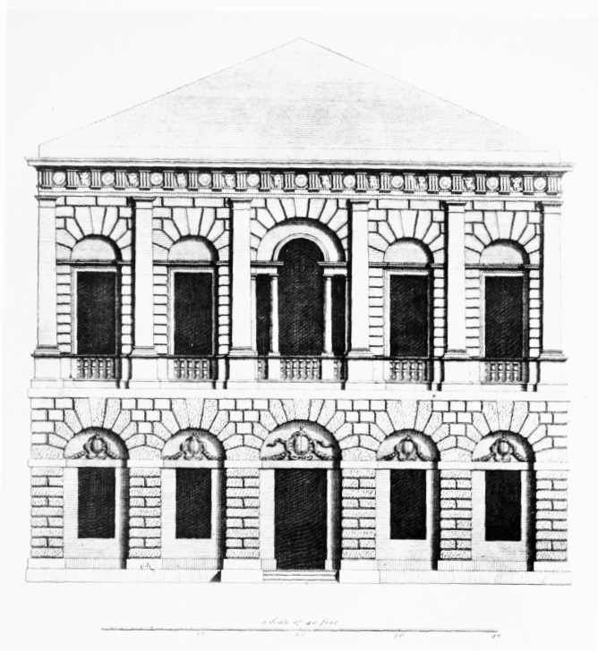
No. 29 Old Burlington Street, 1723: engravings in Vitruvius Britannicus, vol. III, 1725.
Earl of Burlington, architect (p. 500). Demolished
a. West elevation
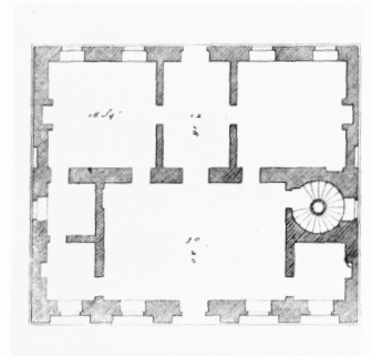
No. 29 Old Burlington Street, west elevation, ground- and first-floor plans.
West elevation
b. Ground-floor plan
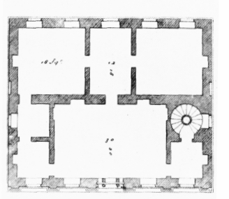
No. 29 Old Burlington Street, west elevation, ground- and first-floor plans.
Ground-floor plan
c. First-floor plan
No. 29 Old Burlington Street, west elevation, ground- and first-floor plans.
First-floor plan