An Inventory of the Historical Monuments in Dorset, Volume 3, Central. Originally published by Her Majesty's Stationery Office, London, 1970.
This free content was digitised by double rekeying. All rights reserved.
'Plate 176: Milton Abbas, Plan of Former Town, Detail From Estate Map', in An Inventory of the Historical Monuments in Dorset, Volume 3, Central(London, 1970), British History Online https://www.british-history.ac.uk/rchme/dorset/vol3/plate-176 [accessed 3 May 2025].
'Plate 176: Milton Abbas, Plan of Former Town, Detail From Estate Map', in An Inventory of the Historical Monuments in Dorset, Volume 3, Central(London, 1970), British History Online, accessed May 3, 2025, https://www.british-history.ac.uk/rchme/dorset/vol3/plate-176.
"Plate 176: Milton Abbas, Plan of Former Town, Detail From Estate Map". An Inventory of the Historical Monuments in Dorset, Volume 3, Central. (London, 1970), British History Online. Web. 3 May 2025. https://www.british-history.ac.uk/rchme/dorset/vol3/plate-176.
Milton Abbas, Plan of Former Town, Detail From Estate Map
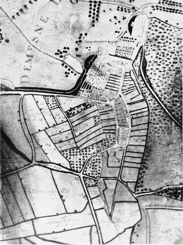
Milton Abbas. Plan of former town. Detail from estate map by W. Woodward. 1769–1771