An Inventory of the Historical Monuments in Dorset, Volume 4, North. Originally published by Her Majesty's Stationery Office, London, 1972.
This free content was digitised by double rekeying. All rights reserved.
'Plate 56: Gillingham and Motcombe, Map of Royal Forest of Gillingham', in An Inventory of the Historical Monuments in Dorset, Volume 4, North(London, 1972), British History Online https://www.british-history.ac.uk/rchme/dorset/vol4/plate-56 [accessed 30 April 2025].
'Plate 56: Gillingham and Motcombe, Map of Royal Forest of Gillingham', in An Inventory of the Historical Monuments in Dorset, Volume 4, North(London, 1972), British History Online, accessed April 30, 2025, https://www.british-history.ac.uk/rchme/dorset/vol4/plate-56.
"Plate 56: Gillingham and Motcombe, Map of Royal Forest of Gillingham". An Inventory of the Historical Monuments in Dorset, Volume 4, North. (London, 1972), British History Online. Web. 30 April 2025. https://www.british-history.ac.uk/rchme/dorset/vol4/plate-56.
Gillingham and Motcombe, Map of Royal Forest of Gillingham
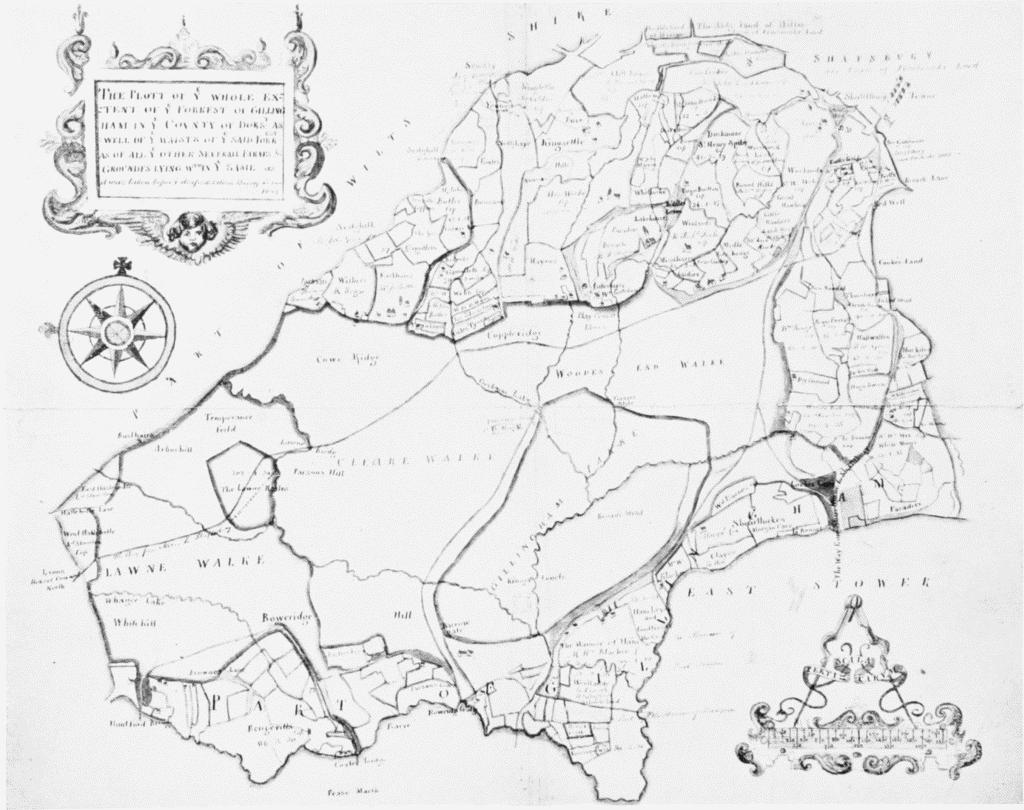
Map of Royal Forest of Gillingham, 1624. Gillingham and Motcombe. Copied 1816 or later (N. to left; scale in perches)