|
|
GENERAL
|
plate or (p) page |
|
Map of North Dorset showing parish boundaries (scale 1 in. to 1 mile) |
in end pocket |
|
Distribution map of Prehistoric and Roman Sites (scale ½ in. to 1 mile) |
do. |
|
Do. Mediaeval Sites do. |
do. |
|
Geological Map of the area |
opp. p. xxv |
|
Classification of typical house plans |
p. xxxvi |
|
'Celtic' Field Groups and associated Monuments. Group (71) |
in end pocket |
|
Do. do. Group (73) |
do. |
|
PARISHES |
|
|
1. ASHMORE
|
|
|
Aerial view of Monuments near the centre of the village, from W. |
32 |
|
(1) Parish Church of St. Nicholas. Cup and cover-paten, 1576 |
25 |
|
(14) Dyke near Hatt's Barn. Cross-section |
p. 2 |
|
(16) Dyke in Mudoak Wood. Cross-section |
p. 3 |
|
2. BOURTON
|
|
|
Map showing the position of Monuments in the village |
p. 4 |
|
(1) Parish Church of St. George. Royal Arms |
27 |
|
(4) Adcroft House. Dated plan |
p. 4 |
|
(5) Cloth Mill. Exterior from W., 1820 |
31 |
|
(53) House (two dwellings). Exterior |
30 |
|
3. BUCKHORN WESTON
|
|
|
(1) Parish Church of St. John the Baptist. Dated plan |
p. 7 |
|
Do. do. Exterior from S. |
33 |
|
Do. do. Paten, c. 1500, and communion cup, 1562 |
24 |
|
Do. do. Lectern, 1696 |
13 |
|
Do. do. Monument (1) with recumbent effigy,
late 14th century |
15 |
|
Do. do. Monument (2) of Samuel Clark, 1761. |
17 |
|
(2) Hope Farm. Dated plan of house |
p. 8 |
|
5. CHETTLE
|
|
|
(1) Parish Church of St. Mary. Dated plan |
p. 10 |
|
Do. do. W. tower from W. |
33 |
|
Do. do. Monument (3) of George Chafin, 1766 |
38 |
|
Do. do. do. (4) of Thomas Chafin, 1691 |
18 |
|
(2) Chettle House. Dated plan |
p. 11 |
|
Do. 18th-century plan |
p. 11 |
|
Do. Exterior from S.W. |
36 |
|
Do. do. from E. |
37 |
|
Do. Staircase |
40 |
|
Do. First-floor room, formerly billiards-room |
37 |
|
(14) Area of former Iron Age and Roman settlement, aerial view |
35 |
|
6. COMPTON ABBAS
|
|
|
(2) Old Church of St. Mary. Dated plan of remains |
p. 14 |
|
Do. do. Tower from N.W. |
33 |
|
(12) Dyke on Melbury Hill. Cross-section |
p. 15 |
|
7. EAST ORCHARD
|
|
|
(7) Bowling Green Farm. Dated plan of house |
p. 15 |
|
8. EAST STOUR
|
|
|
Pre-conquest cross-shaft, formerly at E. Stour |
3 |
|
(1) Parish Church, Christ Church. Plan |
p. 16 |
|
Do. do. Pelican-in-piety reused in lectern |
21 |
|
(6) High Grove Farm. Dated plan of house |
p. 17 |
|
9. FARNHAM
|
|
|
(1) Parish Church of St. Lawrence. Dated plan |
p. 18 |
|
(5) South Farm. Key plan of house |
p. 19 |
|
10. FIFEHEAD MAGDALEN
|
|
|
(1) Parish Church of St. Mary Magdalen. Dated plan |
p. 19 |
|
Do. do. S. door, 1637 |
22 |
|
Do. do. Chandelier |
39 |
|
Do. do. Cup and cover-paten, 1573 |
25 |
|
Do. do. Font |
12 |
|
Do. do. Monument (2) of the Newman family
c. 1750 |
41 |
|
Do. do. Monument (2) of the Newman family,
medallion |
20 |
|
Do. do. Monument (4) of the Davidge family,
probably 1744 |
39 |
|
(5) Fifehead House. E. front |
44 |
|
(7) Middle Farm. House from S. |
30 |
|
11. FONTMELL MAGNA
|
|
|
(1) Parish Church of St. Andrew. Dated plan |
p. 22 |
|
Do. do. 16th-century parapet, reset on N. wall |
10 |
|
Do. do. Font |
11 |
|
Do. do. Lectern |
13 |
|
Do. do. 16th-century carved wood panel |
p. xii |
|
(2) Methodist Chapel. Plan |
p. 23 |
|
(3) Manor Farm. Dated plan of house |
p. 23 |
|
(9) Cross House. Dated plan |
p. 24 |
|
(18) Lower Hartgrove Farm. Dated plan of house |
p. 25 |
|
(23) Cottage. Dated plan |
p. 25 |
|
(26) Woodbridge Mill. Exterior from S.E. |
46 |
|
(28) Piper's Mill, probably 1795. Exterior from S. |
46 |
|
(33) Dyke. Cross-section |
p. 26 |
|
(34) Dyke on Fore Top. Cross-section |
p. 26 |
|
Do. Aerial view |
35 |
|
(35) Tennerley Ditch. Cross-section |
p. 26 |
|
12. GILLINGHAM
|
|
|
Map of the Royal Forest of Gillingham, 1624 (19th-century copy) |
56 |
|
(1) Parish Church of St. Mary. Dated plan |
p. 28 |
|
Do. do. Exterior from S.E. |
4 |
|
Parish Church of St. Mary. Bench-ends |
22 |
|
Do. do. Cup and cover-paten, 1574 |
24 |
|
Do. do. Flagon, 1681 |
25 |
|
Do. do. Monument (1) of Sir Henry Dirdoe, 1724 |
17 |
|
Do. do. do. do. detail |
20 |
|
Do. do. do. (4) of Mrs. Frances Dirdoe, 1733 |
43 |
|
Do. do. do. do. centre panel |
20 |
|
Do. do. do. (5) of Edward Read, 1779 |
17 |
|
Do. do. do. (6) of Thomas and John Jesop |
42 |
|
Do. do. do. (6) of John Jesop, 1625. Detail of
inscription |
23 |
|
Do. do. do. (14) of Mary Read, 1764 |
18 |
|
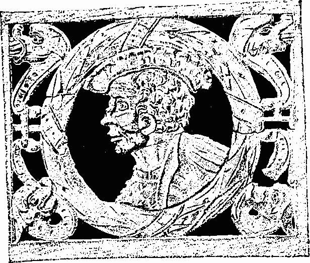
Do. do. Royal Arms, probably 1618 |
Frontispiece |
|
(2) Vicarage. Fragment of Saxon stone carving, reset |
3 |
|
(11) Town Mill. Exterior from S. |
47 |
|
(12) House. Dated plan |
p. 30 |
|
(24) House. S. front |
30 |
|
(59) Higher Langham House. S.E. front, 1770 |
45 |
|
(60) Bainly House. Plan |
p. 33 |
|
Do. S. front |
45 |
|
(63) Wyke Farm. Granary, exterior |
31 |
|
13. IWERNE MINSTER
|
|
|
(1) Parish Church of St. Mary. Dated plan |
p. 33 |
|
Do. do. Exterior from S.E. |
49 |
|
Do. do. Nave looking S.W. |
50 |
|
Do. do. do. N.W. |
50 |
|
Do. do. N. transept from S.E. |
6 |
|
Do. do. Capital, late 12th-century |
9 |
|
Do. do. Stiff-leaf capital, 13th-century |
9 |
|
Do. do. Monument (1) of Robert Fry, 1684 |
16 |
|
Do. do. Pulpit |
16 |
|
Do. do. Royal Arms |
27 |
|
(3) West Lodge. Key plan |
p. 38 |
|
Do. S.E. front |
44 |
|
(7) 'The Chantry'. Dated plan and cross-section |
p. 39 |
|
Do. S. front |
52 |
|
(15) Iron Age settlement and Roman Villa. Dated plan |
p. 40 |
|
Roman Villa, as seen in 1897. General view from S.W. |
48 |
|
Do. do. View of S.W. room from S. |
48 |
|
14. KINGTON MAGNA
|
|
|
(1) Parish Church of All Saints. W. tower from S.W. |
1 |
|
(3) Manor Farm. Key plan of house |
p. 42 |
|
(7) Lower Farm. S.E. front of house |
53 |
|
15. LANGTON LONG BLANDFORD
|
|
|
(1) Parish Church of All Saints. Brasses of John Whitewood and wives, c. 1467 |
14 |
|
Do. do. Monument (3) of James Farquharson, 1795 |
38 |
|
(2) Langton House. Stable courtyard, 1832 |
47 |
|
16. MARGARET MARSH
|
|
|
(2) Church Farm. Dated plan of house |
p. 46 |
|
(4) Higher Farm. Dated plan and cross-section of 15th-century house |
p. 46 |
|
(6) Margaret Marsh Farm. Dated plan of house |
p. 47 |
|
(7) Gore Farm. Dated plan of house |
p. 47 |
|
Do. Exterior from N.W. |
31 |
|
18. MOTCOMBE
|
|
|
Map of the Royal Forest of Gillingham, 1624 (19th-century copy) |
56 |
|
(1) Parish Church of St. Mary. Key plan |
p. 49 |
|
Do. do. Fragment of 15th-century sculpture |
15 |
|
Do. do. Monument (2) of Elizabeth Webbe, 1627 |
16 |
|
Do. do. Royal Arms |
27 |
|
(2) School, 1839. Exterior from S. |
28 |
|
(3) North End Farm. Dated plan of house |
p. 49 |
|
Do. Exterior from S.W. |
53 |
|
(14) Cottages. From S.E. |
29 |
|
(18) Moats and banks of King's Court Palace. Plan |
p. 51 |
|
19. PIMPERNE
|
|
|
(1) Parish Church of St. Peter. Chancel arch reset on N. of chancel |
51 |
|
Do. do. Respond capital of former chancel arch |
9 |
|
Do. do. Doorway reset in W. wall of S. aisle |
51 |
|
Do. do. Brass of Dorothy Williams, 1694 |
14 |
|
Do. do. Font |
11 |
|
(15) Iron Age settlement on Pimperne Down. Plan |
p. 54 |
|
Remains of Iron Age house |
55 |
|
(18) Enclosure, probably Iron Age. Aerial view from S.E. |
54 |
|
Do. do. do. W.N.W. |
54 |
|
(20–28) Chestnut Farm Barrow Group. Aerial view |
55 |
|
'Celtic' Fields, Group (73) |
in end pocket |
|
20. SHAFTESBURY
|
|
|
Aerial view from W. |
57 |
|
Plan showing Monuments in the central part of the town |
p. 56 |
|
St. James's Street, looking N.E. |
29 |
|
Historical documents. Rubbing of fragment of pre-conquest inscription, now lost |
58 |
|
Do. Sketch of Abbey ruins and Trinity Church, c. 1553 |
58 |
|
(1) The Abbey Church. Dated plan |
opp. p. 58 |
|
Do. Site of Abbey Church from N.W. |
60 |
|
Do. Carved stone fragments recovered during excavations |
59 |
|
Do. Saxon carved stone fragments (1), (2), (4) |
3 |
|
Do. Base of small half-column |
p. 61 |
|
Do. Floor-tiles |
pp. xviii, xxiii |
|
(2) Parish Church of St. Peter. Dated plan |
p. 62 |
|
Do. do. Exterior from N.W. |
62 |
|
Do. do. Interior looking E. |
7 |
|
Do. do. Nave roof |
66 |
|
Do. do. W. porch, stone vault |
10 |
|
Do. do. Font |
12 |
|
(3) Parish Church of The Holy Trinity, 1841. Plan |
p. 64 |
|
Do. do. Exterior from N.W. |
63 |
|
Parish Church of The Holy Trinity, 1840. Monument (2) of Abraham Gapper,
1733 |
18 |
|
Do. do. Monument (4) of John Bennett,
1676 |
18 |
|
Do. do. Monument (10) of a priest, late 13th
century |
15 |
|
Do. do. Monument (11) of Margaret Swyer,
1745 |
19 |
|
Do. do. Royal Arms, 1780 |
27 |
|
(4) Church of St. James. Royal Arms |
27 |
|
(5) Church of St. John, Enmore Green, 1843. Plan |
p. 65 |
|
Do. do. Exterior from N.E. |
5 |
|
(6) Church of St. Rumbold. Plan |
p. 65 |
|
Do. Font |
11 |
|
(6A) Congregational Chapel. Font |
12 |
|
(7) Town Hall. Exterior from S.W., 1826 |
61 |
|
Do. The 'Byzant' |
21 |
|
Do. Civic Maces, 1604 and earlier |
26 |
|
(8) House adjacent to St. Peter's Church. Dated plan |
p. 62 |
|
(68–75) Gold Hill, looking S. |
64 |
|
(76) Castle Hill House. Exterior from S.E. |
28 |
|
(77) Ox House. Dated plan |
p. 70 |
|
(81) 'Edwardstowe', Castle Hill. Dated plan |
p. 71 |
|
(90) Cottage. Dated plan |
p. 72 |
|
(92) Holyrood Farm. Dated plan of house |
p. 72 |
|
(102) House in St. James's Street. Dated plan |
p. 73 |
|
(138) Castle earthworks. Plan |
p. 75 |
|
(143) Abbey fishponds. Plan |
p. 76 |
|
21. SILTON
|
|
|
(1) Parish Church of St. Nicholas. Dated plan |
p. 77 |
|
Do. do. Exterior from W. |
62 |
|
Do. do. Nave and chancel looking S.E. |
6 |
|
Do. do. Porch arch spandrel |
10 |
|
Do. do. Capital, late 12th-century |
9 |
|
Do. do. Brass of Sir Hugh Wyndham, 1684 |
14 |
|
Do. do. Monument (1) of Sir Hugh Wyndham, 1684 |
65 |
|
Do. do. do. Weeper |
20 |
|
Do. do. Monument (3) of Dorothy Kingeswell, 1638. |
23 |
|
Do. do. Paternoster inscribed on Purbeck marble slab. |
23 |
|
(8) Waterloo Mill and Cottage. Exterior from E. |
31 |
|
22. STOUR PROVOST
|
|
|
(1) Parish Church of St. Michael. Dated plan |
p. 80 |
|
Do. do. Chancel roof |
66 |
|
(4) Church House. Dated plan |
p. 81 |
|
(5) Diamond Farm. Key plan of house |
p. 82 |
|
(9) Cottage. Dated plan |
p. 82 |
|
(29) Joliffe's Farm. Dated plan of house |
p. 83 |
|
23. SUTTON WALDRON
|
|
|
(1) Parish Church of St. Bartholomew. Plan |
p. 85 |
|
Do. do. Exterior from N.W. |
63 |
|
Do. do. Chest |
22 |
|
24. TARRANT CRAWFORD
|
|
(1) Parish Church of St. Mary and (2) Abbey site. Aerial view |
34 |
|
Do. do. Dated plan |
p. 86 |
|
Do. do. Interior looking E. |
68 |
|
Do. do. Wall-painting: Annunciation |
67 |
|
Do. do. do. Allegory of the Three Living and
Three Dead |
68 |
|
Do. do. do. Acts of St. Margaret of Antioch |
69 |
|
25. TARRANT GUNVILLE
|
|
|
Aerial view, looking N.W. |
73 |
|
(1) Parish Church of St. Mary. Dated plan |
p. 89 |
|
Do. do. 12th-century wall arcading |
8 |
|
Do. do. Monument (3) of Thomas Daccomb, 1567 |
23 |
|
(2) Eastbury. Dated plan of surviving part of house |
p. 91 |
|
Do. Original plan (from Vitruvius Britannicus) |
71 |
|
Do. Bridgeman's plan of gardens, c. 1717 |
72 |
|
Do. Earthwork remains of gardens |
p. 92 |
|
Do. Surviving wing, exterior from S.E. |
70 |
|
Do. Bridge and gateway at entrance to park |
70 |
|
Do. The house in course of demolition, c. 1780 |
71 |
|
Do. Archway to stable court, from W. |
80 |
|
(3) Gunville House. plan |
p. 94 |
|
(4) Old Rectory. Plan |
p. 94 |
|
Do. Exterior from S.W. |
74 |
|
(32) Iron Age Hill-fort at Bussey Stool Park. Plan |
p. 96 |
|
'Celtic' Fields, Group (73) |
in end pocket |
|
26. TARRANT HINTON
|
|
|
Aerial view, looking N.W. |
73 |
|
(1) Parish Church of St. Mary. Dated plan |
p. 97 |
|
Do. do. Exterior from S. |
4 |
|
Do. do. Tower from S.W. |
75 |
|
Do. do. Communion rails |
21 |
|
Do. do. Easter Sepulchre |
76 |
|
Do. do. do. Details |
77 |
|
Do. do. Font |
11 |
|
Do. do. Lectern, 199 |
13 |
|
(4) Old Rectory. Exterior from S. |
74 |
|
(18) Iron Age and Romano-British settlement S. of Hinton Bushes. Aerial view |
79 |
|
(19) Iron Age and Romano-British settlement on Tarrant Hinton Down.
Aerial view |
78 |
|
'Celtic' Fields, Group (73) |
in end pocket |
|
27. TARRANT KEYNESTON
|
|
|
(1) Parish Church of All Saints. Table tomb of the Bastard family, 1731 |
19 |
|
(16) Buzbury Rings. Plan |
p. 103 |
|
Do. Aerial view |
79 |
|
'Celtic' Fields, Group (70) |
in end pocket |
|
28. TARRANT LAUNCESTON
|
|
|
(14) Track, ditches and enclosures. Aerial view |
78 |
|
29. TARRANT MONKTON
|
|
|
(1) Parish Church of All Saints. Dated plan |
p. 108 |
|
Do. do. Cup and cover-paten, 1607 |
24 |
|
30. TARRANT RAWSTON
|
|
|
(1) Parish Church of St. Mary. Dated plan |
p. 110 |
|
Do. do. Exterior from S.W. |
5 |
|
Do. do. Pulpit |
13 |
|
31. TARRANT RUSHTON
|
|
|
(1) Parish Church of St. Mary. Dated plan |
p. 112 |
|
Do. do. Carved lintel of S. doorway, early 12th-century. |
8 |
|
Do. do. Squints. Traceried stonework |
10 |
|
Do. do. Piscina |
12 |
|
Do. do. Royal Arms, 1825 |
27 |
|
32. TODBER
|
|
|
(2) Pre-conquest cross-shaft |
2 |
|
33. WEST ORCHARD
|
|
|
(1) The Parish Church. Dated plan |
p. 115 |
|
34. WEST STOUR
|
|
|
(1) Parish Church of St. Mary. Dated plan |
p. 116 |
|
Do. do. Communion table |
22 |
|
(4) Manor Farm. S. front of house |
30 |