Survey of London: Volume 23, Lambeth: South Bank and Vauxhall. Originally published by London County Council, London, 1951.
This free content was digitised by double rekeying. All rights reserved.
'Plate 119', in Survey of London: Volume 23, Lambeth: South Bank and Vauxhall, ed. Howard Roberts, Walter H Godfrey (London, 1951), British History Online https://www.british-history.ac.uk/survey-london/vol23/plate-119 [accessed 5 May 2025].
'Plate 119', in Survey of London: Volume 23, Lambeth: South Bank and Vauxhall. Edited by Howard Roberts, Walter H Godfrey (London, 1951), British History Online, accessed May 5, 2025, https://www.british-history.ac.uk/survey-london/vol23/plate-119.
"Plate 119". Survey of London: Volume 23, Lambeth: South Bank and Vauxhall. Ed. Howard Roberts, Walter H Godfrey (London, 1951), British History Online. Web. 5 May 2025. https://www.british-history.ac.uk/survey-london/vol23/plate-119.
In this section
(a) LAMBETH BRIDGE AND TOLL HOUSE, 1896
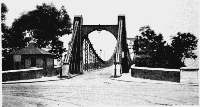
Lambeth Bridge and toll house, 1896
LAMBETH BRIDGE AND TOLL HOUSE, 1896
(b) RIVER FRONTAGE OF FORE STREET, circa 1860
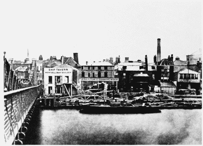
River frontage of Fore Street, south of Lambeth Bridge, circa 1860
RIVER FRONTAGE OF FORE STREET, circa 1860