Survey of London: Volume 25, St George's Fields (The Parishes of St. George the Martyr Southwark and St. Mary Newington). Originally published by London County Council, London, 1955.
This free content was digitised by double rekeying. All rights reserved.
'Plate 29: Elevations of Nos. 133-45 Blackfriars Road, Nos. 29-53 Lant Street, and Nos. 190-220 Southwark Bridge Road', in Survey of London: Volume 25, St George's Fields (The Parishes of St. George the Martyr Southwark and St. Mary Newington), ed. Ida Darlington (London, 1955), British History Online https://www.british-history.ac.uk/survey-london/vol25/plate-29 [accessed 30 April 2025].
'Plate 29: Elevations of Nos. 133-45 Blackfriars Road, Nos. 29-53 Lant Street, and Nos. 190-220 Southwark Bridge Road', in Survey of London: Volume 25, St George's Fields (The Parishes of St. George the Martyr Southwark and St. Mary Newington). Edited by Ida Darlington (London, 1955), British History Online, accessed April 30, 2025, https://www.british-history.ac.uk/survey-london/vol25/plate-29.
"Plate 29: Elevations of Nos. 133-45 Blackfriars Road, Nos. 29-53 Lant Street, and Nos. 190-220 Southwark Bridge Road". Survey of London: Volume 25, St George's Fields (The Parishes of St. George the Martyr Southwark and St. Mary Newington). Ed. Ida Darlington (London, 1955), British History Online. Web. 30 April 2025. https://www.british-history.ac.uk/survey-london/vol25/plate-29.
In this section
(a) Nos. 133–145 BLACKFRIARS ROAD (p. 58)
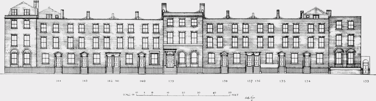
Nos. 133–145 Blackfriars Road, elevation, 1951
(b) Nos. 29–53 LANT STREET (p. 24)
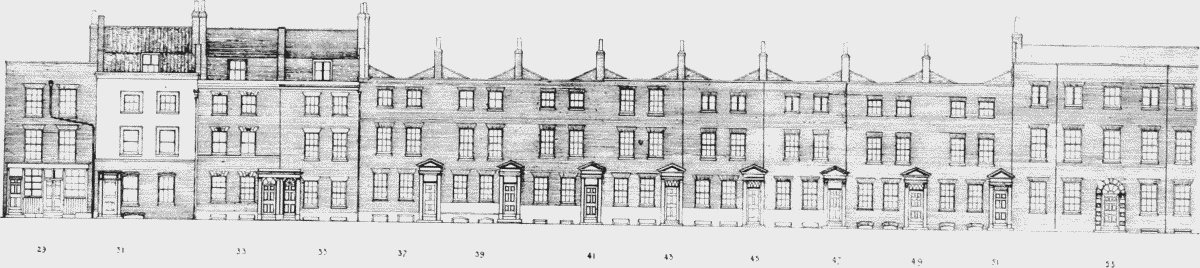
Nos. 29–53 Lant Street, elevation, 1950
(c) Nos. 190–220 SOUTHWARK BRIDGE ROAD (p. 63)
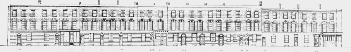
Nos. 190–220 Southwark Bridge Road, elevation, 1952