Survey of London: Volume 36, Covent Garden. Originally published by London County Council, London, 1970.
This free content was digitised by double rekeying. All rights reserved.
'Plate 50', in Survey of London: Volume 36, Covent Garden, ed. F H W Sheppard (London, 1970), British History Online https://www.british-history.ac.uk/survey-london/vol36/plate-50 [accessed 30 April 2025].
'Plate 50', in Survey of London: Volume 36, Covent Garden. Edited by F H W Sheppard (London, 1970), British History Online, accessed April 30, 2025, https://www.british-history.ac.uk/survey-london/vol36/plate-50.
"Plate 50". Survey of London: Volume 36, Covent Garden. Ed. F H W Sheppard (London, 1970), British History Online. Web. 30 April 2025. https://www.british-history.ac.uk/survey-london/vol36/plate-50.
In this section
a. Nos. 23–26 (consec.) King Street (site of Garrick Street) in c. 1859.
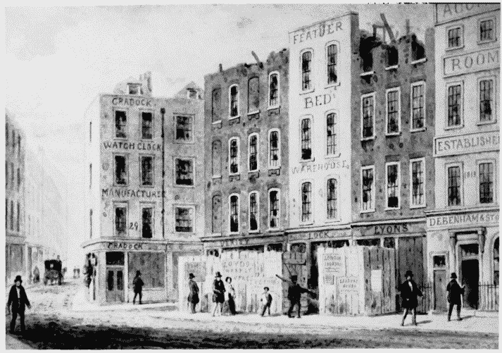
Nos. 23–26 (consec.) King Street.
Demolished
b. Rose Street looking north to Lamb and Flag public house in 1851 (p. 182).
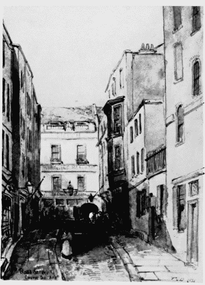
Rose Street.
Partly demolished
c. Bedford Court looking east in 1879 (p. 263). Demolished
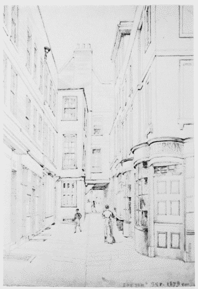
Bedford Court looking east.
Demolished