Survey of London: Volume 42, Kensington Square To Earl's Court. Originally published by London County Council, London, 1986.
This free content was digitised by double rekeying. All rights reserved.
'Plate 108: Edwardes estate', in Survey of London: Volume 42, Kensington Square To Earl's Court, ed. Hermione Hobhouse (London, 1986), British History Online https://www.british-history.ac.uk/survey-london/vol42/plate-108 [accessed 30 April 2025].
'Plate 108: Edwardes estate', in Survey of London: Volume 42, Kensington Square To Earl's Court. Edited by Hermione Hobhouse (London, 1986), British History Online, accessed April 30, 2025, https://www.british-history.ac.uk/survey-london/vol42/plate-108.
"Plate 108: Edwardes estate". Survey of London: Volume 42, Kensington Square To Earl's Court. Ed. Hermione Hobhouse (London, 1986), British History Online. Web. 30 April 2025. https://www.british-history.ac.uk/survey-london/vol42/plate-108.
In this section
The Edwardes Estate
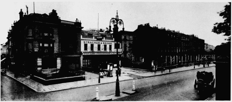
a (above). Leonard Place, Kensington High Street, in 1923 (pp. 251,257,260-1). Demolished
Edwardes estate
Leonard Place, Kensington High Street, in 1923 (pp. 251,257,260-1). Demolished
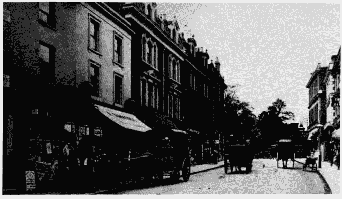
b (right). Earl's Court Road looking northwards towards Kensington High Street in c. 1905.
Edwardes estate
Earl's Court Road looking northwards towards Kensington High Street in c. 1905.
Nos. 2-14 (even) on left (p. 261). Demolished
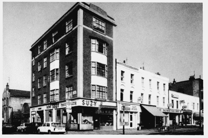
c. Nos. 40-56 (even) Earl' Court Road in 1983.
Edwardes estate
Nos. 40-56 (even) Earl' Court Road in 1983.
Nos. 40-52, Daniel Sutton, developer, 1825-30; Nos. 54-56 (Belmont Court), Fitt and Prior-Hale, architects, 1936-7; St. Barnabas's Schools on extreme left (pp. 261-2)