Survey of London: Volume 5, St Giles-in-The-Fields, Pt II. Originally published by London County Council, London, 1914.
This free content was digitised by double rekeying. All rights reserved.
'Nos. 26 to 28, Great Queen Street', in Survey of London: Volume 5, St Giles-in-The-Fields, Pt II, ed. W Edward Riley, Laurence Gomme (London, 1914), British History Online https://www.british-history.ac.uk/survey-london/vol5/pt2/pp40-41 [accessed 30 April 2025].
'Nos. 26 to 28, Great Queen Street', in Survey of London: Volume 5, St Giles-in-The-Fields, Pt II. Edited by W Edward Riley, Laurence Gomme (London, 1914), British History Online, accessed April 30, 2025, https://www.british-history.ac.uk/survey-london/vol5/pt2/pp40-41.
"Nos. 26 to 28, Great Queen Street". Survey of London: Volume 5, St Giles-in-The-Fields, Pt II. Ed. W Edward Riley, Laurence Gomme (London, 1914), British History Online. Web. 30 April 2025. https://www.british-history.ac.uk/survey-london/vol5/pt2/pp40-41.
In this section
XXXIV.–XXXVI.—Nos. 26 to 28, GREAT QUEEN STREET.
Ground landlord.
The names of the ground landlords of Nos. 27 and 28 have not been obtained.
General description and date of structure.
The date of erection of the original houses on the sites of Nos. 26 to 35 is uncertain. The Subsidy Roll for 1628–9, however, among its few (12) entries relating to Queen Street, contains the names of three persons (fn. 1) who are known to have lived in this row, and that for 1620–21 contains one; (fn. 2) it is therefore fairly certain that the houses on the site of Nos. 26 to 35 were already in existence by the latter date.
The ground on which they stood had, it is known, been let on building lease for a term expiring at Christmas, 1657, and it seems more than likely that the lease in question was that granted to Walter Burton on 28th April, 1607. It will be noticed (fn. 3) that a part of that grant comprised a piece of ground taken out of the north side of the close, and Henry Seagood's messuage erected on a part of that piece. Now Seagood's house occupied the site of Nos. 36–37 (fn. 4), and the piece of ground alluded to above certainly did not extend to the west of Seagood's house, as that property (the site of Nos. 38 to 45) had already been disposed of by Holford. It seems, therefore, probable that it included the ground to the east of the house, thus taking in the site of Nos. 26 to 35.
The earliest description of the property which has been found is dated 30th May, 1661, (fn. 5) where, evidently repeating the account given in the lease of 1636 (when it was let for 51 years as from 27th December, 1657) it is referred to as "all those severall messuages or tenements … with their appurtenances, scituate, lying and being on the north side of … Queene Street … now or late in the several tenures of [here 13 names are given]; abutting upon a messuage or tenement now or late in the tenure … of John Sparkes, his assigne or assignes, on the east, and on a messuage or tenement, now or late in the tenure of one Henry Seagood, his assigne or assignes, on the west part, and the said Queene Street on the south … all which said messuages … conteyne in length from east to west 180 feet … and in breadth from north to south 60 feet." It is clear from the entries in the ratebooks that the original houses on the sites of Nos. 27 and 28 were pulled down between 1723 and 1734, a period which agrees perfectly with the evidence of the dates on the cisterns mentioned below.
The present houses have three floors in addition to a basement and an attic storey. The fronts are treated in brickwork. No. 27 contains an ornamental cast lead cistern (Plate 15) dated 1733, and in No. 26 is a cistern of somewhat similar design, bearing the initials B.B. and the date 1725. On the latter house is a cast lead rain–water head illustrated on Plate 15.
The only external features of interest are the two doorcases, side by side, which are of deal with Roman Doric pilasters, block entablatures and pediments. The doorways are recessed, and have elliptical arches, enclosing fanlights, as shown by the measured drawing (Plate 14).
The staircase of No. 27 has the original carved brackets. That of No. 28 is modern.
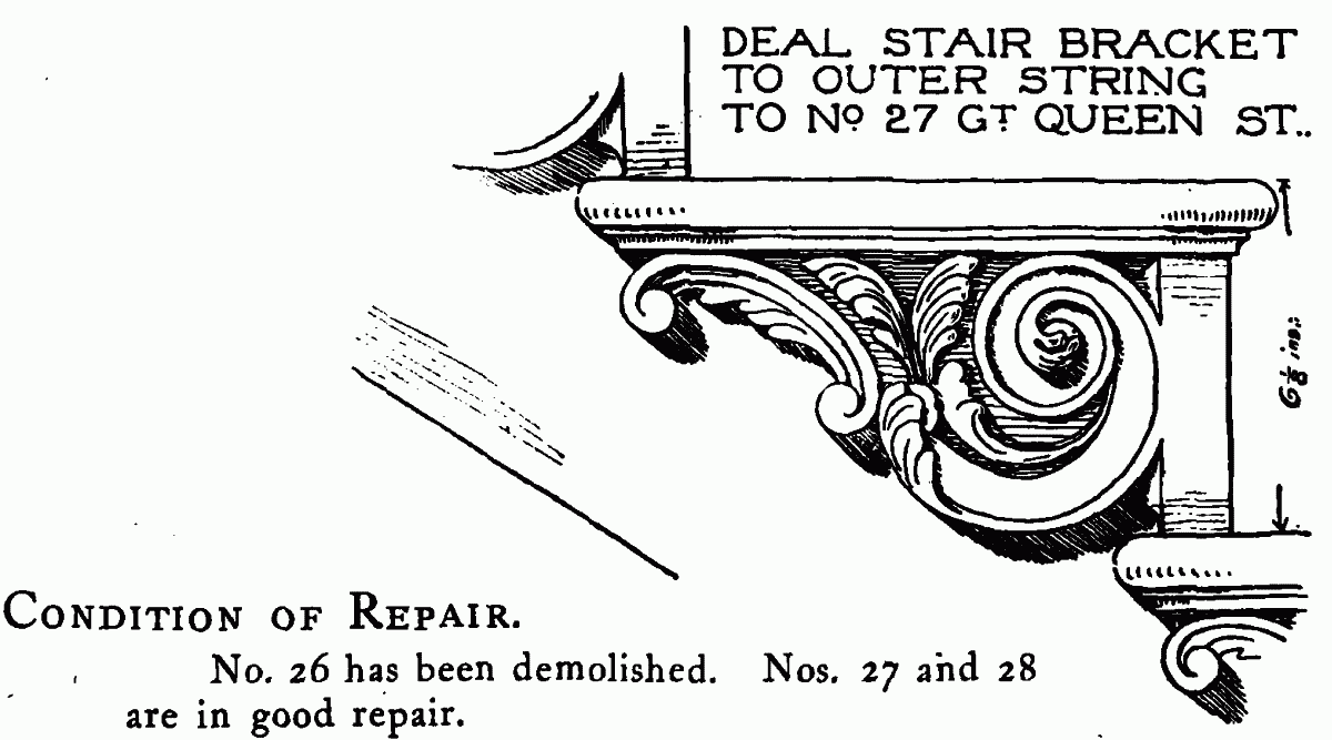
DEAL STAIR BRACKET TO OUTER STRING TO NO 27 GT. QUEEN ST..
Condition of repair.
No. 26 has been demolished. Nos. 27 and 28 are in good repair.
The Council's collection contains:—
(fn. 6) Entrance doorcases to Nos. 27 and 28 (measured drawing).
Entrance doorcases to Nos. 27 and 28 (photograph).
(fn. 6) Ornamental cast lead cistern, No. 27 (measured drawing).
(fn. 6) Ornamental cast lead cistern, No. 26 (measured drawing).
(fn. 6) Carved deal stair bracket (measured drawing).
(fn. 6) Cast lead rain-water head, No. 26 (with others) (measured drawing).