Survey of London: Volumes 31 and 32, St James Westminster, Part 2. Originally published by London County Council, London, 1963.
This free content was digitised by double rekeying. All rights reserved.
'Plate 159: Foubert's Place', in Survey of London: Volumes 31 and 32, St James Westminster, Part 2, ed. F H W Sheppard (London, 1963), British History Online https://www.british-history.ac.uk/survey-london/vols31-2/pt2/plate-159 [accessed 7 May 2025].
'Plate 159: Foubert's Place', in Survey of London: Volumes 31 and 32, St James Westminster, Part 2. Edited by F H W Sheppard (London, 1963), British History Online, accessed May 7, 2025, https://www.british-history.ac.uk/survey-london/vols31-2/pt2/plate-159.
"Plate 159: Foubert's Place". Survey of London: Volumes 31 and 32, St James Westminster, Part 2. Ed. F H W Sheppard (London, 1963), British History Online. Web. 7 May 2025. https://www.british-history.ac.uk/survey-london/vols31-2/pt2/plate-159.
In this section
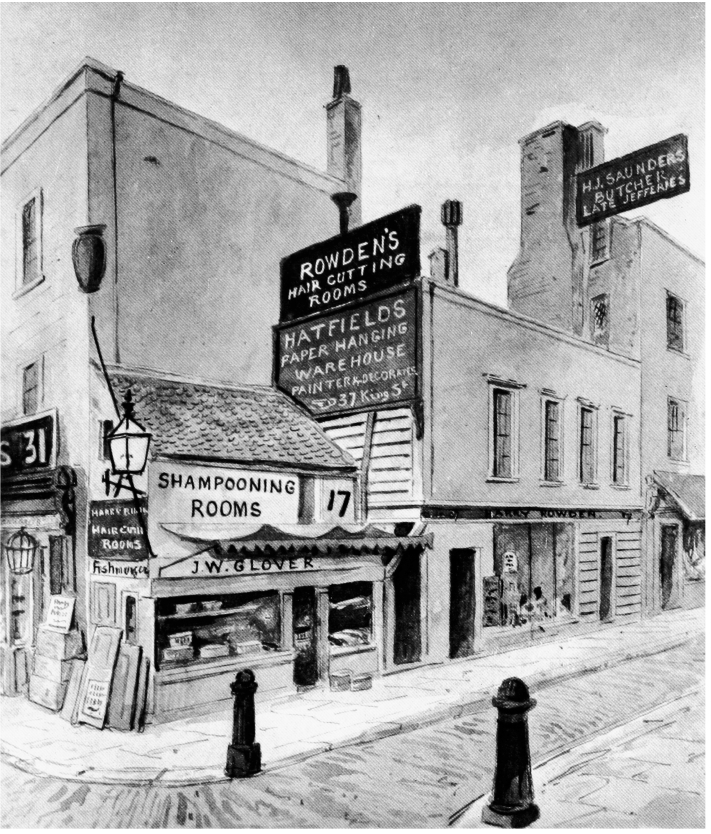
a. Views of north side of Foubert's Place in c. 1885 and 1962, showing buildings on constricted sites within northern boundary of Six Acre Close (pp. 192–3)

Views of north side of Foubert's Place in c. 1885 and 1962, showing buildings on constricted sites within northern boundary of Six Acre Close (pp. 192–3)
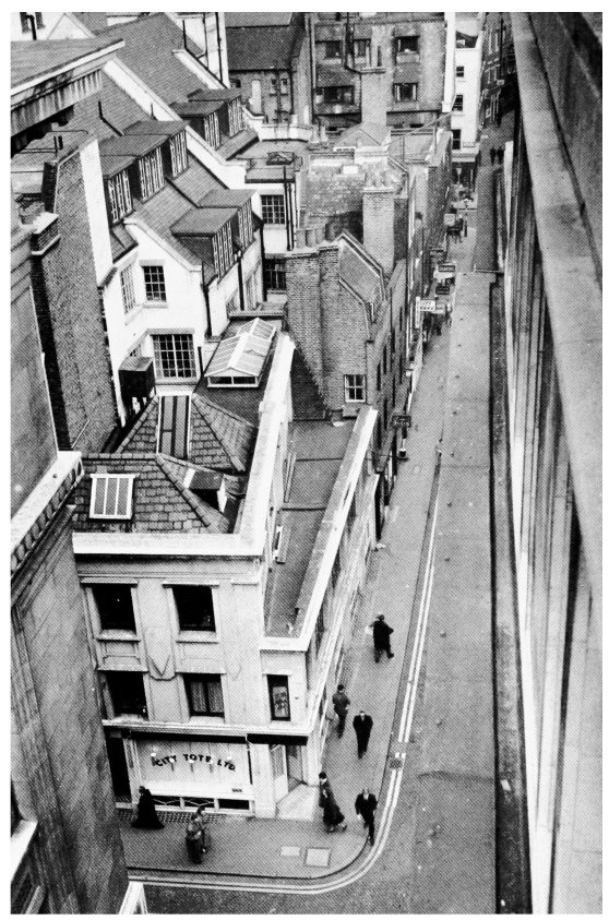
b. Views of north side of Foubert's Place in c. 1885 and 1962, showing buildings on constricted sites within northern boundary of Six Acre Close (pp. 192–3)

Views of north side of Foubert's Place in c. 1885 and 1962, showing buildings on constricted sites within northern boundary of Six Acre Close (pp. 192–3)